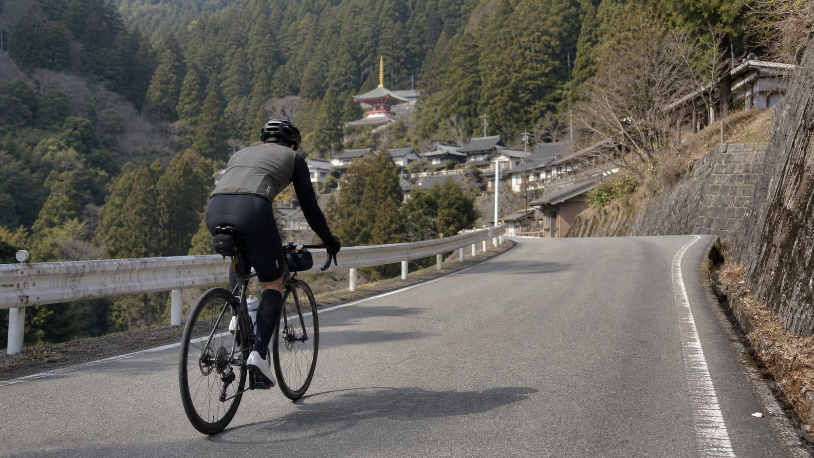
Koyasan is the longest route in this group, and the one with the most distinct significance. It isn’t just a mountain; it’s a Buddhist sacred site with 1,200 years of history, inscribed as a UNESCO World Heritage Site. And the climb leading to Koyasan—17.4 km (17,392 meters) long, with 799 meters of total elevation gain and an average gradient of 4.4%—is a long-distance pilgrimage that tests both your endurance and cleanses your spirit.
First, the data will give you a first impression: an average gradient of 4.4% makes this the most “gentle” route in the group; but don’t be fooled—it’s 17.4 kilometers long, nearly four times the length of Table Six’s route. This is a classic climb that “wins by length, not by intimidating steepness.” To use a Taiwanese route analogy, its magnitude is close to “a Central Mountain Range connector road stretched out long with a very even gradient.” What you need isn’t explosive power, but an endurance engine capable of sustaining a steady output for over an hour.
This is a practical guide. Koyasan has multiple climbing routes (Hashimoto, Kudoyama, Yatate/West side, Katsuragi-cho National Route 480, etc.). This article focuses on this approximately 17.4 km route with an average 4.4% gradient, detailing pacing, gearing, and nutrition.
1. Data Interpretation: The 4.4% Long Climb is an “Engine Endurance Race”
| Item | Data | Interpretation |
|---|---|---|
| Distance | 17.4 km | Long distance, the longest in this group |
| Total Elevation Gain | 799 m | Equivalent to climbing 260 floors continuously |
| Average Gradient | 4.4% | Gentle and even, but endurance-oriented |
| Estimated Steepest Section | Approx. 7~8% | Occurs locally, overall gentle |
| Category | Category 4 | Length determines difficulty |
The significance of 4.4%: This is a gradient where “you can keep pedaling while seated.” Most people won’t need to get off the bike or use extremely low gears. But precisely because the gradient is gentle and the time is long, the biggest enemy on this road isn’t the slope, but “time” and “monotony”—how to maintain a steady power output during a 60–90 minute continuous climb without letting your mind wander is the key.
Key Concept: Steep climbs test muscular strength; long, gentle climbs test endurance and discipline. Koyasan will use its length to slowly filter out who truly has an “engine.”
2. Section-by-Section Strategy: Breaking the 17.4 km into Four Parts
Section 1 (0–4 km): Starting from the Satoyama, Gradient 3~5%
This route mostly starts from the Katsuragi-cho area along National Route 480. The early section features open satoyama farmland scenery, with wide roads and a light mountain atmosphere.
- Pacing: The biggest mistake on a long climb is getting excited in the early stages. Start at an intensity where you can “easily chat,” keeping your heart rate at the lower edge of your aerobic zone.
- Cadence: Maintain 85–90 rpm to establish an efficient long-distance rhythm.
- Mindset: Tell yourself, “This is a race lasting over an hour.” The task for the first 4 km is just warming up.
Section 2 (4–9 km): Entering the Mountain Road, Gradient 4~6%
The road turns into the mountains, and the gradient rises slightly to 4–6%. This is the longest core section of the entire climb.
- Power Management: Lock your output into the aerobic zone (approximately 75–85% of FTP). Better to err on the low side than the high side. Any extra effort spent here will turn into lost speed later.
- Rhythm Maintenance: Establish a steady breathing-pedaling rhythm to let your body enter a “cruising” state.
- Nutrition Timing: This section is best for regular fueling. Replenish carbohydrates and fluids every 20–30 minutes.
Section 3 (9–14 km): Continuous Climbing, Gradient 5~7%
The gradient steepens slightly in the latter middle section, reaching 7–8% locally. This is where your endurance is truly tested.
- Response: This is where fatigue starts to set in. Shift down to protect your cadence, and focus on “maintaining rhythm” rather than “how much further.”
- Mental Game: Break the remaining distance into smaller chunks (e.g., “just hold on for 3 more kilometers to the next settlement”) and conquer it segment by segment.
- Environment: The forest deepens in this section, the air is cool, and the cedar trees tower overhead—this itself acts as a calming agent for the mind.
Section 4 (14–17.4 km): Reaching the Sacred Summit, Gradient Stabilizes
As you approach the religious sacred area on Koyasan (around Danjo Garan, Kongobu-ji), the gradient mostly stabilizes.
- Finishing: If you’ve paced well, you should still have some energy left here, allowing you to ride into the sacred site with ease.
- Summit: You’ll arrive at Koyasan town, at an elevation of about 800 meters. This is an entire “religious city on a mountain,” with temples, shukubo (temple lodgings), and pilgrimage paths. Be sure to slow down and respect the local religion and pedestrians.
3. Gearing and Equipment Recommendations
The 4.4% average gradient doesn’t demand much from your gearing, but for a 17.4 km long distance, it’s still advisable to have some margin to protect your knees.
| Rider Level | Chainring | Cassette | Notes |
|---|---|---|---|
| Advanced / Racing | 50/34 | 11-28 | Easily manageable on gentle slopes |
| General Enthusiast | 50/34 | 11-30 | Most recommended; protects cadence over long distance |
| Beginner / Conservative | 50/34 | 11-32 or 11-34 | For those wanting an easy finish and knee protection |
Equipment Essentials:
- Wheels: For a long, gentle climb, an all-rounder rim profile is best, balancing climbing efficiency with long-distance comfort.
- Comfort Setup: With 17.4 km plus the return trip, the comfort of contact points like the saddle and bar tape matters more than on short climbs.
- Descent: The descent from Koyasan is a long downhill. Ensure your brakes and windbreaker are ready, and watch for overheating rims/discs.
- Lock: If you plan to stop and sightsee in the temple area on the mountain, bring a good lock.
4. Nutrition and Hydration Strategy
This is a long-distance route, so plan your fueling for a “multi-hour complete ride.”
- Hydration: Fill up before you start. There are convenience stores in the Katsuragi-cho and Kudoyama areas at the base, but once you leave, supply points in the mountains are scarce—make sure you carry enough.
- Energy: On a long climb, you need to consume carbohydrates “on a set schedule and in set amounts,” every 20–30 minutes. Don’t wait until you’re hungry to eat (by then, losing speed is inevitable).
- Supplies on the Mountain: Koyasan town has temple settlements, shops, and restaurants (such as the famous shojin ryori vegetarian cuisine and sesame tofu), making it ideal for a good rest and meal after reaching the summit. However, business hours vary by season and establishment, so please check on-site.
5. Weather and Seasonal Considerations
- Spring (April–May): Cherry blossoms and fresh greenery on the mountain, pleasant climate—a popular season.
- Summer (June–August): At about 800 meters elevation, the mountain is much cooler than the plains, making it a great summer retreat; however, the lower starting section is still hot and humid, so pay attention to hydration. Afternoon thunderstorms are common in the mountains.
- Autumn (October–November): Foliage season. Koyasan’s cedar trees and crimson maples create one of the most beautiful scenes of the year, and it’s also the most popular time.
- Winter (December–February): Koyasan is cold in winter and may have snow and ice. Beginners are strongly advised against attempting it in winter—the long descent poses extremely high risks.
- Common: Temperature differences on the mountain are large, and temperatures are low. Always carry a warm windbreaker for the long descent.
6. Common Mistakes and DNF Risks
- Pacing too fast in the early section: Fooled by the gentle 4.4% gradient, riders attack the early part like it’s a short climb, only to have their endurance hit zero in the middle and later sections.—Solution: Manage your effort within the aerobic zone throughout, and deliberately slow down in the early section.
- Running out of fuel: Not consuming carbohydrates on a set schedule over a long distance, with no supply points in the mountains, leads directly to “bonking.”—Solution: Fuel on a set schedule and in set amounts; fill up at the base.
- Underestimating total time: Looking only at the gradient and thinking it’s easy, while ignoring the total effort and time of 17.4 km plus the return trip.—Solution: Plan your energy and time for a “multi-hour ride.”
- Recklessly attempting in winter: Ice on the mountain, loss of body heat, and loss of control on the descent.—Solution: Avoid the depths of winter and prepare adequate warm clothing.
- Not slowing down on the mountain: Treating a religious sacred site like a racecourse, endangering pedestrians and yourself.—Solution: Slow down upon entering the sacred area and show respect.
7. Reference Finish Times for Different Rider Levels
The following are reference finish times for the approximately 17.4 km, 799 m elevation gain climb (climb section only, excluding the return):
| Rider Level | Reference Time | Average Speed | Intensity Concept |
|---|---|---|---|
| Racing | 50–58 min | Approx. 18–21 km/h | Steady rhythm, slightly high |
| Advanced | 59–72 min | Approx. 14–17 km/h | Steady aerobic |
| General Enthusiast | 73–90 min | Approx. 12–14 km/h | Easy aerobic |
| Beginner Finisher | 91–110 min | Approx. 9–11 km/h | Goal is a steady finish |
A word to challengers: Koyasan won’t intimidate you with steep slopes; it will test your patience with its 17.4 km length. Steady your pace, prepare your nutrition, and empty your mind—when you pass through that cedar-lined pilgrimage path and ride into this 1,200-year-old sacred mountain city, you’ll understand that the end of this climb isn’t just 800 meters of elevation, but a rare kind of tranquility.
Route data: Distance 17.4 km, total elevation gain 799 m, average gradient 4.4% (Strava segment), Ito District, Wakayama Prefecture, leading to the World Heritage site Koyasan. A long-distance endurance climb.
8. Koyasan’s Multiple Climbing Routes: Choosing the Right Entrance Makes All the Difference
As a famous climbing destination, Koyasan actually has several climbing routes, each with different difficulty and scenery. Understanding these differences will help you make the best choice based on your ability and purpose. The approximately 17.4 km, 4.4% average gradient route featured in this article is one of the longer, more even options, but you should also know about the others:
| Route Direction | Features | Suitable For |
|---|---|---|
| Katsuragi-cho / National Route 480 | Open satoyama, wide roads, gentle and even slopes | Those wanting a steady long climb with open views |
| Hashimoto / National Route 370 | A continuous climb of about 15 km at about 5% | Those wanting to challenge a classic long climb |
| Kudoyama Start | Rich in historical atmosphere, follows the stone pilgrimage path | Those wanting to experience the pilgrimage culture |
| Yatate (West Side) | Distance about 7 km, elevation difference about 412 m, gentler gradient | Beginners tackling Koyasan for the first time |
Route Selection Advice: For riders attempting Koyasan for the first time or unsure of their fitness, the shorter, gentler Yatate west-side route is a good introduction. For those wanting to fully experience a long-distance endurance climb, choose Katsuragi-cho National Route 480 or Hashimoto National Route 370. Whichever route you choose, the core experience of Koyasan—that cedar-lined pilgrimage path and the sacred religious city on the mountain—is the same.
9. Real-World Scenario Simulation: A Complete Koyasan Expedition
Before Departure: This is a long-distance route, so prepare for a “multi-hour complete ride.” Fill up on water at the roadside station or convenience store at the base, eat a carbohydrate-based meal, confirm your cassette has 30–32T, and stuff a warm windbreaker into your back pocket (the mountain is nearly 800 meters and cold). Warm up thoroughly.
Section 1 (0–4 km): Starting from the satoyama, gradient 3–5%. The biggest mistake on a long climb is going too fast early on. Start at an intensity where you can “easily chat,” maintain 85–90 rpm, and tell yourself, “This is a race lasting over an hour; the early part is just a warm-up.”
Section 2 (4–9 km): Entering the mountain road, gradient 4–6%, the longest core section. Lock your output into the aerobic zone (75–85% of FTP), better low than high. Establish a steady breathing-pedaling rhythm and enter cruise mode. Replenish carbohydrates and fluids every 20–30 minutes.
Section 3 (9–14 km): Continuous climbing, gradient 5–7%. This is where fatigue starts. Shift down to protect your cadence, and focus on “maintaining rhythm” rather than “how much further.” Break the remaining distance into small chunks and conquer them one by one. The forest deepens here, the air is cool, and the cedar trees tower overhead—a natural calming agent.
Section 4 (14–17.4 km): Approaching the sacred area on the mountain, the gradient stabilizes. If you’ve paced well, you’ll still have energy here, so ride into the sacred site with ease. Arrive at Koyasan town at about 800 meters elevation, slow down, and respect the local religion and pedestrians.
After Reaching the Summit: This is an entire “religious city on a mountain.” Lock up your bike, walk into the sacred area to visit Danjo Garan, Kongobu-ji, and the Okunoin pilgrimage path, and enjoy a meal of shojin ryori (sesame tofu). After you’ve rested enough and your body has settled, put on your windbreaker and descend carefully—on the long downhill, control your speed and guard against losing body heat.
10. Customized Advice for Different Groups
- For first-time long-distance challengers: Koyasan’s 17.4 km at 4.4% average gradient is an excellent “first long climb.” The gradient is gentle and doesn’t require extremely low gears. The key is to keep your pacing ultra-conservative and fuel on a strict schedule. If you’re unsure, try the shorter west-side route first to test the waters.
- For endurance riders: This road is an excellent venue for training “aerobic endurance (Zone 2).” Locking into the lower aerobic zone and cruising steadily for over an hour is a high-quality, long-duration aerobic session that can effectively expand your engine’s displacement.
- For culture enthusiasts: Koyasan isn’t just a climb; it’s a World Heritage sacred site. I recommend slowing down your itinerary, leaving ample time after the summit to visit temples, walk the Okunoin path, experience a stay at a shukubo, and savor shojin ryori. Treat it as a deep “cycling + pilgrimage” journey.
- For group rides: This road’s long distance and even gradient make it ideal for a group endurance ride. Agree on a meeting point on the mountain and let everyone cruise at their own pace; after the summit, explore the sacred area and dine together—a meaningful group ride theme.
11. The Science of Pacing on Long Climbs
Koyasan’s biggest enemy isn’t the slope, but “time” and “monotony.” During a 60–90 minute continuous climb, pacing discipline determines success or failure.
Physics and physiology both tell us: maintaining a steady metabolic intensity is the most time-efficient strategy. On a long, gentle climb, if you surge with excitement and then ease off, you’ll repeatedly tap into your anaerobic system and accumulate waste products. Your body’s clearance rate can’t keep up, and ultimately you’ll be slower and more fatigued overall. The correct approach is to lock onto a target intensity that can be sustained for over an hour—those with a power meter should lock into the aerobic zone; those without should anchor on a fixed breathing rhythm.
The ideal long climb is a negative split, where “the second half is slightly faster than the first half,” meaning you saved energy in the early stages. To achieve this, the only way is to deliberately suppress the urge of “I feel great today” in the early section. On a long road like Koyasan, every extra bit of effort spent early will be repaid double in lost speed later. Keep your ambition in check, and steadily, section by section, surrender yourself to this long road leading to the sacred site.
12. The Details of Nutrition: The “Eating and Drinking” Not to Be Overlooked on Long Climbs
With Koyasan’s 17.4 km plus the return trip, plan your fueling for a “multi-hour complete ride.” A single “bonk” (glycogen depletion) is enough to ruin the entire ride.
Carbohydrates are the primary fuel: Eat a carbohydrate-based meal (rice, noodles, bread) 2–3 hours before departure to ensure full glycogen stores. On a long climb, aim for 30–60 grams of carbohydrates per hour. Energy gels, energy bars, bananas, and yokan (sweet red bean jelly) all work. The key is “set schedule, set amounts, small and frequent”—don’t wait until you’re hungry to binge-eat, because once glycogen is depleted, it’s too late to replenish.
Hydration and Electrolytes: Replenish 500–750 ml per hour, more in hot, humid weather. Long climbs cause heavy sweating; replenishing only water without electrolytes can lead to hyponatremia and cramps. In summer or when sweating heavily, add electrolyte tablets to your water or drink sports drinks to replace the sodium and potassium lost through sweat.
Distribution of Supply Points: There are convenience stores in the Katsuragi-cho and Kudoyama areas at the base—the last supply points before you leave, so be sure to stock up. After leaving, supply points in the mountains are scarce, which is the most important thing to note on a long mountain route. Although Koyasan town on the mountain has temple settlements, shops, and restaurants (shojin ryori, sesame tofu, etc.), that’s after the summit—during the climb itself, you must rely entirely on what you carry on your bike. Better to carry too much than too little.
13. Descent Safety: Managing Body Temperature and Brakes on Long Downhills
Reaching the summit of Koyasan is only half done. Safely descending the long distance from the nearly 800-meter mountain back to the base is the true finish.
Body temperature is the number one enemy: You’re drenched in sweat from the climb, and once you hit the long descent with high-speed wind, your body temperature drops rapidly—especially on Koyasan, which is deep in the mountains and naturally cooler. Be sure to put on a warm windbreaker after reaching the summit, finishing your sightseeing, and before starting the descent. This is the single most important thing for descending Koyasan. Hypothermia severely impairs your handling and judgment.
Brake Management: On a long descent, don’t drag your brakes continuously, as this can overheat your rims or discs (rim brakes in particular risk blowouts). Instead, use a “brake before the corner, release through the turn, accelerate out” pulsing technique. On continuous long descents, stop periodically to let the wheels cool down. The primary braking force comes from the front brake (about 70%), but be sure to apply the rear brake progressively in coordination.
Road Conditions and Wildlife: Deep mountain sections may have fallen leaves, slippery surfaces, oncoming traffic, and even wildlife suddenly appearing. Always leave a margin in your speed, and always assume there’s a hazard around every blind corner. In winter, be sure to check whether the road is icy—Koyasan is cold in winter, and an icy long descent is practically gambling with your life. In such conditions, decisively rescheduling is the mark of a mature rider.
14. Pre-Ride Preparation and Fitness Planning
Koyasan is a long-distance endurance challenge, so physical preparation before departure is crucial. Climbing requires three abilities: aerobic endurance (a foundation of long Zone 2 rides—most critical for a long, gentle climb like Koyasan), threshold power (sweet spot intervals to increase sustained horsepower), and muscular strength and fatigue resistance. For Koyasan, aerobic endurance is paramount—you need an engine capable of steady output for over an hour.
In training, schedule at least one or two 60–120 minute Zone 2 long rides per week as a foundation, supplemented by sweet spot intervals to raise your threshold. If you usually only ride short distances and lack a long-duration aerobic base, attempting Koyasan recklessly can easily lead to a breakdown in the middle or later sections due to insufficient endurance. Additionally, climbing is a game of “power-to-weight ratio.” Reasonably managing body fat in the pre-season can effectively improve climbing performance, but do it gradually—don’t resort to extreme dieting before departure. Build your endurance engine, prepare your nutrition and descent safety thoroughly, and you’ll truly enjoy this long journey to the sacred site rather than being crushed by its length.
15. Itinerary Planning: Making Koyasan a Complete Journey
Koyasan shouldn’t just be “climb up, take a photo, ride down.” It’s a World Heritage sacred site, worthy of slowing down your itinerary for a deep experience. Here’s a suggested framework for a complete trip.
One-Day Itinerary: Depart from the base in the early morning to avoid afternoon thunderstorms and poorer visibility in the mountains. Complete the 17.4 km long climb at your most conservative pace. After reaching the summit, allow a full two to three hours to visit Danjo Garan, Kongobu-ji, walk the Okunoin pilgrimage path, and enjoy a shojin ryori meal on the mountain. In the afternoon, after your body has settled and you’ve put on your windbreaker, descend carefully. This way, you can balance challenge and culture in a single day.
Two-Day Itinerary (Highly Recommended): On the first day, ride up to Koyasan and stay at a temple shukubo. In the evening, sit quietly in the temple garden, enjoy shojin ryori, and feel the tranquility of the sacred mountain after nightfall. The next morning, attend the morning sutra chanting service (Asa-gyō), greet the dawn of the sacred mountain amid the chanting, tour thoroughly, and then descend at a leisurely pace. This arrangement fully combines the cycling challenge with spiritual practice—the ultimate way to experience Koyasan.
Equipment Checklist: Climbing gears (30–32T is sufficient given the gentle gradient), a warm windproof jacket (cold on the mountain, cold on the descent), plenty of water bottles and energy supplies (supplies are scarce in the mountains), basic repair tools and a spare tube, a good bike lock (for sightseeing stops on the mountain), and a phone with a power bank. If staying at a shukubo, bring a change of clothes and toiletries.
16. Quick FAQ
Q: A 4.4% gradient is gentle—does that mean it’s easy? The gradient is indeed gentle, but don’t forget it’s 17.4 km long, and with the return trip, it’s a multi-hour expedition. The real challenge is “endurance” and “time,” not “steepness.” Those lacking a long-duration aerobic base may still struggle in the later sections.
Q: Do I need very low gears? No. At a 4.4% average gradient, 30–32T is more than enough for most people, and you can even stay seated for the entire climb. The margin in gearing is just for protecting your knees.
Q: What’s the best season? Spring cherry blossoms and autumn foliage are both stunning and the most popular times. Summer is cool on the mountain, ideal for escaping the heat. Winter is cold with possible snow and ice—strongly not recommended. Regardless of when you go, temperature differences are large, so warm clothing is essential.
Q: Can I go up by train or cable car instead of cycling? Yes, Koyasan is directly accessible via Nankai Electric Railway and a cable car, which is how most tourists get there. But for a cyclist, climbing this sacred mountain under your own power is part of the experience itself—that sense of “arriving by your own effort” is something the cable car can’t provide.
17. Conclusion
To sum it all up, Koyasan is a road like this: 17.4 km, 799 meters, 4.4% average gradient—the longest in this group and the one with the most distinct significance. It doesn’t intimidate with steepness, but uses its length and that 1,200-year-old solemnity to test your endurance and cleanse your spirit. The core of conquering it is keeping your pacing ultra-conservative, fueling on a strict schedule, preparing thoroughly for descent safety and warmth, and then—with a humble heart—slowly riding into this sacred city on the mountain.
Bring ample supplies and warm clothing, restrain your early ambition, and let the cedar-lined pilgrimage path accompany you all the way—when you pass through that long road to the sacred site and ride into this 1,200-year-old mountain holy city, you’ll understand that the end of this climb isn’t just 800 meters of elevation, but a rare tranquility in modern life. May you ride with composure, find peace of mind, and safely complete this dual pilgrimage of body and spirit.
One final reminder: After entering the religious sacred area of Koyasan, please be sure to slow down and respect the local religious atmosphere and pedestrians. This is a sacred place in the hearts of countless believers, not a racecourse. Speak softly, move slowly, carry your trash down the mountain, and treat this thousand-year-old sacred mountain with the utmost humility—this isn’t just etiquette, but the respect a mature rider should show this land.
Related Reading
- Luye Songlin Practical Guide: How to Ride a Short, Explosive 3.8 km Climb with Steep Sections Exceeding 20%
- Guguan Climb Guide: A Textbook 4.4 km, 11.7% Average Pure Steep Climb
- Gassan Park Line Climb Guide: Data Analysis of a 4.84 km, 7.8% Average Short Steep Climb
- Shibi Yunling Zhiqiu Practical Guide: The Art of Endurance and Pacing on a 10.76 km Long Gentle Climb
台北闊瀨陡坡 騎旅 / 日本單車雜誌編輯車友臨時加入!/ 髮香才是最強的 / feat. 北迴歸線小隊 / 公路車 CT Yeh
6 個月前
#公路車 #西進武嶺 配速配瓦實驗 坡度分析 四小時內攻略 建大盃 NeverStop #西進武嶺攻略
6 年前
大禹嶺 到 武嶺牌樓 全程前後實況錄影 | 北進武嶺 | 東進武嶺 | KOM | 訓練台 | 坡度分析 | Taiwan KOM Last 10 km HARD | 公路車
6 年前
大武山後門26%歡樂陡坡!JJSC南台灣單車行Day2 / 被颱風追著跑 / 公路車 / CT Yeh
2 年前
爬坡ITT實境)台中 魔王 松鼠坡 首航 6:12 大肚山 大三元 科福路
8 年前
半日 小台灣 極限單車路線挑戰實錄
7 年前
萬年峽谷! 30% 超激陡坡 里佳部落DAY2 還是很硬! | 公路車 | CT Yeh
3 年前
西進武嶺各路段 前8000名 大數據分析 配速攻略/功率/心律/推力比/維持率/踏頻/踏瓦比/牽車率 大公開 | 建大盃 NeverStop 可參考 | 公路車 | CT Yeh
5 年前