Maokong Zhanghu Mountain Crossing Practical Guide: 4.17 km at 6.2% Average Grade, Full Breakdown of the Tea Region Mountain Road
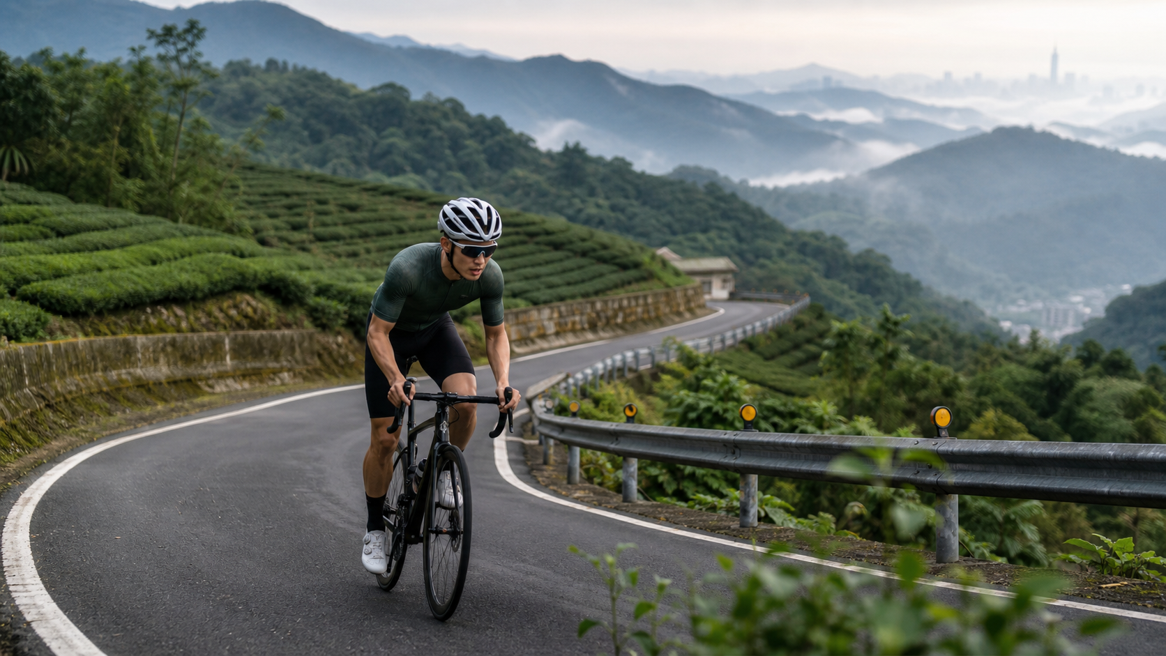
Route Snapshot: Distance 4.17 km | Average Grade 6.2% | Total Elevation Gain approx. 258–325 m (discrepancy due to calculation vs. measurement; refer to your on-site cycling computer for actual figures) | Category Cat 2 | Location: Muzha Tea Region, Wenshan District, Taipei City (Zhanghu Traverse Section)
CatKong is the most iconic tea-region landmark in the mountainous area of Wenshan District, Taipei. For years, it has been a popular weekend destination for residents to relax, enjoy tea, and take in the scenery. With the opening of the Maokong Gondola, it has also become a fixed stop for domestic and international visitors to Taipei. But for cyclists, CatKong has another identity—it is one of the few training grounds around central Taipei that can be reached within a half-hour ride while still offering solid mountain climbing intensity. And the “Zhanghu Traverse” section is precisely the core segment within the CatKong tea region that best encapsulates this intensity.
Following the engineer’s usual approach, this article lays out the route’s data, segments, equipment setup, and pacing strategy in full detail—no exaggeration, no sugarcoating—so you have an accurate expectation of this road before you even set off.
1. Look at the Data First: The Real Intensity of 4.17 km at 6.2% Average Grade
The official survey data for this section is 4,166.5 meters (approx. 4.17 km) in distance with an average grade of 6.2%. If you simply use the physical formula “distance × average grade” to back-calculate total elevation gain, you get approximately 258 meters (4166.5 × 0.062 ≈ 258); however, another set of actual GPS track measurements in the route database records total elevation gain at 325.3 meters. The discrepancy between these two figures exists for the same reason as with most mountain traverse routes—“average grade” is a linear estimate calculated from the elevation difference between start and end points, while “total elevation gain” is the actual figure accumulated from all undulations along the way. If the middle of the route contains several descending-then-ascending terrain transitions (a common feature of traverse routes), the GPS-accumulated total gain will naturally be higher than the linear estimate.
Therefore, the engineer’s honest statement is: the total elevation gain for CatKong Zhanghu Traverse conservatively falls between 258 meters and 325 meters; refer to your own cycling computer or GPS track recording for the actual number. The word “traverse” itself implies the undulating nature of the terrain—it is not a simple continuous climb to the top, but rather a crossing of the mountain ridge that likely involves alternating up-and-down sections. This is also key information we must factor into our segment-by-segment pacing strategy.
Using several well-known mountain routes in the Taipei suburbs as a comparison to establish a reference frame:
| Route | Distance | Average Grade | Difficulty Classification |
|---|---|---|---|
| Back of NCCU to Maokong Gondola Station | Approx. 5 km | Approx. 6% | Classic Short Training Route |
| CatKong Zhanghu Traverse (this article) | 4.17 km | 6.2% | Short, High-Intensity Traverse |
| Erge Mountain System Trailhead Vehicle Section | Approx. 6 km | Approx. 5–7% | Medium-Distance Undulating |
| Zhinan Temple to Maokong Vehicle Road | Approx. 4 km | Approx. 7–8% | Short, Steep Climb |
From this table, it is clear that CatKong Zhanghu Traverse ranks as “short-distance, high-efficiency” among suburban mountain routes around Taipei—under 5 km in distance, yet capable of delivering near-threshold training stimulus in a short time. This is precisely why many Taipei cyclists choose the CatKong tea region as their preferred training ground for after-work or weekend morning rides: low time investment, but solid training returns.
2. Segment-by-Segment Strategy: How to Manage the Grade Rhythm from CatKong Core to Zhanghu
The terrain characteristic of the Zhanghu Traverse section is “climbing interspersed with undulations.” The following pacing strategy is planned according to route progression; for actual grade changes, please refer to on-site road signs and cycling computer readings.
Segment 1 (Start to approx. 1 km): Leaving the Tourist Core, Entering the Tea Garden Mountain Path
The entrance area of CatKong typically has heavy pedestrian and vehicle traffic, especially on weekend afternoons, with tourists, scooters, and cars intermingling, plus numerous branching roads leading to various tea houses. The focus of this segment is not on rushing to pick up speed, but on ensuring riding safety first while gradually easing your body into the climbing rhythm. Heart rate is recommended to be controlled at 70–75% of maximum, with attention prioritized on reading road conditions.
Segment 2 (Approx. 1–2 km): The Main Climb, Testing Sustained Power Output
After leaving the tourist core, the Zhanghu Traverse enters a relatively quiet tea garden mountain path with sparse traffic, and the grade noticeably steepens here—this is the core section of the entire route requiring the most focused power output. An average grade above 6% combined with mountain curves requires riders to find a balance between pedaling cadence and cornering lines. It is recommended to maintain a cadence of around 85 rpm, avoiding wasted energy from slowing down for corners and then having to accelerate again.
Segment 3 (Approx. 2–3 km): Traverse Characteristics Emerge, Alternating Ascents and Descents
Based on the discrepancy between total elevation gain and the linear estimate, this section is likely where the “traverse” characteristic is most pronounced—first a brief descent or flat section, followed by renewed climbing. This terrain poses a major challenge to energy management: the descent section can easily lead riders to mistakenly think they are near the finish and let their guard down, only to be caught off guard when the climb resumes. It is recommended to treat the descent as an active recovery period—keep pedaling to maintain cadence, but reduce power output to reserve muscle energy for the next climb.
Segment 4 (Approx. 3–4.17 km): Approaching Zhanghu, the Final Stretch
In the latter part of the route, as you near the Zhanghu area, the terrain gradually approaches the ridgeline and the views open up. This is the moment of reckoning for your overall energy distribution—if the earlier pacing was well managed, you should still have enough reserve to enjoy the tea garden scenery and distant vistas along this final stretch; if you pushed too hard early on, this section could become a painful grind. It is recommended that beginners reserve at least 10% of their energy before reaching the finish to ensure they can complete the route steadily, rather than collapsing by the roadside after barely crossing the line.
3. Gear Ratios and Equipment Setup
An average grade of 6.2% combined with the undulating nature of the traverse section places certain demands on gear ratio configuration. The following is explained by bike type.
Road Bike Riders: If using a standard crankset (53/39T), it is recommended to pair it with at least an 11-28T or larger cassette to maintain a stable cadence on both the main climb and undulating sections; if your training volume is insufficient or you rarely climb, consider a compact crankset (50/34T) paired with an 11-30T or larger cassette, which will make the entire ride smoother and more comfortable—especially on the continuously undulating terrain of the traverse section, where gear-shifting flexibility is particularly important.
E-Bike Riders: The grade on the CatKong tea region’s industrial roads varies considerably. An e-bike can effectively save energy on the main climb, but be sure to manage battery usage during the alternating ascents and descents of the traverse section. It is recommended to moderately increase the assist level on climbs and switch back to eco mode on descents to avoid running out of battery midway.
Equipment Inspection Checklist:
- Brake system: The CatKong mountain area has many curves and significant grade changes, especially on descents (whether the brief downhill sections during the ride or the descent after completion)—be sure to check brake pad wear beforehand
- Tires and pressure: Tea garden mountain paths occasionally have slippery leaves or gravel, especially in rain-prone Taipei; it is recommended to slightly lower tire pressure to increase grip
- Lighting: Some sections of CatKong have dense tree cover, and the mountain area is prone to fog; even during daytime rides, it is recommended to have basic front and rear lights to improve visibility and safety
4. Nutrition and Hydration Management
At 4.17 km, the distance is short and theoretically requires no mid-route refueling, but the CatKong tea region offers unique refueling resources worth taking advantage of.
Preparation Before Departure: Since the area around CatKong is mostly tea houses and restaurants, refueling resources are relatively abundant. It is recommended to shift the pressure of “on-route refueling” to the two ends—“thorough preparation before departure” and “local refueling after arrival”—so the ride itself can focus on pacing and road conditions without carrying excessive gear.
The Humid, Hot Climate of the Taipei Basin: Due to terrain effects, humidity in the Wenshan District mountain area tends to be high, especially on summer afternoons when it can become stifling. Even for a short 4.17 km route, it is recommended to carry at least a 500ml water bottle and take sips during the descents in the undulating third segment, rather than waiting until you feel thirsty to remember hydration.
The Unique Advantage of Post-Ride Local Refueling: CatKong is famous for tea. After completing the Zhanghu Traverse section, there are numerous tea houses and scenic restaurants along the route and in the surrounding area where you can stop to replenish fluids and energy. This “refuel immediately after the ride” convenience is rare among suburban mountain routes around Taipei and is well worth taking advantage of.
5. Weather and Seasonal Considerations
The Maokong tea region is significantly influenced by the Taipei Basin climate, and seasonal weather patterns have a direct impact on both the riding experience and safety.
Plum Rain Season and Typhoon Season: During the plum rain season in May and June, roads in the Maokong mountain area become slippery and prone to fog, reducing visibility. This is especially true on the Zhanghu Yue Ling (ridge-crossing) section, which has many curves. It is recommended to check the weather forecast before setting out during this season to avoid the risk of crashing on wet surfaces. Afternoon convective thunderstorms are also common in Taipei’s mountain areas during summer; it is advisable to depart in the early morning or before evening to avoid periods of thunderstorm activity.
Northeast Monsoon and Clouds/Fog in Autumn and Winter: Due to Maokong’s higher elevation, the northeast monsoon in autumn and winter often brings cloud and mist conditions. While this creates stunning sea-of-clouds visuals, it also means visibility can drop significantly. When riding, be sure to slow down and stay alert, especially on the undulating ridge-crossing sections.
Summer Heat and Tourist Crowds: As a renowned tea tourism area, Maokong sees significantly increased traffic and visitor numbers on weekend afternoons. Roads around the Maokong Gondola station are especially prone to congestion. It is recommended to avoid peak weekend afternoon hours and instead visit in the early morning or on weekdays for a purer riding experience.
6. Common Mistakes and DNF Risks
Mistake 1: Underestimating traffic risks on tourist sections. Traffic in the core Maokong area is complex, with scooters, cars, and tourist buses interweaving. Combined with riders tending to focus on their pacing numbers while neglecting changing road conditions, this is one of the hidden safety risks on this route.
Mistake 2: Letting your guard down on gentle descents, leaving you unprepared for the next climb. As mentioned in the segment strategy above, the undulating nature of the ridge-crossing section can easily cause riders to fully relax on gentle descents. When the subsequent climb arrives, muscles haven’t been re-activated, leading to disrupted rhythm or even forcing an unplanned stop to catch your breath.
Mistake 3: Neglecting hydration in summer and being defeated by the muggy heat. The hot, humid mountain climate of Wenshan District makes it easy to underestimate the rate of fluid loss. The short distance in particular can make riders complacent about carrying a water bottle, resulting in early dehydration symptoms in the humid heat, affecting performance and even safety.
7. Reference Target Times for Riders of Different Levels
The following times are for reference only. Actual completion times will vary depending on daily weather, physical condition, and equipment. It is recommended to calibrate against your own completion times on routes of similar gradient.
| Rider Level | Estimated Completion Time | Reference Heart Rate Zone | Notes |
|---|---|---|---|
| Beginner / Recreational Rider | 22–32 min | Zone 2–3 | Stopping at a tea house for a rest is recommended; no need to push for a non-stop ride |
| Generally Trained Rider | 14–18 min | Zone 3–4 | Continuous riding throughout with steady pacing |
| Advanced / Competitive Rider | 9–12 min | Zone 4–5 | Near-maximal effort; suitable as a TT training segment |
| E-bike (standard assist mode) | 14–18 min | — | Adjust according to assist level and battery status |
The value of Maokong Zhanghu Yue Ling lies in how it condenses the core training elements of riding in Taipei’s suburban mountains—sustained climbing, terrain undulation reading, and cornering adaptability—into less than 4.2 kilometers. Master this route, and you’ll find your pacing judgment noticeably improved when facing other, longer mountain routes.
8. Route Positioning Summary: The Training Value of the Maokong Tea Region
As one of the few areas around Taipei city that combines tourism resources with mountainous terrain intensity, Maokong’s Zhanghu Yue Ling section plays the dual role of “tourism and training coexisting.” For riders purely seeking to build fitness, the 4.17 km at 6.2% average gradient provides sufficient intensity for a solid interval training session. For those wanting to combine leisure with exercise, the abundant tea houses and scenic restaurants in the surrounding area offer excellent post-ride relaxation options after completing this segment.
Whatever your riding purpose, the engineer’s advice remains consistent: master the data first, then enjoy the scenery. 4.17 km, 6.2% average gradient, elevation gain between 258 and 325 meters—internalize these numbers into your pacing rhythm, and you’ll find that Maokong Zhanghu Yue Ling is a training route worth revisiting again and again, with something new to gain each time.
9. Quantitative Training Applications of Power and Heart Rate
For advanced riders equipped with a power meter, Maokong Zhanghu Yue Ling is an excellent route to serve as a “short-climb power testing ground.” With a fixed distance of 4.17 km and intensity concentrated in the middle-to-late sections, it is well-suited for examining the stability of your climbing power output. The recommended approach is: choose a day when you’re in good physical condition and wind conditions are stable (such as a calm early morning), attempt a maximal effort, record average power, normalized power, and completion time, then repeat the test every few weeks to track the growth curve of your climbing ability. Because the middle section of the ridge-crossing route has undulating changes, it also serves as excellent “variable-power output” training material—unlike constant-gradient climbs that require maintaining steady power, Zhanghu Yue Ling forces you to rapidly switch output modes between gentle descents and climbs. This ability is highly beneficial for long-distance riding across Taiwan’s predominantly rolling terrain.
For riders without a power meter, heart rate can equally serve as a quantitative metric, but it is recommended to accumulate data from at least three to five attempts and judge based on the average trend, to avoid misjudgment from a single day’s weather or sleep conditions. Whether you’re in the power camp or the heart rate camp, treating Maokong Zhanghu Yue Ling as a fixed “self-testing station” will, over the long term, give you a clear sense of improvement in both your pacing judgment and physical reserves.
10. Route Planning Connections with Other Tea Regions and Mountain Routes Near Taipei
Maokong Zhanghu Yue Ling is rarely treated as a standalone out-and-back destination. Most riders familiar with this mountain area incorporate it into larger route plans covering the Wenshan District and Muzha mountain areas. Below are several common combination options.
Beginner Combination (approx. 12–18 km total): Starting from around National Chengchi University (NCCU), warm up and climb via Zhanghu Yue Ling, then loop around the tea garden roads in the core Maokong area before returning the same way. Suitable for novice riders new to mountain riding who want to build experience.
Standard Combination (approx. 20–30 km total): After completing Zhanghu Yue Ling, connect to the roads around Zhinan Temple to experience mountain sections with different gradient characteristics, then return via Muzha urban area. This is the most common combination among veterans familiar with Maokong.
Advanced Combination (approx. 35 km+ total): Linking Zhanghu Yue Ling with the industrial roads around the Erge Mountain system, and even extending toward Shiding and Shenkeng, creating a long-distance challenge route spanning the Wenshan District’s hilly terrain. This combination features frequent elevation changes and relatively dispersed supply points; it is recommended only for riders with ample long-distance mountain riding experience.
Whichever combination you choose, Zhanghu Yue Ling works well as the opening segment—its concentrated intensity and low time cost allow you to quickly gauge your physical condition for the day, then decide on the intensity and length of the subsequent ride.
11. Night Riding and Stargazing: Another Side of Maokong
It’s worth noting that the Maokong tea region is one of the few mountain areas near Taipei suitable for nighttime visits. Some scenic tea houses even feature night views and stargazing as their selling points. If you’re considering a night ride, be sure to pay special attention to the following: First, lighting equipment—some sections of the Zhanghu Yue Ling route have dense tree cover and sparse streetlights, so ensure your front and rear lights have sufficient brightness and battery life. Second, road condition assessment becomes significantly more difficult at night; with limited visibility, reaction time for anticipating curves and gradient changes is shortened, so reduce your speed and ride with companions familiar with the route. Finally, warmth—mountain temperatures drop noticeably at night; even in summer, it’s advisable to carry a light jacket to cope with the temperature difference.
Night riding in Maokong reveals scenery completely different from daytime visits—the distant lights of Taipei city spread out across the valley, with the gondola station’s lights dotted among them. On clear nights with less light pollution, there’s even a chance to see the starry sky. While this experience demands more from both riding skill and equipment, for veterans already familiar with the route’s daytime appearance, it’s a fresh perspective well worth trying.
12. Common Equipment Upgrade Suggestions and Long-Term Maintenance Reminders
Since Maokong Zhanghu Yue Ling is a short-to-medium distance but intensely demanding mountain route, riders who train on it repeatedly over the long term should consider equipment upgrades tailored to this type of route. Regarding cassette combinations, as suggested earlier, a compact crankset paired with a wide-range cassette can significantly reduce knee joint strain. This investment is especially worthwhile for riders planning long-term, high-frequency training, as it effectively lowers the risk of overuse injuries. As for braking systems, hydraulic disc brakes offer better modulation and heat dissipation performance than traditional rim brakes on sections with continuous corners and changing gradients. If you plan to make the Maokong mountain area your primary long-term training ground, this is worth considering for an upgrade.
In terms of maintenance, mountain riding conditions are more complex than urban roads. Leaf litter, moisture, and the braking load from gradient changes all place greater demands on the bike than flat-road riding. It is recommended to increase maintenance frequency, especially brake pad wear inspections and drivetrain cleaning and servicing, to ensure your bike remains in peak condition for every Zhanghu Yue Ling challenge, allowing you to focus on pacing and the scenery rather than worrying about unexpected equipment issues.
13. Rainy Season and Mountain Drainage: Practical Details for Reading Road Conditions
The Maokong tea-growing area features rolling terrain, and combined with the Taipei Basin’s rainy climate, certain sections of the Zhanghu Yue Ling route are prone to poor drainage and standing water after rainfall—a detail many out-of-town riders overlook on their first visit. It is advisable that after rain or consecutive wet days, you pay special attention to the inside of corners and gradient transition points for obvious standing water or mud and debris washout marks. Traction drops noticeably on such sections, so it is recommended to brake earlier and slow down before entering corners, rather than focusing solely on your pacing numbers and missing subtle changes in road conditions.
Additionally, some of the industrial roads around Maokong run alongside slopes and tea terraces on both sides. During heavy rainfall, there is occasionally a risk of falling rocks or mudslides. While such events are rare, if you encounter periods of prolonged heavy rain or typhoon warnings, it is advisable to postpone your visit and only head out after confirming the road conditions are safe. This is both a matter of taking responsibility for your own safety and a basic gesture of respect for the natural environment of this mountain area.
14. Summary: Maokong Zhanghu Yue Ling—A Training Asset Worth Long-Term Investment
Looking back over this entire article, from the most basic distance, gradient, and elevation gain data, to segment pacing strategies, gearing and equipment configurations, nutrition and weather considerations, then on to power and heart rate quantification training, route linking planning, night riding experiences, and long-term equipment maintenance, we have covered nearly every aspect required for a route to serve as a “primary training route.” The value of Maokong Zhanghu Yue Ling lies not only in the intensity and enjoyment of a single challenge, but also in its status as one of the few route combinations around Taipei City that offers both terrain difficulty and convenient access, along with post-ride amenities. It deserves a place in your long-term training plan—return to it repeatedly, keep accumulating data, and witness the growth of your pacing judgment and fitness reserves.
Internalize those numbers—4.17 kilometers, 6.2% average gradient, 258 to 325 meters of elevation gain—into your own sense of rhythm, and you will discover that Maokong Zhanghu Yue Ling is not just a route, but a training asset worth investing in for the long term.
Related Reading
- Maokong Zhinan Temple Practical Guide: 6.93 km, 388 m Elevation Gain, 5.6% Average Gradient—A Complete Breakdown of a Taipei Classic Intermediate Climb
- Maokong Zhanghu Yue Ling: Rediscovering the Simple Joy of Riding Amid Tea Aroma and Mist
- Maokong Climbing Training Mecca: A Complete Guide to Multiple Climbing Routes from Muzha to Maokong
- Jinguashi Jinshui Road Practical Guide: Complete Segment Analysis of 4.84 km at 6.3% Average Gradient
台北闊瀨陡坡 騎旅 / 日本單車雜誌編輯車友臨時加入!/ 髮香才是最強的 / feat. 北迴歸線小隊 / 公路車 CT Yeh
6 個月前
半日 小台灣 極限單車路線挑戰實錄
7 年前
#北橫 + #北進武嶺 最硬的員工旅遊 EP1 | #公路車 #拉拉山 | 明池 | 武嶺 | 武陵農場 | 雲海 | Taiwan Cycling Route Wulin
6 年前
西進武嶺 世界紀錄挑戰!破2:30 ?!一群人推著一個夢上山 直播精華版 / ft. 張翰允 & 台視主播魏于恬 & KPLUS / #cycling 公路車 CT Yeh
2 個月前
爬坡ITT實境)台中 魔王 松鼠坡 首航 6:12 大肚山 大三元 科福路
8 年前
風櫃嘴時間 預測西進武嶺時間?13000名車友統計數據分析告訴你 !
5 年前
雨戰! 西進武嶺員工旅遊 加料 各路段大數據分析 | 同事端出5公斤的公路車來挑戰!? EP1
4 年前
單車 梅山36灣 坡度介紹 路段介紹 空拍 (相關遊記影片,請參考說明或我的頻道喔,歡迎訂閱)
6 年前