Pingxi Township Road 47 Battle Guide: Full Analysis of Pacing on the Quiet 8.3km Long, Gentle Climb with 376m of Elevation Gain
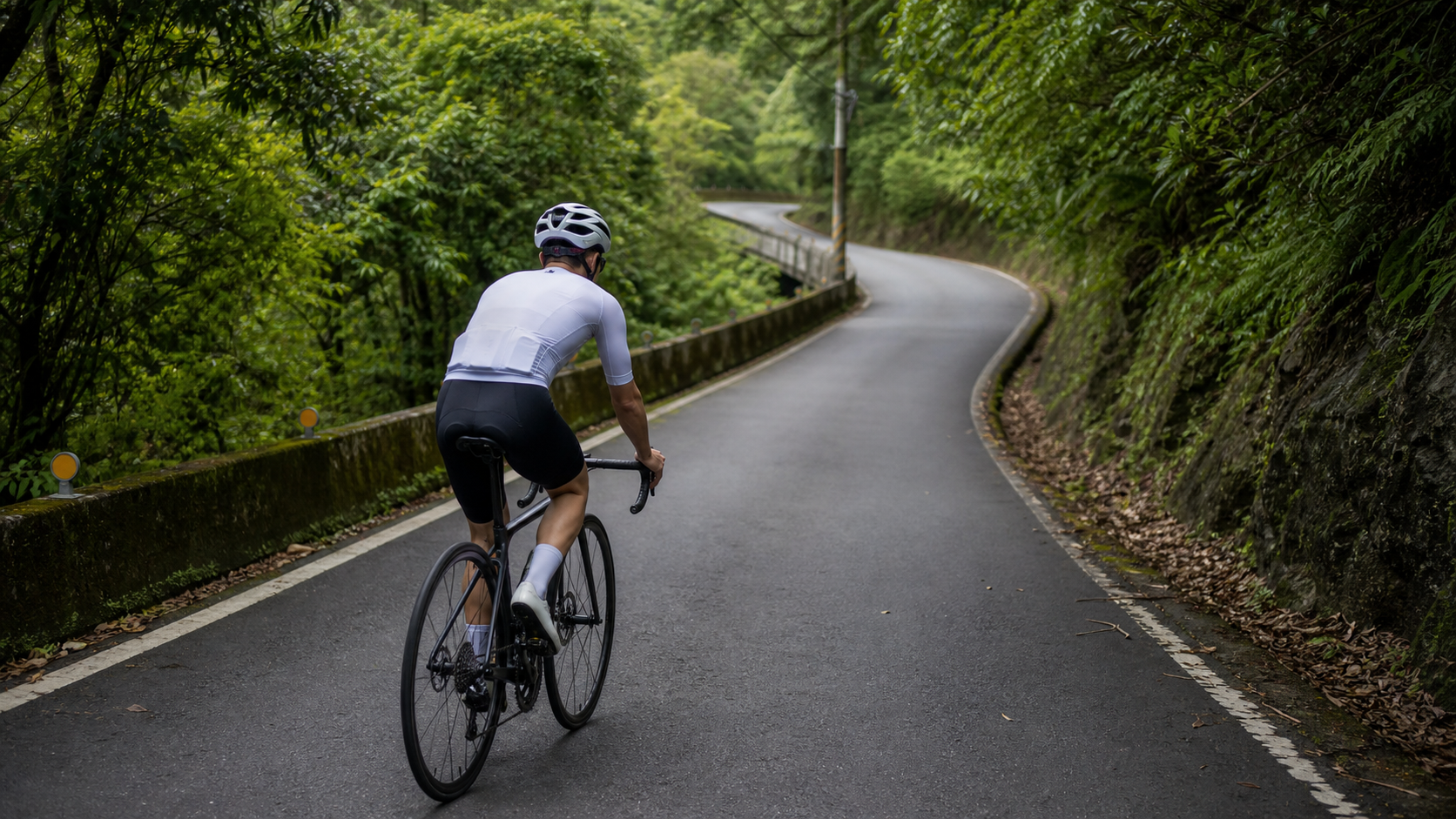
Distance 8.26 km, elevation gain 376 m, average gradient 4.5% (officially classified as Category 3 by Strava)—County Road 47 is a relatively obscure yet highly valuable long climb tucked into the mountain road network at the border of Shiding and Pingxi in New Taipei City. It doesn’t draw the crowds of Jiufen’s Buyanting or Fengguizui, nor does it demand a full-day itinerary like Wuling. Instead, it sits quietly in the rolling hills between Shiding and Pingxi, waiting for riders who appreciate the training value of “sustained, steady output.”
Dividing the 376.069 m of elevation gain by the 8,255.54 m distance yields an average gradient of 4.56%, which aligns almost perfectly with Strava’s official 4.5% figure. This means the route’s elevation data is clean and reliable, with no obvious measurement or segmentation errors that would require readers to exercise caution. A route where “the numbers add up” like this is actually better suited for long-term pacing tracking, because you don’t need to waste energy questioning the accuracy of the data itself—you can put your focus directly into optimizing your pacing strategy. This article takes an engineering approach, breaking this 8.3 km climb into four functional segments, explaining pacing, gearing, fueling, and common mistakes for each, and closing with target time references for riders of different levels.
1. First, Understand the Route’s Character: Long, but Not Fierce
At a 4.5% average gradient, this falls into the “moderately gentle” category of climbs—milder than the sustained hard grades of Yangjin Highway, yet far more substantial than typical riverside access ramps. The key challenge of this gradient isn’t the steepness of any single moment, but rather the “duration.” At 8.26 km, a typical intermediate rider will take roughly 30 to 45 minutes to complete it, which enters the territory where you need to seriously manage your pacing rhythm rather than simply grinding through on feel alone.
In other words, County Road 47 doesn’t test your anaerobic explosiveness—it tests your rhythm management and mental endurance. Many riders underestimate this road based on the gradient number, thinking “it’s only 4.5%, should be easy,” only to feel the dual pressure of legs and willpower being simultaneously eroded by the fifth or sixth kilometer—this is precisely where long, gentle climbs catch people out: the gradient won’t fool your lungs, but the length will slowly grind away your focus.
| Distance Segment | Characteristics | Recommended Heart Rate Zone (based on personal LTHR) | Recommended Cadence |
|---|---|---|---|
| 0–2K | Warm-up start, find your rhythm | Zone 2–3 (65%–78% LTHR) | 85–95rpm |
| 2–4.5K | Core segment with stable gradient | Zone 3 (75%–85% LTHR) | 80–90rpm |
| 4.5–6.5K | Mental and physical test segment | Zone 3–4 (80%–90% LTHR) | 75–88rpm |
| 6.5–8.26K | Final push, adjust based on remaining energy | Zone 3–4 (78%–92% LTHR) | 85–95rpm |
If you have a power meter, aim to hold your target power between 70%–82% of FTP for the entire segment, placing it squarely in the typical Tempo to Sweet Spot intensity range. This intensity is just enough to sustain over eight kilometers without blowing up prematurely, while still being substantial enough to meaningfully improve your endurance performance near your aerobic threshold.
2. Segment-by-Segment Strategy: A Four-Part Breakdown for Managing a Long Climb’s Rhythm
Segment 1 (0–2K): Warm up and find your rhythm—don’t let the length intimidate you. After entering County Road 47, the first two kilometers are typically smoother in gradient, making this the golden window for establishing your pedaling rhythm. The task here is simple: smoothly bring your heart rate from Zone 1–2 flat-road cruising into Zone 2–3, while confirming that today’s gearing choice, riding position, and breathing rhythm are all in sync. Many riders make their first mistake here—subconsciously accelerating because the gradient feels gentle, thinking “let me get a head start,” but on a climb of over 8 kilometers, any surplus power output in the early stages is borrowing from your future self, and the interest is steep. I recommend keeping the effort here at a level where “you can hold a conversation but are slightly breathless”—this is the most fundamental yet most easily overlooked discipline of long-distance rhythm riding.
Segment 2 (2–4.5K): The core stability segment—practice focus within “boredom.” This is the most consistent section of the entire route in terms of gradient distribution, with no dramatic undulations. The real test here is mental patience. Long, gentle climbs tend to cause distraction or discouragement precisely in this kind of middle section, where “you can’t see the end and the gradient isn’t particularly exciting.” I recommend adopting a fixed cadence strategy (80–90rpm) here and locking your attention onto your breathing rhythm and pedaling smoothness, rather than constantly staring at the remaining distance on your head unit—the latter only amplifies mental fatigue. If you have a power meter on this stretch, strictly cap your output at no more than 82% of FTP, because more than half the distance remains, and spending too early will directly manifest as a performance collapse in the later stages.
Segment 3 (4.5–6.5K): The physical and mental crucible—a mirror for pacing discipline. As mileage accumulates, genuine fatigue begins to set in here—not just the burning in your legs, but also the mental restlessness of “when will this end.” This is the section of the route where pacing breakdowns are most likely: some riders, driven by impatience, suddenly surge in an attempt to end this limbo of discomfort early, only to blow up right before the finish; others unconsciously slow to well below their intended pace due to fatigue, losing the training intensity that this route was meant to deliver. The correct approach is to set psychological anchor points in advance—for example, breaking this segment into two one-kilometer mini-goals, giving yourself a small acknowledgment after each kilometer, using attention-splitting to push through the section that tests your willpower the most.
Segment 4 (6.5–8.26K): The final push—use your remaining energy to deliver a strong finish. Entering the final stretch of less than two kilometers, most riders’ bodies shift into an excited “almost there” state. The key here is to judge whether you have enough left to slightly raise the intensity. If the first three segments were paced well, you should be able to push power up to around 85%–90% of FTP for a clean finish; if your legs are completely heavy, your cadence has dropped below 70rpm, and your speed keeps falling, that signals a pacing discipline problem in the middle segments—a clear indicator of what to fix on your next ride. I recommend recording the average power and heart rate for each of these four segments after every ride. Over time, you’ll clearly see your pacing curve becoming increasingly stable and approaching the ideal even-power-output pattern.
3. Gearing and Equipment Recommendations
Given the overall 4.5% average gradient and the absence of any significant short, steep ramps, this route’s gearing demands are actually not particularly demanding. A standard crankset (53/39T) paired with an 11-28T cassette is entirely sufficient for intermediate riders and above. However, considering the sustained output required over 8.26 km, even with a moderate gradient, maintaining a heavier gear for extended periods will prematurely deplete muscle glycogen. Therefore, a compact crankset (50/34T) with an 11-30T or 11-32T cassette is more advisable, allowing you to hold a more comfortable cadence in the 85–95rpm range and reduce fatigue accumulation from prolonged high muscle tension.
The increasingly popular 1x systems (for example, a 40T single chainring with a 10-33T cassette) perform exceptionally well on this kind of long climb with smooth, even gradients and no dramatic swings. The simplified shifting logic is particularly well-suited for riders who use this route as a regular training ground and ride it repeatedly, reducing the risk of rhythm disruption from mis-shifts.
Regarding tire pressure and width: since this is a relatively low-traffic county road, pavement maintenance may not be as frequent as on major arterial roads. I recommend tires of 28c or wider that balance grip and comfort, with tire pressure set 5–10psi lower than your usual setting to handle the occasional road patches or accumulated loose debris. As for braking systems, the overall gentle gradient of this route means both hydraulic disc brakes and traditional caliper brakes can handle it safely. However, given the remote nature of the road and sparse traffic, I recommend maintaining the habit of tapping the brakes early on the descent back, to avoid being caught off guard after a prolonged period of relaxed vigilance.
4. Nutrition and Hydration Strategy: The Distance Demands More Planning Than the Gradient
At 8.26 kilometers with an estimated completion time of 25 to 45 minutes, this long climb falls within a range that requires serious attention to nutrition planning. It is no longer at the level of a 4-kilometer short climb that can be handled with “just a bottle of water.” Before setting off, make sure your bottles are completely full. If you are incorporating this route into a longer loop ride (for example, linking it with other road networks in the Shiding and Pingxi mountains), it is recommended to carry an extra serving of solid food or an energy gel, and to refuel based on how you feel after reaching the summit or at the midpoint of the climb, to avoid a sudden drop in blood sugar after prolonged moderate-to-high intensity output.
One thing that deserves special attention is that County Road 北47 is a relatively remote industrial-access country road, with virtually no convenience stores or aid stations along the way. This stands in stark contrast to popular climbing routes near urban areas (such as Yangmingshan’s Fengguizui, which is lined with shops). Be sure to complete your hydration and refueling in the Shiding or Pingxi town centers before departure, and carry enough water and energy to cover the entire trip (including the return). Do not assume you will find a shop to rescue you halfway.
Taiwan’s mountain areas are hot and humid in summer, and the valley terrain around Shiding and Pingxi tends to trap moisture, making the perceived temperature noticeably higher than in urban areas at noon. It is recommended to ride in the early morning or evening. If you must set out at midday in high summer, in addition to normal refueling, it is advisable to carry an extra bottle of plain water for pouring over your head to cool down, and to moderate your pace to avoid the risk of heat exhaustion from an excessively high core temperature.
5. Weather and Seasonal Advice: The Rainy Microclimate of the Shiding and Pingxi Mountains
Located in the eastern mountain area of New Taipei City, Shiding and Pingxi sit right in the path of the northeast monsoon and a zone of abundant orographic rainfall. This is one of Taiwan’s most well-known rainy regions. Humidity in the mountains remains high year-round, and road surfaces tend to stay damp. Even if there was no rain the previous day, morning fog or dew can still leave the roads slippery. Before riding County Road 北47, be sure to check recent rainfall records and the day’s weather forecast. After rain or in foggy conditions, it is recommended to lower your overall pace target by 10–15%, and to pay extra attention to corners and shaded sections where wet leaves may have accumulated.
In winter (November to February), under the influence of the northeast monsoon, the Shiding and Pingxi mountains frequently experience days of continuous drizzle. Both visibility and road grip are affected. It is recommended to wear a windproof and water-repellent jersey, and to consider shortening your ride or rescheduling. In late spring and early summer (April to June), afternoon convective showers are common, and the mountainous terrain can easily trigger localized heavy rainfall. It is advisable to monitor real-time radar echoes, plan to start in the morning, and finish early. Autumn (September to November) is generally the best season to visit this mountain area, with relatively lower rain probability and forest scenery that gradually turns crisp and pleasant as temperatures cool—making for an enjoyable riding experience.
6. Common Mistakes and DNF Risk Assessment: The Problem Is the Length, Not the Gradient
The gradient of County Road 北47 itself does not pose a technical DNF risk, but several execution-related mistakes directly tied to the “long distance” deserve special attention from riders:
- Overly optimistic pacing in the early section: Because the gradient looks gentle, riders push high power output in the opening stretch, overlooking the fact that the climb exceeds 8 kilometers. This leads to premature depletion of muscle glycogen in the middle and later stages—the most typical and most fatal pacing error on a long, gradual climb.
- Misinterpreting mental fatigue as physical exhaustion: The “boredom and lethargy” commonly felt in the middle of a long climb is easily mistaken for running out of physical capacity, causing riders to give up voluntarily or drastically slow down. In reality, by adjusting mental strategy (setting small segment goals), the body still has the capacity to finish the entire climb.
- Underestimating refueling needs: Because the gradient of any single section is not steep, riders underestimate the total energy expenditure over the full distance and set out without enough supplies. This risk is especially high on this route because there are no shops along the way for immediate resupply.
- Ignoring the risk of mechanical failure on a remote stretch: Traffic on County Road 北47 is sparse and the area is seldom visited. If you suffer a flat tire or mechanical failure midway, the time cost of waiting for help or walking down the mountain will be far higher than on popular routes. It is strongly recommended to carry a complete repair kit and spare inner tubes, and to inform riding companions or family of your planned route and expected return time.
- Overlooking slippery roads and leaf accumulation: Drainage systems on mountain country roads are not as well developed as in urban areas, and with tree shade overhead, slippery surfaces and accumulated leaves are more common than you might expect. Be sure to brake early when descending through corners.
7. Target Time References for Riders of Different Levels
The following times are for reference only. Actual performance will vary depending on wind conditions, fitness level, and equipment weight on the day:
| Rider Level | Estimated Completion Time | Average Power Reference (70kg rider) |
|---|---|---|
| Advanced / Race level | 22–28 minutes | 3.8–4.3 W/kg |
| Intermediate / Consistent trainer | 29–38 minutes | 2.8–3.3 W/kg |
| Beginner / Recreational rider | 39–50 minutes | 1.8–2.3 W/kg |
It is worth noting that because this route exceeds eight kilometers in length, even advanced riders will find it difficult to maintain a single constant power output for the entire climb. In practice, the data typically shows a slightly higher output in the early section, a settling in the middle, and fluctuation in the later section depending on remaining energy. This is normal, and there is no need to force a perfectly flat power curve across the entire ride.
8. Fitting County Road 北47 into Your Training Week: An Ideal Sweet Spot Training Ground
With its steady gradient, sufficient length, and no violent short steep pitches to interrupt the rhythm, County Road 北47 is actually an ideal venue for Sweet Spot (approximately 84–97% of FTP) or Tempo intensity training. If you are planning a training menu for the aerobic endurance base phase, you can schedule this route into one to two fixed-intensity sessions per week, treating a single full ascent as one complete Sweet Spot interval session. Compared to staring at a timer while grinding out 20 minutes on the trainer, this approach better combines mental adaptation with the accumulation of real road feel.
For riders preparing for longer multi-day endurance events or multi-day climbing itineraries (such as round-island rides or the Wuling series), this route is also well suited for the pre-race distance adaptation phase. It provides a realistic scenario of “continuous moderate-to-high intensity output for more than 25 minutes,” allowing the body to adapt in advance to the energy metabolism patterns and mental tolerance required for prolonged endurance efforts. Compared to repeated short-climb intervals, this is closer to the real demands of long-distance racing.
9. Road Conditions and Traffic Safety Reminders: The Unique Risks of a Remote Country Road
County Road 北47 lies in the mountain road network at the border between Shiding and Pingxi. It is a local industrial-access road with extremely low traffic volume. This is both its quiet, charming advantage and the source of some risks that require extra attention. First, precisely because traffic is sparse, some drivers (especially local freight or shuttle vehicles) may be accustomed to taking corners at higher speeds. When riding, be sure to stay to the right and stay alert. Especially on corners with poor sightlines, it is recommended to wear a reflective vest or add a flashing rear light to improve visibility—which paradoxically matters more in low-traffic conditions where riders are easier to overlook.
Second, because the area is seldom visited, if an unexpected situation arises midway (mechanical failure, physical discomfort, getting lost, etc.), the difficulty of seeking help is significantly higher than on popular routes. It is strongly recommended that you: inform family or riding companions of your planned route and return time before departure; carry your phone and confirm it is fully charged; and avoid riding this route alone near dusk when daylight is fading—especially in winter when daylight hours are short and darkness can fall suddenly mid-ride. After typhoons or heavy rain, mountain roads are more prone to rockfalls or washed-out roadbeds. It is recommended to wait at least one to two days and to confirm road conditions through local riding community groups before heading out.
10. Equipment Checklist: Final Confirmation Before Departure
Given the remote location of County Road 北47 and the limited availability of resupply and rescue resources, checking your equipment before departure is especially important: confirm that tire pressure matches the day’s temperature and your body weight; carry at least one spare inner tube, a repair kit, and a mini pump, and make sure you are familiar with basic roadside repair procedures; confirm your bottles are full and carry enough energy supplies for the entire trip (including the return); confirm that your headlight and rear light have sufficient battery, since even in daylight, dense tree shade in the mountains can leave visibility dim; and confirm that your phone is fully charged with offline maps downloaded, as mobile network signals may be unstable or even drop out on some sections of the mountain roads.
These seemingly trivial preparation steps are exactly what makes riding a remote long climb safely and solidly possible. Although the gradient of County Road 北47 is gentle, precisely because of its remoteness and sparse traffic, any small problem can be magnified into a challenge you must face alone. Thorough preparation before departure is always the most important safety line of defense on routes like this.
11. Data Recording and Training Tracking Recommendations
To truly turn County Road 47 North into an effective long-term training tool, it is recommended to pair it with a GPS cycling computer or sports watch to fully record each ride’s segment pacing, heart rate curve, and power output (if equipped with a power meter). Because this route is long enough to provide a more complete power distribution sample than shorter climbs, you can clearly see your performance characteristics across different segments after accumulating data over time—for example, whether you consistently show a noticeable psychological slowdown in the third segment (4.5–6.5K), allowing you to adjust your pacing strategy or mental preparation accordingly.
Additionally, it is recommended to spend a few minutes after each ride recording that day’s Rate of Perceived Exertion (RPE), weather conditions, and nutrition arrangements. These contextual details are often the key clues for explaining abnormal single-ride performance when reviewing data later. As a training route that can be visited regularly over the long term and offers clean, reliable data (measured elevation gain closely matches official gradient data), County Road 47 North is particularly well-suited for building a personalized long-distance pacing model.
12. Summary: An Underrated Foundation for Long-Distance Tempo Training
Looking back at this entire guide, the positioning of County Road 47 North is quite clear—it is not a route for explosive bursts or technical challenges, but rather a training cornerstone for honing the core ability of “sustained, steady output over time.” With a distance of 8.26 kilometers, 376 meters of climbing, and an average gradient of 4.5%, this combination of numbers lands precisely in the sweet spot best suited for developing Sweet Spot and Tempo endurance.
For riders preparing to tackle multi-day itineraries or stage races, this road offers a safe, predictable training environment with trustworthy road data. For riders simply looking for a quiet, long climb to seriously practice pacing discipline, its low traffic volume and consistent terrain are equally rare assets. Once you master the four-segment pacing logic of this road, you will find that your rhythm management ability has been solidly accumulating without you even noticing when facing longer, more complex climbing routes.
13. Combined Training Recommendations with the Nearby Road Network
If you have already become familiar with the pacing logic of County Road 47 North and feel that the 8.3 kilometers alone no longer constitutes a sufficient training volume, consider linking it with other county roads in the Shiding and Pingxi areas to form a combined route covering dozens of kilometers with over a thousand meters of climbing. This mountainous region features fragmented terrain and numerous junctions; for veterans familiar with the local road network, a wide variety of loop combinations can be designed—using County Road 47 North as the primary climbing segment, then connecting to other county roads toward Pingxi, deciding based on energy levels whether to turn back or extend deeper into the mountains.
This planning logic of “linking a single long climb into a combined route” is particularly suitable for athletes preparing for the Wuling series or other multi-day mountain events. The sustained 25+ minutes of mid-to-high intensity output provided by County Road 47 North itself can serve as a foundational unit during the pre-race distance adaptation period. After repeated practice, you can gradually stack on more climbing volume and distance, progressively conditioning your body to handle true multi-day event demands.
14. Mental Preparation for Beginners Tackling Their First Long-Distance Climb
For beginners who have only ridden short climbs of three or four kilometers, the psychological impact of tackling a long climb like County Road 47 North—over eight kilometers—for the first time can be no less significant than the physical fatigue. Many people will begin to feel restless thoughts of “how much longer is this road” halfway through, which is a completely normal reaction and does not mean you chose the wrong route or lack fitness. The key mindset for long-distance climbing has never been about forcing yourself not to think about the finish line, but rather learning to break your attention into manageable small segments—just like the segment-based pacing logic mentioned earlier: breaking the 8.3 kilometers into four tasks of roughly two kilometers each and conquering them one by one is far easier to push through than thinking “six more kilometers” all at once.
The reason County Road 47 North is suitable as an entry-level option for beginners challenging long-distance climbs is precisely because its gradient is gentle and consistent, without adding explosive power demands from steep sections on top of a body not yet adapted to long-distance output. Once you have ridden this road until it feels familiar, you will find that the psychological restlessness of “how much longer do I have to endure” has been gradually tamed into a self-regulating internal rhythm when facing true multi-day events or longer mountain routes.
15. Final Thoughts: Long, Gentle Climbs Are an Underrated Training Asset
In discussions of climbing routes in Taiwan, short and steep hard climbs often capture the most spotlight—Wuling, Fengguizui, Lulin Front Mountain—these names are on nearly everyone’s lips. But long, gentle climbs like County Road 47 North, while lacking in buzz factor, play an equally indispensable role in actual training effectiveness. What they teach riders is the most core and most easily overlooked ability in endurance sports—how to maintain a steady, rational pace throughout a long process without being dragged along by momentary emotions or fatigue.
If your training menu is still missing a route that allows you to seriously practice sustained, steady output over time, consider adding County Road 47 North to your shortlist. It will not earn you many likes on social media, but it will become that invisible yet unshakably solid foundation that carries you to the finish line when you face truly long and grueling events in the future.
Related Reading
- Pingxi Wufenshan Guide: A Complete Analysis of a Tough 4km Short Climb with 257m Elevation Gain and 6.4% Average Gradient in Ruifang’s Mountainous Area
- A Secluded Long Climb Off the Beaten Path: Solitary Moments Between County Road 47 North and the Shiding-Pingxi Mountain Trails
- Pingxi Shifen Waterfall Direction Climbing Guide: Full Analysis of 4.0km, 264m Elevation Gain, and 6.5% Gradient Data
- Xiping Highway Practical Guide: 8.3km with 793m Elevation Gain—The Most Solid Climbing Test in New Taipei’s Suburbs
台北闊瀨陡坡 騎旅 / 日本單車雜誌編輯車友臨時加入!/ 髮香才是最強的 / feat. 北迴歸線小隊 / 公路車 CT Yeh
6 個月前
#公路車 #西進武嶺 配速配瓦實驗 坡度分析 四小時內攻略 建大盃 NeverStop #西進武嶺攻略
6 年前
西進武嶺各路段 前8000名 大數據分析 配速攻略/功率/心律/推力比/維持率/踏頻/踏瓦比/牽車率 大公開 | 建大盃 NeverStop 可參考 | 公路車 | CT Yeh
5 年前
大禹嶺 到 武嶺牌樓 全程前後實況錄影 | 北進武嶺 | 東進武嶺 | KOM | 訓練台 | 坡度分析 | Taiwan KOM Last 10 km HARD | 公路車
6 年前
大武山後門26%歡樂陡坡!JJSC南台灣單車行Day2 / 被颱風追著跑 / 公路車 / CT Yeh
2 年前
半日 小台灣 極限單車路線挑戰實錄
7 年前
96聯賽 桃園市長盃 歷屆各路段大數據攻略 從菁英組到新手組的平均瓦數、均速、平均時間 x 賽前探路
5 年前
2020 戀戀197 全程4K雙錄影 訓練台實境 市民競賽組 M30 M40 #公路車
6 年前