Fencihu Big Climb Complete Guide: A 14.03 km, 5.9% Average Grade Long-Distance Trial, and a Data Misunderstanding About "Elevation Gain"
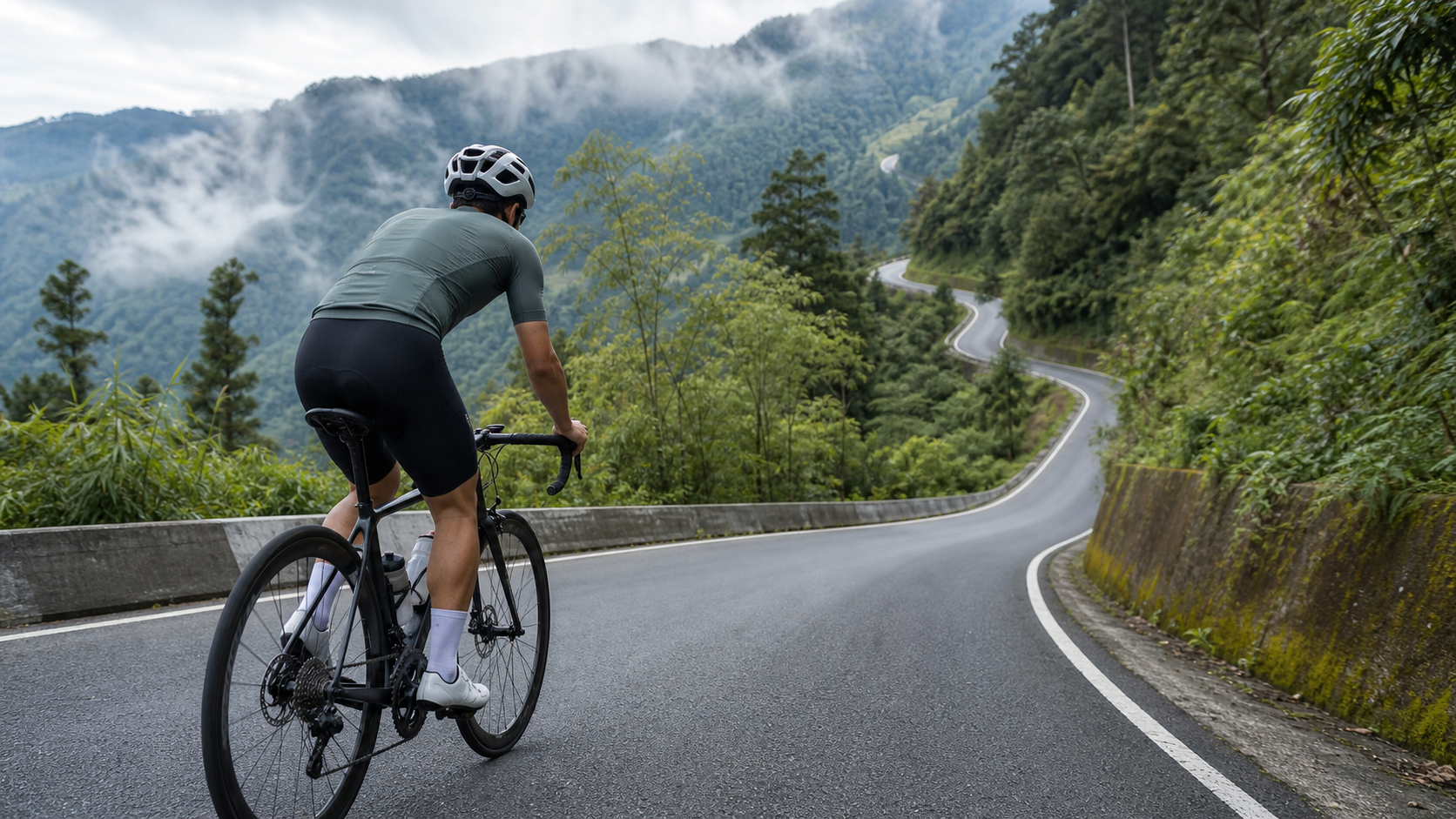
Fenchihu Big Climb Complete Guide: 14.03 km, 5.9% Average Grade Long-Distance Test, and a Data Misunderstanding About “Elevation Gain”
Route Overview and Data Analysis
Fenchihu Big Climb, Strava segment ID 9767837, is a highly representative long-distance climbing route within the Alishan road system. The officially recorded distance is 14,034.9 meters, which converts to 14.03 km, with an average grade of 5.9%. Under Strava’s climb categorization system, it is classified as Category 5, belonging to the long-distance major climb tier, with the finish located around Fenchihu Old Street.
Before diving into the guide, one thing must be honestly clarified for readers, as it affects how you should assess the true difficulty of this route before heading out.
In the route database, the “total elevation gain” (elevation_m) field for this segment displays 1,499.1 meters. At first glance, this is a daunting figure—if 14.03 km were to gain 1,499 meters, the average grade would need to exceed 10% to make sense, yet this route’s stated average grade is only 5.9%, and the two clearly don’t align. Working backward with the most basic climbing estimation formula:
Distance × Average Grade = 14,034.9 m × 5.9% ≈ 828 meters
If this estimated elevation gain of 828 meters is compared with the aforementioned short climbing route, you’ll find that although Fenchihu Big Climb’s distance is nearly 1.3 times that of the short route, its average grade is slightly gentler (5.9% vs. 6.6%), making the actual climbing intensity per unit distance somewhat milder. This is also why Fenchihu Big Climb is classified as Category 5 (long-distance major climb) rather than a steeper tier—its challenge comes primarily from “extended duration” rather than “extremely steep gradients at any single point.” This characteristic directly affects your pacing and energy allocation strategy; see the section-by-section guide below for details.
The gap between 828 meters and the database’s 1,499.1 meters is nearly double—this discrepancy is not normal fluctuation within an error margin but rather a problem with the data’s definition itself. After cross-referencing the data formats of other routes, the more reasonable explanation is that 1,499.1 meters is likely not “the elevation gain of this climb” but rather “the altitude of the Fenchihu finish point”—Fenchihu itself does indeed sit in a mountainous area at approximately 1,400 meters above sea level, a figure consistent with general geographic knowledge of Taiwan, but it appears to have been mistakenly entered or interpreted as this segment’s total elevation gain.
Therefore, this guide adopts the more credible estimated value of 828 meters as this route’s “total elevation gain” for readers’ pre-ride planning reference. At the same time, it’s important for readers to understand a key concept: “How high Fenchihu itself is” and “how much elevation this climb gains” are two entirely different things. Fenchihu’s altitude of approximately 1,400 meters describes the absolute height of this location; 828 meters describes the relative elevation difference you actually climb from the starting point to the finish. It’s like the difference between being on the 88th floor of Taipei 101 and taking the elevator from the 1st floor up to the 88th floor—these are two different measurement baselines: one is an absolute position, the other is a relative change. Confusing these two figures will cause you to seriously misjudge this route’s difficulty.
This verification process also reflects the basic literacy every cyclist should possess when using any route database or app. Elevation gain and altitude/elevation are two concepts that are frequently conflated but are fundamentally different in nature. Especially during data integration or import processes, if field definitions are unclear, situations like this route’s “finish altitude” being mistakenly entered into the “elevation gain” field can easily occur. For cyclists seriously planning their training, 828 meters and 1,499.1 meters represent vastly different levels of challenge intensity—if you truly had to gain 1,499 meters over 14.03 km, the average grade would need to be around 10.7%, a level reserved for only a few of Taiwan’s hardest climbs. But the actual stated average grade is 5.9%, and the two clearly cannot both be true. Only by cross-referencing distance and average grade to work backward can you reconstruct an estimate closer to reality.
Going one step further, the figure of 828 meters itself is also an “estimated value” rather than a precise measurement, for the same reason mentioned earlier—the average grade is a single number derived by averaging out the entire route’s undulations, and the actual route likely contains several sections with grades noticeably above or below the average. Readers are therefore advised to treat 828 meters as a reasonable difficulty expectation baseline before the ride, but after completing the challenge, you should defer to the actual climbing data recorded by your own GPS device. Cross-referencing the two will give you the most complete and authentic understanding of this route.
Section-by-Section Guide: Energy Allocation for a 14 km Long Climb
14.03 km is no short distance, and with a sustained 5.9% average grade, it’s a considerable test of both energy allocation and mental endurance. The following sections follow the typical pacing rhythm for a Category 5 long-distance major climb; for actual terrain variations, please refer to your personal GPS track and the Strava segment map.
Section 1 (Warm-up Start, approximately the first 3 km): The biggest taboo in long-distance climbing is starting with high-intensity output from the very beginning, because you still have over 10 km to go. For this section, it’s recommended to keep your heart rate around 70–75% of maximum, and err on the conservative side with power output, giving your body and cardiovascular system ample time to adapt to sustained effort. Many riders unconsciously speed up in this section because it “still feels easy,” only to burn through their energy reserves prematurely in the later stages—this is the most common and most fatal pacing error in long-distance major climbs.
Section 2 (Steady Climbing Section, approximately km 3 to 8): After entering the middle portion of the route, the grade gradually approaches the overall average of 5.9%, and this is the critical stretch that determines whether you can complete the entire ride smoothly. It’s recommended to adopt a “sustainable steady output” strategy, focusing on maintaining a consistent cadence rather than chasing instantaneous speed. This stage is also the best time for fueling—solid food and fluid intake should be scheduled during this relatively stable section to avoid the safety risk of distracted eating on steep or winding sections.
Section 3 (Test Section, approximately km 8 to 11): Most long-distance big climbs experience a compounding effect of physical fatigue and grade load in the middle-to-late stages. Even if the actual grade doesn’t become noticeably steeper, your subjective rating of perceived exertion (RPE) will rise significantly. This is the section where thoughts of giving up most easily arise. It’s recommended to use the segmented goal method—breaking the remaining distance into smaller units (e.g., “just hold on for two more kilometers to the next switchback”) to reduce psychological burden.
Section 4 (Final Push Section, approximately km 11 to 14): Approaching the Fenchihu finish, most riders’ energy has noticeably declined, but because the finish is in sight, morale typically rebounds somewhat. For this section, adjust according to your body’s actual response—if you still have reserves, you can gradually increase output; if you’re already near your limit, completing the ride is the primary goal, and there’s no need to force a sprint. After arriving in the Fenchihu Old Street area, remember to slow down—there’s considerable mixing of pedestrians and vehicles here, and safety always takes priority over performance.
Looking at the entire 14.03 km route as a whole, the biggest difference between long-distance major climbs and short climbs is that “energy allocation” matters far more than “instantaneous power output.” A short climb might be survivable by sheer willpower for the final few minutes, but 14 km is long enough to amplify the cost of any pacing mistake—using 10% more effort in the early stages may well cost you far more than 10% to repay in the later stages. It’s recommended to make good use of your bike computer’s lap function, dividing the entire ride into checkpoints every 2 to 3 km, and periodically checking whether your power or heart rate falls within the expected range. If you notice values consistently running high, proactively slow down rather than passively reacting only after your body sends clear fatigue signals. This proactive pacing management is the most fundamental tactical difference between long-distance and short climbs.
Gear Ratio and Equipment Recommendations
A 14.03 km long-distance major climb with a 5.9% average grade but possible localized steep sections demands gear ratios and equipment that prioritize “endurance” over sheer “explosiveness” compared to short climbs.
| Rider Level | Recommended Chainring | Recommended Cassette | Notes |
|---|---|---|---|
| Beginner/Long-distance challenger | 34/50 (Compact) | 11-34T or wider range | Long climbing hours take a heavy toll on energy; be sure to keep the easiest gear for late-stage fatigue |
| Advanced rider | 34/50 | 11-30T or 11-32T | Balances full-route endurance with gear flexibility for localized steep sections |
| Competitive level | Adjust per personal FTP | 11-28T or more compact range | Professional setup pursuing sustained high power output throughout |
In terms of equipment, this type of long-distance major climb requires special attention to:
- Fuel capacity: Since challenge times typically exceed 1 hour (see the time estimation table below), it’s recommended to carry at least two bottles and prepare sufficient solid or gel nutrition to avoid a sudden downturn from energy depletion mid-ride.
- Thermal layer: The Fenchihu finish sits at approximately 1,400 meters above sea level. Even if it’s sweltering at the base, temperatures at altitude can be noticeably lower. Especially if you plan to descend the same way back, a lightweight windbreaker or arm warmers are strongly recommended to guard against hypothermia risk on the descent.
- Brake system: A long climb means an equally long descent. Brake pad condition and wheel heat dissipation must be verified in advance to avoid brake fade from continuous braking.
- Lighting and reflective gear: If the challenge runs long and darkness falls during the descent, front and rear lights and reflective accessories are essential safety equipment.
Beyond hardware, long-distance major climbs place higher demands on the overall mechanical condition of your bike. Before departure, it’s recommended to perform a complete pre-ride check, including whether the drivetrain shifts smoothly (you’ll be shifting frequently throughout the 14 km climb, and a dropped chain or skipping gears will seriously disrupt your pacing rhythm), whether the chain has sufficient lubrication (to avoid noise or accelerated wear under prolonged high-load pedaling), and whether the wheel hubs spin freely. These seemingly trivial mechanical checks may have limited impact on a short climb, but over a 14 km long-distance challenge, any small issue can be magnified by time into a severely degraded experience or even a safety risk.
Nutrition and Hydration Strategy
A 14.03 km climb at 5.9% average grade is, for most riders, a sustained battle lasting over an hour, and the nutrition strategy must be more systematic than for short climbs.
Before the ride: It’s recommended to start paying attention to fluid and electrolyte intake the day before. Avoid starting on an empty stomach on the day of the ride; finish a carbohydrate-focused, easily digestible meal 1 to 2 hours before the start.
During the ride: Within this duration range, a single bottle may well be insufficient to sustain the entire ride. At least a two-bottle setup is recommended, with one bottle containing electrolyte supplementation. Establish a fixed fueling rhythm during Section 2 (the steady climbing section)—for example, replenishing fluids and a small amount of energy gel or banana every 20 to 30 minutes—rather than waiting until you’re clearly thirsty or hungry to fuel on the fly.
After the ride: The golden recovery window after completing the challenge is equally important, especially if your itinerary includes descending the same way or other travel needs. Moderately replenishing carbohydrates and protein helps maintain subsequent energy and focus, preventing sluggish reactions from low blood sugar during the descent.
One point worth special emphasis is that many riders overlook the fact that “reaching the finish doesn’t mean the fueling task is over.” Shops in the Fenchihu Old Street area can usually provide food and drink, but if your plan is to descend the same way and continue with additional mileage afterward, it’s recommended to maintain a steady rhythm of fluid and energy intake even after arriving, rather than letting your guard down on energy management for the rest of the itinerary just because the main climbing goal is complete. The nutrition strategy for a long-distance major climb is, in essence, a sustained campaign spanning the entire journey (including the descent and subsequent itinerary), not just aimed at the climb itself.
Weather and Seasonal Recommendations
Due to its higher elevation, the Fenchihu area has a climate distinctly different from the lowlands. Be sure to pay special attention to the following before heading out:
Temperature variation: Even if the base is under a blazing, muggy sun, temperatures at the Fenchihu finish altitude are often noticeably lower. Especially in the early morning and evening, the temperature difference can reach 5 to 10°C or more. It’s recommended to carry a lightweight thermal layer even for summer challenges to cope with the perceived cold during the descent.
Cloud and fog: High-altitude mountain areas are prone to fog, and visibility can drop sharply in a short time, particularly common in the afternoon. It’s recommended to schedule your challenge for the morning hours to avoid fog affecting visibility and safety.
Recommended season: Autumn and winter through early spring of the following year are relatively dry and stable seasons, well suited for this type of long-distance major climb. In summer, special attention is needed for afternoon thundershowers and the rapidly developing convective cloud systems typical of mountain areas; it’s recommended to start early and aim to complete the challenge before noon.
UV and sun protection: The higher the altitude, the stronger UV intensity typically becomes. Combined with prolonged exposure during the climb, sun protection cannot be taken lightly. It’s recommended to apply sunscreen throughout the ride and reapply regularly, paired with UV-resistant arm sleeves or a long-sleeve jersey, to avoid sunburn affecting subsequent riding experience or even health.
Wind effects: Over a 14 km long-distance route, wind direction and speed can vary more noticeably than on short routes. Especially near mountain ridgelines or open-visibility sections, crosswinds or headwinds can substantially increase riding resistance. It’s recommended to check the day’s wind forecast in advance; if winds are clearly strong, adjust your pacing expectations accordingly rather than fixating on your usual target time.
Common Mistakes and DNF Risks
Mistake 1: Misinterpreting elevation data and underestimating challenge difficulty. As discussed earlier, if you mistakenly believe the database’s 1,499.1 meters is the actual elevation gain, you’ll overestimate the difficulty and be overly conservative. Conversely, if you completely ignore the climate effects (low temperatures, fog) brought by the finish altitude, you may suffer from inadequate preparation. Be sure to grasp both figures with their distinct meanings: “828 meters of climbing” and “finish at approximately 1,400 meters altitude.”
Mistake 2: Pacing too fast in the early stages of a long climb. The 14 km length amplifies the cost of pacing errors. If the early section feels easy and you speed up, you may face severe slowdown or even be forced to dismount and walk in the later stages.
Mistake 3: Insufficient fueling rhythm planning. Without a systematic fueling plan for a long climb, you can easily hit a sudden downturn in the later stages from insufficient energy and fluids—this is also one of the primary causes of DNF on this type of route.
Mistake 4: Ignoring the need for warm clothing at the high-altitude finish. Many riders only prepare gear for the base climate and discover upon arriving at Fenchihu that the perceived temperature is noticeably lower. Combined with damp, cold clothing from sweat, this creates a hypothermia risk, especially as wind chill on the descent further amplifies the discomfort of the cold.
Mistake 5: Underestimating the dual toll of 14 km on both machinery and physical capacity. Compared to short climbs, 14 km simultaneously tests your bike’s mechanical integrity and your physical reserves. Inadequate preparation on either front can lead to abandoning the ride mid-way. It’s recommended to thoroughly check your bike beforehand and honestly assess, based on your actual training foundation, whether you have the ability to take on this combination of distance and grade, to avoid being caught in a dilemma halfway up the mountain due to insufficient preparation.
Mistake 6: Riding solo without informing others of your itinerary. Mountain signals can be unreliable. If you’re tackling this type of long-distance major climb solo, it’s recommended to inform family or fellow riders of your planned route and time in advance, and carry basic emergency contact tools so you can receive timely assistance if a mechanical failure or physical discomfort occurs mid-ride. This may be a cliché, but risk management on long mountain challenges is always worth repeating.
Estimated Finish Times for Different Rider Levels
The following time estimates are based on a general long-distance climbing performance model for 14.03 km at 5.9% average grade, provided for pre-ride reference only. Actual finish times will vary with individual fitness, fueling conditions, and daily weather.
| Rider Level | Estimated Finish Time | Average Speed | Notes |
|---|---|---|---|
| Beginner/Long-distance challenger | 75–100 minutes | Approximately 8.4–11.2 km/h | Plan moderate rest and fueling stops; completing the ride is the primary goal |
| General advanced rider | 55–75 minutes | Approximately 11.2–15.3 km/h | Has long-distance climbing experience and can maintain a steady pace throughout |
| Experienced/Competitive rider | 40–55 minutes | Approximately 15.3–21 km/h | Has structured training background and can sustain high-intensity output for extended periods |
| Elite/Professional level | Under 35 minutes | Above 24 km/h | Represents an extremely rare top-tier performance level |
Note: The time ranges above are rough model estimates, not officially certified data. Long-distance major climbs demand far more from both physical and mental endurance than short climbs. First-time challengers are strongly advised to pace conservatively and stay attuned to their body’s condition at all times. When necessary, taking a mid-ride break is always preferable to forcing your way through—safety is always the top priority.
Pre-Ride Checklist
| Check Item | Description |
|---|---|
| Drivetrain and chain system | Confirm smooth shifting and chain lubrication to avoid dropped chains or skipping gears during the long climb |
| Brake system | Check brake pad wear; the 14 km descent equally requires reliable stopping power |
| Gear ratio setup | Confirm the easiest gear is sufficient for late-stage fatigue and localized steep sections |
| Fueling plan | At least two bottles, plus enough solid or gel nutrition for a challenge exceeding one hour |
| Thermal layer | Even in summer, carry a lightweight windbreaker for the high-altitude finish temperature difference and descent wind chill |
| Weather and wind forecast | Check rain probability, fog conditions, and daily wind speed to schedule an appropriate departure time |
| Itinerary notification | Inform family or riding buddies of the planned route and time; carry basic emergency contact tools |
Conclusion: The Dual Test of Data Verification and Long-Distance Climbing
Fenchihu Big Climb is not just a long-distance route that tests your legs and cardiovascular endurance—it also reminds every cyclist who takes pre-ride preparation seriously of one thing: when facing data displayed on any route platform, it’s worth cultivating a habit of verification. The gap between 1,499.1 meters and 828 meters may seem like a mere numerical discrepancy, but in reality it can cause serious deviations in your training planning and perceived expectations. Mastering the correct estimated elevation gain of 828 meters while understanding the climate effects of the finish at approximately 1,400 meters altitude is the only way to truly complete your pre-ride preparation and safely, composedly finish this 14.03 km long-distance trial.
Finally, I’d also like to remind every rider preparing to take on Fenchihu Big Climb that a long-distance climb is never merely a race of speed—it’s a comprehensive test of self-awareness and risk management. May every reader, with adequate preparation and an honest approach to both data and personal ability, safely complete this remarkable journey stretching all the way to Fenchihu at approximately 1,400 meters above sea level. And when you look back at the road you’ve traveled from the finish, may you experience that solid sense of accomplishment earned through sweat. I also look forward to you recording your actual measured data from this challenge, accumulating more authentic and credible reference points for the next rider who consults this guide.
Related Reading
- Xiangtian Lake Climb Complete Guide: 5.83 km, 418 Meters of Elevation Gain, Strava-Certified Classic Hard Climb in Nanzhuang
- Alishan Highway Complete Guide: 53.57 km, Over 2,000 Meters of Climbing, Southern Taiwan’s Long-Distance Pilgrimage
- Riding into the Mist: A 14 km Journey Slowly Winding Toward Fenchihu Old Street
- Chiayi Waterway Climb Complete Guide: 10.93 km, 6.6% Average Grade, a Trial in Zhuqi Township
單車 梅山36灣 坡度介紹 路段介紹 空拍 (相關遊記影片,請參考說明或我的頻道喔,歡迎訂閱)
6 年前
梅山36彎 奮起湖 單車挑戰 下集 #公路車
6 年前
梅山36彎 奮起湖 #公路車 之旅 2400m
6 年前
半日 小台灣 極限單車路線挑戰實錄
7 年前
阿里山塔塔加 兩倍特濃版!全新隧道開通! 進喔!公路車 | CT Yeh
3 年前
新竹羅平 x 天湖部落 大禹嶺級變態陡坡! 4K超高畫質 空拍 | 公路車
5 年前
4K單車實境) 嘉義 梅山36灣 訓練台 爬坡 輕鬆騎
6 年前
一定要騎一次!阿里山最深處:里佳部落!單車旅行 | 2800m爬升 | 深度部落體驗:嗨翻晚會、螢火蟲、銀河 | feat. JJSC & 廢物伙伴 | 公路車 CT Yeh
10 個月前