Fanlu Puwei Practical Guide: Data and Tactical Breakdown of the Best Warm-Up Section on Alishan Highway
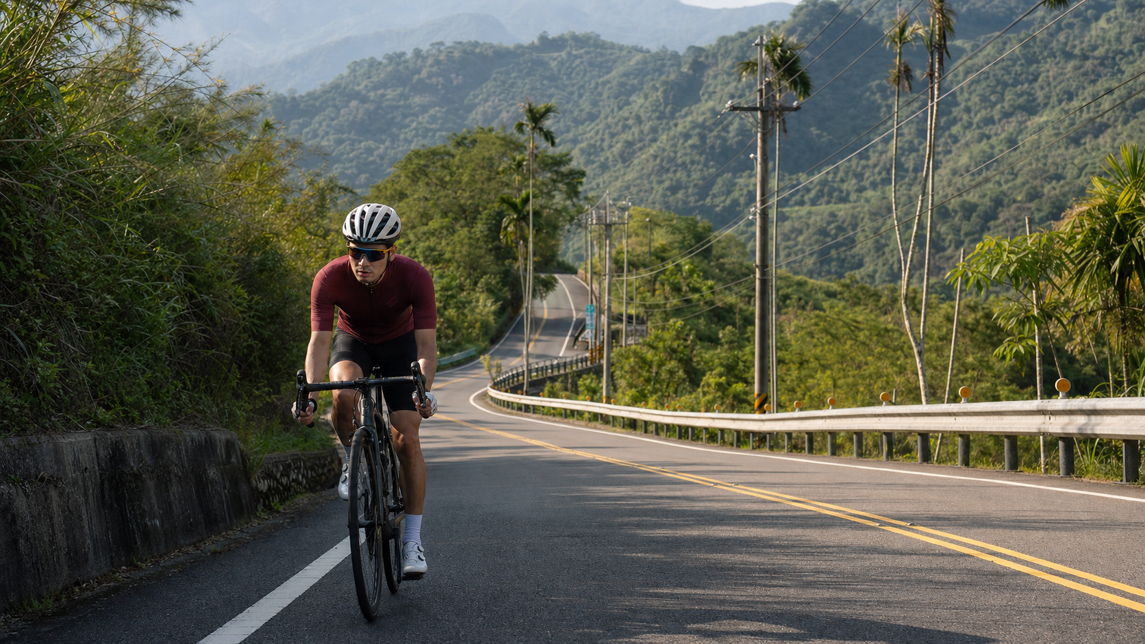
Route Overview: The Best Warm-Up Segment in the Alishan Highway System
Fanlu Puwei, Strava segment ID 6293819, is another training route in the Chiayi foothills that cycling enthusiasts should take seriously. Let’s start with the hard numbers: total length 6269.9 meters, approximately 6.27 kilometers, with an average gradient of 5.1% throughout, and a Strava climb category of Category 3. Compared to the Meishan Wangfengting introduced earlier, Puwei is shorter in distance and slightly gentler in gradient, but that doesn’t mean it should be taken lightly—a 5.1% average gradient sustained for over six kilometers still places sufficient demands on cardiovascular and muscular endurance to constitute a solid moderate-intensity workout.
Regarding elevation gain data, an honest correction is needed here as well. The elevation_m field value for this route in the database is 0, which is clearly a missing value or improperly recorded data and cannot be taken at face value. Recalculating by multiplying distance by average gradient, 6269.9 meters multiplied by 5.1% yields a total elevation gain of approximately 320 meters. This figure is the estimated value adopted in this guide. Readers should note: it is a reasonable estimate derived from distance and gradient, not a precise number measured by an actual GPS altimeter. The actual elevation gain may vary slightly due to road surface undulations, but as a reference baseline for pacing and physical planning, it is already quite serviceable.
This type of missing data is actually not uncommon in the Strava segment databases of many local Taiwanese routes. The causes may range from inaccurate altitude recording due to unstable GPS signals in mountainous areas, to omissions during the data upload process when the segment was created. As a rider seriously planning training, when encountering such data gaps, developing the habit of using basic reverse-calculation logic like “distance multiplied by gradient” to verify the plausibility of numbers will prove more reliable than blindly trusting any single field in the database—especially when a particular number clearly doesn’t align with other known information (such as the distance and gradient of the same route). In such cases, priority should be given to estimates that can be cross-validated, rather than taking raw field values displayed as 0 or anomalous at face value.
Geographically, Fanlu Puwei is located near Chukou and Xiding, sitting precisely in the forward outpost zone leading to Alishan Highway (Provincial Highway 18). For local Chiayi riders, this route has long served as a “warm-up segment” and “foundational training segment”—short in distance with moderate gradient, making it well-suited as a warm-up before tackling the main Alishan Highway on longer challenges, or as an efficient choice for riders with limited training time on weekdays who want to quickly accumulate climbing volume.
From a route engineering perspective, the reason Puwei is particularly suitable as a training segment lies in its relatively straightforward gradient profile—unlike certain mixed-terrain routes that alternate between steep and gentle, up and down, it maintains a relatively consistent moderate-gradient climb. This simplicity in gradient is quite advantageous for riders seeking structured training, as it reduces the interference of terrain variables on training data, allowing you to more precisely assess your sustained power output within specific intensity zones, without having to guess “was I faster this time because the gradient eased, or because I genuinely got stronger?”
Furthermore, Puwei’s connectivity with the surrounding road network in Fanlu Township is quite comprehensive. As one of the essential nodes on the route from the Chiayi suburbs into the Alishan Highway system, there are multiple branch roads and alternative paths nearby for linking together. For riders planning long-distance training menus, Puwei can be flexibly inserted at different stages of a ride—whether as a warm-up, a mid-ride intensity test point, or even a final sprint segment before finishing. This flexibility in route planning is another reason it has long been favored by local cycling teams.
Segment-by-Segment Strategy: Breaking Down the Rhythm of Six Kilometers
Breaking the 6.27 kilometers into three to four stages will allow you to manage pacing and energy distribution more precisely.
Stage 1 (0-1.5 km): The warm-up period for getting into rhythm. The gradient here is typically relatively gentle, making it suitable for using a moderate gear ratio to gradually transition your body from flat-road riding rhythm into climbing mode. It’s recommended to keep cadence above 85 rpm, avoiding the temptation to start with too heavy a gear that drops cadence and causes premature lactate accumulation in the muscles.
Stage 2 (1.5-4 km): The core climbing section, testing sustained output capacity. This is the core interval where the gradient is most demanding and the physical requirements are most direct. It’s recommended to keep heart rate or power slightly below the lactate threshold zone, maintaining steady rather than explosive output. Since the route isn’t long overall, many riders tend to overexert here in pursuit of speed, only to run out of steam in the later stages—be sure to pay attention to pacing consistency.
Stage 3 (4-5.5 km): Maintain rhythm, prepare for the finish. This section tests sustained focus—with the finish not far away, it’s easy to unconsciously let your guard down, but the gradient hasn’t fully ended yet. It’s recommended to continue maintaining steady output, avoiding pacing fluctuations caused by mental relaxation.
Stage 4 (5.5-6.27 km): The closing sprint section. For the final stretch of less than one kilometer, you can moderately increase output intensity and sprint toward the finish based on your current physical condition. Since the overall route isn’t long, this closing sprint also has a certain effect on training anaerobic capacity and finish-line sprint awareness.
It’s worth specifically noting that because Puwei’s overall distance is relatively short, the significance of segment strategy differs somewhat from long-distance climbing routes. On a nine-kilometer-grade route like Wangfengting, segmented pacing is primarily about avoiding excessive depletion in the early stages and ensuring reserve energy remains for the latter part; but on a route just over six kilometers like Puwei, since the overall riding time naturally falls within the 20-to-35-minute range, it more closely resembles a “short-duration high-intensity interval” training pattern. The meaning of segmentation here lies more in “training your ability to adapt to switching between different heart rate zones” rather than merely energy distribution. If you’re an experienced rider, consider treating Puwei as a structured tempo interval—deliberately raising intensity in Stage 2 to near the upper edge of threshold and observing how your body responds at moderate-to-high intensity. This training approach offers direct benefits for riders preparing for time trials or climbing-oriented road races.
Additionally, regarding the pairing of breathing and cadence, because Puwei’s gradient is slightly gentler than Wangfengting’s (5.1% vs 6.4%), the overall riding rhythm can be set at a slightly higher cadence, maintaining around 90 rpm. This cadence configuration on moderate-gradient terrain balances power output efficiency with muscle fatigue management, preventing the thighs from rapidly accumulating lactate within just six kilometers due to overly heavy gearing.
Gear Ratio and Equipment Recommendations
Given the route characteristics of an average gradient of 5.1%, a total length of 6.27 km, and a Category 3 rating, the equipment setup can be slightly more flexible than for longer climbing routes like Wangfengting, but the basic principles still apply.
| Rider Level | Recommended Chainring | Recommended Cassette | Recommended Minimum Gear Ratio |
|---|---|---|---|
| Beginner/Recreational | 34T (small ring) | 30-32T large cog | 34/30 or lower |
| Advanced/Semi-pro team | 34-36T | 27-30T | 34/27 |
| Competitive | 36-39T | 25-27T | 39/25 |
Since Puwei’s gradient is slightly more moderate than Wangfengting’s (5.1% vs 6.4%) and the distance is shorter, riders with a power-to-weight ratio above 3.0 can actually consider using a gear one step heavier than what they would use on Wangfengting to train power output, thereby strengthening muscular strength and power ceilings. However, for beginners and recreational riders, maintaining a smooth cadence should remain the top priority to avoid excessive knee joint stress from overly heavy gearing.
Because this route is short in both distance and duration, the impact of equipment differences on overall finishing time is not as significant as on longer climbing routes. An aluminum wheelset used for daily training is more than sufficient. Allocating your resources to the longer Alishan Highway system challenge segments would be a smarter equipment strategy.
Regarding tire pressure and width selection, since the road conditions and gradient on Puwei are relatively moderate, you can lean slightly toward a comfort-oriented setup—for example, using tires 28mm or wider with slightly lower pressure. This improves ride comfort while maintaining efficiency. For riders using Puwei as a daily commute and training route, this setup balances long-term comfort with training effectiveness. If using Puwei as a final pre-race test, you can switch back to narrower, higher-pressure racing tires for purer rolling efficiency and acceleration response.
For bike preparation, since Puwei is often ridden as one segment of a longer route (e.g., a long journey connecting to the Alishan Highway system), it is recommended to check brake pad wear and derailleur cable tension before departure. After all, if Puwei is only the first segment of the day’s ride, with longer and steeper roads ahead, any minor equipment issue could be amplified into a safety concern later on.
Nutrition and Hydration Strategy
For a 6.27 km route with an average gradient of 5.1%, most riders will finish in approximately 18 to 35 minutes (depending on individual ability), classifying this as a “very short, high-intensity” type of effort.
Before the ride: Since the single ascent is relatively short, there is no need for extensive carbohydrate loading like in long-distance endurance riding. However, it is still recommended to ensure you start in a well-hydrated state, avoiding tackling a moderate-intensity climb on an empty stomach or while dehydrated.
During the ride: For a distance of just over 6 km, the vast majority of riders will not need any solid food during a single ascent—one full water bottle is more than sufficient. If you are using Puwei as a warm-up before continuing onto the longer Alishan Highway system routes, it is recommended to focus your nutrition on the break after completing Puwei and before starting the next segment, rather than rushing to take energy gels within those short six kilometers.
After the ride: If Puwei is the final segment of the day’s training, it is recommended to consume an appropriate amount of carbohydrates and protein within 15-30 minutes after finishing to help the body transition from training into recovery mode. If Puwei is merely a warm-up with a longer ride planned afterward, it is recommended to focus on steady, small sips of water and save your main energy resources for the longer ride ahead.
One detail worth noting in the nutrition strategy concerns the timing of electrolyte intake. Since a single ascent of Puwei is short, there is generally no significant risk of electrolyte imbalance. However, if you plan to ride Puwei multiple times in the same day (e.g., for interval training) or continue onto longer Alishan Highway system segments, it is recommended to supplement with electrolyte drinks before starting the second ascent, rather than waiting until cramping symptoms appear to take emergency action. Once cramping occurs, it often takes far longer to recover than it would have taken to prevent it, and the impact on your training rhythm is much greater than the effort of prevention.
Weather and Seasonal Recommendations
Fanlu Township is adjacent to Chukou and the entrance to the Alishan Highway. Its terrain and climate characteristics are similar to Meishan Township, and it is equally susceptible to convective rainfall triggered by hilly terrain.
Spring (March-May): The climate is relatively stable, but brief rainfall from frontal systems is still possible. Morning rides are recommended.
Summer (June-August): Afternoon thunderstorms are particularly easily triggered in hilly terrain. Combined with Fanlu Township’s proximity to Chukou’s topography, the probability of mountain fog and rainfall is high. It is strongly recommended to depart in the early morning and complete your training before convective cloud systems develop.
Autumn (September-November): This is the most climatically stable season of the year. Whether using Puwei as a standalone training route or as a warm-up for a long-distance Alishan Highway system challenge, autumn offers the lowest risk and the most comfortable conditions.
Winter (December-February): Temperatures are lower under the influence of the northeast monsoon. However, since Puwei’s elevation is not particularly high, the impact of low temperatures and strong winds is more moderate compared to the high-elevation sections of Wangfengting or the Alishan Highway main line. Still, it is recommended to bring basic cold-weather gear to cope with early morning low temperatures.
It is worth adding that because Puwei’s overall elevation is not particularly high, the seasonal temperature variation affecting this route is indeed more moderate compared to Wangfengting or the higher-elevation Alishan Highway sections. This is one reason it is well-suited as a year-round training route—unlike high-elevation segments that risk road frost or dense fog reducing visibility in winter, Puwei maintains relatively stable and rideable conditions in most seasons. However, it is still worth reminding: if your plan is to use Puwei as a warm-up before connecting to higher-elevation segments of the Alishan Highway system, be sure to check the real-time weather and road condition announcements for your destination segment that day. Clear weather at Puwei does not guarantee the same conditions on the higher-elevation roads above—vertical weather variation in Taiwan’s hill-to-mountain terrain is quite common.
Common Mistakes and DNF Risks
Mistake 1: Treating a short route as an all-out sprint while ignoring pace control. A distance of just over 6 km can easily create a “it’ll be over soon anyway” mentality, leading riders to attack at near-maximum effort. The result is being forced to slow down dramatically mid-climb due to an excessively high heart rate, ultimately producing a slower overall finishing time.
Mistake 2: Underestimating the actual intensity of a warm-up route. Although Puwei is often used by local riders as a warm-up before heading to the Alishan Highway, a 5.1% average gradient combined with over 6 km of sustained climbing is already a meaningful training intensity in itself. Preparation should not be taken lightly with a “it’s just a warm-up” attitude—especially pre-ride checks of the drivetrain and tire pressure.
Mistake 3: Ignoring energy allocation when riding as part of a longer route. If your plan is to use Puwei as a lead-in segment before entering the Alishan Highway system, be sure to conserve energy for the longer, steeper roads ahead. Do not exhaust your reserves on Puwei itself.
The DNF risk on this route is very low. The main cautions center on summer afternoon weather risks and energy allocation strategy when riding as part of a longer route.
Mistake 4: Mistaking estimated elevation gain for precise measurements, creating overly high expectations. The elevation gain field in the route database is missing (displayed as 0). This article uses an estimated value of approximately 320 meters derived from distance multiplied by gradient. Readers should be reminded that this is a reasonable estimate, not a precise GPS-measured elevation result. If your cycling computer or training software displays a slightly different elevation gain figure, there is no need to be overly concerned—this falls within the normal margin of error between estimation methods and actual micro-terrain undulations.
Mistake 5: Ignoring the need to warm up even on short routes. Many riders assume that since Puwei is short, they can skip the warm-up and start at full effort immediately. This approach places moderate-to-high intensity load on a body that is not yet fully prepared, increasing the risk of muscle strains or joint discomfort. Even for a route of just over 6 km, simple dynamic stretching and an easy-paced start before departure are preparation steps worth investing in.
Mistake 6: Repeatedly training the same route without recording data, making progress impossible to track. Puwei is well-suited as a benchmark route for repeated long-term training. But if you finish each ride without recording power, heart rate, or finishing time, you lose the ability to use it to measure your improvement. It is recommended to pair it with a cycling computer or training app, accumulate ride data on this route over time, and periodically review your performance changes on the same segment. Only then can you truly maximize Puwei’s training value.
Estimated Finish Times by Rider Level
The following estimates are based on route conditions with an average gradient of 5.1%, an estimated total elevation gain of approximately 320 meters, and a total length of 6.27 kilometers. Actual times may vary depending on individual fitness, wind conditions, and road surface conditions.
| Rider Level | Power-to-Weight Ratio Reference | Estimated Finish Time | Average Speed Reference |
|---|---|---|---|
| Beginner/Recreational Rider | 2.0-2.5 W/kg | 28-35 minutes | Approx. 11-13 km/h |
| Intermediate/Advanced Rider | 2.5-3.2 W/kg | 20-27 minutes | Approx. 14-19 km/h |
| Experienced/Semi-competitive | 3.2-4.0 W/kg | 15-19 minutes | Approx. 20-25 km/h |
| Competitive/Professional | 4.0 W/kg and above | 11-14 minutes | Approx. 27-34 km/h |
Note: The table above is for training planning reference only. When attempting the route, it is recommended to first focus on familiarizing yourself with the road conditions, then gradually adjust your pacing strategy based on your own data.
Since completion times at Puwei generally fall within 35 minutes, even beginner riders can easily incorporate this route into a weekly fixed training frequency, accumulating data samples through repeated rides. Compared to sections like Wangfengting that require longer recovery time, Puwei has a lower training cost and is better suited as a high-frequency, short-duration intensity stimulus. If you are planning a periodized training program, consider scheduling Puwei during recovery weeks or lower-intensity training days as a low-cost option for maintaining climbing strength and cardiovascular adaptation, while reserving higher-intensity, higher-load routes such as Wangfengting and the main Alishan Highway for training weeks when your fitness level is at its best.
Conclusion: A Small but Solid Training Tool
Although Fanlu Puwei is less than 7 kilometers in distance with an estimated elevation gain of only about 320 meters—figures that pale in comparison to those heavy climbing routes spanning 20 to 30 kilometers—its value lies precisely in this “small but solid” training efficiency. For commuter cyclists with limited training time, or riders who need a route for warm-up testing before a long-distance challenge, Puwei offers an excellent choice with low time cost and high training benefit. Add it to your Chiayi hill training map and alternate it with Wangfengting and other nearby sections, and you will discover that this seemingly unremarkable six-kilometer stretch is actually an important piece of the puzzle on the path to the greater challenges of the Alishan Highway system.
From a training science perspective, short, moderate-gradient sections like Puwei play an irreplaceable role in overall training planning—they allow you to repeatedly perform high-quality intensity stimuli within limited time costs, accumulate sufficient training sample sizes, while reducing the recovery burden each session places on your body. Compared to long-distance heavy routes that require an entire morning to complete, sections like Puwei can be more flexibly inserted into a busy daily schedule, whether it’s an evening session after work or a quick workout before heading out on a holiday morning, allowing you to complete a meaningful climbing stimulus within a reasonable time frame. Accumulated over the long term, this training pattern of high frequency and low per-session load is often more efficient for building a stable climbing strength foundation than occasional long-distance heavy challenges, and it better aligns with the real-world time constraints of most amateur riders. Treat Puwei as the “fundamentals” section in your Chiayi hill training system, and by consistently repeating rides on it, you will find your performance on more challenging sections like Wangfengting and even the main Alishan Highway will also improve steadily.
Related Reading
- The Six-Kilometer Threshold: Fanlu Puwei and the Persimmon and Dragon Eye Fruit Road to Alishan
- Complete Guide to Alishan Highway: The 53.57-Kilometer, 2,000-Meter-Climb Long-Distance Pilgrimage of Southern Taiwan
- Complete Guide to Chiayi Waterway Climb: The 10.93-Kilometer, 6.6% Average Gradient Trial of Zhuqi Township
- Meishan Wangfengting Practical Guide: Complete Analysis of the 9-Kilometer, 6.4% Gradient Chiayi Hill Training Route
台北闊瀨陡坡 騎旅 / 日本單車雜誌編輯車友臨時加入!/ 髮香才是最強的 / feat. 北迴歸線小隊 / 公路車 CT Yeh
6 個月前
阿里山塔塔加 兩倍特濃版!全新隧道開通! 進喔!公路車 | CT Yeh
3 年前
嘉義大埔、阿婆灣挑戰賽,美到以為在日本!ft. 環騎5 Cool 西拉雅188 / 公路車 / CT Yeh
7 個月前
單車 梅山36灣 坡度介紹 路段介紹 空拍 (相關遊記影片,請參考說明或我的頻道喔,歡迎訂閱)
6 年前
爬坡ITT實境)台中 魔王 松鼠坡 首航 6:12 大肚山 大三元 科福路
8 年前
半日 小台灣 極限單車路線挑戰實錄
7 年前
梅山36彎 奮起湖 單車挑戰 下集 #公路車
6 年前
4K單車實境) 嘉義 梅山36灣 訓練台 爬坡 輕鬆騎
6 年前