North Cross-Island Highway Mingchi Practical Guide: 19.45 km, 4.3% Average Grade Cloud-Mist Trial, Full Data Breakdown and Segment-by-Segment Tactics
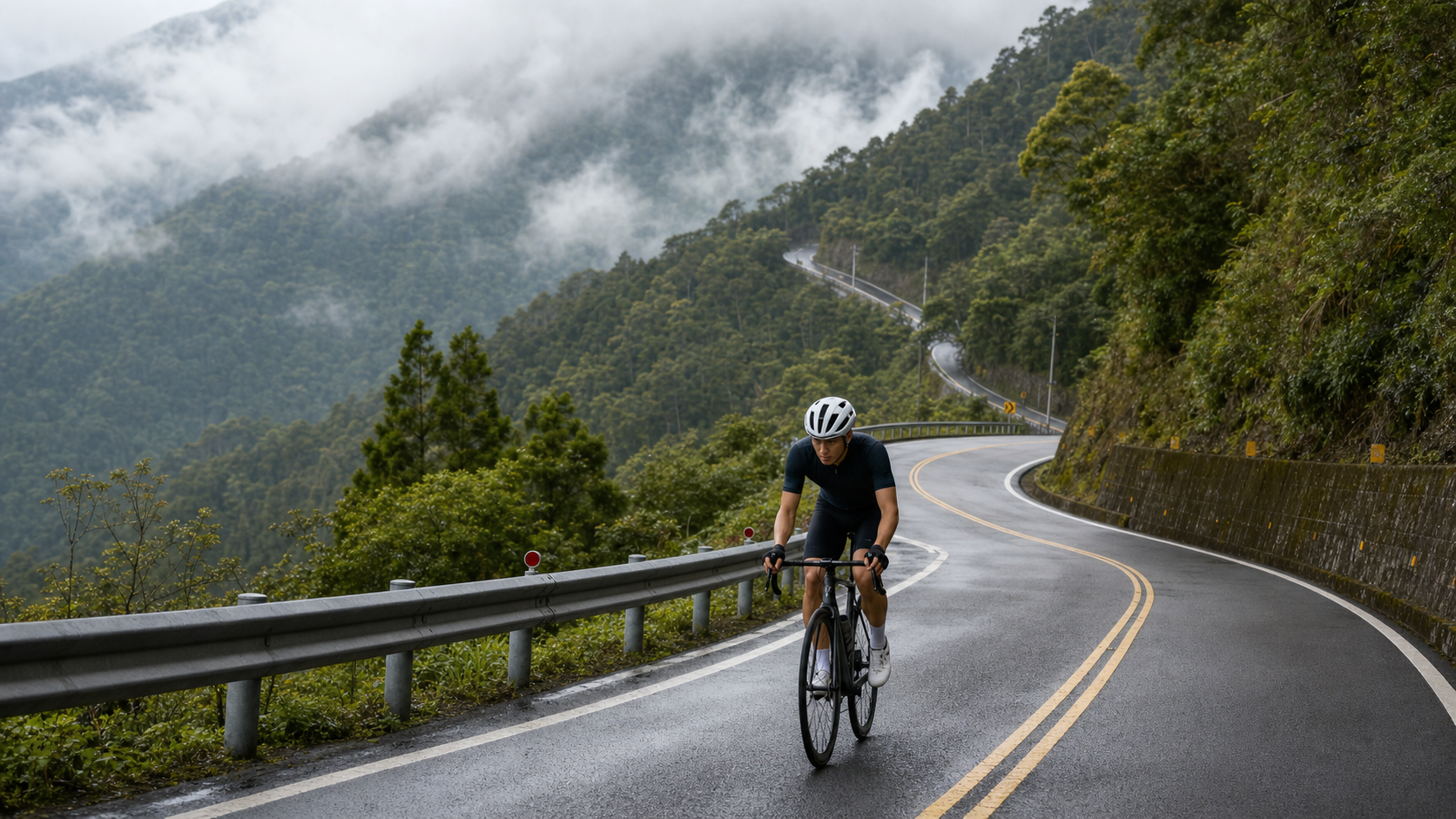
North Cross-Island Mingchi Practical Guide: 19.45 km, 4.3% Average Grade, a Cloud-and-Mist Trial—Data Breakdown and Segment-by-Segment Tactics
North Cross-Island Mingchi, Strava segment 10498838, is a well-known “hard fight” in the northern Taiwan road cycling community. It covers the core climbing section of Provincial Highway 7 from Baling toward Mingchi Forest Recreation Area, and is the actual embodiment of what many riders call the “boss-level segment.” The goal of this article is simple: clarify the data, break down the tactics, and give you an accurate mental map of this road before you get on your bike—not just a hearsay impression.
Route Overview and Real Data Analysis
Let’s start with the conclusion: this segment is 19,451.7 meters in total length, or 19.45 km, with an average grade of 4.3%, classified by Strava as Category 5, with the start and end points roughly falling along the Provincial Highway 7 corridor between Baling and Mingchi Forest Recreation Area.
Here, we must honestly confront a data contradiction rather than gloss over it. The original route database simultaneously lists “total elevation gain of 2,452.3 meters” and “average grade of 4.3%,” but these two figures together are mathematically inconsistent. We can verify this using the most basic climbing formula:
Elevation gain (meters) = Distance (meters) × Average grade
If we take the distance as 19,451.7 meters and the average grade as 4.3%, the calculated elevation gain should be 19,451.7 multiplied by 0.043, which equals approximately 836.4 meters. In other words, based on the distance and average grade this segment itself lists, a reasonable total elevation gain should fall around 830 to 840 meters, not 2,452 meters.
The reverse check is equally inconsistent: if the total elevation gain were truly 2,452.3 meters and the distance 19.45 km, then the average grade would have to be as high as 12.6%—that would already be a super-steep, mountain-pass-style climb at Taiwan road race event level (such as certain sustained steep sections on the western approach to Wuling). Given that North Cross-Island Mingchi is a two-lane provincial highway that mainly follows river valleys and rises gradually along the terrain, it would be physically impossible to sustain such an average grade over the full 19.45 km without cliff-like drops or extreme steep sections. If a 19.45 km stretch with a 12.6% average grade truly existed, it would be one of the most famous “boss-level” segments in all of Taiwan, and it would be highly unlikely to be classified only as Strava Category 5 (the lowest difficulty tier). This classification contradiction is itself another clue supporting the unreasonableness of the 2,452.3-meter figure.
My assessment is that the 2,452.3-meter elevation gain figure is very likely a data entry error—the most common scenario being that the cumulative elevation gain for “the entire North Cross-Island Highway (Daxi to Yilan, over 110 km in total length, passing through multiple consecutive climbs and descents, with cumulative gain naturally far exceeding that of a single sub-segment)” was mistakenly entered into the field for this 19.45 km sub-segment. This kind of database field misplacement is not uncommon on route information platforms, especially when a long highway is split into multiple sub-segments for archiving; the total elevation gain field can easily go wrong during copy-paste or system import processes, particularly if the original GPS track covered a longer range and was then trimmed into sub-segments without the elevation figures being recalculated accordingly.
Therefore, all subsequent tactical planning, perceived-effort estimates, and target time conversions in this article will use the internally consistent data set of “distance 19.45 km, average grade 4.3%, converted elevation gain of approximately 830–840 meters,” and will no longer reference the 2,452.3-meter figure, which contradicts the distance and grade. If you see this segment listed with a conspicuously high elevation gain on other platforms or apps, I recommend verifying it yourself using the formula above: elevation gain equals distance times grade. Don’t blindly trust a single field’s number, especially such an extreme value that clearly deviates from common sense.
So, with the elevation gain pinned at the 830–840-meter range, what level of challenge is this road? Let me put it in plain terms first: This is not a limit climb that will break your legs, but it is a segment that will wear you down through “time” and “continuity.” An average grade of 4.3% falls in the “moderate-to-hard” sustained climbing range in road cycling classifications—not like the western approach to Wuling, where some sections demand frequent standing sprints at 8–10% average grades, but also far from a gentle slope where you can cruise in the big chainring. At this grade over 19.45 km, for most amateur riders, it means a continuous effort lasting 50 to 90 minutes. This “duration” is the segment’s true killing power—it tests not your instantaneous output, but your aerobic endurance base and pacing discipline.
Strava’s Category 5 rating for this segment is the relatively lowest tier in that system (5 is lightest, 1 and HC are heaviest), and this rating mainly reflects a quantitative score of “elevation gain multiplied by distance,” which does not mean the segment is an easy ride. Compared to other well-known climbs in Taiwan, the North Cross-Island Mingchi section sits in intensity between typical suburban hill climbs (such as Fengguizui or Balaka Highway) and heavyweight long climbs (such as Wuling, Hehuan Mountain, or Taipingshan). It is suitable as a training benchmark segment for advanced riders and also as an “entry-level heavyweight” choice for riders new to tackling long climbs to level up their skills.
Another point worth mentioning is the elevation context: Mingchi Forest Recreation Area itself sits at an elevation of around 1,000 meters, while the Baling area is roughly in the 600 to 700-meter range. The difference between the two corresponds reasonably to the 830–840-meter elevation gain of this segment—the elevation difference from start to finish falls in that magnitude, and it mutually corroborates the converted elevation figure. This serves as yet another on-the-ground geographic piece of evidence supporting the judgment that “2,452 meters is a data entry error.” In other words, whether you work backward from the mathematical formula or cross-check against actual geographic elevations, both point to the same conclusion: the true elevation gain of this segment should fall around 830 to 840 meters, not 2,452.3 meters.
Section-by-Section Strategy: Six Tactical Zones from Baling to Mingchi
Breaking the 19.45 km into manageable sections is the key to successful pacing. Below, based on the actual terrain characteristics of Provincial Highway 7, the entire segment is divided into six tactical zones, each with recommended power output strategies. Please note that since mileage markers along the Northern Cross-Island Highway may slightly differ from actual road conditions, the following sections are described based on relative terrain features; when riding, please defer to on-site road conditions and official mileage signage.
Zone 1 (0 to 3 km): Warm-up Climb, Do Not Rush
The starting section typically features a gentler gradient, but this is precisely where mistakes are most commonly made. Many riders, feeling “warm” in the early section, tend to ride at a power output exceeding their overall pacing plan, paying the price in the middle and later stages. It is recommended to keep your heart rate in Zone 2 to the low end of Zone 3 of your FTP heart rate zones during this section. Treat these 3 km as a dynamic warm-up, allowing your cardiovascular and muscular systems to gradually enter a state of sustained output. Do not spike your heart rate from the start.
Zone 2 (3 to 7 km): Gradient Increases, Entering the Main Battlefield
This section begins to exhibit the main characteristic of the route’s 4.3% average gradient, with continuous curves and sustained climbing creating a noticeable increase in load. This is the most critical interval for pacing discipline—do not chase after fellow riders who accelerate ahead. Maintain your planned power or heart rate zone. There is still more than half the distance to ride; burning through your willpower too early will only make the later stages more painful.
Zone 3 (7 to 11 km): Continuous Curves and Visual Fatigue
The Northern Cross-Island Highway is renowned for its many bends. This section features a series of hairpin turns and switchback climbs, which can easily induce the psychological fatigue of “why aren’t we there yet.” Here, a “segmented mental tactic” is recommended: do not stare at the remaining kilometers on your GPS. Instead, focus on the next curve, the next utility pole, using short-term goals to reduce mental burden. Break the long distance into a series of short tasks to complete.
Zone 4 (11 to 15 km): The Most Demanding Core Section of the Entire Route
According to feedback from most riders who have tackled the Mingchi section of the Northern Cross-Island Highway, the gradient is most concentrated in the latter half (especially the core section between Lala Mountain Visitor Center and Mingchi, commonly known as the “Big Demon King Section,” which also includes the famous Nine Bends and Eighteen Turns). Combined with the fact that your energy reserves are already more than half depleted by this point, this is the section most prone to pacing collapse and heart rate drift. It is recommended to proactively shift to a lower gear, preferring a lower cadence to maintain heart rate stability over forcing high power output, which could lead to a complete loss of speed in the final stretch. This is the critical decisive point of the entire route.
Zone 5 (15 to 18 km): Entering the Cloud Belt, Dual Challenges of Temperature and Visibility
Near Mingchi, the elevation gradually rises to around 900 to 1,000 meters, and the climate transitions from subtropical to temperate mountain conditions, with a noticeable increase in clouds, fog, and humidity. Beyond the physical challenge, this section also requires attention to how reduced visibility affects safety. It is recommended to install or confirm that your rear light is turned on, even during the day, because in dense fog, motorists may have difficulty spotting cyclists ahead in time.
Zone 6 (18 to 19.45 km): Final Sprint or Steady Finish
By the final section, most riders are already feeling significant fatigue. Here, two strategies are recommended based on your goal: if your target is a Strava personal best or a KOM/QOM challenge, you may attempt a final sprint provided you confirm you still have energy in reserve; if your goal is to finish safely, maintain a steady rhythm to the end, avoiding cramps or loss of control from overexertion near the finish line. After all, finishing safely is always more important than any PR.
Gear Ratio and Equipment Recommendations
On a 19.45 km section with a 4.3% average gradient, your gear ratio choice directly determines your riding quality and completion rate. Below are recommended setups for different rider levels.
| Rider Level | Recommended Chainring | Recommended Cassette | Minimum Gear Ratio Recommendation |
|---|---|---|---|
| Advanced / Race-oriented | 50-34 (semi-compact) | 11-28T or 11-30T | 34x28 or higher |
| General recreational / Advanced | 50-34 (semi-compact) | 11-32T or 11-34T | 34x32 or higher |
| First-time long climb challengers | 46-30 or lighter compact crank | 11-34T or wider | 30x34 or higher, lighter is safer |
Core principle: It is better to have gear ratios that are too light than too heavy. Over 19.45 km at a 4.3% average gradient, if your gearing is not light enough, you will be forced to either grind at an excessively high cadence or stomp at too low a cadence. Both will prematurely deplete muscle glycogen, leading to a pacing collapse in the middle and later stages, or even early entry into anaerobic metabolism, causing lactate accumulation to far outpace your body’s clearance capacity. In recent years, road bikes and gravel bikes have widely adopted support for wider cassette ranges (11-32T or even 11-34T are now quite common). If your bike still has a traditional race-oriented setup of 11-25T or 11-28T, it is strongly recommended that before attempting this route, you confirm whether your rear derailleur can be upgraded to a long-cage version to accommodate larger cassettes. This investment often yields faster results than hard training alone.
Other equipment recommendations:
- Wheels: There is no need to specifically pursue ultra-light climbing wheelsets; standard training wheels are sufficient. The key focus should be on ensuring your braking system (especially disc brake pads) is in good condition, because the route toward Mingchi will eventually require facing long descents on the return or subsequent sections. Brake system reliability matters more than wheel weight.
- Tire pressure: Mountain roads occasionally have potholes and loose gravel. It is recommended to run tire pressure slightly lower than your typical flat-road setting to improve grip and comfort, while also reducing hand fatigue from prolonged vibration.
- Layered clothing: Since temperatures drop noticeably in the cloud belt near the end of the route, it is recommended to carry a lightweight windbreaker or arm warmers, especially in cooler seasons. The stuffy feeling at the start does not mean the temperature will remain the same throughout the ride.
- Tire selection: It is recommended to choose training tires with decent puncture resistance. Mountain shoulders occasionally have loose stones and plant debris. While race-grade lightweight tires have lower rolling resistance, their puncture resistance is typically weaker, and the cost of a flat tire in a mountain section with sparse support stations is relatively high.
Nutrition and Hydration Strategy
A 19.45 km sustained climb lasting 50 to 90 minutes falls into the category of “requires proactive fueling” rather than “rely on breakfast to get through” for most amateur riders. Below are specific fueling timeline recommendations.
1.5 to 2 hours before riding: Your main meal should be carbohydrate-focused with moderate protein, avoiding high-fat and high-fiber foods that can burden the digestive system. If time permits, consider caffeine intake (such as black coffee). Research shows that moderate caffeine can enhance prolonged aerobic performance, but individual tolerance varies. It is recommended to test your reaction during regular training first, and never try a new fueling method for the first time on event day.
15 to 30 minutes before riding: You may consume a banana or an energy gel as immediate energy reserve, ensuring adequate blood glucose levels before the actual climb begins.
During riding (every 20 to 30 minutes): Even if you do not yet feel thirsty or hungry, proactive fueling is recommended. Aim for 500 to 750 ml of fluid per hour (adjust based on temperature and personal sweat rate), and 30 to 60 grams of carbohydrates per hour, supplemented in portions via energy gels, sports drinks, or solid foods (such as energy bars or bananas). Avoid consuming large amounts at once to prevent gastrointestinal discomfort.
Electrolytes cannot be overlooked: The Northern Cross-Island Highway is hot and humid in summer, and the mountain sections are stuffy with little wind. Sodium and potassium loss during prolonged climbing far exceeds that of flat riding. It is recommended to carry electrolyte tablets or choose sports drinks containing electrolytes to avoid cramping, particularly in the calves and hamstrings, which are the most cramp-prone muscle groups during long climbs.
Carrying quantity recommendations: Since supply points along the Northern Cross-Island Highway are not densely distributed (especially between Baling and Mingchi, where shops and convenience facilities are relatively limited), it is recommended to carry at least two water bottles (approximately 1,000 to 1,500 ml) and 2 to 3 portions of portable fuel (energy gels or bars), ensuring you can complete the entire segment even if you do not encounter suitable supply points along the way. Actual business hours of shops and supply points may vary over time; please defer to on-site conditions and do not rely entirely on purchasing along the way, especially on weekdays or non-holiday periods when mountain shop hours may be irregular.
Weather and Seasonal Considerations: The Ever-Changing Mountain Climate
The Northern Cross-Island Highway traverses the northern section of the Xueshan Range, with the climate along the route gradually transitioning from subtropical conditions in Fuxing, Taoyuan, to a temperate mountain climate around Mingchi and Cilan. This climatic gradient is one of the variables that requires the most advance planning on this route, and it is also the biggest difference from riding on flat terrain.
Fog and rain are the norm, not the exception. At an elevation of nearly 1,000 meters, combined with terrain that blocks moisture from the Pacific Ocean and the northeast monsoon, fog and mist are almost a daily occurrence in the Mingchi area rather than an occasional weather event. For riders, this means several things: first, the likelihood of wet roads is far higher than riding on flat ground, requiring more conservative cornering and braking—especially on the continuous nine-bends-and-eighteen-switchbacks section, where wet pavement combined with limited visibility compounds the risk; second, visibility can drop suddenly at any time due to fog, which tends to form in the afternoon, so an early morning departure is recommended to avoid the period when convective cloud systems develop over the mountains in the afternoon; third, even if it is sunny at the start, carrying lightweight rain gear is advisable—mountain weather can change in an instant, a sentiment shared by every cyclist who has ridden the Northern Cross-Island Highway.
Managing temperature differences is another key variable. You may start from lower elevations in muggy weather of 28 to 32 degrees Celsius, but after climbing to the Mingchi area, temperatures can drop by 5 to 8 degrees or more. Combined with mountain winds and the effects of humidity on perceived temperature, the actual felt temperature difference can be even more pronounced. Especially after sweating, encountering a temperature drop makes the risk of hypothermia a genuine concern, not an exaggeration. The “onion layering” strategy is recommended: a moisture-wicking base layer jersey paired with a removable lightweight windbreaker or arm and leg warmers, allowing you to adjust easily according to temperature changes along the way, rather than wearing a single heavy jacket from start to finish.
Seasonal recommendations:
- Spring (March to May): The climate is relatively stable, but be mindful of the increased chance of rain during the plum rain season (starting around mid-May). Be sure to check the short-term forecast before heading out during this period.
- Summer (June to August): The lowlands are oppressively hot, but this is also the most comfortable season for shade along the Mingchi Forest Recreation Area. It is advisable to avoid the unstable weather of typhoon season, start early to avoid the midday heat, and pay special attention to the likelihood of afternoon thunderstorms.
- Autumn (September to November): One of the most stable seasons of the year, with relatively lower humidity and rainfall probability. It is considered the golden season for tackling the Northern Cross-Island Highway by many cyclists, and the fog and cloud scenery during this period is often at its most spectacular.
- Winter (December to February): Under the influence of the northeast monsoon, the mountain areas are prone to persistent rainfall and low temperatures, occasionally triggering cold weather advisories. Without adequate thermal and waterproof gear, this season is not recommended for the challenge; even if you do attempt it, be mentally prepared to turn back at any time.
Regardless of the season, always check the Central Weather Administration’s real-time forecast for Datong Township in Yilan and Fuxing District in Taoyuan before departure, and pay attention to traffic control information regarding rockfalls or landslides on mountain roads. Provincial Highway 7 occasionally experiences road controls due to typhoons or heavy rain, so it is also advisable to check road conditions announced by the Directorate General of Highways or relevant authorities before setting out, to avoid discovering a closed road halfway through and having to turn back.
Common Mistakes and DNF Risk Assessment
Based on long-term observation of common failure modes on road cycling climbs, the following are the mistakes most likely to lead to a mid-route abandonment (DNF) or a poor experience when tackling the Mingchi section of the Northern Cross-Island Highway, along with a breakdown of causes and countermeasures.
Mistake 1: Pacing too fast in the early stages, using “flat-terrain thinking” on climbs
This is the most common and most fatal mistake. Many riders feel the gradient is not particularly steep at the start and maintain a power output close to their flat-road cruising pace. As a result, by the time they reach the third and fourth sectors (the continuous switchbacks and core steep sections), heart rate and lactate accumulate rapidly, and they end up exhausted before reaching the finish. Countermeasure: Adopt a “conservative start, steady middle, and decide the final section based on how you feel” pacing strategy throughout. Do not exceed 90% of your planned overall average power or heart rate in the first 3 kilometers.
Mistake 2: Insufficient gearing, forcing out-of-the-saddle climbing on steep sections
As mentioned in the equipment recommendations earlier, if your lightest cassette gear cannot handle the 4.3% average gradient plus localized steeper sections, you will be forced to stand and climb frequently. While standing climbs can maintain speed for short periods, the load on the quadriceps and cardiorespiratory system is far greater than seated pedaling. Over-relying on standing climbs during a long ascent significantly increases the risk of premature muscle fatigue and even cramping. Countermeasure: Before departure, make sure your lowest gear ratio can at least handle the average gradient of the route while seated. It is better to have gearing that is too light than insufficient.
Mistake 3: Poor fueling timing—waiting until “already very tired” to refuel
By the time the body feels hungry or thirsty, energy and fluid levels are already in deficit. The effectiveness of refueling at this point is greatly diminished, and reduced blood flow to the digestive system can even cause discomfort after eating, leading to bloating or nausea later in the ride. Countermeasure: Use “timed fueling” rather than “feel-based fueling.” Stick to the rhythm of proactively drinking every 20 to 30 minutes and consuming carbohydrates every hour as described earlier. Setting reminders on your watch or cycling computer is also a very practical approach.
Mistake 4: Underestimating the impact of fog and wet roads on bike handling
Many cyclists with extensive flat-terrain experience tend to underestimate the effect of wet mountain roads on cornering and braking distance. In dense fog with poor visibility, it is easy to misjudge the distance of oncoming traffic or road conditions—a risk that is especially pronounced on continuous hairpin sections. Countermeasure: Always ride conservatively in mountain sections. When visibility drops or the road is clearly wet, proactively reduce speed and maintain longer braking distances. Better to be slower than to take risks through corners.
Mistake 5: Ignoring the psychological trap of “climbing is easy, descending is harder”
Many riders focus all their attention on the physical exertion of climbing while overlooking that continuous descents—whether on the return trip or in short downhill sections along the route—place additional demands on grip strength, concentration, and the braking system (especially disc brake heat fade). After prolonged climbing, when muscles are already fatigued, handling response noticeably deteriorates. Countermeasure: Proactively slow down on descents, use intermittent braking rather than holding the brakes continuously to avoid heat fade, and check your grip strength and focus before descending. If necessary, stop briefly at a scenic overlook to rest before continuing downhill.
Overall DNF Risk Assessment: With reasonable pacing and adequate preparation, the Mingchi section of the Northern Cross-Island Highway has a high completion rate for cyclists who ride regularly and can complete 30 to 40 kilometer training rides. The main risks are concentrated in pacing errors and unexpected weather, rather than the route’s absolute difficulty being too high. What truly leads to abandonment is often not the gradient itself, but insufficient preparation and psychological miscalculation.
Target Time References for Different Rider Levels
The following times are for reference only. Actual completion times will vary due to individual fitness, wind resistance on the day, weather conditions, number of rest stops, and other factors. It is recommended to make a reasonable estimate based on your own historical climbing performance rather than directly applying someone else’s numbers.
| Rider Level | Estimated Average Speed | Estimated Completion Time | Notes |
|---|---|---|---|
| Advanced/Racing (FTP 4.0 W/kg and above) | Approximately 20–23 km/h | Approximately 50–58 minutes | Possesses good anaerobic threshold and pacing discipline |
| Intermediate/Consistent Trainer (FTP 3.0–4.0 W/kg) | Approximately 15–18 km/h | Approximately 65–78 minutes | Needs to pay attention to pacing stability in the middle and later stages |
| Advanced Recreational Rider | Approximately 12–14 km/h | Approximately 83–97 minutes | Recommended to include moderate rest stops |
| First-time Long Climb Rider | Approximately 9–11 km/h | Approximately 106–130 minutes | Recommended to rest in segments; no need to chase a non-stop finish |
The core value of this time table is not to make you chase a number you “should” achieve, but to help you set reasonable expectations for the total time required before departure, allowing you to plan fueling, rest, and overall ride scheduling. If this is your first time tackling this type of sustained long climb, it is recommended to set your goal as “finishing safely” rather than “chasing speed.” Accumulate experience first, then gradually challenge your personal best. Pacing discipline and experience often determine the quality of the ride more than raw fitness training alone.
It is worth noting that the estimates above do not account for return trip time. If your ride plan involves returning along the same route, remember that while descending is fast, long descents take a significant toll on your hands and concentration. When planning your overall ride schedule, be sure to factor in the return leg as well—do not estimate the total ride duration based on climbing time alone.
Conclusion: Treat Data as a Tool, Not a Source of Pressure
The 19.45 km of the Beihang Mingchi section, with a 4.3% average gradient and approximately 830 to 840 meters of elevation gain, is a solid yet not unattainable training-grade route. Its value lies in using a sustained challenge at moderate intensity to test your pacing discipline, nutrition management, and mental resilience—abilities that are the most worthwhile fundamentals to build before tackling more difficult routes such as Wuling or Hehuan Mountain.
Before you set off, treat this article as a reference manual: confirm whether your gear ratio is sufficient for the continuous climb at a 4.3% average gradient, plan your nutrition timeline so you have a rhythm to follow every 20 to 30 minutes, check the Central Weather Administration’s forecast for the day to avoid the risk of afternoon fog, and have a segment-by-segment strategy in mind for what power output approach to use in each section. Leave the rest to your legs and willpower, and ride your own rhythm on this mist-shrouded road from Baling to Mingchi.
Also, don’t forget that the ultimate meaning of this route has never been just the finish time or a personal record on Strava. When you ride close to Mingchi, the temperature drops, and the fog slowly rolls out from the forest—that’s the moment you’ll understand why so many cyclists are willing to return to Beihang again and again to re-challenge the same climb. Because every physical sensation, every weather condition, and every pacing decision turns this seemingly fixed 19.45 kilometers into a completely different journey each time.
Related Reading
- Beihang Baling to Mingchi Practical Guide: An 18.5 km Endurance Test with a 3.2% Average Gradient and an Estimated 592 Meters of Climbing
- Beihang Highway Mingchi–Baling Section: A Misty Forest Ride Beneath Lala Mountain
- South Cross-Island Highway Westbound Meishan to Tianchi Guide: Full Breakdown of Six-Segment Pacing and Nutrition for 25 km with 1,477 Meters of Climbing
- Dongyan Mountain Practical Guide: An Intermediate Training Ground with 12.4 km, 501 Meters of Climbing, and a 4.0% Average Gradient
台北闊瀨陡坡 騎旅 / 日本單車雜誌編輯車友臨時加入!/ 髮香才是最強的 / feat. 北迴歸線小隊 / 公路車 CT Yeh
6 個月前
大禹嶺 到 武嶺牌樓 全程前後實況錄影 | 北進武嶺 | 東進武嶺 | KOM | 訓練台 | 坡度分析 | Taiwan KOM Last 10 km HARD | 公路車
6 年前
半日 小台灣 極限單車路線挑戰實錄
7 年前
#北橫 + #北進武嶺 最硬的員工旅遊 EP1 | #公路車 #拉拉山 | 明池 | 武嶺 | 武陵農場 | 雲海 | Taiwan Cycling Route Wulin
6 年前
#東進武嶺 全程實況錄影 5小時半 #夏季KOM #太魯閣 Taiwan KOM Challenge Reality Video Taroko scenery
7 年前
2019 夏季KOM 5小 完賽心得 準備攻略 東進武嶺 夏季登山王之路 Taiwan KOM Challenge
7 年前
雨戰! 西進武嶺員工旅遊 加料 各路段大數據分析 | 同事端出5公斤的公路車來挑戰!? EP1
4 年前
TBA 北高360 逆風爆熱再送空汙 苦行挑戰賽全記錄 4K沈浸式臨空畫質| 公路車 | CT Yeh
3 年前