Shaoya Industrial Road (Tuban) Practical Guide: A 10.4 km, 672 m Climb on a Hidden South Link Long Slope
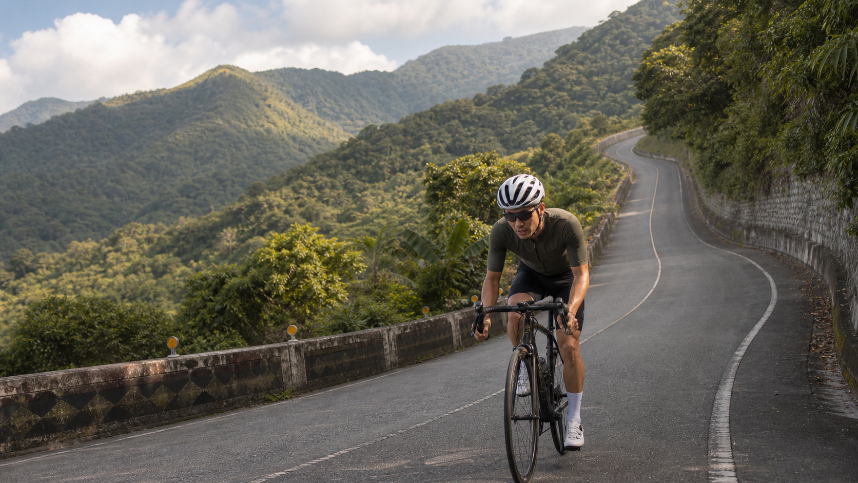
Average gradient 6.4%, total elevation gain 672 m, total length 10.37 km—this is a standard mid-to-long sustained climb, hidden in the sparsely trafficked mountains of Daren Township at the southernmost tip of Taitung.
1. Let’s Lay Out the Numbers First
Before planning this route, let’s first confirm the basic data is sound. The official figures for Shaoya Industrial Road (Tuban section) list a total distance of 10,368.6 m, total elevation gain of 672.4 m, and an average gradient of 6.4%. Cross-checking distance against gradient: 10,368.6 m × 6.4% ≈ 663.6 m, a difference of less than 10 m from the stated 672.4 m total gain. The data is internally consistent and can be trusted.
| Item | Data | Engineering Perspective |
|---|---|---|
| Total Distance | 10.37 km | Mid-to-long climbing segment |
| Total Elevation Gain | 672.4 m | Continuous accumulation throughout, no significant respite sections |
| Average Gradient | 6.4% | Mid-to-high intensity, requires full climbing preparation |
| Steepest Section | Approx. 16.9% (per site data) | Localized sections require extra attention to gearing and effort management |
The route starts near Tuban Suspension Bridge and climbs steadily to the high point, making it one of the representative long climbs in the Southern Cross-Island (Nanhui) region of Taitung. Compared to the previously mentioned Zhiben Sanhe Radio Station climb at 8.5 km with a 5.7% average gradient, Shaoya Industrial Road is more demanding in both distance and average gradient. Combined with localized sections reaching up to 16.9%, this is an advanced-level climb that requires thorough preparation to complete safely.
2. Location and Route Background
Shaoya Industrial Road is located in Daren Township, Taitung County, one of Taiwan’s southernmost indigenous townships, with most residents being Paiwan people. The industrial road network within Daren Township is quite extensive. In addition to Shaoya Industrial Road, there are County Road East 68 connecting Tuban and Daxi, County Road East 70 connecting Xinhua and Dawu, as well as multiple industrial roads including Daxi, Xinhua, and Daxin, together forming a dense network linking the indigenous villages along the Pacific coast.
The starting point of this route, Tuban Suspension Bridge, is itself a historically significant structure. The bridge was originally built in 1938 during the Japanese colonial era to connect the Tuban and Xinxing tribes. After more than fifty years of use, it was abandoned due to storm damage and was not rebuilt until 2011. The new bridge spans 123 m with an arched design, and the bridge entrance and cable walls are decorated with traditional Paiwan motifs such as the hundred-pacer snake, clay pots, and warriors—a cultural landmark worth stopping to appreciate before beginning this climb.
3. Section-by-Section Strategy: Breaking the 10.4 km into Four Segments
Segment 1 (0–2.5 km) Starting from Tuban Suspension Bridge: The Golden Window for Establishing Rhythm
The first 2.5 km from Tuban Suspension Bridge is the most critical section for establishing your rhythm for the entire climb. The gradient here is typically relatively moderate, serving as a transition period as your body shifts from flat-road riding mode to climbing mode. It’s recommended to consciously control your output from the start, keeping power around 75% to 82% of FTP, avoiding the temptation to push hard just because the terrain is relatively gentle, and reserving energy for the steeper sections ahead.
With an average gradient of 6.4% and a total distance exceeding 10 km, this route is a classic “sustained endurance” long climb. Any excessive energy expenditure in the early sections will be amplified and felt doubly in the latter half. Use this segment to confirm that your breathing rhythm and cadence are stable, preparing yourself for the more demanding challenges ahead.
Segment 2 (2.5–5.5 km) Entering the Main Climbing Section: A Test of Endurance and Willpower
As you enter the middle section of the route, the gradient begins to increase steadily and noticeably—this is the core climbing zone of the entire route. With an average gradient of 6.4% already at mid-to-high intensity, and some sections potentially approaching or exceeding the average steepness, it’s recommended to adopt a “seated-first, standing-assist” strategy here—seated pedaling maintains a more stable cardiovascular load and breathing rhythm, suitable for prolonged sustained output; only when the gradient spikes suddenly should you briefly stand to add torque, then immediately return to the saddle to restore your rhythm.
Since this section is sparsely trafficked and far from main roads, riders are strongly advised to carry sufficient water, as there will be no aid stations or shops to rely on for a very long stretch ahead.
Segment 3 (5.5–8 km) The Steepest Section: A 16.9% Test of Willpower
According to site data, the steepest point on this route can reach approximately 16.9%—a grade that demands serious respect. It’s not just a physical challenge; it also tests whether your gearing is properly configured. Before entering this section, make sure your front derailleur has been shifted to the small chainring and your rear derailleur to a sufficiently low gear, to avoid discovering mid-climb that your gearing isn’t light enough and being forced to muscle through with brute force—a common cause of knee injury and cramping.
Breathing rhythm management is especially critical on such steep grades. It’s recommended to use a “short and deep” breathing pattern, maintaining a relatively high cadence of around 70 to 80 rpm. Use lighter gearing with a faster cadence to distribute the load per pedal stroke, rather than grinding with heavy gears and low cadence, which is more likely to cause premature muscle fatigue or cramping.
Segment 4 (8–10.4 km) The Final Push to the Summit: Holding Your Last Breath
In the final 2 km, fatigue will accumulate noticeably. The key principle here is “preserve rhythm over preserving speed.” Rather than fixating on the average speed on your bike computer, redirect your focus to the stability of your cadence and breathing. It’s better to slow down than to compromise pedaling efficiency, avoiding form breakdown or cramping from excessive fatigue.
After reaching the summit, if you plan to descend the same way, be sure to let your heart rate recover to a relatively safe range and confirm your braking system is in good condition. Some sections of the roads in Daren Township’s mountains may have minor surface weathering or leaf accumulation due to sun and rain exposure. Control your speed on the descent, especially braking early before corners with limited visibility.
4. Gearing and Equipment Recommendations
Given the localized challenge of up to 16.9%, gearing configuration should lean decidedly toward “conservative and forgiving”:
- Front Derailleur: Strongly recommend a 50/34 compact crank or lighter. Avoid racing-oriented chainrings like 53/39, as the gearing will be noticeably too heavy when facing the 16.9% steep sections.
- Rear Derailleur: Recommend at least an 11-32T cassette. If you do less climbing training or are still building fitness, an 11-34T or even wider cassette combination will provide greater safety margin.
- Tire Pressure and Width: Road conditions on Daren Township’s industrial roads vary considerably. It’s recommended to use tires of 28C or wider, and fine-tune tire pressure based on actual conditions to balance grip and comfort.
- Braking System: The descent on this route deserves equal attention. Confirm brake pad wear and braking power before departure. If using disc brakes, be sure to verify that hydraulic fluid or cable condition is good.
5. Nutrition and Hydration Strategy
Since this route is located on sparsely trafficked industrial roads in the Southern Cross-Island mountains, there are virtually no shops or aid stations to rely on along the way. It’s strongly recommended to make complete self-support preparations before riding:
| Time Point | Nutrition Recommendation |
|---|---|
| 30 minutes before departure | Fully hydrate to ensure your body is in a well-hydrated state |
| Every 20-30 minutes | At least 150-200 ml of fluid, adjusting frequency based on temperature |
| Before the steep section (approx. 5.5 km mark) | Take one energy gel or portable food to reserve energy for the steepest stretch |
| After reaching the summit | Replenish electrolytes, preparing for the descent and return trip |
During summer rides, be sure to carry ample water (recommended at least 1.5 to 2 liters). Summer temperatures in the Southern Cross-Island mountains frequently exceed 33°C, and combined with the high-intensity output of sustained climbing, the risk of dehydration and heat exhaustion should not be underestimated.
6. Weather and Seasonal Considerations
Daren Township is located in the Southern Cross-Island mountains with a unique geographical position. During the summer and autumn typhoon seasons, it is susceptible to heavy rainfall, and mountain roads carry risks of rockfall and roadbed erosion. Be sure to check recent rainfall conditions and any road closure notices before riding. It’s not recommended to go immediately after a typhoon; wait until road conditions are confirmed safe before planning your trip.
In winter, the northeast monsoon has a relatively smaller impact on this mountain area compared to coastal regions, but morning temperatures can still be low, so layered clothing for warmth is recommended. Overall, spring and autumn offer more stable weather and are the ideal seasons for planning a ride on this route.
7. Common Mistakes and DNF Risks
- Gearing too heavy: Underestimating the difficulty of the steepest 16.9% section and using an unsuitable heavy gear ratio, leading to being forced to dismount and push or cramping midway.
- Insufficient supplies: There are almost no shops to rely on along this route; failing to carry enough water can easily lead to a double deficit of energy and hydration in the latter half.
- Ignoring weather risks: Failing to check recent rainfall and road conditions, and heading out rashly after a typhoon or heavy rain, increases the risk of rockfalls and slippery surfaces.
- Losing pace control in the early section: Misled by the relatively gentle gradient at the start of the climb, riders expend their energy reserves too early and have nothing left when facing the steep slopes later.
- Neglecting brake maintenance on descents: Eager to descend after reaching the summit without first checking the brake system, increasing the risk of losing control on the way down.
8. Target Time References for Riders of Different Levels
The following times are for training reference only; actual performance will vary depending on fitness level, temperature, and road conditions:
| Rider Level | Estimated Completion Time | Average Speed Reference |
|---|---|---|
| Advanced / Race level | 30–42 minutes | 15–21 km/h |
| Intermediate / Trained | 42–58 minutes | 11–15 km/h |
| Recreational / Climbing novice | 58–80 minutes | 8–11 km/h |
Shaoya Industrial Road is a solid mid-to-long distance climbing route with a total elevation gain of over 670 meters and localized gradients approaching 17%, making it suitable as a real-world testing ground before tackling higher-difficulty long climbs (such as Wuling or other famous classic climbs). As long as you properly configure your gearing, prepare your supplies, and assess weather risks, this long climb hidden in the South Link mountains will be a solid and rewarding climbing training experience.
9. Power Training Perspective: An Excellent Venue for Simulating Long-Climb Endurance Races
For riders preparing for long-distance climbing events (such as the Wuling Cup, Hualien–Taitung Tour, and other classic races), Shaoya Industrial Road is an ideal training venue. With a length of 10.37 kilometers and an average gradient of 6.4%, a full climb takes approximately 30 to 60 minutes (depending on rider level)—a duration that falls right within the typical range of a single long climb in many climbing races, effectively simulating the physiological load of sustained power output in actual competition.
A “segmented power control” training strategy is recommended: hold 78% to 85% of FTP for the first 5 kilometers, allow brief surges to 90% to 100% at the steepest middle section, then ease back to 75% to 82% in the final stretch depending on remaining energy. This trains the ability to manage pacing by resisting maximum intensity in the middle of a long climb while preserving reserves for the finish. This training mode is more specific to improving real-world performance in long-distance climbing races than simply pursuing short, explosive interval training.
10. Route Safety and Emergency Preparedness
Because Shaoya Industrial Road is located in the sparsely populated South Link mountain area, and mobile phone signals may be unstable in some remote mountain sections, thorough emergency preparedness is essential before riding. It is recommended to inform family and friends of your complete itinerary and expected departure and return times in advance, and to consider carrying a basic first-aid kit containing antiseptic supplies, elastic bandages, and personal regular medications.
If riding solo, it is advisable to depart on a day with stable weather and during off-peak hours on weekdays, and to confirm that your bicycle is in good mechanical condition—dealing with basic mechanical issues such as flat tires or dropped chains on a remote industrial road is far more difficult than on city roads. Carrying a complete on-bike tool kit (spare inner tubes, pump, hex wrench set, chain tool) is essential equipment for this route; it is not recommended to let your guard down just because the distance is not particularly long.
11. A Comparative Perspective with Other South Link Mountain Routes
When placing Shaoya Industrial Road within the overall coordinate system of routes in the Taitung South Link region, its difficulty sits between typical suburban gentle climbs and renowned long-distance mountain challenges, making it a representative segment of “moderate-to-high intensity, mid-to-long distance.” Compared to the previously introduced Zhiben Sanhe Radio Station (8.5 km, 5.7% average), Shaoya Industrial Road is more demanding in both total distance and total elevation gain, making it the next-stage goal worth challenging for advanced riders.
For riders currently building their long-climb capabilities, it is recommended to start with mid-distance climbs like Sanhe Radio Station to practice gear selection and breathing rhythm. Once familiar with the basic techniques, riders can then take on routes like Shaoya Industrial Road with over 670 meters of total elevation gain, and gradually progress toward even higher-difficulty challenges. This progressive training plan effectively reduces the risk of sports injuries while steadily accumulating real-world experience in long-distance climbing.
12. Technical Details of Gradient Transitions
The steepest section of Shaoya Industrial Road reaches 16.9%, and gradients like this require more refined technique. First is weight distribution—on extremely steep sections exceeding 15%, the front wheel tends to feel light and lose steering precision due to rearward weight shift. Riders are advised to lean the body slightly forward, pressing the center of gravity toward the middle of the frame, while avoiding excessive forward lean that could cause the rear wheel to slip and lose drive traction. This delicate front-rear weight balance can only be found through repeated practice.
Second is the timing of gear changes. At the transition point where the gradient shifts from moderate to extremely steep, it is recommended to shift one to two gears earlier rather than waiting until significant resistance is already felt before making a hasty downshift—this avoids the risk of chain jamming or skipping under high load, especially for riders using older drivetrain models, who should develop the habit of anticipating and shifting early.
13. Vegetation and Ecological Observations in the South Link Mountains
Daren Township is located in the low-elevation mountain area at the southern tip of Taiwan, with rich and diverse vegetation. Along Shaoya Industrial Road, riders can observe typical subtropical broadleaf forest landscapes, and as elevation gradually increases, the types and density of vegetation also change. If your riding pace allows, it is worth slowing down slightly to observe the subtle changes in the roadside forest structure—this close-up experience with natural ecology is a precious reward that urban road riding simply cannot match.
In addition, the South Link mountain area is one of Taiwan’s important ecological corridors. Occasionally you may spot birds flying past or hear the calls of insects. These subtle natural sounds weave together into the unique background soundtrack of Shaoya Industrial Road, and are also what makes this route, compared to urbanized routes, the most relaxing and therapeutic.
14. Post-Ride Recovery and Long-Term Training Planning
After completing a challenge like Shaoya Industrial Road with over 670 meters of total elevation gain and localized gradients approaching 17%, the metabolic stress on the body is considerable. It is recommended to perform moderate dynamic stretching and easy spinning within 15 to 20 minutes after reaching the finish to help heart rate gradually return to baseline, avoiding the circulatory discomfort caused by coming to a complete stop immediately after intense exercise. On the way back or after arriving home, thoroughly stretching and massaging the quadriceps, glutes, and calf muscles is an important step in preventing next-day muscle soreness and potential sports injuries.
For riders treating Shaoya Industrial Road as a long-term training milestone, it is recommended to re-challenge this route periodically (for example, once a month) and carefully record each completion time, average heart rate, and subjective fatigue level. This long-term longitudinal data tracking clearly reveals your progress trajectory in climbing endurance and power output, and also serves as a concrete reference for assessing whether you are ready to take on higher-difficulty long climbs.
15. For Riders Attempting Their First South Link Long Climb
If Shaoya Industrial Road is your first attempt at a mid-to-long distance climb with over 600 meters of total elevation gain, it is strongly recommended to make “finishing safely” your primary goal rather than chasing a specific completion time. When attempting a route of this difficulty for the first time, your body’s tolerance for prolonged high-intensity output has not yet been validated; rushing for speed can easily lead to depleted energy in the latter half, or even trigger warning signs such as cramping or dizziness.
Before departing, confirm that you have recently accumulated sufficient climbing training (such as the aforementioned Zhiben Sanhe Radio Station or other mid-distance climbs), and carry ample water and portable food. Once on the road, pay close attention to the signals your body sends; if you feel significant discomfort, it is better to stop and rest or even turn back rather than push through. Every challenge that seriously confronts your limits is the most valuable nourishment for building long-climb strength, and Shaoya Industrial Road is precisely such a solid training ground worth practicing repeatedly and improving on step by step.
16. Appendix: Pre-Departure Equipment and Route Checklist
Given that Shaoya Industrial Road is located in a remote, sparsely populated area of the South Cross-Island Highway region with scarce resupply options, it is recommended to confirm the following items in order before departure: bike condition (brake pad wear, drivetrain smoothness, chain lubrication, tire pressure and casing condition), personal gear (helmet, gloves, cycling jersey and bib shorts, sun protection), nutrition supplies (at least 1.5 to 2 liters of water, energy gels or portable food, electrolyte supplements), emergency preparedness (basic first-aid kit, on-bike tool kit, spare inner tubes, power bank), communication and itinerary notification (fully charged phone, offline maps downloaded, complete route and estimated return time shared with family or friends), and weather confirmation (recent rainfall records, daily forecast, road closure notices). This checklist may seem tedious, but it is a crucial safeguard for completing this remote long-climb challenge safely and smoothly—especially for solo riders, who should never take any chances.
17. Conclusion: Put Shaoya Industrial Road on Your Training Map
Taitung offers a wide variety of climbing routes, from short explosive efforts to long alpine challenges. With its solid specs of 10.37 kilometers, 672.4 meters of total elevation gain, and a maximum gradient of 16.9%, combined with the cultural richness of Tuban Suspension Bridge and the Paiwan tribal community, Shaoya Industrial Road stands out as a rare route that balances physical challenge with cultural depth. Whether you are looking to build long-distance climbing strength or simply want to explore the most southerly indigenous hidden gem in Taiwan, this road deserves a serious place on your Taitung riding map—a training ground you can return to and challenge yourself against again and again. The next time you plan a South Cross-Island Highway riding itinerary, don’t forget to include Tuban Suspension Bridge and Shaoya Industrial Road. Approach this long climb hidden at the southern tip of Taiwan with thorough preparation and respect—when you finally reach the summit and look back at every rise and fall you’ve conquered, you’ll find that this solid training achievement is far more worthy of pride than any finisher’s certificate. It will also become your strongest source of confidence when facing harder challenges ahead—because you will have proven to yourself that you have what it takes, with steady pacing and discipline, to conquer a South Cross-Island climb with over 670 meters of total elevation gain and gradients approaching 17%.
Related Reading
- Shaoya Industrial Road: Riding into the Paiwan Tribal Village Beyond Tuban Suspension Bridge, a Remote Long Climb with Sparse Traffic
- Taiwu Back Door Guide: 5.2 km at 7.9% Average Gradient, Pingtung’s Benchmark Mountain Climb
- Tou 56 Sacred Tree Climb Guide: 6.9 km with 653 m of Elevation Gain, Nantou’s Remote Hard-Climb Data Analysis
- Sandimen Guchuan Aiyu Climb Guide: 5.37 km at 6.8% Average Gradient, a Southern Taiwan Hard Climb Undersold by Misprinted Numbers
台北闊瀨陡坡 騎旅 / 日本單車雜誌編輯車友臨時加入!/ 髮香才是最強的 / feat. 北迴歸線小隊 / 公路車 CT Yeh
6 個月前
大武山20%魔王陡坡【JJSC南台灣遊騎Day2】!屁股真的要裂開了...凡士林抹滿也沒用?神秘金教堂還有超便宜夜市
3 個月前
嘉義大埔、阿婆灣挑戰賽,美到以為在日本!ft. 環騎5 Cool 西拉雅188 / 公路車 / CT Yeh
7 個月前
大武山後門26%歡樂陡坡!JJSC南台灣單車行Day2 / 被颱風追著跑 / 公路車 / CT Yeh
2 年前
#北橫 + #北進武嶺 最硬的員工旅遊 EP1 | #公路車 #拉拉山 | 明池 | 武嶺 | 武陵農場 | 雲海 | Taiwan Cycling Route Wulin
6 年前
爬坡ITT實境)台中 魔王 松鼠坡 首航 6:12 大肚山 大三元 科福路
8 年前
大禹嶺 到 武嶺牌樓 全程前後實況錄影 | 北進武嶺 | 東進武嶺 | KOM | 訓練台 | 坡度分析 | Taiwan KOM Last 10 km HARD | 公路車
6 年前
半日 小台灣 極限單車路線挑戰實錄
7 年前