Beidawu Japing Climb Complete Guide: A Tough Pingtung Challenge with 1,300m of Elevation Gain over 12.9km
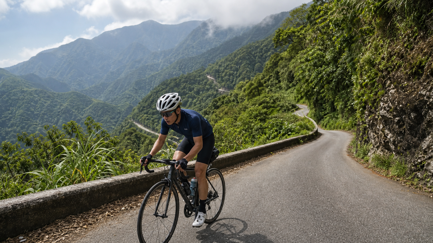
Route Overview and Data Analysis
The Beidawu Jiaping climbing route is located in Taiwu Township, Pingtung County. The starting point is near Jiaping Village (Jiaping is the administrative seat of Taiwu Township). The route climbs along the industrial road heading toward Beidawu Mountain, covering a total length of 12.89 km with 1,300.5 meters of cumulative elevation gain and an average gradient of 5.6%. What does this combination of numbers mean? Let’s do a quick calculation: 12.89 km with 1,300 meters of climbing should theoretically yield an average gradient of around 10%, yet the official average gradient is only 5.6%—a clear discrepancy. This situation is common on Taiwan’s mountain routes—the usual reason is that the early or middle section includes a stretch that is nearly flat or even slightly downhill (such as a section along a river valley or a village connector road), which dilutes the overall average gradient. However, the total elevation gain remains unchanged, meaning the middle or later sections must contain stretches far exceeding 10%, even approaching 15% to 20%. This article adopts the principle of “distance and elevation gain as the basis, average gradient for reference only” to break down the route. Riders should set their physical expectations based on the total elevation gain of 1,300 meters and not be misled by the 5.6% average gradient into thinking this is just an “ordinary mountain road.”
Beidawu Mountain stands at 3,092 meters, making it the highest peak in the southern Central Mountain Range and the only one among Taiwan’s Hundred Peaks named “Dawu” that is regarded as a sacred mountain by both the Paiwan and Rukai peoples. This climbing route named “Beidawu Jiaping” is not an industrial road that reaches the summit directly (the actual trailhead for the Dawu Mountain hiking route is at the old trailhead at a higher elevation, unreachable by road bike). Instead, it is a connector industrial road that departs from Jiaping Village in Taiwu Township and extends toward Beidawu Mountain. Most riders set their endpoint at the last passable village connection point or scenic overlook rather than the actual trailhead. Before planning your trip, be sure to confirm the actual road conditions and the latest landslide closure information, as industrial roads in the Pingtung mountain area frequently suffer from roadbed loss and temporary road repairs after typhoon and rainy seasons. It is recommended to call the Taiwu Township Office or check the latest announcements from the Pingtung County Government Public Works Department before departing.
In terms of difficulty classification, Strava lists this segment as Category 4 (in the HC system, smaller numbers indicate higher difficulty, with Category 4 being a moderately hard level). Given the data of 12.89 km, 1,300 meters of climbing, and a 5.6% average gradient, this classification is actually somewhat conservative. The main reason lies in the aforementioned “diluted average gradient” phenomenon—if the route is broken down into several segments and instantaneous gradients are calculated separately, the actual difficulty of certain segments far exceeds the initial impression that Category 4 gives. Riders are advised to mentally prepare for a challenge comparable to a much harder segment. Better to overestimate the difficulty and finish comfortably than to underestimate it and blow up halfway.
Core Data Summary:
| Item | Value |
|---|---|
| Total Distance | 12.89 km |
| Total Elevation Gain | 1,300.5 m |
| Average Gradient | 5.6% (Note: actual gradient varies significantly along the route; not a uniform climb) |
| Strava Category | Category 4 |
| Starting Point | Jiaping Village area, Taiwu Township |
| Direction | Industrial road heading toward Beidawu Mountain |
| Administrative Area | Taiwu Township, Pingtung County |
Segment-by-Segment Strategy from Start to Finish
Since official segment data for this route is limited, the following breaks the full route into four phases based on common patterns of Taiwan’s mountain climbing routes to plan riding strategy. Actual terrain should be confirmed by on-site conditions, and riders should dynamically adjust their pace using real-time gradient readings from their cycling computer.
Phase 1 (0–3 km): Warm-Up and Gentle Climb Zone. Departing from Jiaping Village, this section typically climbs along village connector roads or county road branches with relatively gentle gradients. It is one of the few sections on the entire route where you can slightly increase cadence and gradually bring your cardiovascular system and muscles into working mode. The key here is not to go fast but to control your heart rate so it doesn’t spike into Zone 4 right from the start. Keep your heart rate around 70% to 75% of maximum, maintain a cadence above 80 rpm, and preserve muscle glycogen and neuromuscular reserves for the harder phases ahead.
Phase 2 (3–7 km): Village and Steep-Section Alternation Zone. As the route penetrates deeper into the Taiwu Township mountains, consecutive visually imposing steep sections begin to appear—this is also the critical stretch that dramatically pushes up the route’s average gradient. Since the vast majority of the 1,300 meters of total elevation gain is concentrated in the middle to later sections, riders should mentally prepare for sustained gradients of 8% to 12% or even steeper at this stage. For pedaling rhythm, it is recommended to shift early into the small chainring paired with a large cassette cog, maintaining a cadence above 70 rpm to avoid rapid lactate buildup from grinding heavy gears. This section is also where you’re most likely to see slate architecture, traditional house craftsmanship, and indigenous language place-name signs. If your energy allows, it’s worth slowing down to appreciate the cultural landscape along the way. However, be mindful that industrial roads may have falling rocks, moss, or potholes, and mountain roads are mostly single-lane two-way traffic—be sure to slow down at passing points and corners.
Phase 3 (7–10 km): Core Grind Zone. This is the hardest section of the entire route. Gradients are likely to remain above 12% for extended periods, and some hairpin turns may even spike to 15% to 18%. At this point, it is recommended to adopt the “short-interval pedaling method”: every 200–300 meters, stand and sprint for 10–15 seconds to relieve fatigue in the seated muscles, then immediately sit back down and maintain a steady cadence. Avoid standing the entire time, as this can cause your heart rate to spike too quickly and hit the red zone prematurely. For breathing rhythm, adopt a fixed pattern of two breaths in and two breaths out, or three breaths in and three breaths out, to help stabilize core tension and delay hyperventilation. If you feel your heart rate approaching 90% of maximum and sustained for more than 2 minutes, proactively slow down or even stop briefly to drink water. Pushing through is often a precursor to cramps or heat exhaustion later on.
Phase 4 (10–12.89 km): Finale and Scenic Overlook Finish. As elevation continues to rise, gradients typically ease slightly near the end of the route. At this point, air temperature will be 3 to 6 degrees Celsius lower than at the base, and the perceived wind will be noticeably stronger. If you’re soaked in sweat and exposed to direct mountain wind, the risk of hypothermia should not be underestimated. It is recommended to prepare a windbreaker or lightweight jacket and immediately add a thermal layer when you stop briefly at the finish. If the weather is clear, the endpoint offers panoramic views of the layered peaks of the southern Central Mountain Range—the most direct visual reward for the hard work of the entire ride.
Gear Ratio and Equipment Recommendations
Facing a route with 1,300 meters of total elevation gain and localized gradients that may exceed 15%, gear ratio configuration is one of the key variables determining whether you finish.
Road Bike Recommended Setup:
- Crankset: It is recommended to use a small chainring of 34T or a smaller compact crank (Compact, 50/34T). A standard 53/39T crankset on gradients like this can easily cause knee strain or premature blowup for average riders in the later stages.
- Cassette: It is recommended to start with at least 11-32T. For riders of average fitness or first-time challengers, it is recommended to go straight to 11-34T or an even wider range, paired with a derailleur cage extension (such as Shimano GRX or mountain bike rear derailleur) to expand compatibility.
- Lowest gear ratio: It is recommended to aim for 1:1 or even lower (e.g., 34/32 or 34/34) to ensure there is still ample spinning room on 15%+ grind sections, rather than muscling a heavy gear and putting excessive stress on the knees.
The Necessity of Disc Brakes: The descent sections of this route are equally steep and may be mixed with slippery leaves and gravel. Disc brake bikes offer significantly better heat dissipation and braking stability on long descents compared to traditional rim brakes. If you happen to have both a disc brake and a rim brake bike available, prioritize the disc brake model for mountain descents.
Wheelset and Tire Width: It is not recommended to use overly light, overly narrow racing tubular tires or ultralight rims. The road surface quality of Pingtung’s mountain industrial roads varies. It is recommended to use training or endurance tires between 25C and 28C with decent puncture resistance and durability, and to reduce tire pressure by 5–10 psi according to the day’s temperature and road conditions to increase grip and comfort.
Other Carry-On Equipment:
- Puncture repair tools and spare inner tubes (mountain areas have low density of repair stations and convenience stores; be sure to bring a complete repair kit).
- Power bank and offline maps (some sections may have poor signal reception).
- Lightweight windbreaker (as mentioned above, temperature differences at the summit and hypothermia risk).
- Headlight or front and rear lights (if you estimate the ride may be delayed into the evening, note that it gets dark faster in mountain areas than on flat terrain).
Refueling and Hydration Strategy
With a total elevation gain of 1,300 meters, the estimated total riding time (including rest stops) for this route, based on the fitness level of an average amateur cyclist, falls roughly between 1.5 and 3 hours, depending on individual fitness and whether the descent is an out-and-back return.
Before Departure: It is recommended to finish your main meal 2 hours before departure and consume an additional 300–500ml of fluids to ensure adequate hydration before tackling the climb.
During the Ride: Since resupply points in the mountains are scarce (there are almost no convenience stores along the route, with only a few sporadic village shops that have irregular opening hours), be sure to carry at least 1.5–2 liters of water or sports drink, along with portable snacks (energy gels, bananas, salt candies, or traditional local foods like dried taro and sweet potatoes are all good options). It is recommended to take small sips of water every 20–30 minutes and consume 30–60 grams of carbohydrates per hour to avoid realizing only during the core steep section (Stage 3) that your energy and electrolytes are already depleted.
Electrolytes and Cramp Prevention: Taiwan’s summer mountain areas are hot and humid, and with sustained high-intensity output, electrolytes such as sodium and potassium are lost very quickly. It is recommended to carry extra salt tablets or electrolyte supplements. This is especially important if you plan to tackle this route around midday, as the risk of heatstroke and heat cramps increases significantly.
Weather and Seasonal Recommendations
Due to the terrain of Pingtung’s mountain areas, afternoon convective cloud systems develop strongly, and the probability of afternoon thunderstorms in summer (June–September) is high. It is recommended to depart before 6 AM, aiming to complete the main climbing sections before noon to avoid the risk of lightning and heavy rainfall.
In winter (November to February of the following year), although the lowlands of Pingtung remain warm, the mountain areas experience significant temperature differences between day and night under the influence of the northeast monsoon. If you choose to challenge this route in winter, the perceived temperature on the summit sections may approach single digits, so cold-weather gear is essential.
After rain or the passage of a typhoon, the risk of landslides, roadbed loss, and falling rocks on mountain industrial roads increases significantly. It is strongly recommended to check the latest road closure announcements from the Pingtung County Government Public Works Department or the Taiwu Township Office before departure. Do not venture out rashly within a day or two after a typhoon warning has just been lifted.
Common Mistakes and DNF Risks
Mistake 1: Gear ratios that are too heavy. Many cyclists accustomed to flat terrain underestimate the actual difficulty of this route and head up with a standard crankset, only to be forced to dismount and push their bikes during the core steep section, wasting time and damaging morale.
Mistake 2: Departing too late. If you start around noon, you are likely to enter the core climbing zone during the hottest period with the strongest UV rays around midday, greatly increasing the risk of heatstroke.
Mistake 3: Underestimating resupply needs. The scarcity of resupply points in the mountains is a defining feature (or risk) of this route. Do not prepare using the same resupply logic you would apply to a flatland route.
Mistake 4: Ignoring real-time weather changes. Afternoon thunderstorms in the mountains arrive quickly and violently. If you face the risk of lightning on an exposed industrial road, be sure to plan shelter points in advance or turn back early. Do not push through with a gamble mentality.
High DNF Risk Section: Based on the route’s gradient distribution, the core steep section of Stage 3 (7–10 km) is the area where cyclists are most likely to choose to dismount and push, or even abandon the challenge altogether. First-time challengers are advised to set a clear mental cutoff point. Pushing your bike is not shameful; knowing your limits is what gets you home safely.
Target Time References for Different Rider Levels
The following times are rough estimates. Actual times will vary depending on individual fitness, weather conditions on the day, and the number of rest stops. They are for training planning reference only:
| Rider Level | Estimated Completion Time (incl. rest) | Recommended Preparation |
|---|---|---|
| Beginner / Occasional Cyclist | 2.5–3.5 hours | Recommended to accumulate experience on at least 3–5 training routes with 800+ meters of elevation gain before attempting |
| Advanced Recreational Cyclist | 1.5–2.5 hours | An FTP of 2.5–3 W/kg or above is recommended for a more comfortable ride |
| Competitive / Club-Level Rider | 1–1.5 hours | May attempt to challenge personal best single-run times with interval intensity |
| Pro / Semi-Pro Athlete | 45–70 minutes | This route is suitable as a mountain endurance test segment during the season |
Regardless of which level you fall into, the core value of this route is not about “how fast” but about “completing it safely and riding within your limits.” Beidawu Jiaping is not a popular check-in route; resupply and rescue resources along the way are relatively limited. It is recommended to ride with at least one other companion, and to inform family or friends of your planned itinerary and expected return time in advance. This is an unchanging basic principle for any challenging mountain route in Pingtung.
Route Planning and Transportation Connection Suggestions
For most cyclists, the Beidawu Jiaping route will not be a standalone one-day trip. The more common approach is to incorporate it into a multi-route connection plan in the Pingtung mountain area, such as combining it with nearby Dewen Mountain, Taiwu Back Gate, and other sections to form a “Pingtung Mountain Gateway Peaks” training or challenge itinerary. Below are several common itinerary planning approaches:
Out-and-Back Type: Ride from Pingtung City or the Sandimen direction to Jiaping Village in Taiwu Township, complete the climb, then return the same way back to the lowlands. This is the simplest and lowest-risk planning method, suitable for first-time challengers or riders still building their fitness. Including the round-trip travel and the climb, it is recommended to allocate a time window from the morning through midday.
Shuttle Up, One-Way Descent Type: If you have car support or a shuttle vehicle, consider transporting yourself and your bike to the base starting point, then after completing the climb, have the support vehicle take you back down. This saves energy and reduces the fatigue on your braking system and arm muscles from the long descent, making it particularly suitable for unstable weather conditions or itineraries where you plan to take on other routes later the same day.
Multi-Route Connection Type: Advanced riders often arrange Beidawu Jiaping together with routes like Dewen Mountain and Shenshan to Wutai in the same expedition, using the early morning hours to tackle the highest-altitude and most difficult section (this route climbs 1,300 meters and ranks among the hardest), then deciding based on energy levels whether to add on other sections. This type of connected itinerary places extremely high demands on fitness and resupply planning. It is strongly recommended to prepare a detailed route sheet and backup plan in advance, and to carry sufficient electrolytes and portable snacks.
Public Transportation Connection: Public transportation coverage in the Pingtung area is limited. For reaching the Taiwu Township mountain area, driving yourself, using a team van shuttle, or arranging club charter transport is the most practical. If you plan to ride from Pingtung Railway Station or Chaozhou Station to the starting point, you will need to factor in an additional 20–40 km of flatland connection distance and time, and incorporate this into your overall fitness and resupply planning.
Local Indigenous Village Culture and Riding Etiquette Reminders
The Beidawu Jiaping route passes through the Jiaping Village area of Taiwu Township, which is part of the traditional territory of the Paiwan people. Jiaping Village itself is also the administrative seat of Taiwu Township, holding a certain administrative and cultural status. Mount Beidawu holds a revered sacred mountain status in the traditional cultures of the Paiwan and Rukai peoples. Over the years, it has also served as an important source of imagery for Taiwan’s literary and musical creators, including Hu De-fu’s renowned work “Dawu Mountain, Beautiful Mother,” writer Lung Ying-tai’s “Beneath Mount Dawu,” and Zhong Li-he’s “Record of Climbing Mount Dawu,” all of which use this mountain as their spiritual coordinate. As cyclists pass through this mountain forest, it is worth slowing down the pace and viewing the tribal settlements, houses, and landscape along the way with respect, rather than merely treating it as a training ground for “climbing data.”
In terms of practical riding etiquette, cyclists are advised to pay attention to the following points:
- Respect the pace of tribal life: The mountain industrial roads are also the daily thoroughfares for tribal residents commuting and tending to agricultural work. When passing through settlements, be sure to slow down, and give priority to pedestrians, the elderly, and children.
- Do not enter private land or house premises for photos without permission: Many slate buildings and traditional houses in the tribe are private property or hold specific cultural significance. Do not enter, photograph, or touch them without consent.
- Carry your own trash down the mountain: The mountain area lacks a waste collection system. Please be sure to carry out any trash generated from refueling, such as energy gel wrappers and bottles, and dispose of it properly down in the lowlands. Do not leave it in the tribe or along the mountain roads.
- Take advantage of local spending opportunities: If there are tribe-run small shops or farm produce stalls along the way, making modest purchases not only replenishes your energy but is also the most direct way to support the local economy.
This kind of riding attitude is the key foundation for allowing “challenge routes” and “local tribes” to coexist and treat each other well over the long term. It is also the biggest difference between this type of route that goes deep into indigenous mountain areas and ordinary tourist-oriented bike paths.
Training Plan: How to Prepare for This Route
If you’ve set Beidawu-Jiaping as a near-term challenge goal, it’s recommended to start targeted training at least 6–8 weeks in advance rather than cramming at the last minute. Below is a simple periodized training framework for reference:
Base Phase (6–8 weeks before the challenge): Focus on aerobic endurance riding, with 2–3 rides per week, each lasting 1.5–2.5 hours. Keep your heart rate between 65%–75% of max HR, with the goal of building an aerobic foundation and long-duration saddle comfort. There’s no need to deliberately seek out steep climbs during this phase—the priority is accumulating riding hours and endurance reserves.
Climbing Specialization Phase (4–6 weeks before the challenge): Begin incorporating climbing interval training. For example, find a climb near your home with a 6%–10% gradient and 500 meters to 2 kilometers in length, then perform 4–6 repeated efforts. Between each effort, recover by spinning easy or coasting until your heart rate drops below 60% of max HR before starting the next rep. The goal of this phase is to improve muscular lactate tolerance and neuromuscular coordination under high-intensity output.
Simulation Phase (2–3 weeks before the challenge): If geography permits, it’s recommended to ride an actual mountain route of similar difficulty for a simulation session—for example, known climbs of comparable difficulty around Pingtung or Kaohsiung. Use this to test whether your gear ratio setup, nutrition strategy, and mental endurance are sufficient to handle the route characteristics of Beidawu-Jiaping, which features extremely steep localized sections.
Taper Phase (1 week before the challenge): Significantly reduce training volume and intensity to allow full recovery and glycogen storage, avoiding accumulated fatigue from overtraining that could compromise performance on challenge day.
Beyond physical training, core strength and flexibility work are equally important. Prolonged high-intensity climbing places significant stress on the lower back and hip joints. It’s recommended to incorporate 1–2 core training and stretching sessions per week to reduce injury risk—especially given the extended out-of-saddle climbing efforts likely in the latter half of this route, which demand core stability no less than cardiovascular capacity.
Conclusion: A Route Worthy of Respect, Not Underestimation
Beidawu-Jiaping condenses a solid mountain challenge into 1,300.5 meters of total elevation gain over 12.89 kilometers. Even though the official average gradient is only 5.6%, the actual riding experience will inevitably feel far harder than that number suggests—this is a common trait of many mountain climbing routes in Taiwan: the data speaks, but it often “doesn’t tell the whole story.” Anyone preparing to take on this route should prepare mentally and with their equipment based on the total elevation gain and the extreme gradients of the steepest sections, rather than underestimating the difficulty by looking only at the average gradient.
At the same time, the Jiaping tribal community in Taiwu Township and the surrounding mountain areas along this route carry the deep cultural and historical heritage of the Paiwan people, and Beidawu Mountain stands as an irreplaceable sacred mountain in their worldview. Approaching this mountain with respect and humility, placing “finishing the ride” and “honoring the mountain” on equal footing, is what truly makes this route worthy of being documented and recommended.
Related Reading
- Gateway to Beidawu: A Practical Guide to Southern Taiwan’s Hardman Climb—10.56K, 677m Elevation Gain in Pingtung, Full Data Breakdown
- Taiwu Back Door Guide: Pingtung’s Benchmark Steep Mountain Climb—5.2 km at 7.9% Average Gradient
- Beiyi Nine Bends and Eighteen Turns Climb Guide: A Pacing Masterclass—13.37K, 511.6M Elevation Gain
- Riding to the Foot of Beidawu Mountain: A Cycling Conversation Through Jiaping Village and the Sacred Mountain in Taiwu Township
大武山後門26%歡樂陡坡!JJSC南台灣單車行Day2 / 被颱風追著跑 / 公路車 / CT Yeh
2 年前
大武山20%魔王陡坡【JJSC南台灣遊騎Day2】!屁股真的要裂開了...凡士林抹滿也沒用?神秘金教堂還有超便宜夜市
3 個月前
台北闊瀨陡坡 騎旅 / 日本單車雜誌編輯車友臨時加入!/ 髮香才是最強的 / feat. 北迴歸線小隊 / 公路車 CT Yeh
6 個月前
#北橫 + #北進武嶺 最硬的員工旅遊 EP1 | #公路車 #拉拉山 | 明池 | 武嶺 | 武陵農場 | 雲海 | Taiwan Cycling Route Wulin
6 年前
萬年峽谷! 30% 超激陡坡 里佳部落DAY2 還是很硬! | 公路車 | CT Yeh
3 年前
大禹嶺 到 武嶺牌樓 全程前後實況錄影 | 北進武嶺 | 東進武嶺 | KOM | 訓練台 | 坡度分析 | Taiwan KOM Last 10 km HARD | 公路車
6 年前
一定要騎一次!阿里山最深處:里佳部落!單車旅行 | 2800m爬升 | 深度部落體驗:嗨翻晚會、螢火蟲、銀河 | feat. JJSC & 廢物伙伴 | 公路車 CT Yeh
9 個月前
新竹羅平 x 天湖部落 大禹嶺級變態陡坡! 4K超高畫質 空拍 | 公路車
5 年前