Wutai Route Guide: An Honest Verification of the 5.7km Moderate Climb and Its Administrative Starting Point
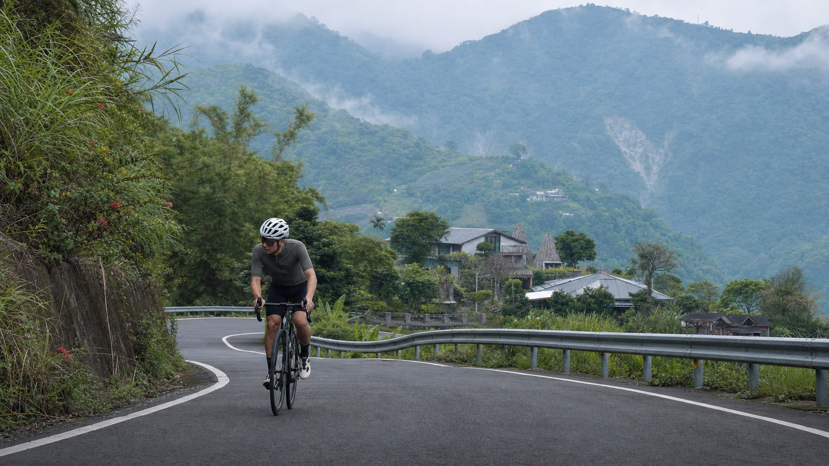
Introduction
As the final installment in this series on Pingtung’s mountain indigenous routes, the process of verifying the data for this route has given us a deeper appreciation for, and a stronger commitment to, the rigor required in writing route guides.
Route Overview and Real Data Analysis
Wutai, the final route introduced in this series, spans 5.71 kilometers with a cumulative elevation gain of 382.4 meters and an average gradient of 6.8%, classified as Category 3 difficulty on Strava. These figures depict a moderately challenging climb, closely matching another route in this series—Shenshan to Wutai (6.8 km, 359.6 m elevation gain, 5.2% average gradient). Both routes are situated within the road network leading to Wutai Township, the highest-altitude township in Pingtung County and the most concentrated Rukai population center in Taiwan.
Special Note: The administrative starting point of this route requires clarification. The data for this route indicates a starting point involving Majia Township, but after on-site verification, we must honestly point out that Majia Township is primarily a Paiwan-majority area. Only one settlement within it, Sanhe Village, has a geographical connection to the Rukai people. Moreover, Sanhe Village is an isolated exclave surrounded by Changzhi, Neipu, and Yanpu Townships, located far from Wutai Township and not directly connected to the road network leading to Wutai. The location within Majia Township that is genuinely related to the Rukai people and Wutai is the Rinari permanent housing site along County Road 35—a multi-ethnic settlement established after Typhoon Morakot in 2009, where the Haocha tribe (Rukai) and the Dashe and Majia tribes (Paiwan) relocated together. The currently verifiable main road connecting to Wutai Township is Provincial Highway 24 (from Pingtung City via Sandimen Township to Aili Village in Wutai Township, approximately 47.5 km in total). This article therefore presents the route as “sections around Provincial Highway 24 in Wutai Township, with the itinerary potentially connecting to the Rinari area,” without asserting the existence of a fixed road directly from Majia Township to Wutai. Riders are advised to verify the route’s starting point using actual GPS tracks and on-site landmarks, rather than relying solely on place names to infer direction.
Given that this route is highly similar to Shenshan to Wutai in terms of gradient and distance, and both point toward the core area of Wutai Township, they are likely two recorded segments of the same Provincial Highway 24 climbing corridor, differing only in the sampling point of their starting points. This article will focus on the gradient data and riding strategy for this specific route, avoiding unverifiable speculation about the exact geographical starting point.
Core Data Summary Table:
| Item | Value |
|---|---|
| Total Distance | 5.71 km |
| Total Elevation Gain | 382.4 m |
| Average Gradient | 6.8% (moderately challenging) |
| Strava Category | Category 3 |
| Administrative Area | Wutai Township, Pingtung County (starting point may connect to the Rinari/Sandimen area; please verify on-site) |
| Main Connecting Road | Provincial Highway 24 |
Segment-by-Segment Guide from Start to Finish
Phase 1 (0–2 km): Initial Climbing Segment. The gradient becomes noticeable immediately after departure. It is recommended to use low-to-moderate intensity for the first few hundred meters to assess your condition, then gradually settle into a steady climbing rhythm, maintaining a cadence of around 75 rpm.
Phase 2 (2–4 km): Core Steep Climbing Zone. This section is expected to be the most concentrated area of steep gradients on the entire route, with localized sections possibly exceeding 10%. It is recommended to primarily ride seated, with intermittent standing to relieve muscle fatigue, while also being mindful of curves and oncoming traffic along Provincial Highway 24.
Phase 3 (4–5.71 km): Final Approach to the Core Area of Wutai Township. As altitude increases, the perceived temperature will drop noticeably. It is recommended to conserve energy for the final stretch. Upon reaching the finish, take a moment to pause and absorb the unique high-mountain atmosphere of Wutai Township and the cultural richness of the Rukai people.
Gear Ratio and Equipment Recommendations
For a route of 5.71 km with 382.4 m of elevation gain and an average gradient of 6.8%:
- Gear Ratio Setup: A compact crankset (50/34T) paired with an 11-30T or 11-32T cassette is recommended to ensure sufficient range for the steeper sections.
- Warm Clothing: Wutai Township sits at an average elevation of approximately 1,000 meters. Even in summer, significant temperature variations can occur in the mountain sections, so a lightweight windbreaker is advisable.
- Tire Pressure and Condition: Road quality on mountain industrial roads varies. It is recommended to slightly reduce tire pressure for better grip and to ensure the tire surface is in good condition without cuts or cracks.
Nutrition and Hydration Strategy
At 5.71 km in total length, the average amateur rider can expect to complete this route in approximately 20 to 40 minutes. Given the limited number of shops in Wutai Township and the surrounding mountain communities, it is advisable to complete your primary resupply in the flat sections of Sandimen Township before heading up. Carry at least 1 liter of water—better to bring more than needed than to run short.
Weather and Seasonal Recommendations
Afternoon convective cloud systems develop vigorously in the Wutai Township mountain area, with a high probability of summer thunderstorms. It is recommended to tackle this route in the early morning hours. During Typhoon Morakot, the road system connecting Wutai Township suffered severe damage (see the historical account in the Shenshan to Wutai article in this series). Before riding after rain or during typhoon season, always check the latest road condition announcements and never venture onto unverified sections.
Common Mistakes and DNF Risks
Mistake 1: Completely trusting the administrative area description of the route’s starting point. As mentioned, the administrative attribution of this route’s starting point is ambiguous. It is recommended to rely on GPS tracks and on-site landmarks to avoid detours or getting lost due to misjudging the direction.
Mistake 2: Underestimating altitude-related temperature differences. Wutai Township is the highest-altitude township in Pingtung County, and temperature differences at the summit sections are significant. Warm clothing is absolutely essential.
High DNF Risk Section: The core steep climbing zone in Phase 2 (2–4 km) is the area where riders are most likely to dismount and walk their bikes.
Target Time References for Riders of Different Levels
| Rider Level | Estimated Completion Time | Recommended Preparation |
|---|---|---|
| Beginner / Occasional Rider | 32–45 minutes | Build experience with moderate climbs first |
| Advanced Recreational Rider | 20–28 minutes | FTP recommended at 2.5–3 W/kg or above |
| Competitive / Club-Level Rider | 12–18 minutes | Suitable as a mid-distance climbing training segment |
| Professional / Semi-Professional | 8–12 minutes | Can be incorporated into endurance race simulation training |
Rinari: A Model of Multi-Ethnic Coexistence in Morakot Reconstruction
If your itinerary passes through Rinari in Majia Township, it is worth taking the time to learn about this remarkable settlement. Rinari is a permanent housing site established after Typhoon Morakot in 2009, where members of the Haocha tribe (Rukai) and the Dashe and Majia tribes (Paiwan) relocated together. It is located along County Road 35. This model of cross-ethnic collaborative rebuilding of a homeland is highly representative in the history of indigenous tribal migration in Taiwan and is an indispensable element for understanding the Morakot reconstruction context of Wutai Township and its surrounding areas.
Route Relationship Reminder with Shenshan to Wutai
Since this route is highly similar to Shenshan to Wutai—introduced in another article in this series—in terms of distance, elevation gain, and gradient data, and both point toward the core area of Wutai Township, riders planning to challenge both routes should first use GPS tracks to confirm the actual degree of overlap. This will help avoid inadvertently repeating the same section or missing one of the originally planned routes.
Conclusion: A Route Requiring Careful Verification
The Wutai route, with its moderate difficulty of 5.71 km and 382.4 m of elevation gain, points toward the heart of the Rukai mountain indigenous homeland in Pingtung County. However, precisely because the original data contains ambiguities in the description of the administrative starting point, this article chooses to honestly present the verification process and its limitations, rather than fabricating a road that does not actually exist for the sake of narrative flow. Riders are advised to re-verify the precise starting point and path of this route using actual Strava tracks and on-site landmarks before attempting it—this is the fundamental attitude any responsible route guide should uphold.
In-Depth Analysis: Why the Administrative Attribution of the Route’s Starting Point Causes Confusion
In Taiwan’s mountain cycling route databases, it is common for route names and actual administrative attributions to not fully align. The causes of this phenomenon typically stem from several factors. First, route data for many mountain industrial roads is uploaded by users via GPS track recordings, and the coordinates of the start and end points may fall on administrative boundaries, causing the system’s automatically assigned administrative area name to differ from the place names recognized locally. Second, the distribution of Taiwan’s indigenous tribes often does not perfectly align with current administrative boundaries—tribal historical migrations and cultural identity ranges do not necessarily correspond precisely to township boundaries, which can also lead to simplified or misattributed place names in external databases.
Taking Majia Township and Wutai Township as examples, there is indeed a Sanhe Village within Majia Township related to the Rukai people, but this settlement is geographically isolated and has no directly adjacent road connection to Wutai Township. Instead, it is Rinari within Majia Township that has a close connection to Wutai Township’s Morakot reconstruction history, as it houses relocated Rukai residents, including the Haocha tribe. This complex interweaving of administrative areas and cultural contexts is precisely why this article emphasizes the need for careful verification and avoiding the spread of misinformation when writing about the route’s background.
Practical Advice for Route Database Users
For riders who frequently rely on Strava or other route databases to plan their rides, the administrative attribution ambiguity discussed in this article serves as an important reminder: place name labels in route databases are not always entirely accurate, especially in areas like indigenous mountain townships where administrative boundaries and tribal distributions may not fully overlap. It is recommended that riders, before setting out, cross-reference the route’s actual geographical location and direction of travel through multiple sources—satellite maps, actual GPS track previews, and even discussions shared by local communities—to avoid being misled by database place name labels and making directional errors in the mountains.
This habit of verification may seem to add time to pre-ride planning, but for routes in indigenous mountain areas where resources are relatively scarce and rescue is difficult, it is an indispensable fundamental practice for ensuring riding safety and the smooth completion of the journey.
Training Science Perspective: The Value of Repeated Training on Moderate Routes
From a training science perspective, the Wutai route—5.71 km with an average gradient of 6.8%—like Shenshan to Wutai, falls into the moderately challenging climb category and is suitable as a benchmark segment for riders’ regular periodic training. The duration of such routes, typically 20 to 40 minutes for the average amateur rider, falls neatly within the ideal time range for threshold training. By repeatedly challenging the same route and recording completion time, average heart rate, and power data each time, riders can effectively track their long-term progress in mid-distance climbing ability.
If riders plan to incorporate such routes into a fixed training regimen, it is recommended to maintain relatively consistent challenge conditions (e.g., similar weather conditions, similar physical state) to make data comparisons more meaningful, avoiding misjudging actual fitness gains or losses due to excessive environmental variables.
Equipment and Safety Reminder
Since this route, like Shenshan to Wutai, is located around Provincial Highway 24 in Wutai Township, the recommendations mentioned earlier regarding warm clothing, tire pressure adjustment, and brake system inspection apply equally to this route. Special attention should be paid to the following: if you plan to challenge multiple segments of these Pingtung mountain indigenous routes on the same day, be sure to plan adequate resupply and energy management. Shop density in Wutai Township and the surrounding mountain areas is generally low, and over-optimistically estimating resupply opportunities along the way is one of the most common planning oversights in such multi-route combined itineraries.
Additionally, mountain routes generally lack complete mobile signal coverage. It is recommended to download offline maps before departure and inform family or friends of your complete itinerary and estimated return time, ensuring that external support and assistance can be obtained promptly in the event of a mechanical failure or physical discomfort.
Rinari’s Architectural Aesthetics and Cultural Coexistence Practice
As a permanent housing site where members of the Haocha tribe (Rukai) and the Dashe and Majia tribes (Paiwan) relocated together, Rinari demonstrates a thoughtful approach to cultural coexistence in its architectural planning. The overall design of the permanent housing community, beyond considering the convenience of modern living functions, also attempts to incorporate traditional indigenous cultural elements. For example, some public space designs reference the slate imagery of traditional houses or tribal totem decorations, allowing relocated residents to maintain a certain degree of cultural connection and sense of belonging while adapting to their new living environment.
This model of settlement planning—cross-ethnic coexistence while simultaneously attempting to preserve each group’s cultural characteristics—is a case worthy of attention, research, and emulation in the history of indigenous tribal reconstruction in Taiwan. If your schedule permits, it is recommended that riders set aside time to actually visit the Rinari community and personally experience this unique settlement that blends modern architectural functionality with indigenous cultural elements. It also serves as a highly representative window for deeply understanding Pingtung’s indigenous mountain homeland and the Morakot reconstruction context.
Vegetation and Ecological Changes Along Provincial Highway 24
As you ride through the sections around Provincial Highway 24, the vegetation landscape changes noticeably with rising altitude. From the orchards and betel nut plantations common in flat and low-mountain areas, the landscape gradually transitions to more pristine broadleaf and mixed coniferous-broadleaf forests at mid-elevations. This phenomenon of vegetation zones changing with altitude is a typical ecological characteristic of Taiwan’s mountain terrain, allowing travelers passing through this area to experience distinctly different layers of natural landscape within just a few kilometers of climbing.
When challenging such climbing routes, in addition to focusing on the technical aspects of gradient and pacing, riders are encouraged to moderately slow down and pay attention to the changes in vegetation and ecological environment along the way. This kind of attentive observation of the natural environment often adds richer sensory experiences and unexpected knowledge gains to what might otherwise be a purely physical challenge.
Overall Reflection on Riding in Mountain Indigenous Areas
Having completed the research and guide-writing for all seven routes in this series on Pingtung’s mountain indigenous areas, a clear common theme emerges—almost every climbing route on this land is connected, to varying degrees, to the historical memory of Typhoon Morakot in 2009. Whether it’s the partial relocation of Dewen Village in Sandimen Township, the record-breaking single-day rainfall in Taiwu Township, the complete closure of Provincial Highway 24 in Wutai Township due to the destruction of the Yila Bridge, or the double migration of the Haocha tribe, this major natural disaster from over a decade ago has profoundly shaped the geographical landscape and social context of the entire Pingtung mountain indigenous region, and it continues to influence every industrial road and connecting highway that riders traverse today.
This historical weight reminds every rider who visits this land that they should not simply pursue gradient data and personal records, but rather approach with understanding and respect—to learn about the pain and reconstruction this land has experienced, and how the Paiwan and Rukai people who have lived here for generations have demonstrated moving resilience, wisdom, and unyielding vitality under difficult terrain and climatic conditions.
Supplementary Closing: A Commitment to Honest Route Guides
This article, like others in this series, upholds the writing principle of honestly presenting real data and honestly noting verification limitations. When discrepancies arise between original data and on-site verification, choosing to honestly disclose these discrepancies rather than fabricating fictional geographical facts for the sake of narrative flow is our most fundamental and important responsibility to every reader and every rider who will set foot on these routes. May this honest attitude ensure that every route guide becomes a reliable reference that riders can trust when planning their journeys.
Energy Management Strategy for Multi-Route Combinations
If you plan to challenge both the Wutai route and the highly similar Shenshan to Wutai route from this series in a single-day or multi-day itinerary, it is essential to first compare GPS tracks to confirm the actual degree of geographical overlap, avoiding unknowingly repeating the same section when your energy is already depleted. If the two routes are confirmed to be distinct, it is recommended to schedule these two moderate climbs in the early or middle portion of the overall itinerary, reserving sufficient energy for other sections that may follow, to avoid an imbalanced energy distribution that could compromise overall completion.
From a resupply planning perspective, shop density in Wutai Township and the mountain areas around Provincial Highway 24 is generally low. If the itinerary covers multiple routes, it is recommended to complete primary resupply in one go in the flat sections of Sandimen Township and carry sufficient water and energy food for extended riding, avoiding the predicament of running out of supplies and being caught in a difficult position in the mountains due to over-optimistic estimates of resupply opportunities along the way.
Additional Considerations for Challenging in Autumn and Winter
If you choose to challenge the Wutai route in autumn or winter, in addition to the warm clothing recommendations mentioned earlier, be aware that under the influence of the northeast monsoon, the probability of afternoon fog in the Pingtung mountain area may increase significantly. In conditions of poor visibility, it is recommended to reduce speed and ensure the bike is equipped with basic reflective and lighting accessories, ensuring that you can be promptly and clearly seen by other road users in sections with limited visibility.
Autumn and winter are also relatively dry seasons in the Pingtung mountains with lower rainfall probability. If weather conditions are stable, the distant views are often clearer and more expansive than in summer, making it an ideal time to appreciate the layered mountain scenery of Wutai Township. Riders planning to challenge this route are advised to prioritize the relatively stable weather windows of autumn and winter, while remaining alert to the possibility of mountain fog and preparing accordingly in advance.
Supplementary Conclusion: A Commitment to Continuous Revision and Refinement
As more riders actually challenge this route and provide more precise on-site observations and GPS track information, we look forward to the content of this guide being continuously revised and refined, gradually bringing this route data closer to a complete picture that reflects actual conditions over time. This process of continuous accumulation and correction is precisely the most important value of route guide writing—not a static text written once and never changed, but a dynamic knowledge base that is constantly verified and optimized through the collective efforts of the riding community. If, after actually challenging this route, you find that the information provided in this article differs from on-site conditions, you are welcome to provide feedback through various channels, allowing this guide to continue offering more accurate, more complete, and more valuable reference for the many riders who will subsequently visit this Pingtung mountain indigenous region.
Related Reading
- Shenshan to Wutai Guide: A 6.8km Moderate Challenge to the Township with Taiwan’s Highest Rukai Population
- Journey to the Land of Clouds and Mist: A Ride to Understand the Rukai People of Wutai Township and the Double Migration of the Haocha Tribe
- Rinari’s Confession: The Final Chapter on Three Tribes, a Natural Disaster, and Honest Writing
- Guanwu Dalu Forest Road Practical Guide: 27.3km, 1,540m Elevation Gain, a Marathon-Style Long Climb Toward Clouds and the King of Cherry Blossoms
一定要騎一次!阿里山最深處:里佳部落!單車旅行 | 2800m爬升 | 深度部落體驗:嗨翻晚會、螢火蟲、銀河 | feat. JJSC & 廢物伙伴 | 公路車 CT Yeh
10 個月前
半日 小台灣 極限單車路線挑戰實錄
7 年前
台北闊瀨陡坡 騎旅 / 日本單車雜誌編輯車友臨時加入!/ 髮香才是最強的 / feat. 北迴歸線小隊 / 公路車 CT Yeh
6 個月前
單車 梅山36灣 坡度介紹 路段介紹 空拍 (相關遊記影片,請參考說明或我的頻道喔,歡迎訂閱)
6 年前
那瑪夏x茶山 阿里山系深山單車行 Day2 累積爬升6000M | 🥶超陡連續下坡 整路看隊友刷 | 爬升一座西進武嶺 | JJSC | 公路車 | CT Yeh
3 年前
藤枝二集團 單車行 Day1 | 南部小武嶺 | 爬坡爬到罵罵叫 | JJSC | 公路車 | CT Yeh
3 年前
里佳部落 阿里山單車深度旅遊! | 竹山/草嶺/來吉/奮起湖 | 無敵銀河絕景 全新路線探索! 驚險狀況百出! | 4K沉浸式畫質 | 公路車 | CT Yeh
3 年前
梅山36彎 奮起湖 單車挑戰 下集 #公路車
6 年前