Southern Cross-Island Highway Westbound Meishankou to Tianchi Guide: Full Analysis of Six-Segment Pacing and Nutrition for 25km with 1,477m of Climbing
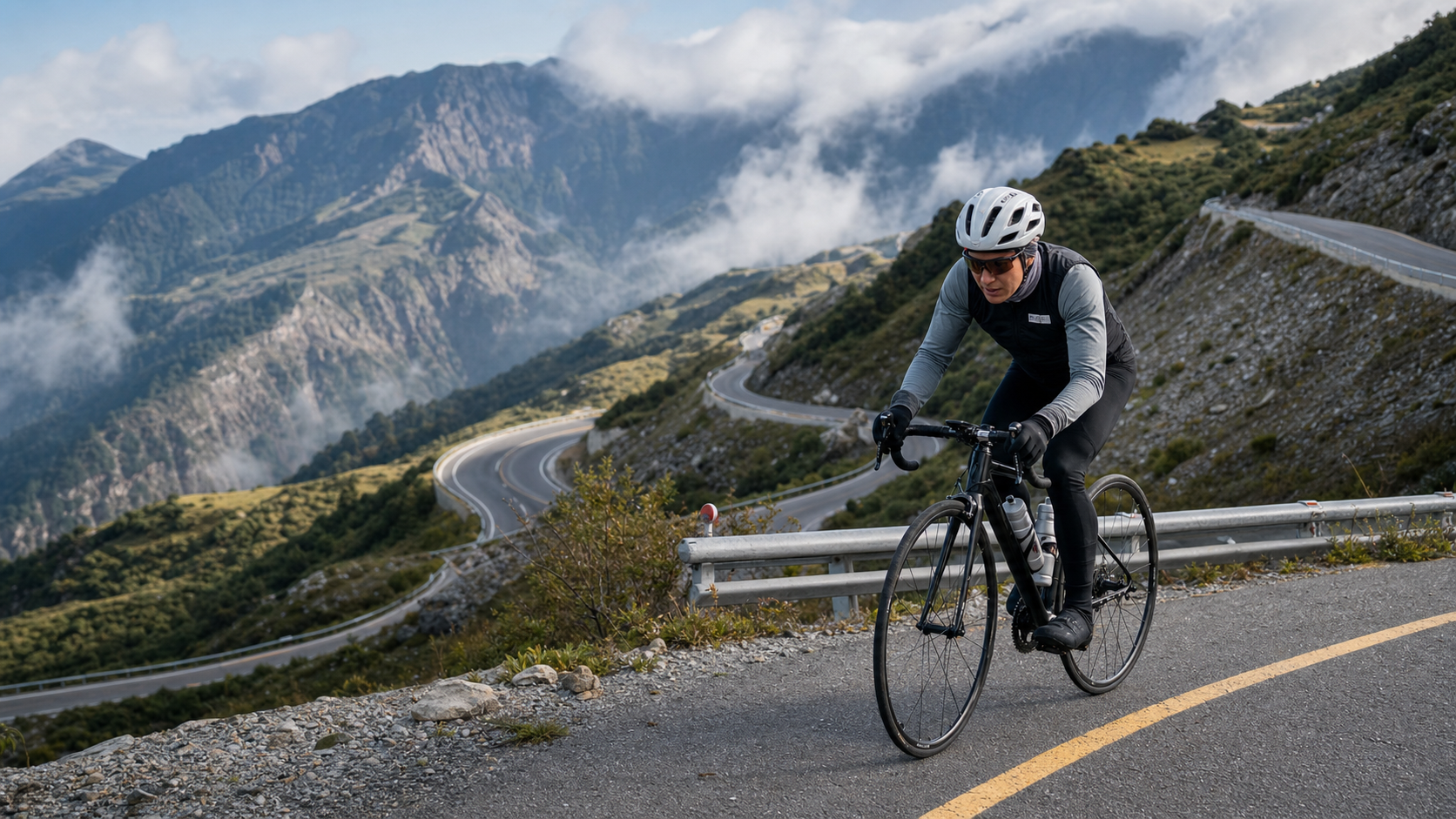
South Cross-Island Highway westbound, from Meishankou to Tianchi: 25 km, 1,477 m of climbing, a Category 5 long-distance high-mountain battle. This is not a route you can just “ride casually”—it’s a serious challenge that requires homework beforehand and disciplined execution. This article breaks down the data, laying out every segment’s gradient, every aid point, and every piece of gear configuration in detail.
Route Overview and Data Analysis
The western section of the South Cross-Island Highway (Provincial Highway 20), from Meishankou to Tianchi, is widely recognized as one of the toughest long-distance climbs in Taiwan’s road cycling community. Let’s put the hard numbers up front:
| Item | Value |
|---|---|
| Route Name | South Cross-Island Highway Westbound — Meishankou to Tianchi |
| Region | Taoyuan District, Kaohsiung City |
| Total Distance | 25,092.1 m (25.09 km) |
| Total Elevation Gain | 1,477.3 m |
| Average Gradient | 5.3% |
| Strava Category | Category 5 (highest tier) |
First, let’s clarify the Strava categorization. Strava’s climb ratings range from Category 4 (easiest) to Category 1, and then to the top-tier Hors Catégorie (HC, “beyond categorization”). However, many people don’t know that under certain calculation standards or regional conventions, the “Category 5” label is actually used to designate extreme long-distance, high-intensity segments that fall outside the standard four-tier system and require special notation. In practice, this means the climb intensity of this road already exceeds the scope of a typical continuous climb. Regardless of how the system labels it, 25 km with nearly 1,500 m of climbing speaks for itself: this is a route that demands full physical reserves, a solid nutrition plan, proper gear configuration, and a clear understanding of your own abilities before you even start.
Using the simplest calculation, 25.09 km multiplied by a 5.3% average gradient gives a theoretical elevation gain of roughly 1,330 m. But the measured total gain is 1,477.3 m—a discrepancy of about 147 m, or roughly 11%. This gap is actually quite common on long mountain routes, for a few reasons: first, GPS elevation data inherently carries some error in mountainous terrain due to signal reflection and terrain obstruction; second—and more importantly—the “average gradient” figure is a statistical value that flattens all sections together, mixing gentle slopes, or even brief descents, with the steepest hairpin turns into a single average. In other words, the 5.3% average masks the fact that certain sections of continuous hairpins in the middle of the route may feature short, steep pitches of 8% or even 10%+. Anyone who has ridden mountain roads knows that climbs are rarely a “steady ascent”—they’re built from a series of undulating segments stacked together. The average only tells you “roughly how hard it will be,” not “where you might suddenly blow up.” This is precisely why the segment-by-segment breakdown below is so important—you need to know where the breaking points are so you can allocate your energy in advance.
In terms of riding profile, this route is a typical “long-duration steady output plus intermittent steep-pitch surges” composite climb. Compared to internationally renowned long-distance mountain climbs (such as the classic climbs in the Alps), a 25 km distance is enough to put most amateur riders’ finish times between 1.5 and 3 hours. That duration alone introduces a whole set of variables—nutrition, warmth, psychological management—that need to be planned in advance. This is not a “just pedal hard” kind of ride.
Segment Breakdown: Six Elevation Zones, One by One
Breaking the 25 km from Meishankou to Tianchi into six segments is the more practical approach, because each section has different gradient characteristics, scenery, and riding strategies. The kilometer markers and elevation ranges below are general estimates based on the route’s overall climb distribution; for actual mileage markers and gradient changes, it’s still recommended to rely on your bike computer or a pre-downloaded GPX track.
Segment 1 (0–4 km): Warm-up start. Departing from Meishankou, this section is typically a warm-up stretch that enters the valley and gradually opens up the views. The gradient is relatively gentle, but be careful not to push your heart rate too high here. Many riders get pulled along by their companions’ pace in the opening phase, driving their heart rate near lactate threshold within the first 4 km, only to fade progressively over the remaining 20 km. The strategy for this segment should be: ride at a pace you can sustain for a long time, where you can still breathe naturally through your nose, keeping your heart rate around 70–75% of the heart rate corresponding to your FTP (Functional Threshold Power).
Segment 2 (4–8 km): Entering the sustained climb. The gradient starts to pick up noticeably, and the road begins to feature regular switchback climbing. This section is a critical test of pedaling efficiency. It’s recommended to maintain a steady cadence and avoid grinding a heavy gear just to power through the gradient—doing so will quickly accumulate lactate in your muscles and compromise your performance in the later stages.
Segment 3 (8–13 km): Dense hairpin zone—one of the most demanding sections on the entire route. The western South Cross-Island Highway is famous for its hairpin turns, and this section is likely where the local gradient exceeds the average most significantly. Short, steep pitches combined with continuous switchbacks put a dual strain on both bike handling and physical output. When cornering, it’s recommended to take a wide outside arc and avoid muscling the front wheel up at the steepest apex, which would cause a sudden spike in instantaneous power demand. This is also the section where riders are most prone to psychological wavering—having climbed nearly a third of the way yet feeling like it’s only just begun. You need to be mentally prepared for that sense of deflation.
Segment 4 (13–18 km): Forest transition zone—gradient eases but elevation keeps rising. As altitude increases, the vegetation gradually shifts from broadleaf to coniferous forest, and the temperature drops noticeably. The gradient here is somewhat gentler than the previous section, making it a good opportunity to reset your breathing rhythm and replenish fluids and calories. It’s recommended to complete your planned mid-route aid stop within this zone.
Segment 5 (18–22 km): The final hard push before the pass. The closer you get to Tianchi, the higher the elevation, and the lower the partial pressure of oxygen in the air—fatigue will feel more pronounced than climbing the same gradient at sea level. The gradient typically ramps up again in this section, and having already ridden nearly 20 km, both your muscles and cardiovascular system are in a relatively fatigued state. This is the section most prone to “hitting the wall” on the entire route. At this point, be sure to slow down—it’s far better to grind slowly with a lighter gear and higher cadence than to stubbornly muscle a heavy gear up the slope.
Segment 6 (22–25 km): The final push to Tianchi. In the last few kilometers approaching Tianchi, the elevation is already quite high, and temperature and wind become additional variables. The strategy here should be to focus on maintaining steady breathing and staying warm—save any sprinting until you’ve truly confirmed the finish is in sight. When you arrive at Tianchi, remember to put on warm layers before stopping to take photos. The wind at the summit is strong, and the moment you stop, your perceived temperature will drop rapidly.
Gear Ratio and Equipment Recommendations
With 25 kilometers, 1,477 meters of climbing, and sections where the gradient may significantly exceed the 5.3% average, the demands on your gear ratio configuration are clear: this is not a route to tackle with a racing compact setup (e.g., 53/39 front, 11-25 rear) unless your climbing ability is exceptionally solid.
Recommended gear ratio configurations:
- Chainrings: A compact or semi-compact crankset with a 34-tooth small ring is recommended. Some riders may even opt for a lighter sub-compact setup (e.g., 46/30), especially heavier riders or those with limited climbing experience.
- Cassette: At minimum, an 11-32T cassette is recommended. Riders who prefer a more conservative approach can consider 11-34T or even wider ranges to provide a more comfortable spinning gear at the lightest end.
- Minimum gear ratio: Aim to keep your “easiest gear ratio” at 1:1 or lower (e.g., 34/32 is close to 1:1, while 34/34 or 30/32 is below 1:1). This gives you the margin to maintain a higher cadence on the steep sections of segments three and five, avoiding excessive torque load on your knees and thigh muscles.
Other equipment recommendations:
- Wheels and tire pressure: Mountain roads occasionally have patches, potholes, or debris from rockfalls. Durable training tires or puncture-resistant tires are recommended. There is no need to inflate to race-level high pressures; moderately lowering tire pressure (adjusted according to tire width and rider weight) can improve grip and comfort, benefiting both long climbs and descents.
- Braking system: Whether you use rim brakes or disc brakes, be sure to check brake pad thickness and brake fluid/cable condition before departure. This route features long descents where continuous braking generates significant heat, and brake system reliability is directly tied to riding safety.
- Layered clothing: This route has a huge elevation difference, and temperatures between the base and Tianchi can differ by more than 10°C. Layered clothing is recommended, and carrying a lightweight windbreaker or water-resistant jacket in a jersey pocket or saddle bag allows you to add a layer when reaching higher elevations.
- Gloves and thermal accessories: Even when departing in summer, temperatures around Tianchi can be noticeably cool. Thin gloves, a headband, or a small buff are worth carrying. Wind chill on descents will make the perceived temperature far lower than the actual reading.
Nutrition and Hydration Strategy
At 25 kilometers with 1,477 meters of climbing, most amateur riders can expect a completion time of 90 to 180 minutes at moderate intensity—a duration that calls for a well-planned fueling strategy.
Hydration recommendations:
- Ensure you are fully hydrated before departure to avoid starting the ride in a mildly dehydrated state.
- Carry at least two bottles (approximately 1,000–1,500 ml total). Resupply points in the mountains are scarce and their operating status is uncertain, so it is better to carry extra than to gamble.
- Take small sips every 15–20 minutes during the ride. Do not wait until you feel thirsty—thirst is already a signal that your body is dehydrated.
Calorie and electrolyte intake:
- Aim for 60–90 grams of carbohydrates per hour, consumed in portions via energy gels, energy bars, or easily portable solid foods (such as bananas or energy cookies).
- Sweat loss is significant on high-mountain climbs, and the combination of sweating and increased respiration at altitude accelerates fluid and electrolyte loss. Carry electrolyte tablets or sports drink powder so you are not replacing water without sodium and potassium, which can trigger cramps.
- Plan to consume the bulk of your calories between the end of segment two and segment four, rather than leaving fueling until the final steep section (segment five), when blood flow has already shifted heavily to the muscles and digestive efficiency drops.
Resupply point planning:
Along the Southern Cross-Island Highway, the operating status of shops and resupply points varies considerably depending on the year’s access controls and road repair status. It is strongly recommended that:
- Before departure, confirm available resupply and water points at Meishankou or the last settlement—do not assume shops along the way will be open.
- Carry enough supplies to cover the worst-case scenario of “no resupply points at all for the entire ride.” On a remote mountain route like the Southern Cross-Island Highway, this is a practical approach rather than over-caution.
- If you plan to return the same way (westbound out-and-back), reserve enough supplies for the return leg. Running out of food and water on the way out before turning back would be an extremely dangerous situation.
High-Altitude Weather and Hypothermia Risk
The area around Tianchi falls within high-altitude climate conditions. Even during Taiwan’s summer, temperatures, cloud cover, showers, and strong winds at the summit can change dramatically within a short period—this is one of the most underestimated risks by riders from the lowlands.
Key risks:
- Sudden temperature drops: The elevation difference from Meishankou to Tianchi is substantial, and temperature differences between the base and the summit frequently exceed 10°C. Combined with sweat from riding, if you do not change into dry clothing promptly upon reaching higher elevations, your perceived temperature will plummet rapidly.
- Afternoon convective showers: The Central Mountain Range of Taiwan is prone to localized convective rainfall in the afternoon, sometimes accompanied by lightning risk. It is advisable to start early in the morning and complete the main climbing sections before noon to avoid the window when afternoon weather deteriorates.
- Wind chill on descents: On the descents after completing the climb, high speeds and strong wind resistance mean that even without significant changes in actual temperature, the perceived temperature drops markedly due to wind chill. This is the stage where hypothermia cases most commonly occur—many riders assume that because they were hot and sweating on the climb, they are immune to the cold, only to experience hypothermia symptoms on the descent as their soaked jersey rapidly dissipates body heat.
Hypothermia warning signs and response:
Early signs of mild hypothermia include involuntary shivering, reduced finger dexterity, impaired judgment, and slurred speech. If any of these symptoms appear, stop riding immediately, find a sheltered spot, change into dry clothing, and consume warm food and drink. If necessary, seek help from riding companions or nearby people. Do not push on or continue descending.
Recommended preparations:
- Carry a lightweight windproof and waterproof jacket. Even if the forecast calls for clear skies, mountain weather changes far more rapidly than in the lowlands.
- Check the Central Weather Bureau’s latest forecasts and mountain-specific advisories before departure. If heavy rain, thunderstorms, or strong wind warnings have been issued, consider postponing or shortening the ride.
- Inform family or your riding group of your full itinerary and expected turnaround time so that others know your whereabouts.
⚠️ Access Status Must Be Confirmed with the Latest Official Announcements
Since the western section of the Southern Cross-Island Highway (Provincial Highway 20) suffered massive landslides during Typhoon Morakot in 2009, it has undergone years of repair work, and its access status has changed many times—including closures, emergency reopenings, controlled access, phased openings for passenger vehicles with permits, re-closures due to new damage, and shuttle-only access during specific periods. This article cannot confirm the actual access status at the time you read it. Whether the Meishankou-to-Tianchi section is open to general bicycle traffic, whether advance application is required, and whether there are time restrictions or capacity limits can all change at any time due to weather, road maintenance work, or disaster risk assessments.
Therefore, anyone planning to ride this route must verify the latest information through the following channels before departure:
- The latest announcements from the Southern Region Branch of the Directorate General of Highways or relevant Kaohsiung City Government agencies
- Real-time access information from the on-site control station (Meishankou Control Station)
- Do not rely on past riding experience, old articles from others online, or “word of mouth” from community discussions as the basis for your decisions. Road access controls change frequently, and outdated information may no longer be valid
Do not set out without confirming the latest access regulations. This is not merely a question of whether you can complete the challenge—it concerns mountain road safety, potential landslide risks, and rescue difficulty. The terrain and history of this route are themselves a microcosm of Taiwan’s mountain roads in their long-term struggle with the natural environment. Respecting the access regulations is also a way of respecting this land and the workers who maintain the road.
Common Mistakes and DNF Risks
On long-distance, high-mountain climbing routes, the common mistakes that lead to abandoning the ride (DNF) or significantly diminishing the experience are actually highly predictable. Most stem from the planning phase rather than physical fitness itself:
- Starting too fast: Being swept up by riding companions or driven by a desire to perform well, riders push their heart rate near the limit in the early section. This is the most common and most fatal mistake. The golden rule for long-distance climbing is “start conservatively, build gradually.” Feeling “too easy” in the early section is actually the correct pace.
- Gearing that is too heavy: Using a racing-compact gearing setup to grind through 25 kilometers of continuous climbing will cause premature fatigue in the knee joints and thigh muscles. Even if your cardiovascular system can hold up, your muscles will go on strike first.
- Insufficient nutrition planning: Underestimating ride time and energy expenditure, not carrying enough food and water, and falling into hypoglycemia or dehydration on remote sections without resupply points.
- Ignoring high-mountain weather variability: Judging the entire ride’s conditions based only on the weather at the base of the mountain at departure, without carrying warm and windproof gear, leaving riders unprepared for sudden temperature drops or rain at altitude.
- Failing to verify road control status: As mentioned earlier, the access status of the western section of the Southern Cross-Island Highway changes frequently year to year. Setting out without confirmation may result in being stopped by traffic control personnel mid-route, or even facing safety risks due to unclear road conditions.
- Overlooking return-leg energy and supplies: Many riders focus all their attention on the goal of “reaching Tianchi” but forget that the descent and possible backtracking require just as much energy and focus. Especially after a long climb, when muscles are already quite fatigued, the handling risk on the descent is actually higher.
- Failing to perform a pre-ride mechanical check: Long-distance, high-intensity climbing and descending place heavy demands on the drivetrain and braking systems. Before departure, chain maintenance, brake pad inspection, and tire pressure and condition checks should be completed to avoid being stranded with a mechanical failure on remote sections.
Target Time Table for Riders of Different Levels
The time ranges below are for reference only. Actual completion times are affected by individual fitness, weather conditions, wind direction, and whether extended mid-ride breaks are needed. Treat these as reference benchmarks for planning nutrition and time management, not as hard targets that must be met.
| Rider Level | Estimated Completion Time (One-Way) | Recommended Strategy |
|---|---|---|
| Advanced/Race-Level Riders (high FTP, frequent high-mountain training) | Approximately 70-100 minutes | Can adopt a more aggressive power pacing strategy, but still advised to leave a buffer in Segment 5 |
| Intermediate/Riders with Regular Training Habits | Approximately 100-150 minutes | Maintain a steady pace, schedule 1-2 brief refueling stops in the middle section |
| Beginner/Riders with Limited Climbing Experience | Approximately 150-210+ minutes | Recommended to adopt a “ride-rest-ride” segmented rhythm, not pursuing continuous riding; the priority is safe completion |
Regardless of which range you fall into, it is recommended to set “completion” rather than “breaking a record” as the goal for your first attempt on this route. A 25-kilometer route with 1,477 meters of climbing is enough to give most amateur riders a full sense of accomplishment and training value in a single challenge. There is no need to sacrifice nutrition and safety precautions in pursuit of time.
Pre-Departure Checklist
Finally, here is a condensed checklist distilled from the key points of this entire article that you can verify item by item before departure:
- [ ] Confirmed the latest access control status for the Meishankou to Tianchi section of the Southern Cross-Island Highway (Provincial Highway 20) (via Highway Bureau announcements or on-site control station information)
- [ ] Checked the latest weather forecast, confirming no heavy rain, thunderstorm, or strong wind warnings
- [ ] Gearing adjusted for long-distance high-mountain climbing (recommended lightest gear close to or below 1:1)
- [ ] Carrying sufficient water (at least 1000-1500ml) and caloric intake (60-90 grams of carbohydrates per hour)
- [ ] Carrying electrolyte supplements to prevent cramping from prolonged sweating
- [ ] Carrying a lightweight windproof/waterproof jacket and thermal accessories (gloves, headband)
- [ ] Completed bicycle mechanical inspection (brakes, shifting, tire pressure, chain maintenance)
- [ ] Informed family, friends, or riding group of the full itinerary and estimated turnaround time
- [ ] Planned a safe turnaround or mid-ride abandonment contingency plan
The Southern Cross-Island Highway westbound from Meishankou to Tianchi is a route where the data alone convinces you that “this road is no joke”—25 kilometers, 1,477 meters of climbing, hairpin sections with gradients far exceeding the average, plus the unpredictability of high-mountain weather. Do your homework thoroughly, pack all the necessary gear, and this route will reward you with one of the most treasured completion experiences in Taiwan’s road cycling community.
Supplement: An Engineering Approach to Power and Heart Rate Pacing
For riders with a power meter, this route is ideal for a complete power-pacing practice session. Breaking it down from an engineering perspective: 25 kilometers, 1,477 meters of climbing, with an average gradient of 5.3%. Planning your output intensity based on your FTP (Functional Threshold Power) as a benchmark is far more effective at avoiding the problem of overexertion in the early section than simply riding by feel.
The generally recommended power-pacing principle for long-distance high-mountain climbs is: keep the overall average output in the 75-85% of FTP range, rather than pushing toward or above FTP like you would in a short climbing race segment. The reasoning is straightforward—the climbing time on a 25-kilometer route easily exceeds one hour. If you push your power to near or above FTP in the early section, lactate accumulation in the muscles will far outpace your body’s ability to clear it. This is essentially borrowing from your own body, and that debt typically comes due at the hairpins in Segment 3 or the hard fight before the pass in Segment 5, at which point your power will drop off a cliff and your actual completion time will end up longer.
For riders without a power meter, heart rate can serve as an alternative reference metric, but remember that heart rate has a significant lag compared to power—it takes tens of seconds to a minute to reflect your actual output intensity. Therefore, you need to anticipate and adjust proactively rather than waiting for the heart rate monitor to warn you before easing off. The practical heart-rate pacing principle is: in the early section (Segments 1-2), keep heart rate at 70-78% of your maximum heart rate; in the middle section (Segments 3-4), allow brief excursions to 80-85% depending on terrain, but be sure to actively bring the heart rate back down where the gradient eases; in the final section (Segments 5-6), adjust dynamically based on how you feel and the remaining distance—better to be conservative than to blow up in the last few kilometers.
This engineering-oriented, data-driven pacing mindset essentially transforms “the uncertain mountain road” into a controllable variable that can be planned in advance and reviewed afterward. After the ride, export your power or heart rate data and review each of the six segments to identify where you output too high and where you held back too much, using this as a basis for your next challenge or training plan for other Southern Cross-Island Highway sections. In the long run, this practice of reviewing data rather than riding purely by feel will be the most solid methodology for advanced riders seeking continued improvement in long-distance high-mountain climbing.
Related Reading
- Southern Cross-Island Highway Westbound: From Meishankou to Tianchi, a Ride Through Resilience, Bunun Mountain Forests, and Cloud-Level Lakes
- The Tianchi-Yakou Section of the Southern Cross-Island Highway: A High-Mountain Road Crossing the Central Mountain Range
- Southern Cross-Island Highway Eastbound Practical Guide: A Full Breakdown of the Category 5 Battle from Chulai to Xiangyang—48 Kilometers, 2,074 Meters of Climbing
- Northern Cross-Island Highway Mingchi Practical Guide: 19.45 Kilometers at 4.3% Average Gradient—A Cloud-and-Mist Trial, with Full Data Breakdown and Segment-by-Segment Tactics
#公路車 #西進武嶺 配速配瓦實驗 坡度分析 四小時內攻略 建大盃 NeverStop #西進武嶺攻略
6 年前
#北橫 + #北進武嶺 最硬的員工旅遊 EP1 | #公路車 #拉拉山 | 明池 | 武嶺 | 武陵農場 | 雲海 | Taiwan Cycling Route Wulin
6 年前
西進武嶺各路段 前8000名 大數據分析 配速攻略/功率/心律/推力比/維持率/踏頻/踏瓦比/牽車率 大公開 | 建大盃 NeverStop 可參考 | 公路車 | CT Yeh
5 年前
大武山20%魔王陡坡【JJSC南台灣遊騎Day2】!屁股真的要裂開了...凡士林抹滿也沒用?神秘金教堂還有超便宜夜市
3 個月前
大禹嶺 到 武嶺牌樓 全程前後實況錄影 | 北進武嶺 | 東進武嶺 | KOM | 訓練台 | 坡度分析 | Taiwan KOM Last 10 km HARD | 公路車
6 年前
單車 梅山36灣 坡度介紹 路段介紹 空拍 (相關遊記影片,請參考說明或我的頻道喔,歡迎訂閱)
6 年前
台北闊瀨陡坡 騎旅 / 日本單車雜誌編輯車友臨時加入!/ 髮香才是最強的 / feat. 北迴歸線小隊 / 公路車 CT Yeh
6 個月前
雨戰! 西進武嶺員工旅遊 加料 各路段大數據分析 | 同事端出5公斤的公路車來挑戰!? EP1
4 年前