Baolai to Jiasian Route Guide: A Perfect Data-Driven Training Climb of 5.29 km with 202.2 m of Elevation Gain
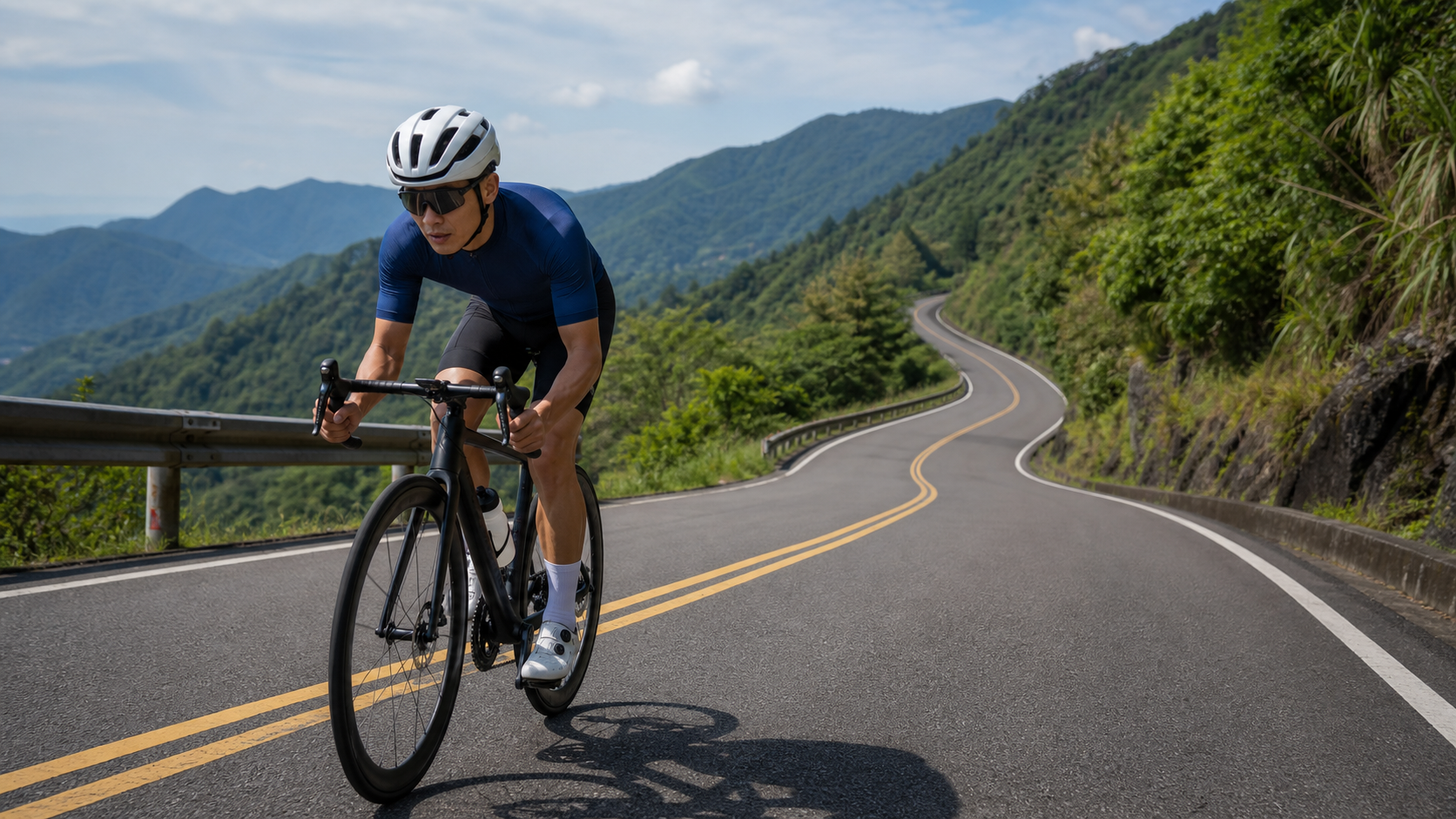
From Liugui’s Baolai to Jiaxian in Kaohsiung, this is a standout section of Provincial Highway 29—under six kilometers long yet packing a solid, sustained climb. For riders looking to squeeze in high-intensity training in a short window, or for those planning a long Southern Cross-Island Highway western section ride and wanting to warm up and gauge their feel beforehand, this route’s numbers are almost textbook-clean. This article starts from the hard data and lays out the route’s training value, segment strategy, gear setup, and common mistakes in one go.
Route Overview: A Short Climb with Remarkably Clean Data
Let’s lay out the basic facts first:
| Item | Value |
|---|---|
| Route Name | Baolai-Jiaxian |
| Location | Baolai, Liugui District, Kaohsiung City → Jiaxian District, Kaohsiung City |
| Total Distance | 5,289.8 m (approx. 5.29 km) |
| Total Elevation Gain | 202.2 m |
| Average Gradient | 3.8% |
| Strava Category | Category 2 |
Let’s start with a simple physics check: if a route has an average gradient of 3.8%, the theoretical elevation gain should be “distance × gradient,” meaning 5.29 km (5,290 m) multiplied by 0.038, which equals roughly 201 m. The actual measured total gain on this route is 202.2 m—a difference of only about 1 m from the theoretical value, an error margin of under 0.5%.
This matters a great deal to riders. On many routes, the “average gradient” figure is simply a number calculated by flattening out a highly varied profile (with descents, flats, and steep pitches), so the actual feel on the bike can differ noticeably from the number—some sections might be as steep as 8% or 10%, while others are nearly flat, and after averaging it all out, it looks “manageable,” but riding it is a completely different story. Baolai-Jiaxian, however, has a remarkably even distribution of climbing, with no hidden extreme pitches and no big descents diluting the numbers. In other words, this is a “what you see is what you get” route: the 3.8% average gradient you see on the route page will closely match the sustained resistance you feel as you pedal.
This characteristic makes Baolai-Jiaxian especially well-suited for two purposes. First, if you want to know your true power output or heart rate response on a “steady, moderate climb,” this route will have almost no noise interfering with your reading—there are no short, steep ramps to spike your power curve into outliers, and no long descents dragging your average heart rate down. Second, if you’re planning a long ride on the western section of the Southern Cross-Island Highway (from Liugui and Baolai heading toward Meishan), this stretch can serve as a warm-up or feel-calibration segment before the main event: spend ten to twenty minutes sensing how your legs feel today and whether your gearing is dialed in, then decide whether to adjust your pace for what lies ahead.
As for the Strava Category 2 rating, this tier typically corresponds to climbs of moderate length and gradient, sitting between a “warm-up slope” and a “hardcore long climb.” Given this route’s 5.29 km and 202.2 m of gain, falling into Category 2 is a reasonable placement—not an especially punishing rating, but certainly not a slope to be taken lightly.
It’s also worth noting that at 5.29 km, this distance is relatively compact within the database of routes in Taiwan’s central and southern mountain regions. Compared to classic long climbs like Wuling or the eastern section of the Southern Cross-Island Highway—which routinely stretch 20–30 km with over a thousand meters of gain—Baolai-Jiaxian is more like a “condensed” climbing sample: it distills the training stimulus of a “sustained moderate gradient” into the shortest possible distance, letting riders complete a structurally complete, intensity-defined climbing workout without committing an entire day. For city riders with busy workweeks who can only spare two or three hours on a weekend morning, this is a highly practical route format—you can ride it out-and-back (turning around at Jiaxian to return to Baolai, or the reverse) to stack up around an hour of training volume, or embed it into a longer Southern Cross-Island western section or Liugui loop as an intensity block within the main ride.
From a route-planning perspective, this kind of “short distance, highly recognizable gradient” segment is also ideal for repeat hill intervals in periodized training. Compared to finding a flat stretch and timing your own climbing effort, a real road with actual gradient variation provides training stimulus closer to race conditions—the muscle recruitment patterns and cardiorespiratory load rhythm will more closely mirror real climbing races or the terrain between aid stations on a long mountain tour, rather than just stacking power numbers on paper.
Segment Strategy: Pacing Across Three Phases
Since the total length is only 5.29 km, this route doesn’t lend itself to being broken into too many small segments—slicing it too finely would defeat the purpose. In practice, it’s best to plan your pacing with a three-phase mindset: “start, mid-climb, finish,” with the focus on stability in heart rate and power output.
Start Segment (approx. first 1.5 km): Climbing from Baolai toward Jiaxian, this is where you establish your rhythm. A common mistake many riders make is pushing their heart rate near lactate threshold right from the start, thinking, “The route isn’t long, so a hard push won’t hurt.” But don’t forget—this is a sustained 3.8% climb, not a sprint segment. Treat this 1.5 km as an observation window for settling into your pace: keep your heart rate between the upper end of Zone 3 and the lower end of Zone 4 (roughly 80% to 87% of max heart rate; adjust based on your own threshold heart rate test), with power corresponding to 85%–95% of FTP. If you go too hard here, you’ll pay for it in the next two segments.
Mid-Climb (approx. middle 2.5 km): This is the main body of the route and the section with the most consistent gradient. As mentioned earlier, the gradient distribution here is remarkably even, with no hidden steep pitches, so this stretch is best suited for “cruise-style” pedaling—find a power or heart rate zone you can sustain for over 10 minutes, then hold it as steadily as you can. In this phase, focus your attention on cadence: if your cadence drops below 60 rpm as the road tilts up, it usually means your gear is too heavy, and your muscles will quickly slip into anaerobic mode; ideally, keep your cadence between 75 and 90 rpm, relying on aerobic metabolism to sustain output rather than grinding a heavy gear.
Finish Segment (approx. final 1.3 km): The stretch approaching the Jiaxian urban area. By now, fatigue has accumulated to a certain degree, and many riders experience a “see the finish and want to sprint” psychological reaction. It’s best to maintain your existing pace—unless your training goal is specifically a final sprint (e.g., simulating a time trial finish), there’s no need to spike your heart rate here. At 5.29 km, it’s neither long nor short, and if your heart rate is already nearing anaerobic threshold in the final 1.3 km, you could easily find yourself nearly unable to pedal for ten-plus minutes of recovery after reaching Jiaxian. If your plan is to explore Jiaxian town or continue on to other roads afterward, that kind of fatigue management isn’t worth it.
Gear Ratio and Equipment Recommendations
Given the route’s characteristics—a 3.8% average gradient, Category 2 classification, and evenly distributed gradient—this is not a climb that requires an extremely light gear ratio to manage, but it’s also not advisable to tackle it with a purely flat-terrain setup.
Road cyclists: If your fitness and FTP fall within the general recreational riding level (FTP below 3.0 W/kg), it’s recommended to pair a compact crankset (50/34T) with a rear cassette that offers at least a 28T or even 30T option, giving you the margin to maintain a cadence above 75 rpm during the mid-section climbs without having to grind through with heavy gears. If you’re in better shape (FTP above 3.5 W/kg), a standard crankset (53/39T) paired with a 25T or 28T cassette can handle it, but it’s still advisable to have a 28T or larger option as insurance, especially during hot weather when the perceived effort increases.
Gravel bikes / all-road bikes: Since this route follows mountain roads in the Tai 29 line area, road surface conditions can vary with the seasons and maintenance status. If you’re using gravel tires or slightly wider tires (28c and above), both comfort and grip will be more assured compared to pure racing narrow tires.
Drivetrain: The climbing on this route is concentrated in a sustained gradient in the middle section. It’s recommended to shift one to two gears in advance, avoiding sudden hard pedaling shifts on steep sections that could cause chain hesitation or skipping, especially for riders using mechanical drivetrains. While electronic shifting has an advantage in shift response speed, it’s still recommended to develop the habit of “anticipating gradient changes and shifting down early,” rather than relying on the system’s shift speed to compensate for timing errors in pacing.
Wheels and tire pressure: This route is on mountain roads where the surface may develop potholes or patched sections from sun and rain exposure. It’s not advisable to inflate tires to racing-level high pressures. Generally, it’s recommended to set tire pressure in the middle of the manufacturer’s suggested range based on rider weight and tire width, balancing rolling efficiency with ride comfort. If your riding plan includes a longer journey on the western section of the Southern Cross-Island Highway, also consider that loose gravel or fallen leaves may accumulate in the mountains during the afternoon—a slightly more conservative tire pressure setting will provide better grip margin for unexpected avoidance maneuvers or emergency braking.
Braking system: Although the Baolai–Jiaxian section is primarily a climbing route, don’t forget its mirror direction—the return trip or reverse ride from Jiaxian to Baolai will be a continuous descent. Whether your bike has disc brakes or traditional rim brakes, it’s advisable to check brake pad wear and the condition of brake fluid lines (hydraulic disc) or cables (mechanical) before departure. Continuous mountain descents place far greater stress on the braking system than flat-road riding—don’t overlook this basic check.
Nutrition and Hydration Strategy
At 5.29 km with 202.2 meters of climbing, estimating at a normal riding pace (roughly 12–18 km/h depending on individual ability), completing this climb takes approximately 18 to 26 minutes. Looking at this section in isolation, it doesn’t quite reach the threshold where mid-ride refueling is necessary—generally, energy gels or sports drinks are only recommended during rides exceeding 60–90 minutes or when caloric expenditure is notably high.
In practice, however, the Baolai–Jiaxian route is rarely ridden as a standalone complete outing. More commonly, it’s combined with the western section of the Southern Cross-Island Highway or loop routes around Liouguei and Baolai. Therefore, the focus of your nutrition strategy should be on “before the climb” and “after the climb”:
- Before the climb: If this climb comes in the middle or later portion of your day’s itinerary, make sure your water bottles are sufficiently filled before setting out. Especially in summer heat, the sun exposure on mountain roads makes the perceived effort far higher than on flat terrain. A baseline of 500–750 ml of water per hour is recommended, adjusted according to the day’s temperature and your personal sweat rate.
- During the climb: This section isn’t long, so there’s no need to stop specifically for refueling, but you can take a sip or two of water during the initial stretch before you enter high-intensity output, maintaining fluid balance and avoiding reaching the mid-climb only to realize you’re thirsty.
- After the climb: Upon arriving at Jiaxian, it happens to be a natural node where many riders stop to replenish calories and fluids (the culture section will cover Jiaxian’s local specialties and suitable stopover options). This is a good opportunity to reset your body’s state and prepare for the continuation of your ride.
From a caloric expenditure perspective, a rider weighing roughly 65–75 kg completing this 202.2-meter climb at moderate intensity will burn approximately 150–250 kcal, though actual figures will vary based on weight, riding intensity, and pedaling efficiency. If this climb is just a small part of your day’s ride, there’s no particular need to consume additional solid food specifically for these 5.29 km—maintaining fluid balance should suffice. However, if you’re planning a long-distance route covering the western section of the Southern Cross-Island Highway or multiple climbs around Liouguei and Baolai, it’s advisable to factor the Baolai–Jiaxian section into your overall nutrition pacing. For example, have an easily digestible carbohydrate snack (banana, energy bar, etc.) before departing from Baolai to ensure your blood sugar and glycogen stores are adequate when entering the climb, rather than thinking about refueling only at the last minute.
Electrolyte supplementation is also worth mentioning. During mountain climbs in summer heat, sweat rates are noticeably higher than on flat rides. If you only replenish with plain water while neglecting sodium, potassium, and other electrolyte losses, you may experience early signs of cramping or decreased focus in the latter half of the climb. It’s recommended to prepare sports drinks containing electrolytes or carry salt tablet supplements, especially when planning rides during the peak summer months.
Weather and Seasonal Recommendations
The Liouguei and Jiaxian area of Kaohsiung features mountainous terrain with a climate distinctly different from the flatlands. When planning your riding time, consider the following:
Summer (June–September): Strong sunlight and a high probability of afternoon convective showers—mountain terrain readily triggers thunderstorms. It’s recommended to depart in the early morning hours, both to avoid the peak midday heat and to reduce the chance of encountering afternoon thunderstorms. Once rain hits mountain roads, wet surfaces combined with poor visibility make the safety impact on climbing sections more pronounced than on flat terrain.
Typhoon season and after heavy rainfall: The Tai 29 line and surrounding mountain roads are part of a network susceptible to wind and flood damage. Especially after a typhoon passes or several days of heavy rain, mountain sections may experience rockfalls, landslides, or damaged road foundations. Before planning a ride, it’s strongly advised to check with road authorities or local information to confirm the roads are open and safe—don’t rely solely on past experience to judge road safety.
Autumn/Winter (October–February): The climate is relatively dry and stable, with gentler sun angles—this is the better season for riding this route and extending exploration into the western Southern Cross-Island Highway and the Laonong River basin scenery. Day–night temperature differences are more pronounced in the mountains than on flat terrain; it’s recommended to carry a lightweight windbreaker for early morning chill and wind chill effects on descents.
Spring (March–May): Overall mild weather, but be mindful of brief rainfall from southward-moving frontal systems. Check real-time rainfall radar before departure to avoid scheduling mountain rides during frontal passages. This season also sees the Laonong River basin vegetation at its most lush green—if time permits, slow down and pay attention to the natural scenery changes along the way.
Overall, because this route is short with minimal time required per trip, weather risks are relatively manageable—even if conditions suddenly turn unfavorable, you can quickly adjust your plans or turn back, unlike long-distance mountain itineraries where retreating mid-route is difficult once you’ve set out. But this doesn’t mean basic weather-checking habits can be ignored. The mountain terrain around the Tai 29 line is complex, and microclimate changes in the mountains often occur faster than flatland forecasts suggest—make it a habit to check real-time weather and road conditions before departing.
Common Mistakes and Reminders
Mistake 1: Treating a short route as a “casual ride” without intensity planning. 5.29 km may not sound long, but with 202.2 meters of climbing and a sustained 3.8% gradient, riding without any rhythm strategy can easily lead to anaerobic accumulation mid-way and premature burning sensations in the legs. This route can actually catch unprepared riders off guard more easily than a long, gentle climb.
Mistake 2: Gearing configured primarily for flat-road riding. As mentioned earlier, this route requires at least a 28T or larger rear cassette option. If you’re used to flat-road gearing (e.g., a maximum 25T rear cog), you’ll likely be forced to grind at an unfavorable cadence during the mid-section climb—not only inefficient, but also increasing the risk of knee joint strain.
Mistake 3: Ignoring real-time changes in mountain weather. As noted in the earlier section, the Provincial Highway 29 area is part of a mountain road network susceptible to weather and geological conditions. Always check road conditions and weather forecasts before scheduling a ride—don’t rely solely on past experience.
Mistake 4: Viewing this segment in isolation and neglecting energy allocation across the full itinerary. Most riders don’t just ride these 5.29 km and call it a day; they treat it as part of a larger loop around the Southern Cross-Island Highway western section or the Liouguei and Baolai area. If you exhaust yourself on this climb, it will seriously compromise the quality and safety margin of the rest of your ride. Plan your power output according to the day’s overall itinerary rather than sprinting this segment as if it were a standalone time trial.
Mistake 5: Relying entirely on the real-time gradient display from GPS devices for pacing decisions. Many cycling computers or GPS devices show slight delays or noise in real-time gradient readings, especially at transition points where the slope changes, causing the numbers to jump around. Rather than staring at the live gradient figure and reactively adjusting your output, it’s better to familiarize yourself with the overall gradient profile of the route beforehand (like the route overview at the beginning of this article), and ride by feel with a pre-planned pacing strategy. Use the device numbers merely as a supplementary reference—this will produce a steadier rhythm and prevent unnecessary accelerations or decelerations triggered by brief numerical fluctuations.
Mistake 6: Underestimating the descent risk when turning back or riding the route in reverse. If your itinerary involves turning around at Jiasian and heading back to Baolai, you’ll face the descent corresponding to that 202.2 meters of climbing. Mountain descents feature numerous corners, limited sight distance, and possible local traffic or agricultural vehicles. It’s advisable to maintain controlled braking on the descent, especially slowing down well before corners. Don’t over-accelerate downhill just because you’ve finished a climbing workout and want to “recover” on the way down.
Target Time Table for Riders of Different Levels
The time ranges below are for reference only; actual completion times will vary depending on individual fitness, ambient temperature, wind direction, and road surface conditions:
| Rider Level | Estimated Completion Time | Average Speed (approx.) | Recommended Heart Rate Zone |
|---|---|---|---|
| Beginner / Recreational Rider | 25–32 min | 10–13 km/h | Zone 2–3 (easy aerobic to moderate aerobic) |
| General Club Rider | 18–24 min | 13–18 km/h | Zone 3–4 (moderate aerobic to sub-threshold) |
| Well-Trained Competitive Rider | 12–17 min | 19–26 km/h | Zone 4–5 (near-threshold to anaerobic) |
| Elite Category Race Rider | Under 10 min | Above 26 km/h | At or above anaerobic threshold |
It’s worth noting that the reference values in this table are reasonable estimates based on route distance, elevation gain, and gradient classification—not derived from a single recorded ride. Actual results can fluctuate considerably depending on individual fitness, wind conditions that day, temperature, and road surface. For your first attempt, we recommend prioritizing “maintaining a steady heart rate without blowing up,” recording your completion time and perceived exertion, and then gradually building a progression strategy—rather than charging straight at the fastest time bracket in the table from the very beginning.
Training Applications: Fitting Baolai–Jiasian into Your Schedule
For riders with specific training goals, the Baolai–Jiasian route can be developed into several different workout formats, rather than simply “riding through it.”
Threshold Interval Workout: Thanks to the route’s even gradient and lack of distracting variations, it’s well-suited for single or repeated threshold power testing and training. With a single-pass completion time of 18–26 minutes, it falls right around the duration range many training systems define for “threshold zone testing.” If you have the option to turn around or repeat the segment, you can even schedule two repeats with recovery in between, allowing your body to accumulate more effective training time at near-lactate-threshold intensity.
Cadence and Force Endurance Training: If your training goal is to improve climbing cadence efficiency, you can deliberately ride one to two gears harder than usual during the mid-section climb, keeping cadence between 60–70 rpm for 5–10 minutes of force endurance stimulus. This is a common climbing strength-building method in many professional team training programs. However, this type of workout is best scheduled during a training phase with lower overall fatigue, and you should monitor knee joint response closely—if any discomfort appears, stop immediately and return to your normal gearing.
Beginner Climbing Adaptation Route: If you’re new to road bike climbing and lack confidence for tackling Southern Cross-Island Highway–level long climbs, Baolai–Jiasian is an excellent “entry test” route. Its short distance means that even if you need to stop mid-way to catch your breath, there’s none of the psychological pressure of a long climb. Yet the gradient and elevation gain are substantial enough to give you a genuine feel for what “sustained climbing” is like, building foundational muscle memory and mental preparation for tackling longer routes in the future.
Group Ride with Split Training: For teams or clubs, this short, moderate-difficulty climb is well-suited for a group training session with competitive splits—divide members by fitness level, each setting their own target completion time. This maintains team cohesion while ensuring riders of different abilities all receive training intensity appropriate to their level, avoiding the common group-ride dilemma of “strong riders waiting for weaker ones” or “weaker riders getting dragged beyond their limits.”
Conclusion: A Short but Punchy Training Segment
The greatest value of the Baolai–Jiasian route lies in its “just right” specifications: short enough not to consume an entire day’s itinerary, yet with climbing and gradient substantial enough to constitute meaningful training stimulus. Combined with the clean, verified data discussed earlier, this route becomes an ideal tool for assessing your climbing form and honing your pacing sense. Whether you treat it as a warm-up segment before a long Southern Cross-Island Highway western section ride, or simply want a mid-distance climbing workout, Baolai–Jiasian deserves a place on your pocket route list. As for the local stories behind these two towns—the hot springs, the taro industry, and the storms and reconstruction this mountain region has weathered—those will be saved for the next article, told from a rider’s first-person perspective.
Related Reading
- Dona Route Practical Guide: Beneath the Category 0 Gentle Rating Lies the Truth of 508 Meters of Climbing
- From Baolai to Jiasian: A Cycling Memory of Hot Springs, Taro, and a Land Reborn
- Biaoliujia Driveway Complete Guide: Segment Pacing, Gearing, and Steep-Wall Strategy for 4.7 km at 8.8% Average Gradient
- Pingjing Street Climb Practical Guide: 4.66 km at 6.3% Average Gradient, a Complete Breakdown of the Lengshuikeng Prelude
爬坡ITT實境)台中 魔王 松鼠坡 首航 6:12 大肚山 大三元 科福路
8 年前
台北闊瀨陡坡 騎旅 / 日本單車雜誌編輯車友臨時加入!/ 髮香才是最強的 / feat. 北迴歸線小隊 / 公路車 CT Yeh
6 個月前
半日 小台灣 極限單車路線挑戰實錄
7 年前
大武山20%魔王陡坡【JJSC南台灣遊騎Day2】!屁股真的要裂開了...凡士林抹滿也沒用?神秘金教堂還有超便宜夜市
3 個月前
公路車 | 塔塔加驚險員工旅遊 | 還好手腳快沒被抓交替!
5 年前
大禹嶺 到 武嶺牌樓 全程前後實況錄影 | 北進武嶺 | 東進武嶺 | KOM | 訓練台 | 坡度分析 | Taiwan KOM Last 10 km HARD | 公路車
6 年前
西進武嶺 8000名單車友數據分析 PART1 | 從新手到高手數量/瓦數/推力比/FTP推力比/功率計使用率 大解析 | 公路車 | CTYeh
5 年前
太平山單車員工旅遊 | 這樣玩CP值最高!| 公路車
5 年前