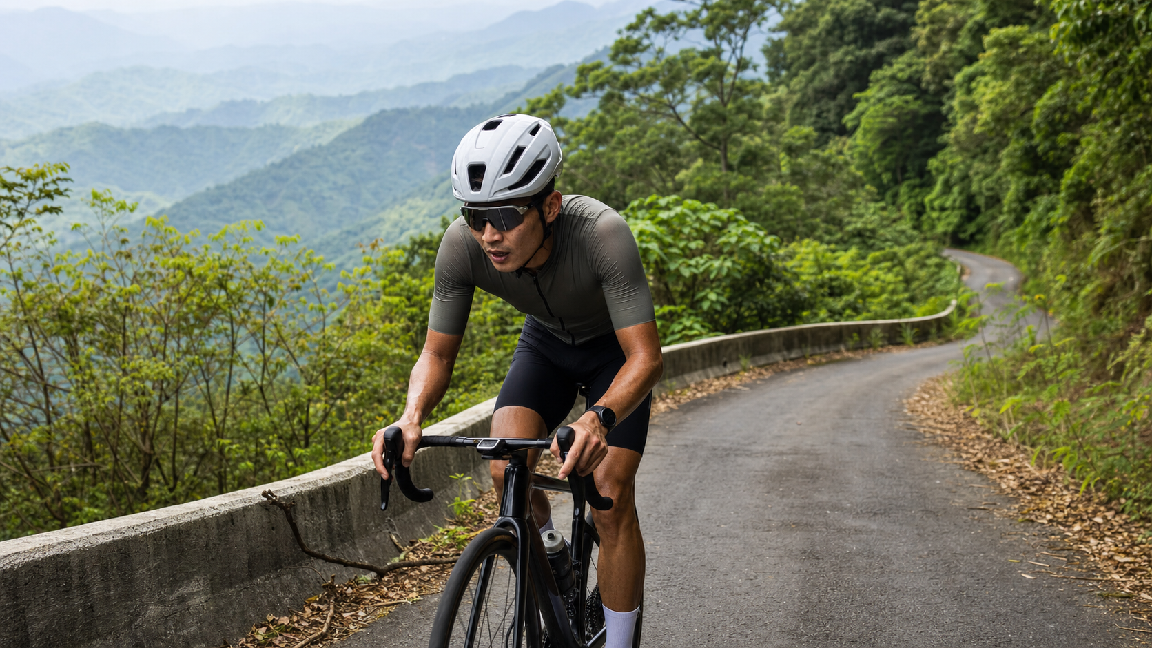
Tengzhi in Liugui, Kaohsiung: a Category 4 forest road with a total length of just 11.06 km but 750 m of climbing. The distance is short, yet the average gradient is marked at 6.6%, making it a “condensed” high-intensity mountain road, ideal for testing your climbing power and fueling strategy. This article breaks down every piece of data on this route from an engineer’s perspective and provides practical riding tactics.
Route Overview and Data Analysis
Tengzhi Forest Road is located in Liugui District, Kaohsiung City. The total route distance is 11,063.3 meters (11.06 km), with 750.0 meters of total climbing, and a Strava rating of Category 4. At first glance, the distance is short and easy to underestimate, but once you lay out the numbers, it’s clear this road is no pushover.
Let’s start with a basic physics check: using the route’s average gradient of 6.6%, 11.06 km × 6.6% gives a theoretical climb of approximately 730 meters, which is quite close to the measured 750.0 meters—a discrepancy of only about 20 meters, well within the reasonable GPS elevation measurement error range (GPS elevation accuracy typically falls within ±10–30 meters as normal, especially in forested environments where satellite signals are more susceptible to canopy interference). This indicates the route data is highly reliable, and we can confidently use it as a basis for training and pacing plans without needing additional conservative adjustments.
To imagine the overall pace using the average gradient: 6.6% is no longer “gentle climbing” territory, but rather a threshold gradient requiring sustained mid-to-high intensity output. Compared to other well-known forest road climbs in Taiwan—such as the western approach to Wuling, which often exceeds 20 km with an average gradient in the 5%–6% range—Tengzhi is nearly half the distance, but the gradient is steeper and more concentrated. It’s essentially compressing the same climbing into a shorter segment, meaning the instantaneous load on your muscles and cardiorespiratory system is no easier than a long climb. In fact, because there’s no mid-course respite, it demands even greater tolerance above the anaerobic threshold.
From a power perspective, taking a mid-level rider with an FTP (Functional Threshold Power) in the 200–250W range as an example: to maintain a steady output on a 6.6% average gradient, you typically need to ride at 85%–95% of FTP. This means the entire climb is spent hovering at the edge of Zone 4 (Threshold)—a classic test of lactate management rather than aerobic cruising.
The Category 4 rating in Strava’s system falls on the easier end of the spectrum (Strava climb categories from easiest to hardest are Category 4, 3, 2, 1, Hors Catégorie), but this rating is calculated based on a climbing score of “distance × gradient” and does not fully reflect the subjective perceived exertion (RPE, Rate of Perceived Exertion) during actual riding. For a route like Tengzhi—short but steep—many riders find their actual perceived suffering exceeds what the rating implies, a gap you must keep in mind when planning training intensity.
Digging further into Strava’s climb categorization logic: the scoring formula roughly multiplies the elevation gain in meters by the distance in kilometers, with higher values corresponding to harder categories. Tengzhi’s climbing score falls near the boundary between Category 4 and Category 3, which also explains why, despite carrying the “lowest category” label, it often feels like “this can’t really be the lowest.” Compared to other well-known Category 4 routes in Taiwan—which tend to be longer in distance with relatively milder gradients—Tengzhi instead stacks the same score through a “short distance, steep gradient” approach. For riders whose usual training is mostly cruising and who lack experience with high-intensity intervals, this route presents a clear dual challenge, both technical and physiological.
Looking at it from another angle: if you compare Tengzhi to other popular weekend riding routes in the Qishan–Meinong–Liugui area, most of those are 40 km or more in mileage but with gentle gradients, falling into the aerobic cruising category. Tengzhi is the complete opposite—the kind of route where “the moment you get on the bike, you’d better be ready to suffer.” This is also why we recommend against underestimating this route’s training value simply because of its “short total distance.” In fact, for urban riders with limited training time who can only squeeze in high-efficiency interval sessions in short windows, Tengzhi is actually an ideal “condensed” threshold training route, delivering maximum physiological stimulus in the shortest possible time.
Core Data Quick Reference Table:
| Item | Value |
|---|---|
| Total Distance | 11.06 km |
| Total Climbing | 750.0 m |
| Average Gradient | 6.6% |
| Strava Category | Category 4 |
| Administrative District | Liugui District, Kaohsiung City |
| Theoretical Climb (Gradient × Distance) | Approx. 730 m |
| Deviation from Measured | Approx. 20 m (reliable) |
Segment Strategy: From Liugui Urban Area to the Cloud Forest Belt
Although there is no officially published segment-by-segment gradient analysis, based on the typical terrain logic of forest-road climbs and the elevation distribution of the Liugui area, this ascent can reasonably be broken down into three representative riding phases, which you can cross-reference and fine-tune against the actual gradient changes recorded on your own GPS track.
Phase 1: Warm-up Climb, Muscle Activation Period. Starting from the Liugui urban area and connecting to the Tengzhi Forest Road entrance, the initial section of road usually gives you a “greeting gift” of test gradients, forcing your body to switch from flat-road riding rhythm to climbing mode. In this phase, it is recommended to deliberately keep your power output low—even if the gradient feels like you “could push harder,” you should control your heart rate and avoid spiking into the threshold zone too quickly, because there is still a much longer road ahead. The root cause of many riders’ DNF (Did Not Finish) is actually using up too much energy in the first phase.
Phase 2: Core Forest Road Climb, A Dual Test of Gradient and Physical Sensation. Once you enter the main body of the forest road, as elevation gradually rises, mixed stands of cedar and broadleaf trees will gradually envelop both sides of the road, improving shade coverage. However, because forest roads have many switchbacks and limited visibility, gradient changes are difficult to anticipate in advance, which can easily lead to the psychological fatigue of “not being able to see where the finish line is.” This section is the main contributor to the route’s average gradient and is also the most demanding test of pacing discipline—it is recommended to use power or heart rate as objective indicators rather than riding purely by feel, to avoid being misled by visual illusions of the gradient ahead (climbs often produce a “visual steepness illusion,” where the road looks steeper or shallower than it actually is).
Phase 3: Approaching Tengzhi, Cloud Belt and Sudden Temperature Drop. As elevation continues to rise, approaching the Tengzhi area (the forest recreation area sits at approximately 1,600 meters above sea level), temperatures will drop noticeably. Combined with the tendency for mountain clouds and fog to gather in the afternoon, both perceived humidity and chill will increase simultaneously. By this phase, muscles have accumulated considerable fatigue, and the temperature change can cause rapid core body heat loss. At this point, be sure to check whether your nutrition and thermal gear are properly prepared (see subsequent chapters for details).
Pacing Recommendation: When riding in segments, it is recommended to apply the “negative split” mindset in reverse, operating as a strategy of “conservative start, steady middle, and reserved power for a final push,” because on a short, high-gradient route like Tengzhi, it is very easy to go out too hard in the early section and then run out of steam in the latter section when the gradient stays steep or even increases.
Fine-Tuning Breathing and Cadence Rhythm: On a sustained climb averaging 6.6%, cadence management matters more than chasing absolute speed. It is recommended to keep your cadence between 75 and 90 revolutions per minute, avoiding both excessively low cadence (below 60 rpm), which places excessive load on the knee joints, and excessively high cadence, which prematurely fatigues the cardiorespiratory system. Breathing rhythm can be paired with cadence using a simple mnemonic pattern, such as “two pedal strokes in, two pedal strokes out,” allowing the body to maintain stable oxygen uptake efficiency rather than gasping erratically with gradient changes, which actually accelerates lactate accumulation.
Psychological Segmenting Techniques: Because forest roads have limited visibility and many switchbacks, it is recommended that riders mark several clear visual landmarks in their minds or on their bike computers before departure (for example, a distinctive corner, a particular section of forest, or a specific milestone), breaking the entire 11-kilometer ride into 4–5 psychological segments. After completing each segment, give yourself a small acknowledgment of achievement, rather than constantly staring at “how many meters remain,” which is a sustained source of psychological pressure. This technique is particularly effective during prolonged high-intensity efforts and can significantly reduce the urge to quit midway.
Safety Reminder for the Descent: Although this article focuses on the climbing strategy, the descent after finishing equally demands focus. Forest road descents have many corners, and the surface may be damp or covered with fallen leaves. Combined with hand and core muscle fatigue from the long climb, braking response and cornering stability will both be affected. It is recommended to start the descent at a conservative speed to warm up, confirm road conditions and brake feel, and only then gradually increase speed. Never recklessly push the descent while physically depleted.
Gear Ratio and Equipment Recommendations
For a Category 4 route with an average gradient of 6.6%, the requirement for the drivetrain is not simply “light is better,” but rather having sufficient low-gear flexibility to handle local sections where the gradient may exceed the average on steeper pitches (forest-road climbs commonly feature short, steep sections hitting 10%–15% or more).
Gear Ratio Recommendations:
- Road Bike: It is recommended to pair a 50/34T or 52/36T compact or semi-compact crankset with at least an 11-32T or 11-34T rear cassette, ensuring the easiest gear provides enough cadence room to handle local steep sections.
- Mountain Bike / Off-Road Setup (Gravel/MTB): If the Tengzhi road conditions include unpaved or gravel surfaces, a 1x system with a wide-range cassette (e.g., 10-50T) is recommended, simplifying shifting decisions and reducing the risk of chain drops.
- Wheels and Tire Width: Forest road surfaces may have fallen leaves, gravel, and locally slippery sections. A tire width of at least 28c is recommended, with tire pressure moderately reduced (adjusted according to rider weight and tire width, aiming for the lower-middle range of the manufacturer’s recommended range) to improve grip and comfort.
Other Equipment Checklist:
- Heart rate strap or power meter: for objectively monitoring output intensity and avoiding impulsive riding based on subjective feeling
- GPS bike computer: pre-load the route track; in forested environments, cell phone signal and GPS positioning quality may be unstable
- Spare inner tubes and inflation tools: supplies are scarce in mountain areas, and mechanical issues must be resolved self-sufficiently
- Windbreaker or windproof vest: to address the sudden temperature drop at the summit and wind chill during the descent
Nutrition and Hydration Planning
This is the aspect most easily overlooked on mountain forest-road climbs like Tengzhi, yet it is also the most likely cause of a DNF. Supply points in mountain areas are scarce, and there are unlikely to be convenience-store-level facilities along the route. Be sure to plan with a “self-sufficiency” mindset.
Hydration Recommendations: For weather with an average temperature above 25°C and moderate-to-high intensity climbing, a typical rider loses approximately 500–1,000 milliliters of fluid per hour. Estimating a finish time of 1–2 hours (depending on rider ability), it is recommended to carry at least 1.5–2 standard water bottles (approximately 1,000–1,500 milliliters). Weaker riders or hotter weather conditions warrant carrying more, or consider using a hydration pack to increase capacity while also allowing hands-free drinking without releasing the handlebars.
Energy Nutrition Recommendations:
| Time Point | Recommended Nutrition |
|---|---|
| 30–60 minutes before departure | Moderate carbohydrates (banana, energy bar) |
| Mid-climb (approximately at the 5–6 km mark) | Energy gel or sports drink; avoid solid food that adds digestive burden |
| Before reaching the summit | Electrolyte supplementation to prevent cramping |
| After the descent | Mixed protein and carbohydrate intake to accelerate recovery |
Because moderate-to-high intensity climbing suppresses gastrointestinal digestive function, mid-climb nutrition should favor easily absorbed liquid or semi-liquid forms, avoiding difficult-to-digest solid foods during high-intensity efforts, which can cause stomach discomfort or even nausea. This risk is even higher in summer heat and high humidity.
Electrolytes and Cramp Prevention: The Tengzhi section features concentrated, high-intensity climbing, combined with significant mountain temperature variation, which can easily cause electrolyte loss and replenishment to fall out of sync. If you are prone to cramping, it is recommended to begin increasing fluid and electrolyte intake the day before departure, rather than waiting until mid-ride to attempt last-minute correction.
Confirming Supply Stops Before Departure: Since Liugui District is a mountain agricultural and forestry hub, there are scattered shops and convenience facilities in the urban area and around Baolai, but once you enter the main body of the Tengzhi Forest Road, supply options diminish rapidly. It is recommended to clearly mark “the last confirmed supply point” when planning your route, and conduct a full equipment and nutrition check there—whether bottles are filled, energy food is sufficient, and tire pressure is normal—treating this checkpoint as the final preparation before officially entering the “no-support zone.” This mindset also applies to other long mountain climbs in Taiwan (such as Xiangyang, Alishan, and Lala Mountain) and is a fundamental discipline of mountain riding.
Group Riding Nutrition Division of Labor: If tackling Tengzhi with multiple riders, it is recommended to divide responsibilities in advance, having stronger riders carry more shared supplies (such as extra electrolyte tablets and basic repair tools), and agree on mid-route regrouping points. This prevents the group from scattering due to individual pacing differences. If someone experiences cramping, mechanical failure, or physical exhaustion, the team can provide immediate support—this is especially critical on mountain routes with scarce supplies.
Weather and Seasonal Advice
The Tengjhih area sits at a higher elevation, and its climate differs significantly from the Liouguei urban area below. When planning a ride, be sure to factor in this “elevation-driven climate difference.”
Temperature Variation and Humidity: High-altitude forest road environments are humid, and clouds and fog tend to accumulate easily. Convective cloud systems in the mountains also develop rapidly in the afternoon. Even if the weather is clear down below when you set off, you may still encounter localized rain or heavy fog during the ride. Recommendations:
- Carry lightweight rain and wind protection: Mountain weather changes quickly, and a light windproof, water-repellent jacket is essential gear. The wind chill effect during descents can quickly lower your core temperature if your clothing is soaked through.
- Watch out for slippery road surfaces: Fog belts and shaded forest sections tend to stay damp for long periods, and with possible leaf litter, braking distances will be longer. Brake early and avoid excessive cornering speed on descents.
- Dress for temperature swings: The temperature difference between the summit and the base can exceed 5–10°C. If you plan to stop at the top for refueling or photos, bring a light insulation layer (Arm Warmers or a thin long-sleeve top).
Seasonal Advice: Generally speaking, spring and autumn (milder temperatures, relatively lower chance of rain) are better suited for this type of high-altitude forest road challenge. In summer, while mountain temperatures are cooler than on the plains, the chance of afternoon thunderstorms is high, so try to start early in the morning to avoid the peak convective period in the afternoon. In winter, be mindful of the combined effects of low temperatures and heavy fog on visibility and grip. Actual weather conditions can change rapidly, so always check the latest forecast from the Central Weather Administration and any mountain road closure notices before setting out—don’t rely on experience alone.
Recommended Start Time: Since fog and convective cloud systems tend to develop in the mountains during the afternoon, it’s best to start early in the morning. This not only avoids the risk of afternoon rain and fog but also takes advantage of cooler morning temperatures to reduce the heat load on your body during high-intensity climbing. Summer mornings also typically bring better air quality and visibility in the mountains, which is a bonus for enjoying the forest scenery along the way. If you must start later, be sure to carry a lightweight rain jacket and keep a close eye on cloud development. If you see clouds and fog gathering quickly around the peaks or a shift in wind direction, that’s a signal to stay alert and consider shortening the ride or turning back.
Layering Advice: Given the significant elevation gain on the Tengjhih route, an “onion layering” strategy is recommended: a moisture-wicking base layer to manage sweat, a mid-layer that can be added or removed depending on conditions, and a lightweight windproof, water-repellent outer shell. You’ll sweat heavily during the climb, and if your base layer doesn’t breathe and wick well, you risk rapid heat loss from soaked clothing combined with dropping temperatures when you reach the summit or take a break—something to pay particular attention to in autumn and winter.
Common Mistakes and DNF Risk Assessment
Based on typical riding patterns on forest-road climbing routes, here are the most common mistakes riders make on a route like Tengjhih:
Mistake 1: Starting the climb too fast and underestimating the 6.6% average gradient. Because the total distance is only 11 km, many riders subconsciously approach it with a “short sprint” mentality. They only realize their pacing is off when the mid-section shows no sign of easing, and are eventually forced to slow down dramatically or even dismount and walk.
Mistake 2: Underestimating refueling needs. Because the route is short, it’s easy to assume “no special preparation needed.” But don’t forget that a 6.6% average gradient means sustained high-intensity output, and energy and fluid depletion rates are far higher than riding the same distance on flat ground.
Mistake 3: Ignoring gear ratio setup and muscling through the steep sections. If you use a typical flat-terrain gear setup (e.g., a cassette with only a 25T or 28T largest cog), you’ll be forced to stand and grind on the steeper sections, significantly increasing anaerobic load and the risk of cramping.
Mistake 4: Setting off without checking the weather. Mountain weather changes quickly, and fog and afternoon convective rain are common risks on this type of high-altitude forest road. Heading out without checking the forecast and road conditions in advance leaves you vulnerable to unexpected situations mid-climb.
DNF Risk Assessment: Overall, the DNF risk on the Tengjhih forest road is moderately low (because the total distance is short and you can turn back at any point), but the “perceived suffering index” is high, which can easily trigger thoughts of “wanting to give up”—even when you’re actually not far from the summit. It’s recommended to set clear segmented mental goals before riding (e.g., every 2 km as a mini-goal) to reduce the overall psychological burden.
Mistake 5: Overlooking the impact of gear weight on climbing efficiency. Some riders habitually carry a lot of non-essential equipment (e.g., heavy camera gear, spare clothing). This makes little difference on flat rides, but on a sustained 6.6% climb, extra weight translates directly into higher power demands. Before the challenge, do a gear audit and carry only what’s truly necessary for refueling and safety; keep everything else to a minimum.
Mistake 6: Underestimating the importance of warming up. Since the forest road entrance typically leads straight into the climbing effort with little buffer distance to get your body warmed up, many riders start cold and immediately push high intensity. This prevents the cardiovascular and muscular systems from adapting in time, increasing the risk of injury and early fatigue. Before entering the forest road, do a 10–15 minute progressive warm-up on flatter sections to get your heart rate and breathing rhythm into exercise mode first.
Mechanical Failure Response: Mountain forest road conditions may include gravel, leaf litter, and even potholes, so the risk of flats or shifting issues is higher than on typical urban roads. Before riding, check your tire pressure and condition, carry enough spare tubes and a basic tool kit, and learn basic roadside repair skills (changing a tube, adjusting shift cables). With limited resupply points, a mechanical failure without the ability to fix it could leave you walking your bike down the mountain—a risk factor that shouldn’t be overlooked when planning this route.
Target Time Table by Rider Level
The following table is for training planning reference only. Actual completion times will vary depending on the day’s weather, wind resistance, personal fitness, and number of stops. First-timers at Tengjhih are advised to prioritize “finishing over time”—there’s no need to chase record-breaking times on your first attempt.
| Rider Level | Estimated Completion Time (climb section only) | Average Power Perception | Recommended Strategy |
|---|---|---|---|
| Beginner (recreational riding, occasional climbing practice) | 55–75 min | Moderately hard, needs multiple breathing adjustments | Conservative pacing throughout; brief stops for water if needed |
| Intermediate (regular training, FTP approx. 3.0–3.5 W/kg) | 40–55 min | Steady threshold intensity, close to but not exceeding anaerobic threshold | Segmented pacing; maintain steady output in the middle; save some sprint reserve before the summit |
| Advanced (race level, FTP approx. 4.0 W/kg and above) | 28–40 min | Near-threshold or slightly above threshold intensity throughout | More aggressive early pacing; use gradient changes to find rhythm and attack points |
| Elite / Professional level | Under 25 min | Near-VO2max intensity output throughout | Requires precise power pacing and aerodynamic position optimization |
For first-timers at Tengjhih: Don’t be fooled by the “only 11 km” distance figure. Treat it as a mid-to-high intensity climbing workout that requires careful planning of refueling, gearing, and mental pacing. You’ll enjoy the sense of accomplishment this route offers far more than if you just charge up on a whim. When you look back at this results sheet after finishing, you’ll find that this “concentrated” forest road actually tests your climbing ability more thoroughly than many longer climbs.
Related Reading
- Caoling Road Practical Guide: How to Ride Yunlin’s 6.4 km, 429 m Elevation Training Climb
- Baolai Jiasian Route Guide: The Perfect Data-Driven 5.29 km, 202.2 m Elevation Training Climb
- Lileng Creek Forest Road Practical Guide: A 4.57 km, 378 m Elevation, 8.3% Average Gradient Battle in the Gu guan Mountains
- Chike Mountain Climbing Guide: Data Analysis of a 11.05 km, 6.2% Average Gradient Ride in the Huatung Valley
藤枝二集團 單車行 Day1 | 南部小武嶺 | 爬坡爬到罵罵叫 | JJSC | 公路車 | CT Yeh
3 年前
那瑪夏x茶山 阿里山系深山單車行 Day2 累積爬升6000M | 🥶超陡連續下坡 整路看隊友刷 | 爬升一座西進武嶺 | JJSC | 公路車 | CT Yeh
3 年前
台北闊瀨陡坡 騎旅 / 日本單車雜誌編輯車友臨時加入!/ 髮香才是最強的 / feat. 北迴歸線小隊 / 公路車 CT Yeh
6 個月前
半日 小台灣 極限單車路線挑戰實錄
7 年前
一定要騎一次!阿里山最深處:里佳部落!單車旅行 | 2800m爬升 | 深度部落體驗:嗨翻晚會、螢火蟲、銀河 | feat. JJSC & 廢物伙伴 | 公路車 CT Yeh
9 個月前
2016 彰化經典百K - 74號爬坡全程
10 年前
4K單車實境) 舊陽金P字道 第1P 仰德大道至小油坑 誤跟武嶺神人們 被拉爆爽飛天 Taiwan Cycling Climb Route Recommend
7 年前
萬年峽谷! 30% 超激陡坡 里佳部落DAY2 還是很硬! | 公路車 | CT Yeh
3 年前