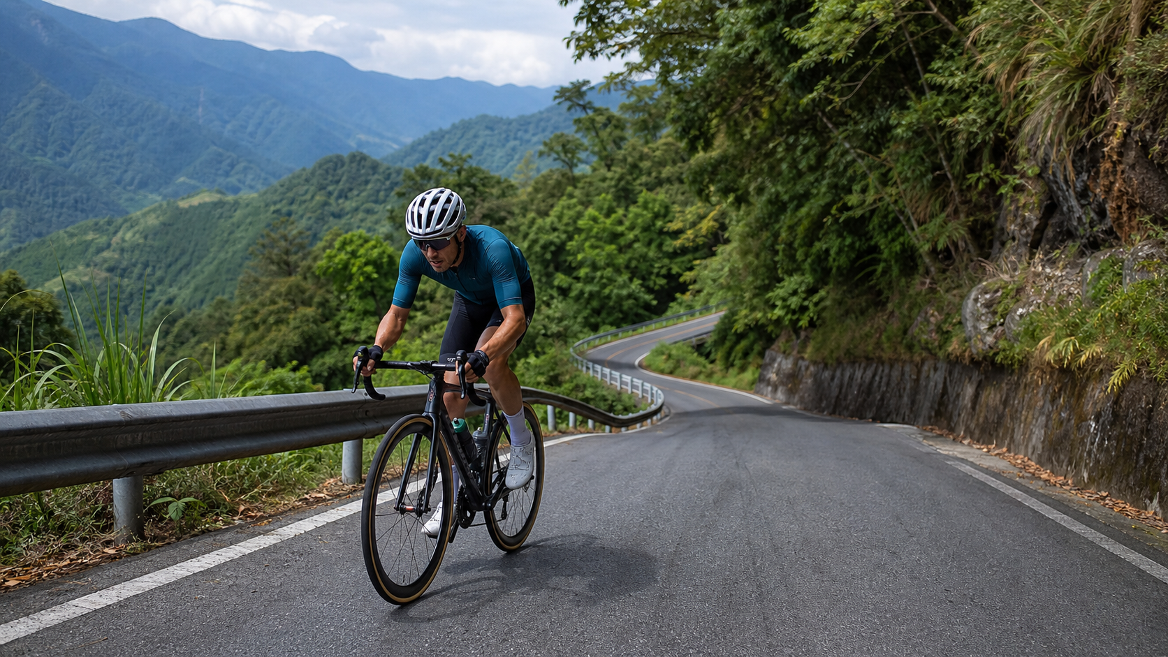
Yufeng to Yulao Practical Guide: An 8.3 km, 8.2% Average Gradient Test of Grit in Jianshi Township
Short distance doesn’t mean easy—this route packs less than ten kilometers into the most honest gradient test for road cyclists on Taiwan’s mid-elevation mountain roads.
Route Overview and Data Analysis
The Yufeng to Yulao section in Jianshi Township, Hsinchu County, is a legendary “compact but brutal” climb among the road cycling community in northern Taiwan’s mid-elevation mountains. According to route records, the total length is 8.3 km (precisely 8,304.5 meters), with a total elevation gain of 678.8 meters and an average gradient of 8.2%. How does this number rank among Taiwan’s benchmark climbs? For comparison: the western approach to Wuling from Dayuling to Wuling is about 10 km with an average gradient of roughly 8%; Fengguizui averages around 7% plus; Lulin Front Mountain averages about 7.5%. Although Yufeng to Yulao is shorter in distance, its 8.2% average gradient already surpasses Fengguizui and approaches the intensity of the western Wuling approach—and there are absolutely no flat sections to catch your breath and recover. This is the most important thing to understand about this route: it is a “pure climb” route—no flats, no descents, fighting the gradient from start to finish.
Let’s verify the relationship between elevation gain and distance: 678.8 meters of total gain divided by 8.3 km equals an average of approximately 81.8 meters of climbing per kilometer, which converts to an 8.2% gradient—the two figures cross-check perfectly, confirming that this route data is reliable and free of significant measurement errors. Cross-referencing community reports on this Strava segment (segment ID 4447805), riding times typically range from 30 minutes to over an hour, depending on the rider’s power-to-weight ratio and experience with mountain terrain.
Jianshi Township is located in Hsinchu County’s mountain region. Yufeng Village is an important settlement along Provincial Highway 7 (the Northern Cross-Island Highway) before it plunges deep into the mountains, while Yulao is a key high point on the road network leading toward Neiwan, Qingquan, and Smangus, sitting at an elevation of roughly 1,450 meters and serving as a crossroads for the area’s road system. Climbing from Yufeng to Yulao essentially presents the elevation difference of Jianshi Township’s hinterland in the shortest possible distance—which is precisely why the average gradient is so steep.
When planning this route, riders must understand one critical premise: this is not a “warm-up” route, nor is it recommended as the opening leg of a long endurance ride. It is better suited as the main course of a single-day training session, or paired with surrounding routes (such as Yulao to Naluo or Neiwan Old Street) to form a full day of mountain training. In terms of intensity classification, this route is a classic “short and steep climb” type. Unlike the long, progressive gradients of Wuling or Hehuan Mountain, it more closely resembles an interval training session in real-world form—testing a rider’s anaerobic endurance and mental toughness through a single, high-tension effort.
For cyclists with established mountain riding experience, Yufeng to Yulao is an excellent “self-assessment” route: it’s short enough to complete an out-and-back within a single training window; it’s steep enough to genuinely reflect your current fitness level; and the road conditions are straightforward (a single route with no confusing junctions), making it ideal for regular benchmark testing.
Section-by-Section Strategy from Start to Finish
Section 1 (0–2 km): The Settling-In Zone
Departing from Yufeng, the route enters climbing mode almost immediately, leaving no room for a warm-up buffer. Riders are strongly advised to spend 10 to 15 minutes on dynamic warm-up before setting off, including easy spinning at high cadence and simple leg stretches, to avoid muscle strains or cramps from hitting steep slopes cold. The gradient in this section typically falls between 6% and 8%, making it the relatively “gentle” portion of the entire route. It’s recommended to use conservative gearing here, keeping heart rate in the aerobic zone (approximately 70% to 75% of max heart rate) to reserve energy for what lies ahead. A common mistake riders make here is seeing that the gradient isn’t too extreme and trying to push high power right away, only to run out of steam in the core steep section later. Treat these two kilometers as a “find your rhythm” zone—ride the entire stretch at a consistent cadence while observing your body’s condition and the road’s wetness, then decide on your pacing strategy for the rest of the climb.
Section 2 (2–5 km): The Core Steep Climb Zone
This is the most critical and mentally demanding section of the Yufeng to Yulao climb. Based on the overall gradient distribution of the route, this section is likely to feature localized gradients exceeding 10% and possibly approaching 12%, because to sustain an 8.2% overall average, there must be steeper segments to balance out the relatively milder sections before and after. The recommended pedaling rhythm here is “seated as primary, standing as secondary”: seated climbing with a higher cadence (80 rpm or above) conserves quadriceps glycogen, and only when the gradient becomes so steep that cadence drops below 60 rpm should you switch to standing bursts, keeping standing efforts to 15 to 30 seconds to avoid spiking heart rate too rapidly.
For these three kilometers, riders are advised to employ a “sectional mental tactic”: break it into three 1-kilometer mini-goals, and after completing each one, give yourself a brief psychological reward (a sip of water, a deep breath, a check of heart rate data) to avoid being crushed by the overarching pressure of “three more kilometers.” Experienced climbers all know that the biggest enemy on a hard climb is often not muscular failure itself, but mental collapse that disrupts rhythm, which then triggers genuine physical exhaustion.
Section 3 (5–6.5 km): Switchbacks and Shaded Forest Zone
The industrial and county roads in Jianshi’s mountain area are generally densely forested. This section is likely to feature consecutive hairpin turns with significant gradient differences between the inside and outside of each corner—the outside is typically gentler while the inside is steeper. When riding hairpins, take the outside line: besides the milder gradient, visibility is also better, allowing you to spot road conditions and oncoming traffic earlier. Mountain roads are narrow with limited passing space, so stay alert throughout this section, especially on weekends when motorcycle convoys or shuttle vans and tour buses carrying Smangus visitors may be present.
This section has denser tree cover, with a higher proportion of sunlight blocked, making the perceived temperature slightly lower than on open stretches and affecting sweat evaporation rates. Adjust your hydration frequency accordingly. Additionally, because visibility is obstructed, be sure to ring your bell or call out well before corners—especially on hairpin bends where oncoming traffic is harder to spot in advance.
Section 4 (6.5–8.3 km): The Final Push to Yulao
The last 1.8 kilometers approaching Yulao are typically the most scenic stretch of the entire route—but also the section where riders are most likely to “blow up because they can see the finish.” Here, discipline in pacing is paramount: don’t exhaust your reserves early just because you can spot the Yulao Police Station or other prominent landmarks. Maintain a steady cadence, save a final surge for the last 300 meters, and upon reaching Yulao, plan to stop for supplies and photos while letting your heart rate and breathing settle before deciding on the next step (continuing toward Naluo or Neiwan, or turning back the way you came).
The Yulao area offers expansive views—on clear days, you can look down over the layered mountain ridges of Jianshi Township. This is one of the few spots on this tough-guy route where you can slow your heartbeat, catch your breath, and truly enjoy the scenery. It’s recommended to stay for at least 10 to 15 minutes to let your core temperature and heart rate stabilize before considering the next leg of your ride or the descent back.
Gear Ratio and Equipment Recommendations
Facing a route with an average gradient of 8.2% and localized sections that may reach double digits, gear ratio configuration is the key factor determining ride quality and whether you’ll hit the wall (not a race time cutoff, but an energy cutoff that forces you to dismount and walk). The following recommendations are provided by rider level:
| Rider Level | Recommended Chainring | Recommended Cassette | Lowest Gear Ratio |
|---|---|---|---|
| Advanced / Competitive | 50-34 (semi-compact) | 11-30 | ~1.13 |
| General recreational | 50-34 or 48-32 | 11-32 to 11-34 | ~1.0 or lower |
| Beginner / Weight-loss goal | 46-30 or lighter | 11-34 to 11-36 | ~0.88 or lower |
When facing gradients averaging over 8% with localized double-digit sections, most amateur riders in Taiwan using the traditional 53-39 chainset paired with an 11-28 cassette will find themselves forced to grind out of the saddle in the core steep sections, or even blow up entirely. It is recommended to at least equip a compact chainset (50-34) paired with a cassette of 28 teeth or larger. Riders with average fitness or those attempting this climb for the first time should go straight to a 34-tooth lowest gear or even lighter, with a mountain-bike-style wide-range cassette (11-34, 11-36). Regarding wheelsets, this route does not require a particularly aero-focused set. Instead, it is better to choose a lighter climbing-oriented wheelset, or at least ensure your current wheels don’t have excessive brake pad friction issues. After all, over 8 kilometers of sustained climbing, every gram of rolling resistance is amplified.
For tire pressure, mountain roads occasionally have rock debris and potholes. It is recommended not to run road bike tires rock-hard (approximately 90-100 psi, adjusted based on tire width and rider weight), leaving some cushion to reduce the risk of pinch flats. For bike fit and setup, if you haven’t ridden in the mountains recently, it is advisable to check brake pad wear and derailleur cable smoothness before the ride. If shifting is sluggish on steep gradients, you risk dropping the chain or skipping gears at the exact moment you need the lightest gear, which is very dangerous.
Additionally, be sure to carry a basic tool kit (spare tube, pump or CO2 inflator, hex wrench set). The Jianshi mountain area is remote, and mobile phone reception may be unstable on some sections. In the event of a mechanical failure, you cannot fully rely on calling for a ride or phone assistance.
Nutrition and Hydration Management
With 8.3 kilometers and an estimated climbing time ranging from 30 minutes to over an hour, this is a short-to-medium distance but high-intensity effort for most riders. Here are practical recommendations:
- Before departure: Be sure to fill your bottles at the last resupply point before Yufeng (Neiwan Old Street or Zhudong city center). Resupply points are scarce once you enter the Jianshi mountain area, so don’t expect convenience stores or drink shops along the way.
- During the ride: In theory, one 500ml bottle should suffice for most riders over the 8-kilometer stretch. However, if it’s hot summer weather, or you’re a heavier rider with high sweat output, it’s recommended to carry a second bottle or use electrolyte supplements to avoid cramping.
- After arriving at Yulao: There are occasionally scattered vendors or small grocery stores around Yulao, but their operating hours and inventory are inconsistent, so please rely on the actual on-site conditions. It is not advisable to fully depend on local resupply; be sure to carry sufficient portable food (energy gels, bananas, energy bars).
- Return trip planning: If you choose to descend the same way, be sure to control your speed. The Jianshi mountain area has many corners, and the road surface can occasionally be slippery with wet leaves. The risk of accidents on the descent is no less than the physical risk of the climb.
For electrolyte replenishment, especially during hot summer climbs, you lose significant sodium and potassium ions through sweat. If you only drink plain water without electrolytes, you may actually increase the risk of cramping. It is recommended to carry salt tablets or electrolyte supplements, especially for riders below intermediate level expecting ride times exceeding 45 minutes.
Weather and Seasonal Recommendations
The Jianshi Township mountain area has a typical mid-altitude climate, with noticeable temperature variations due to diurnal temperature swings and elevation differences. The elevation gain from the Yufeng start to the Yulao finish is nearly 700 meters, meaning it may still be muggy valley temperatures at the start, but by the time you reach Yulao, the perceived temperature may have dropped noticeably. Especially in cloudy, foggy, or post-rain high-humidity conditions, the wind chill effect at the summit will make the descent feel significantly colder.
Rider recommendations:
- Spring/Summer (April to September): Start in the early morning or near dusk to avoid the midday heat. UV radiation is intense in the mountains, so sunscreen and a visor or cap are essential. Summer afternoons often bring fog or thunderstorms in the mountains, so it’s advisable to start early and keep an eye on the weather forecast.
- Autumn/Winter (October to March): Be sure to carry a lightweight windbreaker or arm warmers. After reaching the Yulao summit, if you plan to stop for photos or resupply, put on extra layers immediately to stay warm and avoid hypothermia on the descent. Under the influence of the winter northeast monsoon, the Yulao area can occasionally experience cold, damp weather with perceived temperatures approaching single digits.
- Post-rain road conditions: Mountain roads are prone to rockfalls and slippery sections after rain, especially on the inside of hairpin turns. It’s recommended to wait 1-2 days after rain before riding, or at least significantly reduce your descent speed.
Common Mistakes and DNF Risks
Based on real-world observations, the most common mistakes riders make on “short-distance, high-intensity” routes like Yufeng to Yulao include:
- Gear ratio too heavy: Assuming the short distance means no need for light gears, only to be forced to dismount and walk multiple times in the core steep sections, dealing a double blow to both physical and mental state.
- Poor pacing: Riding too hard early on because “there’s still plenty of distance left,” causing heart rate to spike and lactate to accumulate too quickly in the core steep sections, eventually forcing long rest stops or even giving up.
- Insufficient nutrition: Underestimating the energy expenditure of a short-distance route, especially in summer heat where sweat loss far exceeds expectations.
- Skipping warm-up: Starting a full-power climb directly from the Yufeng start point, which can easily lead to cramping or muscle strains in a cold state, particularly in the calves and hamstrings.
- Underestimating descent risks: The sense of accomplishment after completing the climb can lead to overconfidence on the descent. Mountain corners have limited visibility, and the risk of encountering oncoming vehicles should not be taken lightly.
- Neglecting mechanical checks: Getting help in remote mountain areas is difficult, so be sure to perform basic bike condition checks (brakes, shifting, tire pressure) before departure.
Target Time References by Rider Level
The following times are approximate reference frameworks; actual performance will vary based on fitness, daily condition, weather, and equipment differences:
| Rider Level | Target Completion Time | Reference Power-to-Weight Ratio |
|---|---|---|
| Pro / Top amateur | Within 25-30 minutes | 4.0 W/kg or above |
| Advanced club rider | 30-40 minutes | 3.2-4.0 W/kg |
| Regular trained rider | 40-55 minutes | 2.5-3.2 W/kg |
| Recreational / First-time challenger | 55 minutes or more, including rest stops | Below 2.5 W/kg |
Regardless of which category you fall into, Yufeng to Yulao is a worthy benchmark route for testing your climbing ability. Its length is moderate, and the gradient is honest without any tricks, making it ideal for regular return visits to track your improvement curve on the same route. It is recommended to schedule a “benchmark test” once per season, recording completion time, average heart rate, and average power (if you have a power meter). Accumulated over the long term, this becomes an extremely valuable personal training database, reflecting true fitness trends far better than relying solely on subjective feelings.
Pre-Ride Training Recommendations
If you’re planning to tackle Yufeng to Yulao in the near future, a four-to-six-week training plan before the event will significantly impact your riding quality and overall finish experience. Here’s a simple hybrid training framework combining indoor and outdoor sessions, suitable for amateur riders with busy weekday schedules who can only manage long rides on weekends:
Weeks 1–2: Aerobic Base and Strength Foundation. Schedule two 1-hour flat or gently rolling rides per week, keeping your heart rate in the aerobic zone (approximately 60% to 70% of max heart rate), with the goal of building mitochondrial density and capillary foundation. Pair this with one strength training session targeting the quadriceps, glutes, and core muscles—squats, step-ups, and planks are all excellent home-based options.
Weeks 3–4: Gradient Simulation and Interval Training. Find a route with a gradient between 5% and 8% and a length of 2 to 4 kilometers for repeated climbing efforts. Ride each rep at full effort, then recover by descending slowly, repeating 4 to 6 times. This training mode effectively simulates the intensity and rhythm of the core hard-climb section from Yufeng to Yulao, allowing your body to adapt to sustaining output while lactate accumulates. If no suitable climb is available, an indoor trainer with a structured interval workout (e.g., 4 minutes at full effort, 4 minutes recovery, repeated for 5 sets) can achieve a similar effect.
Weeks 5–6: On-Route Simulation and Tapering. It’s recommended to schedule at least one on-site ride that closely matches the length and gradient of Yufeng to Yulao, testing your equipment, nutrition strategy, and mental state, while recording your finish time as a baseline. In the final week before the event, taper appropriately—reduce training intensity but maintain frequency—so your body is in optimal recovery condition on challenge day.
Quick-Fire FAQ
Q: For a first-time challenger of Yufeng to Yulao, is it advisable to go straight for a one-day summit attempt?
A: If you don’t have a regular climbing training routine, it’s recommended to first build experience on gentler routes (e.g., average gradient below 5%, around 5 kilometers in distance) to confirm you can complete them steadily before taking on this route. This avoids the risk of severe fatigue leading to impaired judgment on descents, which increases the chance of accidents.
Q: Is this route better suited for group rides or solo riding?
A: Both work, but if riding solo, be sure to inform family or friends of your itinerary and estimated return time. Mobile phone signals are unreliable in some mountain sections. Group riding offers greater safety and mutual support, especially for riders attempting this route for the first time.
Q: Are electric-assist bicycles (E-bikes) allowed on this route?
A: Yes, but it’s still recommended to follow local traffic regulations and pay close attention to battery planning. The steep mountain gradients will drain battery power quickly, so be sure to factor round-trip distance and elevation gain into your battery assessment to avoid running out of power mid-route and adding unnecessary physical strain.
Q: Can the route be extended beyond the endpoint at Yulao?
A: Yulao is an important transportation junction. Depending on your energy and time, you can extend toward Naluo or Neiwan, or head toward Cinsbu and Smangus for longer, deeper mountain routes. However, road conditions and distances beyond this point should be researched and planned separately—don’t venture deeper on a whim without preparation.
Q: Is there a suitable training cycle that pairs well with this route?
A: It’s recommended to schedule it as a monthly “mountain capability assessment day,” combined with weekday interval training and weekend long-distance aerobic rides, forming a complete three-part training structure: weekday intervals for anaerobic endurance, weekend long rides for aerobic base, and monthly hard climbs for race-pace conversion ability. Over the long term, this develops overall climbing strength more comprehensively than any single training mode.
Transportation and Itinerary Planning
When traveling from Hsinchu City or Zhudong to Yufeng, plan at least half a day of complete itinerary time, accounting for commuting, warm-up, climbing, nutrition stops, descending, and cool-down. For riders driving themselves, it’s recommended to park in legal parking spaces around Yufeng and confirm in advance that your parking spot won’t obstruct local residents’ passage. Mountain village roads are narrow, so parking etiquette is especially important.
If you plan to ride from Zhudong or Neiwan as a shuttle to Yufeng before starting this hard-climb route, remember to include the shuttle mileage and elevation gain in your day’s energy budget, so you don’t discover mid-challenge that your energy is already depleted before the core section. It’s recommended to build ample buffer time into your itinerary. Lighting conditions after sunset in the Jianshi mountain area are poor, so be sure to complete your ride and return to the city before dark. Carrying front and rear lights as basic safety equipment is a detail that cannot be skipped.
In summary, Yufeng to Yulao is a short, hard-climb route with honest data, straightforward road conditions, and solid intensity—well suited as a regular staple in a northern Taiwan intermediate mountain training menu. Master the fundamentals of pacing, gear selection, and fueling, and this route will become a classic benchmark worth revisiting again and again for every road cycling enthusiast to witness their own growth.
One final reminder: mountain roads are public thoroughfares, not closed racecourses. Oncoming traffic, agricultural vehicles, produce trucks, or even wildlife crossings can appear at any time. Maintain safe riding awareness throughout, and don’t neglect basic road safety in pursuit of pacing or segment rankings. Treat Yufeng to Yulao as a long-term training partner for your growth, not a one-off check-in task—only then can you truly build solid climbing strength from this route.
Related Reading
- Hsinchu Jianshi Township Mountain Routes: Climbing Training Route Guide in Indigenous Tribal Mountain Areas
- Yulao Battle Guide: 20km HC-Grade Climb, the Grand Slam Trial of Hsinchu Jianshi
- The Crossroads Deep in Jianshi: Yufeng to Yulao, a Ride Alongside Clouds and Mist
- Yulao, Gazing at the Mountain Peaks: A Riding Epic of Perseverance and Vastness
宇老大滿貫 拉拉山 員工旅遊 有如爬了一座東進武嶺 #公路車 4K高畫質
6 年前
台北闊瀨陡坡 騎旅 / 日本單車雜誌編輯車友臨時加入!/ 髮香才是最強的 / feat. 北迴歸線小隊 / 公路車 CT Yeh
6 個月前
風櫃嘴時間 預測西進武嶺時間?13000名車友統計數據分析告訴你 !
5 年前
大禹嶺 到 武嶺牌樓 全程前後實況錄影 | 北進武嶺 | 東進武嶺 | KOM | 訓練台 | 坡度分析 | Taiwan KOM Last 10 km HARD | 公路車
6 年前
#北橫 + #北進武嶺 最硬的員工旅遊 EP1 | #公路車 #拉拉山 | 明池 | 武嶺 | 武陵農場 | 雲海 | Taiwan Cycling Route Wulin
6 年前
新竹羅平 x 天湖部落 大禹嶺級變態陡坡! 4K超高畫質 空拍 | 公路車
5 年前
#公路車 #西進武嶺 配速配瓦實驗 坡度分析 四小時內攻略 建大盃 NeverStop #西進武嶺攻略
6 年前
西進武嶺 世界紀錄挑戰!破2:30 ?!一群人推著一個夢上山 直播精華版 / ft. 張翰允 & 台視主播魏于恬 & KPLUS / #cycling 公路車 CT Yeh
2 個月前