Dongyan Mountain Practical Guide: 12.4 km, 501 m of Climbing, an Intermediate Training Ground with an Average 4.0% Gradient
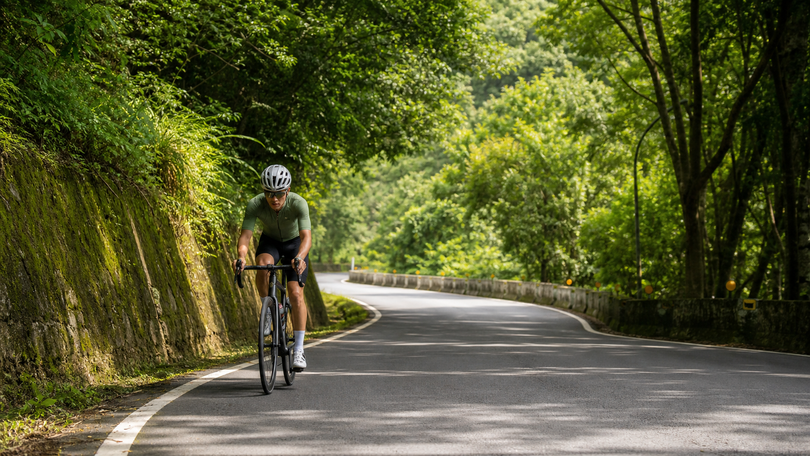
Dongyanshan Practical Guide: A 12.4 km, 501 m Climb at 4.0% Average Gradient for Intermediate Training
Dongyanshan, located in Fuxing District, Taoyuan City, is a highly familiar “moderate climbing” route among cyclists in northern Taiwan. The route spans 12.4 km in total, with 501.4 m of cumulative elevation gain and an average gradient of around 4.0%—let’s verify this with simple math: 12.4 km multiplied by a 4.0% average gradient gives a theoretical elevation gain of approximately 497 m, which closely matches the actual measured 501.4 m. This indicates that the gradient distribution along the route is relatively even, with no situation where “the average figure is misleading while the road actually hides brutal steep sections.” This is precisely why Dongyanshan is recommended by many coaches and experienced riders to those “moving from beginner to intermediate, or intermediate riders looking to train steady output”: it is honest.
First, let’s clarify Dongyanshan’s position within the network of roads in the Northern Cross-Island Highway (Beihang) / Taoyuan mountain area. Compared to the main line of the Beihang Highway, which often exceeds 20 km with average gradients of 5% to 6% and even includes brutal 8%+ pitches, Dongyanshan as a branch route takes a “gentle companion” approach—it won’t suddenly hit you with a 7% or 8% gradient around a corner that forces you out of the saddle and weaving, but it’s also not the kind of mild slope you barely feel. The 4.0% figure falls precisely within the range that cycling training science describes as “sustainable seated steady output while still requiring continuous core engagement and breathing control.” In other words, Dongyanshan is highly suitable as a training route for “Tempo Rides” or “Sub-Threshold” sessions, because the gradient is stable enough that you can complete the entire climb at a nearly constant power output, without having to do intermittent bursts and recoveries the way you would on the Beihang main line.
From a distance-planning perspective, the 12.4 km route can be completed by most recreational riders with a reasonable base in roughly 40 to 70 minutes. This duration fits neatly as the core segment of a morning ride or afternoon training session, with a warm-up and cool-down ride bookending it to form a complete training plan. If you are a beginner just transitioning from flat-road riding to mountain challenges, Dongyanshan is also often considered a candidate for “the first serious climbing route,” because its difficulty curve progresses gradually and won’t cause severe frustration or safety concerns on your first climbing attempt.
However, “moderate average gradient” does not mean you can let your guard down. With 501.4 m of total elevation gain, if you ride at a careless pace and push too hard early on, you will still face muscle soreness, a spiking heart rate, and even the predicament of having to dismount and rest in the latter half. In particular, most of the Dongyanshan route runs through forested mountain roads; while the shade along the way is beneficial against sun exposure, it also means slippery road surfaces, narrower shoulders, and more blind spots, so you must maintain a high level of focus while riding. Below, we will break down these 12.4 km into several segments, explaining riding techniques, gear ratios, refueling timing, and common mistakes segment by segment, so that riders of different levels can plan a safe and rewarding Dongyanshan challenge according to their own fitness.
Segment-by-Segment Guide from Start to Finish: Breaking 12.4 km into Five Sections
To ride a 12.4 km climbing route smartly, thinking in segments is far more efficient than “charging head-down all the way to the top.” Below, based on approximate mileage proportions, we break the Dongyanshan route into five sections, each with its own pacing recommendations. Please note that actual gradient variations may differ slightly due to local road undulations, corners, and forest cover; always prioritize on-site road conditions and your own feel while riding. This segmentation is intended as a reference framework for training and mental preparation.
Section 1 (Start to approximately 2.5 km): Warm-up climbing phase. This is typically the relatively gentle opening of the entire route, with gradients mostly around 2% to 3%, serving as the transition zone where your body shifts from flat-road riding to climbing mode. The most common mistake in this phase is “because the gradient isn’t obvious yet, pushing hard at flat-road cruising speed,” causing your heart rate to spike too early. It is recommended to ride this section in the warm-up heart rate zone (approximately 65% to 75% of max heart rate), allowing your lower-body muscle groups and cardiovascular system to gradually adapt to the vertical climbing load. At the same time, since road conditions here are relatively straightforward, use this stretch to confirm that your nutrition is secured properly and that your drivetrain is shifting smoothly.
Section 2 (Approximately 2.5 km to 5 km): The gradient enters the main battleground. This section begins to feature continuous climbing at or slightly above the 4.0% average, marking the watershed where the route “starts to feel demanding.” At this point, you should settle into your personal tempo riding zone (approximately 75% to 85% of max heart rate, or the Tempo to Sweet Spot range on a power meter). Breathing becomes rhythmically deep, but you should still be able to hold a brief conversation. Be careful not to expend all your energy here, because more than half of Dongyanshan’s climbing still lies ahead.
Section 3 (Approximately 5 km to 8 km): Sustained expenditure deep in the forest. This is the longest stretch of the entire route and the one that most tests endurance management. As elevation gradually increases, tree canopy coverage typically increases as well, and temperatures drop a few degrees compared to the base, making it feel more comfortable. However, this is also the section where “mental relaxation while the body keeps draining” is most likely—because the cool sensation can easily make you underestimate the actual rate of fatigue accumulation. It is recommended to consciously implement a “timed refueling” strategy starting here: take small sips of water every 15 to 20 minutes and supplement carbohydrates as needed to avoid hitting the wall in the later stages.
Section 4 (Approximately 8 km to 10.5 km): The final test of willpower. As you gradually approach the Dongyanshan Forest Recreation Area, many riders feel noticeable fatigue accumulation here, especially the growing soreness and tightness in the quadriceps and calves. In this section, it is recommended to shift down one to two gear ratios, using a slightly higher cadence and reduced force per pedal stroke to delay muscle fatigue, while pairing this with deep, steady breathing. Mentally, tell yourself the summit is not far off.
Section 5 (Approximately 10.5 km to 12.4 km finish): Wrapping up and the mental sprint. Although this final stretch is short, it is often the trap zone where riders “see the finish, sprint out of control, and end up with muscle cramps.” It is recommended to maintain a steady pace until you confirm the summit is in sight, then decide based on your condition whether to make a final acceleration. After arriving near the Dongyanshan Forest Recreation Area, remember to ride easily for a few minutes to let your heart rate gradually come down before stretching and refueling, rather than stopping and collapsing immediately.
Gear Ratio and Equipment Recommendations
Facing a continuous climbing route with an average gradient of 4.0% and maximum local gradients that may be slightly higher, gear ratio configuration is one of the key factors determining the quality of your riding experience. Many riders, before taking on Dongyanshan, will first check whether their drivetrain setup is sufficient for this “mid-distance, moderate gradient” route profile—because if the gear ratios are chosen incorrectly, the consequences range from wasted energy to, in worse cases, knee joint overuse leading to injury.
| Rider Level | Recommended Chainrings | Recommended Cassette | Notes |
|---|---|---|---|
| Beginner / Average fitness | Compact 50-34T | 11-32T or 11-34T | A wide-range cassette provides sufficient low gears to avoid excessive knee strain, suitable for conquering climbs at a higher cadence |
| Intermediate / Some climbing experience | Compact 50-34T or Standard 52-36T | 11-30T | Balances climbing ease with flat-road cruising efficiency; the mainstream setup for most recreational-competitive riders |
| Advanced / Strong climbing ability | Standard 52-36T | 11-28T | Pursues higher pedaling force output and lower shifting frequency; suitable for riders with a solid power base |
| Time trial / Chasing personal best | Depends on individual setup | Depends on individual setup | It is recommended to test different gear ratios on similar gradient sections before the event to find your most efficient personal sweet spot |
Beyond gear ratios, because much of Dongyanshan runs through shaded forest with higher road moisture, occasional fallen leaves, and loose gravel, the following equipment preparations are also recommended: tire pressure can be slightly lower than for pure flat-road riding to increase grip, especially important on the descent back down; brake pads should be checked for wear in advance, as continuous descending places significant demand on the braking system; wear your cycling clothing in layers, as temperature differences between climbing while sweating and descending in the wind are quite pronounced in the forest area; front and rear lights are recommended even for daytime riding, because the shaded sections are dim and visibility is lower than you might expect. At least two bottle cages are recommended to accommodate fluid consumption over this mid-distance climb.
Nutrition and Hydration Management
The route covers 12.4 kilometers with 501.4 meters of climbing. At a typical recreational rider’s pace, completion time falls roughly between 50 and 90 minutes—long enough for noticeable fluid and electrolyte loss, especially on hot, humid summer days. Nutrition planning is absolutely essential.
Dongyanshan Forest Recreation Area itself has a visitor center and related service facilities, which can serve as a rest and refueling stop during or after the ride. For actual operating hours, drinking water availability, and store supplies, it’s best to check the latest announcements from the Forestry Bureau or the local Forestry and Nature Conservation Agency, as well as on-site conditions, to avoid being caught off guard by seasonal adjustments or last-minute notices. Before departing, be sure to carry sufficient water and portable food on your own—do not rely entirely on roadside supply points, especially on weekdays when the operating status of mountain shops and facilities tends to be more variable.
For refueling strategy, the “small amounts, frequent intake” principle is recommended: ensure you are fully hydrated before starting, and take small sips every 15 to 20 minutes during the ride rather than waiting until you feel noticeably thirsty and then gulping down large amounts. For portable food, on medium-to-long climbs it’s advisable to bring easily digestible carbohydrate sources such as bananas, energy gels, or sports yokan, avoiding greasy or hard-to-digest foods during the climb, which can cause gastrointestinal discomfort and actually hinder your climbing performance. If you’re planning a longer out-and-back or loop ride, it’s also worth considering whether you need to stock up on supplies in the Dongyanshan area or other settlements in Fuxing District beforehand, since convenience stores and shops in the mountains are far less dense than in the lowlands.
Electrolyte replacement is equally important, especially in summer heat with heavy sweating. Replacing water alone while ignoring the loss of sodium, potassium, and other electrolytes can easily lead to muscle cramps—one of the common reasons many riders suddenly experience calf or thigh cramps near the finish. It’s recommended to carry electrolyte tablets or sports drinks and supplement them as needed based on your sweat rate.
Weather and Seasonal Advice
Dongyanshan Forest Recreation Area sits at an elevation of around 1,200 meters, so temperatures are typically noticeably lower than in the Taoyuan lowlands, making it a popular summer retreat and a winter destination for mist-viewing. When riding this route, pay special attention to the temperature differential—“hot at the start down below, but a sharp drop in temperature in the middle and later sections of the climb.” Especially in autumn and winter, the mountains are prone to fog and drizzle, and visibility and road surface conditions are far more challenging than down in the lowlands. Be sure to check real-time weather forecasts and mountain road conditions before heading out.
Dongyanshan’s most well-known seasonal feature is the maple viewing period along the Formosan sweet gum trail, roughly from November to December each year. During this time, the sweet gum forests in the park gradually turn red and yellow, drawing large numbers of leaf-peeping visitors and photography enthusiasts, and traffic and parking demand on mountain roads increase noticeably. If you plan to tackle Dongyanshan during this period, consider the following: first, road passing space may become more congested due to visitor traffic, so stay highly alert and leave extra braking distance; second, if your destination is inside the forest recreation area, plan your arrival and departure times early to avoid peak maple-viewing crowds; third, the exact peak foliage timing shifts slightly each year depending on weather, so check real-time foliage reports from the Forestry and Nature Conservation Agency or local authorities before departure rather than relying solely on past experience.
Beyond maple season, Dongyanshan in late spring and early summer is lush and verdant, with thriving Japanese cedar plantations, and temperatures are relatively comfortable—many riders consider this the best season of the year for climbing training. Regardless of season, the chance of afternoon thunderstorms in the mountains cannot be ignored. It’s best to start in the morning or at dawn to avoid the period of strong afternoon convection, and carry lightweight rain gear just in case the weather turns suddenly.
Common Mistakes and DNF Risks
Even though Dongyanshan’s average gradient is only 4.0%—moderate to gentle—many riders still end up disappointed on this route, some even abandoning the challenge early. The common causes of failure can be grouped into the following categories:
Pacing loss in the early section. This is the most common and most typical mistake. Because the start of Dongyanshan is relatively gentle, many riders mistakenly assume “this route is easy” and sprint through the first two kilometers at near-flat cruising speed. By the time they hit the sustained climbing in the middle section, heart rate and lactate accumulate rapidly, forcing them to slow dramatically or even dismount and rest. The correct approach is to start at a pace that feels “easy” throughout, distributing effort evenly across the full 12.4 kilometers rather than burning it all up front.
Improper gear selection. Some riders insist on using heavier gears to chase speed, resulting in excessive pedaling force and low cadence. While this may look faster in the short term, it places enormous strain on the knees and muscles, often leading to muscle spasms or knee pain in the middle-to-late stages and forcing an early end to the ride. It’s recommended to choose gears light enough for your fitness level and complete the climb with a higher cadence and lower per-stroke force.
Insufficient fueling or poor fueling timing. As mentioned in the previous section, poor nutrition planning on medium-to-long climbs can lead to a sudden energy crash or cramps in the later stages. Some riders habitually wait until they’re thirsty to drink and hungry to eat—this reactive approach is often too late during high-intensity climbing, because the body takes time to absorb and metabolize. By the time symptoms appear, the effectiveness of refueling is already greatly diminished.
Underestimating weather and road condition changes. Dongyanshan is located in mountain forest terrain, where afternoon thunderstorms, fog, wet roads, and fallen leaves are not uncommon. There have been riders who ignored real-time weather forecasts, set out under clear skies, and were caught in sudden rain mid-route—not only did riding comfort plummet, but braking distance and grip on the descent were severely compromised, increasing the risk of accidents.
Neglecting equipment checks. Failing to properly inspect brakes, shifting, tire pressure, and other basics before departure is another hidden risk factor for abandoning mid-ride or even safety incidents. Continuous climbing and descending over medium-to-long distances places far greater demands on a bicycle’s mechanical systems than flat riding, so pre-ride basic checks are absolutely essential.
Target Time References by Rider Level
The time references below are summarized from the experiential feedback of general recreational and training-oriented riders. Actual completion times will vary depending on individual fitness, weather conditions on the day, road conditions, and traffic, and are intended only as a reference baseline for training planning and self-assessment—not as official race timing standards.
| Rider Level | Estimated Completion Time (12.4 km) | Average Speed Reference | Training Advice |
|---|---|---|---|
| Beginner / First-time climb | Approximately 75–95 minutes | Approximately 8–10 km/h | Primary goal is to complete the route without overexerting; rest in segments as needed |
| General recreational rider | Approximately 55–75 minutes | Approximately 10–13 km/h | Practice steady pacing output throughout; reduce unnecessary stops |
| Intermediate / Regular training habit | Approximately 40–55 minutes | Approximately 13–18 km/h | Try tempo training controlled by power or heart rate zones |
| Advanced / Race-level rider | Approximately 28–40 minutes | Approximately 18–26 km/h | Use as an interval or climbing ability test segment; focus on VAM climbing rate performance |
It’s worth noting that the time ranges above mainly reflect general riding experience. Differences in individual fitness baselines, daily condition, wheel sets, and bike weight can all create significant variation. First-time challengers are advised to aim for “completion” rather than “record-breaking.” After accumulating several rides on this route, you can gradually work on improving your pace and pursuing a personal best.
Pre-Ride Training Recommendations
If you plan to take on Dongyan Mountain, especially as a benchmark route for advancing your climbing ability, it is recommended to schedule at least three to four weeks of targeted training in advance, with the focus placed on building muscular endurance and aerobic base.
Base aerobic endurance training. Schedule one to two rides per week of 60 to 90 minutes at low-to-moderate intensity, maintaining a heart rate between 65% and 75% of your maximum. The goal is to build a sufficient aerobic metabolic foundation, allowing your body to efficiently utilize fat and carbohydrates as energy sources during sustained output, thereby delaying the onset of fatigue.
Tempo riding and gradient simulation training. If there is a climb near your residence with a similar gradient (around 4%) and a length of 2 to 5 kilometers, you can schedule one tempo ride per week, riding continuously at near race or challenge intensity (75% to 85% of maximum heart rate). This simulates the sustained load experienced in the middle and latter sections of Dongyan Mountain, training your body to adapt to prolonged mid-to-high intensity output.
Low-cadence strength training. Appropriately incorporating some low-cadence (approximately 50 to 60 rpm) climbing intervals with heavier gear ratios can effectively enhance pedaling power and muscle recruitment. However, be sure to progress the training volume gradually to avoid knee injuries from excessive load. It is recommended to keep this type of training to a small proportion of your overall training volume.
Core and lower-body flexibility training. Maintaining a forward-leaning position while climbing for extended periods places considerable strain on the core muscles and lower back. It is recommended to incorporate basic core training (such as planks and bridges) along with lower-body stretching, which helps maintain stability in your riding position and reduces soreness and compensatory injuries from prolonged climbing.
On-site reconnaissance and adaptive riding. If time permits, it is recommended to schedule one low-intensity reconnaissance ride before the official challenge to familiarize yourself with the route’s gradient changes, road surface conditions, corners, and supply point locations. This not only helps you formulate a more precise pacing strategy but also reduces the psychological stress on challenge day caused by unfamiliarity with the route.
Quick FAQ
Q1: Is Dongyan Mountain suitable for road bike beginners to challenge?
Yes. With an average gradient of 4.0%, Dongyan Mountain is a moderate-to-gentle climbing difficulty. The gradient changes are relatively smooth, with no consecutive steep sections, making it a route many coaches recommend to beginners as their “first serious climbing route.” However, it is advised that beginners ensure they have a certain foundation in flat-road riding and basic climbing experience before the challenge, and choose a gear ratio that is sufficiently easy, following the principle of riding within your limits and progressing gradually.
Q2: Is the Dongyan Mountain route better suited for a road bike or a mountain bike?
As a route designed for paved roads, both a road bike and a gravel bike with wider tires are capable. If you plan to venture further into the forest trails or trail systems inside Dongyan Mountain Forest Recreation Area, please note that some areas within the park may restrict bicycle access. It is recommended to follow the officially announced open areas to avoid riding into restricted zones.
Q3: Is it dangerous to ride during the autumn maple-viewing season?
During the maple-viewing season (approximately November to December each year), visitor and vehicle traffic increases significantly, making passing space relatively congested and requiring heightened riding awareness. It is recommended that riders during this period start early, avoid peak hours, and maintain a defensive riding mindset throughout, leaving ample braking and reaction space. Racing or overtaking in crowded sections is not advised.
Q4: Are there supply points along the Dongyan Mountain route? How much water should I bring?
The Dongyan Mountain Forest Recreation Area has service facilities such as a visitor center, which can generally serve as a supply reference point. However, actual opening hours and availability may vary depending on the season, weekdays versus holidays, and temporary announcements, so it is best to rely on on-site conditions and official announcements. To be conservative, it is recommended to prepare at least two water bottles (totaling approximately 1000 to 1500 ml or more) plus a certain amount of portable food before departure. Especially during hot summer periods, you should increase the amount of water you carry accordingly and not rely entirely on en-route supplies.
Transportation, Itinerary Planning, and Summary
For rides to Dongyan Mountain, most cyclists choose to depart from Taoyuan City or communities around Fuxing District, connecting to the Northern Cross-Island Highway system or local roads before turning toward Dongyan Mountain. If you plan to transport your bike by car or motorcycle to a nearby starting point before beginning your ride, it is advisable to plan your parking location in advance, as parking space in the mountainous area is limited, especially during the peak maple season or on holidays when spots are hard to come by. If you are planning a day trip, Dongyan Mountain can be combined with nearby attractions along the Northern Cross-Island Highway or the previously mentioned Luoma Road to create a cycling mini-tour covering forests, valleys, and mountain roads. However, be sure to assess your physical condition and time to avoid overextending yourself, which could lead to exhaustion in the latter half and increase safety risks.
In summary, the Dongyan Mountain route—12.4 kilometers, 501.4 meters of total elevation gain, and an average gradient of 4.0%—is an “honest and friendly” intermediate training route: it won’t embarrass you with sudden steep ramps, but it is by no means an easy, painless climb. It suits beginners as a stepping stone into climbing challenges, serves as a regular menu item for intermediate riders for tempo riding and endurance training, and is a practical test segment for advanced riders to evaluate their climbing efficiency and VAM performance. Whether your goal is to finish, break a personal record, or simply to feel the rhythm of steady breathing and pedaling surrounded by the forest’s phytoncides, Dongyan Mountain deserves a place on your ride list. Do your homework on the route, gear ratios, supply planning, and weather confirmation before setting out, and you will find that the rewards this route offers are far richer than its difficulty numbers suggest.
Related Reading
- Sanxia North 113 Dongyan Bridge Practical Guide: Don’t Be Fooled by the “6.7% Average Gradient” — This Road Hides 12% Grade Killers
- Dongshan Coffee Road Practical Guide: 16.41 km, 3.9% Average Gradient — A Top Choice for Endurance Training
- 12.4 Kilometers Deep in the Cryptomeria Forest: A Ride and Reflections on Dongyan Mountain
- Dakeng Zhongzheng Campground Climb Practical Guide: A 5.8 km Taichung Entry-Level Training Ground, Gentle with Hidden Steep Sections
台北闊瀨陡坡 騎旅 / 日本單車雜誌編輯車友臨時加入!/ 髮香才是最強的 / feat. 北迴歸線小隊 / 公路車 CT Yeh
6 個月前
爬坡ITT實境)台中 魔王 松鼠坡 首航 6:12 大肚山 大三元 科福路
8 年前
大禹嶺 到 武嶺牌樓 全程前後實況錄影 | 北進武嶺 | 東進武嶺 | KOM | 訓練台 | 坡度分析 | Taiwan KOM Last 10 km HARD | 公路車
6 年前
#東眼山 #公路車 單車約騎 空拍 北 113 水蜜桃冰沙 Mavic Pro
9 年前
大武山後門26%歡樂陡坡!JJSC南台灣單車行Day2 / 被颱風追著跑 / 公路車 / CT Yeh
2 年前
單車 梅山36灣 坡度介紹 路段介紹 空拍 (相關遊記影片,請參考說明或我的頻道喔,歡迎訂閱)
6 年前
大武山20%魔王陡坡【JJSC南台灣遊騎Day2】!屁股真的要裂開了...凡士林抹滿也沒用?神秘金教堂還有超便宜夜市
3 個月前
半日 小台灣 極限單車路線挑戰實錄
7 年前