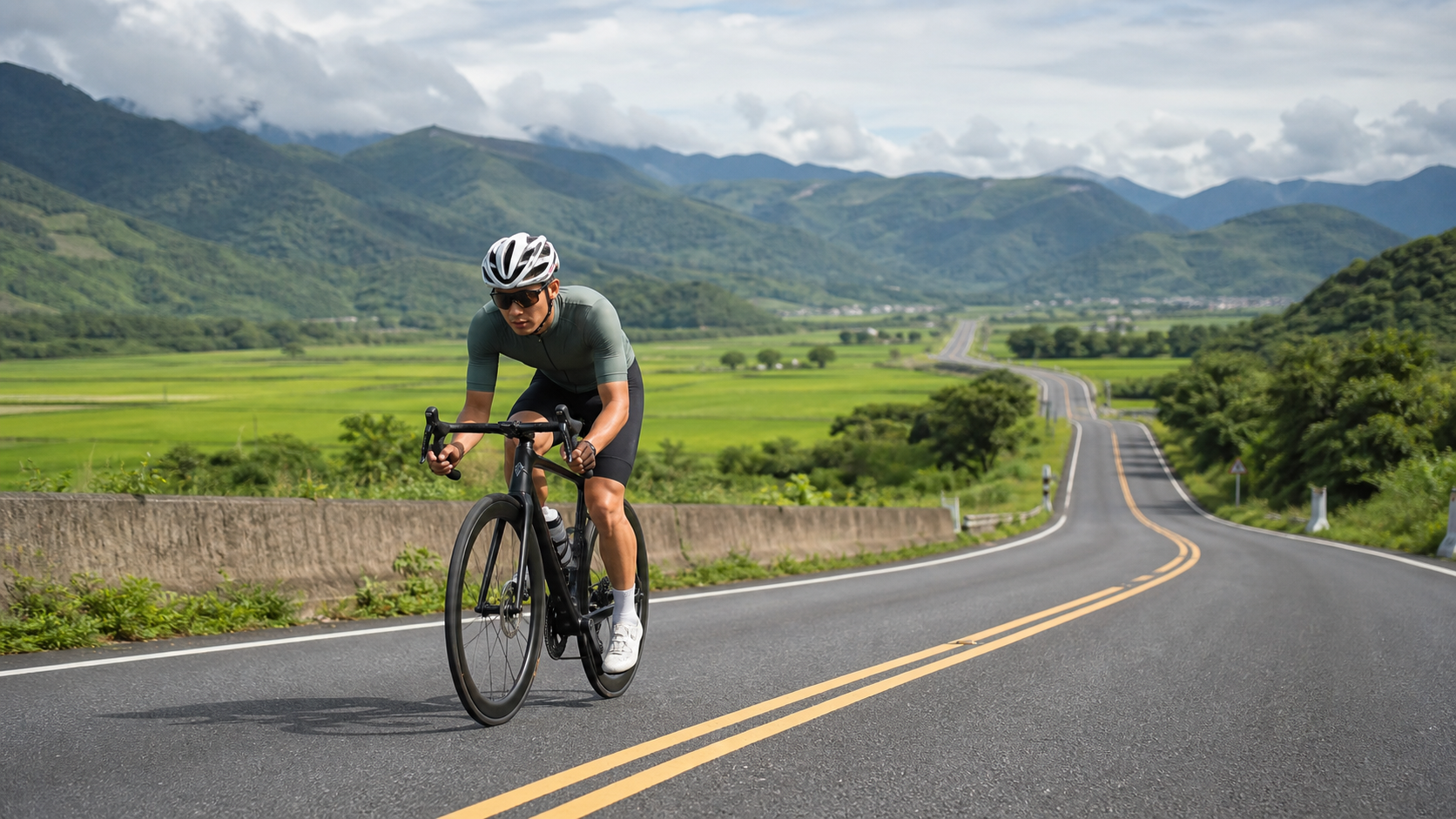
Route Overview: An Underrated Rolling Road in the East Rift Valley
Dongfu Highway, also known as Provincial Highway 9D, is a provincial B-class road within Hualien County that connects Dongli (Fuli Township) on Provincial Highway 9 with Fuli. It spans approximately 17.9 kilometers with a total elevation gain of 457.8 meters. Its Strava segment ID is 9326074, classified as Category 0—in Strava’s climbing grade system, Category 0 is the lightest tier, indicating that this route’s difficulty is far below the intimidating levels of HC (Hors Categorie) or C1/C2. At first glance, the average gradient of 2.1% leads many riders to instinctively judge: “This is a gentle climb; I can handle it with a steady output on the middle chainring.” But if you hit the road with that mindset, Dongfu Highway might just teach you an unexpected lesson.
Let’s lay out the numbers first. 17.9 kilometers multiplied by a 2.1% average gradient would theoretically produce a net elevation gain of approximately 376 meters, yet Strava’s actual recorded total gain is 457.8 meters—a discrepancy of about 82 meters. This 82-meter gap is not a measurement error or GPS drift noise; it is direct evidence of the route’s “rolling” nature. The 2.1% average gradient is merely the net value calculated by subtracting the starting elevation from the finishing elevation and dividing by the horizontal distance. It completely fails to reflect how many times the route rises and falls in its middle section. In other words, Dongfu Highway is not a road that “steadily climbs at 2.1% from start to finish,” but rather a rolling hill section composed of several steeper short climbs alternating with gentle descents. The total gain of 457.8 meters is actually the cumulative sum of the climbing from these undulations, far more complex than what a single average gradient can convey.
This phenomenon of “average gradient not matching total gain” is actually quite common on segment-style routes like this on Strava, especially on roads that traverse rolling terrain with multiple small hills or gentle undulations along the way. On a long, single-direction sustained climb like the west approach to Wuling, the average gradient and total gain are almost interchangeable; but on a rolling hill road like Dongfu Highway, situated at the junction of the East Rift Valley and the Coastal Mountain Range, the pavement rises and falls with the terrain, and the “feel” of the gradient that riders actually experience is completely different from what the average gradient suggests. This is also the core message this article aims to emphasize: Dongfu Highway is a rolling road, not a uniform gentle climb. Any rider who plans their pacing as if it were a single steady ascent is likely to get a rude awakening on a sudden short climb somewhere in the middle.
From an equipment and sensation standpoint, the Category 0 rating combined with the 17.9-kilometer distance means this route is better classified as a “cruising practice route” or “interval training route” rather than a “King of the Mountains challenge.” Traffic volume is typically lower than on the main Provincial Highway 9, and the pavement quality is good, making it ideal for practicing gear-shifting reactions, aerobic cruising output, and short-interval transition skills. For planners of East Rift Valley cycling itineraries, Dongfu Highway is also commonly used as an alternative road to connect with Provincial Highway 9, helping to avoid main-road traffic while adding a section of varied terrain training. In the following sections, we will use an engineer-style data breakdown to divide these 17.9 kilometers into several functional segments, analyzing pacing strategies, gear recommendations, refueling rhythms, and common mistake patterns one by one.
Segment-by-Segment Strategy: Breaking 17.9 km into Alternating Tactical Zones
Since Dongfu Highway lacks publicly available per-kilometer elevation profile data, the following segment strategy adopts a “functional zone” approach, dividing the 17.9 kilometers into five representative tactical phases based on general riding logic for rolling hill routes. This allows you to match the road feel and adjust your output rhythm during actual riding, rather than rigidly adhering to a fixed power or heart rate number.
Segment 1 (Start to approximately 4 km): Warm-up cruising, getting a feel for the road. In this opening section, keep your heart rate in Zone 2 or even slightly lower. The goal is not speed but “feeling the road.” Because the undulations on Dongfu Highway do not appear at regular intervals, you need the first few kilometers to adapt to the rhythm of the terrain—when a short steep climb will pop up, and when a gentle descent will follow. Another key focus here is confirming that your drivetrain is shifting smoothly. Especially if your derailleurs haven’t been serviced in a while, rolling roads are the most likely place for chain drops or skipped gears precisely when you urgently need to shift—a hidden cause of many DNFs.
Segment 2 (Approximately 4 to 8 km): The first wave of rolling challenges. This section typically features the more pronounced clusters of short climbs on the entire route, and it is one of the primary sources of that 82 meters of “hidden gain.” For these short climbs, adopt a strategy of “high cadence, light gear,” maintaining a cadence between 85 and 95 rpm rather than grinding with a heavy gear. Short climbs are characterized by “going up fast and coming down fast.” If you push a heavy gear on the ascent and load your quadriceps with lactate, the subsequent descent won’t provide enough recovery time, directly compromising your output capability in the later stages.
Segment 3 (Approximately 8 to 11 km): The mid-route descent recovery zone. One major advantage of rolling roads is that descents can be used for active recovery. If the terrain turns into a gentle descent here, relax your upper body and keep a light pedaling motion to maintain blood circulation, but do not stop putting out power entirely—allow your heart rate to slowly drop to between Zone 1 and Zone 2, preparing for the next wave of climbs. Many riders make the mistake of “coasting completely without pedaling” here, which causes the muscles to be suddenly called upon when the next climb begins, potentially triggering early signs of cramping.
Segment 4 (Approximately 11 to 15 km): The second wave of rolling challenges, and the most likely section to lose speed. After the earlier exertion, this is where the physiological load of the entire route is most demanding. At this point, consider dialing your power or perceived exertion down by 5% to 10%, and push through with the principle of “steady output over explosive output.” If your equipment is properly configured (see the gear recommendations in the next section), you should still be able to maintain an average speed of 18 to 22 km/h here; but if you chose the wrong gearing or mismanaged your energy distribution, it’s easy to drop below 15 km/h here, or even be forced to spin at your easiest gear.
Segment 5 (Approximately 15 km to the finish): Final gentle climb and sprint preparation. The last few kilometers are usually the relatively mellow section of the entire route. If you’ve managed your energy well, you can gradually increase your output here for a strong finish. This is also the key indicator of whether your earlier pacing strategy succeeded—if you still have energy to accelerate here, your energy management was correct; if your legs are already shot, that’s the classic pacing mistake of “treating a gentle climb like flat road and sprinting.”
Gear and Equipment Recommendations: A Drivetrain Designed for Rolling Roads
When facing a rolling hill section like Dongfu Highway, characterized by “dense short climbs and uneven gradients,” the core logic of gear selection is completely different from tackling a single long climb. Long-climb routes (such as Wuling or Hehuan Mountain) demand “the most efficient gear ratio for sustained steady output,” but rolling routes require a drivetrain with “quick response and frequent shifting,” because you may experience a complete climb-to-descent cycle in just two or three minutes.
Front chainring recommendation: A standard double crankset (50/34 or 52/36) paired with an 11-speed or 12-speed rear cassette is sufficient for this route. There is no need to install a triple crankset or e-bike-level ultra-light gearing. Since the Category 0 rating and individual gradients rarely exceed 8% to 10% (estimated, depending on actual road conditions), a standard double setup will allow most road cyclists to complete it comfortably.
Rear cassette recommendation: This is the key equipment decision for the entire route. It is recommended to choose a “wide-range cassette” such as 11-30T or 11-32T, rather than racing-type 11-25T or 11-28T. The reasoning is straightforward: rolling roads require the flexibility of “having a light gear available for climbs while not being too spinny to make progress on flats.” A wide-range cassette lets you quickly drop into a light gear to maintain cadence on short climbs, then rapidly shift back to a heavier gear on descents to sustain speed, without getting stuck in the awkward zone of “can’t go up, too light to go down” due to excessive gear jumps.
Wheelset and tire pressure recommendation: Dongfu Highway has relatively light traffic and generally good road conditions. Mid-to-deep section wheels (40 to 50 mm) offer a balanced choice, combining aerodynamic benefits for flat cruising with acceptable weight performance for climbs. For tire pressure, considering that rolling roads occasionally have potholes or patched sections, it’s advisable not to inflate to maximum racing pressure. Instead, aim for a range 5 to 10 psi below your typical flat-road cruising pressure, which provides better grip and comfort on descents while also reducing the risk of flats.
Drivetrain shift speed: Since one hallmark of rolling roads is the need for frequent and rapid shifting, confirm the precise adjustment of both front and rear derailleurs before riding. In particular, electronic shifting users should verify sufficient battery charge—on consecutive short climbs, a 0.5-second shift delay could be the critical difference that drops your cadence out of the sweet spot and costs you extra energy. Mechanical shifting users are advised to lubricate and service the drivetrain before riding to avoid chain noise or skipped gears during frequent shifts.
Nutrition and Hydration Strategy: Energy Management for Mid-Distance Rides
At 17.9 kilometers, estimating an average speed of 18 to 22 km/h for a typical recreational rider, the entire ride takes approximately 50 minutes to 1 hour; for a well-trained advanced rider averaging 28 to 32 km/h, it could be completed in 35 to 40 minutes. This duration falls into the “mid-distance” refueling planning range—not like a short sprint segment (under 10 km) where no refueling is needed, and not yet at the level of a long-distance endurance event (over 50 km) requiring meticulous nutrition planning. Still, basic energy and hydration management is worthwhile, especially considering that the rolling nature of this route will make actual energy expenditure higher than cruising the same distance on flat roads.
Before departure: It is recommended to complete a carbohydrate-containing meal or snack 60 to 90 minutes before riding, giving your body enough time to digest and convert it into usable energy. Summer temperatures in the East Rift Valley are relatively high, so it’s advisable to prepare your hydration beforehand, allowing your body to enter a state of slight “overhydration” rather than waiting until you’re thirsty to start drinking.
During the ride: Since the total time is mostly between 30 minutes and 1 hour, for most riders, carrying one bottle of sports drink or electrolyte water is sufficient for the entire route; additional solid fuel (such as energy gels or bananas) may not be necessary. However, if you’re treating Dongfu Highway as one segment of a longer cycling itinerary (such as a full East Rift Valley loop), you must incorporate it into your overall refueling plan rather than viewing it in isolation—especially since the rolling terrain will consume 10% to 15% more energy than riding the same distance on flat roads, a deficit that is easily underestimated over multi-day rides.
Electrolytes and cramp prevention: Because rolling sections require muscles to frequently switch between exerting effort on climbs and relaxing on descents, they are more prone to triggering early signs of cramping than steady flat cruising, particularly in the quadriceps and calf muscle groups. It is recommended to take small sips of water or electrolyte drinks every 15 to 20 minutes during the ride, rather than waiting until you’re clearly thirsty or feel muscle tightness, because by then it’s often already too late.
Coping with East Rift Valley summer heat: Summer sunlight in the Hualien Rift Valley is intense, with temperatures often exceeding 30 degrees Celsius. It is advisable to avoid riding during midday hours and instead depart in the early morning or late evening, incorporating sun protection and heat dissipation into your riding gear (breathable jersey, arm sleeves, sunscreen). If riding around noon, increase the frequency of fluid intake and stay alert for early signs of heatstroke such as dizziness or an abnormally rapid heartbeat.
Weather and Seasonal Recommendations: Timing It Right for Maximum Benefit
The climate patterns of the East Rift Valley differ significantly from western Taiwan. As a route in the valley’s hilly terrain, Dongfu Highway is notably affected by season and weather, which is worth factoring into your planning before scheduling a ride.
Spring (March to May): Temperatures are mild, making this one of the golden seasons for cycling in the East Rift Valley. Rainfall during this period is relatively stable but not frequent, with slightly larger temperature differences between morning and evening. It’s advisable to carry a lightweight windbreaker for the morning chill. During this time, the farmland along the route is mostly in the rice transplanting or early growth stage, offering open views—an ideal window for planning multi-day East Rift Valley loops and using Dongfu Highway as a connecting segment.
Summer (June to September): Temperatures are high, sunlight is intense, and the East Rift Valley is frequently affected by afternoon convective thunderstorms or typhoons. It is recommended to schedule riding between 5:00 and 8:00 AM, avoiding midday heat and unstable afternoon weather systems. Summer is also when rice crops are lush, with some areas entering the harvest season, bringing noticeable seasonal changes to the scenery. However, this also demands more careful sun protection and hydration management.
Autumn (October to November): Temperatures turn cooler and winds gradually strengthen. The valley terrain can produce localized strong winds under certain wind directions, so it’s advisable to check the daily wind forecast before riding, particularly noting the impact of crosswinds on riders using deep-section wheels. This season typically has lower rainfall probability and good air quality, making it one of the periods many riders consider the most comfortable for riding all year.
Winter (December to February): Winter temperatures in the East Rift Valley remain relatively mild, with less of the damp cold seen in western or northern Taiwan, but the northeast monsoon can occasionally bring rain and stronger winds. Traffic is typically at its lowest this season, making it suitable for riders who enjoy a quiet riding experience. However, be sure to pay attention to layered clothing, as early morning low temperatures can differ from daytime highs by more than 10 degrees Celsius.
Overall, if you’re looking for the “lowest-risk, best-experience” riding window, early morning hours in spring and autumn are the most recommended combination for Dongfu Highway—stable climate, good visibility, low traffic, while avoiding summer heat and the uncertainty of typhoon season.
Common Mistakes and DNF Risks: Pacing Strategies Fooled by the Average Gradient
Although Dongfu Highway is only a lightweight Category 0 segment and theoretically unlikely to produce serious DNF (Did Not Finish) situations, precisely because its difficulty is severely underestimated by the 2.1% average gradient figure, riders are more prone to making pacing errors under insufficient mental preparation, leading to a perceived “mini-collapse”—commonly known as bonking or losing speed. Below are several of the most common mistake patterns:
Mistake 1: Treating the 2.1% average gradient as the sole basis for assessing route difficulty. This is the most fundamental and common misjudgment. As the data analysis at the beginning of this article shows, 2.1% is only the net average gain. The actual route contains multiple steeper short climbs, and the total gain of 457.8 meters exceeds the theoretical value by approximately 82 meters—evidence of these undulations. If a rider departs with the mindset of “gentle climb, can cruise at moderate-to-high power the whole way,” encountering a sudden short steep climb in the middle can easily cause a massive expenditure of anaerobic energy due to missed shifts and cadence dropping too low. On a mid-distance route like 17.9 kilometers, this energy deficit is difficult to fully recover from in the later stages.
Mistake 2: Completely stopping output on descents. As mentioned earlier, descents on rolling roads are actually important opportunities for active recovery, but many riders mistakenly believe that “downhill means rest, do nothing,” completely stopping pedaling and coasting with a stiff body. The problem is that when the next short climb suddenly appears, the muscles haven’t restarted and the cardiorespiratory system hasn’t readjusted to working state, easily causing a physiological “restart delay” that makes the climb even more strenuous.
Mistake 3: Incorrect gear selection leading to repeated shifting failures. Using a racing-type narrow-range cassette (such as 11-25T) to tackle this kind of rolling route can leave you without a sufficiently light gear when short climbs appear, forcing you to grind against excessive resistance. This is a direct cause of premature muscle fatigue in the later stages, or even cramping.
Mistake 4: Poor refueling timing, especially hydration mismanagement in summer heat. Some riders, seeing that the distance is only 17.9 kilometers and the time may be under an hour, completely skip refueling preparations. As a result, under the combined toll of summer heat and rolling terrain, they experience mild dehydration or electrolyte imbalance in the middle-to-late stages, affecting performance and even safety.
Mistake 5: Neglecting drivetrain maintenance, leading to chain drops or skipped gears at critical moments. Rolling roads demand far more frequent drivetrain use than flat roads or a single sustained climb. If the chain, cassette, or shift cables are poorly maintained, chain drops or skipped gears are highly likely at the start of a short climb precisely when rapid shifting is needed—not only affecting pacing but also raising safety concerns.
The common root of all these mistake patterns points to the same thing: underestimating the rolling nature of Dongfu Highway. As long as you establish the correct route awareness before departure—this is a rolling road, not a uniform gentle climb—most pacing errors can be avoided through reasonable mental expectations and proper equipment preparation.
Target Time Table for Riders of Different Levels
The following table provides reasonable target time ranges and average speed references for riders of different levels, based on the characteristics of Dongfu Highway’s 17.9 kilometers, 457.8 meters of total gain, and Category 0 rolling terrain. These figures are reasonable estimates derived from the route’s difficulty rating and general riding experience on rolling hill sections. Actual completion times will vary depending on individual fitness, daily wind conditions, and traffic situations, so they should be used as a reference baseline for training planning rather than absolute standards.
| Rider Level | Target Time | Average Speed | Recommended Strategy Focus |
|---|---|---|---|
| Beginner / Recreational Rider | 60–75 minutes | 14–18 km/h | Conservative pacing throughout; downshift on short climbs to maintain cadence; prioritize experience and safety over performance |
| General Enthusiast | 45–55 minutes | 20–24 km/h | Execute the five-segment strategy; use high cadence on rolling sections; actively micro-pedal on descents for recovery |
| Advanced Club Rider | 35–42 minutes | 26–31 km/h | Attack short climbs with standing high-power efforts, quickly return to seated cruising; power fluctuations throughout require precise calculation |
| Race Level / Strong FTP | 28–34 minutes | 32–38 km/h | Treat as an interval training route; view each short climb as a mini explosive interval; recover heart rate quickly on descents |
Notes on using the table: Due to Dongfu Highway’s alternating rolling terrain rather than a single gradient, actual pacing during the ride will absolutely not be a smooth speed curve, but will fluctuate continuously with short climbs and gentle descents. Therefore, the “average speed” in the table above is the overall mean for the entire ride. Actual instantaneous speed on short climbs may drop to half the average or even lower, while on descents it may significantly exceed the average. Riders are advised to focus on “the reasonableness of the overall pacing strategy” rather than speed performance on any single segment when planning target times, allowing for a more accurate assessment of their true performance on this rolling route.
In summary, Dongfu Highway is an East Rift Valley rolling hill route whose data appears approachable on the surface but conceals variation in actual riding. The 457.8 meters of total gain tells us it is by no means the kind of route that “gently climbs all the way to the top” as the 2.1% average gradient suggests, but rather a technically demanding cruising route built from stacked undulations. As long as you hit the road with the correct route awareness—understanding it’s a rolling road, preparing a wide-range cassette, and planning segment pacing and refueling strategies—these 17.9 kilometers will be a highly effective training experience and a scenic East Rift Valley journey well worth taking.
Related Reading
- Between Rice Waves and Rolling Hills: Slow Moments on the East Rift Valley’s Dongfu Highway
- Dongshan Coffee Road Practical Guide: 16.41 km, 3.9% Average Gradient—The Top Choice for Endurance Training
- Pinglin North 42 Practical Guide: A Hidden Hard Climb with 12% Steep Sections Concealed in 5.1 km—Full Data Contradiction Breakdown
- Macao Mountain Road Practical Guide: 9.9 km of Continuous Rolling—A Hidden Training Route
台北闊瀨陡坡 騎旅 / 日本單車雜誌編輯車友臨時加入!/ 髮香才是最強的 / feat. 北迴歸線小隊 / 公路車 CT Yeh
6 個月前
西進武嶺 8000名單車友數據分析 PART1 | 從新手到高手數量/瓦數/推力比/FTP推力比/功率計使用率 大解析 | 公路車 | CTYeh
5 年前
昇陽SYB車隊 & Fuji 菁英選手們的趣味經驗分享,長知識了!市民車友必看~ 一路被拉爆後才給問 | 戀戀197 武嶺 凸台經驗分享 | 公路車 | CT Yeh
4 年前
西進武嶺各路段 前8000名 大數據分析 配速攻略/功率/心律/推力比/維持率/踏頻/踏瓦比/牽車率 大公開 | 建大盃 NeverStop 可參考 | 公路車 | CT Yeh
5 年前
爬坡ITT實境)台中 魔王 松鼠坡 首航 6:12 大肚山 大三元 科福路
8 年前
#公路車 #西進武嶺 配速配瓦實驗 坡度分析 四小時內攻略 建大盃 NeverStop #西進武嶺攻略
6 年前
大武山20%魔王陡坡【JJSC南台灣遊騎Day2】!屁股真的要裂開了...凡士林抹滿也沒用?神秘金教堂還有超便宜夜市
3 個月前
大禹嶺 到 武嶺牌樓 全程前後實況錄影 | 北進武嶺 | 東進武嶺 | KOM | 訓練台 | 坡度分析 | Taiwan KOM Last 10 km HARD | 公路車
6 年前