Chike Mountain Climbing Full Guide: 11.05km with 6.2% Average Grade — Real-World Data Analysis of the East Rift Valley
Route Overview and Data Analysis: What 11.05 km and 693 m of Elevation Gain Really Mean
Chike Mountain (Strava segment ID 16845548) is a classic climbing route in Yuli Township, Hualien County. The segment spans 11,051.8 meters (approximately 11.05 km) with 693.2 meters of total elevation gain and an average gradient of 6.2%, officially rated Category 4 by Strava. For riders familiar with Strava’s categorization system, Category 4 may not sound like an extreme climb, but once you actually ride it, you’ll realize the numbers hide the true difficulty of this road.
Let’s do a quick sanity check: 11.05 km multiplied by a 6.2% average gradient yields a theoretical elevation gain of roughly 685 meters, closely matching the official 693.2 meters. This indicates the gradient distribution along the route is relatively even and consistent, with no long, easy sections dragging down the average. In other words, you’re essentially in a constant state of effort for nearly the entire climb, with few opportunities to truly ease off and catch your breath. This contrasts with many famous Taiwanese climbing routes (such as the Wuling western approach or the Hehuan Mountain main line), which often exceed 20 km but average only 4% to 5% — a “long-distance attrition battle.” Chike Mountain, by contrast, follows a “short-distance, high-intensity” approach, closer to a mid-distance gradient test.
From a power perspective, a mid-level rider with an FTP (Functional Threshold Power) between 200 and 250 watts, attacking the summit at near-maximal effort, would sustain an average output of roughly 85% to 95% of FTP, translating to a completion time of approximately 35 to 50 minutes. For a stronger rider who trains in the mountains year-round and has an FTP above 280 watts, this route could be completed in under 28 minutes. This time spread illustrates that despite its modest length, Chike Mountain demands no less from the cardiovascular system and muscular endurance than some longer climbs.
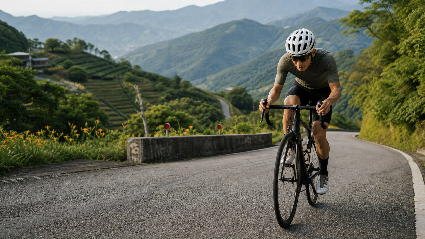
Looking at the gradient profile, Chike Mountain is a typical “farm-access-road” climb found in the East Rift Valley. The road primarily serves the surrounding tea plantations and daylily fields, carrying agricultural and tourist traffic. The road width is relatively narrow, some sections lack standard asphalt shoulder buffers, and corner radii tend to be tight. This means that beyond managing the physiological load of the gradient itself, riders must constantly watch road conditions and blind spots, especially when passing oncoming vehicles — requiring early braking and keeping to the right. These road characteristics mean that even though the gradient numbers aren’t the most brutal, the mental focus required to ride Chike Mountain is considerable.
It’s worth noting that the climbing section of Chike Mountain isn’t a single uniform gradient. The middle and later sections may feature localized stretches exceeding 10%, which is why even with a 6.2% average, many riders feel a noticeable surge in pedaling resistance as they approach the open viewpoints near the summit. Therefore, when planning your pacing strategy, don’t rely solely on the “6.2% average” as the basis for your entire output. Instead, reserve extra power headroom to handle the instantaneous load from localized steep sections.
In summary, Chike Mountain is a condensed mountain challenge: short in distance, but with solid gradients, road conditions that demand focus, and localized steep sections that shouldn’t be underestimated. Whether you treat it as a standalone training goal or incorporate it as a key climbing segment in a longer East Rift Valley ride, it deserves the same rigorous preparation as any serious climb — not a seat-of-the-pants approach.
Section-by-Section Strategy: Gradient Changes and Pacing from Start to Finish
To conquer Chike Mountain efficiently, you need to understand that the route can be roughly divided into four riding phases, each with distinct gradient characteristics and strategies. The following breakdown is estimated based on typical gradient curves of farm-access-road climbs; adjust according to actual on-site conditions.
Section 1 (Start to approximately 2.5 km): Warm-up and gradual climb. This stretch is typically the most forgiving part of the entire route, with gradients likely ranging from 4% to 5%. It’s the critical adaptation period as your body transitions from flat-road riding to climbing mode. Many riders tend to push too hard here because they don’t yet feel fatigued, driving heart rate or power to near-maximum levels, which leads to premature slowdown in the middle and later sections. It’s recommended to ride at a perceived exertion (RPE) of 6 to 7 out of 10, maintaining a cadence of 80 to 90 rpm, allowing your aerobic system to fully engage while saving anaerobic reserves for where they’re truly needed.
Section 2 (Approximately 2.5 to 5.5 km): Gradient increase and transition. As elevation gradually rises, the road begins to feature more corners and gradient variations, with the average gradient potentially increasing to 6% to 8%. Some inside corners may even deliver a sudden, sharp steepness. This phase is the watershed for pacing strategy — if you didn’t hold back in Section 1, this is where your body starts to feel the strain. It’s recommended to deliberately lower your cadence to 70 to 80 rpm, shifting to a larger gear ratio with lower spin to stabilize heart rate rather than chase speed. At the same time, start paying attention to your breathing rhythm, adopting a fixed pattern such as “two breaths in, two breaths out” or “three breaths in, one breath out” to avoid losing your pedaling rhythm from gasping.
Section 3 (Approximately 5.5 to 8.5 km): The core hard-climb zone. This is the most challenging section of Chike Mountain, with localized gradients potentially exceeding 10%. Combined with narrower road width and restricted visibility around corners, it tests both bike-handling skills and mental toughness. At this point, you should lower your power target to a sustainable output level (recommended at 80% to 90% of FTP), preferring to slow down rather than sacrifice a steady cadence. Avoid burning through glycogen reserves by frequently switching between seated and standing positions. While standing sprints can briefly boost output, over-relying on them on a continuous steep section like Chike Mountain will spike your heart rate too quickly, leaving you with nothing in the tank for the later stages. It’s recommended to stand only briefly on localized sections where the gradient suddenly exceeds 12% to reset your rhythm, staying seated for the remainder.
Section 4 (Approximately 8.5 km to the summit finish): Open views and the final stretch. As elevation continues to rise, this section begins to reveal the expansive vistas of the East Rift Valley. The gradient eases slightly compared to the previous section, but accumulated fatigue makes even gentler slopes feel demanding. This is the final test of willpower and pacing discipline. It’s recommended to shift your focus from how much distance remains to maintaining your current rhythm, using the open scenery ahead to distract from fatigue. At the same time, watch for road markers and kilometer posts to avoid misjudging the remaining distance due to visual fatigue, which could lead to premature sprinting or excessive caution.
Overall, the pacing philosophy for Chike Mountain can be distilled into one sentence: conserve your capital early, stay steady without overreaching in the middle, and let the scenery carry your willpower at the end. This route doesn’t reward a gamble-and-sprint approach, because the unpredictability of the gradients — especially the steep sections that may appear in the middle and later stages — will exact a price from overly aggressive strategies.
Gear Ratio and Equipment Recommendations: Preparing for a 6.2% Average Grade with Steep Sections
Chi-Ke Mountain’s average grade of 6.2%, with local sections potentially exceeding 10%, places clear demands on gear ratio setups. With a standard road bike configuration (e.g., 50/34 compact crankset paired with an 11-28 or 11-32 cassette), most intermediate riders will still find the gearing too heavy for this route, especially on the steeper sections, where they may be forced to grind at a lower cadence, accelerating muscle fatigue.
Recommended gear ratios are listed in the table below, categorized by rider fitness level:
| Rider Level | Recommended Chainring | Recommended Cassette | Reference Lowest Gear | Notes |
|---|---|---|---|---|
| Beginner or heavier rider | Compact 34T | 11-34T or 11-36T | 34/34 or lower | Prioritize maintaining cadence to avoid excessive knee strain |
| Intermediate rider | Compact 34T | 11-30T or 11-32T | 34/30 | Balances efficiency on regular sections with reserve for steep climbs |
| Advanced or climber-type rider | Standard 36T or Compact 34T | 11-28T | 34/28 or 36/28 | Pursues speed but still needs buffer for local steep sections |
If using off-road oriented groupsets such as those on mountain bikes or disc-brake gravel bikes, the stock cassette range typically already covers lower gear ratios (e.g., 11-34T or even 11-42T), which offers an advantage on industrial roads like Chi-Ke Mountain. Especially when facing potholes or gravel, wider tires and more forgiving braking systems also provide an additional safety margin.
Tire selection is another aspect that is easily overlooked. Chi-Ke Mountain is a general paved industrial road, but it lacks large-scale maintenance over time, so the surface may have cracks, patches, or localized potholes. Combined with increased traffic during the golden needle flower season and occasional scooters and tour buses sharing the shoulder, it is recommended to use 25 to 28C tires with some puncture resistance. Tire pressure can be set 5 to 10 psi lower than racing tires to increase grip and comfort, providing extra handling confidence especially on descents.
Regarding braking systems, whether rim brakes or disc brakes, be sure to check the condition of the brake pads before the descent back down. Chi-Ke Mountain’s terrain features many corners and some steep sections, and continuous braking can easily lead to brake fade. Disc brake riders are advised to use metallic/sintered pads for better heat resistance, while rim brake riders should avoid prolonged heavy braking and instead use intermittent, pulsing braking to control speed, allowing the pads and rims space to dissipate heat.
Other equipment recommendations include: a cycling computer with a power meter or at least a heart rate strap to quantify intensity and avoid blowing up purely on feel; a breathable, moisture-wicking jersey, as summer heat in the East Rift Valley combined with climbing effort can push perceived temperatures above 35 degrees; and a spare tube and tool kit. The industrial road is remote and mobile phone signals may be unstable, so the ability to fix a flat is a necessary self-rescue skill. If planning to visit during the golden needle flower season (approximately August to September), it is recommended to attach front and rear lights to cope with crowded conditions and significant light variations.
Nutrition and Hydration Strategy: Coping with Sparse Supply Points in the Mountains
Although Yuli Township, where Chi-Ke Mountain is located, is an important town in the East Rift Valley with relatively ample supply options in town, once you turn onto the Chi-Ke Mountain industrial road, shops and supply points along the way become noticeably scarce. Especially on weekdays outside the flower season, you may not encounter a single convenience store or grocery store in the mountains. Therefore, the core principle of your nutrition strategy must be to carry everything you need yourself, rather than relying on random supplies along the way.
Pre-ride nutrition preparation recommendations are as follows. For hydration, based on the 11 km distance, 693 meters of climbing, and average summer temperatures potentially exceeding 30 degrees in the East Rift Valley, it is recommended to carry at least two 750ml water bottles (1.5 liters total). If the weather is particularly hot or you sweat heavily, consider carrying a hydration pack for additional capacity. Especially since there may be no supply points at the summit turnaround, you need to reserve enough water for the return trip as well. For electrolytes, climbing in the mountains combined with high temperatures means electrolyte loss occurs much faster than riding on flat ground. It is recommended that at least one bottle contain an electrolyte drink to avoid diluting blood electrolyte concentration with plain water alone, which increases the risk of cramping. For energy, based on a moderate-intensity ride of 45 minutes to 1 hour, it is recommended to prepare 1 to 2 energy gels or bars. Especially if your challenge time crosses a meal time, you should complete a full meal or at least a half light meal in Yuli Township or before departure, to avoid low blood sugar mid-ride affecting your judgment and pedaling efficiency.
Given the sparse supply points in the mountains, the following coping strategies are worth considering:
- Fill up on water and food in Yuli Township before departure: Yuli Township has convenience stores and a traditional market. Treat this as your final supply stop—fill your bottles and confirm you have enough energy supplies before heading up the mountain.
- Reserve margin for the return trip: Many riders underestimate the water and energy needed for the return leg. After consuming large amounts of water on the climb, failing to reserve enough for the return can lead to dehydration or hypoglycemia symptoms on the descent. It is recommended to reserve at least 20% of your total supplies for the return and emergencies.
- Watch for temporary vendors during the flower season: During the golden needle flower season at Chi-Ke Mountain, temporary food or drink stalls may appear in the mountains, but their availability is unreliable. It is not recommended to rely on such temporary supplies; self-provisioning should remain the primary approach, with temporary stalls serving only as a bonus option.
- Make good use of offline maps and emergency contacts: Since mobile signals are unstable on some mountain sections, download offline maps before departure and let riding partners or family members know your planned route and expected return time. If riding solo, assess the risks even more carefully.
It is worth special emphasis that although Chi-Ke Mountain is not particularly long and theoretically does not require carrying large amounts of supplies like a long-distance Wuling challenge, precisely because the distance is short and the climbing is concentrated, riders tend to underestimate their preparation needs. Under the combined assault of high heat and high-intensity output, they may run out of energy faster than expected. Short distance does not mean easy—this is the most important lesson to remember when planning your nutrition strategy for this route.
Weather and Seasonal Advice: Coping with Golden Needle Flower Season Traffic and Summer Heat
Chi-Ke Mountain’s most famous moment is undoubtedly the golden needle flower season from August to September each year (actual bloom conditions vary with weather; check on-site conditions). The hillsides covered in orange-yellow flower fields bring large numbers of tourists and photography enthusiasts to this road, which primarily serves an agricultural function. For riders, this is both a golden opportunity to enjoy spectacular scenery and a high-risk period requiring extra caution regarding traffic.
Riding strategies during the flower season include the following. First, start early to avoid peak traffic: On flower season weekends, traffic on Chi-Ke Mountain increases significantly, with tour buses, cars, and scooters mixed together. Combined with narrow, winding roads, it is recommended to ride on weekdays or in the early morning hours—this avoids congested traffic while also offering better light and cooler temperatures for riding. Second, wear bright jerseys and attach reflective accessories: In a mixed-traffic environment, visibility and recognition are the first line of defense for safety. Choose bright-colored jerseys and attach reflective strips or blinking lights to the seat post and handlebar area, which increases your chances of being noticed even during daytime riding. Third, yield to others and control your speed: Many road users during the flower season may be first-time visitors unfamiliar with mountain driving, and their speed control may be erratic. Riders should proactively slow down at corners and areas with limited visibility, and remain ready to brake at all times. Be especially cautious on descents and do not compete with cars or scooters for the right of way. Fourth, when stopping to take photos, be sure to move to a safe shoulder: The scenery along Chi-Ke Mountain is highly appealing, and riders may be tempted to stop for photos. However, be sure to choose a spot with a sufficiently wide shoulder and good visibility, avoiding occupying the lane and causing following vehicles to brake suddenly.
Compared to the bustling flower season, Chi-Ke Mountain returns to a relatively peaceful mountain riding atmosphere outside the flower season, with significantly reduced traffic—more suitable for hardcore riders focused on pacing and training goals. However, precisely because there are fewer people and vehicles, if a mechanical failure or physical discomfort occurs, the wait for rescue or help may be longer. Riders challenging this route during this period should be better prepared for self-reliance and inform friends and family of their plans.
Summer heat is another variable that cannot be ignored. Summer temperatures in the East Rift Valley frequently exceed 33 to 35 degrees, and the perceived temperature is even higher when climbing under effort, significantly increasing the risk of heatstroke and heat exhaustion. It is recommended to avoid the peak heat hours between 10 a.m. and 2 p.m., opting instead for early morning or evening. If you experience symptoms such as dizziness, nausea, abnormally cold and clammy skin, or conversely abnormally dry and hot skin—precursors to heatstroke—stop riding immediately, find shade to rest, and replenish fluids and electrolytes. Also apply sunscreen appropriately; UV intensity in the mountains is no less than on flat ground, and prolonged exposure can cause sunburn that affects subsequent riding plans.
Typhoon season and rainy season also require special attention. The East Rift Valley is frequently affected by the outer circulation of typhoons or tropical depressions during summer and autumn. Mountain roads may experience loose soil, falling rocks, or flooding due to heavy rainfall. Be sure to check the latest weather and road condition information before riding. If weather conditions are poor, decisively cancel or postpone—mountain safety always takes priority over sticking to a schedule.
Common Mistakes and DNF Risks: These Situations Are Most Likely to Make You Quit Halfway
Although Chike Mountain is only 11 kilometers long and is a relatively short climbing challenge, a considerable number of riders still give up midway due to various oversights, or finish but pay a far higher price than expected. Below are several of the most common mistake patterns, listed as a warning for riders.
Mistake 1: Underestimating the intensity demands of a short climb, with too heavy a gear ratio setup. Many riders see only 11 kilometers and subjectively assume no special gear adjustment is needed, using a standard crankset setup suited for flats or gentle rollers. As a result, when they hit localized steep sections in the middle-to-late portion, they are forced to grind at extremely low cadence, accelerating muscle fatigue and sending heart rate soaring out of control, ultimately burning through their energy reserves prematurely. Gear ratio isn’t just about distance—it must be evaluated comprehensively based on gradient and physical condition.
Mistake 2: Losing pace control in the early section, saving reserves in the wrong place. As described in the segment-by-segment strategy above, the early section of Chike Mountain is relatively gentle, which easily gives riders the illusion that this road isn’t as hard as expected, causing them to unconsciously push higher output. By the time they reach the core hard-climbing zone in the middle-to-late section, they realize they have little energy left—often too late to adjust, leaving them to grind through, slow down, or even dismount and walk.
Mistake 3: Insufficient supplies, overestimating tolerance to high temperatures. Summer heat in Hualien-Taitung combined with sustained climbing effort means fluid and electrolyte loss far exceeds what most people intuitively expect. Many riders set off with only one bottle, only to show clear signs of dehydration near the summit—dizziness, cramping, and declining focus arrive in succession, not only affecting finish time but potentially causing handling errors that lead to accidents.
Mistake 4: Ignoring the psychological preparation for localized steep sections, panicking on the spot and compromising bike handling stability. An average gradient of 6.2% easily leads people to assume the entire climb is relatively moderate. But when actually encountering localized steep sections exceeding 10%, without prior mental preparation, the sudden resistance can trigger panicked shifting or overly aggressive standing surges, disrupting the original pedaling rhythm and even causing low-speed falls from losing balance.
Mistake 5: Recklessly sprinting for time during flower season, ignoring the safety risks of mixed pedestrian and vehicle traffic. Some riders, in pursuit of personal records or Strava rankings, insist on going all-out during peak flower-season crowds, only to be caught off guard when passing oncoming traffic or dodging tourists, resulting in close calls or even accidents. Personal records can always be attempted during less crowded times—safety should always take priority over performance.
Specific recommendations for reducing DNF risk are as follows: thoroughly inspect your gear ratio setup before departure, replacing or adjusting the cassette if necessary—better to over-prepare than under-prepare; adopt a conservative opening strategy, keeping intensity in the first 2.5 kilometers within a comfortably sustainable range; follow the principle of bringing more supplies rather than fewer, especially fluids and electrolytes; check weather and road condition information in advance, decisively adjusting plans during extreme heat or poor weather; mentally accept that this road is harder than the numbers alone suggest, maintaining a respectful mindset to truly perform at your best and complete the challenge.
Target Time Table and Training Recommendations for Riders of Different Levels
To give riders of different fitness backgrounds a concrete reference point for the difficulty of the Chike Mountain challenge, the following table summarizes estimated completion times based on typical road cyclists’ power-to-weight ratios and experience levels. Please note that actual times will be affected by weather, wind direction, road conditions, and individual circumstances on the day; this table is intended only as a reference for training planning and goal setting.
| Rider Level | Power-to-Weight Ratio (W/kg, FTP estimate) | Estimated Completion Time | Average Heart Rate Zone Reference | Recommended Strategy |
|---|---|---|---|---|
| Beginner or recreational rider | Below 2.0 | 55 to 70 minutes | Primarily Zone 2 low intensity | Aim for completion throughout, may take moderate rest and refueling stops, no pursuit of speed |
| Advanced recreational or semi-trained | 2.0 to 3.0 | 40 to 55 minutes | Zone 2 to Zone 3 | Conservative early, steady output in the middle-to-late section, avoid anaerobic surges |
| Intermediate trained rider | 3.0 to 3.8 | 30 to 40 minutes | Zone 3 to Zone 4 | Execute segment strategy, maintain 85% to 90% of FTP in the core hard-climbing zone |
| Advanced or race-level rider | 3.8 to 4.5 | 24 to 30 minutes | Zone 4 to Zone 5 | Near-threshold output throughout, brief supra-threshold surges on localized steep sections |
| Elite or professional level | Above 4.5 | Under 24 minutes | Zone 5 and above | High-intensity output throughout, approaching anaerobic endurance limits |
From the table, it can be observed that although Chike Mountain is short in distance, achieving advanced-level completion times still requires a fairly solid power foundation. This confirms what was stated earlier: this route is a condensed intensity test, not merely a distance accumulation challenge.
Training recommendations also differ by goal. If your goal is to complete the climb for the first time, avoid injury, and enjoy the scenery, the training focus should be on building aerobic base endurance—schedule 1 to 2 steady Zone 2 rides of 60 minutes or more per week, paired with core strength training to enhance climbing posture stability. No additional high-intensity interval training is needed before departure; the key is familiarizing yourself with climbing pedaling rhythm and breathing coordination. If your goal is to challenge your personal best time, schedule targeted gradient interval training 4 to 6 weeks before the event—for example, on a road with similar gradient (6% to 8%), perform 3 to 5 sets of 6 to 10 minutes at threshold intensity (95% to 105% of FTP) with 5 minutes of rest between sets, thereby improving lactate tolerance during sustained moderate-to-high output. Also include 1 to 2 segment practice sessions simulating actual Chike Mountain road conditions to familiarize yourself with the response rhythm on localized steep sections. If your goal is to conquer the top of the Strava segment leaderboard, in addition to the threshold training above, you will need to add anaerobic power training—for example, 30-second to 2-minute all-out sprint intervals—to strengthen instantaneous output capability when facing localized sections exceeding 10% gradient. Be sure to use a power meter for precise pace monitoring to avoid misjudging based on subjective feel and losing speed on critical sections.
Finally, a reminder: regardless of which time goal you set, the value of the Chike Mountain challenge lies not only in the numbers themselves, but in how it condenses all the characteristics of climbing on an industrial road in the East Rift Valley—solid gradients, varied road conditions, and expansive views. Only by combining rigorous data planning with a respectful attitude toward the route can you truly experience the sense of accomplishment this route offers, safely and completely.
Related Reading
- Chiayi Waterway Climb Complete Guide: 10.93 km, 6.6% Average Gradient Test in Zhuqi Township
- Provincial Highway 3 Guanziling Practical Guide: An 11.5 km Mid-Distance Climb to One of Taiwan’s Four Major Hot Springs
- Guguan Climb Guide: 4.4 km, 11.7% Average Gradient—A Textbook of Pure Steep Climbing
- Dongfu Highway Practical Guide: Pace Traps and Gear Tactics on a 17.9 km Rolling Road
台北闊瀨陡坡 騎旅 / 日本單車雜誌編輯車友臨時加入!/ 髮香才是最強的 / feat. 北迴歸線小隊 / 公路車 CT Yeh
6 個月前
半日 小台灣 極限單車路線挑戰實錄
7 年前
西進武嶺 8000名單車友數據分析 PART1 | 從新手到高手數量/瓦數/推力比/FTP推力比/功率計使用率 大解析 | 公路車 | CTYeh
5 年前
公路車 爬坡 破PR 紀錄 小技巧 分享
6 年前
一日北高 11小時 賽後心得分享篇 | TWB北高360 | 一日雙城 | 單車 | 公路車
6 年前
大禹嶺 到 武嶺牌樓 全程前後實況錄影 | 北進武嶺 | 東進武嶺 | KOM | 訓練台 | 坡度分析 | Taiwan KOM Last 10 km HARD | 公路車
6 年前
單車 梅山36灣 坡度介紹 路段介紹 空拍 (相關遊記影片,請參考說明或我的頻道喔,歡迎訂閱)
6 年前
風櫃嘴時間 預測西進武嶺時間?13000名車友統計數據分析告訴你 !
5 年前