Xiping Highway Practical Guide: 8.3 km, 793 m of Climbing — the Most Demanding Climb Test in New Taipei's Suburbs
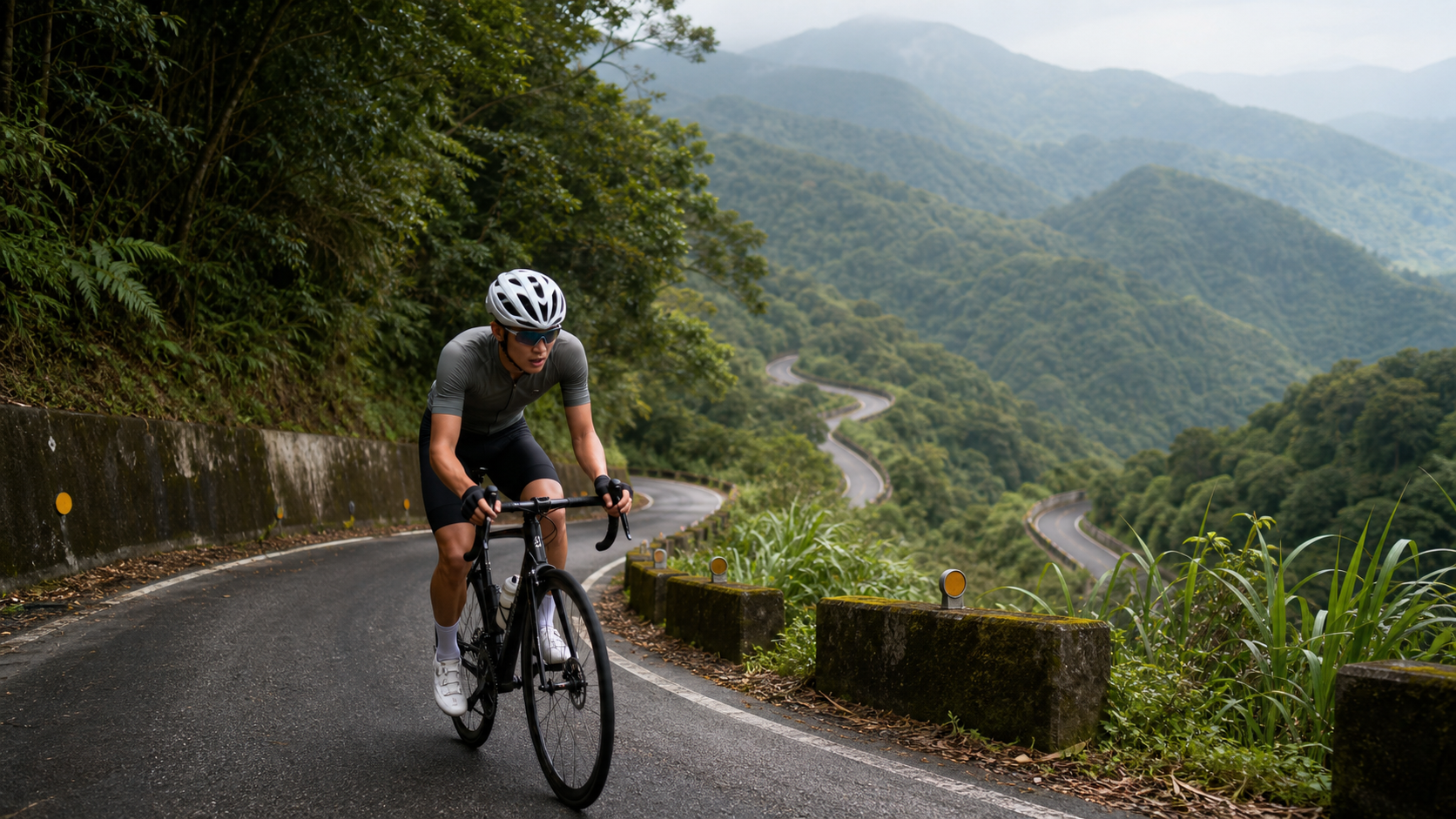
Practical Guide to Xiping Highway: 8.3 km, 793 m of Climbing, the Most Solid Climb Near New Taipei City
Route Overview and Real Data Analysis
Xiping Highway (New Taipei City Route 31) is an important mountain road connecting Xizhi and Pingxi, and this article focuses on the classic climb segment numbered 956511 on Strava—starting from the Baochangkeng direction in Xizhi and heading toward Pingxi. The official data for this segment is not long, only 8,326.75 meters (8.33 km), but the total elevation gain is as high as 793.926 meters, which translates to an average gradient of 4.9%.
Let’s first address an honest but important numbers issue: if you simply use “distance multiplied by average gradient” to back-calculate the elevation gain, 8,326.75 meters times 4.9% should theoretically yield only about 408 meters of climbing—nearly half of the 793.9 meters recorded by Strava. This is not a data error; rather, the “average gradient” figure is inherently misleading. The climbing profile of Xiping Highway does not progress smoothly at a steady 4.9% all the way up; instead, it is a typical mountain road profile where “gentle and steep sections alternate, with continuous climbing through switchbacks.” In the middle section, there are several short steep pitches approaching or even exceeding 10%, combined with numerous hairpin turns and consecutive curves that amplify the cumulative climbing effect—this is why GPS-recorded elevation gain far exceeds what the simplified “distance times average gradient” calculation can reflect. In other words, 4.9% is only the “average,” not “uniform”, and riders planning their pacing and perceived effort should base their expectations on “793 meters of total climbing with steep sections in the middle,” rather than naively assuming the entire route is a gentle 5% incline.
The reason this route draws polarized reviews in the cycling community—some see it as a benchmark climb for beginners, others as a regular weekend morning ride staple—is precisely because it combines the dual characteristics of “achievable for entry-level riders” and “painful if ridden seriously.” At 8.33 km in total length, it is not long for the average rider, and at a normal pace it can be completed in roughly 35 minutes to an hour, but the density of nearly 800 meters of climbing (about 95 meters of gain per kilometer) already approaches the intensity range of many well-known climbs. It is definitely not a route you can casually warm up for and just ride.
Xiping Highway itself is part of County Road 31, running from Baochangkeng in Xizhi in the north to Pingxi in the south. After crossing Panshi Ridge along the way, a series of hairpin turns appears, which is the topographical reason the climbing data looks “dishonest.” For riders familiar with the mountain terrain of the northern suburbs, this combination of “gentle average gradient with locally hard sections” is not uncommon, but the contrast on Xiping Highway is particularly pronounced, making it worth establishing the correct mental expectations before riding.
From a training science perspective, a route like this—where total elevation gain far exceeds the theoretical value of distance times average gradient—is an excellent venue for assessing a rider’s “tolerance for variable intensity.” Riders with strong flat-road cruising ability but lacking experience in handling sudden gradient changes often underperform on such routes, because the body is forced to repeatedly switch between aerobic and anaerobic metabolic systems within short time frames, placing demands on cardiorespiratory regulation and muscle recovery that are far more stringent than a uniformly graded long climb. This is also why many northern cycling clubs schedule Xiping Highway into their midweek intensity workouts, using it to train members’ “gradient adaptability” rather than purely “climbing leg strength.”
From the perspective of the Strava leaderboard, segment times on this type of route often offer greater differentiation than the climbing numbers superficially suggest—because the steep sections directly filter out riders with correct or incorrect pacing strategies, meaning two riders with similar completion times around 30 minutes may have completely different power curves. This is also why many experienced coaches advise their athletes to not only pay attention to total time but also to record their segment-by-segment power data on this route, gradually analyzing the differences in their output efficiency between steep and gentle sections.
Segment-by-Segment Guide from Start to Finish
Segment 1 (0 to 2 km): Warm-Up on Gentle Slopes, Don’t Rush to Push Hard
In the first 2 km from the Baochangkeng starting point, the gradient is relatively mild, mostly ranging between 3% and 5%, with smooth pavement and open views—a golden zone for gradually getting your lungs and legs into climbing rhythm. It is recommended to ride at an “aerobic pace” here, keeping heart rate around 70% to 75% of maximum, with cadence maintained at 80 to 90 rpm. Many riders overdo it on this section because the gradient isn’t steep, leaving insufficient reserves for the steep sections later—this is one of the most common pacing mistakes on this route.
Segment 2 (2 to 4 km): Entering Rolling Terrain, Alternating Steep and Gentle Sections Begin
After the warm-up zone, the route begins to show noticeable undulations, with some sections suddenly ramping up to 7% to 8% before dropping back to around 4% on gentler stretches. This “sawtooth” gradient variation is precisely the key reason total elevation gain far exceeds the theoretical value. It is recommended to shift into lighter gearing in this section and approach each steep pitch with a “short interval” mindset—surge over the steep section, then immediately recover your heart rate on the following gentle stretch, rather than maintaining the same high intensity output all the way through.
Segment 3 (4 to 6 km): The Core Challenge Zone, Hairpin Turns and Double-Digit Gradients Intertwined
This is the hardest section of the entire route. Consecutive hairpin turns amplify the perceived steepness, and the actual road surface does feature short steep pitches approaching or even exceeding 10%. It is recommended to alternate between “standing out of the saddle and seated climbing” to distribute the load across different leg muscle groups and avoid excessive fatigue in any single group. Cadence can be moderately reduced to 60 to 70 rpm paired with heavier gearing for out-of-saddle efforts, but be sure to stay within a range where you can maintain a steady breathing rhythm—don’t let your heart rate spike into an unrecoverable zone just to power up the climb.
Segment 4 (6 to 8.3 km): Final Gentle Rise, Arriving Toward Pingxi
In the final 2-plus kilometers, the gradient gradually eases back to the 4% to 5% range near the average, marking the stage to re-establish rhythm and prepare for the finish. It is recommended here to moderately increase cadence and lighten the gear load, allowing your legs to gradually regain elasticity while maintaining output, preserving energy for the descent or any subsequent plans.
After reaching the finish, if time permits, take a brief stop to hydrate and rest, then decide based on your energy levels whether to turn around and descend the same way or continue riding toward Pingxi Old Street to explore, extending this climbing workout into a complete suburban mountain excursion.
One important note: the division of these four segments is a rough zoning based on the relative intensity of the terrain’s undulations. In actual riding, gradient changes may be more fragmented and more frequent than the text describes. If conditions allow before riding, it is recommended to review the elevation profile once through a GPX track or the Strava route preview feature, building a more precise mental map of the gradients—this will help you make better pacing decisions than riding purely by feel. In particular, the transition between Segment 2 and Segment 3 involves a rather abrupt gradient change; without mental preparation, it is easy to have your rhythm disrupted by the steep pitch before you’ve adjusted your breathing.
Additionally, the descent on the return trip requires careful planning as well. The hairpin turns on Xiping Highway test not only your physical effort management on the climb but also your cornering technique and braking timing on the way down. Especially if the climb has already drained significant energy, your reaction speed and focus may decline on the descent, so it is advisable to moderate your speed and brake early before entering corners, avoiding emergency braking mid-corner that could cause the tires to slip.
Gear Ratio and Equipment Recommendations
For the average amateur rider’s fitness level, gear ratio configuration is far more important than simply looking at the average gradient figure when facing a route like this—one with a modest average gradient but steep localized sections. Below are the recommended setups:
| Rider Level | Recommended Gear Ratio | Notes |
|---|---|---|
| Beginner / Average Fitness | Front 34/50, Rear 11-32 or 11-34 | Ensures sufficient bailout gearing remains on steep sections, avoiding spiked heart rate or knee injuries |
| Intermediate Rider | Front 34/50, Rear 11-30 | Standard compact crank paired with a wide-range cassette, balancing flat-road efficiency and climbing flexibility |
| Advanced / Race-Oriented | Front 36/52 or standard crank, Rear 11-28 | Pursues speed and PRs, but requires sufficient climbing strength to handle double-digit gradients |
In terms of equipment, it is recommended to run slightly lower tire pressure (adjusted according to tire width and body weight; road tires can be set in the 90 to 100 psi range) to improve grip and comfort on hairpin sections. During hot summer weather, it is advisable to carry at least two water bottles, as shade along Xiping Road (汐平公路) is not particularly abundant, and combined with the high heat output from climbing, hydration demands will be noticeably higher than on typical flat rides.
Regarding bike inspection, be sure to check brake pad condition and brake cable adjustment before departure, as the descending sections with consecutive hairpins place considerable load on the braking system. Insufficient braking power or worn pads can create safety concerns on the descents. There is no need to swap to lightweight racing wheels—standard training-level wheelsets are more than capable of handling this route’s intensity.
If riding a disc-brake bike, check that the pad-to-rotor clearance is normal before heading out, to avoid the risk of brake fade from continuous braking on long descents. For traditional rim brakes, pay extra attention to the risk of localized overheating of aluminum rims from repeated hard braking on the consecutive descending hairpins; it is recommended to use intermittent braking rather than dragging the brakes continuously, giving the braking system room to dissipate heat.
For clothing, given the dense climbing and high heat output, choose a breathable, moisture-wicking jersey and consider arm warmers or a vest depending on the season to cope with mountain temperature variations. Temperature changes at different elevations along Xiping Road can be more pronounced than in the city, especially on autumn and winter mornings when mountain temperatures are often several degrees lower than urban areas. It can feel quite cold while waiting at the summit or at the Pingxi end for the return, so packing a lightweight windbreaker is recommended to prevent hypothermia. Gloves and sunglasses are also worth keeping on hand—beyond sun and wind protection, hairpin sections occasionally have fallen leaves or loose gravel, and proper protective gear can reduce the severity of abrasions in the event of a crash.
Nutrition and Hydration Management
Since the route is only 8.33 km in total, heavy mid-ride fueling is theoretically unnecessary. However, given the dense climbing and high intensity, it is recommended to finish a proper meal 1 to 2 hours before riding and to consume an easily digestible carbohydrate source—such as a banana or energy gel—15 to 20 minutes before departure. If you feel significant fatigue or early signs of cramping during the ride, it is better to refuel briefly on the gentler sections (Segment 1 or Segment 4) rather than pushing through the steep hairpins.
In terms of hydration, estimating for a hot summer day, an 8 km climb of this intensity combined with the descent could result in total sweat loss of 500 to 800 ml or more. It is recommended to carry at least one 500 ml bottle and refill at the summit or the Pingxi end to avoid dehydration compromising your focus and reaction time on the descent. If you plan to ride out-and-back or incorporate repeated climbing intervals with other routes, consider adding electrolytes to reduce the risk of cramping from prolonged sweating.
The timing of fueling is also worth attention. Many riders habitually wait until they feel thirsty or notice a clear drop in energy before taking in water or sugar, but by that point the body is already in a state of mild dehydration or low blood sugar, and the effectiveness of fueling is diminished. It is recommended to adopt a “proactive fueling” strategy—plan a fixed fueling rhythm before the ride, such as taking small sips every 15 to 20 minutes, rather than reacting only when the body sends warning signals. For riders prone to cramping in the latter half of climbs, consider moderately increasing sodium and potassium intake the day before the ride to lower the likelihood of electrolyte imbalance.
If you plan to include Xiping Road as part of a longer training session (for example, as the climbing segment within a 100 km ride), check your bottle supply before reaching the route to ensure it can sustain the high-intensity demands of this 8 km section. If necessary, top up at convenience stores in Xizhi urban area beforehand, to avoid being forced to interrupt your training rhythm due to insufficient supplies in the mountain section.
Weather and Seasonal Recommendations
Xiping Road is located in the mountainous area of New Taipei City, and its climate is significantly influenced by the northeast monsoon and orographic rainfall. During autumn and winter (October through February), wet road surfaces and fog are common, particularly in the early morning and evening when visibility can drop substantially. Riders should equip front and rear lights and reduce speed, especially on the consecutive hairpin sections. In summer (June through September), be mindful of afternoon thunderstorms and the risk of rockfalls and landslides before and after typhoons. Mountain road conditions can change rapidly, so check New Taipei City real-time traffic information and the MOTC Highway Bureau updates before riding to confirm the road has not been closed due to weather.
Spring (March through May) and the crisp early-October period are typically the best seasons to take on this route, with moderate temperatures and relatively lower rainfall probability—also a popular window for many cycling clubs to schedule routine climbing sessions. If chasing a personal record (PR), avoid humid summer afternoons and instead choose early morning hours when temperatures are lower and aerodynamic drag and perceived exertion are reduced.
Common Mistakes and DNF Risks
Although this route is short, the uneven gradient distribution makes the most common failure mode “going out too hard in the first section, then blowing up on the steep mid-to-late climbs.” Many riders see the 4.9% average gradient and let their guard down, pushing near-flat-road power output through the first 2 km, only to find their heart rate maxed out upon entering the double-digit gradients of Segment 3, forcing them to dismount and walk or drastically slow down to finish—seriously undermining both the riding experience and their confidence.
Another common issue is insufficient equipment, particularly road cyclists riding overly heavy gearing (for example, a standard 39/53 crank paired with an 11-25 cassette). On steep sections, the lack of a light enough gear forces prolonged out-of-saddle grinding, overloading the knees and lower back and potentially causing overuse injuries. It is recommended to adjust your drivetrain in advance according to the gear ratio table above, rather than discovering at the scene that your gearing is inadequate.
Riding in rain or on wet surfaces is also a common risk factor. Consecutive hairpins combined with slick asphalt and limited sightlines on certain sections increase the likelihood of oncoming-traffic encounters or cornering loss of control. It is best to avoid this route in wet conditions, or significantly reduce cornering speed and signal braking intentions to fellow riders in advance to prevent group-ride rear-end collisions.
Additionally, some riders underestimate the climbing intensity and fail to carry enough water, developing signs of dehydration or cramping on the mid-climb steep sections and being forced to stop on hairpin corners. Stopping on blind corners carries safety risks, so it is advisable to plan fueling points in advance rather than improvising only when energy is completely depleted.
In group rides, another common DNF risk emerges—forcing yourself to keep pace with the strongest rider in the group, pushing your heart rate beyond sustainable levels on the mid-climb sections, and ultimately giving up entirely in the core challenge zone of Segment 3. It is recommended to set realistic goals based on your own fitness during group rides. If you cannot match the group’s tempo, it is far better to drop back early and ensure you can complete the route safely than to push through to cramping or physical distress out of competitiveness. Injuries from such reckless surges often require much longer recovery periods, making the gamble ultimately not worth it.
Finally, mechanical failure is a DNF factor that cannot be overlooked. Continuous climbing places high demands on the drivetrain and chain tension. If the chain is poorly maintained or shifting is not properly adjusted, chain skip or jamming can occur mid-climb on steep sections, not only disrupting your pacing rhythm but, in severe cases, potentially causing a loss of balance from sudden power interruption. Check that the drivetrain is functioning smoothly before riding and carry a basic tool kit for emergencies.
Target Times for Riders of Different Levels
The following times are for reference only; actual results will vary depending on fitness, daily condition, wind direction, and gear ratio setup:
| Rider Level | Target Completion Time (Single Run 8.33 km) | Average Power Reference (Estimated for 70 kg Body Weight) |
|---|---|---|
| Beginner / Recreational Rider | 50 to 70 minutes (including rest) | 100 to 150 W |
| General Amateur Rider | 35 to 45 minutes | 150 to 200 W |
| Intermediate Club Level | 25 to 32 minutes | 200 to 250 W |
| Race Level / High-Intensity Rider | 18 to 24 minutes | 280 W and above |
It is worth noting that due to the high elevation density and uneven gradient distribution of this route, the coefficient of variation in power output tends to be high. This means that even riders of similar ability may see significant differences in final completion time if their pacing strategies differ (for example, conservative in the early section and explosive in the latter, or vice versa). For first-time challengers, it is recommended to follow the principle of “start conservatively, observe gradient changes section by section, then decide on output intensity,” avoiding reckless full-power sprints when information is insufficient.
For riders who want to track their own improvement curve, it is recommended to challenge this segment at fixed intervals and compare changes in heart rate zones and completion times. This will provide more training reference value than a single result. You can also use a power meter to record and observe the stability of your output on steep and gentle sections, gradually optimizing your pacing strategy.
One additional reminder: the power reference values in the table above are estimated based on a 70 kg body weight. If your weight differs significantly from this, it is recommended to convert to power-to-weight ratio to more accurately assess your intensity range. Generally speaking, riders who can sustain a climb of 8 km at around 3.0 to 3.5 W/kg without significant speed drop are roughly at the intermediate club level; those who can complete the entire route at 4.0 W/kg or above are already approaching semi-professional or race-level performance. Because of the dramatic gradient changes on this route, “sustained stability” of power often reflects true ability better than mere peak instantaneous output, making it one of the reference segments many coaches use to evaluate riders’ climbing economy.
Conclusion: The Real Feel Beyond the Numbers
The combination of 8.33 km, 793 meters of climbing, and a 4.9% average gradient on Xiping Road may seem gentle on paper, but the actual riding feel is far more demanding than the surface numbers suggest. This is precisely where data interpretation of mountain roads most easily misleads beginners—averages can never fully represent the true nature of the terrain. For riders looking to challenge a suburban climbing route that is “controllable in distance, solid in intensity, and scenic,” Xiping Road is undoubtedly one of the best training grounds worth repeated practice in New Taipei City. But remember: only by going out with the correct gear ratio, a conservative early pace, and mental preparation for double-digit steep sections can you truly enjoy the sense of accomplishment this route offers, rather than being caught off guard by the hairpin steep climbs in the middle section.
Whether you treat Xiping Road as a routine weekday training segment or a fixed item on your weekend group ride menu, it is recommended to prioritize safety and gradual progression, steadily building familiarity and confidence with the route before challenging faster completion times or longer extended routes.
It is also recommended that after completing your first challenge, take some time to review your Strava records, compare segment times and heart rate curves, and identify where you slowed down the most and where you still had reserve to push harder. This kind of post-ride analysis often helps you make more precise pacing decisions on your next attempt than simply chasing total time. Although Xiping Road is not the hardest climbing route in Taiwan, as a suburban training segment where “the data lies but the terrain is honest,” it deserves repeated study by every rider who takes training seriously.
Related Reading
- Xiding Road Practical Guide: 4.35 km North 33 Tung Blossom Road Gentle Warm-Up Climb, Full Data and Pacing Analysis
- 793 Meters from Xizhi to Pingxi: A Little Path Through Time Hidden in the Valley
- Wuzhi Mountain Practical Guide: 10 km, 839 Meters of Climbing, Don’t Be Fooled by the “Average 5.7%”
- Shenkeng Shennan Road Practical Guide: 2.6 km, 220 Meters of Climbing, a Brutal Test of Short-Distance, High-Intensity Effort
台北闊瀨陡坡 騎旅 / 日本單車雜誌編輯車友臨時加入!/ 髮香才是最強的 / feat. 北迴歸線小隊 / 公路車 CT Yeh
6 個月前
萬年峽谷! 30% 超激陡坡 里佳部落DAY2 還是很硬! | 公路車 | CT Yeh
3 年前
大武山後門26%歡樂陡坡!JJSC南台灣單車行Day2 / 被颱風追著跑 / 公路車 / CT Yeh
2 年前
新竹羅平 x 天湖部落 大禹嶺級變態陡坡! 4K超高畫質 空拍 | 公路車
5 年前
梅山36彎 奮起湖 #公路車 之旅 2400m
6 年前
單車 梅山36灣 坡度介紹 路段介紹 空拍 (相關遊記影片,請參考說明或我的頻道喔,歡迎訂閱)
6 年前
2016 彰化經典百K - 74號爬坡全程
10 年前
爬坡ITT實境)台中 魔王 松鼠坡 首航 6:12 大肚山 大三元 科福路
8 年前