Wulai Fushan Tribe Full Analysis: What Terrain Traps Lie Behind the 14.4km Riverside Forest Road with an Average Grade of 1.4%
Complete Analysis of Wulai Fushan Tribe: What Kind of Terrain Traps Lie Behind the 14.4 km River-Tracing Forest Road with an Average Grade of 1.4%
Introduction: Understand the Data First, So You Won’t Be Fooled by the “1.4% Average Grade”
The route to Wulai Fushan Tribe is one of the few routes in the Greater Taipei area known for its “long-distance, gentle-grade forest road” riding experience. According to public records on the Strava segment (ID 13945159), this route heading toward Fushan Tribe spans a total length of 14,355.3 meters, which converts to 14.36 kilometers; total elevation gain is 291.6 meters; and the average grade is only 1.4%. At first glance, these numbers give the impression of “an easy gentle climb,” but if we work backward using the most basic physics relationship: 14,355.3 meters multiplied by 1.4% gives a theoretical elevation gain of only about 201 meters. Compared to the officially listed total gain of 291.6 meters, there’s a discrepancy of nearly 90 meters.
This discrepancy isn’t a data error—it’s determined by the nature of “average grade” as a statistic. Average grade is the mean value obtained by dividing total elevation gain by total distance. It only tells you the “overall trend” but completely fails to reflect whether the middle section of the route contains undulations, turns, or terrain that alternates between climbing and descending. The Fushan Tribe route is a textbook case: it follows the Nanshi River upstream, winding along the valley terrain, passing through multiple sections of small undulations, climbing through turns, and even occasional short descents followed by re-ascents. These undulations stack up, pushing the total elevation gain far beyond what a linear estimate of “distance multiplied by average grade” can reflect. In other words, Fushan Tribe is not a steep route, but it is absolutely not a leisurely route that is “gently flat all the way through”—this is precisely the terrain trap this guide aims to break down.
For riders preparing to take on this route, understanding the significance of this data gap is highly practical: if you see only the 1.4% average grade and assume this is a route you can ride start to finish at a flat-road pace, you may find yourself gradually burning through more energy than expected in the continuous small undulations of the middle section. Especially given the 14.36-kilometer total length and a one-way riding time that typically falls between 40 minutes and over an hour, the cost of misallocating your energy is far more pronounced than on a short, steep route.
Route Overview: The Terrain Narrative of a River-Tracing Forest Road
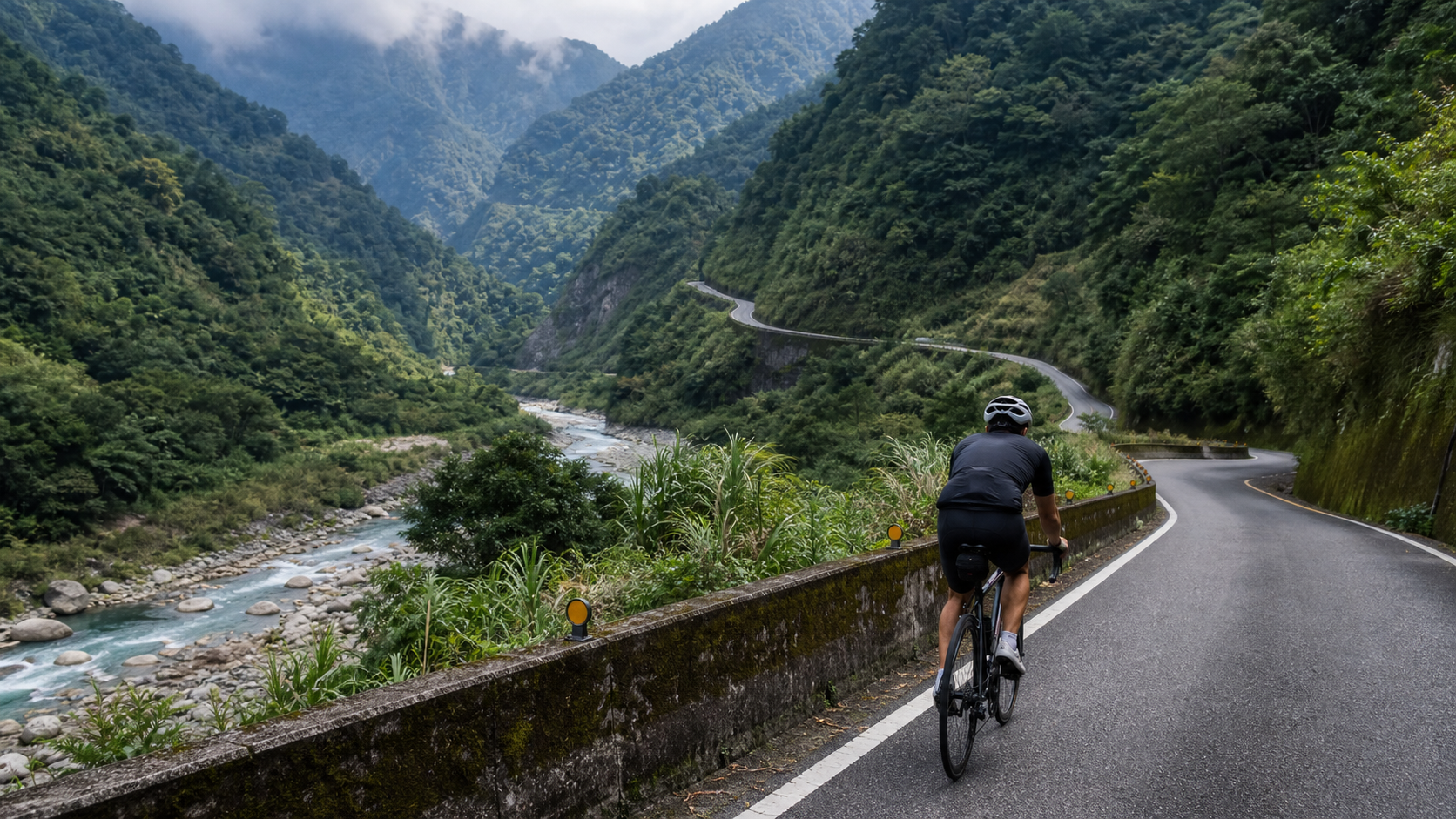
The starting point of the Fushan Tribe route typically connects to the industrial roads around Wulai’s urban area, heading upstream along the Nanshi River valley, with the endpoint reaching the settlement area where Fushan Tribe is located. The most distinctive terrain feature of this route is that it almost entirely “follows the valley’s contour lines”—unlike Baocing Temple, which climbs directly toward a mountain peak, the Fushan Tribe route more closely resembles following the river’s natural gradient, climbing slowly and circuitously to the tribal settlement upstream.
This “river-tracing” route design presents several characteristics in grade distribution: first, the overall average grade is indeed low, because the natural gradient of valley terrain isn’t particularly steep; second, there are multiple short undulating sections created by terrain transitions along the way—where protruding cliff faces force the road to detour upward, and where river bends may cause the road to briefly cut downward before rising again; third, some sections may cross bridges over tributaries, and bridges are typically accompanied by small climbs and descents before and after.
It’s worth emphasizing that this phenomenon of “average grade numbers being diluted by terrain undulations” is not unique to Fushan Tribe—it’s a common characteristic of all forest-road-type routes that wind along valleys and contour lines. Once you understand this principle, whenever you encounter any long-distance route with a “seemingly gentle average grade” in the future, you should develop the habit of verifying whether the ratio of total elevation gain to distance is reasonable, rather than judging route difficulty based solely on the average grade figure. This is a data literacy that every rider who takes training planning seriously should develop.
Conceptually, the 14.36-kilometer route can be divided into four sections for understanding: the initial gentle climb (approximately 0–4 km), climbing gently along the valley with grades mostly between 1–2%; the middle undulating section (approximately 4–9 km), which is where the bulk of total elevation gain accumulates, with grades fluctuating repeatedly across short stretches and occasional short steep pitches interspersed; the deep-mountain transition section (approximately 9–12 km), where as elevation gradually increases, tree cover expands, grades tend to moderate but still retain a sense of undulation; the arrival section (approximately 12–14.36 km), approaching the Fushan Tribe settlement, where the route gradually levels out, and the final stretch may even include a short descent into the core of the settlement.
Section-by-Section Pacing Guide: The Rhythm Management Philosophy of a Long, Gentle Climb
Unlike a “short-distance, high-intensity” climbing route like Baocing Temple, Fushan Tribe is a classic “long-distance endurance” route, and the core logic of pacing strategy is completely different—what matters here isn’t instantaneous power output, but whether you can maintain a steady, sustainable rhythm across 14.36 kilometers, avoiding the trap of fading in the latter half or exhausting yourself prematurely because you ignored the middle-section undulations.
Initial gentle climb (0–4 km): This section has a mild grade, making it well-suited for riding at a pace slightly above your flat-road cruising speed. Heart rate is recommended to be controlled at approximately 70–78% of LTHR, which is the Zone 2 range. The most important task at this stage isn’t chasing speed—it’s “calibrating your terrain expectations for this route”—because with an average grade of only 1.4%, many riders intuitively want to use a flat-road high-cadence, big-gear riding style to power through from start to finish. But this riding style will leave you without reserves when facing the middle-section undulations. It’s recommended to set your rhythm from the very beginning with an “endurance ride” mindset, positioning this ride as a marathon rather than a sprint.
Middle undulating section (4–9 km): This is the section of the entire route that demands the most focus, because grades fluctuate repeatedly over short distances, rising and falling unpredictably. If you don’t anticipate terrain changes in advance, you can easily be caught off guard when a short steep pitch appears, forcing you to grind through with less-than-ideal gearing. It’s recommended to adopt a “dynamic gear management” strategy in this section—maintaining constant awareness to shift gears quickly, dropping one to two gears the moment the grade rises to avoid a sudden cadence collapse; and when encountering short descents or flat stretches, moderately increasing the gear to maintain cruising efficiency. Heart rate is recommended to be controlled between the upper end of Zone 3 and the lower end of Zone 4 (80–88% of LTHR). This intensity is sufficient to handle the intermittent load of undulating terrain without burning out too early.
Deep-mountain transition section (9–12 km): As elevation increases and tree cover expands, the terrain in this section typically moderates, making it an important interval for recovering rhythm, replenishing fluids, and taking a mental breather. It’s recommended to ease heart rate back to between Zone 2 and Zone 3, giving your body a chance to recover from the load of the middle-section undulations and reserving energy stores for the final arrival section.
Arrival section (12–14.36 km): Approaching the Fushan Tribe settlement, the route gradually levels out and may even include a short descent. This section can be ridden at a relatively relaxed pace while starting to take in the changing scenery—after tracing the river upstream, the views typically begin to open up here, and the architectural outlines of the tribal settlement gradually emerge at the end of the valley. This is also the most fitting stretch of the entire ride to slow down and fully savor the joy of arrival.
Gear Ratio and Equipment Recommendations: Configuration Logic for a Gentle-Grade Forest Road
A long-distance, gently undulating route like Fushan Tribe has a fundamentally different gear ratio requirement logic than a short, steep route like Baocing Temple. Because grades are mostly gentle for the majority of the time, an overly lightweight climbing gear configuration will actually sacrifice cruising efficiency; however, the occasional short steep pitches in the middle undulating section still require sufficient gear headroom to handle. This is a configuration challenge that requires finding a balance between “cruising efficiency” and “climbing headroom.”
| Rider Level | Recommended Chainring/Cassette | Notes |
|---|---|---|
| Advanced/Racing | Front 50/34, Rear 11-28 | Balances long-distance cruising efficiency with responsiveness to middle-section undulations |
| General Club Level | Front 50/34, Rear 11-30 | Standard configuration is sufficient for the full range of terrain changes |
| Beginner/Endurance-First | Front 46/30, Rear 11-32 or wider | Prioritizes comfort and knee protection over long-distance riding |
Beyond gear ratios, long-distance riding places greater emphasis on saddle comfort and riding position adjustment. A continuous riding time of 14.36 kilometers typically exceeds 40 minutes, and the pressure on the saddle contact area, as well as the load on wrists and shoulders, will be more pronounced than on a short, steep climb. It’s recommended to periodically change hand positions on the handlebar (alternating between tops, drops, and hoods) during the ride, and to briefly stand up and stretch on flatter sections to avoid localized soreness from maintaining a fixed position for extended periods.
Nutrition, Hydration, and Weather/Season Considerations
With 14.36 kilometers, an estimated riding time of over 40 minutes, and the intermittent load from undulating terrain along the way, the nutrition strategy needs more careful planning than a short, steep route. It’s recommended to complete a full meal 1 to 2 hours before departure, add an extra portable snack (energy bar or banana) before setting off, and during the ride—especially after entering the deep-mountain transition section—replenish fluids and electrolytes moderately to avoid electrolyte imbalance from prolonged sweating.
Bottle capacity should be at least 750 ml. During the hot, humid summer season, it’s recommended to carry two bottles or use a hydration pack, because most of the Fushan Tribe route lies in tree-covered valley terrain where humidity tends to be high, and the perceived mugginess may be more pronounced than on open sections, with correspondingly higher sweat output. Since the route traces the Nanshi River upstream into the deep mountain interior, resupply points along the way are relatively scarce. Be sure to confirm that your water and portable food supplies are sufficient before departure—don’t expect to be able to resupply at any point along the way.
Regarding weather, Fushan Tribe is located deeper in the Wulai mountain area, where microclimate changes can be more dramatic than in urban areas. The mountains are prone to fog, and the chance of afternoon thunderstorms is not low. Additionally, the river-tracing terrain means many sections run adjacent to valley slopes, so slippery roads after rain and the risk of falling rocks require special attention. It’s recommended to plan your departure on a clear, stable day, avoid periods with typhoon or heavy rain warnings, and always check real-time weather and road conditions before setting out. If necessary, confirm road accessibility with local tribal members or relevant authorities.
Common Mistakes and Risks: Misjudgment Caused by the Average Grade Figure
The biggest risk on the Fushan Tribe route isn’t actually the difficulty of the terrain itself—it’s the psychological misdirection created by the “1.4% average grade” figure. Here are several common mistake patterns:
Planning the entire ride’s pace with a flat-road mindset: Many riders see the 1.4% average grade and intuitively assume this is a route where they can maintain high-speed cruising the whole way. They start riding at near-flat-road cruising intensity from the very beginning, overlooking the additional intermittent load from the middle-section undulations, leading to energy depletion and noticeable speed drops in the latter half.
Overlooking nutrition planning for a long distance: Short, steep routes (like Baocing Temple) typically don’t require mid-ride refueling, but on a 14.36-kilometer long-distance ride, insufficient preparation can easily lead to energy depletion in the latter stages—another common planning blind spot for beginners.
Underestimating the psychological burden of undulating terrain: Continuous small undulations, while none individually steep, involve repeated acceleration/deceleration and gear changes that consume more mental focus than you might expect. For riders accustomed to long flat-road cruising who lack experience on undulating terrain, this “constantly needing to react” riding pattern can easily cause additional mental fatigue.
Underestimating the scarcity of resupply deep in the mountains: Fushan Tribe is located deep in the Wulai mountain interior, where convenience stores or resupply points along the way are relatively scarce. Without proper pre-ride nutrition planning, you may find yourself in the predicament of running low on both energy and water on the return trip.
Reasonable Target Times for Riders of Different Levels
The following time ranges are also reference values estimated based on general riding experience. Actual performance will vary depending on fitness level, wind conditions of the day, temperature, and humidity—these are provided solely as training planning references:
| Rider Level | Reasonable Target Time | Average Speed Equivalent |
|---|---|---|
| Competitive/Pro Level | Approximately 28–35 minutes | Approximately 24.6–30.8 km/h |
| Advanced Club Level | Approximately 38–48 minutes | Approximately 17.9–22.7 km/h |
| General Recreational Rider | Approximately 50–65 minutes | Approximately 13.3–17.2 km/h |
| Beginner/First Attempt, Including Stops for Photos | Approximately 65 minutes or more | Depends on individual condition and stop time |
It’s worth noting that because the Fushan Tribe route offers rich scenery along the way and passes through an indigenous tribal cultural area, many riders voluntarily slow down and make multiple stops for photos or rest. As such, “completion time” carries more flexibility in meaning for this route than for a pure climbing training route like Baocing Temple—treating it as a ride that combines training and exploration may be more true to the essence of this route than purely chasing a timed result.
Return Trip and Overall Itinerary Planning Recommendations
Fushan Tribe is located deep in the mountain interior, and most riders complete the entire outing by retracing the same route back. The round-trip total distance is close to 29 kilometers, and when adding the initial connection distance from Wulai’s urban area, the actual one-day itinerary mileage typically falls between 35 and 50 kilometers. Be sure to factor the return trip into your energy and time planning to avoid the risk of riding mountain roads in a fatigued state because you overexerted yourself on the way out.
It’s recommended to schedule Fushan Tribe as an earlier departure in the day when planning your itinerary, leaving ample time to accommodate potential rest, photo, and refueling needs along the way, and to be sure to complete the return trip before dark to avoid the visibility and safety risks of nighttime mountain riding. If energy and time permit, you might also consider linking Fushan Tribe with attractions around Wulai’s urban area (such as the old street or hot springs) into a one-day itinerary, giving this deep-mountain riding experience the dual value of both training intensity and tourism exploration.
Advanced Training Applications: Using Fushan Tribe as a Training Ground for Endurance Riding
For riders preparing for long-distance road races or self-organized long-distance challenges (such as island circumnavigation or cross-county endurance rides), the Fushan Tribe route is actually a highly suitable endurance training venue. Its value doesn’t lie in the intensity test of a single grade, but in simulating the real-world scenario of “continuously adapting to terrain changes” during long-distance riding—a capability that is difficult to train effectively on flat training grounds or single-grade climbing routes, yet is an extremely important physical and mental quality for long-distance riding.
For specific training applications, you can reference the “Tempo Ride” training framework: maintain Zone 3 intensity as the primary target range for the entire ride, allow heart rate to briefly fluctuate into Zone 4 during the middle undulating section, but require it to quickly settle back into the target range on the next flat stretch. This trains your cardiorespiratory system’s “recovery speed”—a capability that has a direct impact on performance in long-distance endurance events (such as 100K+ road races or periodic off-road challenges). After each training session, it’s recommended to record overall average heart rate, maximum heart rate, and the time taken to recover to the target range as quantitative indicators for tracking progress in cardiorespiratory recovery.
Additionally, because this route features frequent terrain undulations, it’s also well-suited for training “terrain anticipation ability”—that is, by observing the road’s direction ahead and changes in the surrounding landscape, anticipating upcoming grade changes and adjusting gears and pedaling rhythm in advance, rather than passively reacting only after the grade has actually changed. This anticipatory ability will be an important hidden skill for future challenges on longer, more complex terrain in off-road or long-distance road routes, and is worth deliberately practicing through repeated rides on terrain-rich routes like Fushan Tribe.
Equipment Checklist: Pre-Ride Preparation for a Long-Distance River-Tracing Forest Road
Compared to short, steep routes, a long-distance route deep in the mountain interior like Fushan Tribe demands more rigorous pre-ride equipment checks, because if a mechanical failure or energy depletion occurs mid-ride, the distance and time cost of turning back is far greater than on a short route. Below is a pre-ride checklist:
- Tire pressure and spare tubes: For long-distance mountain riding, it’s recommended to carry at least one spare inner tube and tire repair tools. Mountain roads occasionally have potholes hidden by gravel or fallen leaves, and the risk of flats is slightly higher than on urban roads.
- Brake system: Confirm brake pad thickness and braking power. Especially considering that by the return trip your energy will be largely spent, the reliability of the brake system directly affects descent safety.
- Drivetrain and chain maintenance: Long-distance riding places higher frequency demands on the drivetrain. It’s recommended to confirm chain lubrication and shifting responsiveness before departure.
- Sufficient supplies: Because the route goes deep into the mountain interior with scarce resupply points, water bottles and portable food should be planned based on the “entire round trip,” not just the one-way requirement.
- Phone battery and offline maps: Some sections in the mountains may have unstable signal. It’s recommended to download offline maps and ensure sufficient phone battery, carrying a power bank if necessary.
- Lights and reflective gear: Even if you plan to ride out and back during daylight, it’s recommended to carry basic lights in case of itinerary delays or weather changes causing insufficient light.
- Warm layers and rain gear: Mountain weather can change quickly in the afternoon. It’s recommended to carry a lightweight windbreaker or rain gear to handle sudden temperature drops or rainfall.
This checklist is specifically designed for routes like Fushan Tribe that are characterized by “deep mountain access, scarce resupply, and long round-trip distances.” Spending ten minutes on a pre-ride check before departure can significantly reduce the risk of being forced to turn back early or getting into trouble due to equipment oversights.
Conclusion: Reading the Language of Terrain Behind the Data
The most valuable insight from the Fushan Tribe route isn’t any specific pacing number or gear ratio recommendation—it’s learning to read the language of terrain revealed by the gap between “1.4% average grade” and “291.6 meters of total elevation gain.” It tells you that this is not a route that can be handled start to finish with a single rhythm, but rather a river-tracing forest road that demands vigilance, dynamic adjustment, and respect for the discipline of long-distance endurance riding. Master the section-by-section pacing strategy, pack sufficient supplies, and reserve energy for the return trip, and you’ll discover that this 14.36-kilometer route is one of the rare routes in the Greater Taipei area that can deliver both training intensity and deep-mountain exploration value.
Finally, a reminder to every rider preparing to take on this route: Fushan Tribe is the traditional living territory of the Atayal indigenous people. When passing through tribal settlements along the way, please maintain appropriate riding etiquette and keep noise levels down to avoid disturbing the daily lives of local residents. It’s also recommended to check in advance whether the road has any restricted hours or special considerations, completing this deep-mountain riding challenge in a way that respects the local community. Read the data, prepare your equipment, and set the right mindset—what the Fushan Tribe route will give back to you is a riding experience far richer than mere climbing numbers: a deep-mountain road that can only truly be ridden by those who bring patience, focus, and respect.
Related Reading
- Riding Along the Nanshi River to a Cloudtop Tribe: The 14.4 km River-Tracing Road to Fushan
- Tonghou Forest Road Practical Guide: The Real Terrain Interpretation Behind 12.07 km and a 1.8% Average Grade
- Lushan Mountain Practical Guide: 6.89 km, 546.2 Meters of Climbing, 7.9% Average Grade—Are You Ready for This Hardman’s Long Climb in the Wulai Mountains
- Lushan Yunlong Bridge Climbing Provincial Highway 14 to the 12.23K Finish Line: Pacing Discipline and Gear Ratio Breakdown for a 4.4% Average Grade
台北闊瀨陡坡 騎旅 / 日本單車雜誌編輯車友臨時加入!/ 髮香才是最強的 / feat. 北迴歸線小隊 / 公路車 CT Yeh
6 個月前
單車 梅山36灣 坡度介紹 路段介紹 空拍 (相關遊記影片,請參考說明或我的頻道喔,歡迎訂閱)
6 年前
新竹羅平 x 天湖部落 大禹嶺級變態陡坡! 4K超高畫質 空拍 | 公路車
5 年前
2016 彰化經典百K - 74號爬坡全程
10 年前
半日 小台灣 極限單車路線挑戰實錄
7 年前
萬年峽谷! 30% 超激陡坡 里佳部落DAY2 還是很硬! | 公路車 | CT Yeh
3 年前
大武山後門26%歡樂陡坡!JJSC南台灣單車行Day2 / 被颱風追著跑 / 公路車 / CT Yeh
2 年前
藤枝二集團 單車行 Day1 | 南部小武嶺 | 爬坡爬到罵罵叫 | JJSC | 公路車 | CT Yeh
3 年前