Maokong Zhinan Temple Practical Guide: Complete Breakdown of Taipei's Classic Intermediate Climb — 6.93 km, 388 m Elevation Gain, 5.6% Average Gradient
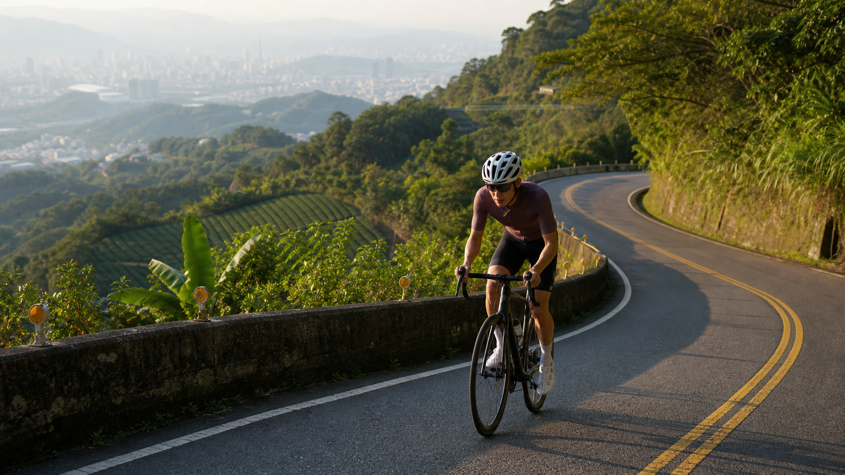
Cat Kong Zhinan Temple Practical Guide: Complete Analysis of Taipei’s Classic Intermediate Climb — 6.93 km, 388 m Elevation Gain, 5.6% Average Gradient
Starting from Shenkeng District and climbing all the way into the tea hills of Muzha in Wenshan District, this route is widely recognized in Taipei’s cycling community as the “entry-level pilgrimage climb” — not particularly long, not outrageously steep, yet demanding enough to expose the limits of your lungs and legs in plain daylight. Today we skip the scenery and the history; we talk only data, tactics, and equipment, breaking this 6.93 km, 388 m elevation gain, 5.6% average gradient route down as an engineering problem.
Route Overview and Real Data Analysis
Let’s lay the numbers out first. This route is officially registered as Strava segment 782516, starting in Shenkeng District and ending near Zhinan Temple in Wenshan District, with a total length of 6.93 km, total elevation gain of 388 m, and an average gradient of 5.6%. Looking at the 5.6% average alone, many would think, “that’s just a gentle slope,” but the average gradient is calculated by spreading the total elevation gain evenly across the entire route — the actual feel on the road is nowhere near as mild as a steady 5.6% throughout.
Almost all mountain roads in the Taipei suburbs share a common gradient distribution pattern: the early section typically features a warm-up stretch of gentle climbing, keeping both body and equipment in “warm-up mode”; the middle section then delivers continuous gradient increases, which is where aerobic capacity and pedaling efficiency are truly tested; the latter section then tightens up depending on the terrain, sometimes offering brief flatter stretches or even short descents to let riders catch their breath before facing the final push. The Cat Kong Zhinan Temple route roughly follows this distribution logic — the overall 5.6% average means the entire ride sits within the “demanding but sustainable” zone, unlike the short, punchy pain of the Ju Ming Museum climb (11.9% average) or the prolonged grind of Zhulu Mountain (7.9% average). Instead, it falls between the two — a mid-distance climb that rewards “steady pacing.”
Compared against the gradient spectrum of well-known climbs across the Taipei suburbs, Cat Kong Zhinan Temple is positioned as relatively friendly: it won’t force you out of the saddle on 10%+ ramps like certain sections of Yangjin Highway, but it’s certainly not a flat warm-up like the riverside bike paths. Converting 388 m of elevation gain over 6.93 km, that’s roughly 56 m of climbing per kilometer — a figure that, within the hilly terrain surrounding the Taipei Basin, qualifies as a typical “suburban mountain fitness training route,” well suited as a climbing endurance training milestone before half or full road races.
One thing worth noting: the endpoint of this route sits near the Muzha Gondola Taipei Zoo Station and the Zhinan Temple area, where elevation has already risen considerably — meaning that before you reach the finish, your body has been switching between oxygen debt and aerobic energy supply for a substantial period. This “mid-distance, mid-intensity” climbing profile is actually the ideal type of route for testing your FTP (Functional Threshold Power) and sustained output stability, because it forces you to ride the entire distance at a “sustainable” power output rather than relying on short bursts of explosive strength.
Let’s further break down what the gradient distribution means. If we compare the 5.6% average against internationally recognized climb categorization systems — such as the HC (Hors Categorie), Category 1, 2, 3, and 4 logic used in the Tour de France — this route typically falls between “Category 3 and Category 4,” meaning it’s at a level that “offers training value without intimidating the average rider.” This is precisely why the route is frequently used by Taipei cycling clubs and training groups as a “climbing entry test segment” — its difficulty curve happens to sit right at the sweet spot where “beginners can grind through it with grit, and experienced riders find it easy yet still beneficial for training.”
From a power perspective, assuming a 70 kg rider aiming to complete this 6.93 km, 388 m elevation gain route in around 20 minutes, the estimated climbing power required would be roughly 2.8 to 3.2 watts per kilogram — a range already approaching the threshold power of amateur club-level riders. This means that while the route isn’t long, producing a “good” time still demands a certain level of fitness and training foundation. Conversely, if you approach it with a training-and-experience mindset and ride at a pace you can sustain, the route is actually highly accessible — which is exactly why it has remained popular for years and is widely recommended to advanced beginners.
Segment-by-Segment Strategy: From the Shenkeng Start to the Zhinan Temple Finish
Breaking the 6.93 km down into psychological and physiological phases will serve you better than staring at the mileage.
Phase 1: The warm-up climb from the Shenkeng start. No route with a 5.6% average gradient is going to flatten you right out of the gate. For the first 1 to 2 km, deliberately keep your heart rate around 70% to 75% of your maximum — the so-called “Zone 2 to Zone 3 boundary.” The goal in this phase is not to test your limits but to gradually bring your muscles and cardiorespiratory system up to working temperature and to warm up your lactate clearance mechanisms. The most common mistake riders make here is seeing a moderate gradient and charging ahead, only to run out of fuel later — this is the classic pacing trap on mid-distance climbs of this type.
Phase 2: The rhythm battle of the continuous middle-section climb. As the route enters the middle section and the gradient begins to shift in more sustained patterns, this is the stretch that most tests your “pedaling rhythm.” Keep your cadence between 85 and 95 rpm, and avoid grinding an overly heavy gear, which will cause premature lactate buildup in your quadriceps. The recommended strategy here is “seated as the primary, standing as the supplement” — seated pedaling maintains energy efficiency over longer periods, while standing out of the saddle is reserved for brief sections where the gradient spikes suddenly, allowing you to redistribute muscle fatigue and engage a different set of muscles.
Phase 3: The psychological endurance period of the mid-to-late section. This is the stretch where any mid-to-long climb triggers the strongest “mental surrender” signals — the body is already fatigued, yet the finish line is still out of sight. In this phase, shift your focus from “how much farther” to “maintain power output,” using your bike computer or power meter to lock onto your target zone rather than watching the remaining distance number drain your morale. Your heart rate will naturally climb toward your threshold HR around this point — that’s a normal physiological response, so don’t panic and slow down excessively, but also avoid pushing too far beyond your sustainable power zone, or you risk “blowing up” in the final stretch.
Phase 4: The closing segment into Wenshan District, approaching the Zhinan Temple area. As elevation gradually builds toward the finish, the terrain around the Muzha hills begins to show the characteristic rolling contours of tea-growing hills. The strategy for this phase is a “measured final push” — if you paced well in the earlier sections and still have energy in reserve, you can try lifting your output slightly in the final kilometer to savor the satisfaction of crossing the line; but if you’ve already spent your reserves, this phase should be about honestly holding a cruising pace and prioritizing finishing the ride above all else. After all, this is a route that balances training and pilgrimage — there’s no need to go all-out every time.
It’s worth adding that the psychological transitions between these four phases are often harder to manage than the physical load itself. Many riders feel confident during the Phase 1 warm-up, thinking “this climb is nothing,” only to realize in the middle of Phase 2’s sustained climbing that their pacing judgment was off. I recommend setting segment goals before you ride — for example, mentally dividing the route into “first third warm-up, middle third rhythm maintenance, final third endurance and closing” — and using the lap timing function on your bike computer to verify whether you’re executing the plan. This habit of “pre-race pacing mental rehearsal” is a practical technique many seasoned climbers use to combat mid-to-late mental fatigue, and it’s well worth adopting for amateur riders.
Additionally, since this route starts in Shenkeng and ends near the Zhinan Temple area in Wenshan District, the entire route crosses administrative boundaries on mountain roads, meaning pavement quality, corner curvature, and shoulder width may vary by section. Before attempting a serious pacing effort or chasing a personal record, I recommend riding the route once at a sightseeing pace to familiarize yourself with the conditions, noting the locations of corners and gradient transition points, so you don’t have to make dangerous braking or avoidance maneuvers at full effort due to unfamiliarity. This is especially important on the Muzha-area sections, where hikers and other recreational riders often share the road on weekends — safety always comes before results.
Gear Ratio and Equipment Recommendations
With an average grade of 5.6% and a maximum elevation gain of 388 meters, most amateur riders can handle this route with standard road bike gearing (e.g., 50/34 chainrings paired with an 11-28 or 11-32 cassette). However, gear ratio selection will still directly affect your fatigue curve and overall ride quality.
| Rider Level | Recommended Gear Setup | Notes |
|---|---|---|
| Beginner / Limited climbing experience | 34T small chainring + 28T or 32T large cog | Prioritize maintaining a cadence above 80 rpm to avoid over-relying on raw leg strength |
| Intermediate / Some climbing mileage | 34T small chainring + 25T or 28T cassette | Balances efficiency and rhythm, suitable for those with a basic aerobic base |
| Advanced / Chasing performance | 36T or 39T small chainring + 25T cassette | Heavier gearing, suited for riders with stable power output and consistent pacing |
Regarding wheelsets, this type of mid-distance climbing route doesn’t demand ultra-lightweight climbing wheels. General training aluminum rims or entry-level carbon wheels are more than sufficient. What you should actually prioritize investing in is tire rolling resistance and grip—mountain roads occasionally have fallen leaves, wet patches, or loose gravel. A tire width of 25c or wider, with tire pressure not set too high, is recommended to balance rolling efficiency and cornering safety.
For clothing, since the route’s endpoint is already at a considerable elevation, temperature differences between morning and evening exist even in Taipei Basin summers. It’s recommended to carry a lightweight windbreaker or arm warmers, especially for riders planning to linger around Maokong after finishing to cool down—pay attention to staying warm to avoid catching a chill.
Beyond gearing and wheels, fine-tuning your frame geometry and saddle height also significantly impacts pedaling efficiency on this type of mid-distance climb. When climbing seated for extended periods, improper saddle height (too low causes excessive knee joint stress; too high makes your hips slide on the saddle, compromising power transfer) can turn sections that should be manageable into a struggle. Before tackling this route, take time to confirm your riding position suits prolonged climbing output. If necessary, consider professional Bike Fitting services for adjustments—this investment is well worth it for riders who frequently challenge mountain routes.
Bike weight distribution is another often-overlooked factor. Climbing routes are relatively sensitive to total bike weight. If you’re used to carrying heavier tool kits, pumps, spare tubes, and other gear, consider trimming down carried items on days specifically targeting a personal best. However, always keep basic tire repair tools and electrolyte supplies—safety and ride completion always trump setting new personal records, especially since cell phone reception along this mountain route can be unreliable. Getting a flat halfway up the mountain alone with no way to call for help would be a miserable situation.
Nutrition and Hydration Management
For a 6.93 km climb averaging 5.6%, most riders will finish in roughly 25 to 50 minutes (highly dependent on individual fitness and pacing strategy—a tiered target time table appears later). This duration falls within the “short-to-mid distance, high intensity” energy metabolism zone. Nutrition strategy doesn’t need to be as complex as for long-distance endurance events, but a few principles are worth noting:
- Before the ride: Finish a proper meal 1 to 2 hours before departure to avoid starting on an empty stomach and hitting hypoglycemia mid-ride, while also avoiding overeating that could cause gastrointestinal discomfort and hinder climbing performance.
- During the ride: For this distance, most riders don’t actually need solid food mid-ride, but hydration remains important—take small sips every 15 to 20 minutes. Taiwan’s humid, hot climate means sweat loss can exceed expectations even on shorter climbs.
- Electrolytes: In summer, add electrolyte supplements to your bottles to prevent sodium and potassium depletion from heavy sweating, which can cause cramping. The steeper middle section is the most common point for leg cramps.
- After the ride: After finishing near Zhinan Temple, the Maokong area is itself a renowned tea region. Many riders choose to stop there to replenish fluids and calories—this is one of the route’s biggest advantages over other pure mountain training climbs: clear options for refueling and rest after finishing.
Weather and Seasonal Considerations
The weather patterns in the mountains surrounding the Taipei Basin significantly impact this type of climbing route. Afternoon convective thunderstorms are the most common weather risk in Taipei’s mountain areas during summer. It’s recommended to start in the cooler morning or evening hours and keep a close eye on weather forecasts, avoiding heading up the mountain during thunderstorm warnings—wet roads combined with poor visibility substantially increase crash risk.
In winter and spring, watch for the cold, damp conditions and fog brought by the northeast monsoon. While Maokong’s elevation isn’t particularly high, the mountain humidity is heavy. Poor visibility can throw off braking distance judgment on descents—slow down and leave extra braking margin.
Regardless of season, avoid riding this mountain route immediately before or after typhoons or heavy rain. Mountain roads carry risks of falling rocks, standing water, or unstable roadbeds. Safety should always come before completing a ride.
Common Mistakes and DNF Risks
Even on a relatively forgiving 5.6% average grade, several common riding errors can cause riders to abandon mid-ride (DNF) or have a significantly diminished experience:
- Pacing too hard in the early section: This is the most common mistake. Seeing that the grade percentage isn’t extreme, riders sprint off the start with a flat-road mentality, only to have lactate accumulate too quickly mid-climb, forcing a drastic slowdown or even dismounting and walking.
- Incorrect gear selection: Less experienced riders often hesitate to use easier gears, worried it looks “weak.” The result is grinding a gear that’s too heavy the entire way, placing excessive stress on knees and muscles, leading to cramps or knee discomfort later on.
- Neglecting hydration timing: Many assume a short climb doesn’t require special attention to drinking. Starting dehydrated or underestimating sweat loss leads to dizziness, weakness, and other hypovolemia symptoms in the latter half.
- Excessively high tire pressure: Mountain roads have occasional potholes, fallen leaves, or slick sections. While higher pressure offers marginally lower rolling resistance, it reduces grip and comfort, increasing crash risk.
- Ignoring weather changes: Taipei mountain weather can change on a dime. Without carrying a lightweight rain jacket or windbreaker, an afternoon thunderstorm or fog can turn a training ride into an ordeal—or worse, a safety hazard.
Beyond these five core errors, there’s another easily overlooked detail—braking strategy on the descent. Many riders focus entirely on “how to get up,” forgetting that after finishing, they typically need to descend via the same or another route. Mountain roads have numerous curves and varying gradients. If you carry insufficient focus into the descent after the tension of climbing, or use brakes improperly with prolonged engagement causing overheated brake pads and reduced stopping power, danger can result. On descents, use “intermittent braking” rather than “continuous hard braking” to give the braking system time to cool. Always watch for oncoming traffic and road conditions—especially on weekends when Maokong attracts tourists and slower riders. Keep descent speeds within a range where you can react safely.
Target Time Reference by Rider Level
The following times are for reference only. Actual performance varies with individual fitness, weather conditions, and carried load (whether bringing supplies, etc.):
| Rider Level | Estimated Finish Time | Characteristics |
|---|---|---|
| Recreational rider (occasional cycling) | 45–60 minutes | Completes at cruising pace, may rest 1–2 times |
| Regular training rider | 30–45 minutes | Has a basic aerobic base, maintains steady rhythm without stopping |
| Advanced club rider | 22–30 minutes | Has a decent FTP level, sustains moderate-to-high intensity throughout |
| Competitive-level rider | 18–22 minutes | Excellent power-to-weight ratio for climbing, rides near threshold the entire way |
This route is ideal as a “regular checkup” segment for climbing ability—repeat it under similar weather and time-of-day conditions, and objectively track your climbing progress through changes in finish time, heart rate, and power data. It’s not as brutally hard as Zhulu Mountain, which intimidates most amateur riders, nor as short as the Juming Museum climb, which tests only explosive power. This 6.93 km road to Maokong’s Zhinan Temple tests the most basic yet most important abilities—steady output and pacing discipline. These are precisely the foundation for all longer, harder climbs.
Advice for Readers with Different Goals
If you are a beginner just starting out with climbing training, this route is an excellent entry-level choice—the distance is short, the gradient is friendly, and after finishing you can rest and refuel at the Maokong tea area, making the overall experience far more complete than a purely training-focused climb.
If you are an intermediate rider with some foundation, preparing for long-distance road events (such as the Wuling Challenge or a round-island route), you can incorporate this route into your weekly training plan as a fixed segment for tempo training, using repeated rides to calibrate your power output and pacing intuition.
If you are an advanced or competitive rider chasing results and targeting the Strava leaderboard, although this route’s average gradient is not the toughest, its 6.93 km length is enough to separate true ability—pure explosive power alone won’t cut it here. Only with excellent threshold power and pacing discipline can you post a strong time on Strava segment 782516.
No matter which type of rider you are, the Maokong Zhinan Temple route deserves a place on your shortlist—it is one of the few intermediate climbs in the Taipei suburbs that combines training value with convenient post-ride refueling, and it is the most honest mirror before moving on to harder challenges.
Training Periodization Recommendations
If you plan to incorporate this route into a long-term training plan, it is recommended to arrange frequency and intensity according to the logic of periodized training, rather than going all-out to challenge your personal record every time. Generally speaking, a mid-distance climbing route is well suited to planning across three phases: “Base Phase,” “Build Phase,” and “Peak Phase”:
Base Phase (6 to 8 weeks before the season): Focus on building aerobic endurance. Ride the full route at moderate-to-low intensity, with emphasis on maintaining a steady cadence and controlled breathing. Keep your heart rate mostly between Zone 2 and Zone 3. The goal is to build your aerobic metabolic foundation, not to chase speed.
Build Phase (3 to 4 weeks before the season): This is the stage where you can begin adding tempo and threshold intensity intervals. For example, split this route into two or three segments, ride each segment at an intensity close to threshold heart rate, and recover with easy riding between segments, thereby simulating the repeated high-intensity output demands of a long-distance race.
Peak Phase (1 to 2 weeks before the event): This stage should focus on maintaining form and avoiding overtraining. You can use one all-out effort to test your training results against your personal best, but avoid scheduling too many high-intensity climbing sessions before the event, so your body has time to recover and your performance on race or challenge day is not compromised.
Through this kind of periodized arrangement, the Maokong Zhinan Temple route can be transformed from a mere “one-off challenge” into a fixed test segment for tracking the long-term progression of your climbing ability. This is also why many well-trained club riders repeatedly use specific climbing routes as their “personal power meter” over the long term.
Related Reading
- Jinguashi Jinshui Highway Practical Guide: Complete Segment Analysis of 4.84 km at 6.3% Average Gradient
- Maokong Zhanghu Cross-Ridge Practical Guide: 4.17 km at 6.2% Average Gradient, Full Breakdown of the Tea Area Mountain Road
- Maokong Climbing Training Mecca: Complete Guide to Multiple Climbing Routes from Muzha to Maokong
- Taipei Muzha–Shenkeng–Maokong Triangle Route: The Perfect Combination of Suburban Climbing and Coffee Refueling
台北闊瀨陡坡 騎旅 / 日本單車雜誌編輯車友臨時加入!/ 髮香才是最強的 / feat. 北迴歸線小隊 / 公路車 CT Yeh
6 個月前
半日 小台灣 極限單車路線挑戰實錄
7 年前
那瑪夏x茶山 阿里山系深山單車行 Day2 累積爬升6000M | 🥶超陡連續下坡 整路看隊友刷 | 爬升一座西進武嶺 | JJSC | 公路車 | CT Yeh
3 年前
爬坡ITT實境)台中 魔王 松鼠坡 首航 6:12 大肚山 大三元 科福路
8 年前
大武山20%魔王陡坡【JJSC南台灣遊騎Day2】!屁股真的要裂開了...凡士林抹滿也沒用?神秘金教堂還有超便宜夜市
3 個月前
一定要騎一次!阿里山最深處:里佳部落!單車旅行 | 2800m爬升 | 深度部落體驗:嗨翻晚會、螢火蟲、銀河 | feat. JJSC & 廢物伙伴 | 公路車 CT Yeh
9 個月前
台灣登山王之路 KOM 全程參賽4K臨空錄影 PART1 穿越峽谷地形! #東進武嶺 太魯閣 / 燕子口 / 天祥 / 西寶 PART1 (公路車 / CT Yeh)
3 年前
大武山後門26%歡樂陡坡!JJSC南台灣單車行Day2 / 被颱風追著跑 / 公路車 / CT Yeh
2 年前