Yangjin Highway Xiaoyoukeng Practical Guide: 17.8 km, 793 m of Climbing — The Trial of Taipei's Backyard
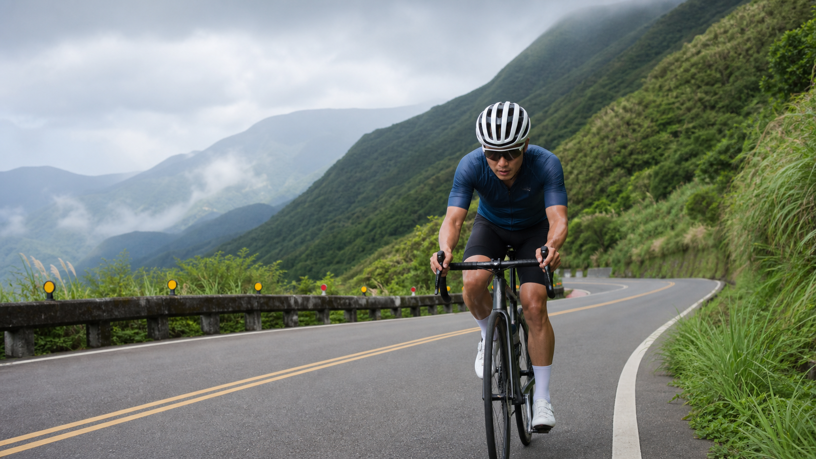
Yangjin Highway Xiaoyoukeng Practical Guide: 17.8 km, 793 m of Climbing in Taipei’s Backyard Test
Summary: Climbing from the Jinshan end of Yangjin Highway to Xiaoyoukeng, this route spans 17.8 km with 793 m of elevation gain and an average gradient of 4.4%, making it one of the most commonly used benchmark routes for Taipei cyclists. This article breaks down the gradient changes segment by segment with data, covers gear ratio setups and nutrition strategies, and provides realistic finish times for riders of different levels.
When it comes to the go-to list for “hill training” in the hills surrounding the Taipei Basin, Yangjin Highway always ranks near the top. Officially designated as Provincial Highway 2C, this road climbs from downtown Jinshan District all the way to the Xiaoyoukeng Visitor Center in Yangmingshan National Park—17.8 km in total length with 793 m of cumulative elevation gain and an average gradient of 4.4%. Compared against Strava records for this segment, it’s a mid-to-long climbing route that “won’t crush you, but won’t let you off easy either,” making it ideal as an early-season fitness benchmark and a regular fixture on northern cycling club weekend group rides.
Compared to HC-rated (Hors Catégorie, super-climb) routes like Wuling or Siyuan Pass, the Yangjin Highway Xiaoyoukeng segment averages only 4.4%, which means a standard road bike with a compact crankset (34/50T) paired with an 11-28T cassette can handle it—no MTB-level ultra-low gearing needed. But don’t let that lull you into complacency—the 17.8 km distance, combined with Taiwan’s humid summer heat and the fact that this stretch from Jinshan to Xiaoyoukeng offers almost no flat recovery sections, means the perceived fatigue will hit harder than the numbers suggest. Below, we break down the entire route segment by segment, complete with target times for riders of different abilities, so you can do your homework before heading out.
Route Overview and Real Data Analysis
Let’s lay out the hard numbers first. The Yangjin Highway Xiaoyoukeng start is typically set at the intersection near the harbor area in downtown Jinshan District, with the finish at the Xiaoyoukeng Visitor Center parking lot, at an elevation of roughly 805 m (the active fumarole field at Xiaoyoukeng itself sits around 800-810 m). The total climb is 793 m, meaning the Jinshan-side starting elevation is approximately 10-15 m—essentially climbing straight up from sea level.
| Item | Data |
|---|---|
| Total Distance | 17.8 km |
| Total Elevation Gain | 793 m |
| Average Gradient | 4.4% |
| Climb Category | Category 4 (per system classification, moderate-to-easy) |
| Start | Downtown Jinshan District |
| Finish | Xiaoyoukeng Visitor Center |
| Terrain Characteristics | Gentle start, continuous switchback climbing in the middle, easing finish |
An average gradient of 4.4% sounds mild, but the gradient distribution along this route is far from uniform. The first 5 km from the Jinshan start serve as a warm-up stretch, with gradients mostly holding at 2-3% to let your body ease into the effort; the middle section (roughly km 5-12) enters a series of continuous hairpin climbs where instantaneous gradients frequently spike to 6-8%—this is the hardest part of the entire route; over the final 5 km as you approach the Xiaoyoukeng Visitor Center, the gradient gradually eases back to around 3%, which should feel slightly more manageable—but by then your energy reserves are near their limit, and many riders actually lose the most speed on this “easier” stretch.
One thing to note: Yangjin Highway is a major arterial road connecting riders from the Taipei-Shuangbei area to Yangmingshan, Jinshan, and Wanli, so weekend traffic is substantial, especially with heavy motorcycles and passenger cars. Safety is always the top priority—ride on the right, stay alert through corners, and never cut across the centerline to save time.
Segment Strategy: Jinshan Start to Midway Point (0-7 km)
In the first few kilometers after departure, the road climbs gently along the outskirts of Jinshan’s urban area, with gradients hovering between 2-4%—this is the best warm-up opportunity of the entire climb. For this section, use a moderately light gear (e.g., 50x17 or 50x19) to maintain a steady cadence of 85-95 rpm, keeping your heart rate in Zone 2 to the low end of Zone 3 (roughly 70-80% of max HR). Whatever you do, don’t push too hard just because the early gradients are gentle—saving your legs for the continuous switchback section ahead is the smart pacing strategy.
Around the 3 km mark, you’ll pass through a short suburban settlement where the road narrows slightly—watch for parked cars and pedestrians on the roadside. After passing the settlement, the gradient begins to ramp up noticeably, entering the true “climbing feel” of Yangjin Highway. The surroundings gradually transition to forested mountain scenery, and the views open up as elevation increases; on clear days, you can look back and see the Jinshan Plain and coastline—a nice psychological reward point.
Around km 5-7, the gradient delivers its first significant surge, with instantaneous gradients potentially reaching 5-6%. For pacing, consider easing your cadence down to 80-85 rpm, trading a bit of efficiency for torque, while keeping your breathing rhythm steady to avoid burning through your anaerobic threshold early. This stage is critical in determining your performance in the latter half—many riders don’t fail on the steepest sections; they fail because they’ve spent their energy in the early-to-middle portion.
Segment Strategy: The Continuous Switchback Core (7-13 km)
From km 7 to km 13 lies the hardest core section of the entire Yangjin Highway Xiaoyoukeng climb—and the place where the gradient data is most “dishonest.” The 4.4% average is for the whole route, but the actual average gradient across these 6 km often sits around 6%, with some hairpin insides spiking momentarily to 8%. The continuous S-curves combined with tree canopy overhead limit visibility, so it’s advisable to slow your rhythm, hold a clean inside-outside line, and re-accelerate at corner exits rather than grinding away at a single cadence the whole way.
For gearing on this section, plan for at least a 34x25; if you’re less experienced at climbing or on the heavier side (over 75 kg), go straight to a 34x28 or even a 34x32 mountain cassette, keeping your cadence between 70-80 rpm to reduce strain on your knees and quadriceps. During Taiwan’s summer, Yangjin Highway often sees dense fog and localized showers around midday, and with the significant temperature difference in the mountains, even in the height of July, temperatures at the Xiaoyoukeng summit area can be 3-5°C lower than in downtown Jinshan—pack a lightweight windbreaker just in case.
Nutrition-wise, this 6 km core section is where your body starts sending clear fatigue signals. Aim to take in fluids every 15-20 minutes, paired with an electrolyte sports drink or salt tablets to prevent cramping from excessive sweating. There aren’t many shops along this stretch to stop for supplies, so make sure your bottles are topped off before you start, and finish any energy gels or bananas before entering this section.
Segment Strategy: The Final Stretch to Xiaoyoukeng (13-17.8 km)
After the 13 km mark, the gradient begins to ease, gradually dropping from around 6% back to 3-4%, and it feels like “finally, a bit of relief”—but this is precisely the trap zone where mistakes happen. Because the core climbing section has already depleted a large share of your glycogen stores and muscle strength, even with the gentler gradient, many riders find their actual pace slowing rather than picking up. At this point, focus on maintaining a steady cadence rather than slamming into a harder gear to sprint; it’s better to hold your cadence with a lighter gear than to muscle through with torque and risk cramping or bonking.
Near the 16 km mark, the views gradually open up, revealing Xiaoyoukeng’s distinctive barren landscape—due to ongoing volcanic activity beneath the ground, vegetation here is sparse and the surface takes on a yellowish tint, with a faint sulfur smell lingering in the air. This is the most iconic stretch of the entire route. Over the final 1.8 km, the gradient undulates mildly before arriving at the Xiaoyoukeng Visitor Center parking lot, which marks the finish. If time permits, I strongly recommend parking your bike and walking into the Xiaoyoukeng trail to observe the fumarole terrain up close—it’s a rare bonus beyond the ride itself.
The finish area parking lot has public restrooms and a water fountain, so you can rest here, refill your bottles, and then decide whether to descend back the way you came or continue on to another destination (such as riding on to the Jinshan Youth Activity Center or heading toward Lengshuikeng). On the descent, be sure to control your speed—Yangjin Highway has numerous corners and steep gradients, plus heavy holiday traffic, so never exceed safe speeds on the downhill for the sake of thrill.
Gear Ratio and Equipment Setup Recommendations
Given the route characteristics of an average gradient of 4.4% and a maximum instantaneous gradient of about 8%, a road bike paired with a compact crankset (50/34T) and an 11-28T cassette is the most versatile and foolproof setup. Riders with better fitness and regular climbing training can consider 50/34T paired with an 11-25T cassette to pursue higher pedaling efficiency; for casual riders or beginners just starting to practice climbing, it is recommended to go straight for a mountain cassette version with 34x28 or 34x32, allowing yourself to always have some reserve for the sudden steep sections in the continuous switchback segment.
Regarding wheelsets, this route does not require specially lightweight climbing rims. Mid-profile training wheels (such as 30-40mm) are more than sufficient. The key focus instead should be on tire grip and puncture resistance. The mountain sections of Yangjin Highway occasionally have falling rocks and gravel, so it is recommended to use 25-28C tires with a thicker puncture protection layer, with tire pressure adjusted to around 90-100psi based on body weight.
For clothing, the temperature difference between the summit and the urban area is significant. It is recommended to dress in layers, carrying a lightweight windbreaker or arm warmers to cope with the perceived cold during descents. Be sure to apply sun protection when riding in summer, as UV penetration is stronger at higher altitudes. Sunscreen and UV-resistant arm warmers are essential gear.
Nutrition, Hydration, and Seasonal Weather Considerations
Before departure, the Jinshan urban area at the start of the route has convenience stores for final supplies, but the middle continuous switchback section has almost no shops, so be sure to prepare your water bottles and energy food fully before setting off. Estimating based on a hot and humid summer riding environment, under conditions of 17.8 kilometers, 793 meters of climbing, and temperatures above 30°C, it is recommended to carry at least 1.5-2 bottles of water (approximately 1000-1500ml), along with electrolyte supplementation, to avoid electrolyte imbalance and cramping caused by heavy sweating.
Seasonally, spring and autumn (March-May, October-November) are the best times to ride Yangjin Highway, with moderate temperatures and higher visibility, allowing clear views of the Jinshan coastline and distant mountain ridges. In summer (June-September), the chance of afternoon thunderstorms is high, so it is recommended to start early in the morning to avoid the period of strong convective activity in the afternoon; in winter, under the influence of the northeast monsoon, the Yangmingshan area is prone to fog and high rainfall probability, making roads slippery. Unless you are an experienced rider, it is advisable to avoid going up the mountain on days when a strong cold front is approaching.
Common Mistakes and DNF Risks
Observing many riders’ attempts at Xiaoyoukeng on Yangjin Highway, the most common failure mode is not insufficient fitness but incorrect pacing strategy. The gentle 2-3% gradient in the early section easily causes riders to misjudge the overall difficulty, sprinting with excessively high power or heart rate, only to run out of steam when entering the core climbing section at kilometers 7-13, or even experiencing cramping, nausea, and other early symptoms of heat exhaustion.
Another common issue is insufficient hydration. Because there are no supply points in the middle section, combined with Taiwan’s hot and humid summer environment, many riders underestimate their sweating rate, leading to running out of supplies. It is recommended to bring one extra bottle of water even at the cost of added bike weight, rather than risking riding light.
Regarding weather risks, the Yangmingshan area is prone to fog or rain in the afternoon, with sudden drops in visibility combined with slippery roads, posing additional risks for riders with weaker descending bike-handling skills. If weather conditions deteriorate, it is recommended to decisively turn back rather than push through. Safety should always take priority over finishing records.
Target Time References for Riders of Different Levels
The following times are for reference only; actual performance will vary depending on fitness status, weather conditions on the day, and traffic situations:
| Rider Level | Estimated Completion Time | Average Power Reference (% of FTP) |
|---|---|---|
| Advanced / Race Level | 55-65 minutes | Near FTP 90-100% |
| Intermediate / Regular Training | 70-85 minutes | FTP 75-85% |
| General Recreational Rider | 90-110 minutes | FTP 60-70% |
| Beginner / First Attempt | 110-140+ minutes | Pace by feel |
Xiaoyoukeng on Yangjin Highway is a route that is “not hard to start, but takes skill to ride well,” suitable as a regular benchmark for climbing ability. Whether you want to use it as a pre-race tune-up ride or simply conquer a landmark route in the Taipei suburbs, mastering segment-based pacing strategy can turn this 17.8-kilometer, 793-meter climbing challenge into a solid and rewarding riding experience.
Practical Details for Heart Rate and Power Distribution
If you ride with a power meter, this route is an excellent venue for validating your threshold power. It is recommended to keep your output at around 75-80% of FTP for the first 5 kilometers, allowing your body to gradually settle into a stable state of mixed fat and carbohydrate burning; after entering the core section at kilometers 7-13, you can raise your output to 85-95% of FTP depending on how you feel, a range that roughly corresponds to the lactate threshold intensity most amateur riders can sustain for 20-40 minutes; for the final stretch, it is recommended to ease back to around 80% of FTP based on feel, keeping a little reserve for the final small undulations and avoiding cramping or bonking before the finish.
For riders without a power meter, heart rate can be used as a substitute indicator. During the core climbing section, it is recommended to keep heart rate at 85-90% of maximum heart rate (approximately around lactate threshold heart rate). If your heart rate exceeds this range without a corresponding increase in speed, it usually means you have entered an anaerobic state with rapid lactate accumulation. At this point, you should proactively reduce output and shift to a lighter gear to increase cadence, diluting the rate of lactate accumulation, rather than stubbornly muscling against the gradient.
Breathing rhythm is equally important. Many amateur riders unconsciously adopt shallow, rapid breathing on steep sections, leading to reduced ventilation efficiency and faster onset of fatigue. It is recommended to deliberately practice a fixed breathing rhythm during climbs, such as “two pedal strokes inhale, two pedal strokes exhale” or similar patterns, combined with core stability and upper body relaxation, which can effectively delay the accumulation of fatigue.
Road Conditions and Safe Cornering Techniques
Yangjin Highway is a two-way, two-lane mountain provincial highway, with a road width of approximately 6-7 meters on most sections, and some corners in the middle continuous hairpin section are even narrower. As an important connecting road, traffic volume is considerable on holidays, especially since motorcycle enthusiasts also enjoy using this route to practice cornering. Stay highly alert while riding, particularly at blind spots on the inside of corners, and never recklessly cross the center line.
For cornering technique, it is recommended to adopt the “outside-inside-outside” line choice: stay as far outside as possible before entering the corner to widen the entry angle and maintain a higher controllable speed; cut toward the inside at the middle of the corner to shorten the travel distance; then gradually move back to the outside after exiting the corner, preparing for the next one. Climbing corners carry relatively lower risk than descending because speeds are slower, but you should still watch for oncoming traffic and vehicles behind you. During periods of heavy fog, reflective vests and rear lights are essential equipment.
Regarding the road surface, Yangjin Highway is generally in good condition overall, but mountain roads inevitably have falling rocks, moss, or localized potholes. The risk of slippery surfaces increases especially after rain. It is recommended that when riding in or after rain, you take a more conservative approach to cornering speed, brake earlier, and avoid emergency braking that could cause tire skidding.
Advanced Variations: Extended Routes and Consecutive Challenges
For riders already familiar with the Xiaoyoukeng section of Yangjin Highway who want to push themselves further, there are several common extended variations. The most classic is continuing from Xiaoyoukeng toward Lengshuikeng and Qingtiangang, then connecting to the other end of Yangjin Highway onto Bala Road or Bailaka back to Beitou, forming a classic grand loop around Yangmingshan National Park. The total distance and climbing will increase significantly depending on the route chosen, suitable for mid-to-advanced riders with a solid fitness foundation.
Another variation is to treat Xiaoyoukeng as a “climbing interval training ground” in the Taipei suburbs, using early morning hours on holidays when traffic is lighter to repeatedly climb the core 7-13 kilometer continuous switchback section for multiple threshold-intensity intervals. This is one of the training workouts many northern cycling team coaches arrange. Because this section has sufficiently varied gradients and plenty of corners, it is also very helpful for practicing advanced techniques such as accelerating out of corners on climbs and transitioning from standing to seated pedaling through corners.
Many triathletes also incorporate Xiaoyoukeng on Yangjin Highway into their bike leg simulation courses, because its gradient combination (gentle climb + continuous switchback climbing + final gentle descent) is similar to the bike course characteristics of many domestic triathlon events, making it suitable for simulating pacing control and feel management under race conditions.
Transportation and Pre-Ride Preparation
For transportation to the starting point of Yangjin Highway, drivers can park in Jinshan city center and then begin climbing onto Provincial Highway 2C; if taking public transit, multiple bus routes serve Jinshan Transfer Station, and rider communities often organize group rides from Taipei city as a warm-up before connecting to Yangjin Highway, factoring the warm-up mileage into overall training volume.
The pre-ride preparation checklist should include: confirming tire pressure and brake system, carrying spare inner tubes and inflation tools, confirming phone battery and route navigation devices, preparing sufficient water and nutrition, and bringing lightweight rain gear or a windbreaker depending on weather conditions. Since there are no supply points in the middle section, it’s recommended to check all equipment the night before to avoid being forced to abandon the challenge midway due to equipment failure or insufficient supplies.
Finally, a reminder: although Yangjin Highway’s gradient difficulty isn’t top-tier, as one of the most frequently challenged routes by riders in the Taipei suburbs, the cumulative number of riders is considerable, and developing road awareness and traffic safety habits is equally important. Whether you’re an advanced rider chasing performance or a recreational cyclist simply wanting to enjoy the geothermal wonders of Yangmingshan National Park, this route is worth revisiting repeatedly to savor the riding pleasure woven from gradients and scenery.
Common Equipment Failure Troubleshooting and Contingency
The biggest fear on long climbs is equipment failure midway with no contingency plan. For a route like Xiaoyoukeng on Yangjin Highway, where the middle section has almost no supply or repair points, pre-departure equipment inspection is especially critical. It’s recommended to check brake pad wear before riding, especially if you plan to return the same way—the descent places significant strain on the brake system. To avoid overheating brake pads and reduced braking power from prolonged continuous braking, it’s recommended to use intermittent braking rather than constant braking.
Regarding the drivetrain, frequent shifting during climbs demands high precision from both front and rear derailleurs. It’s recommended to confirm before departure whether shift cables are loose and whether the rear derailleur is properly aligned, to avoid sluggish shifting or chain drops on steep sections—this can be particularly demoralizing both mentally and physically during the core climbing segment when energy is already depleted. Carrying a multi-tool, spare inner tubes, a mini pump or CO2 inflator is basic equipment; even when riding in groups, everyone should have the ability to independently handle basic mechanical issues.
Seasonal Riding Experience Differences
Riding Yangjin Highway’s Xiaoyoukeng across the four seasons yields noticeably different sensations. In spring (March–April), cloud and mist are common, humidity is high but temperatures are comfortable—ideal for enjoying Yangmingshan’s unique azalea season. However, visibility drops in heavy fog, so descents require extra caution. Summer (June–August) is the most physically demanding season; heat combined with humidity makes climbing especially tough. It’s recommended to depart at 5–6 AM to complete the challenge before the midday heat, while also watching for afternoon convective thunderstorm warnings.
Autumn (October–November) can be said to offer the best riding conditions of the year. The northeast monsoon hasn’t fully arrived, temperatures are cool, air is clear, and views of the Jinshan coastline and Yehliu Cape are especially crisp—many teams list autumn weekends as their preferred time to challenge Yangjin Highway. Winter (December–February) brings stronger northeast monsoons, with Yangmingshan prone to low temperatures, strong winds, and intermittent rain. Summit temperatures can sometimes drop below 10°C. Without adequate cold-weather gear and bike-handling experience, the risk of a winter challenge increases significantly; beginners are advised to avoid days when strong continental cold air masses arrive.
Summary: Put Yangjin Highway Xiaoyoukeng into Your Training Cycle
For riders who maintain a structured training cycle, Yangjin Highway Xiaoyoukeng fits well into the role of “base-period climbing endurance” or “pre-race form check.” Because the distance is moderate (17.8 km), the elevation gain is well-defined (793 m), and the gradient composition is varied (gradual climbs, continuous switchback ascents, and a mellowing finish), it can comprehensively test a rider’s pacing and energy distribution across different gradient zones—unlike certain routes where the gradient is too uniform, limiting training effectiveness.
It’s recommended to schedule a time-trial challenge every 4–6 weeks, recording completion time and average power/heart rate to track your climbing improvement curve. Combined with the segment pacing strategies and gear ratio recommendations mentioned earlier, Yangjin Highway Xiaoyoukeng is not just a “check-in route” but a faithful touchstone that can accompany you long-term in evaluating your training progress.
Related Reading
- Yangjin Highway Macha Section Practical Guide: A 6.3 km High-Intensity Short Climb Interval Training Destination
- Riding from the Jinshan Coast to the Volcanic Crater: Geothermal Scenery, Clouds, and Local Charm on Yangjin Highway Xiaoyoukeng
- Yangjin Highway and Lengshuikeng: A Loop Ride Through Yangmingshan’s Volcanic Landscape
- Jinguashi Jinshui Highway Practical Guide: Complete Segment Analysis of 4.84 km with 6.3% Average Gradient
4K單車實境) 舊陽金P字道 第1P 仰德大道至小油坑 誤跟武嶺神人們 被拉爆爽飛天 Taiwan Cycling Climb Route Recommend
7 年前
台北闊瀨陡坡 騎旅 / 日本單車雜誌編輯車友臨時加入!/ 髮香才是最強的 / feat. 北迴歸線小隊 / 公路車 CT Yeh
6 個月前
經典 陽金P字道 | 路線解析 | 魔王親臨指導 | 武嶺備戰訓練營 | NeverStop | 公路車 | 單車
6 年前
藤枝二集團 單車行 Day1 | 南部小武嶺 | 爬坡爬到罵罵叫 | JJSC | 公路車 | CT Yeh
3 年前
一個測試有沒有認真練車的方法😂 #公路車
10 個月前
大武山20%魔王陡坡【JJSC南台灣遊騎Day2】!屁股真的要裂開了...凡士林抹滿也沒用?神秘金教堂還有超便宜夜市
3 個月前
半日 小台灣 極限單車路線挑戰實錄
7 年前
爬坡ITT實境)台中 魔王 松鼠坡 首航 6:12 大肚山 大三元 科福路
8 年前