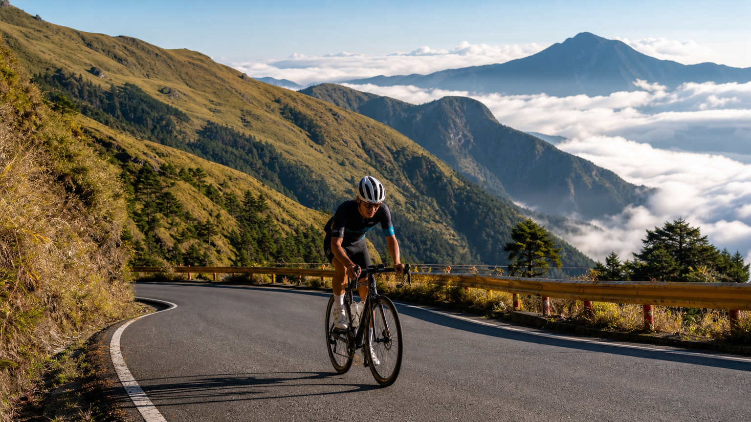
Taiwan’s Top 10 Road Climbing Routes: The Perfect Blend of Difficulty and Scenery
Seventy percent of Taiwan’s terrain is mountainous, creating a high-altitude riding environment that cyclists around the world envy. Across this 36,000-square-kilometer island, there are dozens of road climbs worth riding. This article rounds up the “Top 10 Climbs” as recognized by Taiwan’s road cycling community, ranked by total elevation gain, average gradient, scenic value, and traffic risk.
Rating Explanation
| Metric | Description |
|---|---|
| Difficulty⭐ | 1–5 stars (combining gradient, distance, and elevation gain) |
| Scenery⭐ | 1–5 stars (visual impact along the route) |
| Resupply♻ | Availability of resupply points (Easy/Moderate/Hard) |
| Traffic⚠ | Vehicle density and road safety |
#1: Hehuanshan Main Peak, East Slope (Wuling)
- Route: Puli, Nantou → Cingjing → Wuling (Provincial Highway 14A)
- Distance: About 52km from Puli
- Elevation gain: About 2,700 meters (starting from Puli)
- Summit elevation: 3,275 meters (the highest point on Taiwan’s road network)
- Difficulty: ⭐⭐⭐⭐⭐ | Scenery: ⭐⭐⭐⭐⭐ | Resupply: Moderate | Traffic: Moderate
The highest paved point in Taiwan, bar none. Above Cingjing Farm, the route opens into exposed high-alpine grassland with unobstructed views. In the final 10 kilometers approaching Wuling, the annual spring bloom on Hehuanshan turns this stretch into the most breathtaking climb on the island.
#2: Alishan Highway (Provincial Highway 18)
- Route: Chiayi City → Zhuqi → Fenqihu → Alishan
- Distance: 74km
- Elevation gain: About 2,400 meters
- Summit elevation: About 2,200 meters
- Difficulty: ⭐⭐⭐⭐½ | Scenery: ⭐⭐⭐⭐½ | Resupply: Moderate | Traffic: Moderate
The route climbs from lowland Chiayi all the way into the cloud forest belt, tracing the Alishan Forest Railway and finishing among ancient red cypress groves. The gradient is fairly even, but the distance is long, making it best suited to riders with strong endurance.
#3: Tataka (Yushan National Park)
- Route: Shuili → Xinyi → Tataka (Provincial Highway 21)
- Distance: About 65km from Shuili
- Elevation gain: About 2,400 meters
- Summit elevation: About 2,600 meters
- Difficulty: ⭐⭐⭐⭐⭐ | Scenery: ⭐⭐⭐⭐ | Resupply: Hard | Traffic: Low
Many Taiwanese riders rate this climb as “harder than Wuling.” The reason: resupply points are extremely scarce, there is almost no flat or downhill relief along the way, and the gradient holds steady at 7–10% for long stretches. Once inside Yushan National Park, water is nearly impossible to find. Strong self-sufficiency is essential.
#4: Taipingshan Forest Road (Yilan)
- Route: Yilan City → Datong → Tuchang → Taipingshan
- Distance: About 55km from Yilan City
- Elevation gain: About 1,800 meters
- Summit elevation: About 1,950 meters
- Difficulty: ⭐⭐⭐⭐ | Scenery: ⭐⭐⭐⭐½ | Resupply: Hard | Traffic: Low
A hidden gem in the mountains of Yilan — narrow roads, few tourists, but a well-preserved natural forest along the way, with especially stunning autumn foliage. The finish at Cuifeng Lake is Taiwan’s highest alpine lake.
#5: Cingjing Farm (Lower Section of Provincial Highway 14A)
- Route: Puli → Wushe → Cingjing
- Distance: About 38km
- Elevation gain: About 1,300 meters
- Summit elevation: About 1,748 meters
- Difficulty: ⭐⭐⭐½ | Scenery: ⭐⭐⭐⭐⭐ | Resupply: Easy | Traffic: High
With its European-style architecture, lush green slopes, and sea-of-clouds views, the Cingjing Farm area is one of Taiwan’s most photographed climbing destinations. Tour buses are heavy on weekends, so ride with care.
#6: Lishan (Central Cross-Island Highway, Provincial Highway 8)
- Route: Fengyuan → Guguan → Lishan
- Distance: About 87km
- Elevation gain: About 1,600 meters
- Summit elevation: About 2,000 meters
- Difficulty: ⭐⭐⭐⭐ | Scenery: ⭐⭐⭐⭐⭐ | Resupply: Moderate | Traffic: Moderate
The signature stretch of Taiwan’s Central Cross-Island Highway, tracing the Dajia River gorge past dramatic rock faces. In autumn fruit season, riders can also pick up high-mountain apples and pears in Lishan.
#7: Northern Cross-Island Highway (Provincial Highway 7), Taoyuan to Baling
- Route: Fuxing, Taoyuan → Jiaobanshan → Baling
- Distance: About 45km (Taoyuan to Baling)
- Elevation gain: About 1,200 meters
- Summit elevation: About 900 meters
- Difficulty: ⭐⭐⭐ | Scenery: ⭐⭐⭐⭐ | Resupply: Moderate | Traffic: Moderate
With peach blossoms blooming at Lalashan in spring and Atayal indigenous culture along the way in summer, the Northern Cross-Island Highway offers one of northern Taiwan’s longer mountain rides. Its difficulty is comparatively approachable, making it a good training ground for intermediate riders.
#8: Southern Cross-Island Highway (Provincial Highway 20), Tianchi
- Route: Guanshan → Haiduan → Xiangyang → Tianchi
- Distance: About 60km from Guanshan
- Elevation gain: About 2,400 meters
- Summit elevation: About 2,700 meters
- Difficulty: ⭐⭐⭐⭐⭐ | Scenery: ⭐⭐⭐⭐⭐ | Resupply: Very Hard | Traffic: Very Low
Long closed after Typhoon Morakot, the Southern Cross-Island Highway has gradually reopened in recent years, though cyclists still face access restrictions and must apply in advance. Riders who make it to Tianchi experience the purest wilderness on Taiwan’s wildest high-mountain road.
#9: Wuling via the Eastern Approach (Provincial Highway 8, Hualien Side)
- Route: Taroko, Hualien → Guanyuan → Wuling
- Distance: About 100km
- Elevation gain: About 3,100 meters
- Summit elevation: 3,275 meters
- Difficulty: ⭐⭐⭐⭐⭐ | Scenery: ⭐⭐⭐⭐⭐ | Resupply: Moderate | Traffic: Moderate
Climbing straight from the edge of the Pacific to the roof of Taiwan, this route is longer and gains more elevation than the western approach to Wuling. It passes through Taroko Gorge and represents the ultimate climbing experience in Taiwan.
#10: Zhiben Forest Road (Taitung)
- Route: Zhiben Hot Springs, Taitung → Zhiben Forest Road
- Distance: About 25km one way
- Elevation gain: About 1,500 meters
- Summit elevation: About 1,600 meters
- Difficulty: ⭐⭐⭐⭐½ | Scenery: ⭐⭐⭐⭐ | Resupply: Very Hard | Traffic: Very Low
A little-known forest road climb, with sections of gravel surface that call for off-road capability or a gravel-ready road bike. There is no resupply whatsoever, but in return riders get an almost entirely car-free, pristine mountain experience.
Comparison Table
| Rank | Route | Elevation Gain | Distance | Best Months |
|---|---|---|---|---|
| 1 | Wuling (Western Approach) | 2,700m | 52km | Apr–May, Sep–Oct |
| 2 | Alishan | 2,400m | 74km | Mar–May, Oct–Nov |
| 3 | Tataka | 2,400m | 65km | Apr–Jun, Sep–Oct |
| 4 | Taipingshan | 1,800m | 55km | Apr–May, Oct–Nov |
| 5 | Cingjing Farm | 1,300m | 38km | Year-round (avoid summer weekends) |
| 6 | Lishan | 1,600m | 87km | Sep–Nov (fruit season) |
| 7 | Northern Cross Baling | 1,200m | 45km | Mar–Apr (peach blossoms) |
| 8 | Southern Cross Tianchi | 2,400m | 60km | Check access status first |
| 9 | Wuling (Eastern Approach) | 3,100m | 100km | May, Sep–Oct |
| 10 | Zhiben Forest Road | 1,500m | 25km | Oct–Nov |
Conclusion
Taiwan’s wealth of mountain climbing routes is unmatched in Asia. From the beginner-friendly Cingjing Farm to the extreme eastern approach to Wuling, every route has its own distinct character. Whatever your level, there is a mountain road in Taiwan waiting for you.
Pick your next goal, prepare your gear, and set out with plenty of stamina and a humble mindset.
Related Reading
#北橫 + #北進武嶺 最硬的員工旅遊 EP1 | #公路車 #拉拉山 | 明池 | 武嶺 | 武陵農場 | 雲海 | Taiwan Cycling Route Wulin
6 年前
台灣登山王之路 KOM 全程參賽4K臨空錄影 PART1 穿越峽谷地形! #東進武嶺 太魯閣 / 燕子口 / 天祥 / 西寶 PART1 (公路車 / CT Yeh)
3 年前
太平山單車員工旅遊 | 這樣玩CP值最高!| 公路車
5 年前
爬坡ITT實境)台中 魔王 松鼠坡 首航 6:12 大肚山 大三元 科福路
8 年前
藤枝二集團 單車行 Day1 | 南部小武嶺 | 爬坡爬到罵罵叫 | JJSC | 公路車 | CT Yeh
3 年前
西進武嶺最新路況場勘,台14到清境,還適合騎單車上去嗎?/ 居然有這優勢!?/請開啟字幕/當天現剪/公路車/CT Yeh
2 年前
一定要騎一次!阿里山最深處:里佳部落!單車旅行 | 2800m爬升 | 深度部落體驗:嗨翻晚會、螢火蟲、銀河 | feat. JJSC & 廢物伙伴 | 公路車 CT Yeh
9 個月前
大武山後門26%歡樂陡坡!JJSC南台灣單車行Day2 / 被颱風追著跑 / 公路車 / CT Yeh
2 年前