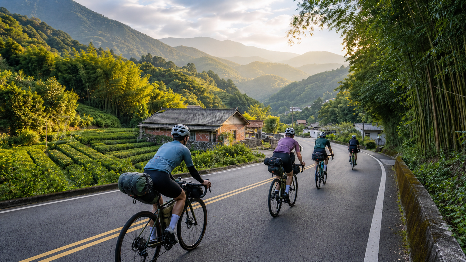
Provincial Highway 3 North-South Journey: Riding the Inland Mountain Road from Taipei to Pingtung
Provincial Highway 3 (also known as “Taiwan’s Inland Mountain Road”) starts from Guangzhou Street in Taipei City, heading south through the mountainous areas of Taoyuan, Hsinchu, Miaoli, Nantou, Chiayi, and Kaohsiung, ending at Fangliao in Pingtung. The total distance is approximately 505 kilometers, making it the longest provincial highway in Taiwan. Compared to Provincial Highway 1 along the western coastline, Provincial Highway 3 runs closer to the mountains, passing through countless Hakka villages, indigenous communities, tea-growing towns, and hilly terrain. It is known as “Taiwan’s Back Mountain Traverse.”
Basic Route Information
| Item | Data |
|---|---|
| Starting Point | Guangzhou Street, Taipei City |
| Ending Point | Fangliao Township, Pingtung County |
| Total Distance | Approximately 505 km |
| Cumulative Elevation Gain | Approximately 7,000–9,000 m (depending on route selection) |
| Recommended Duration | 5–7 days |
| Difficulty | Advanced (long distance, intermittent climbing) |
Why Ride Provincial Highway 3?
The appeal of Provincial Highway 3 lies in its “local character.” Provincial Highway 1 is Taiwan’s transportation artery, lined mostly with towns and commercial districts; Provincial Highway 3, on the other hand, is closer to Taiwan’s mountain village culture. Riding Provincial Highway 3, you will pass through:
- Taoyuan, Hsinchu, and Miaoli Hakka Regions: Sanyi’s wood-carving village in Miaoli, the romantic town of Nanzhuang, and Shitan Township’s century-old old street
- Central Mountain Areas: Tea terraces in Mingjian, Nantou; Moso bamboo forests in Zhushan; and the home of Dongding oolong tea in Lugu
- Chiayi Mountain Areas: The everyday life of small towns like Meishan, Fanlu, and Zhuqi at the foot of Alishan
- Kaohsiung and Pingtung Regions: Meinong’s tobacco-drying tower Hakka culture and Qishan’s banana industry history
Suggested Stage-by-Stage Itinerary (7-Day Version)
Day 1: Taipei → Daxi, Taoyuan (approximately 70 km, elevation gain approximately 600 m)
Depart from Guangzhou Street in Taipei, heading toward Xinzhuang, Tucheng, and Sanxia, then following the Dahan River to connect with Provincial Highway 3 into Taoyuan. Sanxia Old Street is the first attraction worth stopping at.
- Accommodation suggestion: Daxi urban area has several bed-and-breakfasts
- Highlights: Sanxia Old Street’s red-brick arcades, Daxi Riverside Park
Day 2: Daxi, Taoyuan → Nanzhuang, Miaoli (approximately 95 km, elevation gain approximately 1,200 m)
After passing Daxi, you enter the mountainous area of Fuxing District, where gradients begin to appear. Jiaobanshan, the junction with the Northern Cross-Island Highway, is a site of Atayal culture. Continuing south into Miaoli, Nanzhuang is one of Taiwan’s most beautiful small towns.
- Resupply focus: Jiaobanshan, Fuxing District (midpoint of the route)
- Highlights: Nanzhuang Old Street, Xiangtian Lake, Yongchang Temple plaza
Day 3: Nanzhuang, Miaoli → Dongshi, Taichung (approximately 85 km, elevation gain approximately 1,000 m)
Depart from Nanzhuang, follow Provincial Highway 3 through Sanyi, Miaoli (the renowned wood-carving town), enter the Daan River basin in Taichung, and arrive at Dongshi.
- Highlights: Sanyi wood-carving art, central Taiwan hilly rural scenery
- Resupply: Ample resupply options in Sanyi urban area
Day 4: Dongshi, Taichung → Mingjian, Nantou (approximately 80 km, elevation gain approximately 700 m)
Pass through Jiji Line and Lugu, entering Nantou’s most important tea-growing region. Mingjian is Taiwan’s largest tea distribution center, with tea fields stretching continuously along the roadside.
- Highlights: Songboling tea farmer culture, Bagua Mountain range hilly terrain
Day 5: Mingjian, Nantou → Meishan, Chiayi (approximately 85 km, elevation gain approximately 1,100 m)
Entering Chiayi County, the terrain gradually shifts from hills to mountains. Meishan Township is a famous producer of plum blossoms and plums. The winding mountain roads along the way offer pleasant scenery.
- Highlights: Meishan Taiping Old Street, Chiayi mountain agricultural scenery
Day 6: Meishan, Chiayi → Qishan, Kaohsiung (approximately 75 km, elevation gain approximately 800 m)
After passing Chiayi, you enter the mountainous area of Kaohsiung. The Purple Butterfly Conservation Area in Maolin (winter season) and Qishan’s Banana Museum are representative landmarks of the southern section of Provincial Highway 3.
- Highlights: Qishan Old Street, Meinong tobacco-drying towers
Day 7: Meinong, Kaohsiung → Fangliao, Pingtung (approximately 70 km, elevation gain approximately 400 m)
On the final day, cross from Meinong through Liugui, descend along the Laonong River, and finally arrive at Fangliao in Pingtung, completing the full north-south ride of Provincial Highway 3.
- Endpoint marker: The Provincial Highway 3 terminus milestone is located next to Fangliao Railway Station
Accommodation Strategy
Accommodation along Provincial Highway 3 can be categorized as follows:
| Accommodation Type | Advantages | Disadvantages |
|---|---|---|
| General business hotels/B&Bs | Well-equipped, easy to book | Higher cost |
| Traditional Hakka guesthouses | Local experience, hearty breakfast | Requires advance booking |
| Temples (some open to visitors) | Free or low cost | Requires polite inquiry, basic facilities |
| Campgrounds | Outdoor experience | Requires carrying gear |
Resupply Strategy
Most sections of Provincial Highway 3 pass through villages, with resupply points roughly every 15–25 kilometers. However, some mountain sections (such as Nanzhuang to Dahu, and Maolin to Liugui) have sparse resupply options. It is recommended to:
- Always top up water bottles; mountain water availability is unpredictable
- Carry small bags of food (nuts, energy bars) as backup
- Confirm before each stage that the destination has shops or restaurants
Provincial Highway 3 vs. Provincial Highway 1: Which Is More Worth Riding?
| Comparison | Provincial Highway 3 | Provincial Highway 1 |
|---|---|---|
| Road Conditions | Many mountain roads, some sections narrow | Wide, good asphalt quality |
| Scenery | Mountain villages, agriculture, tea country | Towns, commercial areas, coastline (in parts) |
| Resupply | Larger gaps, requires planning | Dense, resupply available at any time |
| Culture | Hakka, indigenous, agricultural | Urban culture, commercial |
| Recommended For | Those seeking local cultural experiences | Fast north-south traversals or first-time long-distance riders |
Conclusion
Provincial Highway 3 is a route meant to be savored slowly. It doesn’t have the challenge of Wuling, nor the ceremonial sense of achievement of a full island loop, but Provincial Highway 3 lets you truly see Taiwan’s mountain hinterland, get to know the villages that are merely dots on a map, and experience Taiwan’s most authentic rural character.
If you want to ride a road that is “truly Taiwan,” Provincial Highway 3 is definitely your answer.
Related Reading
- Provincial Highway 3 Inland Mountain Road: A North-South Mountain Route Ride from Taipei to Pingtung
- Provincial Highway 3 Inland Mountain Road: Route Planning for a North-South Mountain Ride from Hsinchu to Pingtung
- Provincial Highway 3 Romantic Ride: A Hakka Culture Cycling Journey from Hsinchu to Pingtung
- Provincial Highway 3 Southern Section Cycling Route: Hilly Riding from Sanyi to Miaoli
浪漫 #臺三線 #單車 員工旅遊 桃園到台中 老少咸宜 環台賽 路線探索
6 年前
一定要騎一次!阿里山最深處:里佳部落!單車旅行 | 2800m爬升 | 深度部落體驗:嗨翻晚會、螢火蟲、銀河 | feat. JJSC & 廢物伙伴 | 公路車 CT Yeh
9 個月前
藤枝二集團 單車行 Day1 | 南部小武嶺 | 爬坡爬到罵罵叫 | JJSC | 公路車 | CT Yeh
3 年前
太平山單車員工旅遊 | 這樣玩CP值最高!| 公路車
5 年前
高雄綠園道鐵路自行車道 / 外地人能輕鬆駕馭 還是整路崩潰? / 2025 全線開通 春節實地探索一次!(附GPS連結)/ 公路車 / CT Yeh
1 年前
#北橫 + #北進武嶺 最硬的員工旅遊 EP1 | #公路車 #拉拉山 | 明池 | 武嶺 | 武陵農場 | 雲海 | Taiwan Cycling Route Wulin
6 年前
爬坡ITT實境)台中 魔王 松鼠坡 首航 6:12 大肚山 大三元 科福路
8 年前
台灣登山王之路 KOM 全程參賽4K臨空錄影 PART1 穿越峽谷地形! #東進武嶺 太魯閣 / 燕子口 / 天祥 / 西寶 PART1 (公路車 / CT Yeh)
3 年前