Taiwan’s Mid-Elevation Mountain Cycling Routes: Climbs That Rival Wuling
When people think of climbing in Taiwan, Wuling usually comes to mind first — at 3,275 meters above sea level, it’s one of the highest paved road-cycling destinations in the world. But Taiwan is home to many other mountain climbs that rival Wuling in difficulty, and with far fewer crowds, they often deliver a purer riding experience.
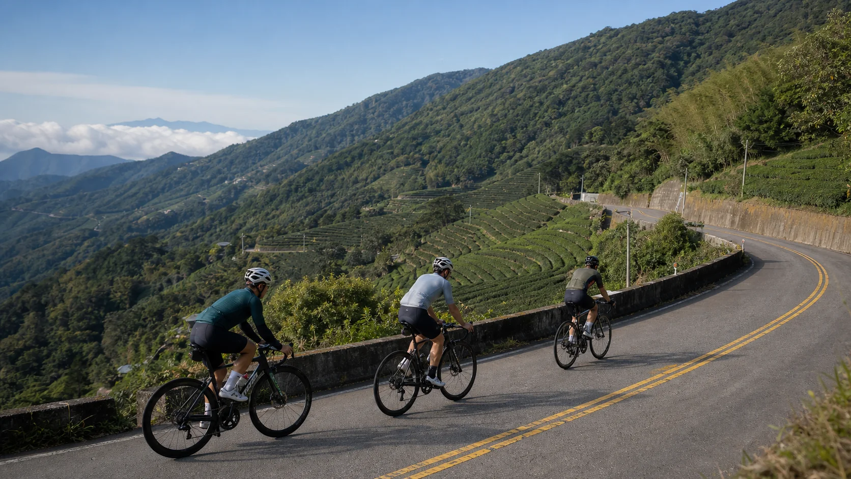
1. Alishan Highway (Provincial Highway 18)
Start: Chiayi City
End: Alishan (elevation 2,200m)
Distance: approx. 70km
Total elevation gain: approx. 2,200m
The Alishan Highway is famous for its countless hairpin turns, especially the section climbing from Fenqihu (elevation 1,400m), where switchbacks come one after another against a backdrop of stunning scenery. There are several supply points along the way, including the Fenqihu Old Street, where you can refuel with the famous “alpine lunchbox.”
Highlights
- The 24 Bends section: the continuous switchbacks from Shizhuo to Alishan are the heart of the challenge
- Fenqihu Old Street: a great mid-route stop for both supplies and sightseeing
- Alishan Sacred Tree Grove: worth exploring on foot once you arrive
2. North Cross-Island Highway (Provincial Highway 7)
Start: Daxi, Taoyuan
End: Yuanshan, Yilan
Distance: approx. 105km
Total elevation gain: approx. 2,800m (round trip), highest point at Mingchi (elevation 1,150m)
Although its highest point isn’t especially high, the North Cross-Island Highway features relentless ups and downs from start to finish. Riding from Taoyuan all the way to Yilan, you’ll cross the northern section of the Central Mountain Range, with scenery shifting from the river valleys and forests of northern Taiwan to the sweeping Yilan Basin — a hugely rewarding traverse route.
Highlights
- Jiaoban Mountain section: indigenous culture meets scenic beauty
- Mingchi National Forest Recreation Area: a picturesque alpine lake
- Fuxing to Yilan descent: a 30km downhill stretch full of thrilling speed
3. South Cross-Island Highway (Provincial Highway 20)
Start: Yujing, Tainan
End: Chishang, Taitung (subject to road conditions; some sections may be restricted)
Distance: approx. 165km
Highest point: Xiangyang (elevation 2,600m)
The South Cross-Island Highway is one of Taiwan’s most challenging cross-mountain routes. Long partially closed following the 2009 Typhoon Morakot disaster, it has gradually reopened in recent years. The route runs through traditional Bunun territory, passing hot springs (Guanshan Hot Spring), Bunun tribal villages, and dramatic canyons along the way.
Note: Always check current road conditions before setting out, as some sections may still be closed for repairs or due to natural disasters.
4. Central Cross-Island Highway, Bilu Sacred Tree Section
Start: Datong, Yilan
End: Bilu Sacred Tree Station
Distance: approx. 45km
Elevation at endpoint: approx. 1,980m
Due to damage from earthquakes and typhoons, the section of the Central Cross-Island Highway east of Wushe remains closed, but the Bilu Sacred Tree section, accessed from the Yilan side, is still open. With its dramatic Taroko-style canyon terrain set against the towering Snow Mountain Range, this is one of the routes that most impresses foreign visitors.
5. Lishan to Fushoushan Farm
Start: Lishan (elevation 1,970m)
End: Fushoushan Farm (elevation 2,600m)
Distance: approx. 22km
Total elevation gain: approx. 630m
This route is often ridden as an extension of a Wuling trip, or as a standalone ride through a beautiful alpine farm setting. Along the way you’ll pass apple and pear orchards, and in autumn the maple foliage is spectacular — making this one of Taiwan’s most scenic alpine roads.
Route Difficulty Comparison
| Route | Highest Elevation | Total Elevation Gain | Difficulty Rating |
|---|---|---|---|
| Alishan Highway | 2,200m | 2,200m | ★★★★☆ |
| North Cross-Island Highway | 1,150m | 2,800m | ★★★★☆ |
| South Cross-Island Highway | 2,600m | 3,500m | ★★★★★ |
| Bilu Sacred Tree Section | 1,980m | 1,980m | ★★★☆☆ |
| Lishan–Fushoushan | 2,600m | 630m | ★★☆☆☆ |
Before You Set Out
- Check supply points: Supply points are limited on mid-elevation mountain routes, so bring enough food and a spare inner tube
- Check the weather: Mountain weather changes quickly — check the Central Weather Administration’s mountain area forecast before departing
- Tell family or friends: Let someone know your route and expected return time
- Emergency contacts: Note down phone numbers for police stations and fire departments along the route
- Bring a headlamp: Mountain roads have no lighting, so carry a light in case you’re delayed and need to descend after dark
Taiwan’s mountain roads are a cyclist’s paradise. Beyond Wuling, there are countless spectacular routes still waiting to be discovered.
Related Reading
半日 小台灣 極限單車路線挑戰實錄
7 年前
梅山36彎 奮起湖 單車挑戰 下集 #公路車
6 年前
那瑪夏x茶山 阿里山系深山單車行 Day2 累積爬升6000M | 🥶超陡連續下坡 整路看隊友刷 | 爬升一座西進武嶺 | JJSC | 公路車 | CT Yeh
3 年前
太平山單車員工旅遊 | 這樣玩CP值最高!| 公路車
5 年前
藤枝二集團 單車行 Day1 | 南部小武嶺 | 爬坡爬到罵罵叫 | JJSC | 公路車 | CT Yeh
3 年前
4K單車實境) 嘉義 梅山36灣 訓練台 爬坡 輕鬆騎
6 年前
梅山36彎 奮起湖 #公路車 之旅 2400m
6 年前
台灣登山王之路 KOM 全程參賽4K臨空錄影 PART1 穿越峽谷地形! #東進武嶺 太魯閣 / 燕子口 / 天祥 / 西寶 PART1 (公路車 / CT Yeh)
3 年前