Cycling Eastern Taiwan: Mountain and Sea Routes Through Hualien and Taitung
Eastern Taiwan is widely regarded as the best region in Taiwan for long-distance bicycle touring. Traffic on the coastal roads of Hualien and Taitung is noticeably lighter than in the west, and the terrain — from the Pacific coastline to the eastern foothills of the Central Mountain Range — is diverse and spectacular, making it a mecca for cyclists both domestic and international.
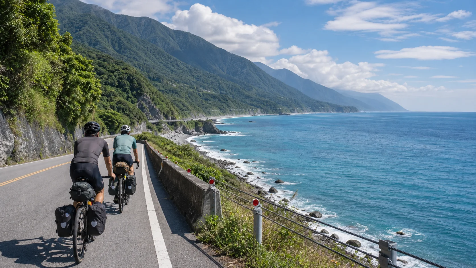
Why Choose the East?
| Comparison | East | West |
|---|---|---|
| Traffic volume | Light | Heavy |
| Air quality | Excellent | Affected by industry |
| Natural scenery | Mountains + coastline | Plains + farmland |
| Road surface quality | Good | Good |
| Distance between supply stops | Longer (planning required) | Frequent |
Best Routes in the Hualien Section
1. Suhua Improvement Route (Provincial Highway 9 / 9C)
- Distance: Hualien City to Su’ao, approx. 104km
- Terrain: the northern section is the old Suhua Highway (Provincial Highway 9, a cliffside road along the sea), while the southern section is the Suhua Improvement route (Provincial Highway 9C, mostly tunnels)
Note: check the latest regulations before cycling through the Suhua Improvement tunnel sections — some long tunnels have time restrictions. It’s recommended to pass through during daytime with good weather.
2. Hualien City to the Mouth of the Xiuguluan River (Provincial Highway 11)
- Distance: approx. 65km (Hualien City to Chenggong Township)
- Highlights: the entire route follows the Pacific coastline, with numerous stunning viewpoints and a winding coastal path
Key sections:
- Baqi Viewing Platform (the first high point heading south, with unobstructed ocean views)
- Shitiping (unique coastal rock formations)
- The mouth of the Xiuguluan River (a spectacular estuary landscape at the Taitung-Hualien border)
3. The Huadong Valley (Provincial Highway 9, Hualien-Taitung)
- Distance: approx. 180km
- Highlights: an open valley between the Central Mountain Range and the Coastal Mountain Range, featuring rice paddies, farms, and Bunun and Amis tribal villages
- Riding experience: open, gently rolling terrain, moderate average difficulty — suitable for first-time long-distance tourers
Best Routes in the Taitung Section
1. Chishang Plateau
- Location: Chishang Township, Taitung County
- Recommended route: the Dapo Pond loop (approx. 8km)
- Highlights: one of Taiwan’s most beautiful rice paddy landscapes, famous island-wide for its rice fields and Chishang bento
Riding tip: depart at dawn — the rice paddies in the morning mist are incomparable, and you can view the rice fields, Guanshan Bridge, and the Central Mountain Range backdrop all at once.
2. Taitung City to Green Island
- Ferry: from Fugang Fishing Port to Green Island, roughly a 50-minute crossing
- Cycling on Green Island: a full island loop of about 16km — bring a folding bike or rent a local bicycle
- Highlights: clear waters, hot springs, unique ecology — Taiwan’s most exotic-feeling offshore island for cycling
3. Zhiben Hot Springs to Dawu Section
- Distance: approx. 70km
- Terrain: the southern section of Provincial Highway 9, mountain roads entering the Hengchun Peninsula
- Supply: Dawu is an important supply point — supply stops become sparser heading further south
Practical Itinerary Planning (5-Day Eastern Longitudinal Ride)
| Day | Route | Distance | Highlight |
|---|---|---|---|
| Day 1 | Su’ao → Hualien City (Provincial Highway 9) | 100km | Suhua coastline |
| Day 2 | Hualien City → Ruisui | 75km | Huadong Valley rice paddies |
| Day 3 | Ruisui → Chishang | 65km | Xiuguluan River, Chishang Plateau |
| Day 4 | Chishang → Taitung City | 65km | Guanshan, Luye Highland |
| Day 5 | Taitung City rest day or Green Island | Depends on choice | Green Island loop |
Precautions for Eastern Riding
1. Longer Distances Between Supply Points
On some sections of the east coast (especially the coastal section of Provincial Highway 11), supply points can be spaced 20-30km apart. Recommendations:
- Fill your bottles completely before departing (at least 1.5L)
- Restock whenever you see a convenience store — don’t assume “there’ll be another one ahead”
2. Typhoon Season (June-October)
The east coast faces the Pacific directly, and typhoon season brings the most violent wind and rain. Always check the week-ahead forecast before departing, and never ride during a typhoon warning.
3. Speeding Scooters
Some sections have fast-moving scooters, especially the southern section of Provincial Highway 9. Stay to the right side of the road while riding, and wear a highly visible jersey and rear light.
4. Book Accommodation in Advance
During peak season (summer vacation, long weekends) in Hualien and Taitung, book accommodation 2-4 weeks in advance. Bike-friendly guesthouses in Chishang and Hualien City in particular are often fully booked.
Riding in eastern Taiwan is a journey of dialogue between humans and nature. As you pedal with the Pacific Ocean to your left and the Central Mountain Range to your right, that sense of vastness is something no other place in Taiwan can replicate.
Related Reading
- The Complete Guide to Cycling Tourism in Taiwan: The East Coast Line and Sun Moon Lake Loop
- Hualien Cycling: The Pacific Bike Path and the Best of the Huadong Valley
- The Eastern Coastal Section: The Challenge of the Suhua Highway and a Safe Riding Guide
- The Suhua Highway Bicycle Odyssey: The Ultimate Riding Experience on Pacific Cliffs
微東進 太魯閣 蘇花 單車兩日遊 ! 颱風過後路況超刺激 行程大亂 | 最狂的鹹酥雞訂單 | CT Yeh | 4K 高畫質空拍絕景!
4 年前
虎豹潭!日本老師來台一日約騎 台灣車友熱情招待私房路線 / CT Yeh
20 天前
太平山單車員工旅遊 | 這樣玩CP值最高!| 公路車
5 年前
大武山後門26%歡樂陡坡!JJSC南台灣單車行Day2 / 被颱風追著跑 / 公路車 / CT Yeh
2 年前
山道猴出沒!? JJSC屏東單車行 Day1 一直催 / 皮卡丘來了!/ 墾丁 旭海 恆春 社頂 / 公路車 / CT Yeh
2 年前
藤枝二集團 單車行 Day1 | 南部小武嶺 | 爬坡爬到罵罵叫 | JJSC | 公路車 | CT Yeh
3 年前
高雄綠園道鐵路自行車道 / 外地人能輕鬆駕馭 還是整路崩潰? / 2025 全線開通 春節實地探索一次!(附GPS連結)/ 公路車 / CT Yeh
1 年前
日本島波海道 EP1 / 五大絕景路線之一! / 私房溫泉 x 豪華單車客棧 / 今治 to 大三島 / 公路車 / CT Yeh
2 年前