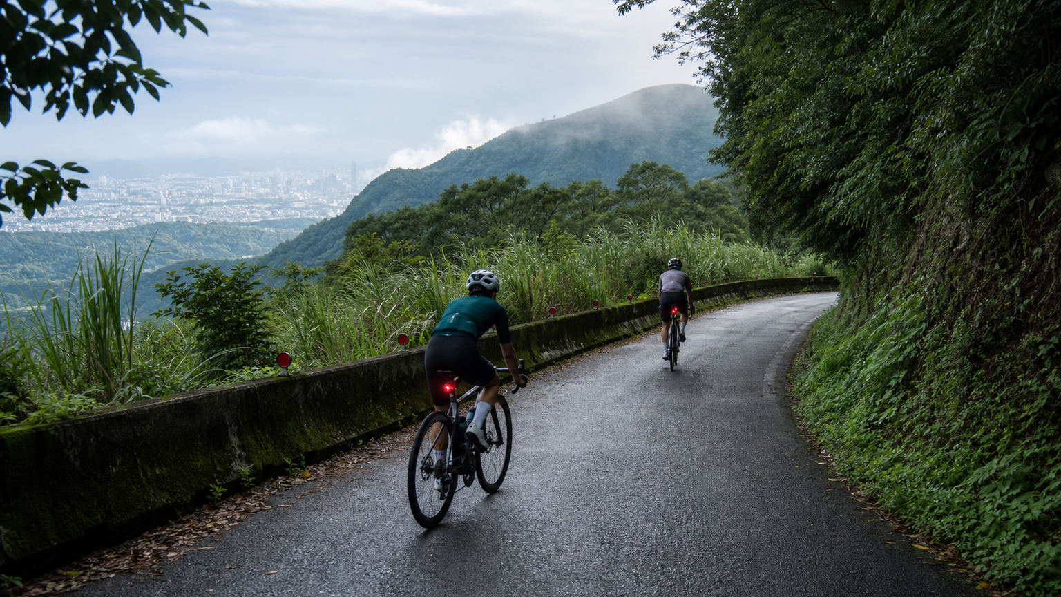
The Mountain at Taipei’s Doorstep
Balaka Road (County Highway 101A) lies within Yangmingshan National Park, climbing from near the Erziping Visitor Service Station toward the Datun Mountain saddle. The core climbing section spans about 7 km with roughly 500 meters of elevation gain, averaging around a 7% grade. For riders in Greater Taipei, it’s a real mountain you can ride straight from home without loading up the car.
Route Data
| Section | Distance | Average Grade | Features |
|---|---|---|---|
| Beitou → Zhuzihu | 5 km | 6% | Calla lily season crowds, warm-up stretch |
| Zhuzihu → Erziping | 3 km | 7.5% | Entering the park’s core, cloud belt |
| Erziping → Balaka Summit | 4 km | 8% | Datun Mountain views, toughest stretch |
Climbing Strategy
Starting from Beitou’s Fuxing 3rd Road, total elevation gain exceeds 800 meters. It’s recommended to warm up in heart-rate Zone 2 before Zhuzihu on the early section, then push into the threshold zone after Erziping. Afternoon fog frequently rolls in over the mountains, potentially cutting visibility to under 20 meters—make sure your rear light is on.
Comparing Three Routes Up
Balaka isn’t a one-way climb. Riders in Greater Taipei commonly use three approaches, each with distinct difficulty and scenery:
| Route Up | Starting Elevation | Core Distance | Total Elevation Gain | Characteristics |
|---|---|---|---|---|
| Beitou Fuxing 3rd Road Route | ~30 m | ~13 km | ~800 m | Most complete, plenty of resupply, heavy traffic |
| Xingyi Road–Zhuzihu Route | ~100 m | ~11 km | ~750 m | Starts from the hot spring area, slightly steeper |
| Tamsui–Datun Route | ~20 m | ~16 km | ~900 m | Longest and hardest, fewer cars, open views |
For advanced training, you can design a loop going up Xingyi Road and down via Beitou—about 30 km total with roughly 800 meters of climbing. Finishing within 90 minutes makes for a solid suburban threshold workout. The descent toward Zhongshan Hall features many technical corners; be sure to leave at least 30 meters of braking distance.
Seasons and Weather
Yangmingshan sits at a higher latitude with elevations around 800 to 1,000 meters, and winter temperatures can drop below 10°C with occasional frost. March brings calla lily season, while April to May sees the hydrangea bloom—the busiest times for crowds and traffic. Early summer mornings are the best window to beat both the heat and the masses.
Extended Combinations
- Yangjin Highway (Provincial Highway 2A): Climb it in reverse from the Jinshan side, with sulfur landscapes along the way
- Lengshuikeng–Qingtiangang: Adds grassland scenery and grazing cattle
- Descent via Zhongshan Hall: Technical corners galore, requires speed control
Safety Reminders
Tour buses and scooters are common inside the national park—always leave ample braking distance on descents. The volcanic terrain occasionally emits sulfur fumes; those with sensitive respiratory tracts should avoid the Dayoukeng section.
Balaka’s value isn’t in how steep it is, but in how close it is to Taipei’s residents. When you’re willing to ride up for a sea of clouds before work, the city can no longer cage your legs.
Related Reading
- Balaka Road Guide: 10.2 km Yangmingshan Classic Gentle Climb, Data Breakdown of the True Difficulty of “The Last Finger of Rulai’s Palm”
- Complete Guide to Yangmingshan Classic Routes: Taipei Riders’ Best Climbing Playground
- Five Classic Yangmingshan Routes: Fengguizui, Lengshuikeng, Balaka, Datun Mountain, Xiaoyoukeng
- Complete Yangmingshan Road Route Guide: Fengguizui, Balaka, Qingtiangang Loop
爬坡ITT實境)台中 魔王 松鼠坡 首航 6:12 大肚山 大三元 科福路
8 年前
#北橫 + #北進武嶺 最硬的員工旅遊 EP1 | #公路車 #拉拉山 | 明池 | 武嶺 | 武陵農場 | 雲海 | Taiwan Cycling Route Wulin
6 年前
一定要騎一次!阿里山最深處:里佳部落!單車旅行 | 2800m爬升 | 深度部落體驗:嗨翻晚會、螢火蟲、銀河 | feat. JJSC & 廢物伙伴 | 公路車 CT Yeh
9 個月前
藤枝二集團 單車行 Day1 | 南部小武嶺 | 爬坡爬到罵罵叫 | JJSC | 公路車 | CT Yeh
3 年前
里佳部落 阿里山單車深度旅遊! | 竹山/草嶺/來吉/奮起湖 | 無敵銀河絕景 全新路線探索! 驚險狀況百出! | 4K沉浸式畫質 | 公路車 | CT Yeh
3 年前
太平山單車員工旅遊 | 這樣玩CP值最高!| 公路車
5 年前
新竹羅平 x 天湖部落 大禹嶺級變態陡坡! 4K超高畫質 空拍 | 公路車
5 年前
嘉義大埔、阿婆灣挑戰賽,美到以為在日本!ft. 環騎5 Cool 西拉雅188 / 公路車 / CT Yeh
7 個月前