The Suhua Highway After the Suhua Improvement: Can You Still Cycle It, and How to Ride It Safely
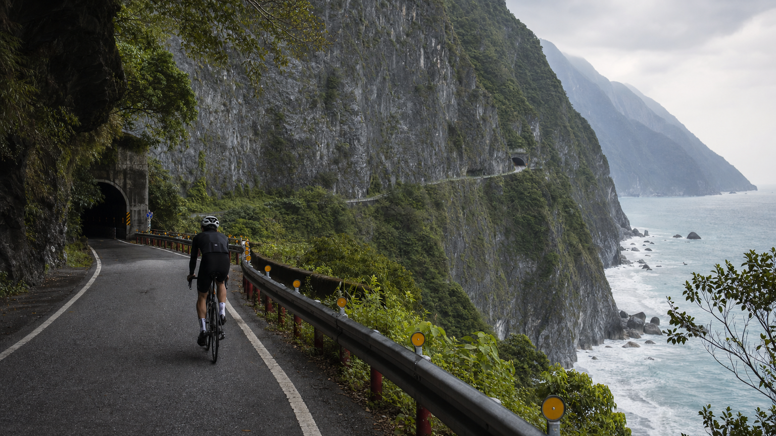
Where Cyclists Can Ride After the Suhua Improvement
Since the Suhua Highway Improvement Project (upgrades to the Provincial Highway 9 Suhua corridor) opened to traffic, many of the new tunnels and realigned sections were built for fast-moving motor traffic, and bicycles are not permitted on the entire route. The full stretch from Su’ao to Chongde runs about 80 km with a highest point of roughly 400 m. What cyclists can actually ride are the sections of the old Suhua Highway that remain open, plus some at-grade (surface-level) segments — you must check the current right-of-way rules before you go.
Feasibility by Section
| Section | Distance | Bicycle Access | Notes |
|---|---|---|---|
| Su’ao → Dong’ao | 12 km | Old alignment rideable | Views of Wushibi (Crow Rock) |
| Dong’ao → Nan’ao | 10 km | Partially old alignment | Confirm current restrictions |
| Heping → Chongde | ~30 km | Mostly at-grade sections | Check the latest rules for the Qingshui Cliffs section |
The Qingshui Cliffs Section
The Qingshui Cliffs are the signature scenery of the Suhua Highway, with sea cliffs dropping nearly 800 m. However, this section has many tunnels, and part of it falls under the fast-through-traffic design of the Suhua Improvement. Whether bicycles may pass, and whether you need to take a specific at-grade alternate route, must be confirmed against the latest announcements from the highway authority — never risk riding into a fast-traffic-only section by mistake.
Reading the Right-of-Way: How to Tell If You Can Ride a Section
The most common danger on the Suhua Highway isn’t falling rocks — it’s cyclists misreading the signage and accidentally riding onto a fast-traffic-only Suhua Improvement section. Remember these rules of thumb:
- Check the signs: If the entrance has a “No Bicycles / No Slow Vehicles” sign or a minimum speed limit sign, that’s an explicit ban — take the at-grade alternate route instead
- Check the tunnel type: The long tunnels on the Suhua Improvement (some several kilometers long) are designed for high-speed car traffic with no buffer space for bicycles — never enter these
- Follow the lane-splitting signage: Intersections often direct larger/faster vehicles to the new alignment and slower vehicles to the old alignment — following the “slow vehicles / bicycles” signs is the safest bet
- When in doubt, stop: It’s better to spend extra time checking official announcements or take the train instead than to gamble
The preserved sections of the old Suhua Highway (roughly Su’ao–Dong’ao–Nan’ao) are cyclist-friendly territory — narrow and winding, but within rideable limits. For the Heping-to-Chongde stretch, including the Qingshui Cliffs area, always confirm the current alternate route via the latest official announcements.
Core Safety Points
The geology along the Suhua Highway is fragile, and landslides are common after earthquakes or heavy rain — check real-time road conditions before you set out. Always run bright front and rear lights inside tunnels. Avoid long holiday weekends and peak hours for large vehicle traffic.
Alternatives
If you’re unsure about right-of-way or the weather is poor, consider taking the train between Su’ao and Hualien (local trains that allow bikes onboard, or bike-checked service), then continuing your ride from the Hualien side. Safety comes first.
Supplies
Dong’ao, Nan’ao, and Heping have convenience stores and food options. There are gaps in supply points between the long tunnels and restricted sections, so stock up in advance.
The most important lesson the Suhua Highway ever taught me is that “not riding” is also a skill. When right-of-way or safety are in question, there’s no shame in putting your bike on the train — true veterans know exactly where to hit the brakes.
Related Reading
- The Suhua Highway Cycling Epic: The Ultimate Ride Along the Pacific Cliffs
- The East Coast Section: A Challenge and Safety Guide to the Suhua Highway
- Suhua Improvement Bicycle Restrictions: Transfers and Alternative Routes
- Cycling the Suhua Highway: A Complete Guide to Scenery, Safety, and Route Planning
微東進 太魯閣 蘇花 單車兩日遊 ! 颱風過後路況超刺激 行程大亂 | 最狂的鹹酥雞訂單 | CT Yeh | 4K 高畫質空拍絕景!
4 年前
高雄綠園道鐵路自行車道 / 外地人能輕鬆駕馭 還是整路崩潰? / 2025 全線開通 春節實地探索一次!(附GPS連結)/ 公路車 / CT Yeh
1 年前
單車 梅山36灣 坡度介紹 路段介紹 空拍 (相關遊記影片,請參考說明或我的頻道喔,歡迎訂閱)
6 年前
觀霧 變好騎了! | 北高車友爆笑大會師 | 公路車 | 單車旅遊 Taiwan Cycling Route GuanWu
6 年前
單車環島 蘇花公路精彩片段
10 年前
4K單車實境) 舊陽金P字道 第1P 仰德大道至小油坑 誤跟武嶺神人們 被拉爆爽飛天 Taiwan Cycling Climb Route Recommend
7 年前
2025崇越「西進武嶺」挑戰VLOG / 賽前改短成165曲柄會如何? / 選手昏倒? / 公路車 / CT Yeh
1 年前
司馬庫斯 | 單車員工旅遊 | 比武嶺還接近上帝的路 | 2021 全面實況 路況解析 | 空拍 櫻花炸開超濃密 | 財伯觀光果園 | CT Yeh
5 年前