Introduction
From Hualien to Taitung, riders face a choice between two routes: Provincial Highway 11 (the Coastal Highway), which hugs the shoreline, and Provincial Highway 9 (the Valley Highway), which cuts through the heart of the valley. Both routes have their devotees, but if you ask which one better represents the soul of Taiwan’s backcountry, most seasoned riders will answer: the Huatung Valley, Provincial Highway 9.
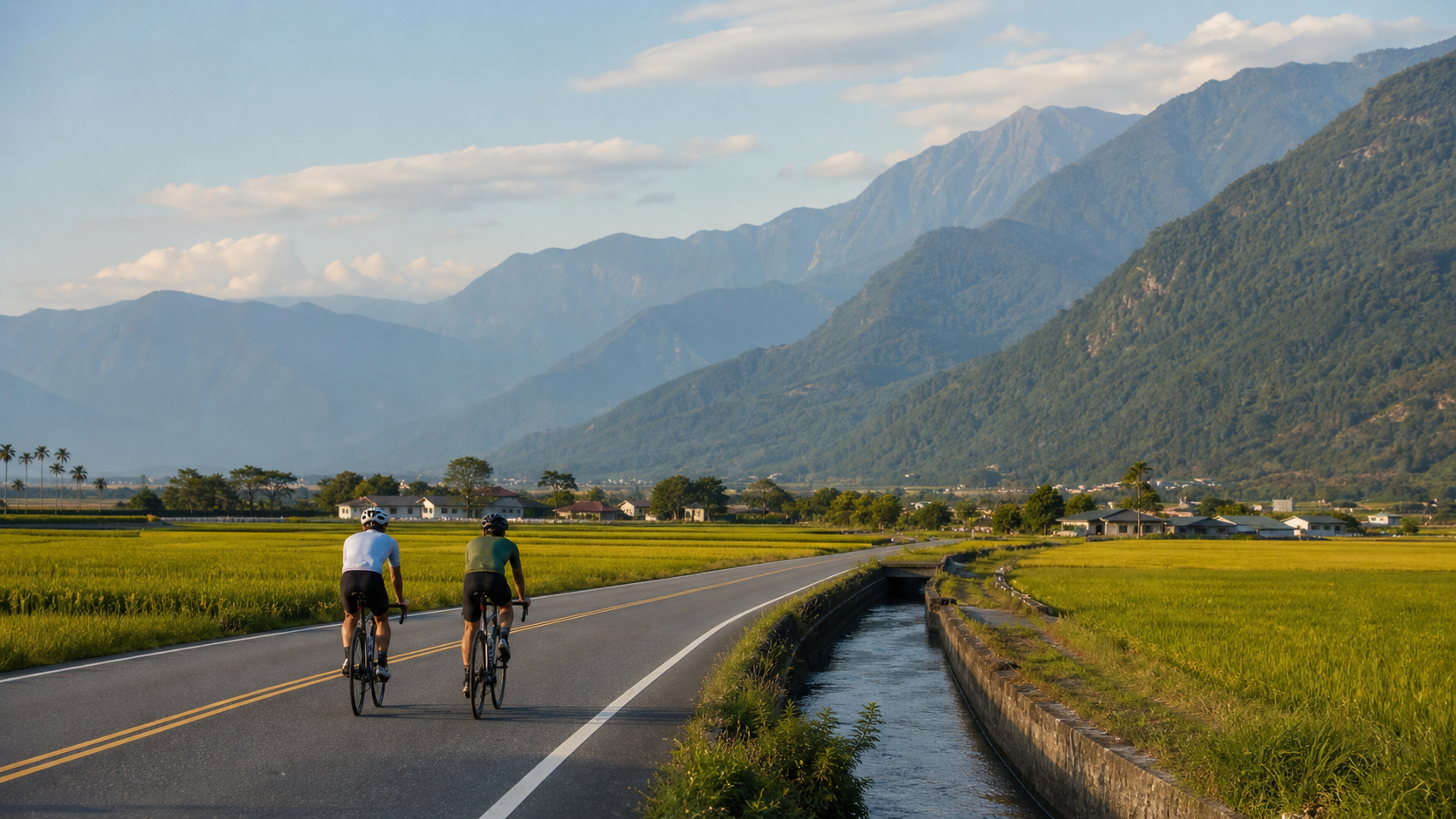
Nestled between the Central Mountain Range and the Coastal Mountain Range, the valley stretches about 180 kilometers in length, with vast farmlands and scattered villages, making it one of Taiwan’s most uniquely shaped plains. Here, you’ll find not only stunning scenery but also indigenous culture, organic farming, and a slow-paced lifestyle—it’s the stretch of the island-wide cycling route where riders are most willing to ease off the pedals.
Route Overview
| Section | Distance | Main Resupply Points | Highlights |
|---|---|---|---|
| Hualien City → Shoufeng | Approx. 25 km | Shoufeng urban area | Flat, gateway into the valley |
| Shoufeng → Guangfu | Approx. 30 km | Guangfu Township | Tafalong, Shalao River, Amis culture |
| Guangfu → Yuli | Approx. 45 km | Yuli Township | Sea of rice paddies, widest section of the valley |
| Yuli → Chishang | Approx. 30 km | Chishang Township | Famous Chishang rice region, Brown Boulevard |
| Chishang → Guanshan | Approx. 15 km | Guanshan Township | Guanshan Ring Cycling Path |
| Guanshan → Luye | Approx. 20 km | Luye Township | Gaotai hot air balloon base |
| Luye → Taitung | Approx. 20 km | Taitung City | Valley finale, entering Taitung City |
Key Sections
Shoufeng to Guangfu: Gateway to the Valley
After leaving Hualien City, the feeling of entering the valley builds gradually—buildings along the road thin out, mountain ridges rise in the distance, and the sky opens up. Morning rides are especially cool along the riverside in Shoufeng and the irrigation canals in Guangfu.
Guangfu is an important cultural center for the Amis people. Here, you can try traditional indigenous cuisine; sticky rice cakes (mochi) and wild boar sausage are common choices.
Yuli: The Heart of the Valley
Located in the middle section of the valley, Yuli Township is the most populous town in the Huatung Valley. The renowned Yuli noodles (a beef noodle variant) are a delicacy many riders make a detour to savor. The town has several bike repair shops, making it a great place to stock up on parts and fine-tune your bike.
Chishang: The Rice Paddy Poetry of Brown Boulevard
Brown Boulevard in Chishang Township is one of the most famous “photo-op” sections on the island-wide cycling route. This farm road, running straight through rice paddies, turns into a golden sea of rice waves around the autumn harvest (September–November), making it one of the most beautiful rural scenes in Taiwan. In spring (April–June), the season of tender green paddies offers a refreshingly different charm.
Note: Brown Boulevard is an agricultural road. Please do not ride into the edges of the rice paddies and respect farmers at work.
Guanshan Ring Cycling Path: A Gem of the Valley
Guanshan Township boasts Taiwan’s most complete dedicated cycling loop, at approximately 12 kilometers in length, with zero sharing of road space with cars. Circling through the valley’s wetlands, farmlands, and small streams, it’s a must-ride section of the valley route.
Guided route maps for the full loop can be rented near Guanshan Railway Station.
Luye Gaotai: Overlooking the Valley
The Luye Gaotai Hot Air Balloon Festival takes place every July–August. Even if you miss the balloon season, the panoramic valley view from the plateau itself is worth the climb. The climb from Provincial Highway 9 up to Luye Gaotai is about 3 kilometers with a gradient of roughly 8–10%, serving as the valley section’s little climbing challenge.
Provincial Highway 11 (Coastal Highway) vs. Provincial Highway 9 (Valley)
If time permits, consider these combinations:
- Hualien → Taitung via Provincial Highway 9 through the valley, then Taitung → Zhiben via Provincial Highway 11 along the coast and back to Taitung
- Or the reverse, contrasting the ocean views of the coastal highway with the farmlands of the valley
Provincial Highway 11 offers magnificent seaside scenery, but some sections are more complicated due to construction on the 11A spur; Provincial Highway 9 through the valley has stable road conditions with evenly distributed resupply points.
Practical Tips
- Ride early for the best experience: Afternoon southeast winds are stronger in the valley, making morning rides more comfortable
- Stock up on water and food in Yuli: Resupply points are relatively scattered on the Yuli-to-Taitung stretch
- Spend an extra half-day in Chishang: If your schedule allows, stay an extra night in Chishang; riding Brown Boulevard at dawn with almost no tourists around is the best time to experience it
- Bring insect repellent: Mosquitoes are plentiful around the valley’s farmlands, especially in the evening
- Watch for weekend TRA train schedules: If your itinerary falls behind in the valley section, you can catch a train at the small TRA stations in various townships
Conclusion
The Huatung Valley isn’t about speed—it’s about slowing down. Riding through endless rice paddies, with distant mountains quietly standing guard on both sides, and occasionally passing a temple or an old banyan tree, the whole world seems to hit pause. This is the stretch of the island-wide route most worth taking slowly, and the one most likely to make you decide, “I have to come back again.”
Related Reading
- Huatung Valley Route: An In-Depth Cycling Journey Through Valley Scenery from Hualien to Taitung
- Huatung Valley Cycling Tour: Taiwan’s Most Magnificent Long-Distance Riding Route
- Huatung Valley Cycling Trip: 163 km Route Planning and Resupply Guide from Hualien to Taitung
- Huatung Valley Cycling Route: A Journey Along Provincial Highway 9 Amid Rice Waves and Mountains
花東縱谷單車遊 feat. Doris 景點五分鐘快速掃瞄 / 公路車 / CT Yeh
2 年前
2022 環花東挑戰賽 Day2 搭到特快車 高速真空吸引! 台東一路逆風殺回花蓮! 總排 ??| Feiyu Pocket 2s | 公路車 | CT Yeh
4 年前
太平山單車員工旅遊 | 這樣玩CP值最高!| 公路車
5 年前
微東進 太魯閣 蘇花 單車兩日遊 ! 颱風過後路況超刺激 行程大亂 | 最狂的鹹酥雞訂單 | CT Yeh | 4K 高畫質空拍絕景!
4 年前
里佳部落 阿里山單車深度旅遊! | 竹山/草嶺/來吉/奮起湖 | 無敵銀河絕景 全新路線探索! 驚險狀況百出! | 4K沉浸式畫質 | 公路車 | CT Yeh
3 年前
虎豹潭!日本老師來台一日約騎 台灣車友熱情招待私房路線 / CT Yeh
20 天前
藤枝二集團 單車行 Day1 | 南部小武嶺 | 爬坡爬到罵罵叫 | JJSC | 公路車 | CT Yeh
3 年前
日本島波海道 EP1 / 五大絕景路線之一! / 私房溫泉 x 豪華單車客棧 / 今治 to 大三島 / 公路車 / CT Yeh
2 年前