Taiwan High Mountain Road Challenge: Preparation Strategies for Wuling, Hehuan Mountain, and Dayuling
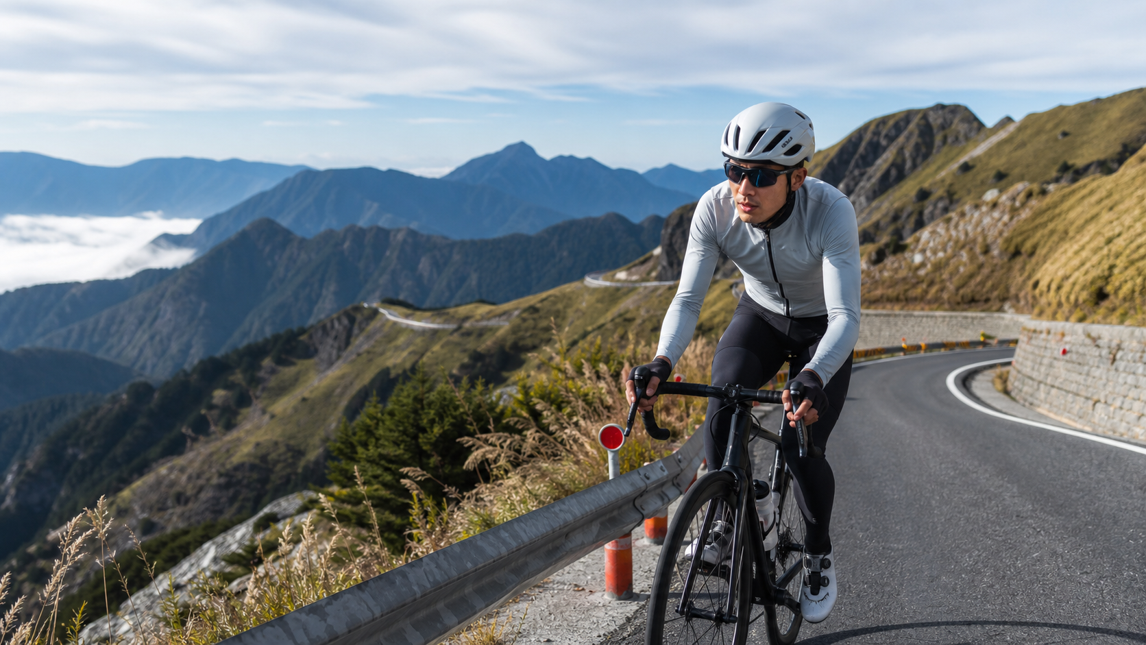
Introduction
Wuling, at an elevation of 3,275 meters, is the highest road cycling destination in East Asia and a sacred goal that every serious cyclist in Taiwan aspires to conquer at least once. Starting from Puli along Provincial Highway 14A, passing through Cingjing Farm and Hehuan Mountain, and finally reaching Wuling near Dayuling, the route spans approximately 100 kilometers with a cumulative elevation gain exceeding 3,200 meters. This is not only an ultimate test of physical endurance but also demands a well-thought-out preparation strategy.
Route Data and Segments
| Segment | Section | Distance | Elevation Gain | Features |
|---|---|---|---|---|
| Segment 1 | Puli → Wushe | Approx. 37 km | 600 m | Gentle slope warm-up |
| Segment 2 | Wushe → Cingjing | Approx. 12 km | 500 m | Dense steep sections |
| Segment 3 | Cingjing → Kunyang | Approx. 20 km | 700 m | Alpine zone |
| Segment 4 | Kunyang → Wuling | Approx. 6 km | 200 m | Final sprint |
Preparation Strategy: Getting Ready Before the Summit
Physical Training (8–12 Weeks Before the Summit)
Wuling’s summit demands exceptional cardiovascular endurance and muscular strength. It is recommended to begin systematic training at least two to three months in advance:
- Ride at least three times per week, including one long ride of 60 km or more
- Incorporate climbing interval training: choose a climb with 200–300 meters of elevation gain and repeat 3–5 sets
- Taper intensity during the final two weeks to allow full recovery
Equipment Preparation
- Gear Ratio: Equip at least a low gear ratio of 34×32 or 36×32 or lower, as leg power drops noticeably at high altitude
- Warm Clothing: Temperatures at the Wuling summit are 15–20°C lower than at the base, and wind chill during descents makes it feel even colder. Carry a lightweight down vest
- Nutrition Strategy: Refuel every 20–30 minutes. It is recommended to bring 4–6 energy gels and solid food
- Backup Medications: Altitude sickness medication (such as Diamox, consult a physician first), pain relievers, and a trauma first-aid kit
Race Day Strategy
Pacing Is the Key to Success
Many cyclists attempting Wuling for the first time ride too fast in the early section (Puli to Wushe), causing severe slowdown or even abandonment in the latter half. It is recommended to maintain an aerobic pace that allows conversation throughout the ride, and to deliberately keep intensity low, especially before Cingjing.
- Puli to Wushe: Warm-up section. Keep an easy pace and control heart rate at 65–70% of maximum
- Wushe to Cingjing: The gradient increases. Maintain a steady rhythm and do not speed up to chase others
- Cingjing to Kunyang: High-altitude air pressure begins to affect breathing efficiency. If headache or nausea occurs, stop and rest immediately
- Kunyang to Wuling: The final 6 km. Decide whether to pick up the pace based on remaining energy
Altitude Sickness Prevention and Emergency Response
Altitude sickness is the greatest safety risk when summiting Wuling:
- Mild symptoms (headache, nausea): Stop immediately, sit and rest, and breathe slowly
- Moderate symptoms (worsening headache, disorientation): Descend to lower elevation immediately and do not continue the ascent
- Severe symptoms (loss of consciousness, inability to walk): Call 119 and descend as soon as possible
Weather Assessment
Visibility on Provincial Highway 14A is extremely poor in rain or fog, and wet road surfaces make descents highly dangerous. If the sky is overcast when arriving at Cingjing at 7:00 AM, consider whether to continue.
Attractions Around Wuling
- Hehuan Mountain Main Peak Trail: A hiking trail starting from the Wuling parking lot, offering panoramic views of the Central Mountain Range
- Shimen Mountain: The easiest Baiyue (100 Peaks) to summit near Hehuan Mountain, a hiking option after cycling
- Kunyang: Home to a high-altitude observatory, where stargazing at night is a special experience
Practical Tips
- Departure Time: It is recommended to depart from Puli between 4:00–5:00 AM to avoid afternoon thunderstorms
- Resupply Points: Shops are available at Wushe and Cingjing Farm, but resupply options are extremely limited above Kunyang
- Descending Warmth: Put on a down jacket at the summit before descending to avoid a rapid drop in body temperature
Conclusion
Summiting Wuling is a rite of passage for cyclists in Taiwan and a comprehensive test of fitness, willpower, and preparation. With thorough preparation and a good weather window, you can safely and comfortably reach the 3,275-meter summit and overlook Taiwan’s mountain ranges—a sense of accomplishment that words cannot fully convey.
Related Reading
- Wuling Climbing Guide: Challenge Strategy and Nutrition Planning for Taiwan’s Highest Road
- Taiwan Baiyue Challenge Route Guide: Complete Guide to Cycling Wuling and Hehuan Mountain
- Taiwan Cycling Baiyue Challenge: Complete Preparation Guide for Conquering Wuling
- Taiwan’s Highest Road Tour: Challenging the Island’s Highest Paved Road
大禹嶺 到 武嶺牌樓 全程前後實況錄影 | 北進武嶺 | 東進武嶺 | KOM | 訓練台 | 坡度分析 | Taiwan KOM Last 10 km HARD | 公路車
6 年前
#北橫 + #北進武嶺 最硬的員工旅遊 EP1 | #公路車 #拉拉山 | 明池 | 武嶺 | 武陵農場 | 雲海 | Taiwan Cycling Route Wulin
6 年前
台灣登山王之路 KOM 全程參賽4K臨空錄影 PART1 穿越峽谷地形! #東進武嶺 太魯閣 / 燕子口 / 天祥 / 西寶 PART1 (公路車 / CT Yeh)
3 年前
#公路車 #西進武嶺 配速配瓦實驗 坡度分析 四小時內攻略 建大盃 NeverStop #西進武嶺攻略
6 年前
2023 夏季KOM 參賽實況 / 穿越空拍視角 / 整車都凸台 / 太魯閣峽谷x合歡山絕美大景 / 東進武嶺 / Taiwan KOM Challenge / 公路車 / CT Yeh
3 年前
FTL 與 SYB 車隊專訪 西進武嶺 實用攻略分享! 2小時 如何練?!你不知道的眉角!新手準備武嶺必看 EP1 | 實力派女車友 | 精華版 | 公路車 | CTYeh
4 年前
2025 乘鞍岳登山賽 比賽全紀錄篇 / 完整路線攻略介紹 / 日本版武嶺 公路最高點 / 高山空拍絕景 / 明年會開團! / 公路車 / CT Yeh
10 個月前
西進武嶺各路段 前8000名 大數據分析 配速攻略/功率/心律/推力比/維持率/踏頻/踏瓦比/牽車率 大公開 | 建大盃 NeverStop 可參考 | 公路車 | CT Yeh
5 年前