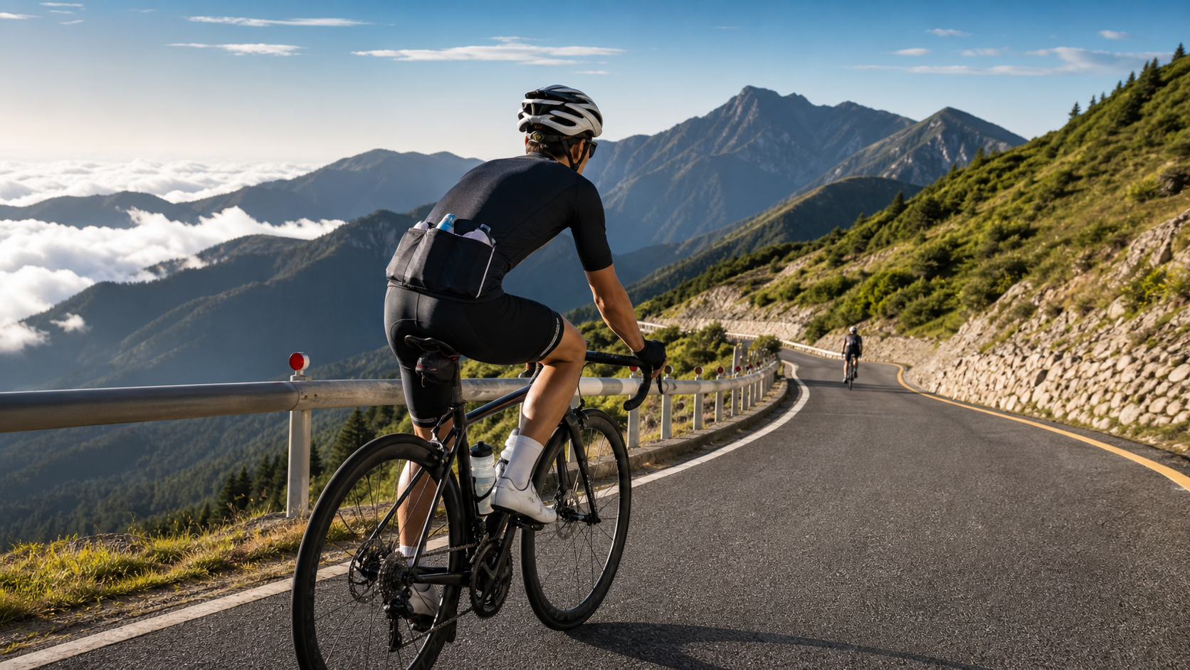
Wuling Guide: Pacing Strategy and Aid Station Arrangement Starting from Puli
Introduction
Wuling, at 3,275 meters above sea level, is the highest point on Taiwan’s road network and a sacred destination for countless cyclists. Starting from Puli Township and climbing over 3,200 meters along Provincial Highway 14A, the full route spans approximately 90 kilometers, making it Taiwan’s most iconic long-distance climbing challenge. Whether you’re attempting it for the first time or hoping to break a personal record, the right pacing strategy and aid planning are the keys to success.
Route Overview
The route from Puli to Wuling is mainly divided into four major sections:
| Section | Start | End | Distance | Elevation Gain | Average Gradient |
|---|---|---|---|---|---|
| Section 1 | Puli (420m elevation) | Wushe (1148m) | Approx. 22 km | 728 m | Approx. 3.3% |
| Section 2 | Wushe | Cingjing Farm (1748m) | Approx. 12 km | 600 m | Approx. 5% |
| Section 3 | Cingjing Farm | Kunyang (3100m) | Approx. 25 km | 1352 m | Approx. 5.4% |
| Section 4 | Kunyang | Wuling (3275m) | Approx. 2 km | 175 m | Approx. 8.8% |
| Total | Puli | Wuling | Approx. 90 km | Approx. 2855 m | Approx. 3.2% |
Distance and elevation gain figures for each section are approximate and may vary slightly depending on the exact starting point.
Section-by-Section Pacing Strategy
Section 1: Puli → Wushe (Gentle Slope Warm-Up Section)
This section is relatively flat, and many riders “jump the gun” here, burning through their early energy at too fast a pace. The right approach:
- Target power: 65–75% FTP (comfortable aerobic)
- Target heart rate: Zone 2–3 (60–78% HRmax)
- Deliberately feel “easy”; the main function of this section is to warm up the body
- Hydrate: take a sip every 20 minutes, don’t wait until you’re thirsty
Section 2: Wushe → Cingjing Farm (Increasing Gradient Section)
The gradient starts to increase, and the mountain roads become more pronounced. As altitude gradually rises, you may begin to feel mild symptoms of altitude (light-headedness).
- Target power: 75–82% FTP
- Heart rate should be in Zone 3–4 (78–87% HRmax)
- Refuel with solid food at the Cingjing aid station (7-11 or local shops)
- Pay attention to hydration: as altitude rises, breathing accelerates and fluid loss is faster
Section 3: Cingjing Farm → Kunyang (Core Climbing Section)
This is the longest and most physically demanding section of the entire route. The “success or failure” of Wuling riders in Taiwan is often decided here.
- Target power: conservatively maintain 72–80% FTP
- Heart rate should not exceed 88% HRmax (avoid pushing into Zone 5 too early)
- Refuel every 8–10 kilometers (approximately every 30–40 minutes)
- Above 2,500m elevation, pay special attention to low temperatures; put on a windproof vest immediately when you stop
Section 4: Kunyang → Wuling (Summit Push Section)
Only 2 kilometers remain, but the gradient reaches its steepest. By now the body is fatigued, and the high altitude makes breathing harder.
- Save a little “summit push” energy; power can be raised to 85–90% FTP when departing from Kunyang
- Decide based on your own condition whether to stand and pedal
- In the final 500 meters, ride freely and create the most lasting memory
Main Aid Station Arrangement
- Before departing from Puli: Eat a hearty high-carb breakfast, finishing your meal 1 hour before departure.
- Wushe (22 km): Refill water at the convenience store, have a banana or a small pack of supplies.
- Cingjing Farm (34 km): Full refueling stop; you can eat a sandwich or rice ball and refill two bottles of water.
- Dayuling (approx. 63 km): Refuel as needed; there are shops here, and this is the last full aid point.
- Kunyang (88 km): Final refueling; one energy gel or half a banana to cover the remaining energy needed for the summit push.
Common Mistakes and Countermeasures
- Starting too fast: Excessive excitement in the first 30 kilometers leaves you completely out of energy in the later stages. Countermeasure: Force your heart rate to stay below Zone 2 for the first 30 minutes.
- Refueling too late: Eating only when you “feel fine” means your blood sugar has already started to drop. Countermeasure: Refuel on a fixed schedule every 45 minutes; don’t wait until you’re hungry to eat.
- Underestimating the effects of high altitude: Above 2,500m, VO2max drops by approximately 10–15%, and the power output corresponding to a given heart rate decreases noticeably. Countermeasure: Accept that your speed will be slower; don’t force the power numbers.
- Ignoring cold-weather preparation: Temperatures at the summit of Wuling can be 15–20°C lower than at the base, and it feels even colder on descents. Countermeasure: Carry a lightweight rain jacket and a windproof layer in your backpack.
- Insufficient hydration: Riders often neglect hydration on mountain rides, and at high altitude you need to hydrate proactively. Countermeasure: Set a reminder to drink every 20 minutes.
Training Advice: Preparation Before Departure
- 8+ weeks of systematic training: At least 10 hours of riding per week, including 2–3 Sweet Spot training sessions.
- Simulated long-climb training: Complete at least 2–3 training rides with over 1,500m of elevation gain.
- Altitude acclimatization (optional): Stay overnight in Cingjing or the Hehuan Mountain area 1–2 days before the summit attempt to help adapt to the high altitude.
Conclusion
Wuling is not a race; it’s a conversation with yourself. It tests not just leg strength, but the wisdom of pacing, the discipline of refueling, and the mental resilience to face fatigue. With proper preparation and a humble heart, every Taiwanese cyclist who trains seriously has the ability to stand at the finish line of Taiwan’s highest road. Wishing you a successful summit!
Related Reading
- Wuling Climbing Guide: Challenge Strategy and Aid Planning for Taiwan’s Highest Road
- Wuling Full 52.2km Section-by-Section Pacing Strategy: A Rhythm Map from Puli to the Rooftop
- The Art of Pacing in Climbing Races: Perfect Strategy for the Wuling Cup and Eastbound Wuling
- Wuling Climbing Race Guide: Pacing Strategy and Aid Point Analysis at 3,275m
#北橫 + #北進武嶺 最硬的員工旅遊 EP1 | #公路車 #拉拉山 | 明池 | 武嶺 | 武陵農場 | 雲海 | Taiwan Cycling Route Wulin
6 年前
#公路車 #西進武嶺 配速配瓦實驗 坡度分析 四小時內攻略 建大盃 NeverStop #西進武嶺攻略
6 年前
大禹嶺 到 武嶺牌樓 全程前後實況錄影 | 北進武嶺 | 東進武嶺 | KOM | 訓練台 | 坡度分析 | Taiwan KOM Last 10 km HARD | 公路車
6 年前
西進武嶺各路段 前8000名 大數據分析 配速攻略/功率/心律/推力比/維持率/踏頻/踏瓦比/牽車率 大公開 | 建大盃 NeverStop 可參考 | 公路車 | CT Yeh
5 年前
台北闊瀨陡坡 騎旅 / 日本單車雜誌編輯車友臨時加入!/ 髮香才是最強的 / feat. 北迴歸線小隊 / 公路車 CT Yeh
6 個月前
西進武嶺最新路況場勘,台14到清境,還適合騎單車上去嗎?/ 居然有這優勢!?/請開啟字幕/當天現剪/公路車/CT Yeh
2 年前
西進武嶺 世界紀錄挑戰!破2:30 ?!一群人推著一個夢上山 直播精華版 / ft. 張翰允 & 台視主播魏于恬 & KPLUS / #cycling 公路車 CT Yeh
2 個月前
雨戰! 西進武嶺員工旅遊 加料 各路段大數據分析 | 同事端出5公斤的公路車來挑戰!? EP1
4 年前