Taiwan Bikepacking Beginner Routes: Overview of Northern Cross-Island Highway, Southern Cross-Island Highway, and Eastward Route
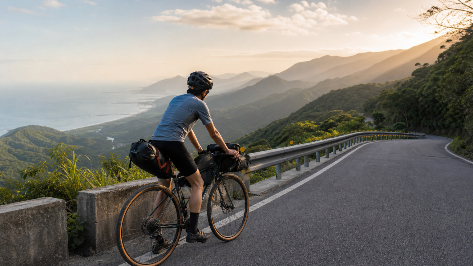
Taiwan’s Natural Advantages for Bikepacking
Taiwan is an ideal country for Bikepacking:
- Diverse Terrain: Coastlines, forests, high mountain roads
- Well-Developed Infrastructure: Dense convenience stores, extensive mobile network coverage
- Rich Route Network: Highways, forest roads, gravel paths
- Varied Climate: Rideable all year round
Three beginner-level Bikepacking routes: Northern Cross-Island, Southern Cross-Island, and East Coast. This article provides an overview to help beginners choose.
Quick Overview of the Three Routes
| Item | Northern Cross-Island (Northern Cross-Island Highway) | Southern Cross-Island (Southern Cross-Island Highway) | East Coast (Eastern Seaboard) |
|---|---|---|---|
| Total Distance | Approx. 200km | Approx. 210km | Approx. 350km |
| Recommended Duration | 3-4 days | 3-4 days | 5-7 days |
| Total Elevation Gain | Approx. 4500m | Approx. 5500m | Approx. 3000m |
| Highest Point | Mingchi (1170m) | Daguanshan Tunnel (2700m) | Mostly below 500m |
| Difficulty | Medium | High | Medium-Low |
| Supply Density | Medium | Low (mountain section) | High |
| Recommended Season | Mar-May, Oct-Nov | Apr-May, Oct-Nov | All year |
| Start/End Points | Daxi → Yilan | Tainan → Taitung | Su’ao → Taitung |
Route 1: Northern Cross-Island (Northern Cross-Island Highway)
Route Characteristics
The Northern Cross-Island is Taiwan’s most popular beginner Bikepacking route, connecting Daxi in Taoyuan with Zhuangwei in Yilan. The entire route is suitable for gravel or road bikes.
Classic Stages
Day 1: Daxi → Baling (approx. 70km)
- Start: Daxi Old Street (150m)
- End: Baling Bridge (1100m)
- Elevation Gain: 1450m
- Supplies: A convenience store every 15-20km
- Accommodation: Baling tribal homestay
Day 2: Baling → Mingchi → Cilan (approx. 60km)
- Passing through: Lalashan, Mingchi, Cilan Forest Recreation Area
- Elevation Gain: 1500m
- Supplies: Shops at Mingchi; bring your own for the rest
- Accommodation: Cilan Resort or camping
Day 3: Cilan → Zhuangwei, Yilan (approx. 70km)
- Mostly downhill
- Arrive at the Lanyang Plain
- End: Zhuangwei seaside, Yilan
Northern Cross-Island Highlights
- Beginner-Friendly: High density of supply points, good road conditions
- Diverse Scenery: Forests, waterfalls, seas of clouds, coastline
- Seasonal Limitations: Possible frost in winter, frequent thunderstorms in summer
Route 2: Southern Cross-Island (Southern Cross-Island Highway)
Route Characteristics
The Southern Cross-Island is Taiwan’s most challenging cross-island highway, connecting Yujing in Tainan with Guanshan in Taitung. The highest point, Daguanshan Tunnel at 2700m, is a high-altitude test for Bikepacking in Taiwan.
Classic Stages
Day 1: Yujing, Tainan → Jiasian → Taoyuan (approx. 60km)
- Start: Yujing (100m)
- End: Taoyuan tribal village (650m)
- Elevation Gain: 800m
- Supplies: Convenience stores at Jiasian and Taoyuan
- Accommodation: Taoyuan tribal homestay
Day 2: Taoyuan → Meishankou → Yako (approx. 70km)
- Arrive at: Daguanshan Tunnel (2700m)
- Elevation Gain: 2500m (hardest day)
- Supplies: Almost no supplies after Meishankou; bring 24 hours of food and water
- Accommodation: Yako Lodge or mountain hut
Day 3: Yako → Guanshan → Taitung (approx. 80km)
- Mostly downhill
- Arrive at: Huatung Valley
- End: Taitung City
Southern Cross-Island Highlights
- High-Altitude Challenge: 2700m elevation demands a lot from your心肺 (cardiopulmonary system)
- Scarce Supplies: Must be fully self-sufficient on Day 2
- Spectacular Scenery: Daguanshan, seas of clouds, endemic Taiwanese flora and fauna
- Important Note: Some sections of the Southern Cross-Island have been closed due to disaster damage; be sure to check road conditions before departure
Route 3: East Coast (Eastern Seaboard)
Route Characteristics
The East Coast route follows Taiwan’s eastern coastline, connecting Su’ao in Yilan with Taitung. It is one of Taiwan’s most beautiful coastlines, with lower difficulty but a longer distance.
Classic Stages
Day 1: Su’ao → Nanfang’ao → Dong’ao (approx. 50km)
- Passing through: Suhua Improvement, Dong’ao Bay
- Elevation Gain: 700m
- Supplies: Shops at Nanfang’ao and Dong’ao
- Accommodation: Dong’ao homestay
Day 2: Dong’ao → Heping → Taroko (approx. 70km)
- Passing through: Qingshui Cliff, Chongde
- Elevation Gain: 500m
- Supplies: Convenience stores at Heping and Xincheng
- Accommodation: Taroko National Park
Day 3: Taroko → Hualien City (approx. 30km)
- Short rest day
- Supplies: Abundant in Hualien City
- Accommodation: Hotel in Hualien City
Day 4: Hualien → Yuli (approx. 80km)
- Passing through: Huatung Valley
- Mostly flat
- Supplies: Convenience store every 15km
- Accommodation: Yuli homestay
Day 5: Yuli → Chishang → Luye (approx. 60km)
- Passing through: Chishang rice paddies, Luye Longtian
- Mostly flat
- Supplies: Chishang, Luye
- Accommodation: Luye homestay
Day 6: Luye → Taitung City (approx. 30km)
- Short final leg
- End: Taitung City
East Coast Highlights
- Suitable for Intermediate Riders: Long distance but low elevation gain
- Dense Supply Points: Convenience store every 15-20km
- Great Scenic Variety: Coastline, mountains, plains
- Seasonal Flexibility: Rideable all year; watch out for stronger northeast monsoon winds in winter
Difficulty Ranking of the Three Routes
Beginner’s First Choice: Northern Cross-Island (good supplies, moderate distance)
Intermediate Challenge: East Coast (long distance but low elevation gain)
High Difficulty: Southern Cross-Island (high altitude + scarce supplies)
Seasonal Selection
Spring (Mar-May)
- Pros: Mild climate, beautiful scenery
- Cons: Occasional spring rain
- Recommended: All routes
Summer (Jun-Aug)
- Pros: Long daylight hours
- Cons: Afternoon thunderstorms, typhoon season
- Recommended: East Coast (the other two mountain routes have more thunderstorms)
Autumn (Sep-Nov)
- Pros: Stable climate, most beautiful scenery
- Cons: Tail end of typhoon season
- Recommended: All routes (best season)
Winter (Dec-Feb)
- Pros: Fewer people, fresh air
- Cons: Frost at high altitudes, northeast monsoon winds
- Recommended: Southern section of the East Coast (others not recommended)
Common Preparation Points for All Routes
1 Month Before Departure
- Confirm the route and book accommodation (book early during peak season)
- Plan supply points and lodging
- Physical training (100km+ per week)
1 Week Before Departure
- Check all equipment
- Confirm the weather forecast
- Inform family of the itinerary
On Departure Day
- Carry ID, NHI card, and cash
- Check bike condition, tires, and brakes
- Fully charge all electronic devices
Distance from Higher Difficulty Levels
After completing these three routes, you can challenge:
- Round-Island Route 1: 1000km, 9-12 days
- Wuling Challenge Bikepacking: Hehuan Mountain series
- Nenggao Cross-Ridge Trail: Pure off-road singletrack
- International Bikepacking: Shikoku loop in Japan, South Island of New Zealand
Conclusion
Taiwan is an excellent place to start bikepacking—with well-developed infrastructure, dense supply points, and diverse landscapes. Start by gaining experience on the Northern Cross-Island Highway, then gradually take on the Southern Cross-Island Highway and the Eastward route, and eventually challenge a full island loop or an international route.
Final reminder: Route information changes over time (road closures, new supply points), so be sure to verify the latest conditions before departure. For detailed route planning, refer to user-shared content on tools such as Komoot and Ride with GPS.
Related Reading
- The Complete Guide to Bicycle Touring: Long-Distance Trip Packing, Route Planning, and Accommodation Options
- The Complete Guide to Cycling Tourism in Taiwan: East Coast Route and Sun Moon Lake Loop
- Bicycle Camping for Beginners: Bikepacking Gear Checklist and Recommended Routes in Taiwan
- Crossing Taiwan: A 3-Day, 2-Night Mountain Road Challenge from Taipei to Taitung
半日 小台灣 極限單車路線挑戰實錄
7 年前
單車 一日北高 ( 雙城 ) 肥宅雙人瘋狂行 紀錄片 REACTO
10 年前
#北橫 + #北進武嶺 最硬的員工旅遊 EP1 | #公路車 #拉拉山 | 明池 | 武嶺 | 武陵農場 | 雲海 | Taiwan Cycling Route Wulin
6 年前
爬坡ITT實境)台中 魔王 松鼠坡 首航 6:12 大肚山 大三元 科福路
8 年前
2019 夏季KOM 5小 完賽心得 準備攻略 東進武嶺 夏季登山王之路 Taiwan KOM Challenge
7 年前
微東進 太魯閣 蘇花 單車兩日遊 ! 颱風過後路況超刺激 行程大亂 | 最狂的鹹酥雞訂單 | CT Yeh | 4K 高畫質空拍絕景!
4 年前
大武山後門26%歡樂陡坡!JJSC南台灣單車行Day2 / 被颱風追著跑 / 公路車 / CT Yeh
2 年前
太平山單車員工旅遊 | 這樣玩CP值最高!| 公路車
5 年前