Introduction
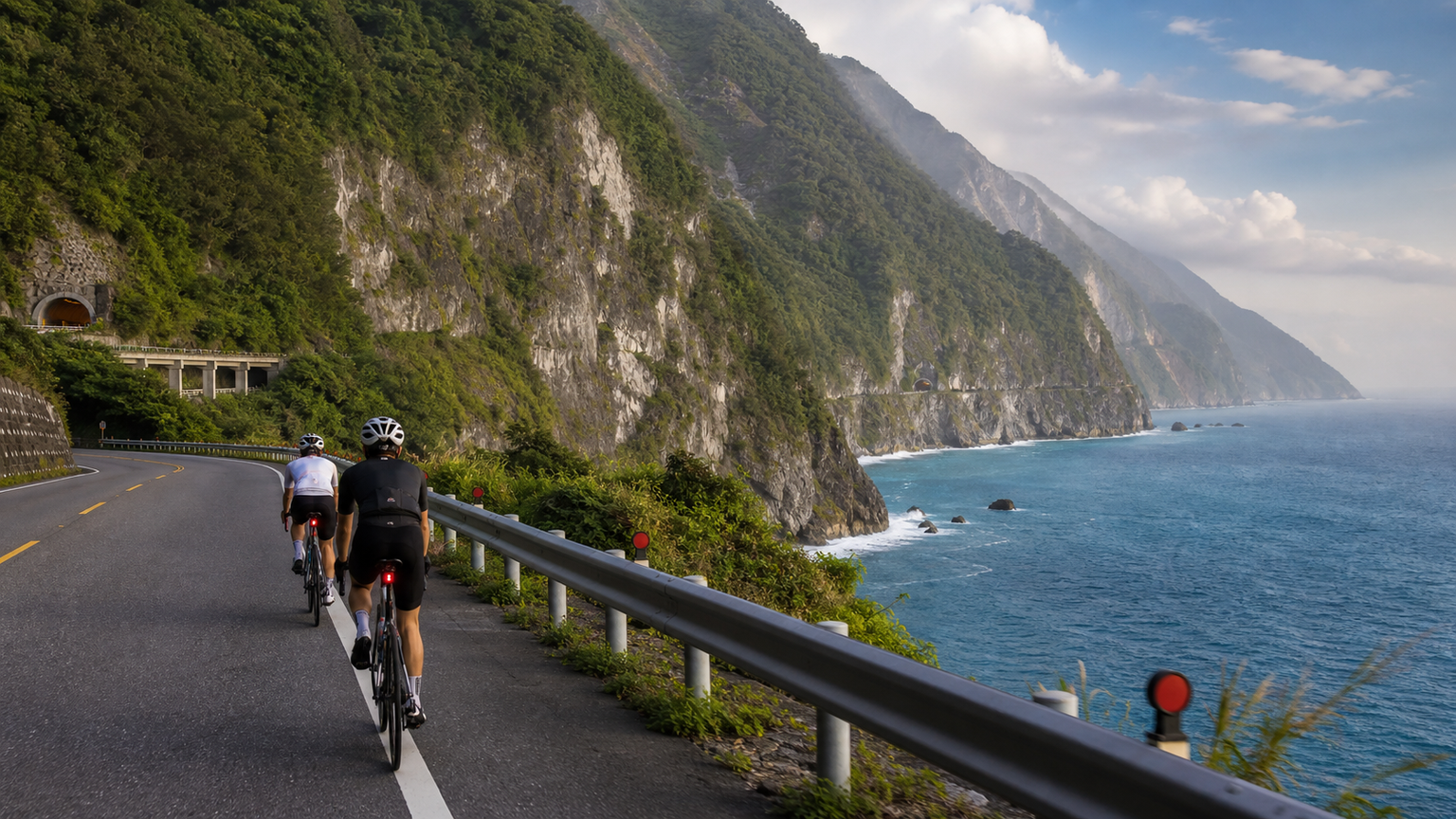
The Su Hua Highway, the Su’ao to Hualien section of Provincial Highway 9, stretches approximately 118 kilometers and is hailed as “Taiwan’s most beautiful and most treacherous road.” This route hugs the eastern flank of the Central Mountain Range, winding between sheer cliffs and the Pacific Ocean, with a breathtaking ocean viewpoint every few kilometers. For cyclists, the Su Hua Highway is more than just a road—it is a magnificent journey through a natural theater. Every year, it attracts countless domestic and international riders to take on the challenge and create their own Su Hua memories.
Route Overview and Segment Planning
Starting from Su’ao, the Su Hua Highway passes through Nan’ao, Heping, Horen, and Chongde before finally reaching Hualien City. The route features rolling terrain with mostly flat to gentle gradients, punctuated by occasional short climbs. For riders with a solid fitness base, completing the ride in one day is feasible, but a two-day itinerary is highly recommended to savor the scenery.
| Segment | Distance | Main Attractions | Difficulty | Suggested Stop |
|---|---|---|---|---|
| Su’ao → Nan’ao | Approx. 26 km | Dongyue Spring, Nan’ao Beach | ★★☆ | 30 minutes |
| Nan’ao → Heping | Approx. 33 km | Gufeng Tunnel, cliffside ocean views | ★★★ | 20 minutes |
| Heping → Horen | Approx. 20 km | Heping Power Plant, ocean-view corridor | ★★☆ | 10 minutes |
| Horen → Hualien | Approx. 39 km | Chongde Cliff, Qingshui Cliff | ★★★ | 60 minutes |
Qingshui Cliff is the most famous attraction on the Su Hua Highway. The cliff rises dramatically from sea level into the clouds, a sight so majestic it leaves you in awe. It is recommended to stop here for ample time to take photos.
Key Safety Considerations for Riding
The dangers of the Su Hua Highway should not be underestimated. The following points are essential knowledge for every rider before setting out:
- Tunnel Lighting Preparation: The Su Hua Highway has multiple tunnels, some of which are long and dimly lit. Front and rear lights are mandatory, and it is recommended to use flashing mode to increase visibility. Turn on all lights before entering a tunnel so vehicles behind you can spot you early.
- Sharing the Road with Large Vehicles: This road is a vital freight route for Hualien, with numerous dump trucks and large trucks. Ride close to the shoulder at all times. When large vehicles overtake you, pull over and wait for them to pass. Never ride side-by-side or occupy the traffic lane.
- Rockfall Awareness: Certain mountain sections carry a risk of rockfall, especially after heavy rain or earthquakes. Watch for loose gravel on the road surface. If you see yellow rockfall warning signs, slow down and proceed with caution.
- Weather Condition Assessment: The Su Hua Highway is frequently closed during typhoons or heavy rain. Always check the latest road conditions from the Central Weather Bureau and the Highway Bureau before departing. Visibility is poor and roads are slippery in the rain, so avoid riding or adjust your plans accordingly.
- Sharing Your Itinerary: Inform family and friends of your riding plan before departure, and keep your phone charged at all times for emergency contact.
Supply Stops and Accommodation Planning
Proper supply planning is crucial for a long-distance ride. The facilities available along the Su Hua Highway are as follows:
- Before Departing from Su’ao: Stock up at convenience stores near Su’ao Station—this is the last densely populated supply point.
- Nan’ao (approx. 26 km): Convenience stores and local eateries offer full meals. Nan’ao River Mouth Beach is worth a short rest stop.
- Heping (approx. 59 km): A small shop next to the gas station sells drinks and light snacks, making it a key mid-route supply point.
- Chongde (approx. 100 km): The last supply stop before reaching Hualien, with a small store available.
- Hualien City: The finish line offers abundant accommodation options, and the Hualien Night Market is the perfect place to recover your strength.
If you opt for a two-day itinerary, staying overnight in Nan’ao on the first day is recommended. Choose from local guesthouses or hostels, enjoy a relaxing seaside evening, and continue south the next morning.
Practical Tips
Riding on weekdays can significantly reduce traffic volume, as the Su Hua Highway sees increased vehicle flow on weekends, raising safety risks. Additionally, if you have limited stamina or want to save time, you can use the train to cover portions of the route. Taiwan Railways currently allows bicycles to be brought aboard select services with an additional ticket, offering flexible route planning.
The Su Hua Highway has no finish line—only scenery worth savoring again and again. Every turn reveals a new painting, and every gust of sea breeze carries the essence of the Pacific.
Conclusion
Riding the Su Hua Highway is a dual test of physical endurance and mental resolve, and a profound encounter with Taiwan’s most spectacular coastline. With thorough safety preparations and a relaxed mindset, this road will leave you with cycling memories that last a lifetime. Safety first, scenery second—let every pedal stroke become a story worth remembering.
Related Reading
- Su Hua Highway Cycling: A Complete Guide to Scenery, Safety, and Itinerary Planning
- Su Hua Highway Bike Adventure: The Ultimate Riding Experience on Pacific Cliffs
- The Majestic Ride on Su Hua Highway: Cliffs, Sea Breezes, and the Unbelievable East Coast of Taiwan
- Su Hua Highway Cycling Challenge: The Complete Guide to Riding the Coastal Road from Su’ao to Hualien
單車環島 蘇花公路精彩片段
10 年前
微東進 太魯閣 蘇花 單車兩日遊 ! 颱風過後路況超刺激 行程大亂 | 最狂的鹹酥雞訂單 | CT Yeh | 4K 高畫質空拍絕景!
4 年前
台北闊瀨陡坡 騎旅 / 日本單車雜誌編輯車友臨時加入!/ 髮香才是最強的 / feat. 北迴歸線小隊 / 公路車 CT Yeh
6 個月前
嘉義大埔、阿婆灣挑戰賽,美到以為在日本!ft. 環騎5 Cool 西拉雅188 / 公路車 / CT Yeh
7 個月前
半日 小台灣 極限單車路線挑戰實錄
7 年前
大武山20%魔王陡坡【JJSC南台灣遊騎Day2】!屁股真的要裂開了...凡士林抹滿也沒用?神秘金教堂還有超便宜夜市
3 個月前
大武山後門26%歡樂陡坡!JJSC南台灣單車行Day2 / 被颱風追著跑 / 公路車 / CT Yeh
2 年前
山道猴出沒!? JJSC屏東單車行 Day1 一直催 / 皮卡丘來了!/ 墾丁 旭海 恆春 社頂 / 公路車 / CT Yeh
2 年前