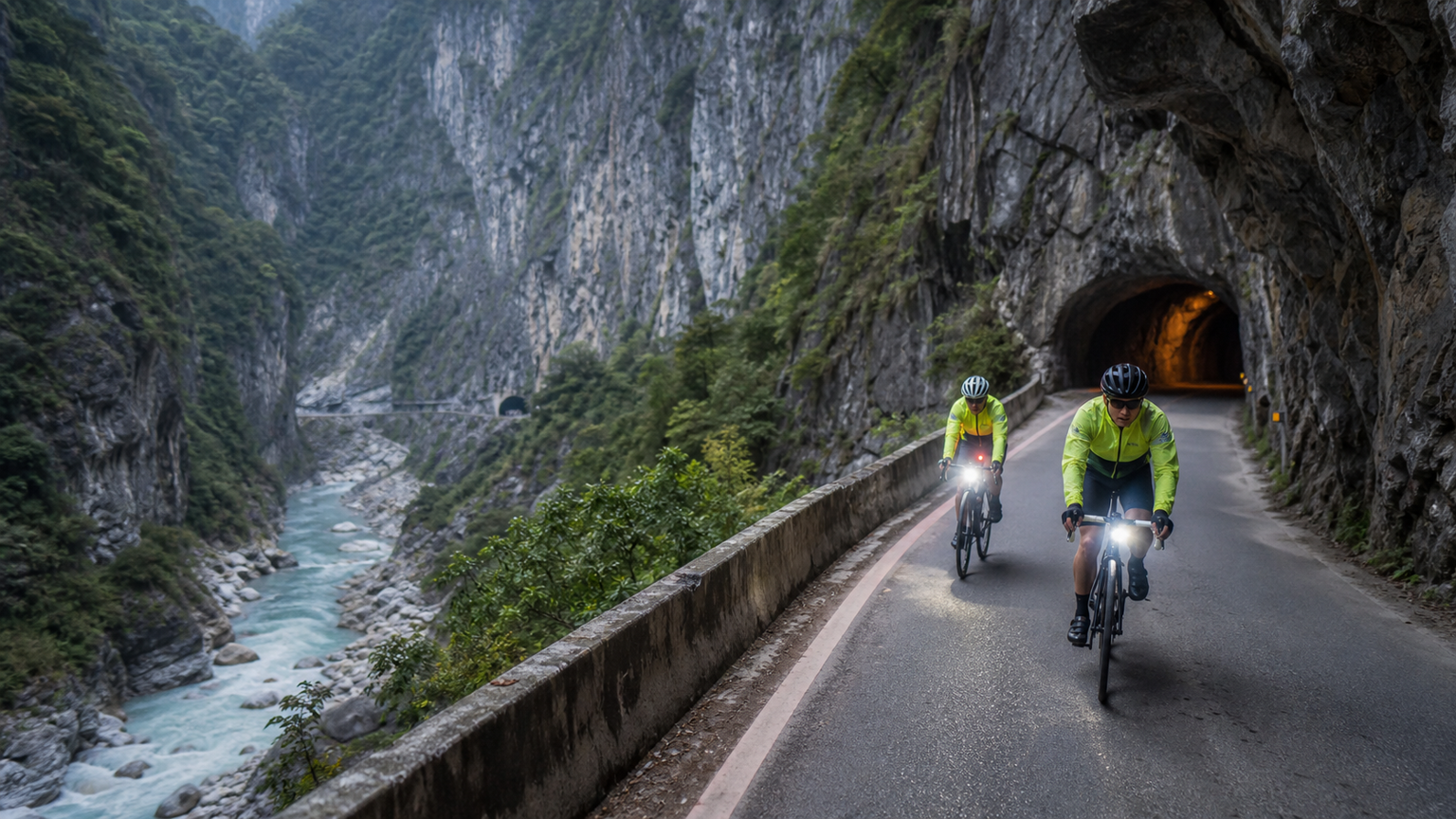
Taroko Gorge Cycling Safety Guide: Riding Tips for Crossing the Marble Canyon
The Central Cross-Island Highway (Provincial Highway 8) within Taroko National Park, stretching approximately 19 kilometers from the Taroko Arch to Tianxiang, is Taiwan’s most spectacular canyon road. The deep gorge carved by the Liwu River through marble rock formations features sheer cliffs rising hundreds of meters, with the road hewn into the cliff face—a sight of rare grandeur worldwide. However, this route also carries significant risks due to frequent geological activity. This article prioritizes safety above all, providing a complete riding guide.
Route Basic Information
- Starting Point: Taroko Arch (Provincial Highway 8, 187K, elevation approx. 60 meters)
- Recommended Turnaround Point: Tianxiang (Provincial Highway 8, 170K, elevation approx. 480 meters)
- One-Way Distance: Approx. 19 kilometers
- One-Way Elevation Gain: Approx. 420 meters
- Average Gradient: Approx. 2.2%
- Difficulty: ★★☆☆☆ (Physical) / ★★★★★ (Risk)
- Estimated Time: 1.5 to 2.5 hours one way; 3 to 5 hours round trip
Risk Assessment: Why Taroko Requires Special Safety Attention
Rockfalls—The Greatest Threat
The rock formations in Taroko Gorge are primarily marble and gneiss, with well-developed joints influenced by earthquakes and rainfall. Rockfalls are a normal occurrence, not an anomaly. Following the April 2024 Hualien earthquake, multiple sections were severely damaged, and some remain under repair to this day.
High-Risk Rockfall Sections:
- Yanzikou to Jioucyutung section (most dangerous)
- Near Cimu Bridge
- Near the entrance of Baiyang Trail
Response Strategies:
- Check the real-time road conditions on the Taroko National Park official website before departing
- Absolutely do not enter within 72 hours after rain or an earthquake
- Speed through rockfall warning sections without stopping to take photos
- Wearing a helmet is the minimum requirement; consider a full-face helmet if conditions allow
- Pay attention to surrounding sounds; if you hear rocks rolling, immediately move away from the cliff face
Tunnels—Dangers in the Dark
There are over 20 tunnels on the Taroko to Tianxiang section, some with insufficient lighting or none at all. Tunnel surfaces may be slippery, and you share narrow spaces with vehicles.
Tunnel Safety Points:
- Front light of at least 600 lumens, set to steady mode (not flashing)
- Rear light in high-brightness flashing mode
- Before entering a tunnel, confirm no vehicles are behind you, or wait for vehicles to pass first
- Ride on the right side inside tunnels, maintaining a straight line
- When exiting tunnels, be aware of pupil adjustment—the brief visual blind spot is dangerous
Vehicles—Risks of Shared Roads
The Central Cross-Island Highway is the only access road to Taroko Gorge, shared by tour buses, cars, motorcycles, and bicycles. Traffic volume is extremely heavy on holidays, and the road is narrow.
Response Strategies:
- Ride on weekdays, avoiding holidays and long weekends
- Depart early in the morning (before 7:00 AM), avoiding the tour bus peak (9:00 AM–3:00 PM)
- On narrow sections, proactively pull over and stop to let large vehicles pass
- Do not ride side by side
Detailed Section Analysis
Taroko Arch → Shakadang Tunnel (2 km)
Risk Level: Medium
Traffic converges at the starting point, requiring extra caution. The Shakadang Tunnel is relatively long; ensure your lights are turned on.
Shakadang → Yanzikou (5 km)
Risk Level: Medium-High
Climbing along the Liwu River valley, the gorge gradually deepens. You may briefly stop at the Changchun Shrine trailhead (watch for rockfalls), where you can view the Changchun Shrine built into the cliff face from afar.
Yanzikou → Jioucyutung (4 km)
Risk Level: High
This is the narrowest and deepest section of Taroko Gorge, with the highest rockfall risk. The gorge is only a few dozen meters wide, flanked by towering sheer walls. The Jioucyutung Trail is a pedestrian-only tunnel; cyclists must use the highway tunnel.
Special Note: This section features multiple consecutive tunnels with dramatic light changes. Some tunnels have water-curtain-like seepage, making the road surface extremely slippery.
Jioucyutung → Cimu Bridge (4 km)
Risk Level: Medium-High
Past Jioucyutung, the gorge opens up slightly, but multiple rockfall zones remain. Cimu Bridge is a good rest point, where you can admire the Frog Rock in the river valley from the bridge.
Cimu Bridge → Tianxiang (4 km)
Risk Level: Medium
The gradient eases on this final stretch, and the area around Tianxiang is more spacious. Tianxiang offers a visitor center, public restrooms, small shops, and hotels, making it an excellent rest and turnaround point.
Equipment Requirements (Not Recommendations, Requirements)
The following equipment is mandatory for riding in Taroko—none are optional:
- Helmet: Must be worn; this is non-negotiable
- High-Brightness Front Light: At least 600 lumens, with sufficient battery
- High-Brightness Rear Light: Flashing mode during daytime
- Reflective Vest or Bright Cycling Jersey: Visibility inside tunnels is critical
- Gloves: To protect your palms during emergency braking in tunnels
- Water: At least one bottle; no resupply before Tianxiang
- Mobile Phone: Keep it charged; call 112 or the Taroko Visitor Center in an emergency
Best Riding Times
Recommended
- Months: October to December (period with least rainfall)
- Days: Tuesday to Thursday (fewest visitors)
- Time: Depart between 6:00–7:00 AM
Avoid
- Typhoon season (July–September) and the two weeks following a typhoon
- Periods of continuous rainfall and 72 hours after rain
- One week after an earthquake (aftershocks may trigger rockfalls)
- National holidays and weekends
Extended Route: West of Tianxiang
Continuing west from Tianxiang leads to Dayuling (junction of Provincial Highway 8 and Provincial Highway 14A, elevation 2,565 meters), but this section is frequently closed due to landslides and has very few resupply points. It is only recommended for experienced riders when road conditions are confirmed to be good.
Alternatives: Safer Routes Around Taroko
If you have concerns about the risks of Taroko Gorge, here are safer alternative routes nearby:
- Provincial Highway 9, Xincheng to Chongde Section: Ride along the Pacific coast with open views and a wide road surface
- Hualien County Road 193: Known as Taiwan’s most beautiful county road, running along the western side of the Huatung Valley with light traffic and scenic views
- Liyu Lake Loop Cycling Path: Easy flat terrain, suitable for leisure riding
Conclusion
The grandeur of Taroko Gorge is beyond doubt, but please make safety your top priority. The power of nature far exceeds human imagination—a single rockfall can cause irreparable harm. With thorough preparation, the right timing, and constant vigilance, you can experience this unforgettable ride through the marble canyon while staying safe.
Related Reading
台灣登山王之路 KOM 全程參賽4K臨空錄影 PART1 穿越峽谷地形! #東進武嶺 太魯閣 / 燕子口 / 天祥 / 西寶 PART1 (公路車 / CT Yeh)
3 年前
微東進 太魯閣 蘇花 單車兩日遊 ! 颱風過後路況超刺激 行程大亂 | 最狂的鹹酥雞訂單 | CT Yeh | 4K 高畫質空拍絕景!
4 年前
太平山單車員工旅遊 | 這樣玩CP值最高!| 公路車
5 年前
一定要騎一次!阿里山最深處:里佳部落!單車旅行 | 2800m爬升 | 深度部落體驗:嗨翻晚會、螢火蟲、銀河 | feat. JJSC & 廢物伙伴 | 公路車 CT Yeh
10 個月前
里佳部落 阿里山單車深度旅遊! | 竹山/草嶺/來吉/奮起湖 | 無敵銀河絕景 全新路線探索! 驚險狀況百出! | 4K沉浸式畫質 | 公路車 | CT Yeh
3 年前
台北闊瀨陡坡 騎旅 / 日本單車雜誌編輯車友臨時加入!/ 髮香才是最強的 / feat. 北迴歸線小隊 / 公路車 CT Yeh
6 個月前
新竹羅平 x 天湖部落 大禹嶺級變態陡坡! 4K超高畫質 空拍 | 公路車
5 年前
阿里山塔塔加 兩倍特濃版!全新隧道開通! 進喔!公路車 | CT Yeh
3 年前