Taoyuan Jiaobanshan Climbing Training: A Complete Guide to a Hilly Route Perfect for Weekend Rides
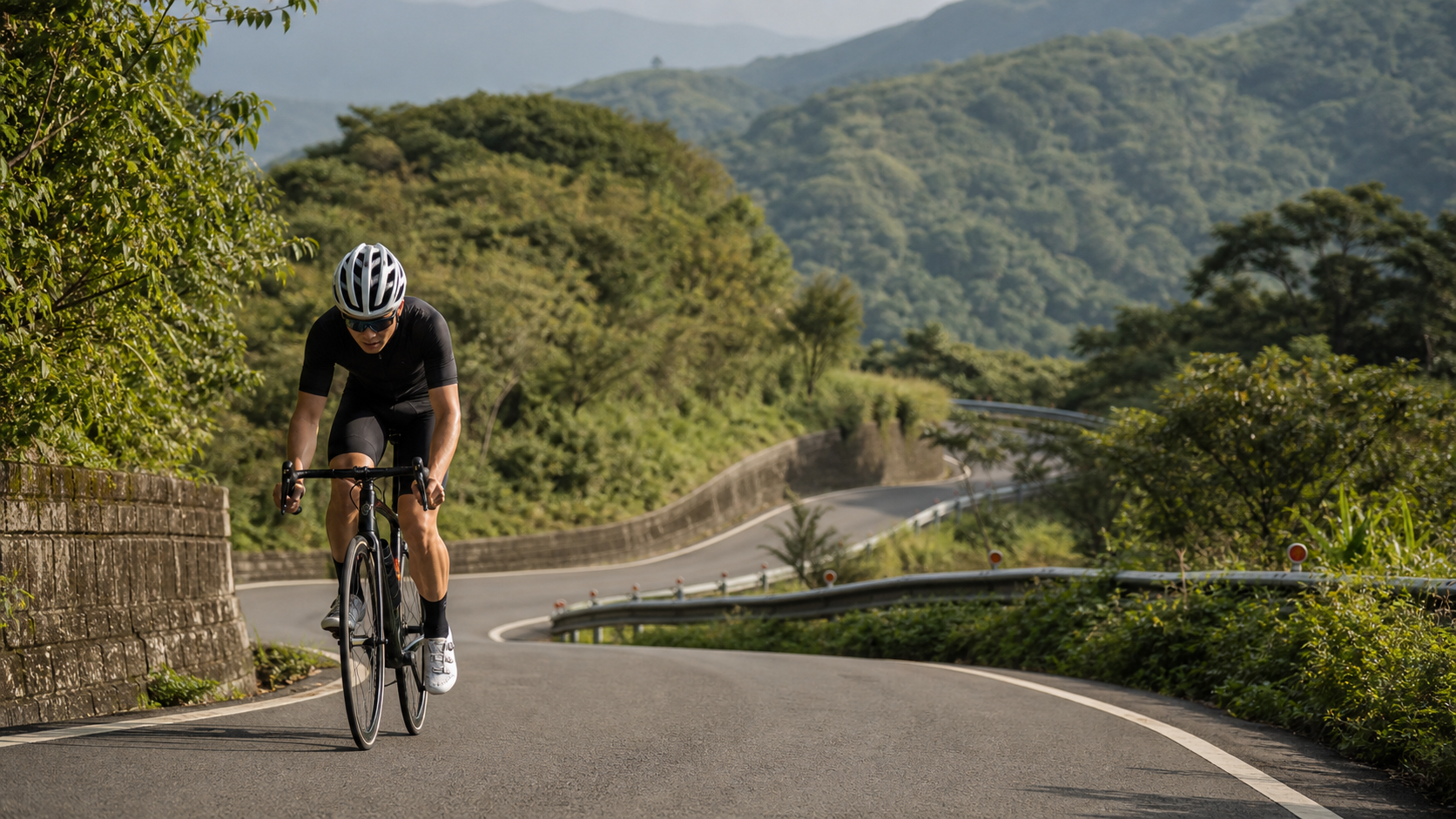
Taoyuan Jiaoban Mountain Climbing Training: The Complete Guide to a Weekend Hill Route
Route Overview: Fuxing District, Taoyuan City | Start Daxi | Finish Jiaoban Mountain | Distance approx. About 20 km | Elevation Gain About 500 m
Taiwan’s mountainous terrain and surrounding seas create dramatic landscapes, which is precisely why it fosters a world-class riding environment. Taoyuan Jiaoban Mountain Climbing Training deserves an in-depth feature because it condenses the essence of riding in Taiwan into a single route. This article will start with the overall route profile, break down the terrain and gradients section by section, and then extend into pacing strategy, fueling rhythm, safety risks, and pre-race training cycles. The goal is to give both first-time visitors and seasoned riders looking to set a new personal record (PR) a complete, three-dimensional understanding of the route before they set off.
1. Route Overview and Geographic Background
Located in Fuxing District, Taoyuan City, this route connects landmarks such as Daxi Old Street, Cihu, and Jiaoban Mountain Park, making it a classic among local riders. From a geographic perspective, Taiwan’s mountain ranges, monsoon patterns, and the intersection of land and sea profoundly influence the riding feel of every route. Jiaoban Mountain is a rolling hill section at the entrance to the Northern Cross-Island Highway, suitable for weekend rhythm and undulating endurance training, and can be extended to Luofu for added volume.
Understanding the “personality” of a route is the first step in planning a ride. Think of the entire route as a piece of music: there’s a warm-up prelude, a main theme that gradually builds tension, a climactic section that truly tests your willpower, and finally a closing passage that returns to calm. Only by grasping the overall structure first can you invest the right effort in the right sections, rather than burning all your matches at the start.
- Route Type: Rolling hills, suitable for rhythm training
- Recommended Season: Rideable year-round; autumn and winter offer better visibility
- Overall Difficulty: Varies by individual fitness; it is recommended to assess your continuous climbing endurance and long-distance experience before deciding on your challenge level and target time.
2. Section-by-Section Terrain and Gradient Breakdown
The most effective way to ride a route well is to break it into several “mentally manageable” segments, setting pacing and fueling goals for each. Based on terrain characteristics, the route is divided into three parts below: the warm-up section, the main climb (or main cruise) section, and the decisive section.
2-1 Warm-Up Section: Establish Rhythm, Avoid Overheating
The early part after departure is key to establishing rhythm. A common mistake many riders make is pushing too hard at the start, driven by adrenaline, which leads to an early “bonk” in the middle and later stages. The correct approach is to keep your heart rate in the aerobic zone (approximately 70% to 80% of maximum heart rate), starting at an intensity slightly below what feels comfortable, allowing your body to gradually ease into working mode.
Cadence in this section should be maintained at 85 to 95 rpm, using a lighter gear and higher spin to warm up the legs, avoiding the accumulation of excess lactate from grinding a big gear from the start. Use this time to check your equipment: tire pressure, shifting, brakes, and the location of your fuel, ensuring everything is ready.
2-2 Main Section: The Core Tension of the Route
Once you enter the core of the route, the terrain characteristics (rolling hills, suitable for rhythm training) will truly begin to test your abilities. If this is a climbing route, focus on “sustainable maximum steady output,” meaning riding at an intensity close to but not exceeding your lactate threshold; if this is a flat or coastal route, the emphasis is on maintaining efficient cruising and paceline rhythm while properly handling crosswinds.
| Pacing Principle | Climbing Route | Flat/Coastal Route |
|---|---|---|
| Intensity Basis | Power at approximately 75–88% of FTP, lower edge of heart rate threshold | Power at approximately 70–80% of FTP, upper edge of aerobic heart rate |
| Cadence | 70–85 rpm, adjusted by gradient | 90–100 rpm, maintain fluidity |
| Gear Strategy | Reserve a light gear for the steepest sections, shift early | Use mid-to-large gears for cruising on flats, downshift into headwinds to maintain cadence |
| Fueling Timing | Fuel with energy and fluids every 30–45 minutes | Fuel every 40–60 minutes, pay attention to electrolytes |
The most important principle in this section is “conserving strength.” The art of pacing lies in this: when you feel “I could actually go a little faster right now,” that is often the correct intensity. Suppress the extra urge and save it for the truly decisive section.
2-3 Decisive Section: The Sum of Willpower and Skill
The final section of a route is often where success or failure is determined. If it’s a climb to the finish, this is usually the steepest, highest, and coldest part of the route. Your body has accumulated fatigue and the air is thinner; only the energy saved in the earlier sections and unwavering willpower can carry you to the finish. If it’s a long flat stretch, the final section is a battle against accumulated fatigue and declining focus.
On descents or the return leg, always put “safety” ahead of “speed.” Take an outside-inside-outside line through corners, complete your braking before entering the turn, avoid heavy braking mid-corner, keep your center of gravity low, and look toward the exit. Mountain roads in Taiwan often have fallen leaves, moss, gravel, and slippery surfaces. Better to go slower than to risk your safety.
3. Highlights and Must-See Scenery Along the Way
The most captivating aspect of this route is the rich cultural and natural scenery along the way. Below are the key landmarks, with a recommendation to slow down and savor them when it’s safe to do so. After all, cycling isn’t just about data—it’s about connecting with the land.
| No. | Landmark | Riding Suggestion |
|---|---|---|
| 1 | Daxi Old Street | Landmark along the route; slow down, be mindful of photo stops and traffic flow |
| 2 | Cihu | Landmark along the route; slow down, be mindful of photo stops and traffic flow |
| 3 | Jiaoban Mountain Park | Landmark along the route; slow down, be mindful of photo stops and traffic flow |
| 4 | Fuxing Suspension Bridge | Landmark along the route; slow down, be mindful of photo stops and traffic flow |
Behind every landmark lies a story of Taiwan—a piece of pioneering history, a center of faith, or a forest and coastline guarded by generations. As you pass these places between pedal strokes, take an extra look; that is the most precious nourishment of riding in Taiwan.
4. Fueling Strategy and Stop Arrangements
Fueling often accounts for half the success or failure of long-distance and climbing rides. During high-intensity exercise, glycogen is continuously depleted, and once it bottoms out, you experience what is commonly called “bonking.” Smart riders adopt the principle of “small amounts, frequent intake, and fueling in advance,” rather than waiting until they’re hungry or thirsty.
4-1 Main Fueling Stops
- Daxi Urban Area: An ideal spot for water, fuel, and a short rest.
- Jiaoban Mountain Image Shopping District: An ideal spot for water, fuel, and a short rest.
4-2 Fueling Rhythm Recommendations
- Fluids: Replenish approximately 500–750 ml per hour, increasing in high heat or high intensity. Monitor sweating and thirst levels to avoid dehydration and avoid over-drinking, which can dilute electrolytes.
- Carbohydrates: High-intensity riding requires approximately 60–90 grams of carbs per hour, which can be supplied by energy gels, energy bars, bananas, or local snacks. For longer rides, consider electrolyte tablets to supplement sodium and prevent cramping.
- Local Cuisine: One of the great joys of Taiwan routes is turning fueling stops into culinary adventures. Local snacks along the way not only replenish calories but also create lasting memories of the journey. However, during races, stick to foods that are easy to digest and gentle on the stomach.
5. Safety Risks and Equipment Checks
No matter how beautiful the route, safety is always the top priority. For this route, here are the risks that require special attention:
- Northern Cross-Island Highway traffic: Anticipate and reduce speed in advance, leaving room for reaction.
- Descent corners: Anticipate and reduce speed in advance, leaving room for reaction.
- Holiday crowds: Anticipate and reduce speed in advance, leaving room for reaction.
Equipment Checklist:
- Helmet: Wear it on every ride, and confirm the strap and fit.
- Lights and Reflectors: Turn on front and rear lights in tunnels, early morning, dusk, or fog, and wear high-visibility clothing.
- Tire Condition and Spare Tubes: Check tire pressure and tread before departure; carry inner tubes, tire levers, and a pump/CO2.
- Warmth and Sun Protection: Temperature differences are significant at high altitudes or on descents; bring a windbreaker and arm warmers. On flats and coastal routes, focus on sun protection and hydration.
- Communication and ID: Keep your phone fully charged, carry ID and some cash, and let family know your route and estimated return time.
6. Pre-Race Training Cycle Recommendations
To complete this route safely and with a sense of accomplishment, a periodized training plan of 8 to 12 weeks is recommended. Below is a general framework that riders can adjust based on their baseline:
| Phase | Focus | Example Content |
|---|---|---|
| Weeks 1–3 (Base Phase) | Build aerobic foundation | 2–3 long aerobic rides per week, heart rate in Zone 2, gradually extending duration |
| Weeks 4–6 (Build Phase) | Improve threshold and climbing power | Add threshold intervals (e.g., 4×8 minutes), repeat hill climbs |
| Weeks 7–9 (Specific Phase) | Simulate route demands | Schedule long rides close to target distance and elevation gain, rehearse fueling and pacing |
| Weeks 10–12 (Taper Phase) | Fine-tune condition | Reduce training volume, maintain intensity, rest fully and load glycogen in the final week |
Beyond training, don’t neglect stretching, strength, and rest. Core and lower-body strength improve pedaling efficiency and stability, while adequate sleep is the foundation of recovery and progress. Treat training, nutrition, and recovery as the three legs of a tripod—none can be missing.
7. Weather, Seasons, and Timing
Taiwan sits at the junction of subtropical and tropical zones, with the towering Central Mountain Range intercepting moisture, so weather affects riding far more dramatically than one might imagine. For this route in Fuxing District, Taoyuan City, rideable year-round, with better visibility in autumn and winter is the optimal time confirmed by local riders, but even in good seasons, many details deserve attention.
- Afternoon Thunderstorms: Especially in summer, convective thunderstorms are common in Taiwan’s mountain areas in the afternoon. Not only are roads slippery and dangerous, but lightning is a lethal threat. It’s best to “start early and return early,” completing the main climbs or itinerary before noon to avoid unstable afternoon weather.
- Fog and Visibility: High-altitude and river valley sections are prone to afternoon fog, and a sudden drop in visibility greatly increases the risk of encounters with vehicles. In fog, turn on front and rear lights, wear bright clothing, and reduce speed.
- Temperature Differences and Hypothermia: Taiwan’s elevation changes can create all four seasons within a single route. Sweat-soaked clothing from climbing can rapidly draw away body heat on long high-altitude descents, causing hypothermia and muscle stiffness. Carrying a windbreaker, arm warmers, and even thin gloves is essential for long climbing routes.
- Monsoon and Crosswinds: On coastal and offshore island sections during the winter northeast monsoon, crosswinds and headwinds significantly increase riding difficulty and danger. In strong winds, reduce speed, hold the drops to lower wind resistance, and maintain a safe lateral distance from companions.
Choosing a departure time isn’t just about avoiding bad weather; it’s also about avoiding peak traffic. Holiday tourist hotspots are often crowded with people and vehicles, while early mornings on weekdays are relatively quiet, allowing you to focus more on the ride itself.
8. Equipment Setup and Gear Ratio Recommendations
“Sharpen your tools before you start.” Given the terrain characteristics of this route (rolling hills, suitable for rhythm training), the rationality of your equipment setup directly affects whether you can finish with ease.
| Item | Recommended Setup | Notes |
|---|---|---|
| Gear Ratio | For climbing routes, a compact crank 50/34 with an 11–32T or larger cassette | Leave margin for knees and lungs, avoid grinding and injuring knees |
| Wheels | Low-profile lightweight for climbing; mid-to-high profile for flats/coastal | Balance climbing agility with flat cruising efficiency |
| Tire Pressure | Adjust by body weight and tire width; slightly lower in mountains and wet conditions | Improve grip and comfort, reduce puncture risk |
| Brakes | Check brake pads and hydraulic/cable systems before departure | Long descents are a severe test for brakes; ensure stopping power |
Pedaling and Position: For long-distance riding, correct frame size and bike fitting prevent cumulative injuries to the knees, lower back, and wrists. If you plan to take on similar routes long-term, investing in a professional bike fitting is worthwhile. Standing to climb (out of the saddle) can engage different muscle groups and relieve saddle pressure, but it consumes more energy, so use it strategically when the gradient steepens or when you need a brief surge.
9. Pacing Math: Managing Your Effort with Numbers
Many riders ride by feel, ending up either too conservative and regretful or too aggressive and crashing mid-ride. In reality, mastering a few simple numerical concepts allows for a more scientific allocation of energy.
- Negative Split Principle: In an ideal long-distance ride, the average intensity of the second half should be equal to or slightly higher than the first half. In other words, “hold back” in the early stages, keeping the effort at a “can still chat” level.
- Climbing Time Estimation: Gaining 100 meters of vertical elevation typically takes an average rider about 8 to 15 minutes, depending on gradient and fitness. With this route’s approximately about 500 m of elevation gain, the vertical climbing alone could take several hours—be sure to factor this into fueling and weather planning.
- Power-to-Weight Ratio (W/kg): Climbing performance is highly dependent on power-to-weight ratio. If you can sustain a steady output of 2.5 to 3 watts per kilogram, most classic Taiwan climbs can be completed in a reasonable time; to chase results, you’ll need to push this number higher.
- Heart Rate Anchoring: Riders without a power meter can use heart rate as a pacing guide. Keeping your heart rate at the lower edge of your threshold (approximately 85% of max) during the main section is the sweet spot balancing speed and endurance.
Apply these principles to the terrain of Fuxing District, Taoyuan City, and you’ll find that “slow is fast”—every bit of energy saved in the early sections will repay you twofold in the decisive section.
10. Common Beginner Mistakes and FAQ
Q1: What’s the most common mistake when tackling this route for the first time?
A: Starting too fast. Adrenaline causes riders to unconsciously accelerate in the early stages, leading to a collapse mid-ride. Deliberately keep the early intensity low.
Q2: How much fuel should I prepare?
A: Better to overprepare. Estimate the calories needed based on route distance and elevation gain, then add 20% as a buffer. Energy gels, energy bars, and electrolyte tablets are standard for long rides.
Q3: What should I do if it rains or fog rolls in?
A: Safety first. If weather clearly deteriorates, don’t push it. Reduce speed, turn on lights, maintain distance, and take shelter or turn back if necessary. The mountain isn’t going anywhere; getting home safely is what matters most.
Q4: Is it better to ride solo or with a group?
A: For routes with sparse fueling options and complex road conditions (such as the risk points mentioned for this route), riding with companions allows mutual support and rotating pace-setting, increasing both safety and enjoyment. Regardless of solo or group riding, always inform someone of your itinerary and estimated return time.
Q5: How do I know if I’m ready?
A: If you can complete a long ride in training that covers 70–80% of the target distance with similar elevation gain without being completely exhausted, you generally have the foundation to take on the challenge. The rest is up to pacing and willpower.
11. Mindset and Conclusion
Taoyuan Jiaoban Mountain Climbing Training is not just a route; it’s a mirror reflecting yourself. It will honestly tell you whether your preparation is sufficient, your pacing is sound, and your willpower is firm. When you stand at the finish and look back at the road you’ve traveled, that sense of accomplishment is something no data can fully measure.
Finally, three words of advice for all riders looking to take on this route: Respect the route, respect your body, respect this land. Do your homework, manage your rhythm, and take in the scenery. You’ll find that every route in Taiwan is a journey of dialogue with yourself. May you ride safely, ride joyfully, and write your own story.
This article is a riding guide and training reference. Actual road conditions, accessibility, and event rules are subject to the organizer and official announcements. Mountain and coastal weather is highly variable; be sure to check real-time weather and road information before departure. Ride within your limits and prioritize safety.
Related Reading
- Taoyuan Fuxing Lala Mountain Route: The Complete Climbing Training Guide for the Northern Cross-Island Highway
- Taichung Dakeng Trail Area Route: A Cross-Training Route for Hill Riding and Hiking
- Taipei Nangang to Muzha Route: The Complete Guide to an Urban-Fringe Climbing Training Route
- Hsinchu Emei to Beipu Hakka Route: The Complete Guide to a Rolling Hill Route for Hakka Culture Riding
爬坡ITT實境)台中 魔王 松鼠坡 首航 6:12 大肚山 大三元 科福路
8 年前
#北橫 + #北進武嶺 最硬的員工旅遊 EP1 | #公路車 #拉拉山 | 明池 | 武嶺 | 武陵農場 | 雲海 | Taiwan Cycling Route Wulin
6 年前
台北大雁西飛 約騎挑戰 feat. Doris | 公路車 | CT Yeh
3 年前
台北闊瀨陡坡 騎旅 / 日本單車雜誌編輯車友臨時加入!/ 髮香才是最強的 / feat. 北迴歸線小隊 / 公路車 CT Yeh
6 個月前
大武山20%魔王陡坡【JJSC南台灣遊騎Day2】!屁股真的要裂開了...凡士林抹滿也沒用?神秘金教堂還有超便宜夜市
3 個月前
太平山單車員工旅遊 | 這樣玩CP值最高!| 公路車
5 年前
嘉義大埔、阿婆灣挑戰賽,美到以為在日本!ft. 環騎5 Cool 西拉雅188 / 公路車 / CT Yeh
7 個月前
大武山後門26%歡樂陡坡!JJSC南台灣單車行Day2 / 被颱風追著跑 / 公路車 / CT Yeh
2 年前