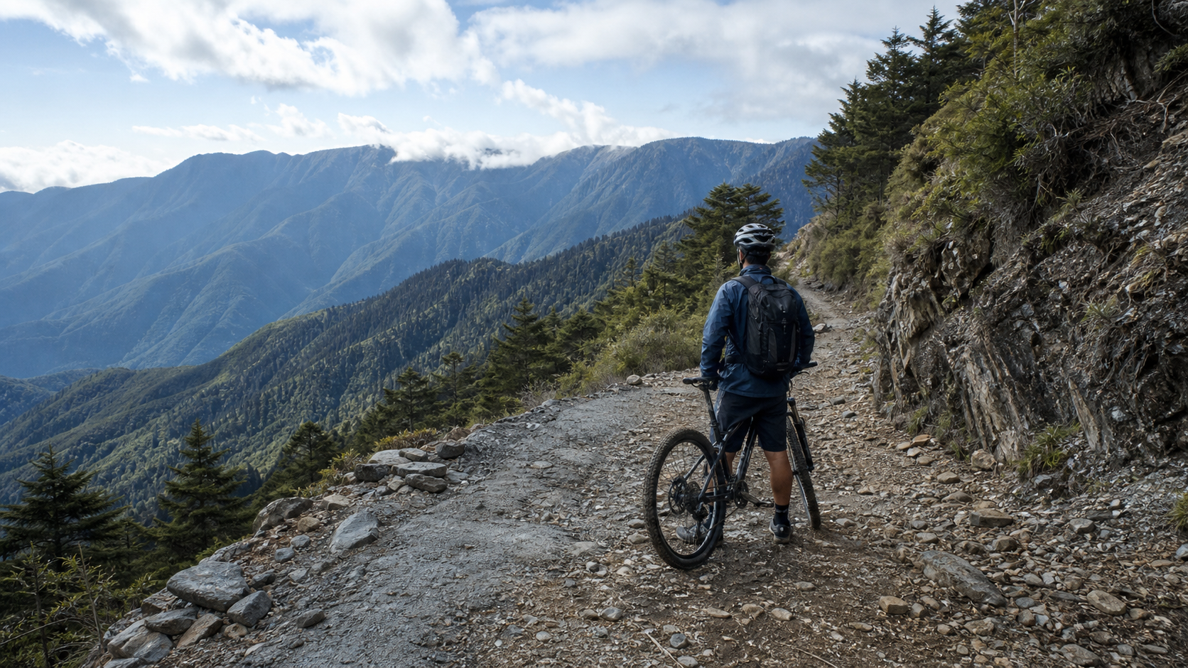
The west section of the Nenggao Cross-Ridge Trail is a route with a unique character. Its full length runs from Tunyuan to Tianchi, with statistics of approximately 12.9 km, cumulative elevation gain of about 1,101 meters, and an average gradient of 6.6%, rated Category 5 on Strava. But before writing any guide, the most important fact must be stated clearly: the vast majority of this route is a hiking trail / ancient path, not a regular road.
For general riding (road bikes, commuters), the practical endpoint is the Tunyuan Trailhead (elevation approximately 1,860 meters). Before Tunyuan, the road is a passable industrial road; after Tunyuan, the section toward Tianchi Lodge (elevation approximately 2,860 meters) and the Guangbei Babel Monument (approximately 2,890 meters) is a hiking trail requiring mountain climbing permits and mountain entry / park entry regulations—it is not a road where you can “easily ride to Tianchi.” This article therefore splits the guide into two parts: the “rideable guide” for general cyclists (to the Tunyuan Trailhead), and an honest explanation of the off-road bike-carrying section.
Route Overview: First Distinguish “Rideable” from “Hikeable”
| Item | Data |
|---|---|
| Statistical section (Tunyuan–Tianchi) | Approximately 12.9 km |
| Cumulative elevation gain | Approximately 1,101 meters |
| Average gradient | 6.6% |
| Strava rating | Category 5 |
| Tunyuan Trailhead elevation | Approximately 1,860 meters (practical vehicle endpoint) |
| Tianchi Lodge elevation | Approximately 2,860 meters (at approximately 13.1 km on the trail) |
| Guangbei Babel Monument elevation | Approximately 2,890 meters (at approximately 15.5 km) |
The west section of the Nenggao Cross-Ridge Trail is located in Ren’ai Township, Nantou County. It was originally a community road used by the Seediq people for migration and trade; during the Japanese colonial period (constructed around 1917–1918), it was developed into the “Nenggao Cross-Ridge Police Road,” the first east-west cross-island road in Taiwan with a width of 2 meters. The access route is: Puli → Wushe → Lushan Tribe → Tunyuan Industrial Road → Tunyuan Trailhead.
Elevation Profile and Gradient Distribution (Conceptual Model of the Rideable Section)
Breaking the “rideable section” into elevation bands is more meaningful than looking at a single average gradient. The 6.6% average is a statistical value; the actual gradient varies greatly across different elevation bands. The route alternates between steep and gentle sections rather than climbing at a constant grade:
| Elevation Band | General Characteristics | Impact on Riding |
|---|---|---|
| 1,100–1,400 m | Settlement and supply zone, gentler gradients | Warm-up, hydration, avoid pushing heart rate too high |
| 1,400–1,700 m | Gradient steepens, settlements thin out | Entering the core climb, need to downshift and hold a steady rhythm |
| 1,700–1,860 m | Approaching Tunyuan, air thinning | Power output drops, recovery slows, watch for landslide repair sections |
Engineer’s perspective: Don’t pace yourself by the “average gradient.” What really bites are those sections that momentarily exceed 10%; save your energy budget for them, and deliberately hold back on the gentler sections—that’s the correct approach for long high-mountain climbs.
General Cyclist Guide: Climbing from Puli / Wushe to the Tunyuan Trailhead
For the vast majority of road cyclists, the “rideable version” of this route is climbing from the Puli and Wushe area, through Lushan, along the Tunyuan Industrial Road up to the Tunyuan Trailhead (approximately 1,860 meters). This section is a proper high-mountain industrial road climb and is the main body of this guide.
Segment 1: Wushe to Lushan (Warm-up and Supply)
- Gearing: Middle chainring with a large cassette cog, maintaining 75–80 rpm, keeping heart rate at 73–76% of max heart rate.
- Key point: This section still has settlements and supplies—it’s the last chance to stock up on water and provisions before heading deeper into the mountains and more desolate terrain.
- Cultural reminder: Passing through Wushe (the historic site of the Wushe Incident) and Lushan, slow down and respect the local community.
Segment 2: Tunyuan Industrial Road Climb (Core Section)
Leaving Lushan toward the Tunyuan Trailhead is a continuous high-mountain climb, with elevation gradually approaching 1,860 meters. High altitude will reduce power output and elevate heart rate.
- Gearing: Drop to the largest rear cog, holding cadence at 65–70 rpm.
- Pacing: Cruise at a set heart rate (78–82% of max heart rate), and be aware that at altitude, recovery is slower.
- Road conditions: The industrial road may have falling rocks, potholes, and signs of landslide repair; be conservative through corners and on descents.
Segment 3: Tunyuan Trailhead (Vehicle Endpoint)
Arriving at the Tunyuan Trailhead is the practical endpoint for road riding. At approximately 1,860 meters, it is the gateway for hikers starting the Nenggao Cross-Ridge Trail and the Qilai–Nanhwa route. Upon arrival, replenish, keep warm, and take photos—do not ride a road bike onto the hiking trail.
Three-Segment Power / Heart Rate Zone Configuration Table
The following are zone configuration recommendations for the “rideable section.” Power is expressed as a percentage of FTP, and heart rate as a percentage of max heart rate (HRmax), for cyclists with power meters / heart rate straps. Actual values should be based on your personal test results—do not force-fit these numbers.
| Segment | Target Power (%FTP) | Target Heart Rate (%HRmax) | Cadence (rpm) | Strategic Focus |
|---|---|---|---|---|
| Wushe→Lushan (warm-up and supply) | 60–70% | 73–76% | 75–80 | Deliberately hold back; don’t burn matches in the warm-up |
| Lushan→Tunyuan core climb | 72–80% | 78–82% | 65–70 | Cruise at set heart rate; allow power to drop with altitude |
| Approaching Tunyuan (1,700 m+) | 68–76% | 80–84% | 60–68 | Power loss from altitude is normal; hold the heart rate ceiling |
Note: At high altitude, the same heart rate corresponds to lower “actual power output.” If you insist on cruising at a set power, your heart rate will be pushed too high; for long high-mountain climbs, it’s recommended to prioritize “set heart rate” and let power naturally drop—this is the safer strategy that’s less likely to blow up.
Gear Ratio Comparison and Cadence Calculation
The core question for steep high-mountain climbs is only this: at the lowest cadence you can sustain, is your gear ratio light enough? The table below uses common combinations to estimate cadence at slow speeds on steep slopes (approximately 6 km/h), helping you determine whether your gearing is sufficient.
| Chainring × Cassette Cog | Perceived Suitability for Gradient | Approximate Cadence at 6 km/h | Notes |
|---|---|---|---|
| 34T × 32T | Acceptable for general climbs | Low | On 10%+ steep sections, easy to grind to a halt, forced to stand |
| 34T × 34T | More comfortable on steep climbs | Moderate | Common safe baseline for amateur high-mountain riding |
| 32T × 34T | Comfortable on steep climbs | Higher | Sub-compact crankset, recommended for long high-mountain climbs |
| 32T × 36T (or higher) | Lifesaver gear for extreme steep sections | High | Insurance for landslide repairs and sections exceeding 12% |
Engineer’s view: Gearing isn’t about “the harder the cooler”—it’s about “whether you can maintain cadence on the climb without stalling.” Better to have a lifesaver gear you never use than to be forced to walk halfway up the mountain because you can’t turn the pedals. Before heading up, be sure to test the lowest cadence you can sustain on the steepest section and work backward to determine the gearing you need.
Honest Explanation of the Off-Road Bike-Carrying Section (Above Tunyuan)
We must be honest: on the section above Tunyuan toward Tianchi and the Guangbei Babel Monument, a small number of off-road cyclists have completed it using a combination of “carrying the bike + riding,” and some have even traversed through to the east section. But according to these riders’ own accounts, the conditions are “trail off-road” in nature—on steep slopes you must dismount and push, with mud, cattle-cart ruts, and multiple landslide cliffs along the way (such as the Tunyuan Great Cliff, and the 6K and 10.1K landslide sections).
This is not a section that general riding can handle. It requires: mountain climbing permits and mountain entry / park entry permissions, the technical skill and fitness for mountain biking, the mental readiness to carry a bike, and a full understanding of high-mountain weather and terrain risks. Unless you have mountain biking experience and have completed all the necessary applications and preparations, make the Tunyuan Trailhead your endpoint and leave the section above Tianchi to your feet.
Assessing the Nature of the Section Above Tunyuan (Why It Doesn’t Count as “Riding”)
A few objective facts make it clear why the section above Tunyuan should be classified as hiking rather than riding:
| Assessment Item | Below Tunyuan (Rideable) | Above Tunyuan (Hiking Trail) |
|---|---|---|
| Surface type | Industrial road, continuous pedaling possible | Trail / ancient path, mud, cattle-cart ruts, and landslide cliffs interspersed |
| Method of progress | Primarily riding throughout | Extensive dismounting and pushing, carrying the bike; riding only in fragments |
| Administrative regulations | General road, no park entry application | Requires mountain climbing application and mountain entry / park entry permits |
| Risk profile | Falling rocks, landslide repair sections | Multiple landslide cliffs, high-mountain weather, risk of getting lost and hypothermia |
| Suitable for | General road / mountain bike riders | A small number of riders with mountain hiking and off-road experience |
One-sentence conclusion: Tunyuan is “where wheels end and feet begin.” Drawing this line clearly is the most important thing in this guide—the cost of misjudging that line can be severe in the high mountains.
Gear and Equipment Recommendations (Rideable Section)
| Equipment Item | Recommendation |
|---|---|
| Chainring | Sub-compact 48/32 or lighter |
| Rear cassette | Largest cog 32–34T |
| Tires | 28c or wider, to handle high-mountain industrial roads |
| Brakes | Disc brakes preferred, key for heat dissipation on long descents |
| Warmth | Windbreaker + insulation layer mandatory; temperatures are low near 1,900 meters |
| Supplies | Minimum two bottles of water; supplies are scarce deep in the mountains |
Effects of High Altitude on the Body (Data-Driven)
The Tunyuan Trailhead is already near 1,900 meters in elevation. While not yet at a height that causes severe acute mountain sickness, the physiological effects are real and must be factored into pacing:
| Physiological Aspect | Effect of High Altitude | Practical Meaning for Riding |
|---|---|---|
| Aerobic output | Reduced partial pressure of oxygen, VO2max decreases with altitude | Actual power at the same heart rate drops; don’t compare with sea-level numbers |
| Heart rate response | Heart rate is higher at the same intensity, recovery is slower | Heart rate ceiling must be more conservative; it takes longer to come back down after a surge |
| Breathing | Faster ventilation, increased subjective effort | RPE (rate of perceived exertion) will be higher than at sea level for the same power—this is normal |
| Perceived temperature | Temperature drops with elevation, plus wind chill | Stopping leads to rapid heat loss; insulation layer is mandatory |
| Hydration | Dry cold air plus faster ventilation, quicker dehydration | Hydrate on a schedule even if you don’t feel thirsty |
Conclusion: Treat high altitude as an invisible resistance that “steals 5–15% of your output.” Proactively budget for this discount when pacing, rather than discovering the numbers don’t add up halfway up the mountain and then having a mental meltdown.
Weather and Landslide Risk Rating
The biggest variables on high-mountain routes aren’t the slopes—they’re weather and geology. Before departing, use the table below for self-assessment; if any item falls in the red zone, postpone. Don’t gamble:
| Risk Item | Green Light (Go) | Yellow Light (Assess Carefully) | Red Light (Postpone Recommended) |
|---|---|---|---|
| Weather forecast | Sunny to partly cloudy all day, no rain | Chance of scattered afternoon showers | Significant rain, thunderstorms, frontal passage |
| Fog conditions | Good visibility | Patchy fog, visibility fluctuating | Dense fog, very poor visibility |
| Road status | Officially open for normal passage | Repairs in progress, some sections controlled | Closed due to landslide / earthquake |
| Personal condition | Well-rested, adequate fitness | Slightly tired, but can shorten the ride | Clearly fatigued, sick, in poor condition |
The mountain geology is fragile, and recent years have seen multiple earthquakes and heavy rains causing landslides. Road and trail opening status can change on short notice—check the latest announcements before departing, and don’t rely on outdated information.
Supplies, Hydration, and Schedule
The Wushe and Lushan area is the supply and hot spring zone along the route (Lushan Hot Springs); beyond this point toward Tunyuan, supplies are scarce, so stock up thoroughly. The nearby Cingjing Farm and Lushan Hot Springs can be visited as side attractions. Choose specific shops on site.
The recommended hydration rhythm is “by schedule” rather than “by thirst.” The following is a conceptual hydration and nutrition schedule; adjust based on your body weight, temperature, and intensity:
| Timing | Hydration | Calories / Electrolytes |
|---|---|---|
| 30 minutes before departure | Drink approximately 300–500 ml | Normal breakfast, avoid being overly full |
| Every 20–30 minutes during the climb | Small sips of water | Approximately 40–60 g of carbohydrates per hour (energy bar / gel) |
| Every 60–90 minutes | Replenish electrolytes based on sweat loss | Avoid drinking only plain water, which can cause hyponatremia |
| Upon arrival at Tunyuan | Rehydrate immediately and keep warm | Have a serving of calories, prepare for hypothermia risk on the descent |
Reminder: These are general endurance-sport hydration principles, not precise medical advice. Supplies are scarce deep in the mountains—better to overpack than underpack; carry at least two bottles of water, plus sufficient energy supplies and spare electrolytes.
Seasonal and Time-of-Day Strategy
Seasonally, high-mountain weather is changeable, with fog and thunderstorms likely in the afternoon, and winter may bring low temperatures or even ice. Start early without fail, monitor the weather forecast, and complete the climb and descent before the weather deteriorates in the afternoon. “Start early” isn’t just a slogan—it’s about placing your ride within the relatively stable weather window of the high mountains, which is typically the morning. Completing both the climb and the long descent before the afternoon weather change is the most basic self-preservation principle for high-mountain routes.
Important Note: Current Status of the Guangbei Babel Monument
At approximately 15.5 km on the trail, the Guangbei Babel Monument (Nenggao Pass) was erected to commemorate the completion of the “Eastern Power, Western Transmission” east-west power transmission line project after the war in Taiwan. Former President Chiang Kai-shek personally inscribed “Guangbei Babel, Benefiting the People” (光被八表、利溥民生), and it stands on the Nantou / Hualien county border. Please note: this monument was damaged and fractured by the April 3, 2024 Hualien earthquake and the January 2025 Chiayi Dapu earthquake. When mentioning this landmark, understand that it is no longer in intact condition.
Target Times for Cyclists of Different Levels (Reference for the Rideable Section from Wushe / Lushan to Tunyuan)
| Rider Level | Gearing Strategy | Reference Completion Time |
|---|---|---|
| Challenge finish | Low gear throughout, rest in segments | Several hours, depending on actual starting point and road conditions |
| General exercise | Cruise at set heart rate | Slightly faster than above |
| Advanced enthusiast | Cruise at set power, cautious on landslide sections | Faster still |
Note: Due to large variations in starting point choices and road repair conditions, and since the section above Tunyuan is not for general riding, this provides only relative reference and no precise times. Go by on-site conditions and weather.
Pre-Ride Training Recommendations (for Long High-Mountain Climbs)
To safely complete this high-altitude industrial road climb, you can’t rely on willpower alone—you need a corresponding training foundation. The following are conceptual preparation directions:
| Training Aspect | Purpose | Conceptual Approach |
|---|---|---|
| Long-duration aerobic endurance | To sustain 1–2+ hours of continuous climbing | Schedule one long, low-intensity climb or ride per week |
| Threshold (FTP) capacity | To raise the cruising power you can sustain in the core section | Schedule threshold-zone training during the week to improve sustained output |
| Low-cadence muscular endurance | To handle slow-speed pedaling on steep slopes | Training segments with large gears and low cadence for muscular endurance |
| High-altitude acclimatization | To reduce discomfort upon first reaching altitude | Schedule rides at mid-elevation areas before the trip to let the body adapt |
| Long-descent handling | To reduce the risk of hypothermia and loss of control on descents | Practice braking control and cornering line selection on long descents |
There are no shortcuts in training, but the right direction makes it far more efficient. Treat “long-duration aerobic” and “threshold” as the two main pillars, then add low-cadence strength and descent technique—your chances of finishing will be much greater.
Common Mechanical Issues and Troubleshooting
Long high-mountain climbs plus long descents are a severe test for your bike. Self-check thoroughly before departure and carry adequate tools:
| Common Issue | Cause | Prevention / Resolution |
|---|---|---|
| Brake overheating and fade | Continuous braking on long descents, heat accumulation | Use “pulse” braking, alternate front and rear brakes, prioritize disc brakes for heat dissipation |
| Flat tire / pinch flat | Road gravel, potholes, landslide repair sections | Don’t overinflate tires, use wider tires, carry sufficient patches and spare tubes |
| Gear skipping / chain drop | High torque on steep climbs, poor derailleur adjustment | Tune the drivetrain before departure, downshift before climbs, avoid hard shifting under high torque |
| Can’t turn the pedals | Insufficient gearing, depleted energy | Confirm the lifesaver gear in advance, use switchback climbing or walk if necessary |
| Electronic shifting battery dead | Not fully charged for long rides | Fully charge before departure, carry a backup plan |
Deep in the mountains, cell signal is weak, supplies are scarce, and rescue is difficult. A basic tool kit (tire levers, patches, spare tube, pump or CO2, hex wrenches, quick-link chain connector) is the minimum equipment; also ride with a partner, inform someone of your itinerary, and treat “being able to handle it yourself” as your safety baseline.
Common Myth-Busting
High-mountain climbing routes often carry misconceptions passed around by word of mouth. Clearing these up before departure reduces unnecessary panic or complacency:
| Common Myth | Actual Situation |
|---|---|
| “The average gradient is only 6.6%, so it should be easy” | The average is dragged down by gentler sections; the instantaneous gradient on the core climb and near Tunyuan is often significantly higher than the average. Don’t judge difficulty by the average. |
| “The Tunyuan Trailhead looks close; I can probably ride onto the trail for photos” | Above Tunyuan is a hiking trail subject to mountain entry regulations. Road bikes and general mountain bikes should not be ridden in; you can only walk in to view the entrance. |
| “Acute mountain sickness only happens when climbing 100 peaks” | Tunyuan is already near 1,900 meters; rapid ascent plus physical exertion can still cause mild AMS symptoms such as dizziness and nausea. It cannot be entirely ruled out. |
| “Disc brakes won’t overheat, so I can brake hard the whole way down” | Disc brakes dissipate heat better than rim brakes, but continuous hard braking will still overheat the pads and rotors. Pulse braking is still required. |
| “If it’s not raining in winter, I can ride as usual” | Low temperature itself is a risk in the high mountains. Even without rain, low temperatures plus wind chill on long descents can cause hypothermia. Insulation gear is non-negotiable. |
Pre-Ride Checklist and Navigation Recommendations
On remote mountain routes, if something goes wrong, rescue time is stretched by distance and terrain, making pre-ride checks and navigation preparation especially important:
- Bike check: Brake pad thickness, tire pressure and condition, derailleur cable adjustment, chain maintenance status—complete the day before departure to avoid discovering problems at the last minute.
- Navigation backup: Pre-download route maps on your GPS watch or phone offline maps. Cell signal is unreliable deep in the mountains; don’t rely solely on real-time online navigation. Sync the route to two devices as mutual backup.
- Itinerary notification: Before departure, inform a third person (not just your riding companions) of your planned route, time, and return. Cell signal in the mountains is intermittent; having someone outside know your itinerary is the most basic self-protection measure.
- Ride with a partner: It’s not recommended to ride alone deep into this kind of high-mountain industrial road. At least two riders should go together so you can help each other with mechanical issues and unexpected situations.
- Reserve return time: Make “off the mountain before dark” a hard deadline. After sunset, temperatures plummet and visibility drops sharply, greatly increasing descent risk.
Challenge Advice for Advanced Riders
For advanced riders with a solid climbing base who want to pursue a personal record (PR) on this route, the following points are worth noting:
- Segment timing is more efficient than going all-out on the whole route: Splitting the ride into Wushe–Lushan and Lushan–Tunyuan and timing each segment separately lets you pinpoint exactly where you’re losing speed, so you can train specifically for that section.
- Temperature and humidity directly affect daily performance: With the same training base, the power output you can sustain on a hot, humid day versus a cool, dry day can differ by more than 10%. Before chasing a PR, prioritize days with cool temperatures and lower humidity.
- Don’t ignore landslide repair sections while chasing speed: Even when sprinting for a personal record, slow down through repair sections with unclear surfaces. The time lost to a single crash far exceeds the few seconds saved by riding through cautiously.
- Include the descent in your total time planning: Many riders only care about climb timing but overlook the toll a long descent takes on the legs and mind. If you have other plans that day, factor conservative braking on the descent into your overall energy allocation.
Post-Ride Recovery and Body Observation
After completing this high-altitude climb, recovery deserves equal attention, especially after rapidly ascending to nearly 1,900 meters and then descending:
- Watch for headache, nausea, and unusual fatigue after descending: These may be delayed reactions to rapid altitude gain and loss. If symptoms are pronounced, seek medical attention promptly—don’t take them lightly.
- Delayed-onset muscle soreness is common after low-cadence climbing: Schedule light stretching or easy activity the evening after the ride and the next day; avoid jumping straight into the next high-intensity session.
- Arm and neck tightness after long descents: Continuous braking and handling will fatigue the upper-body muscles considerably. Do some simple neck and shoulder stretches after getting off the bike.
- Replenish fluids and electrolytes: Remote mountain rides often leave you under-fueled. After returning, prioritize rehydrating and replacing electrolytes rather than rushing to eat a big meal.
Group Riding Etiquette and Considerations
If organizing a group ride, high-mountain industrial roads have a few nuances different from flat-road group riding that are worth including in pre-ride reminders:
- Speed stratification should be clearer: On high-altitude climbs, individual riders lose speed at vastly different rates. Split into front and rear groups by ability to avoid forcing a split that leaves weaker riders isolated on sections with scarce supplies.
- The role of the sweeper: Be sure to assign a rider who knows the route well and has good mechanical skills to sweep at the back, ensuring the slowest member of the group never rides alone.
- Passing along road condition calls: When encountering falling rocks, potholes, or landslide repair sections, the front rider should call out immediately to warn those behind. Mountain roads are narrow, and reaction time is shorter than on flat ground.
- Yielding etiquette: Industrial roads are narrow. When meeting oncoming traffic or descending vehicles, the climbing party typically yields and pulls to the side to maintain safety for both.
- Set regrouping points: It’s recommended to set regrouping points at intervals (such as Lushan and the Tunyuan Trailhead) so the group periodically consolidates, avoiding a situation where someone drops off for too long before being noticed.
Conclusion
The west section of the Nenggao Cross-Ridge Trail is a route that “belongs half to wheels and half to feet.” For road cyclists, the challenge lies in the high-altitude industrial road climb from Wushe and Lushan to the Tunyuan Trailhead—requiring light gearing, good insulation, ample supplies, and respect for remote mountain weather and landslide risks. Above Tunyuan, Tianchi and the Guangbei Babel Monument belong to the world of hikers, requiring permits, experience, and the resolve to carry a bike—not something to be tackled with a general riding mindset. Recognize this boundary clearly, prepare thoroughly, and you can safely enjoy the grandeur of this century-old trail’s entrance, with an added measure of respect for the history and forests it carries.
Related Reading
- Nenggao Cross-Ridge Trail: A Century-Old Path, the Guangbei Babel Monument, and a Power Line That Lit Up Taiwan
- West Route Wuling Complete Riding Guide: 53 km, 2,889 m of Climbing, a Four-Segment Pacing Map
- Southern Cross-Island West Route Meishankou Tianchi Guide: 25 km, 1,477 m of Climbing, Six-Segment Pacing and Supply Analysis
- Southern Cross-Island Highway Tianchi Yakou Section: A High-Mountain Road Crossing the Central Mountain Range
大禹嶺 到 武嶺牌樓 全程前後實況錄影 | 北進武嶺 | 東進武嶺 | KOM | 訓練台 | 坡度分析 | Taiwan KOM Last 10 km HARD | 公路車
6 年前
半日 小台灣 極限單車路線挑戰實錄
7 年前
2025 乘鞍岳登山賽 比賽全紀錄篇 / 完整路線攻略介紹 / 日本版武嶺 公路最高點 / 高山空拍絕景 / 明年會開團! / 公路車 / CT Yeh
10 個月前
騎單車去大屯山賞雪! 助航台滑冰 全記錄 | 台北R友大集合 | 下雪打雪仗囉 | 4K超高畫質
5 年前
台北闊瀨陡坡 騎旅 / 日本單車雜誌編輯車友臨時加入!/ 髮香才是最強的 / feat. 北迴歸線小隊 / 公路車 CT Yeh
6 個月前
#公路車 #西進武嶺 配速配瓦實驗 坡度分析 四小時內攻略 建大盃 NeverStop #西進武嶺攻略
6 年前
單車 一日北高 ( 雙城 ) 肥宅雙人瘋狂行 紀錄片 REACTO
10 年前
新竹羅平 x 天湖部落 大禹嶺級變態陡坡! 4K超高畫質 空拍 | 公路車
5 年前