Zhongzheng Mountain Practical Guide: Data Analysis and Pacing Strategy for the 3.12km Yangmingshan Climbing Route
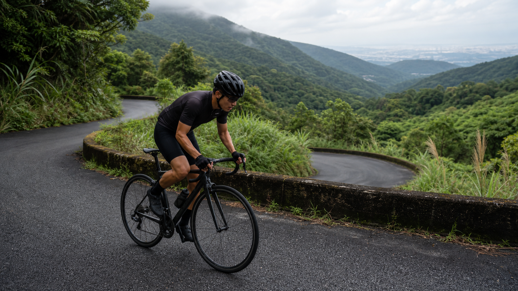
Zhongzheng Mountain, 3.12 km, average gradient 7.5%, difficulty rating 2. Tucked away on the southwestern edge of Yangmingshan National Park and bordering Beitou District, Taipei City, this short mountain road is a regular fixture on many Taipei riders’ training schedules—whether after work or on weekend morning rides. It’s not long, but the gradient is solid, making it the most convenient yardstick for assessing your climbing ability.
Route Overview and Data Analysis: Decoding the Gradient of 3.12 Kilometers
The Zhongzheng Mountain route spans 3,119 meters in total length, with an average gradient of 7.5% and an official difficulty rating of 2. If you simply reverse-engineer the theoretical total elevation gain using “distance multiplied by average gradient,” 3,119 meters times 7.5% equals approximately 234 meters. However, actual measurements and some on-site records show that the total elevation gain for this route may fall anywhere between 234 and 360 meters. This discrepancy mainly stems from differences in how the route’s start and end points are defined, GPS elevation errors, and the fact that the gradient distribution along the way is not perfectly uniform. Riders are advised to rely on actual data measured by their on-bike computers, treating “approximately 234–360 meters” as a reasonable range rather than a single precise figure—this expectation will better match the actual riding experience.
Regardless of where the total elevation gain falls within that range, the two figures of 7.5% average gradient and 3.12 km distance are enough to define this route’s character—it’s a “short-duration, high-intensity” climbing route, ideally suited as a training option for those who have limited time after work or on weekend mornings but still want a solid workout that stimulates the heart, lungs, and legs.
Zhongzheng Mountain, originally named Mituo Mountain, stands at an elevation of approximately 646 meters. It was renamed in memory of the late President Chiang Kai-shek and is located on the southwestern edge of Yangmingshan National Park, bordering Beitou District, Taipei City. This geographic position gives Zhongzheng Mountain a unique advantage: it’s relatively close to downtown Taipei, so riders don’t need to travel long distances to reach the base, yet they can still enjoy Yangmingshan National Park–grade natural scenery and a solid gradient—which is why it has long held a permanent spot on Taipei riders’ list of popular climbing routes.
Zhongzheng Mountain has as many as seven different trailheads/vehicle access points. Among them, the entrance near Zhuzihu features a gentler gradient, making it suitable for families and beginners. Routes approaching from the Beitou direction (such as the Postal Training Institute direction or the Fayu Temple direction) are comparatively steeper and are the preferred challenge sections for advanced riders. Before planning your trip, be sure to confirm which entrance you’re taking, as the gradient distribution and riding feel differ significantly between entrances.
Segment-by-Segment Guide from Start to Finish: Gradient Rhythm When Attacking from the Beitou Side
The following segments are based primarily on the more challenging route approaching from the Beitou direction, which is also the direction most road cyclists prefer for training climbs. Actual mileage and gradient changes should still be confirmed with your on-bike GPS readings.
Segment 1 (0–1 km): The Opening Move from Suburb to Mountain. Transitioning from the edge of downtown Beitou onto the industrial road heading toward Zhongzheng Mountain, the gradient shifts rapidly from the flat suburban roads to a sustained climb within a very short distance. This section is the critical adaptation period as your body switches from “flat-road metabolism” to “aerobic climbing mode.” It’s recommended to keep your heart rate around 75% of your maximum, avoiding going too hard right out of the gate. Many riders get carried away by the initial excitement and push too hard, only to fade later—Zhongzheng Mountain may be just 3.12 km, but a 7.5% average gradient is more than enough to make the cost of pacing mistakes surface early.
Segment 2 (1–2 km): The Core Climbing Zone, Testing Sustained Power Output. This is the core section of the route where the average gradient most closely matches the true 7.5% figure. Continuous switchbacks and terrain undulations make you clearly feel a “sustained load” in your pedaling rhythm. A seated riding position is recommended, maintaining a cadence between 75 and 85 rpm, avoiding the temptation to overuse out-of-saddle surges out of impatience, which could push your heart rate into the anaerobic zone too early. Along this stretch, you’ll occasionally catch glimpses of light filtering through gaps in the trees—a reminder that you’re already within the forest ecosystem of Yangmingshan National Park. Shifting your attention appropriately can also help alleviate climbing fatigue.
Segment 3 (2–2.8 km): Gradient Fluctuations and Opening Views. As elevation continues to rise, some sections begin to offer gradually opening viewpoints, with the distant Taipei Basin skyline appearing intermittently through gaps in the trees. The gradient here may fluctuate, easing locally before steepening again. Riders are advised to make good use of the brief flatter sections to recover your breathing rhythm slightly, saving energy for the final push to the summit.
Segment 4 (2.8–3.12 km): The Summit Section. In the final 300 meters or so, the route typically enters its most open section. On clear days, you can enjoy panoramic views of the Taipei Basin, the Guanyinshan ridgeline, and the Tamsui River estuary. For this section, decide based on your day’s condition whether to raise the intensity for a sprint—if you still have energy in reserve, you can complete the final climb at near-threshold heart rate. If you’re clearly exhausted, steady pedaling and ensuring safety matter more than chasing speed—after all, the scenic reward at the summit won’t be diminished by arriving two minutes later.
Gear Ratio and Equipment Recommendations: Drivetrain Setup for a Short, High-Intensity Route
With a 7.5% average gradient and 3.12 km total length, Zhongzheng Mountain’s demands on the drivetrain sit somewhere between “daily commuter climbing” and “competitive race climbing.” Road cyclists are advised to use a compact crankset (50/34T) paired with a rear cassette of 28 teeth or larger, which balances urban flat-road efficiency with comfortable climbing cadence in the mountains. If you rarely train in the mountains or have limited climbing experience, opting for a wider cassette (e.g., 30T or 32T) can effectively reduce knee strain and help maintain a steadier cadence throughout the climb.
Since Zhongzheng Mountain is close to the city and the roads are mostly well-maintained asphalt, this route is an excellent venue for “lightweight race bikes” to show their strengths—if you’re planning to attempt a segment PR here, choosing a lighter climbing wheelset can yield relatively noticeable benefits. However, for most riders treating Zhongzheng Mountain as a regular training route, standard training bikes and wheelsets are more than sufficient.
As for tire pressure, given the good road surface, there’s no need to lower pressure as you would on gravel trails. Maintaining standard road riding pressure (in the 90–110 psi range depending on bike weight and tire width) is sufficient. As for braking systems, both traditional caliper brakes and disc brakes can handle this route’s demands. However, if you plan to link up with other surrounding Yangmingshan routes (such as the industrial roads around Qingfeng Trail or the Xiaoyoukeng direction), disc brakes are still the preferred choice for better heat dissipation and braking stability on longer descents.
Nutrition and Hydration Strategy: Convenience and Pitfalls of a Suburban Route
One of Zhongzheng Mountain’s biggest advantages is its proximity to downtown Taipei, making resupply far more convenient than deep-forest trail routes. Scattered shops and convenience stores can be found around Beitou and Zhuzihu, allowing riders to top up on water and portable snacks at the base before departing. But precisely because of this convenience, many riders tend to underestimate their preparation needs, thinking, “It’s close anyway, I can always ride down to buy more.” This is actually a common psychological trap—once you’re truly in the climb, the time and energy cost of turning back for supplies far exceeds the cost of carrying one extra bottle before departure.
Before the ride: It’s recommended to complete your base nutrition at least 30 to 60 minutes in advance, especially if you’re riding in the early morning or early evening after work, to avoid tackling a 7.5% average gradient on an empty stomach or with low blood sugar.
During the ride: Based on a 3.12 km ride estimated at 10 to 20 minutes, additional food is typically unnecessary mid-ride, but carrying at least one water bottle is still advised—especially in hot, humid summer conditions, where even a short climb can cause significant fluid loss.
After the ride: The area around Zhongzheng Mountain offers convenient amenities, making it easy to find food nearby to replenish what you need for recovery after completing the challenge. This is another major advantage over remote mountain routes—the recovery process can proceed seamlessly without a long journey to obtain supplies.
Weather and Seasonal Considerations: The Variable Climate of Yangmingshan National Park
The climate within Yangmingshan National Park changes far more dramatically and rapidly than one might imagine. Due to its volcanic geological terrain and the influence of the nearby maritime climate, the mountainous area frequently experiences weather disparities where it is sunny at the base but foggy at higher elevations. This is especially common during the autumn and winter months when the northeast monsoon strengthens, making fog and strong winds common conditions to watch out for when riding up Zhongzheng Mountain.
During winter (November to February), when the northeast monsoon prevails, the probability of rainfall in the Yangmingshan area is significantly higher. Combined with mountain temperatures that are naturally lower than in the city, the cold and damp conditions greatly increase riding difficulty. It is recommended that those tackling Zhongzheng Mountain during this season come fully prepared with windproof and waterproof gear, while paying close attention to slippery road conditions.
In summer (June to September), although the overall probability of rainfall is relatively lower, afternoon convective thunderstorms remain the norm. Additionally, direct sunlight in the Yangmingshan area can make temperatures quite hot. It is advisable to schedule rides in the early morning or evening hours to avoid the double threat of midday heat and afternoon thunderstorms.
Spring and autumn (March to May, October to November) are generally the more comfortable seasons to visit Zhongzheng Mountain. In spring especially, certain sections of the road feature seasonal landscape changes with green maples and other vegetation, making it the best time window for combining training effectiveness with scenic enjoyment. Regardless of the season, the mountain’s rapidly changing weather should never be underestimated. It is recommended to check real-time weather forecasts before riding and to carry lightweight rain gear at all times.
Common Mistakes and DNF Risks
Mistake 1: Choosing the Wrong Starting Point, Leading to Unexpected Gradient Differences. Zhongzheng Mountain has as many as seven different trailheads/vehicle entrances, with significant differences in gradient difficulty. If you originally planned to challenge the gentler Zhuzihu direction entrance but mistakenly took the steeper Beitou direction route (or vice versa), the psychological gap between expectation and reality can easily disrupt your pacing judgment. Be sure to confirm your route direction and entrance location beforehand to avoid mistakes from last-minute decisions on site.
Mistake 2: Underestimating the Intensity of a Short Route and Starting Too Aggressively. A route with an average gradient of 7.5% and a distance of only 3.12 kilometers easily leads riders to the false expectation that “this is so short, it should be over quickly,” causing them to push too hard at the start and run out of steam midway through. The correct strategy is to treat this route as a “high-intensity interval training” session, completing it at a relatively steady but sustained high intensity, rather than sprinting all-out and then collapsing.
Mistake 3: Ignoring the Risk of Sudden Weather Changes on Yangmingshan. As mentioned earlier, weather changes within Yangmingshan National Park often exceed expectations. Fog in particular can drastically reduce visibility, posing a real threat to safety on descents. If you encounter heavy fog or poor visibility during your ride, be sure to reduce speed, turn on your lights, and if necessary, stop and wait for the weather to improve.
Reference Time Targets for Riders of Different Levels
The following times are reference estimates based on general fitness correlations for a route with an average gradient of 7.5% and a distance of 3.12 kilometers. Actual completion times may vary depending on the entrance section chosen, individual fitness levels, and conditions on the day.
| Rider Level | Reference Completion Time | Perceived Intensity |
|---|---|---|
| Advanced/Racing Riders | Approximately 10–13 minutes | Near-threshold intensity, full effort throughout |
| Upper-Intermediate Recreational Riders | Approximately 13–18 minutes | Medium-high intensity, sustained output |
| General Recreational Riders | Approximately 18–25 minutes | Pace can be adjusted moderately along the way |
| Beginners/Riders with Lower Fitness | 25 minutes or more | Recommended to combine with basic climbing training for gradual adaptation |
Due to its convenient location and relatively approachable difficulty rating (Grade 2), Zhongzheng Mountain is well-suited as a starting route for Taipei riders new to mountain climbing training, and also serves as a fixed test segment for tracking long-term progress.
Gear Ratio Reference Table: Practical Setup Recommendations for Different Fitness Levels
To help riders of different levels quickly find a drivetrain setup that suits them, the following is a gear ratio reference table compiled specifically for the Zhongzheng Mountain route with an average gradient of 7.5%. This table is based on general climbing training experience and rules of thumb; actual choices should still be fine-tuned according to individual fitness test results (such as FTP wattage and power-to-weight ratio).
| Rider Type | Recommended Front Chainring | Recommended Rear Cassette | Notes |
|---|---|---|---|
| Racing/High-Power Riders | Standard 53/39T or Compact 50/34T | 11-25T or 11-28T | Higher power-to-weight ratio allows maintaining high cadence output with heavier gears |
| Upper-Intermediate Training Riders | Compact 50/34T | 11-28T or 11-30T | Balanced setup for both flat cruising and climbing comfort |
| General Recreational Riders | Compact 50/34T | 11-32T | Provides easier low gears to reduce strain on knees |
| Beginners/Riders with Less Climbing Experience | Sub-compact 48/32T or lighter setup | 11-32T or above | Priority is maintaining a steady cadence to complete the challenge, avoiding grinding that can injure knees |
It is worth noting that lighter gearing is not always better—while lighter gears reduce the force required per pedal stroke, they can also lead to excessively high cadence and increased cardiovascular load, which may actually hinder maintaining a stable climbing rhythm. Riders are advised to test through actual riding to find the cadence range at which they can sustain stable output on a 7.5% average gradient (generally recommended to fall between 70 and 90 rpm), and then work backward to determine the appropriate gear ratio setup.
Reconstructing Common Mistake Scenarios: Lessons from Three Real Cases
Beyond the three common mistakes mentioned earlier, here are several specific scenario cases reconstructed to help riders more intuitively understand how these mistakes occur and how to respond.
Scenario 1: The Fast Starter. A rider who was accustomed to flat training on riverside bike paths and had little experience with mountain climbing one day decided on a whim to tackle the Beitou end of Zhongzheng Mountain. Due to the habit of flat riding, they started at a relatively high cadence and speed, not realizing the gradient had already quietly climbed past 6%. After roughly 800 meters of riding, their legs began to feel a distinct burning sensation, and their heart rate spiked to nearly 95% of maximum, forcing them to stop at a mid-route intersection and gasp for air for over 3 minutes before continuing. This case illustrates that even a seemingly “not too extreme” average gradient of 7.5% can instantly deplete your energy if you misjudge your pacing.
Scenario 2: The Mismatched Gearing. Another rider used a standard front chainring (53/39T) paired with a narrower cassette (11-25T), primarily for flat racing training. When tackling Zhongzheng Mountain, lacking sufficiently light gears, they were forced to grind through with heavier ratios, with cadence dropping below 50 rpm. Eventually, near the summit section, they experienced noticeable knee pain and were forced to slow down, even dismounting and walking a short stretch. This case highlights the critical impact of gear ratio selection on ride comfort and injury prevention.
Scenario 3: The Weather Misjudgment. A rider once challenged Zhongzheng Mountain in late autumn when the northeast monsoon was strengthening. The weather at the base was clear when they set off, so they paid little attention to the possibility of fog in the mountains. As they neared the summit section, dense fog suddenly rolled in, reducing visibility to less than 10 meters. They were forced to wait in place for nearly 20 minutes until the fog partially cleared before daring to descend. This case reminds riders that weather changes within Yangmingshan National Park far exceed expectations, and conditions at the base cannot be relied upon as a reliable indicator of mountain weather.
Route Planning Suggestions for Connecting with Surrounding Routes
For advanced riders with surplus fitness and time, Zhongzheng Mountain is rarely the sole objective of a single ride. A more common approach is to treat it as one piece of the puzzle connecting other well-known segments around Yangmingshan National Park. Below are several common route combinations for reference.
Zhongzheng Mountain + Yangjin Highway Combination: After tackling Zhongzheng Mountain starting from Beitou, if energy permits, riders can continue onto the renowned Yangjin Highway (Yangmingshan to Jinshan direction) to experience the training stimulus brought by different gradient structures. This combination allows riders to accumulate both short, high-intensity efforts and long-distance cruising volume in a single day, making it suitable for those preparing for long-distance climbing races.
Zhongzheng Mountain + Xiaoyoukeng Extension: Some riders choose to enter from the Zhongzheng Mountain side and continue extending their ride toward Xiaoyoukeng and the Qixing Mountain area, taking in the volcanic geological landscape and the unique scenery of sulfur fumaroles. This route planning places greater emphasis on scenic and ecological experiences, making it suitable for those who treat cycling as a form of in-depth travel.
Zhongzheng Mountain + Zhuzihu Loop: Entering from the gentler approach on the Zhuzihu side, completing the Zhongzheng Mountain challenge, then circling the industrial roads around Zhuzihu to enjoy the calla lily or hydrangea fields (depending on the season), before finally returning to the city. This loop design suits families or novice riders, balancing training benefits with recreational sightseeing needs.
Regardless of which combination you choose, it is recommended to adjust flexibly based on your physical condition and weather on the day. Mountain routes involve far more variables than city riding, and maintaining sufficient energy and time buffers is always the key principle for safely completing multi-day or long-distance combined routes.
Introductory Tips for Beginner Riders
For novice riders tackling a mountain route like Zhongzheng Mountain for the first time, here are a few additional beginner tips. First, be sure to confirm your braking system is in good working order before departure. Mountain descents place far greater strain on braking systems than flat-road riding—worn brake pads or abnormal hydraulic system conditions can create dangers during descents.
Second, it is recommended that beginner riders choose the gentler Zhuzihu entrance for their first attempt, building foundational mountain riding experience and confidence before gradually progressing to the steeper Beitou route. A progressive training pace is far safer and more effective than tackling the hardest segment from the very start.
Third, always carry basic food and water for mountain riding. Even though Zhongzheng Mountain is close to the city and resupply is relatively convenient, your body’s demand for hydration and calories remains during climbs—do not underestimate preparation simply because the distance is short. Finally, beginner riders are advised to ride with companions whenever possible, especially when trying unfamiliar routes for the first time. Having experienced riders alongside can significantly reduce the risk of getting lost or mishandling unexpected situations.
Efficiency Improvement Strategies for Advanced Riders
For advanced riders already familiar with the Zhongzheng Mountain route and possessing a solid fitness foundation, how to further compress completion time within the existing 3.12 km, 7.5% average gradient framework is often the core challenge for continued improvement. The first area to optimize is “precise management of initial power output”—past experience shows that most power output bottlenecks do not occur in the middle of the climb but rather in the first 200 to 300 meters from the start. Mastering how to enter the climb at an intensity closest to your critical power without prematurely depleting your anaerobic energy system requires repeated on-site testing and accumulated power data to grasp the precise rhythm.
The second optimization direction is cornering line selection. Zhongzheng Mountain features numerous consecutive corners along the way. Choosing a line that hugs the inside more closely and follows a smoother gradient transition can slightly increase average speed without noticeably raising power output. While the effect of such detail optimization is limited on any single occasion, accumulated over time, it holds genuine significance for competitive riders pursuing personal records (PRs).
The third is mental toughness training. Although Zhongzheng Mountain is short in distance, precisely because it is short, it tests whether riders can sustain near-limit power output within an extremely brief window without cracking. Through repeated real-world testing and segment review analysis, gradually building a precise understanding of your body’s limits is the key philosophy behind why many veteran riders continue to set new personal records.
Conclusion: A Daily Climbing Haven for Taipei Riders
With its solid 3.12 km, 7.5% average gradient and convenient proximity to the city, Zhongzheng Mountain has become an indispensable route in countless Taipei riders’ daily training menus. It does not require planning an entire day like Wuling or the Beiyi Highway, yet it delivers sufficiently solid climbing stimulus within a limited time—this is precisely the core reason for its enduring popularity. Whether you want to accumulate climbing mileage in an hour or two after work, or you are looking for a convenient route to test your fitness progress, Zhongzheng Mountain is a reliable choice worth keeping in your back pocket.
Related Reading
- From Mituo Mountain to Zhongzheng Mountain: A Taipei Story Riding into the Edge of Yangmingshan National Park
- Dakeng Zhongzheng Campground Climbing Guide: A 5.8 km Taichung Entry-Level Training Ground with Gentle-to-Steep Gradients
- Dongyan Mountain Practical Guide: A 12.4 km, 501 m Climb with 4.0% Average Gradient Intermediate Training Ground
- The Complete Yangmingshan Loop Route Guide: Five Classic Cycling Loop Routes Recommended
台北闊瀨陡坡 騎旅 / 日本單車雜誌編輯車友臨時加入!/ 髮香才是最強的 / feat. 北迴歸線小隊 / 公路車 CT Yeh
6 個月前
爬坡ITT實境)台中 魔王 松鼠坡 首航 6:12 大肚山 大三元 科福路
8 年前
單車 梅山36灣 坡度介紹 路段介紹 空拍 (相關遊記影片,請參考說明或我的頻道喔,歡迎訂閱)
6 年前
半日 小台灣 極限單車路線挑戰實錄
7 年前
#北橫 + #北進武嶺 最硬的員工旅遊 EP1 | #公路車 #拉拉山 | 明池 | 武嶺 | 武陵農場 | 雲海 | Taiwan Cycling Route Wulin
6 年前
2019 夏季KOM 5小 完賽心得 準備攻略 東進武嶺 夏季登山王之路 Taiwan KOM Challenge
7 年前
大禹嶺 到 武嶺牌樓 全程前後實況錄影 | 北進武嶺 | 東進武嶺 | KOM | 訓練台 | 坡度分析 | Taiwan KOM Last 10 km HARD | 公路車
6 年前
梅山36彎 奮起湖 #公路車 之旅 2400m
6 年前