Pingjing Street Climb Practical Guide: 4.66km at 6.3% Average Grade, Full Breakdown of the Cold Water Pit Outpost Battle
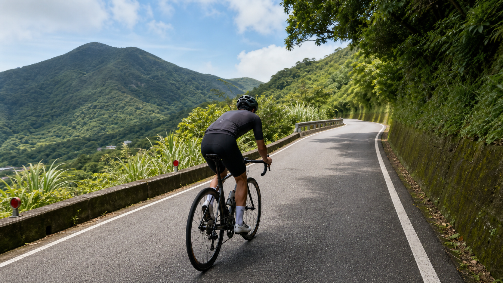
Route Snapshot: Distance 4.66 km | Average Grade 6.3% | Total Elevation Gain approx. 294–394 m (discrepancy due to calculation vs. measurement; refer to your on-site cycling computer for actual figures) | Category 2 | Location: Pingjing Street, Shilin District, Taipei City (toward Lengshuikeng / Cold Water Pit)
The Yangmingshan system in Taipei’s Shilin District is one of the most popular destinations for northern cyclists on weekend morning rides. From Yangde Avenue up through Shanzaihou and Zhuzihu, to Qingtiangang and Lengshuikeng, every fork in the road has its own character. And Pingjing Street is a segment within this system that is often underestimated—it’s not the steepest, nor the longest, but it is the first climb that makes your legs start to “feel it” before reaching Lengshuikeng, which is why the route database classifies it as the “Cold Water Pit Outpost Battle.” This classification is spot-on: what it tests is not whether you have explosive power, but whether you can use a steady rhythm to wake your body up to a state capable of handling the longer climbs ahead.
The purpose of this article is simple: to lay out every gradient segment and pacing strategy on this route with data, clearly and thoroughly. The engineer’s belief is—a route can have scenery and stories, but when you’re actually standing at the start of Pingjing Street ready to depart, what protects you and helps you finish is always your understanding of and respect for the numbers, not wishful thinking about the difficulty.
1. Let’s Lay Out the Data First: What 4.66 km and 6.3% Actually Mean
The official survey data for this segment is distance 4,662.73 meters (approx. 4.66 km), average grade 6.3%. Here we need to be honest with readers about one detail: if you simply use the physical conversion formula of “distance × average grade” to back-calculate total elevation gain, you get approximately 294 meters (4662.73 × 0.063 ≈ 294); however, another set of actual GPS track measurements in the route database shows total elevation gain of 393.88 meters. There is a clear discrepancy between these two figures, usually because “average grade” is a linear estimate calculated from the elevation difference between start and end points, while “total elevation gain” is the actual accumulated ascent from adding up every rise and fall point by point—if there are several small undulations in the middle of the route (a slight descent followed by a climb), the GPS-accumulated total ascent will naturally be significantly higher than the linear estimate.
Faced with this discrepancy, the engineer’s attitude is not to pick a flattering number and force it, but to honestly disclose: the total elevation gain on this route conservatively falls between 294 meters and 394 meters; refer to your own cycling computer or GPS track recording for the actual ascent. This range itself is meaningful information—it tells you that Pingjing Street is not a uniformly graded climb, but a segment with undulating variations, which directly affects pacing strategy. We’ll break this down in detail in the next section.
Let’s first establish a reference point using several well-known short climbs in northern Taiwan:
| Route | Distance | Average Grade | Difficulty Classification |
|---|---|---|---|
| Fengguizui (Neihu end) | approx. 5.5 km | approx. 6% | Classic short-distance training route |
| Pingjing Street (this article) | 4.66 km | 6.3% | Short, high-intensity outpost |
| Yangjin Highway (Shanzaihou → Xiaoyoukeng) | approx. 8 km | approx. 5–6% | Medium-to-long sustained climb |
| Beiyi Highway Nine Bends Eighteen Turns section | approx. 6 km | approx. 4–5% | Medium-distance undulating type |
From this table, you can see that Pingjing Street’s average grade of 6.3% falls into the “solid” tier among short climbs in the Taipei suburbs. Although the distance is under 5 kilometers, the intensity is enough to push your heart rate near the lactate threshold within 15 to 25 minutes—this is exactly why it’s called the “outpost battle”—it’s a condensed test. After riding it, you can roughly judge whether today’s condition qualifies you to take on the longer Lengshuikeng and Qingtiangang sections ahead.
2. Segment-by-Segment Strategy: From the Start to Pingdeng Elementary School, How to Manage the Grade Rhythm
Pingjing Street’s route characteristic is “continuous upward movement with undulations,” rather than a straight climb at a uniform grade. Based on the elevation gain range discrepancy back-calculated in the previous section, we can reasonably infer that there are several undulations in the middle of the route. The following segment strategy is planned based on this assumption; actual grade changes should still be confirmed with on-site road signs and cycling computer readings.
Segment 1 (Start to approx. 1 km): Warm up the tires, don’t rush to elevate heart rate
The starting section of Pingjing Street typically still carries the remnants of urban roads, with relatively moderate grades. The task here is not to accelerate, but to smoothly transition the body from a flat-road riding rhythm to a climbing rhythm. The first mistake many cyclists make here is seeing “only 4.66 km” and going all out, only to push their heart rate into Zone 4 within the first kilometer, then completely blow up in the following two to three kilometers. The correct approach is to treat this segment as a warm-up, keeping your heart rate around 70-75% of your maximum, maintaining a cadence of 85-90 rpm, and letting your body gradually adapt.
Segment 2 (approx. 1 to 2.5 km): Entering the main climb, the rhythm test begins
This is the core section of Pingjing Street where you truly “feel it.” The grade noticeably increases, and riders begin to experience sustained resistance from an average grade above 6%. The key here is “don’t look at the finish line, only look at the 50 meters ahead.” The most common reason for blowing up on a climb is often not insufficient physical strength, but the constant mental calculation of “how much farther” that disrupts your rhythm. It’s recommended to adopt a “segmented breathing method” here: coordinate each pedal stroke with a fixed breathing rhythm (for example, one deep inhale every three pedal strokes), using mechanical regularity to override anxiety.
Segment 3 (approx. 2.5 to 3.5 km): Possible undulation zone, a test of judgment
Based on the discrepancy between total elevation gain and the linear estimate, this section likely features a slight easing or even a small descent, followed by a re-climb. This terrain is a double-edged sword for a rider’s psychology—the easing section makes you feel “finally a breather,” but if you relax too much and lose your gear rhythm, you’ll struggle even more when the climb resumes. The correct strategy is to treat the easing section as “active recovery” rather than “complete relaxation”: keep pedaling, maintain cadence, but reduce power output, allowing your heart rate to drop slightly into Zone 3, storing muscular energy for the next climb.
Segment 4 (approx. 3.5 km to Pingdeng Elementary School finish): Final sprint or steady finish
As the route nears its end, Pingdeng Elementary School serves as the finish landmark, typically indicating that the grade gradually eases into flatter village roads. This is the critical point that determines the effectiveness of today’s training session—if you managed your pacing well in the first three segments, you should still have enough energy to slightly increase output in the final few hundred meters and finish with good form; but if you pushed too hard earlier, this is likely where you’ll be walking your bike or struggling at a crawl. It’s recommended that beginners mentally reserve “10% conservative” energy before reaching Pingdeng Elementary School—better to finish early with margin to spare than to blow up before the finish line.
3. Gear Ratios and Equipment: How to Configure for a 6.3% Average Grade
A 6.3% average grade has entered the range where recreational cyclists need to seriously consider their gear ratio configuration. The following recommendations are categorized by bike type.
Road bike riders
If you’re using a standard crankset (53/39T) with an 11-28T cassette, a climb of this intensity on Pingjing Street will make you feel significant strain on the main climb section, especially if your training volume is insufficient or you carry more body weight. It’s recommended to at least configure a “small chainring + 28T or higher” combination. The mainstream compact crankset (50/34T) paired with an 11-30T or 11-32T cassette in recent years will make the climb easier and help maintain cadence in the ideal range.
E-bike / general recreational bike riders
E-bikes have a clear advantage on this kind of grade, but battery range still needs attention—a 4.66 km climb using high assist mode throughout consumes a significant amount of battery. It’s recommended to confirm the charge level at the start and only switch to a higher assist level on the main climb sections (Segments 2 and 3), while conserving battery during the warm-up at the front and the finish at the end.
Equipment checklist
- Brake system: Yangmingshan mountain roads have many continuous curves. Even on an uphill route, be sure to check the wear condition of disc brakes or rim brake pads for the descent back down
- Tire pressure: Mountain asphalt surfaces occasionally have potholes or accumulated leaves. It’s recommended to reduce tire pressure by 5-10 psi compared to flat-road riding to increase grip
- Hydration bottle: Although 4.66 km isn’t long, if the day’s temperature is high, it’s recommended to carry at least one full water bottle
4. Nutrition and Hydration Management
Pingjing Street is less than 5 kilometers in total length, so theoretically no mid-route refueling is needed, but there are several easily overlooked details worth reminding.
Preparation before departure is more important than on-route refueling. Since this route is typically the “front section” of a Yangmingshan system morning ride, many cyclists continue on to challenge the longer Lengshuikeng or Qingtiangang sections after finishing Pingjing Street. If you treat Pingjing Street as a warm-up, then the real nutrition strategy should be: before the start of Pingjing Street, ensure you’ve completed basic hydration and energy intake, letting your body enter this outpost battle with sufficient reserves, rather than realizing halfway through that you skipped breakfast.
Temperature and humidity are invisible variables. Due to terrain effects in the Yangmingshan area, there are often significant differences in temperature and humidity between the mountains and the city. Especially in summer afternoons, fog or brief showers are common, and high perceived humidity accelerates fluid loss. It’s recommended that even for this short climb, you develop the habit of carrying at least a 500ml water bottle, and take small sips mid-route (at any obvious easing point between Segments 2 and 3), rather than waiting until you’re thirsty—thirst itself is a signal that your body is already mildly dehydrated.
Electrolyte supplementation. If you plan to continue riding a longer route after Pingjing Street, it’s recommended to include electrolyte supplementation (sports drink or salt tablets) in your pre-departure intake, to avoid the issue of electrolyte dilution from plain water after prolonged sweating. This is especially important in the more humid and hot seasons.
5. Weather and Seasonal Considerations
The most well-known seasonal highlight of Pingjing Street is the cold-season cherry blossoms (kanzakura) blooming along nearby Lane 42 of Pingjing Street every January to February, attracting large crowds of flower viewers and vehicles to the area. Here’s a practical reminder that’s very important for cyclists: if you plan to visit during the cherry blossom season, be sure to factor “traffic” and “pedestrian crossings” into your riding strategy. During peak bloom hours, road congestion, illegal roadside parking, and pedestrians crossing the street will noticeably increase, inevitably disrupting your climbing rhythm. It’s recommended to avoid peak weekend hours or visit early in the morning.
Plum rain season and typhoon season. During the May-June plum rain season in Taipei’s mountain areas, wet roads combined with frequent fog reduce visibility and grip. Climbing itself consumes significant attentional resources, so it’s recommended to check the weather forecast before departing during this season to avoid the increased risk of crashes on slippery surfaces. Summer afternoon convective showers are also common, so it’s recommended to depart early in the morning to avoid afternoon thunderstorm periods.
Winter northeast monsoon. The Yangmingshan area is significantly affected by the northeast monsoon in winter, with mountain temperatures several degrees lower than the city. Combined with the body heating up during the climb, the wind chill effect of rapidly dropping perceived temperature on the descent back down requires special attention. It’s recommended to carry a lightweight windbreaker to cope with the temperature difference between sweating on the climb and losing body heat on the descent.
6. Common Mistakes and DNF Risks
Mistake 1: Using the short distance as an excuse to go all out. 4.66 km sounds short, but with a 6.3% average grade plus possible undulating terrain, if you sprint from the start, you’ll likely face sky-high heart rate and leg failure on the main climb in Segment 2, forcing you to walk your bike or stop to catch your breath.
Mistake 2: Ignoring mountain traffic and pedestrian risks. Especially during the flower season, traffic and foot traffic around Pingjing Street noticeably increase. Combined with the road itself being narrow, if a rider focuses only on their own pacing performance, they can easily overlook changing road conditions. This is a hidden safety risk on this route, not merely a physical challenge.
Mistake 3: Underestimating the energy allocation needed for longer routes after the “outpost battle.” Many cyclists treat Pingjing Street as the final goal, sprinting all out, only to realize they had planned to continue challenging Lengshuikeng or Qingtiangang afterward, leaving them with little energy remaining. If your goal is a complete Yangmingshan system route, your pacing on Pingjing Street should be conservatively held at 70-80% effort, saving your true maximum output for the later sections.
7. Target Time References for Different Rider Levels
The following times are for reference only. Actual completion times will vary depending on daily wind conditions, physical condition, and equipment. It’s recommended to calibrate against your own completion times on similar-grade routes (such as Fengguizui or Yangjin Highway) rather than directly applying others’ data.
| Rider Level | Estimated Completion Time | Average Heart Rate Zone Reference | Notes |
|---|---|---|---|
| Beginner / Recreational rider | 25–35 minutes | Zones 2–3 | Short stops for photos and rest are acceptable; continuous riding not required |
| Generally well-trained cyclist | 15–20 minutes | Zones 3–4 | Continuous riding throughout with steady pacing |
| Advanced / Competitive rider | 10–13 minutes | Zones 4–5 | Near-maximal output, used for TT training or route record attempts |
| E-bike (standard assist mode) | 15–20 minutes | — | Adjust based on assist level and battery status |
The greatest value of this route lies not in how hard it is in itself, but in that it serves as a mirror—using just 4.66 km at a 6.3% average grade to reveal your current condition before you truly challenge the longer core sections of Yangmingshan. Riding it well and riding it steadily matters more than riding it fast.
8. Route Positioning Summary: Why It’s Called the “Cold Water Pit Outpost Battle”
Returning to the route database’s positioning description—“Cold Water Pit Outpost Battle.” This naming precisely captures Pingjing Street’s role within the entire Yangmingshan riding system: it’s not the destination, but the first checkpoint before the more core climbing sections (toward Lengshuikeng and Qingtiangang). For veterans familiar with Yangmingshan, Pingjing Street is a warm-up and leg-testing segment; for newcomers attempting the Yangmingshan system for the first time, it serves as an excellent “preparatory course”—short in distance, sufficiently representative in intensity, allowing you to experience the real feeling of a 6%+ average grade before formally challenging longer climbs, and to adjust your subsequent nutrition and pacing plans accordingly.
Whether you treat Pingjing Street as a standalone training route or as the first segment of a longer journey, the engineer’s advice is the same: look at the data first, then the scenery. 4.66 km, 6.3% average grade, elevation gain between 294 and 394 meters—internalizing these numbers into your body’s rhythm will help you ride this route steadily and with margin to spare far more than any motivational slogan, and face the challenges ahead with confidence.
9. Power and Heart Rate Dual-Track Training: A Quantitative Training Method for Advanced Riders
If you already have a power meter, Pingjing Street is an excellent segment for “short-climb power testing.” With the distance fixed at 4.66 km and concentrated intensity, it’s ideal for checking whether your FTP (Functional Threshold Power) has improved. The recommended approach: every training cycle (for example, every four to six weeks), using the same equipment, the same route, and choosing weather conditions with similar wind as much as possible, challenge Pingjing Street all out once, recording average power, normalized power (NP), and completion time. Accumulated over the long term, you’ll clearly see the growth curve of your climbing ability.
For riders without a power meter, heart rate can serve as a substitute indicator, but note that heart rate responses are affected by temperature, sleep, fatigue accumulation, and other factors, with greater fluctuation. It’s recommended to compare data from at least three to five challenges and judge based on the average trend rather than drawing conclusions from a single session. Whether using power or heart rate, the key is “using the same route as your own testing ground.” Pingjing Street, with its moderate length, sufficient intensity, and convenient location, is very well suited for this role.
Interval training application: If you don’t just want to ride it through but want to use Pingjing Street as an interval training venue, consider the “repeated climb” training method—after riding up, safely descend back to the start at a slow pace, rest for 3 to 5 minutes until your heart rate recovers to below Zone 2, then repeat the challenge. Depending on your training goals and physical condition, arrange 2 to 4 repetitions. This training method is a highly efficient dual stimulus for muscular strength and cardiovascular fitness for riders preparing for longer climbing events (such as Wuling or the Hehuan Mountain system).
10. Route Integration Planning with Other Yangmingshan System Segments
Pingjing Street is rarely treated as the endpoint of a standalone itinerary. Most cyclists incorporate it into a larger Yangmingshan system route plan. Below are several common integration combinations for you to choose based on your fitness and time availability.
Beginner combination (total distance approx. 15-20 km): Depart from Shilin urban area, warm up on Pingjing Street, then turn back or head toward the gentler Zhuzihu direction for a loop. Suitable for newcomers just getting into mountain riding who want to progressively accumulate experience.
Standard combination (total distance approx. 25-35 km): After warming up on Pingjing Street, formally challenge the Lengshuikeng or Qingtiangang sections. This is the combination most recommended by veterans, offering a complete experience of the gradient layering from outpost to core in the Yangmingshan system. It’s recommended to reserve 60-70% of your energy on Pingjing Street, saving your strongest output for the main climb of Lengshuikeng.
Advanced combination (total distance approx. 40 km and above): Connect Pingjing Street, Lengshuikeng, Qingtiangang, and descend toward Jinshan, forming a long-distance challenge route spanning both the eastern and western sides of Yangmingshan. This combination places high demands on both fitness and nutrition planning, and is recommended only for riders with sufficient long-distance riding experience. Be sure to carry adequate supplies and emergency equipment.
Regardless of which combination you choose, Pingjing Street’s role as the opening move remains unchanged—its value lies in using the shortest time and most concentrated intensity to quickly grasp your body’s condition for the day, enabling you to make reasonable itinerary adjustments.
11. Mindset for Rainy and Wet Road Conditions
Taipei’s climate characteristics mean you can’t always choose to ride only on sunny days. If you challenge Pingjing Street in overcast, rainy, or wet road conditions, the following mindsets are worth considering. First is recalibrating braking distance—brake response time lengthens on wet surfaces, especially on sections with more curves. It’s recommended to brake earlier and reduce corner entry speed; it’s better to sacrifice a bit of pacing than to compromise safety. Second is adjusting pedal output—traction decreases on rainy roads. If you push too hard, the rear wheel can easily slip and spin. It’s recommended to adopt a smoother, more rounded pedaling style, avoiding sudden bursts of force. Finally, equipment and visibility—it’s recommended to wear cycling apparel with reflective elements and turn on front and rear lights. Even during the day, dim rainy conditions require additional lighting assistance to increase your visibility among traffic.
Riding Pingjing Street in the rain lacks the expansive views of sunny days but offers a unique sense of tranquility—the sound of raindrops hitting leaves, the feel of tires gliding over wet asphalt, are sensory experiences you can’t get on sunny rides. Of course, safety is always the top priority. If there’s a heavy rain warning or extremely poor road conditions, it’s recommended to cancel the ride. There’s no need to take unnecessary risks on mountain roads.
12. Conclusion: Carve Pingjing Street into Your Riding Resume
Writing to this point, looking back over the entire article, we’ve started from the most basic distance, grade, and elevation gain data, broken down segment pacing, gear ratios and equipment, nutrition strategy, weather considerations, and even route integration planning and rainy-day responses—covering nearly every aspect you need to know to take on this route. But ultimately, all the data and strategies serve one purpose—to enable you to ride this route safely, steadily, and with confidence, and to gain your own sense of accomplishment from it.
Pingjing Street may not appear on any “Taiwan’s Hardest Climbs” ranking, but its role as the “outpost” within the Yangmingshan system is irreplaceable. Whether you’re aiming to challenge the longer Lengshuikeng and Qingtiangang sections, or simply looking for a short, high-intensity training route, Pingjing Street deserves repeated visits and repeated testing. Internalize these numbers—4.66 km, 6.3% average grade—into your own rhythm and experience. That will be the most tangible gift this route gives to every rider who takes it seriously.
Related Reading
- Pingjing Street Cold-Season Cherry Blossom Path: A Seasonal Riding Memory Hidden on the Yangmingshan Slope
- Jinguashi Jinshui Road Practical Guide: Complete Segment Analysis of 4.84 km at 6.3% Average Grade
- Lengshuikeng Practical Guide: 3.59 km, 290 m Elevation Gain, 7.0% Average Grade—A Hard Battle on the Eastern Side of Yangmingshan
- Pingxi Shifen Waterfall Direction Climb Practical Guide: Full Data Analysis of 4.0 km, 264 m Elevation Gain, 6.5% Grade
台北闊瀨陡坡 騎旅 / 日本單車雜誌編輯車友臨時加入!/ 髮香才是最強的 / feat. 北迴歸線小隊 / 公路車 CT Yeh
6 個月前
半日 小台灣 極限單車路線挑戰實錄
7 年前
#公路車 #西進武嶺 配速配瓦實驗 坡度分析 四小時內攻略 建大盃 NeverStop #西進武嶺攻略
6 年前
單車 梅山36灣 坡度介紹 路段介紹 空拍 (相關遊記影片,請參考說明或我的頻道喔,歡迎訂閱)
6 年前
西進武嶺 8000名單車友數據分析 PART1 | 從新手到高手數量/瓦數/推力比/FTP推力比/功率計使用率 大解析 | 公路車 | CTYeh
5 年前
風櫃嘴時間 預測西進武嶺時間?13000名車友統計數據分析告訴你 !
5 年前
96聯賽 桃園市長盃 歷屆各路段大數據攻略 從菁英組到新手組的平均瓦數、均速、平均時間 x 賽前探路
5 年前
梅山36彎 奮起湖 #公路車 之旅 2400m
6 年前