Pinglin North 42 Practical Guide: A Hidden Hard Climb with 12% Steep Sections Concealed in 5.1 km — Full Breakdown of the Data Contradictions
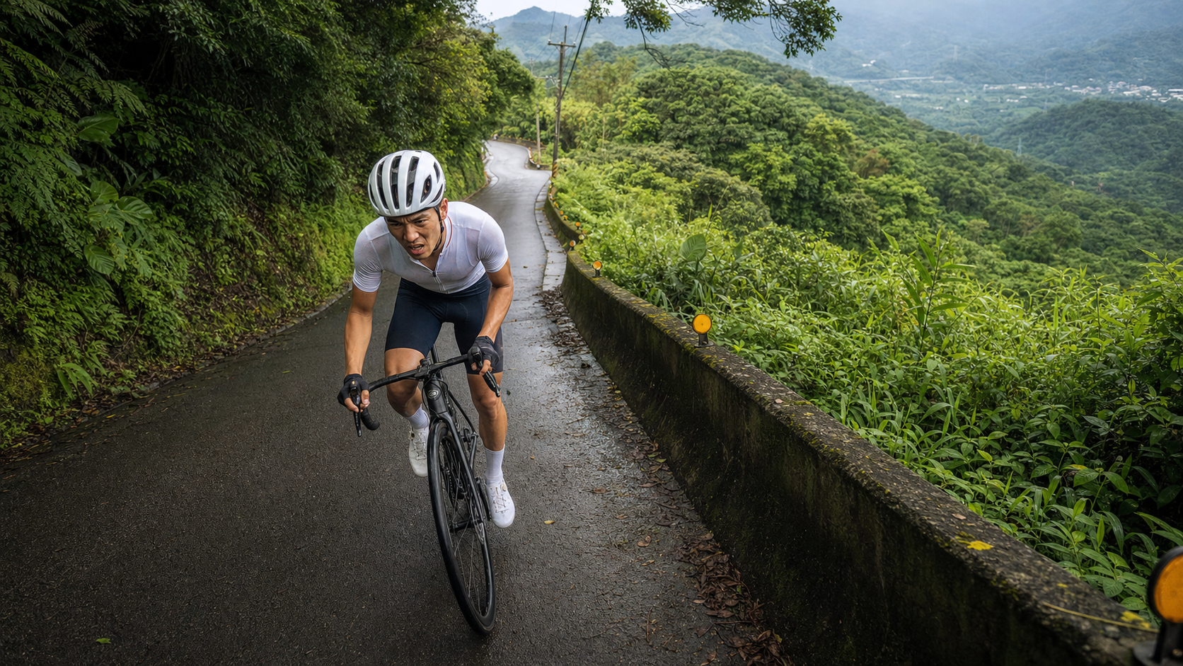
5.1 km in distance, 629 meters of total elevation gain, and a 7.0% average gradient as listed on Strava — at first glance, Pinglin North 42 Township Road looks like just a mid-length township-road climb. But once you actually crunch the numbers, things are not that simple. This is a route where the data lies, yet the feel on the bike is absolutely honest.
If you file this under “warm-up-grade small climb” just because you see “5 km, 7% average gradient,” you may get severely punished halfway up. This article will first honestly confront the contradictions in this route’s data, then break down segment pacing, gear selection, nutrition strategy, and common mistakes from an engineering perspective, helping you prepare more thoroughly for this hidden, relatively unknown, yet potentially quite demanding route tucked away in the Pinglin mountains.
1. Let’s Lay Out the Contradictory Data First
Before planning any pacing strategy, we must honestly confront one thing: the official data for Pinglin North 42 Township Road is self-contradictory. The system lists total elevation gain as 629.4 meters, but the distance is only 5,095.9 meters (about 5.1 km); at the same time, the system also lists the average gradient as 7.0%. These two numbers simply do not add up when placed side by side — multiplying the 7.0% average gradient by the 5.1 km distance works out to a theoretical elevation gain of only about 357 meters, a gap of nearly 270 meters from the 629-meter figure. Conversely, if the 629-meter gain is accurate, then dividing by the 5.1 km distance means the average gradient should be over 12%, not 7.0%.
This kind of discrepancy is not uncommon in route data for mountainous, hilly terrain. It usually stems from two possibilities: first, on continuously undulating sections (small back-and-forth variations of descending then climbing, climbing then descending), a GPS altimeter will repeatedly accumulate each gain, systematically inflating the total elevation figure — especially noticeable in mountainous areas with dense tree canopy where GPS signals tend to drift. Second, the route itself may not be a single constant-gradient climb, but rather hilly terrain with additional undulations, containing brief descents or flatter sections in between, all of which the system lumps into the total distance and total gain.
This article takes a clear stance: we do not deliberately pick a side, but honestly lay out both possibilities for you. However, regardless of which scenario is true, the conclusion they point to is actually the same — this route is likely not a climb that rises at a constant gradient, but rather terrain with significant gradient swings, where some sections may feature double-digit grades. The perceived difficulty is very likely considerably harder than the “7.0% average gradient” figure alone suggests. Riders must head out with the mindset of tackling a “hard climb” rather than a “gentle climb,” so they won’t be thrown off by the terrain on site.
| Distance Segment | Estimated Characteristics | Recommended Heart Rate Zone (based on personal LTHR) | Recommended Cadence |
|---|---|---|---|
| 0–1.5K | Opening probe section; gradient may swing sharply between steep and gentle | Zone 3 (78%–88% LTHR) | 75–85 rpm |
| 1.5–3.3K | Core section where double-digit steep grades are most likely | Zone 4 (88%–95% LTHR; brief spikes allowed on steep sections) | 55–75 rpm |
| 3.3–5.1K | Closing section; pick up pace at the end depending on energy levels | Zone 3–4 (82%–92% LTHR) | 70–90 rpm |
This table is a conservative pacing framework estimated from the contradictory data. Once on the road, be sure to use your bike computer’s real-time gradient and your own feel as the guide, adjusting at any time — do not rigidly stick to the numbers in the table.
2. Segment-by-Segment Strategy: Breaking the 5 km into Three Functional Sections
Segment 1 (0–1.5K): Opening probe — watch for gradient ambushes. The entrance section of Pinglin North 42 typically gives you a seemingly gentle warm-up climb first, but based on the contradictory data analysis above, this route is likely to feature dramatic gradient changes within very short distances. It is recommended that you do not approach this section with the mindset you would normally use for a “7% gentle climb.” Instead, switch your mentality to alert mode: “a steep section could appear at any moment.” Keep cadence around 75–85 rpm, and start with the chainring on the middle-to-easier side, preserving room to handle sudden steep sections — avoid forcing a heavy gear from the start, only to find yourself with no easier gear left when the road truly turns steep in the middle.
Segment 2 (1.5–3.3K): The core battle — likely the concentration zone for double-digit steep grades. If the 629-meter gain figure is true, then after subtracting the relatively gentler climbing of the opening and closing sections, the middle section must absorb most of the elevation difference — this is precisely where consecutive double-digit grades are most likely to appear. On this kind of terrain, alternate between standing out-of-saddle surges and seated climbing: for short, extremely steep sections (if the gradient exceeds 15%), stand and surge, using your body weight to assist the pedal stroke; for sustained steep sections (10%–14%), stay seated with a low cadence (55–70 rpm) paired with high torque output, avoiding prolonged standing that could push your heart rate past the anaerobic threshold too early. The worst thing on this segment is the reflexive riding style of “surge at the sight of a climb, gasp at the sight of a breather.” The correct approach is to shift down one gear before the corner, letting your cadence drop first before meeting the steep section, rather than being forced into a frantic last-second reaction.
Segment 3 (3.3–5.1K): The closing section — decide strategy based on remaining energy. Entering the final stretch of less than 2 km, if you paced the earlier sections well, you should still have enough energy to raise output and sprint for the line if conditions allow. But if the middle section has drained you, the mission for this segment becomes “stability over speed” — better to slow down than to sacrifice a steady cadence and breathing rhythm, avoiding cramps or a loss of balance and a crash from excessive fatigue. After reaching the summit, it is recommended to stay for a few minutes to let your heart rate gradually come down before starting hydration and cool-down — do not sit down or lie flat immediately, to avoid dizziness from poor blood return.
3. Gear Ratio and Equipment Recommendations: Don’t Gamble on This Route
Given that this route very likely contains double-digit steep sections, it is strongly recommended that you err on the conservative side with gear ratios. Road riders are advised against a standard crankset (53/39T) — even paired with an 11-28T cassette, on truly steep sections the gearing may be too heavy, forcing you to crawl or even stop to catch your breath. A compact crankset (50/34T) paired with an 11-32T or 11-34T cassette is strongly recommended, ensuring your easiest gear can handle extreme situations where the gradient suddenly jumps above 15%. If your frame and rear derailleur support it, you could even consider an ultra-wide-range cassette beyond 11-34T, or go with a 1x system (e.g., a 40T single chainring paired with a 10-36T cassette), which makes shifting more intuitive on sections with dramatic gradient swings and reduces the distraction of continuous shifting.
For wheels and tire pressure: road surface quality on mountain township roads is not always stable, so it is recommended to choose tires of 28c or wider and moderately reduce tire pressure (5–10 psi lower than your flat-road setting) to increase grip on the pavement and comfort, especially for torque transfer when standing and surging on steep sections. As for braking, since this route very likely includes steep descents, hydraulic disc brakes are the safer choice. If you use traditional rim brakes, be sure to check brake pad wear in advance, and on descents use intermittent feathering rather than prolonged dragging, to avoid heat fade reducing braking power.
4. Nutrition and Hydration Strategy: Limited Services in the Pinglin Mountains — Bring Enough
Although the full length is only 5.1 km, and theoretically a single pass does not take long, if this route is indeed as steep as the data suggests, the time to complete it may stretch to a perceived effort comparable to a typical “10 km moderate climb.” The Pinglin area sits within the Feitsui Reservoir watershed protection zone, and roadside shops and supply points along the mountain roads are relatively scarce — unlike urban roads where convenience stores are everywhere. Be sure to confirm your water bottles are full before departure, and carry at least one extra bottle of sports drink or electrolyte supplement — do not assume you can buy water or drinks along the way at any time.
If you are incorporating North 42 into a longer Pinglin mountain loop ride, it is recommended to schedule this steep climb in the early or middle portion of the ride, while your energy reserves are still substantial — avoid facing this hard climb of unknown gradient swings after you have already expended significant energy, to prevent risks such as dehydration or cramps. After reaching the summit, it is recommended to stay for at least 5 minutes for small sips of water and electrolyte replenishment. This is especially important on high-intensity, short-duration steep climbs, because heavy sweating combined with rapid breathing can cause electrolyte loss at a faster rate than flat-road cruising.
5. Weather and Seasonal Recommendations: Watershed Terrain — Don’t Underestimate the Slippery Risk
Pinglin sits in the Feitsui Reservoir watershed, and it is precisely the environmental restrictions of this protected area that have preserved a relatively pristine hilly forest landscape — but it also means rainfall frequency and humidity here are often higher than in other parts of the Taipei Basin. Pinglin has a reputation as a “rainy mountain town,” with a fairly high chance of afternoon clouds, drizzle, or even sudden downpours in the mountains. When riding a steep climb like North 42, wet pavement significantly reduces grip on steep sections, requiring extra caution whether surging uphill or braking downhill.
It is recommended to go on clear days or days with a low chance of rain, and to keep an eye on real-time weather forecasts and radar returns. If you encounter the common afternoon convective rain in the mountains mid-ride, immediately reduce your speed and avoid forcing surges on slippery steep sections. During the winter northeast monsoon season, the Pinglin mountains are prone to persistent cold drizzle and fog; reduced visibility raises the risk of this already gradient-heavy route another notch. It is recommended not to schedule a challenge on this route during that season unless absolutely necessary.
6. Common Mistakes and DNF Risk Assessment
Because the data for this route is clearly contradictory, most riders tend to misjudge its difficulty. Here are the most common mistakes:
- Underestimating the gradient contradiction and heading out with a “7% gentle climb” mindset: This is the most dangerous misjudgment. If you let your guard down based only on the average gradient figure, then when you hit the possible double-digit steep sections, your gear ratios and mental preparation will not have time to adjust, and you can easily blow through your energy in an instant under the gradient ambush.
- Gear ratios set too heavy: Continuing from the misjudgment above, if you use a standard crankset or a cassette with too narrow a range, you may find yourself unable to turn the pedals on steep sections, forced to dismount and walk — a common and highly frustrating failure experience on steep township-road climbs.
- Insufficient hydration: Services in the Pinglin mountains are limited. If you do not bring water in advance, you risk showing signs of dehydration after high-intensity output on steep sections, with the risk even higher in the hot, humid summer environment.
- Ignoring the slippery road risk: In this rainy watershed terrain, the chance of wet pavement is high. Failing to slow down on descents or steep sections can easily cause a slide. The safety risk on this route should not be equated with a typical dry-pavement township-road climb.
- Pacing too hard in the opening section: Even if you are not sure how steep the middle section will get, conservatively you should hold back energy in the opening section, avoiding burning through your aerobic reserves before the true core steep section.
7. Target Time References for Riders of Different Levels
The following times are estimated under the conservative assumption that “the actual gradient of this route may be far steeper than the 7.0% average.” Actual performance will vary noticeably depending on the day’s road conditions, fitness state, and gear configuration:
| Rider Level | Estimated Completion Time | Reference Average Power (70 kg rider) |
|---|---|---|
| Advanced / Race level | 18–24 minutes | 3.8–4.3 W/kg |
| Intermediate / Consistent trainer | 25–33 minutes | 2.8–3.3 W/kg |
| Beginner / Recreational rider | 34–45 minutes (including mid-ride rest) | 1.8–2.3 W/kg |
A special note: if the actual gradients encountered that day approach the core steep sections of 12% or more, beginner riders may very well need to dismount and walk partway. This does not mean a lack of ability — it means the terrain difficulty of this route itself may indeed be underestimated. It is recommended that beginner riders set “completion” rather than “no stopping” as their goal on the first attempt, and ride within their limits.
8. Training Period Planning: Treat North 42 as a Training Ground for Threshold and VO2 Max
If this route truly has the terrain characteristics the data hints at — dramatic gradient swings and possible double-digit steep sections — then its training value is actually quite high. A short-distance, high-intensity section with dramatic gradient changes is an excellent venue for honing threshold power (FTP) and short-duration VO2 Max output. It is recommended to schedule North 42 into your “intensity phase” training menu, arranging 3–5 repeat climbs per session, using gentle descents or flat cruising as recovery between reps, allowing your body to repeatedly adapt to the physiological response of “dramatic gradient changes within a short time.”
For riders preparing to tackle longer, bigger-gain classic routes (such as Wuling or Balaka Highway), a “concentrated steep climb” like North 42 offers training value no less than long-distance climbing, because it forces the body to rapidly adapt to intensity changes in a short time, training the reaction speed of the cardiovascular system and muscles — not just pure endurance accumulation. This kind of high-intensity interval hill training is convenient to access, low in time cost, and well suited for fitting into short training windows after work on weekdays.
9. Road Conditions and Traffic Safety Reminders
North 42 Township Road belongs to the New Taipei City mountain township road numbering system, serving the industrial roads of the hilly terrain around Pinglin and Shiding. The road width is typically narrow, and along the way there may be local agricultural transport vehicles or local traffic heading to tea gardens — it is not a closed cycling-only path. When riding, be sure to stay to the right, especially on sections with dramatic gradient swings and poor sightlines around corners; anticipate blind spots for oncoming traffic well in advance. It is recommended to wear a reflective vest and install a rear warning light to increase your visibility on steep, winding sections.
Because Pinglin is in a reservoir watershed, mountain roads may experience falling rocks or slippery pavement after rain due to drainage or geological factors. It is recommended to check recent road conditions through local cycling community groups before riding, especially after typhoons or heavy rain, when mountain roads are more prone to washed-out roadbeds or landslides. Avoid challenging the route for one to two days after extreme weather.
10. Equipment Checklist: Final Confirmation Before Departure
Before wrapping up this guide, here is a pre-departure equipment checklist. Because the gradient uncertainty on this route is relatively high, pre-ride preparation is especially important: confirm that your cassette and gear ratios can handle double-digit steep sections (it is recommended to have at least a 34T or larger easiest gear); confirm tire pressure has been adjusted for the day’s temperature, and consider slightly lowering pressure for more grip; confirm water bottles are full and carry extra electrolyte supplements — shops in the Pinglin mountains are limited, so do not gamble; confirm brake feel is normal, especially braking power for downhill sections; confirm your phone is charged and offline maps are downloaded, as signal may be unstable in some mountain sections; confirm bike lights and rear light batteries are sufficient, to handle a ride time that may be extended due to gradient delays.
11. Mental Preparation for Riders Tackling This Route for the First Time
Facing a route with self-contradictory data, the most important mental preparation is “prepare for the worst, ride with the best mindset.” Do not let your guard down just because you see numbers like “5.1 km, 7% average,” and do not over-tense from worrying about the 629-meter gain — the correct attitude is to treat it as “unknown but potentially on the harder side,” heading out with conservative gear ratios and pacing strategy, always keeping reserve for steep sections.
If you find the gradient does swing dramatically after actually riding it, that confirms this article’s data analysis; if it feels gentler than expected, that is a pleasant surprise. Either way, this attitude of “honestly confronting contradictory data first, planning conservatively, then verifying on site” is precisely the scientific spirit that all rigorous climb guides should embody. I also hope it reminds more riders: when facing route data of unclear origin or contradictory figures, do not blindly trust a single number — learn to cross-reference and evaluate conservatively.
12. Suggested Combined Route Plans with the Nearby Pinglin Road Network
The mountain roads around Pinglin crisscross in all directions, and North 42 Township Road is not an isolated segment. Once riders become familiar with this road, they can consider linking it with downtown Pinglin, the Beiyi Highway (Provincial Highway 9), or other surrounding township roads to form a combined ride covering dozens of kilometers. A common planning logic is to start from downtown Pinglin for a warm-up, connect to North 42 as the intensity training block in the middle of the ride, then decide whether to extend in a certain direction or turn back based on energy levels. Because North 42 consumes significant energy with its dramatic gradient swings, it is recommended not to schedule it at the very end of a longer ride, to avoid the increased risk of hitting steep sections with depleted energy.
For veteran riders who have already conquered long-distance hard climbs of Wuling or Hehuan Mountain caliber, a “short but concentrated” steep climb like North 42 is also well suited for the tapering period before a race, used to maintain the body’s sensitivity to high-intensity gradient changes. At the same time, because it is short and easy to access, it does not carry the risk of excessive pre-race fatigue.
13. Summary: A Hidden Hard Climb Underestimated by the Numbers
Looking back over this entire guide, the most distinctive thing about Pinglin North 42 Township Road is not its length or fame, but the obvious contradiction in its data — the 629-meter gain and the 7.0% average gradient figures contradict each other, and behind them may lie a route far harder than the surface numbers suggest. Regardless of whether the true cause of this contradiction is cumulative GPS altimeter error on hilly terrain, or the route itself containing additional undulating terrain, the conclusion points to the same reminder for every rider preparing to tackle this route: do not be fooled by the deceptively light-sounding distance of “5 km.” Be sure to face it with conservative gearing, ample supplies, and a cautious pacing strategy.
Prepare thoroughly for this route, and what you gain is not just a training record, but a practice of the rigorous attitude of “not blindly trusting a single data point” — an attitude far more worth carrying into every future ride plan of yours than any single route itself.
14. How to Verify a Route’s True Gradient on Your Own
When facing a route with contradictory data, rather than passively accepting the officially listed numbers, it is better to learn to verify it yourself. The most direct method is to check contour lines on a map service or route planning platform before departure, roughly comparing the relationship between elevation changes and distance along the route to identify sections where steep grades may appear. Once on the road, it is recommended to use a GPS bike computer with a barometric altimeter to read the instantaneous gradient in real time, rather than relying only on the average report generated afterward — instantaneous gradient is the number you actually face in the moment; the average is just a statistical summary after you finish. The two have completely different meanings during the ride.
After finishing, it is also recommended to export and compare the segment gradient data from that ride, examining which section contributed the most elevation gain. Over time, accumulating data comparison experience across several different routes, you will gradually develop an intuition for “looking at numbers and roughly judging whether a route’s difficulty is reasonable.” This is extremely helpful for pre-ride preparation when planning unfamiliar routes, and it will also keep you from being caught off guard again when facing the next route with unclear or contradictory data.
15. Final Thoughts: The Right Mindset for Facing an Uncertain Route
Pinglin North 42 Township Road teaches every rider preparing to tackle an unfamiliar route a valuable lesson — data is always just a reference; the road itself is the final judge. Rather than agonizing over whether the 629-meter gain or the 7.0% average gradient is the “correct” number, put your energy into preparing conservatively and comprehensively to handle whatever terrain variations may appear. Leave enough margin in your gearing, bring ample supplies, and adjust your mindset properly — if you get these three things right, no matter what the actual gradient distribution of this route turns out to be, you can ride it safely and steadily to the end.
This is also why this guide has spent so much space dissecting the data contradiction itself, rather than rushing to give a dogmatic conclusion — because for any rider seriously preparing to hit the road, understanding “why the numbers contradict each other” is far more valuable than simply being told “this route is hard.” I hope this guide helps you prepare for Pinglin North 42, this hidden hard climb, more thoroughly than its fame suggests.
Related Reading
- Wugong Mountain Climb Full Analysis: The 14% Truth Hidden Behind the Official 9.7% Gradient (Maolin, Kaohsiung)
- Lianlian 197 Practical Guide: How to Ride 120 km? The Fake-Flat Truth Behind a 0.2% Average Gradient
- Pingxi North 47 Township Road Practical Guide: Full Pacing Analysis of a Serene 8.3 km, 376 m Long Gentle Climb
- Tou 56 Sacred Tree Climb Practical Guide: 6.9 km, 653 m of Gain — Data Analysis of a Hidden-Gem Hard Climb in Nantou
西進武嶺 8000名單車友數據分析 PART1 | 從新手到高手數量/瓦數/推力比/FTP推力比/功率計使用率 大解析 | 公路車 | CTYeh
5 年前
單車 梅山36灣 坡度介紹 路段介紹 空拍 (相關遊記影片,請參考說明或我的頻道喔,歡迎訂閱)
6 年前
台北闊瀨陡坡 騎旅 / 日本單車雜誌編輯車友臨時加入!/ 髮香才是最強的 / feat. 北迴歸線小隊 / 公路車 CT Yeh
6 個月前
公路車 爬坡 破PR 紀錄 小技巧 分享
6 年前
半日 小台灣 極限單車路線挑戰實錄
7 年前
西進武嶺各路段 前8000名 大數據分析 配速攻略/功率/心律/推力比/維持率/踏頻/踏瓦比/牽車率 大公開 | 建大盃 NeverStop 可參考 | 公路車 | CT Yeh
5 年前
一日北高常見問題大集合 | 攻略 | 路線 | 訓練 | 補給 | 自行車 單車 | 一日雙城 | 雙塔 | TWB北高360 | 屁股痛
6 年前
新竹羅平 x 天湖部落 大禹嶺級變態陡坡! 4K超高畫質 空拍 | 公路車
5 年前