Dongshan Coffee Road Practical Guide: The Top Endurance Training Choice with 16.41 km and 3.9% Average Grade
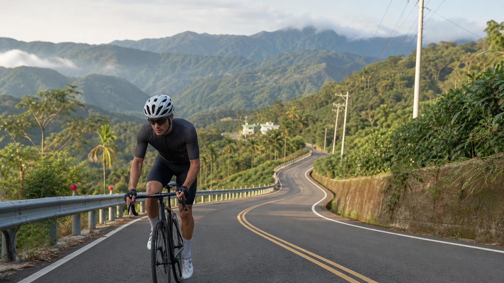
Route Overview and Real Data Analysis
Dongshan Coffee Road is a training route in Zhongpu Township, Chiayi County that has long been underestimated by the cycling community. According to measured data from the Strava segment (Segment ID 3286625), the total length of this road is 16,414.9 meters, or 16.41 km, with an average grade of 3.9%. Strava classifies it as a Category 4 climb, the most approachable of the four categories — but don’t let the “Cat.4” label fool you. A 3.9% average grade multiplied by a distance of over sixteen kilometers means this is a long, gradual ascent that demands endurance management rather than brute-force sprinting.
Let me first clarify something discovered during the data verification process: the elevation_m field recorded for this segment in the database is 1,557.64 meters, but if you work backward using “distance × average grade,” 16.41 km multiplied by 3.9% yields a net elevation gain of roughly 640 meters. The gap between the two is nearly a thousand meters, which clearly doesn’t add up. A reasonable explanation is that the figure 1,557.64 likely records the absolute elevation at the finish point, not the elevation gain of the route itself — the Dongshan area of Zhongpu Township sits on the western foothills of the Alishan mountain range, so elevation naturally rises with mileage along the route. Mistaking “finish elevation” for “elevation gain” is a common data confusion scenario. Based on the principle of honest data disclosure as an engineer, all subsequent pacing and energy expenditure estimates in this article will use the converted figure of 640 meters of elevation gain, not the raw database number. If readers encounter claims elsewhere that “Dongshan Coffee Road has 1,500 meters of climbing,” please cross-check the mileage and grade yourself rather than taking it at face value.
The simplest way to understand the nature of this road: 640 meters of elevation gain spread over 16.41 km keeps the average gradient at 3.9%. This combination corresponds to a riding style closer to the Northern Cross-Island Highway or certain industrial roads in central Taiwan that feature “more gradual climbs than steep pitches,” rather than heavy-grade routes like Wuling or Hehuan North Peak, which routinely exceed 8%. In other words, this is a route ideally suited for practicing “cruising power output” and “aerobic endurance,” not a test of whether you can grind your way up a steep slope.
Let’s further break down this route’s positioning in training planning. In the language of power-based training, a segment with a 3.9% average grade falls, for the vast majority of riders, somewhere between the “Tempo” and “Sweet Spot” zones — roughly 76% to 90% of Functional Threshold Power (FTP). This is an intensity band that can be sustained for relatively long periods without rapidly depleting anaerobic reserves. This intensity range is highly valued in training science because it simultaneously stimulates improvements in aerobic metabolism without allowing lactate accumulation to spiral out of control like an all-out sprint. It is highly suitable as a base aerobic volume workout in periodized training plans, and also ideal for riders preparing for long-distance events (such as century rides or the Twin Towers Challenge) to simulate the feel of sustained, steady output over extended periods.
Another point worth mentioning: because this route is classified as an industrial road, traffic volume is far lower than on Provincial Highway 18 itself or other well-known scenic routes. Road conditions and traffic density are relatively straightforward, making it perfect for treating the entire route as a “testing ground for your power meter or heart rate monitor.” In other words, you can repeatedly test your performance data on the same fixed route on different days, objectively tracking the progression of your aerobic capacity — something many popular influencer routes struggle to offer due to traffic congestion or traffic light interruptions.
Start-to-Finish Segment Guide
Segment 1 (0–4 km): Gentle Climb Warm-Up Zone
In the first four kilometers after departure, the gradient typically falls around 2% or even flatter, serving as a buffer zone for transitioning from flat-road riding mode to climbing mode. On this stretch, be sure to restrain your cadence and heart rate. Many riders push near-maximal output here because it “still feels easy,” only to run out of steam midway through the route. It’s recommended to treat this section as a warm-up, keeping your heart rate around 70–75% of your maximum, and using the middle chainring paired with mid-range rear cassette gears to gradually settle into a rhythm.
Another key focus at this stage is gradually raising your core body temperature and muscle temperature to a state suitable for output. Many riders habitually jump straight into climbing sections without adequate flat-road warm-up, causing heart rate to spike sharply in a short time—entering the edge of anaerobic territory before the body has adapted. This “cold-start climbing” pattern very easily leads to early depletion later on. If time permits, it’s recommended to ride 10–15 minutes of flat roads around Zhongpu urban area before entering the official Dongshan Coffee Road section, letting your heart rate and breathing frequency first rise to near the lower edge of the aerobic zone before formally entering this gentle climb.
Segment 2 (4–9 km): Core Climbing Zone
After entering the middle section of the route, the gradient begins to increase noticeably, with instantaneous grades on some sections reaching 5–6%. This is also why the overall average settles at 3.9%—the front and rear sections are gentler while the middle is steeper, forming a “low at both ends, high in the middle” gradient curve. For this segment, it’s recommended to adopt a “steady power” rather than “steady speed” riding strategy—that is, when encountering steeper sections, naturally slow down while maintaining the same pedaling effort, rather than forcing a heavier gear to hold the same speed. Long-term riding experience shows that climbing with a fixed heart rate or fixed power is far more effective at preventing late-stage blowups than stubbornly holding a specific speed number.
This segment also offers the most dramatic contrast in visuals and riding feel along the entire route. The gentle climb of the front section creates the illusion that “this road is easy,” but once entering this core zone, sudden gradient changes often cause cadence to drop faster than expected—especially for riders with heavier gear setups, who may feel noticeable leg burning here. At this point, it’s recommended to shift attention from the speedometer to breathing rhythm, using a steady breathing rate to gauge whether you’re still in a sustainable output range. Once you begin gasping for air or can no longer breathe smoothly through your nose, that’s the signal to actively back off. Pushing through will only bring on the wall earlier in the later stages.
Segment 3 (9–13 km): Rolling Hills Zone
This section features alternating short climbs and brief descents—typical of rolling hill terrain on rural industrial roads. This terrain demands strong cadence-transition ability from riders. It’s recommended to use the coasting time on descents to let your heart rate recover slightly, saving energy for the next short climb. The surroundings also gradually open up into the rolling hill vistas of the Dongshan area, with distant mountain ridges and the Chianan Plain beginning to unfold—suitable for briefly lifting your gaze to enjoy the scenery while adjusting your breathing rhythm, provided your physical condition allows.
Worth noting: this kind of alternating undulating terrain is actually relatively friendly for riders sustaining prolonged output, because the brief descents or flat sections provide valuable recovery time, allowing heart rate to drop and metabolic waste accumulated in muscles to be partially flushed away by blood flow. Conversely, riders who stubbornly hold a fixed gear and refuse to shift frequently based on terrain changes are the ones most disadvantaged on these rolling sections—it’s recommended to develop the reflex of “shift first when you see a gradient change” here, keeping cadence as close as possible to your comfortable range (most riders fall between 80–95 rpm), rather than leaving the gear fixed and forcing brute strength.
Segment 4 (13–16.41 km): Final Gentle Climb to the Finish
In the final three kilometers or so approaching the finish, the gradient typically eases back to a relatively moderate range. For this section, it’s recommended to reassess your remaining energy reserves. If you’ve managed the earlier segments well, you can attempt to slightly increase output here, finishing with a pace slightly above your average; if you’re already depleted, honestly maintain a cruising speed to complete the ride, avoiding cramps or excessive heart rate spikes. After reaching the finish, this route doesn’t present severe long-descent return risks, but it’s still advisable to control your speed on descents—especially since agricultural vehicles and local traffic occasionally appear on the road, so stay alert.
This final stretch also serves as the best indicator of whether your earlier pacing strategy succeeded. If you can maintain a steady cadence here without uncontrolled heart rate spikes, your rhythm management in the front sections was spot-on. Conversely, if you find yourself needing frequent stops to catch your breath within these three kilometers, or your cadence drops to extremely low rpm yet your legs still feel heavy and powerless, this usually means your output in the middle core climbing zone was too aggressive, revealing a clear imbalance in energy distribution—worth adjusting on your next attempt by dialing the front-section intensity down a notch further.
Gearing and Equipment Recommendations
Given the route’s characteristics of an average 3.9% gradient and approximately 640 meters of total elevation gain, a standard road bike with a compact crankset (50/34 or 52/36) paired with an 11-28T or 11-30T rear cassette is sufficient for most riders with a reasonable fitness base. If you’re new to climbing training, heavier in build, or still building your aerobic foundation, it’s recommended to choose an 11-32T or even wider rear cassette, allowing you to maintain a smooth cadence on the steeper middle sections rather than forcing heavy gears and placing excessive strain on your knees.
| Rider Level | Recommended Front Chainring | Recommended Rear Cassette | Notes |
|---|---|---|---|
| Beginner / Fitness Building | 34T or 36T small ring | 11-32T or wider | Use low-speed high-cadence strategy throughout |
| Intermediate / Stable Aerobic Base | 34T or 36T small ring | 11-28T | Can push harder on middle steep sections as needed |
| Competitive Level | 36T or 39T small ring | 11-25T or 11-28T | Suitable for tempo training |
Regarding tire pressure: since the road surface is mostly paved rural industrial roads in generally good condition but with occasional patches and potholes, it’s recommended to maintain tire pressure in the middle of the manufacturer’s recommended range. There’s no need to pump to maximum pressure chasing minimal rolling resistance—sacrificing comfort and grip isn’t worth it.
Regarding bike weight and overall equipment setup: because this route’s total climbing isn’t extremely demanding (estimated around 640 meters), sensitivity to bike weight isn’t as pronounced as with Wuling-level long climbs. However, if you’re preparing for higher-intensity climbing events or challenges, you can still treat this route as a “lightweight equipment testing ground,” actually experiencing the climbing feel differences before and after removing bottle cages or switching to lightweight wheelsets, thereby building your judgment experience on equipment adjustment benefits. For riders purely oriented toward training and recreation, bike weight isn’t the priority variable on this route—rather, whether your gearing allows you to maintain a smooth cadence is what truly affects riding quality.
Additionally, since some sections feature alternating gradients, brake system reliability shouldn’t be overlooked. Whether using traditional rim brakes or hydraulic disc brakes, it’s recommended to check brake pad wear and listen for any unusual brake cable noises before departure. While this route isn’t a high-risk long continuous descent, there are still several short steep downhill sections along the way, and poor braking performance directly impacts riding safety and confidence.
Nutrition and Hydration Strategy
At 16.41 kilometers with an estimated 640 meters of climbing, most riders will take anywhere from 40 minutes to 1.5 hours to complete a single ascent (this varies greatly depending on fitness level; see the detailed estimation table in the next section). This duration falls in the gray zone between “can make it without mid-ride refueling” and “refueling recommended.” In practice, the advice is:
- If you can finish within 60 minutes: Hydrate thoroughly before departure and carry one bottle of sports drink or water; mid-ride refueling is not mandatory.
- If it takes over 60 minutes: It is recommended to take in small amounts of fluid and electrolytes every 20–30 minutes, especially since Chiayi’s summer temperatures are high and humidity is significant—fluid loss happens faster than you might expect.
- Energy gels/snacks: If you plan to continue tackling other routes afterward (for example, pairing the Dongshan Coffee Road with rides into nearby mountain areas on the same day), carrying 1–2 energy gels as insurance is recommended.
Since this route follows agricultural industrial roads, convenience stores or supply points become increasingly sparse as the mileage accumulates. It is strongly advised to complete your final proper hydration and restroom stop in Zhongpu town before entering the route—do not assume there will be shops along the way to bail you out.
As for food pairing, in addition to fluids and electrolytes, the meal before tackling this route should focus on easily digestible carbohydrates, avoiding greasy or high-fiber foods that could cause gastrointestinal distress during the climb. If you choose to depart in the early morning, finish breakfast one to two hours before starting, giving your body enough time to digest and avoiding side stitches or indigestion while riding. Post-ride refueling is equally important. After completing the full route, it is recommended to consume an appropriate amount of carbohydrates and protein within 30 minutes to aid muscle glycogen recovery—especially if you plan to ride additional routes that day or have training scheduled the next day. This “golden recovery window” should not be overlooked.
Weather and Seasonal Recommendations
The Zhongpu area of Chiayi has a typical subtropical climate—hot and humid in summer, relatively mild with little rain in winter. In terms of riding comfort on the Dongshan Coffee Road, late autumn through early spring of the following year (roughly November to March) is the relatively ideal season, with moderate temperatures and a sun angle that won’t leave you overexposed at noon. For summer riding (June to September), be sure to start early—early morning or near sunset is recommended—to avoid the midday heat and the afternoon thunderstorms common on the Chianan Plain.
Since the route mostly traverses open hilly terrain with relatively limited shade, sun protection and UV-resistant gear (arm sleeves, sunglasses, sunscreen) should be treated as essential items rather than optional extras. During the rainy season (the plum rain season in May and June), pay extra attention to slippery road surfaces and the occasional risk of falling rocks or loose soil in the mountainous terrain. If road conditions are uncertain after several days of continuous rain, it is advisable to check with local riders or route reports before setting out.
Wind direction is another variable on this route that is easy to overlook. The Dongshan area of Zhongpu Township sits at the transition zone between hills and plains, where monsoonal and terrain-induced wind effects can create crosswinds or headwinds on certain sections. Especially during the strengthened northeast monsoon in winter, if the day’s winds are strong, it is wise to adjust your expectations accordingly—do not hold yourself to the pacing you’d achieve on a normal windless day. Forcing yourself to fight a headwind with hard output will drain your energy early without delivering proportional speed in return. Conversely, on a tailwind day, do not be misled by unusually impressive speed numbers on your computer, which could cause you to misjudge your true fitness and overestimate your ability on the next ride.
Common Mistakes and DNF Risks
Most riders’ problems on this route are not that the gradient itself is too difficult, but rather poor pacing strategy leading to imbalanced energy distribution. Here are the most common mistakes:
- Starting too fast: As mentioned earlier, the gentle slope at the start can easily mislead riders about the route’s overall difficulty. Pushing too hard in the first four kilometers means you’ll start losing speed—or even be forced to stop and catch your breath—once the gradient steepens in the middle section.
- Incorrect gear ratio setup: Without a wide enough rear cassette, riders are forced to stand and grind on the mid-route sections that briefly hit 5–6%, expending far more energy than seated riding and slipping into anaerobic fatigue prematurely.
- Inadequate hydration planning: Underestimating fluid loss over 16 kilometers and nearly an hour or more of riding—especially in summer, where dehydration can quickly trigger cramps or a sharp decline in how you feel.
- Ignoring changing road conditions along the way: Some sections are narrow and shared with local agricultural vehicles. If you keep your head down charging up the climb while ignoring traffic around you, there is a real safety risk.
- Overestimating your climbing level: Although Strava classifies this as Cat.4—a relatively approachable grade—for beginners with no experience on long, gradual climbs, 16.41 kilometers is still a distance that requires basic endurance. It should not be casually dismissed as a “warm-up route.”
As long as you get a handle on the key points above, the Dongshan Coffee Road is actually a route with a very high completion rate and low DNF (did-not-finish) risk. Its threshold is mainly about “pacing discipline” rather than “absolute difficulty.”
There is one more observation worth highlighting that is easy to overlook: because this route is not as well-known as Meishan’s 36 Turns or the main Alishan Highway, the chance of encountering other cyclists along the way is relatively low. This means that if you experience a mechanical failure or physical discomfort mid-ride, the likelihood of getting timely help from other riders is also relatively small. Therefore, when tackling this route, in addition to basic tire repair tools and spare tubes, you should also develop the habit of informing family or your riding group of your itinerary and expected return time, and ensure your phone has sufficient battery to make an emergency call if needed. This is basic safety awareness that applies to any “non-popular route,” not just the Dongshan Coffee Road.
Estimated Completion Times by Rider Level
The times below are rough ranges. Actual conditions will vary depending on wind direction, temperature, personal fitness, and the number of rest stops, so use them only for pre-ride planning:
| Rider Level | Estimated Average Speed | Estimated Completion Time | Notes |
|---|---|---|---|
| Beginner (first time tackling a climbing route) | Approx. 8–11 km/h | 90–120 minutes | Plan 1–2 short rest stops along the way |
| Intermediate (rides regularly, has basic climbing experience) | Approx. 12–15 km/h | 65–82 minutes | Can complete the entire route without stopping |
| Competitive (club race squad, racer level) | Approx. 18–22 km/h or more | 45–55 minutes | Can be used as an interval or tempo training segment |
Overall, the Dongshan Coffee Road is a training route that is “friendly in difficulty with high added value in scenery and local culture.” It works well as a regular item in your aerobic endurance training menu, and is also suitable for pairing with a tour of the Dongshan coffee industry on weekends, combining exercise with local cultural experiences in a single outing.
One final reminder: the time ranges in the table above are only rough estimation baselines. Actual completion times will be affected by the day’s temperature, wind direction, road conditions, and whether you stop for photos or rest along the way—so don’t obsess over the numbers themselves. A more practical approach is to treat your first attempt on this route as your personal baseline, then re-challenge the same route periodically, using the same segment to track your improvement over time. That is far more meaningful than simply comparing yourself to others’ results. After all, everyone’s fitness background, training history, and daily physical condition are different. The route’s data is objective, but how you use that data to structure your own training rhythm is what truly determines ride quality and long-term progress.
Related Reading
- A Cyclist’s Private Memory of the Dongshan Coffee Road: Rolling Hills in the Aroma of Coffee
- Dongyanshan Practical Guide: 12.4 km, 501 m of Climbing, an Intermediate Training Ground at 4.0% Average Gradient
- Meishan 36 Turns Complete Guide: How to Conquer the 11.84 km Hairpin Battle at 6.4% Average Gradient
- Maokong Zhanghu Yue Ling Practical Guide: 4.17 km at 6.2% Average Gradient, a Full Breakdown of the Tea District Mountain Road
半日 小台灣 極限單車路線挑戰實錄
7 年前
台北闊瀨陡坡 騎旅 / 日本單車雜誌編輯車友臨時加入!/ 髮香才是最強的 / feat. 北迴歸線小隊 / 公路車 CT Yeh
6 個月前
單車 梅山36灣 坡度介紹 路段介紹 空拍 (相關遊記影片,請參考說明或我的頻道喔,歡迎訂閱)
6 年前
阿里山塔塔加 兩倍特濃版!全新隧道開通! 進喔!公路車 | CT Yeh
3 年前
那瑪夏x茶山 阿里山系深山單車行 Day2 累積爬升6000M | 🥶超陡連續下坡 整路看隊友刷 | 爬升一座西進武嶺 | JJSC | 公路車 | CT Yeh
3 年前
爬坡ITT實境)台中 魔王 松鼠坡 首航 6:12 大肚山 大三元 科福路
8 年前
大武山後門26%歡樂陡坡!JJSC南台灣單車行Day2 / 被颱風追著跑 / 公路車 / CT Yeh
2 年前
4K單車實境) 嘉義 梅山36灣 訓練台 爬坡 輕鬆騎
6 年前