Taipingshan Climbing Challenge: 14.18 km, 973 m of Elevation Gain — How to Ride This "Taiwan's Fuji Road" Without DNFing
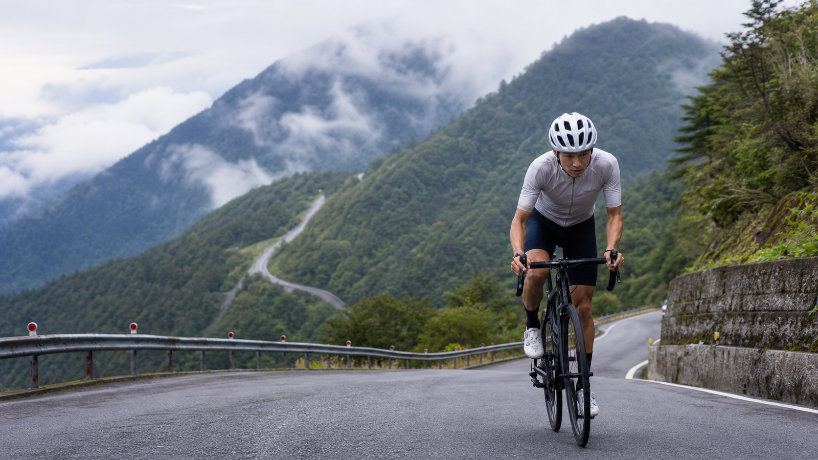
Taipingshan Climbing Challenge: 14.18 km, 973 m of Elevation Gain — How to Ride This “Taiwan’s Fuji Mountain Road” Without DNFing
Route Overview and Data Breakdown: Know What You’re Up Against First
The Taipingshan-2025 route is one of the most talked-about climbing routes among cyclists in Yilan in recent years. Official data classifies it as a Category 5 route — in most Taiwanese route grading systems, Category 5 is already considered “hardcore shark” territory, meaning the combination of gradient and distance poses a genuine challenge to the vast majority of amateur riders. The route starts at Changpi Lake and ends at Jianqing High Point, with the route label simply reading “Taipingshan,” indicating that its core selling point is the Taipingshan National Forest Recreation Area, a legendary forestry zone located in Datong Township, Yilan, at an elevation of roughly 2,000 meters.
Let’s lay out the hard numbers first:
| Item | Value |
|---|---|
| Total Distance | 14,177.8 m (approx. 14.18 km) |
| Total Elevation Gain | 973.0 m |
| Average Gradient | 6.9% |
| Classification | Category 5 |
| Start Point | Changpi Lake |
| End Point | Jianqing High Point |
Looking at these numbers together, they already reveal the character of this route. 14.18 km paired with 973 m of climbing translates to an average gradient of 6.9%, and this figure is consistent with the two raw data points of distance and elevation gain (14.18 km × 6.9% ≈ 978 m, very close to the measured 973 m, with no contradiction). This means it’s not a route where you can “start easy then get steep” or “start steep then ease off” and power through a section with a burst of effort — it’s a “constant climbing route” that maintains moderate-to-high intensity throughout, with almost no recovery sections.
For a simple mental coordinate reference against other well-known climbing routes in Taiwan: the Hehuan Mountain North Peak section toward Wuling averages around 5% gradient, most sections of the Alishan Highway and Lulin Mountain average between 4-6%, while this Taipingshan route’s 6.9% average gradient already approaches the intensity level of the Songluo Forest Road or certain consecutive hairpin sections of the Beiyi Highway. If you think of it as “an upgraded version of the Alishan Highway,” you won’t be far off — the distance is short and the time might seem manageable, but the elevation gain per kilometer is far higher than what most people are used to on long-distance climbing routes. This is precisely why it’s easy to underestimate, leading to blowing up midway.
The Taipingshan National Forest Recreation Area itself is Taiwan’s second-largest forestry legacy site after Alishan. This historical positioning also explains why the route was designed as a climbing route — the entire park has been an important forestry operation area since the Japanese colonial period, and the road system was originally built for timber transport and forestry work, with gradients designed for engineering and transport efficiency rather than recreational riding comfort. This is also why you’ll find almost no obvious “flat recovery sections” on this route, making the riding experience significantly harder than a typical scenic road of the same distance.
Section-by-Section Strategy: From Changpi Lake to Jianqing High Point, Breaking Down Six Key Segments
Since the official public data does not provide a kilometer-by-kilometer gradient profile or GPX point-by-point data, the following section strategy is a pacing plan based on the route type (mountain forestry road), the terrain characteristics of the Taipingshan area, and the 6.9% average gradient. For actual on-road gradient variations, please refer to on-site conditions and the latest official GPX track.
Segment 1 (Start to approx. 2-3 km): Launching from Changpi Lake — Warm-Up Is Real Combat
Changpi Lake is the starting point, at a relatively lower elevation, which means you face climbing from the very beginning. The entry section of the Taipingshan area usually has a tire-warming stretch, but with an overall average gradient of 6.9%, in practice you have almost no true “easy warm-up slope” to rely on. The strategy here is: start with a more conservative cadence and heart rate than you’d normally use when launching into a climb. Many riders habitually charge out of the gate, thinking “I’ll break away from the group or build an early lead,” but on a route with a constant 6.9% average gradient, pushing too hard early almost guarantees you’ll pay for it later. Keep your heart rate at the upper edge of Zone 3 corresponding to your FTP, letting your body and respiratory system adapt to the oxygen changes that come with rising elevation.
Segment 2 (approx. 3-6 km): Consecutive Hairpins and Forestry Road Terrain Transition
The Taipingshan road system is famous for its hairpin turns — a typical geometric feature of forestry timber-hauling roads. To gain sufficient elevation within limited horizontal distance, the road spirals upward in consecutive hairpins. This section is one of the most psychologically demanding areas of the entire route, because the hairpins constantly deliver the visual blow of “another turn, then up again.” The recommendation here is to adopt a visual strategy of “don’t look far ahead, only look 50 meters in front,” collapsing your attention onto your current cadence and breathing rhythm, avoiding the mental fatigue caused by the visual monotony of continuous switchbacks.
Segment 3 (approx. 6-9 km): Mid-Section Elevation Gain — Oxygen Levels Start to Make a Noticeable Difference
As elevation gradually climbs toward the main recreation area of Taipingshan, most riders will begin to feel the tangible impact of reduced oxygen on power output. Generally speaking, for every 1,000 meters of elevation gain, maximum oxygen uptake (VO₂max) drops by approximately 6-10% (actual figures vary by individual and are highly dependent on acclimatization). The Taipingshan recreation area itself sits at around 2,000 meters, and while the official data does not specify the exact elevation of the route’s endpoint at Jianqing High Point, based on the terrain of the Taipingshan park, it should be quite close to or exceeding the 1,500-1,800 meter range. This means that in the mid-to-late sections, you’ll experience the phenomenon of “the same power output but an abnormally elevated heart rate.” This is a normal physiological response — no need to panic — but you must factor this into your pacing plan. At this point, you should proactively lower your target power rather than stubbornly holding your original rhythm.
Segment 4 (approx. 9-11 km): The Hardest Section of the Entire Route — The Psychological Breaking Point for Over 60% of Riders
Based on the terrain data of the Taipingshan road system and the 6.9% average gradient, most commentators believe that the mid-to-late section will feature “tough sections” where local gradients significantly exceed the average, possibly with short ramps of 8-12% or even higher. This is the most critical decision point in your pacing strategy: if you’ve already used up 70% of your energy before reaching this point, this section is very likely where you’ll DNF. Before entering this segment, riders are advised to do a “self-check of how you feel” — if your breathing is already near the upper edge of your lactate threshold and your legs feel noticeably heavy, you should proactively shift to a lower gear and reduce cadence to a sustainable rhythm. Better to sacrifice a little time than to fail to preserve the energy reserves needed to finish the remaining sections.
Segment 5 (approx. 11-13 km): Approaching the Jianqing Historic Trail Area — Terrain Opens Up
As you gradually approach Jianqing High Point, the route enters the core zone of the Taipingshan recreation area. Because this area is adjacent to the Jianqing Historic Trail (a 0.9 km trail converted from the old Jianqing Line timber railway bed), the terrain becomes relatively open and the views gradually expand. At this point, cloud mist or sea-of-clouds scenery may begin to appear in your field of vision — one of the few sections on the entire route where riders can gain positive psychological feedback. Make good use of this visual reward to reset your mindset and prepare for the final push.
Segment 6 (approx. 13-14.18 km): The Final Climb to Jianqing High Point
This last section is short in distance, but if you’ve mismanaged your pacing earlier, it’s often the most painful part of the route. At this point, abandon any thought of “sprinting to the line” and instead adopt a closing strategy of “steady cadence, regular breathing,” focusing on finishing rather than breaking your personal record. After reaching Jianqing High Point, remember to take basic measures to stay warm (in the Taipingshan area, even in summer, the wind at the summit can cause the perceived temperature to drop rapidly) before considering taking photos.
Gear Ratio and Equipment Recommendations: This Road Isn’t for Just Any Road Bike
The 6.9% average gradient, combined with possible double-digit short climbs, means gear ratio configuration is one of the keys to success on this route—arguably even more important than your absolute fitness.
Gear Ratio Recommendations:
- General amateur riders: Strongly recommended to use a compact crankset (Compact, 50/34T) paired with an 11-32T or 11-34T rear cassette, ensuring the easiest gear provides enough cadence room to handle the localized steep sections.
- Advanced riders (FTP > 4.0 W/kg): A 50/34T with an 11-28T is feasible, but it’s still advisable to keep at least one easy gear that allows you to maintain a cadence above 80 rpm on steep climbs.
- If your bike has a traditional crankset (53/39T), unless you’re a pro-level rider, it’s strongly advised against tackling this route—the short, steep climbs in the latter half will likely force you to stand and grind, causing your energy expenditure to increase non-linearly.
Bike Selection: Taipingshan Road belongs to the forestry road system. While most sections are paved with asphalt, some parts may have unstable road conditions due to forest drainage or accumulated fallen leaves. It’s recommended to choose a road bike or gravel bike (Gravel/Endurance geometry frame) with a certain degree of comfort and compliance, avoiding overly aggressive low handlebar positions that could put excessive strain on your lower back during long climbs.
Wheels and Tire Width: Racing tires that are too narrow (below 23c) are not recommended. Given the potentially slippery surfaces and gravel in the mountains, a tire width of 25-28c provides better grip and comfort cushioning.
Nutrition and Hydration Management: The Most Underestimated Aspect of a Climbing Route
Many riders make a classic mistake: because the route is only 14.18 kilometers long, it looks “short,” so they neglect their nutrition preparation. This is completely flawed logic. Nutrition needs should be estimated based on elevation gain and estimated riding time, not horizontal distance.
With 973 meters of total climbing and a 6.9% average gradient, a typical amateur rider will take anywhere from 50 to 90 minutes to complete this route (see the next section for detailed time estimates). This time frame is already sufficient for the body to deplete significant glycogen stores and fluids.
Hydration Recommendations:
- Ensure you’re fully hydrated before departure; it’s recommended to consume at least 500ml of fluid within 2 hours before the ride.
- Carry at least one 750ml bottle on the bike. If temperatures are high or you tend to sweat heavily, prepare two bottles (including electrolyte supplementation).
- The mountain roads in the Taipingshan area are winding, and the actual operating status of mid-route supply points (such as the visitor center or shops) varies by season and time of day. It’s strongly recommended to bring sufficient water and supplies yourself—don’t expect there to always be a shop along the way to refill.
Energy Intake:
- If your estimated completion time exceeds 60 minutes, consume an easily digestible carbohydrate source (such as a banana or energy bar) 30-45 minutes before departure, and take one energy gel mid-ride depending on how you feel.
- Electrolyte supplementation is especially important on high-altitude climbs, as the combination of altitude and sweating accelerates electrolyte loss. Sports drinks or electrolyte tablets containing sodium and potassium are recommended.
Weather and Seasonal Considerations: Taipingshan Is a High-Mountain Terrain That Can “Change Its Mood” at Any Moment
Taipingshan National Forest Recreation Area sits at approximately 2,000 meters above sea level and features a typical high-mountain climate. Weather changes far more rapidly than on flat or low-elevation routes—a factor that absolutely cannot be overlooked when planning this ride.
Cloud, Fog, and Visibility: Taipingshan is famous for its sea of clouds, which means fog and mist are the norm rather than the exception. Fog dramatically reduces visibility, and this is especially significant for safety on the descent—impaired visibility on the climb is merely an annoyance, but on the descent it directly affects braking distance judgment and cornering line safety. If weather conditions are poor (dense fog, visibility below 50 meters), consider canceling or postponing the ride. It’s better to reschedule than to risk riding through it.
Rain and Slippery Surfaces: Rainfall probability in the mountains is generally higher than in the lowlands, and afternoon convective showers are especially common in summer. Wet surfaces combined with fallen leaves and moss that may accumulate on forest roads will significantly reduce grip in hairpin turns. In rainy conditions or when the road is still wet after rain, significantly reduce cornering speed and brake earlier.
Low Temperatures and Possible Icy Sections: In winter (especially December through February), temperatures in the Taipingshan elevation zone occasionally approach or drop below freezing. In extreme cases, road icing cannot be ruled out, particularly in shaded areas or on windward slopes. Such road conditions are nearly unbearable for road bike tires (especially narrow ones). Before departing in winter, be sure to check the official real-time weather and road condition announcements from Taipingshan National Forest Recreation Area. If there’s any concern about ice, abandon the ride outright—this isn’t a risk that willpower can overcome; it’s a safety bottom line.
Day-Night Temperature Variation: Even in summer, the temperature difference between day and night at the Taipingshan summit area can exceed 10°C. Combined with stopping at higher elevations after climbing and sweating, the wind chill effect can cause your perceived temperature to drop rapidly. Even when departing in summer, it’s recommended to carry a lightweight windbreaker in your saddle bag and put it on immediately upon reaching the Jianqing high point to avoid getting chilled.
Common Mistakes and DNF Risks: These Pitfalls, Others Have Already Stepped Into
Mistake One: Equating “short distance” with “low difficulty.” The number 14.18 kilometers looks approachable, but the absolute volume of 973 meters of climbing, combined with a 6.9% average gradient, means the actual intensity may exceed what many people associate with “a 40-kilometer gradual climb.” Always assess difficulty by elevation gain and gradient, not distance alone.
Mistake Two: Pacing too hard in the early section, then hitting a cliff-like drop in energy mid-to-late ride. This is the most typical DNF cause on climbing routes. Since there’s almost no truly flat recovery section along the entire route, any excessive output early on will directly translate into an energy deficit later—and the terrain gives you very few opportunities to “find a spot to catch your breath and regroup.”
Mistake Three: Underestimating the effect of altitude on power output. Many riders who are well-trained at sea level are surprised on their first 2,000-meter-class mountain route to find that “my power output isn’t down, yet my heart rate is abnormally high.” This is a normal physiological response to reduced oxygen availability. Without prior awareness of this, riders may quit prematurely due to psychological frustration.
Mistake Four: Insufficient gear range, forcing standing grinds that drain excessive energy. As mentioned earlier, if you’re using a traditional crankset or a cassette without a light enough gear, the double-digit short climbs in the latter half will force you to stand and grind repeatedly. This intermittent high-intensity output pattern is a disastrous way to manage your overall energy.
Mistake Five: Ignoring real-time weather changes and riding through, creating safety risks. The speed of weather change at Taipingshan is not the rhythm flatland riders are used to. In the mountains, “looks fine right now” and “ten minutes later” can be two completely different worlds. Develop the habit of constantly observing the sky and cloud changes, and maintain the mental readiness to turn back at any time.
Mistake Six: Insufficient hydration and energy preparation. Already detailed above, but emphasized again here: the nutrition logic for a short, high-climbing route is completely different from a long, gradual route. Never underestimate it just because the mileage number is small.
Target Time References for Riders of Different Levels
The following time ranges are reasonable estimates based on the route’s elevation gain, average gradient, and climbing performance data for typical amateur and advanced riders. Actual completion times will vary significantly depending on individual fitness, daily condition, weather, and rest stops. These figures are for pre-ride expectation setting only and do not represent officially certified data.
| Rider Level | Reference Power-to-Weight Ratio (W/kg) | Estimated Completion Time |
|---|---|---|
| Beginner / Recreational Rider | Below 2.0 | 90+ minutes (including rest) |
| General Amateur Rider | 2.0–3.0 | 65–90 minutes |
| Advanced / Well-Trained Rider | 3.0–4.0 | 45–65 minutes |
| Competitive-Level Rider | 4.0+ | 35–45 minutes |
It’s worth noting that this table assumes the rider is focused on a finish-oriented pace throughout. If you treat the route as a sightseeing trip, riding slowly with multiple stops for photos and rest, extending the actual time to over 2 hours is perfectly reasonable and even recommended—after all, the sea of clouds, forest scenery, and the landscapes around the Jianqing Historic Trail along Taipingshan are well worth slowing down to savor. Not every challenge needs to be approached with a racing mindset.
Pre-Race Training Plan: Four Weeks to Get Your Body Ready
If you’re not a veteran who rides long-distance climbing routes like Wuling or Lulin Mountain every day, it’s recommended to start targeted training at least four weeks in advance to get your body ready for the intensity of a 6.9% average gradient and 973 meters of elevation gain. Below is a conservative yet practical four-week training framework that riders of different fitness levels can reference and adjust.
Week 1: Base Aerobic Fitness and Climbing Muscle Activation. The focus this week isn’t intensity, but rather waking up your body’s memory of climbing movement patterns. It’s recommended to schedule 2-3 moderate-intensity rides, with at least one route featuring a continuous climb (even if it’s just a short hill), to let your thighs and glutes readapt to sustained power output. Pair this with core training, because the core stability required for long climbs is often underestimated by amateur riders.
Week 2: Building Gradient Tolerance. This week introduces interval climbing training—for example, pick a section with a 5-8% gradient and 3-5 minutes in length, climb it repeatedly for 4-6 reps, recovering with easy spinning in between. The goal is to help your body adapt to sustaining steady output in a higher heart-rate zone, while also observing your breathing patterns and physical sensations at that intensity. This will directly help with the reduced oxygen availability at higher elevations in the latter half of the Taipingshan route.
Week 3: Long-Endurance and Simulation Training. It’s recommended to schedule one long ride that includes at least 600 meters of climbing, simulating the intensity curve of the Taipingshan route as closely as possible—maintaining moderate-to-high output throughout with few flat recovery sections. Beyond physical adaptation, this session also covers the psychological side: getting used to the mental pressure of “continuous climbing with no obvious easy sections,” and practicing the pacing strategy and visual focus techniques mentioned earlier.
Week 4: Tapering and Fine-Tuning. The final week before the challenge should significantly reduce training volume to let your body recover from the previous three weeks’ load, avoiding showing up with fatigued legs. It’s recommended to do only 1-2 easy rides, focusing on maintaining cadence feel rather than accumulating volume, and use this week to confirm all equipment, gearing, and nutrition supplies are ready.
With this four-week preparation period, even riders who don’t train on climbs daily can significantly reduce the risk of blowing up or DNF-ing midway through the Taipingshan route. Of course, if you already have a consistent climbing training routine, or your FTP power-to-weight ratio is already above 3.0 W/kg, this route will be considerably more manageable for you, and you can adjust training intensity and periodization based on your own situation.
Pre-Ride Checklist: Verify Every Item Before Departure
The biggest fear on a mountain route isn’t a lack of fitness—it’s unexpected situations caused by inadequate preparation: a flat tire, not bringing enough water, or heading out without checking the weather forecast. These seemingly minor oversights are often what ultimately turn a ride into a miserable ordeal. Below is a pre-departure checklist that we recommend reviewing once the night before the challenge and once again on the morning of departure.
Bike: Confirm your gearing matches the earlier recommendation (compact crankset + 11-32T or larger), tire pressure suits the day’s road conditions (slightly lower pressure is recommended in wet conditions for better grip), brake pads have enough remaining life for the continuous descent, and the drivetrain shifts smoothly (especially rear derailleur stability under high load while climbing).
Nutrition: Water bottles filled and carrying enough (at least 750ml to start, adjust based on weather), energy gels or food supplies ready, and electrolyte supplements packed.
Gear: Even if departing in summer, it’s recommended to carry a lightweight windbreaker for the cold wind-chill at the Jianqing summit, a basic flat-repair kit (spare tube, pump or CO2, tire levers), and ensure your phone is fully charged with offline maps downloaded in case of unstable mountain cell signal.
Information Check: Before departure, be sure to check the official real-time weather and road condition announcements from Taipingshan National Forest Recreation Area, confirm sunrise and sunset times for the day to avoid riding in the dark, and if you plan to enter the park, pay attention to possible entry time restrictions or vehicle quota controls—always defer to on-site announcements and the latest official information.
Mental Preparation: Honestly assess your physical condition for the day. If you didn’t sleep well the night before or feel slightly unwell, it’s better to postpone the challenge than to force it—a route with 973 meters of climbing and a 6.9% average gradient isn’t something you can safely complete on willpower alone. Knowing your limits is always the first rule of mountain riding.
Frequently Asked Questions (FAQ)
Q: Is this route suitable for beginners?
A: With a 6.9% average gradient, 973 meters of climbing, and a Category 5 classification, this route has a relatively high threshold for newcomers with no climbing experience. It’s recommended to first build a foundation by completing routes with 300-500 meters of elevation gain before attempting this one, or ride it at a “sightseeing pace, no rush” mindset.
Q: Do I need to apply for park entry permission in advance?
A: Taipingshan National Forest Recreation Area is a controlled-access recreation area. Actual entry regulations, time restrictions, and vehicle quota details are subject to official policy changes. Please always defer to the latest official announcements from Taipingshan National Forest Recreation Area and confirm everything before departure.
Q: Are there supply stations near the Jianqing summit at the route’s end?
A: Some areas within the park may have visitor centers or vending facilities, but actual operating hours and available items vary by season and time of day. It’s strongly recommended to bring ample supplies and not assume you’ll be able to refill water or food along the way or at the finish.
Q: What should I watch out for on the descent?
A: The descent also involves continuous hairpin turns, plus possible mountain fog and wet pavement. It’s recommended to keep your speed within a range where you can safely navigate each corner, brake early, and especially slow down when visibility is poor. Safety always comes before speed.
Conclusion: A Route That Demands Respect
The Taipingshan route—14.18 kilometers with 973 meters of climbing—looks “short and punchy” on paper, but at its core, it’s a high-mountain climbing route that demands thorough preparation and serious respect. The 6.9% average gradient, potentially steeper local sections, and the unpredictability of alpine weather make it a classic challenge where “the unprepared often go home defeated, while the well-prepared reap great rewards.” For all riders planning to take on this route, be sure to check the day’s weather and road condition announcements before departure, bring ample supplies and warm clothing, and complete the entire ride with a conservative yet steady pacing strategy—rather than going all-out and collapsing midway, steadily grinding your way to the Jianqing summit is the proper way to finish this route.
Related Reading
- Taipingshan Road Challenge: The Hidden Climbing Route in Yilan’s Mountains
- Taipingshan Cycling Challenge: A Forest Climb from Yilan to Taipingshan
- Taipingshan Climb Race: Strategies for Forest Road Characteristics and Weather Changes
- Yilan Jiaoxi Hot Springs to Taipingshan: The Complete Climbing Route Guide Starting from the Hot Springs
太平山單車員工旅遊 | 這樣玩CP值最高!| 公路車
5 年前
台灣登山王之路 KOM 全程參賽4K臨空錄影 PART1 穿越峽谷地形! #東進武嶺 太魯閣 / 燕子口 / 天祥 / 西寶 PART1 (公路車 / CT Yeh)
3 年前
台北闊瀨陡坡 騎旅 / 日本單車雜誌編輯車友臨時加入!/ 髮香才是最強的 / feat. 北迴歸線小隊 / 公路車 CT Yeh
6 個月前
半日 小台灣 極限單車路線挑戰實錄
7 年前
爬坡ITT實境)台中 魔王 松鼠坡 首航 6:12 大肚山 大三元 科福路
8 年前
富士山KOM 賽事篇 VLOG!/ 小野田出沒!/ 完整路段分析 / 武嶺要騎多快才能拿環?/ 台灣選手 第20回Mt.富士ヒルクライム 参加!/ 公路車 / CT Yeh
2 年前
新竹羅平 x 天湖部落 大禹嶺級變態陡坡! 4K超高畫質 空拍 | 公路車
5 年前
2025 乘鞍岳登山賽 比賽全紀錄篇 / 完整路線攻略介紹 / 日本版武嶺 公路最高點 / 高山空拍絕景 / 明年會開團! / 公路車 / CT Yeh
10 個月前