Lianlian 197 Race Guide: How to Ride 120km? The Truth Behind the 0.2% Average Gradient "False Flat"
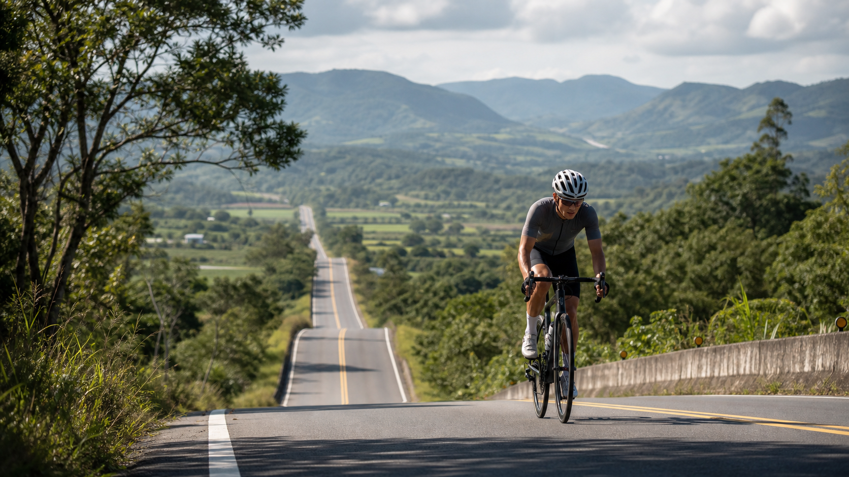
An average gradient of only 0.2%, yet a total elevation gain of 1,028 meters—these numbers alone are a lesson in pacing. Love 197 reminds us: never judge a route by its averages alone.
1. Engrave These Three Numbers in Your Mind
Before planning any pacing strategy, remember the three most critical real-world figures for this route:
| Item | Figure | Engineering Perspective |
|---|---|---|
| Total Distance | 120.822 km | Over 100 km; a full-day, long-distance route |
| Total Elevation Gain | 1,028.4 m | Spread across the entire route; no single major climb |
| Average Gradient | 0.2% | Looks nearly flat on paper, but actually hides continuous undulations |
There is a gap between these three numbers that must be honestly confronted: if the average gradient across the entire route were truly 0.2%, theoretically 120 km would require only about 240 meters of climbing (120,822 m × 0.2% ≈ 242 m). Yet the actual total elevation gain is 1,028 meters—more than four times that figure.
This discrepancy is not a data error; it is a true reflection of the route’s nature: the average gradient is a “net value,” where climbs and descents cancel each other out to near zero; but total elevation gain is a “cumulative value,” which honestly sums up every actual climb. In other words, this route does not climb steadily throughout—it is a “sawtooth” profile woven from countless undulations—up one stretch, down the next, up again. The gradient shifts frequently, and your muscles rarely get a true rest.
Understanding this is the first lesson in completing Love 197. Many riders are misled by the “0.2% average” figure, set off with a flat-road mentality, push the throttle to the floor, and end up being drained bit by bit by the continuous short climbs in the second half, finally hitting the wall 15 km before the finish.
2. Route Skeleton: The Dual Identity of County Road 197 and Provincial Highway 11
To understand Love 197, you must first distinguish two things: one is “County Road 197,” the physical road; the other is the cycling event named “Love 197” (also rendered as “Fall in Love with 197” in official copy), organized by the Taitung County Urban-Rural Life Sports Association. The names are similar, but the routes are not exactly the same—be sure to clarify when planning your ride.
County Road 197 spans approximately 59.67 km, a north-south county road entirely within Taitung County. It starts in the urban area of Chishang Township in the north and ends at Shichuan in Taitung City to the south, passing through five townships—Chishang, Guanshan, Luye, Yanping, and Beinan—and Taitung City in sequence. It is the most important connecting road in the Huadong Rift Valley after Provincial Highway 9. About 75% of the surface is asphalt, with the remainder being gravel. The tree-lined section near Guanshan, praised for its serene scenery, is known as “Taiwan’s New Zealand” and is a公认 favorite for photography and riding among valley cyclists and motorcyclists alike.
The cycling event named “Love 197,” however, follows Provincial Highway 11 along the east coast for most of its actual route: starting from Beinan Waterway Waterfront Park, it heads along the Beinan River flood-control road, across Taitung Bridge, onto Zhihang Road, then joins Provincial Highway 11 heading north, passing through Chenggong Township and Baishoulian, reaching the area around Sanxian Bridge before turning back, and finally cutting back onto County Road 197 for the finish. In other words, this is a composite route that stitches together two completely different terrains—“the openness and sea breeze of the coastline” and “the grinding climbs of the inland valley county road.” This is also why its difficulty is easily underestimated—many assume the entire ride is on County Road 197 in the valley, when in fact most of the mileage is spent on the rolling terrain of Provincial Highway 11.
This guide uses the full riding specification of 120.822 km total distance and 1,028.4 m total elevation gain as its baseline, covering the terrain characteristics of both Provincial Highway 11 and County Road 197. It is suitable as a long training ride spanning coast and valley—whether or not you participate in the official event, you can plan accordingly.
3. Segment-by-Segment Strategy: Break 120 km into Four Battles
Segment 1 (0–35 km) Provincial Highway 11 Northbound: Cherish This Smooth and Flat Stretch
After departure, head north on Provincial Highway 11—this is the smoothest and most open section of the entire route. The Pacific Ocean unfolds on your right; the road profile is gentle, gradients are mild, and coastal hills mostly undulate below 100 meters. Tactical key: do not show off your speed here. Many riders get carried away by the open views and possible tailwind, pushing their average speed up to 32–35 km/h while their heart rate quietly creeps into the threshold zone without them noticing. I recommend deliberately holding back your output, treating this section as a warm-up, keeping power around 65–70% of your personal FTP, letting your cardiovascular system and muscles gradually settle into a long-distance rhythm, and saving your perceived effort for the later stages.
Segment 2 (35–70 km) Rolling Hills Zone: The Real Test Begins
After heading toward Chenggong and Baishoulian, the route begins to feature continuous short climbs and descents—this is the key zone where the gap between total elevation gain and average gradient emerges. Each climb may be only 200–500 meters long with gradients between 3% and 6%, looking unremarkable, but a dozen or more stacked together places considerable cumulative load on your quadriceps and glutes.
Here I recommend an alternating rhythm of “standing pedaling on short climbs” and “seated cruising”: when the gradient noticeably kicks up, briefly stand and pedal for two or three strokes to maintain speed, avoiding frequent gear changes that disrupt your cadence; once the gradient eases, immediately sit back down and resume cruising cadence (recommended to hold 85–95 rpm), giving your heart rate a chance to recover. Remember not to treat every short climb as a sprint point—otherwise, by the 70 km mark, you will find your legs have no reserve left for the County Road 197 climbs ahead.
Segment 3 (70–100 km) Turnaround and Transition: Full Preparation—Both Nutrition and Mentality
After reaching the turnaround near Sanxian Bridge, the route direction shifts southward. At this point, the wind may turn from tailwind to headwind (especially noticeable during the northeast monsoon season)—this is the section where pacing is most likely to spiral out of control. Near the turnaround, I recommend scheduling a full refueling stop, topping up your water bottles, energy gels, and salt tablets all at once, because you are about to cut onto County Road 197, where aid station density will drop.
On the mental side, this is also the section where complacency is most likely to set in—you have already ridden more than half the distance, fatigue is beginning to accumulate, yet the finish line is still 40 km away. I suggest breaking your focus into “small goals every 10 km” rather than staring at the remaining total distance, which can effectively reduce psychological drain.
Segment 4 (100–120.8 km) County Road 197 Finish: The Final Test of the False Flat
The final 20 km cuts onto County Road 197—this is where the route’s elevation gain concentrates. Although no single gradient is particularly steep (mostly between 4% and 7%), by this point riders have accumulated over 100 km of fatigue, muscle glycogen is near depletion, and any additional climb will feel amplified.
The tactical principle here is “sacrifice speed, preserve rhythm”: shift your goal from maintaining average speed to maintaining a steady cadence. Rather than muscling through with brute force and risking cramps, downshift and spin more revolutions. The tree-lined section near Guanshan, though scenic, is also where many riders report “my legs have gone numb.” I recommend doing a mental preparation before entering: tell yourself this is the final piece of the puzzle—slowing down is fine; finishing matters more than speed.
4. Gear Ratio and Equipment Recommendations
Considering that while there is no single major climb, the cumulative elevation gain exceeds 1,000 meters, plus the drain of a 100+ km long-distance ride, gear ratio configuration should lean toward “endurance” rather than “sprint”:
- Front derailleur: A compact double crankset of 50/34 or 52/36 is recommended, to avoid the risk of chain drops from frequent shifting due to changing gradients.
- Rear derailleur: Pair it with a large cassette of 11-30T or 11-32T. If your strength fades on the County Road 197 finishing section, the forgiving low gears will effectively protect your knees.
- Tire pressure and width: Approximately 23.5% of County Road 197 remains gravel. Tires of 28C or wider are recommended, with pressure 5–10 psi lower than on pure asphalt, to increase grip and comfort and reduce lower-back fatigue from long-distance vibration.
- Saddle and handlebar position: For a 100+ km long-distance ride, choose a saddle with better shock absorption, and confirm before departure that your handlebar height allows you to freely switch between an aero tuck and an upright position in the second half, distributing pressure on your neck and shoulders.
5. Nutrition and Hydration Strategy
The summer heat in Taitung, combined with direct sun exposure along the coastal sections of Provincial Highway 11, means fluid loss happens faster than most riders expect. The recommended approach is a “mandatory hourly refueling” principle, rather than waiting until you feel thirsty to drink:
| Time Point | Refueling Recommendation |
|---|---|
| 30 minutes before departure | One full bottle of sports drink + moderate carbohydrates |
| Every hour | At least 500ml of fluid + 1 energy gel or portable snack |
| Aid stations at 35km, 70km, 100km | Top up water bottles, take salt tablets as needed |
| Turnaround point (approx. 65-70km) | Full refueling—this is the last ample refueling opportunity |
Note that place names such as the “Donghe Pork Bun Section” are geographic descriptions used for race aid stations, and actual vendor arrangements may change each year. When planning a private ride, it is recommended to carry sufficient supplies of your own rather than relying on roadside shops, especially along County Road 197 where businesses are sparsely distributed.
6. Weather and Seasonal Considerations
Wind conditions along the eastern coastline vary significantly throughout the year. When the northeast monsoon strengthens in autumn and winter, the coastal sections of Provincial Highway 11 are prone to significant crosswinds or even headwinds, which directly affect pacing strategy and energy expenditure. If choosing to ride in winter (around December), it is recommended to:
- Depart earlier to avoid potentially stronger afternoon winds
- Carry a windproof vest—wind chill effects along the coast can make the perceived temperature significantly lower than the actual air temperature
- Pay special attention to the terrain transition zone where Provincial Highway 11 meets County Road 197, as wind direction can shift abruptly due to terrain obstruction
For summer riding, sun protection and hydration take top priority. Taitung’s UV index is consistently high year-round, so wearing arm sleeves, applying sunscreen, and using UV-protective cycling jerseys is recommended.
7. Common Mistakes and DNF Risks
Based on route structure analysis, the most common failure mode on this route is not “failing to climb the hills,” but rather “losing control of pacing in the early section and running out of steam later.” Specifically:
- Going too fast in the first 35km: Tempted by the flat, open views, riders push the average speed too high, keeping their heart rate above threshold for extended periods, which severely compromises muscle recovery in the latter half.
- Underestimating cumulative elevation gain: Seeing only the 0.2% average gradient, riders misjudge the route as easy flat terrain and fail to carry enough supplies or prepare climbing muscle strength.
- Poor refueling timing: Waiting until clearly thirsty or hungry to refuel means the body has already entered an energy deficit, diminishing the effectiveness of the intake.
- Ignoring wind direction changes: Failing to account for how crosswinds/headwinds on Provincial Highway 11 amplify the actual workload, leading to a larger-than-expected gap between power output and expectations.
- Mental breakdown on County Road 197: Having already ridden over 100km, riders often mentally collapse first when facing the final climbing section. It is recommended to mentally prepare in advance that “the last mile is inherently harder.”
8. Target Time References for Different Rider Levels
The following times are for training planning reference only; actual completion times will vary significantly based on fitness, wind conditions, and temperature:
| Rider Level | Estimated Completion Time | Average Speed Reference |
|---|---|---|
| Advanced / Race level | 3.5–4.5 hours | 27–34 km/h |
| Intermediate / Trained | 4.5–6 hours | 20–27 km/h |
| Recreational / First long-distance | 6–8 hours | 15–20 km/h |
Regardless of which tier you fall into, the core challenge of this route is not the explosive power needed for a single steep climb, but rather the endurance management ability to sustain steady output over a long period. Treat it as a full-day endurance training session, using scientific pacing and refueling strategies to break down each section of terrain. This approach is far more likely to result in a safe completion than simply riding on feel, and it also allows you to better enjoy the unique scenery where Taitung’s coastline and rift valley intertwine.
9. Dual Monitoring of Power and Heart Rate: The Real Insurance for Long Distances
For riders equipped with a power meter, this route is particularly well-suited for practicing the management of the gap between Normalized Power (NP) and Average Power. Due to the frequent undulations throughout the route, instantaneous power fluctuations are significant—short climbs may spike to over 120% of FTP, while gentle descents may drop below 60%. Looking only at average power can easily underestimate the actual physiological load. It is recommended to set a target of keeping the overall Intensity Factor (IF) between 0.65 and 0.75, which is a safe range that most riders can sustain for 120km or more while still preserving sprint reserves.
For riders without a power meter, heart rate zones combined with Rating of Perceived Exertion (RPE) can serve as an alternative monitoring tool. As a general principle, heart rate should be kept below 75% of maximum for the first 70km, and only allowed to briefly reach 80% to 85% during the final County Road 197 finishing section. Many riders fail not because the latter half is too hard, but because their heart rate control in the early section is poor, causing the aerobic system to be exhausted prematurely—leaving them with the will but not the capacity to accelerate later.
Breathing rhythm is also worth attention. For long-distance endurance riding, a “three breaths in, two breaths out” or “two in, two out” breathing pattern is recommended, maintaining a steady ventilation frequency in sync with cadence. Especially on consecutive short climbs, many riders unconsciously shift to shallow, rapid breathing, which accelerates core muscle fatigue. It is recommended to deliberately take several deep breaths at regular intervals to recalibrate your breathing rhythm.
10. Practical Considerations for Night Riding and Early Departures
Since the total distance exceeds 100km, many riders choose to depart before dawn to avoid daytime heat and traffic. If adopting this strategy, be sure to note the following: the section from Beinan Waterway Waterfront Park to Provincial Highway 11 has relatively sparse street lighting, so it is recommended to equip at least an 800-lumen front light and a rear warning light, and wear a reflective vest; on sections of Provincial Highway 11 shared with large vehicles, early-morning freight truck traffic can be considerable—slow down well in advance at intersections and curves, and signal your direction clearly with hand gestures; parts of County Road 197 still have gravel and potholes, and poor nighttime visibility increases the risk of flats or crashes, so reduce your speed on this section.
Another advantage of an early departure is capturing the stunning morning light of the Pacific sunrise—especially on the ocean-facing northern section of Provincial Highway 11. If timed well, you can watch the sun rise above the sea horizon while riding. This is widely regarded by finishers as one of the most memorable images of the entire journey, and serves as an extra reward for the sacrifice of sleep in exchange for an early start.
11. Post-Ride Recovery and Next-Day Arrangements
Completing a 120km ride with over 1,000 meters of climbing places considerable metabolic stress on the body. Within 30 minutes of reaching the finish, it is recommended to prioritize recovery nutrition with a carbohydrate-to-protein ratio of approximately 3:1, paired with adequate fluids and electrolytes to help replenish muscle glycogen as quickly as possible. If other activities are planned for the following day, low-intensity stretching and foam rolling in the evening are recommended, focusing on the quadriceps, hamstrings, and glutes—the muscle groups that bear the heaviest load on continuously undulating terrain.
For riders targeting this route as their annual key event, it is recommended to begin specific training at least six to eight weeks in advance. Training content should include: at least one long-distance endurance ride per week (80km or more), interval-style short-climb sprint training (simulating the rolling terrain of County Road 197), and core stability training. These preparations can effectively reduce the risk of cramping and compensatory injuries during the ride, allowing this journey across coast and rift valley to be completed safely and enjoyably.
12. Tactical Differences Between Group Riding and Riding Solo
When departing as a group, the management of pace-line rotation rhythm directly affects the entire team’s finish time. It is recommended to split into groups based on FTP differences, avoiding situations where riders of significantly different strengths are forced to maintain the same average speed—causing the weaker riders to burn out early while the stronger riders waste energy. Rotation intervals should be kept to 1 to 2 minutes per turn. Especially on the northern section of Provincial Highway 11, if encountering a tailwind section, the average speed can easily be pushed too high. This is when an experienced team captain needs to actively call for pace control to prevent the team from collectively falling into the trap of “going too fast in the early section.”
Solo riders, on the other hand, need more precise self-pacing discipline. Without teammates to remind each other, it is recommended to make good use of the bike computer’s interval reminder function—for example, setting a prompt every 20km to force yourself to re-examine your current heart rate, power, and remaining supplies. Use data to replace subjective feelings, reducing judgment errors caused by fatigue. Another risk of riding solo is that psychologically, a low point is more likely to occur between 70 and 90km. During this period, it is recommended to use music or pre-set mental cue phrases to help yourself push through the section where thoughts of giving up are most likely to arise.
13. Route Safety and Traffic Guidelines
Although traffic on County Highway 197 and Provincial Highway 11 is far lighter than on major western trunk roads, they remain important routes for local residents’ daily commutes and agricultural vehicle access. When riding, be sure to follow these principles: when passing farm machinery or tractors, maintain a safe distance and slow down in advance—do not overtake recklessly; some sections of County Highway 197 have narrow shoulders adjacent to irrigation canals, with many blind spots at curves, so reduce speed and always leave room to maneuver; on Provincial Highway 11, the likelihood of sharing the road with large gravel trucks and tour buses is higher, especially at intersections around Chenggong Township—use clear hand signals and eye contact to confirm drivers have noticed you before crossing.
Additionally, it is recommended to download offline maps and confirm mobile reception along the entire route. On some sections of County Highway 197 that cut deep into the valley, cellular data signals may be unstable. If a mechanical failure or physical discomfort occurs, informing family or friends of your full itinerary and estimated timing in advance is a safer approach. Medical resources in Taitung are sparser than in western cities, so long-distance solo riders in particular should make thorough emergency contact preparations.
14. Mechanical Inspection and Tool Carrying Checklist
On rides exceeding 100 kilometers, improperly handled mechanical failures—rather than energy depletion—are often the direct cause of a DNF. Before departure, be sure to complete the following checks: chain cleaning and lubrication condition, whether the shift cables have any unusual noise or hesitation, brake pad wear, and most importantly—whether the tire sidewalls have cracks or embedded debris. The gravel sections of County Highway 197 pose a higher risk of tire wear and cuts, so it is recommended to carry at least two spare inner tubes (or one inner tube plus a tubeless repair kit), along with CO₂ cartridges or a mini pump, to ensure you can quickly handle flats on rougher road sections.
Recommended tool kit contents: a multi-tool hex wrench set, a spare derailleur hanger, a chain tool with spare quick links, tire levers, and basic zip ties and electrical tape—these seemingly insignificant small items are often the key to handling unexpected situations on long rides. In addition, a power bank and spare batteries for your bike lights are essential, especially if your itinerary crosses sunrise or sunset hours—lighting endurance is directly related to riding safety.
15. For First-Time Riders Tackling 100 Kilometers or More
If Lianlian 197 is your first attempt at a ride exceeding 100 kilometers, it is strongly recommended to accumulate at least two to three training rides of 60 kilometers or more in advance, allowing your body to fully adapt to the saddle and handlebar position, so that soreness or numbness caused by unfamiliar posture does not amplify on race day. At the same time, be sure to actually test the compatibility of your nutrition with your stomach—gastrointestinal discomfort is one of the common causes of DNF on long rides. It is recommended to confirm during training rides which energy gels and solid foods suit your stomach, and never try new products on race day itself.
Mentally, the most important principle for your first attempt at this distance is “finishing takes priority over pacing.” There is no need to compare speed with anyone else. Focus on completing the entire course safely and steadily. After experiencing it once, you will have a clearer understanding of your physical limits, and this experience will become an important foundation for future challenges of longer distances or more difficult routes. With its relatively forgiving gradient design, Lianlian 197 provides an ideal “advanced training ground,” allowing you to take the first step into long-distance endurance riding while enjoying the beauty of Taitung’s coast and valley.
Related Reading
- Pinglin North 42 Practical Guide: A Hidden Steep Climb with 12% Grades Hidden in 5.1 km—Data Contradictions Fully Analyzed
- Xiping Highway Practical Guide: 8.3 km, 793 Meters of Climbing—The Most Solid Climbing Test in New Taipei’s Suburbs
- Tucheng Guanzizai Practical Guide: 3 km with 220 Meters of Climbing—Deconstructing This Hidden Steep Climb with Data
- Xiding Road Practical Guide: A 4.35 km Gentle Warm-Up on North 33 Tung Blossom Road—Full Data Pacing Analysis
2020 戀戀197 全程4K雙錄影 訓練台實境 市民競賽組 M30 M40 #公路車
6 年前
戀戀197 賽前一天記錄 與高手路線探索 快剪版 #公路車
6 年前
戀戀197 競賽組 | 50頁投影片心得報告 | 賽後檢討 攻略 #公路車
6 年前
台北闊瀨陡坡 騎旅 / 日本單車雜誌編輯車友臨時加入!/ 髮香才是最強的 / feat. 北迴歸線小隊 / 公路車 CT Yeh
6 個月前
備戰 戀戀197 賽前關門點分析 西濱團練 #公路車 4K高畫質
6 年前
戀戀197 血脈噴張 多視角剪輯版 最艱難的市民競賽組 M30 M35 參賽記錄 請開字幕 4K高畫質 #公路車
6 年前
昇陽SYB車隊 & Fuji 菁英選手們的趣味經驗分享,長知識了!市民車友必看~ 一路被拉爆後才給問 | 戀戀197 武嶺 凸台經驗分享 | 公路車 | CT Yeh
4 年前
單車 梅山36灣 坡度介紹 路段介紹 空拍 (相關遊記影片,請參考說明或我的頻道喔,歡迎訂閱)
6 年前