Route 162A Ruifeng Practical Guide: 10km Challenge with Nearly 1,200m of Climbing, a Hardcore Long Climb in the Meishan Tea Region
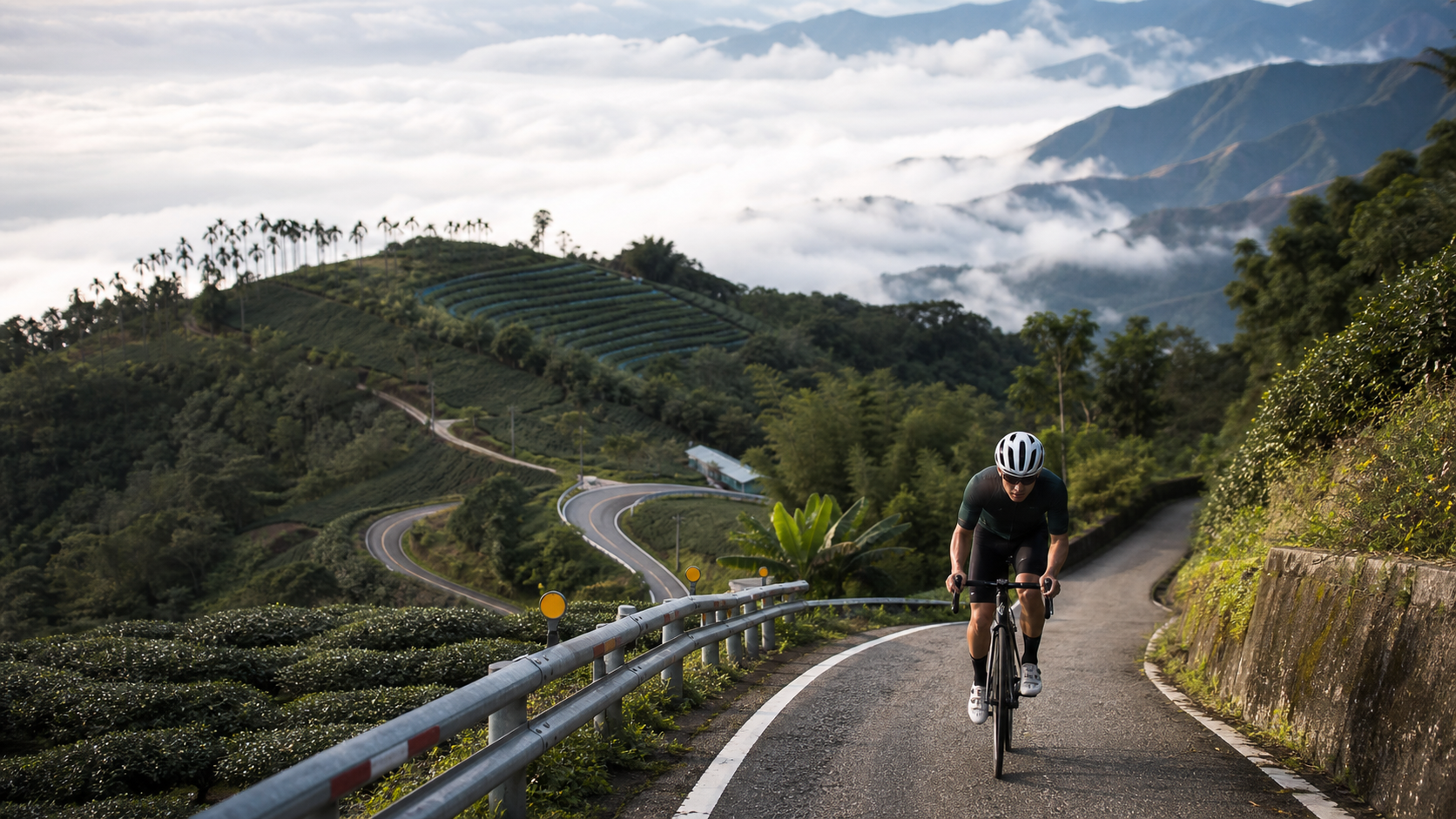
Average gradient 5.8%, yet the total elevation gain is listed as 1,197.7 meters—these figures don’t add up. This article will first honestly confront this contradiction, then provide reliable riding advice.
1. First, Honestly Facing the Data Contradiction
Before planning this route, an engineer’s mindset requires us to first examine the internal consistency of the data. The official figures for 162甲 Ruifeng (the section from Grand Canyon Ruifeng Bridge to Ruifeng Elementary School) are: total distance 10,006.9 meters, average gradient 5.8%, total elevation gain 1,197.7 meters.
Working backward from distance and gradient: 10,006.9 meters × 5.8% ≈ 580.4 meters. This result differs from the stated 1,197.7 meters by more than double, and the two clearly cannot corroborate each other. Conversely, working backward from total elevation gain and distance to find the average gradient: 1,197.7 meters ÷ 10,006.9 meters ≈ 11.97%, which again shows a significant discrepancy from the stated 5.8% average gradient.
| Item | Data | Notes |
|---|---|---|
| Total Distance | 10.01 km | Mid-distance climbing segment |
| Stated Average Gradient | 5.8% | Contradicts the total elevation gain figure |
| Stated Total Elevation Gain | 1,197.7 m | If accurate, implies an average gradient close to 12% |
| Implied Average Gradient | ~12% | Calculated from total elevation gain and distance |
Faced with this data contradiction, this article adopts the principle of honest disclosure: we will not deliberately pick one figure to package into a single narrative, but rather remind readers that the route’s true difficulty lies somewhere between “moderately hard (if the 5.8% gradient is believed)” and “a fairly hardcore long climb (if the 1,197.7-meter total elevation gain and its implied ~12% average gradient are believed).” When actually riding, please rely on the measured data recorded by your personal GPS device, and maintain the mental preparation that “this route may be harder than the stated average gradient suggests.” Better to overestimate the difficulty and be well-prepared than to underestimate it and be caught off guard.
2. Geographic Location and Route Background
This route is located in Meishan Township, Chiayi County, and is part of the transportation network connecting the Meishan lowlands with the Alishan tea region (Taiping, Ruili, Ruifeng, Taihe, etc.). The terrain across Meishan Township is complex, ranging from hills, to low mountains, to deep mountains from west to east, with significant elevation differences. This is why, even though the distance is only 10 kilometers, the total elevation gain can reach a considerable figure.
The road segment is named “Grand Canyon (Ruifeng Bridge) to Ruifeng Elementary School.” The starting point, Grand Canyon Ruifeng Bridge, is an important landmark on this route, while the endpoint, Ruifeng Elementary School, is located within the Ruifeng community. The deep-mountain villages of Ruili, Ruifeng, and Taihe within Meishan Township are important high-mountain tea-producing areas. The hillsides were originally planted with fruit trees and bamboo, but were gradually converted to high-mountain tea cultivation, developing into one of the important production areas of today’s Alishan tea series.
3. Section-by-Section Strategy: Breaking the 10 km into Four Segments
Segment 1 (0–2.5 km) Starting from Grand Canyon Ruifeng Bridge: Establishing Rhythm
Starting from Grand Canyon Ruifeng Bridge, this is the most critical starting point for both mind and body on the entire route. Considering that the route’s true difficulty may be far higher than the stated 5.8% average gradient, it is recommended to start the climb at a relatively conservative intensity, keeping power output around 75% to 80% of FTP, to avoid being misled by the incorrect expectation that “the average gradient isn’t that steep” and starting with excessively high output.
On this section, it’s recommended to spend more effort observing the rhythm of gradient changes, using the actual feel of pedaling to recalibrate your expectations of the route’s difficulty—if you find the gradient continuing to rise more than expected, you should immediately lower your pacing target rather than stubbornly sticking to the original plan.
Segment 2 (2.5–5.5 km) Entering the Deep-Mountain Tea Region: The Test of Sustained Climbing
As elevation gradually increases, the route begins to enter the tea garden belt of Meishan Township’s deep-mountain area. This section is likely to be the core zone where the total elevation gain is concentrated. Especially if the 1,197.7-meter total elevation gain figure is accurate, the actual gradient felt here should clearly exceed the stated 5.8% average. It is recommended to adopt a strategy of “primarily seated, standing as a supplement.” Facing continuously rising gradients, seated pedaling maintains a more stable cardiovascular load, and you should only briefly stand to add torque at moments when the gradient suddenly spikes.
Along this section, you can enjoy the layered tea garden landscape. If weather permits, the elevation advantage also makes this area a popular spot for viewing the morning sea of clouds—but while riding, it’s recommended to prioritize safety and energy management. The scenery can be savored after reaching a rest point or the finish.
Segment 3 (5.5–8 km) The Core Climbing Section: A Test of Endurance and Willpower
If we accept the 1,197.7-meter total elevation gain figure, this section is likely the most demanding core interval of the entire route, with actual gradients potentially reaching double-digit percentages. Facing this challenge, it’s recommended to confirm your gear ratios are sufficiently wide, and adopt a “short and deep” breathing pattern, combined with a higher cadence (70 to 80 rpm) to distribute the load of each pedal stroke, avoiding the approach of muscling through with heavy gears and low cadence.
Psychologically, this section is also where the urge to give up most easily arises. It’s recommended to break your focus into smaller goals, such as “hold on until the next turn,” rather than constantly thinking about how far the finish line is, which can effectively reduce mental fatigue.
Segment 4 (8–10 km) Finishing at Ruifeng Elementary School: Steadying Your Last Strength
In the final 2 kilometers approaching Ruifeng Elementary School, physical fatigue will accumulate noticeably. The principle here is “preserve rhythm over preserving speed.” It’s better to slow down than to compromise the economy of your movement, to avoid cramping or muscle strains. After arriving at Ruifeng Elementary School, it’s recommended to first let your heart rate recover to a safe range before considering onward plans or turning back the same way.
4. Gear Ratio and Equipment Recommendations
Considering that the route’s true difficulty may be far higher than the level implied by the stated average gradient, gear ratio configuration should definitely lean toward the conservative side:
- Front Derailleur: A 50/34 compact crankset is strongly recommended. Avoid racing-oriented large chainrings, especially if the 1,197.7-meter total elevation gain figure is accurate, as it would mean the route likely contains a significant proportion of double-digit gradient sections.
- Rear Derailleur: At least an 11-32T cassette is recommended. If you have limited climbing experience, an 11-34T or wider cassette combination provides greater safety margin.
- Tire Pressure and Width: Conditions on mountain industrial roads vary considerably. Tires of 28C or wider are recommended, with tire pressure adjusted according to actual road conditions.
- Brake System: If you plan to descend back the same way after reaching the summit, be sure to confirm the brake system is in good condition. Meishan’s mountain area has many corners and large elevation drops, making braking stability during descent critically important.
5. Nutrition and Hydration Strategy
Considering this route may be a fairly demanding long-climb challenge, nutrition preparation must be thorough:
| Time Point | Nutrition Recommendation |
|---|---|
| 30 minutes before departure | Fully hydrate to ensure the body is in a well-hydrated state |
| Every 20-30 minutes | At least 150-200 ml of fluid |
| Before the core climb in the middle section | Consume one energy gel or solid food to reserve energy stores for the most demanding section |
| After reaching the finish | Replenish electrolytes, prepare for the descent and return trip |
Shops along the route in Meishan Township’s mountain area are limited, so it’s recommended to carry sufficient supplies yourself and not rely on roadside vendors.
6. Weather and Seasonal Considerations
The high-mountain tea areas of Taiping, Ruili, and Ruifeng in Meishan Township are ideally located and are popular spots for viewing the morning sea of clouds. If you choose to challenge this route in the early morning, besides the cooler temperatures being favorable for a long climb, you’ll also have the opportunity to enjoy sea-of-cloud views from open viewpoints during the climb—an additional visual reward beyond the mere climbing mileage.
During the summer and autumn typhoon seasons, mountain roads are susceptible to rainfall-induced rockfalls or road damage. It’s recommended to check recent weather conditions and any road closure notices before riding. In winter, mountain temperatures are significantly lower than in the lowlands, especially in the early morning hours, so layered thermal clothing is recommended.
7. Common Mistakes and DNF Risks
- Trusting the stated average gradient: Underestimating the difficulty based only on the 5.8% figure, without carrying sufficient supplies or being mentally prepared for a long climb.
- Gear ratios that are too heavy: If the 1,197.7-meter total elevation gain figure is accurate, it means there may be a significant proportion of steep sections. Insufficient gearing will directly lead to being forced to walk the bike.
- Losing pace control in the early section: Being misled by the relatively gentle gradient at the start and failing to reserve enough energy for the potentially high-intensity climbing in the middle and later sections.
- Ignoring weather risks: Failing to check recent rainfall and road conditions, and rashly heading out after a typhoon, increasing the risk of rockfalls and slipping.
- Neglecting brake maintenance on the descent: The Meishan mountain area has many corners and large elevation drops. Rushing to descend after reaching the summit without checking the brake system increases the risk of losing control.
8. Target Time References for Riders of Different Levels
Due to the uncertainty in the route’s actual difficulty data, the following time references use a broader estimated range. Actual performance will vary significantly based on fitness level, temperature, and road conditions:
| Rider Level | Estimated Completion Time | Notes |
|---|---|---|
| Advanced / Race Level | 35–55 minutes | If the gradient is close to 12%, this is hardcore long-climb territory |
| Intermediate / Trained | 55–80 minutes | Recommended with wide gearing and ample supplies |
| Recreational / Climbing Novice | 80–110 minutes (may include brief rests) | Recommended to tackle in segments; no need to force completion in one go |
162甲 Ruifeng is a long climb that requires careful handling. Due to the obvious internal contradictions in the official data, riders are advised to adopt a mindset of “better to overestimate the difficulty” when preparing. Regardless of where the actual gradient ultimately falls, adequate gear ratios, supply preparation, and weather risk assessment will make this climb into the Meishan tea region safer and more solid.
9. Power Training Perspective: A Conservative Strategy for Data Uncertainty
In power training planning, when facing a route with internal contradictions in its official data, a strategy of “conservative estimation, actual calibration” is recommended. On the first attempt, it’s not advisable to set overly aggressive power targets. Instead, prioritize completing the ride while recording actual power output, heart rate changes, and GPS elevation data throughout. After completion, use this measured data to recalibrate the route’s true difficulty as a more precise training reference for future attempts.
If measured data shows the total elevation gain is indeed close to 1,197.7 meters, it means the route’s training value is actually quite close to the training intensity of a long-distance mountain climb. It can be viewed as a “condensed” long-climb training route, achieving training effects close to a long-distance climb in a relatively shorter time. This high-efficiency training characteristic makes it a highly valuable training resource for riders with limited time who still want to maintain their climbing ability.
10. A Comparative Perspective with Other Chiayi Climbing Routes
Placing 162甲 Ruifeng within the coordinate system of Chiayi County’s overall climbing routes, whether you accept the stated 5.8% average gradient or the nearly 12% actual gradient implied by the 1,197.7-meter total elevation gain, it belongs to the moderately hard and above level of challenge. Compared to the Guanziling route on Provincial Highway 3 (11.5 km, 5.8% average, with higher internal data consistency) that will be introduced later, 162甲 Ruifeng, precisely because of its data contradiction, requires riders to prepare with a more cautious and conservative attitude.
For riders preparing to challenge other famous long climbs in the Alishan highway system (such as Ding Shizhuo or the Taihe direction), 162甲 Ruifeng can serve as a preliminary real-world test—if you can successfully handle the potentially high-intensity climbing sections on this route, it means your climbing ability already has the foundation to challenge higher-difficulty long climbs.
11. Route Safety and Traffic Information
County Highway 162甲, as an important connecting road between the Meishan lowlands and the deep-mountain tea region, is not only used by cyclists and motorcyclists but is also a vital route for local tea farmers transporting tea leaves and agricultural products. Be sure to note the following when riding: maintain a safe distance from trucks carrying tea or agricultural products and slow down and yield in advance; the mountain area has many corners and blind spots, so reduce speed at turns and always leave room to maneuver; if visibility is poor during early morning or evening hours, equip front and rear lights to increase your visibility.
Since this route goes deep into the mountains, mobile network signals may be unstable in some sections. It’s recommended to download offline maps and inform family and friends of your complete itinerary and estimated departure and return times in advance. If a mechanical failure or physical discomfort occurs, proper emergency contact preparation is the most basic and important part of ensuring your own safety.
12. Post-Ride Recovery and Training Benefit Assessment
After completing a long climb like 162甲 Ruifeng, whose true difficulty may far exceed the stated data, it’s recommended to perform moderate dynamic stretching and cool-down riding after reaching the finish to help your heart rate gradually return to normal. If the route’s actual total elevation gain is indeed close to 1,197.7 meters, it means the metabolic stress on your body will be considerably greater than what is generally perceived as a moderately difficult climb, so post-ride muscle recovery and nutritional replenishment require equal attention.
It’s recommended to meticulously record the measured data from each 162甲 Ruifeng attempt (completion time, average heart rate, subjective fatigue level). Accumulating this first-hand data over the long term will not only help you more accurately grasp the route’s true difficulty but also serve as an important reference for planning similar long-climb training in the future.
13. For Riders Challenging a Hardcore Long Climb for the First Time
If 162甲 Ruifeng is your first attempt at a long climb with such obvious uncertainty in its official data, it’s strongly recommended to make “conservative assessment, safety first” your core principle before departure. Don’t rely solely on the stated 5.8% average gradient figure for your mental preparation. Instead, treat it as a route with “unknown difficulty that requires personal verification”—carry ample supplies, choose wide gear ratios, and dynamically adjust your pacing strategy throughout the ride based on the actual gradient you feel.
This cautious attitude when facing uncertainty is actually a highly important skill in long-distance climbing. After all, not every route will have complete and accurate data available for reference. Learning to make reasonable risk assessments and contingency plans even with incomplete information will be invaluable practical experience as you take on more unknown routes in the future.
14. Conclusion: Let Your Body Be the Most Honest Measuring Stick
The most distinctive feature of the 162甲 Ruifeng route is that it offers every rider an opportunity for personal verification—rather than agonizing over the contradiction between the average gradient and total elevation gain in the official data, let your own body be the most honest measuring stick. When you push down on the first pedal stroke and begin to feel the route’s true gradient changes, the heart rate, power, and subjective fatigue you collect will be more real and reliable than any set of stated figures. This, perhaps, is one of the most precious values of cycling—it never deceives you. What you put in, your body will honestly give back.
15. Appendix: Complete Pre-Departure Preparation Checklist
Considering the uncertainty in the difficulty data for the 162甲 Ruifeng route, it’s strongly recommended to complete the following preparations before departure: vehicle condition inspection (brake pad wear, drivetrain smoothness, chain lubrication, tire pressure and tire condition), gear ratio confirmation (at least an 11-32T or larger cassette combination recommended), supply preparation (at least 1.5 liters of fluid, 2 to 3 energy gels or solid food, electrolyte supplements), weather and road condition confirmation (recent rainfall records, day’s temperature and cloud/fog forecast, road closure notices), and emergency preparedness (basic first-aid kit, on-bike tool kit, spare inner tubes, power bank, and having informed family and friends of your itinerary).
This checklist may seem tedious, but precisely because the route’s true difficulty lacks fully consistent official data for reference, thorough and conservative advance preparation is the most important guarantee for completing this long climb through the Meishan tea region safely and successfully.
16. Conclusion: Put 162甲 Ruifeng on Your Chiayi Riding Map
Chiayi County offers a rich variety of climbing routes, from gentle low-mountain slopes to deep-mountain long climbs. 162甲 Ruifeng, with its unique data contradiction, layered tea garden landscapes, and the serendipitous sea-of-clouds spectacle, stands out as a route especially worthy of serious attention. Regardless of where the true gradient you ultimately verify falls, this journey through the deep-mountain tea region of Meishan will leave a profound chapter in your riding memories, combining both challenge and beauty. The next time you plan a Chiayi riding itinerary, consider including it—with thorough preparation and an open mind, personally unravel the route’s most authentic difficulty puzzle.
17. The Meaning of Challenging It with Companions
If you choose to tackle 162甲 Ruifeng with companions, it’s recommended to fully communicate the uncertainty in the route’s data before departure, so that every companion is mentally prepared rather than taking it lightly based solely on the stated 5.8% average gradient. During the group ride, faster riders can appropriately slow down to wait for less fit companions. Especially if the middle section truly presents near-12% high-intensity climbing, encouraging each other and reminding each other to refuel will greatly improve the completion rate and safety of the entire challenge.
After reaching the finish, sharing the actual gradient and heart rate data each person experienced with your companions is also an interesting way to exchange insights—through the collective compilation of first-hand experiences, you may piece together a more complete picture of the route’s true nature than any single official figure.
18. Conclusion: Leave the Answer to Personal Experience
The story of 162甲 Ruifeng ultimately has no standard answer. Whether its average gradient is 5.8% or closer to 12%, or when its sea of clouds appears most easily—these questions can perhaps only be gradually pieced together into your own version of the answer through repeated personal visits and records. And this is precisely what makes the route so fascinating—it doesn’t provide standard solutions; it only offers a journey worth personally embarking on and personally experiencing.
19. Appendix: A Universal Mindset for Routes with Uncertain Data
The case of 162甲 Ruifeng also reminds all riders passionate about exploring Taiwan’s county roads and industrial roads of an important concept: not every route’s public data is flawless. Data discrepancies, measurement errors, and even oversights during recording can all cause the numbers we see to differ from actual feel. Faced with this situation, rather than obsessing over who is right or wrong, it’s better to cultivate a practical mindset of “data is for reference only, body feel prevails”—treat official figures as the starting point of planning, not the absolute endpoint. Always maintain sufficient safety margin to give yourself the ability to handle situations harder than expected.
This ability to adapt flexibly will give you more composure and confidence as you explore more of Taiwan’s undocumented hidden routes in the future, without being limited or misled by a single number. It also makes every pre-departure preparation more solid and trustworthy. This is the core ability truly worth cultivating for long-term commitment to climbing.
Related Reading
- Wuzhishan Practical Guide: 10 km, 839 Meters of Climbing, Don’t Be Fooled by the “5.7% Average”
- Dongshan Coffee Road Practical Guide: 16.41 km, 3.9% Average Gradient, the Endurance Training Choice
- Maokong Zhanghu Traverse Practical Guide: 4.17 km at 6.2% Average Gradient, a Complete Breakdown of the Tea Region Mountain Road
- Biaoliujia Driveway Complete Guide: 4.7 km at 8.8% Average Gradient, Segment Pacing, Gear Ratios, and Steep Wall Strategy
單車 梅山36灣 坡度介紹 路段介紹 空拍 (相關遊記影片,請參考說明或我的頻道喔,歡迎訂閱)
6 年前
西進武嶺 8000名單車友數據分析 PART1 | 從新手到高手數量/瓦數/推力比/FTP推力比/功率計使用率 大解析 | 公路車 | CTYeh
5 年前
風櫃嘴時間 預測西進武嶺時間?13000名車友統計數據分析告訴你 !
5 年前
半日 小台灣 極限單車路線挑戰實錄
7 年前
台北闊瀨陡坡 騎旅 / 日本單車雜誌編輯車友臨時加入!/ 髮香才是最強的 / feat. 北迴歸線小隊 / 公路車 CT Yeh
6 個月前
雨戰! 西進武嶺員工旅遊 加料 各路段大數據分析 | 同事端出5公斤的公路車來挑戰!? EP1
4 年前
梅山36彎 奮起湖 #公路車 之旅 2400m
6 年前
萬年峽谷! 30% 超激陡坡 里佳部落DAY2 還是很硬! | 公路車 | CT Yeh
3 年前