Tai 3 Guanziling Practical Guide: An 11.5 km Mid-Distance Climb to One of Taiwan's Four Major Hot Springs
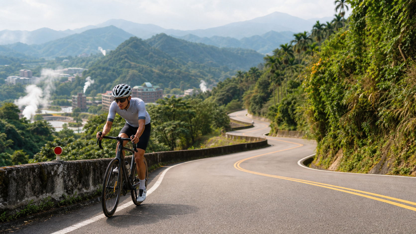
11.46 km, 5.8% average gradient, 659 meters of total elevation gain—these are internally consistent, trustworthy figures pointing toward a solid sustained climb on the road to Guanziling, a century-old hot spring destination in Taiwan.
1. Let’s Lay Out the Data First
Official markings for the Route 3 Guanziling section: total distance 11,457.4 meters, total elevation gain 659.2 meters, average gradient 5.8%. Cross-checking with distance and gradient: 11,457.4 meters × 5.8% ≈ 664.5 meters, which is quite close to the stated 659.2 meters of total gain—a discrepancy of less than 6 meters. The data is internally consistent and can be confidently used as a planning baseline.
| Item | Data | Engineering Perspective |
|---|---|---|
| Total Distance | 11.46 km | Sustained mid-distance climb |
| Total Elevation Gain | 659.2 meters | Relatively evenly distributed throughout |
| Average Gradient | 5.8% | Moderate intensity, suitable for intermediate riders and above |
One point that must be honestly stated: the official Strava location marker for this road places it in Dapu Township, Chiayi County, but in common understanding, “Guanziling,” the renowned hot spring destination, actually falls within Baihe District, Tainan City administratively. This discrepancy in geographic description is worth noting—this Route 3 section is likely one segment of the climbing profile leading toward Guanziling, passing through or near Dapu Township, Chiayi, but the core of the actual Guanziling hot spring area lies within Baihe District, Tainan. It is recommended to double-check the actual route direction via maps or GPS devices before riding to avoid misunderstandings about the endpoint landmark.
2. Guanziling: A Century of History as One of Taiwan’s Four Major Hot Springs
The history of Guanziling Hot Spring dates back to 1898, when Japanese soldiers discovered the hot spring here, and in 1904, the first hot spring inn was established. In 1913, research by the Taiwan Governor-General’s Office found that the spring water contained radium, causing a sensation in society at the time. That same year, a third-class public bathhouse was built and officially opened on December 14. In 1916, Guanziling was listed alongside Beitou, Yangmingshan, and Sichongxi as one of the “Four Major Hot Springs in Taiwan,” cementing its important place in Taiwan’s hot spring cultural history.
Guanziling Hot Spring is an alkaline carbonated spring, with water that feels smooth and carries a sulfur scent, at a temperature of around 75°C. What makes it most distinctive is that the spring water is largely mud-like in form—it is Taiwan’s only mud hot spring, rich in minerals. Folk tradition holds that this mud hot spring offers certain benefits for skin allergies, beauty, and rheumatoid arthritis (this is folk belief terminology, not a medically verified guarantee of efficacy; actual results vary from person to person).
This Route 3 climbing section is one of the paths leading to this century-old hot spring destination. As riders take on the gradient, they also seem to travel along a timeline, gradually drawing closer to this hot spring history that spans over a hundred years.
3. Section-by-Section Strategy: Breaking the 11.5 km into Four Segments
Segment 1 (0–3 km) The Start: Establishing a Sustained Climbing Rhythm
This Route 3 climb is a typical moderate-intensity sustained long climb. For the first 3 kilometers after setting off, it is recommended to keep power output around 75% to 82% of FTP, allowing the body to gradually adapt to the sustained climbing load. Since the overall average gradient sits at 5.8%—not extreme, but by no means easy—pacing discipline in the early section is especially critical, to avoid burning energy too early because the gradient looks deceptively manageable.
Segment 2 (3–6.5 km) The Middle: An Endurance Test of Sustained Climbing
Entering the middle of the route, the gradient maintains a relatively steady climbing rhythm. This section primarily tests endurance management rather than explosive power. It is recommended to adopt a “seated position as the priority” strategy, maintaining a steady cadence (85 to 95 rpm), paired with a regular breathing rhythm, allowing the body to settle into a cruising state capable of sustained output.
Along this stretch, it is advisable to periodically look up and observe the changing mountain terrain and vegetation around you. Moderately shifting your focus can help alleviate the mental fatigue that comes with prolonged climbing.
Segment 3 (6.5–9 km) Sustained Pressure: A Test of Willpower Near the Finish
As the finish line draws closer, fatigue gradually accumulates. For this section, it is recommended to fine-tune your strategy based on your physical condition—if you feel you still have energy in reserve, you can try slightly increasing your output intensity; if you are already feeling significant fatigue, you should prioritize maintaining stable form to avoid cramps or compromised technique from overexertion.
Segment 4 (9–11.46 km) The Finish: A Final Push Toward the Hot Spring Town
For the final 2.5 kilometers, it is recommended to focus on maintaining a steady cadence and breathing rhythm. Better to slow down than to compromise the safety of completing the full distance. After reaching the finish, if your itinerary includes heading to the Guanziling hot spring area to soak and relax, the fatigue accumulated from this climb can be superbly relieved by the hot spring.
4. Gear Ratio and Equipment Recommendations
Considering this is a mid-distance sustained climb with an average gradient of 5.8% and a total distance exceeding 11 kilometers, gear ratio recommendations:
- Front derailleur: A 50/34 or 52/36 compact double crankset is a practical choice, balancing sustained climbing needs with energy management.
- Rear derailleur: At least an 11-30T cassette is recommended; if you have limited climbing experience, a wider 11-32T cassette provides greater safety margin.
- Tire pressure and width: For general paved road conditions, 25C to 28C tires with appropriate pressure will handle this route’s surface conditions.
- Brake system: If you plan to descend back the same way, be sure to confirm your brake system is in good working order—braking stability on winding mountain descents is equally important.
5. Nutrition and Hydration Strategy
| Time Point | Nutrition Recommendation |
|---|---|
| 30 minutes before departure | Fully hydrate to ensure the body is in a well-hydrated state |
| Every 20-30 minutes | At least 150-200 ml of fluid |
| Midway (around the 6 km mark) | Supplement with an energy gel or portable snack as needed |
| After reaching the finish | Replenish electrolytes; hydration is especially important if a hot spring soak is planned |
Store availability along the route in the Dapu Township and Baihe District area depends on the actual road section, so it is recommended to carry sufficient supplies on your own to ensure uninterrupted energy and hydration during the long climb.
6. Weather and Seasonal Considerations
Guanziling Hot Spring is suitable for visiting year-round, with winter typically being the peak season for hot spring tourism (this is a common seasonal observation in the hot spring industry, not a specific finding verified specifically for this route). If you choose to tackle this climb in winter, morning temperatures in the mountains may be noticeably lower than in the lowlands. Layered clothing for warmth is recommended, and after reaching the finish, the hot spring offers a quick way to warm back up.
For summer riding, be mindful of the possibility of afternoon convective showers in the mountains. It is recommended to set off early to avoid the high-risk afternoon hours.
7. Common Mistakes and DNF Risks
- Misjudging the endpoint location: Failing to clarify the discrepancy between the Strava marker (Dapu Township) and the actual administrative area of the Guanziling hot spring district (Baihe District, Tainan) could lead to misunderstandings in trip planning.
- Losing control of early pacing: Fooled by the illusion of a moderate gradient, expending too much energy in the early section, then running out of steam when facing the sustained climb ahead.
- Insufficient supplies: Underestimating the fluid and energy demands of a sustained climb over 11 kilometers and failing to carry enough provisions.
- Neglecting descent safety: Eager to relax on the way down after reaching the summit, without adequately paying attention to road conditions and sightlines through corners.
- Misjudging afternoon convective showers: Failing to account for the rapidly changing mountain weather and setting off recklessly during high-risk hours.
8. Target Time References for Riders of Different Levels
| Rider Level | Estimated Completion Time | Average Speed Reference |
|---|---|---|
| Advanced / Race level | 32–45 minutes | 15–21 km/h |
| Intermediate / Trained base | 45–62 minutes | 11–15 km/h |
| Recreational / Climbing novice | 62–85 minutes | 8–11 km/h |
The Route 3 Guanziling section is a climb with reliable data and moderate difficulty, particularly well-suited as practical training before taking on other famous long climbs in the Alishan highway system. Combined with the bonus of a century-old hot spring destination near the finish, it is a solid route offering both athletic value and cultural-historical significance.
9. Power Training Perspective: The Training Value of a Moderate-Intensity Long Climb
For riders with a power meter, the combination of an average gradient of 5.8% over 11.46 kilometers on Provincial Highway 3’s Guanziling section makes it an ideal Sweet Spot training venue. It is recommended to keep power output between 84% and 94% of FTP, maintaining this intensity zone consistently throughout the climb. This effectively trains lactate threshold and the ability to sustain steady output over extended periods, without causing the sudden anaerobic depletion associated with steeper, shorter climbs.
This moderate-intensity, medium-to-long-distance training pattern is particularly suited to riders preparing for long-distance road races or time trials with fewer intervals. It is recommended to revisit this route periodically, carefully recording changes in power, heart rate, and completion time, using this data to track your progress in sustained power output over time.
10. Comparison with Other Long Climbs in the Chianan Region
Placing the Guanziling section of Provincial Highway 3 within the broader coordinate system of climbs in the Chianan region, its difficulty sits between typical suburban gentle slopes and the well-known long climbs of the Alishan Highway system—a representative route of “moderate intensity with reliable data.” Compared to the previously introduced Route 162A at Ruifeng (which requires conservative preparation due to conflicting data), the official data for the Guanziling section of Provincial Highway 3 is internally consistent, allowing for more precise training intensity and pacing strategy planning.
For riders currently building their long-climb capabilities, the Guanziling section of Provincial Highway 3 is an ideal intermediate training route—difficult enough to provide meaningful training stimulus, yet not so intimidating as to deter riders like the more hardcore long climbs.
11. Route Safety and Traffic Information
As an important provincial highway connecting the mountainous regions of Chiayi and Tainan, Provincial Highway 3 may carry slightly higher traffic volumes than typical rural roads, especially with tourist traffic heading to the Guanziling hot spring area, which can increase noticeably on weekends and holidays. Riders must remain vigilant, maintain a safe distance from motor vehicles, and slow down in advance on corners with poor visibility. If planning to ride on a holiday, it is recommended to set off early to avoid the afternoon surge of tourist crowds and peak traffic.
12. Post-Ride Recovery: Hot Springs as a Natural Recovery Method
After completing the 11.46-kilometer, 659-meter-elevation-gain climb on Provincial Highway 3, soaking in Guanziling’s mud hot springs immediately afterward is, to a certain extent, an ideal post-ride recovery arrangement. The warm spring water helps promote blood circulation and soothe the muscle tightness accumulated during the climb. This combination of exercise and hot spring therapy is uncommon among many long-distance cycling routes in Taiwan, yet it is a unique added value exclusive to the Guanziling route.
It is recommended to perform basic dynamic stretching and rehydration after finishing the ride, then wait until your core body temperature has dropped slightly before heading to the hot spring area. Avoid soaking directly in high-temperature spring water while your body temperature is still elevated, as this may place unnecessary strain on the body. Moderately control your soaking time (15 to 20 minutes per session is recommended, and it can be done in multiple sessions), and hydrate thoroughly before and after soaking to maximize the recovery benefits of this hot spring excursion.
13. For Riders Preparing to Challenge the Alishan Highway System
Although the Guanziling section of Provincial Highway 3 is not itself part of the Alishan Highway system, its geographic proximity, combined with its moderate intensity and reliable data, makes it highly suitable as a warm-up and practical test before tackling other well-known long climbs in the Alishan Highway system (such as those toward Chukou, Fengshan, or Shizhuo). By using this route to verify your gear ratio configuration, fueling rhythm, and long-distance endurance management, you can accumulate valuable experience for subsequently challenging higher-difficulty climbs.
It is recommended to plan your training cycle progressively—first familiarizing yourself with moderate-intensity long climbs like the Guanziling section of Provincial Highway 3, then gradually taking on more challenging routes. This stepwise training approach effectively reduces the risk of sports injuries while steadily building practical long-climb capability.
14. Detailed Observations on Gradient Distribution and Heart Rate Management
Although this route’s average gradient is listed at 5.8%, the actual gradient distribution during the ride may not be perfectly uniform, with natural undulations where some sections are slightly steeper and others slightly gentler. Riders are advised to use heart rate monitoring devices during the climb to stay aware of their physiological load in real time—if heart rate remains above 85% of maximum for an extended period, it indicates that the current output intensity may exceed a sustainable range, and you should moderate your pace to avoid running out of energy in the later stages.
This real-time heart rate feedback mechanism, combined with gradual familiarity with the route’s gradient distribution, can help riders find a more precise and personalized pacing strategy when repeatedly challenging this route, progressively approaching their personal best performance on it.
15. Team Riding Collaboration Suggestions
If you choose to tackle the Guanziling section of Provincial Highway 3 with a group, it is recommended to plan a wind-breaking rotation or group-splitting strategy in advance based on team members’ fitness differences. Given the route’s longer distance and moderate gradient, weaker riders forced to keep up with stronger riders’ pace risk burning out early in the later stages; conversely, stronger riders should also learn to control their output to avoid dragging the entire team’s pace too fast.
After reaching the finish, heading to the Guanziling hot spring area together to soak and relax is also a particularly heartwarming way to conclude a group ride—exchanging the sweat of jointly conquering the climb for leisurely time soaking in the hot springs together. This kind of itinerary combining exercise and social interaction often leaves especially memorable impressions on the bonds between team members.
16. Appendix: Pre-Departure Equipment and Itinerary Checklist
Before planning this Guanziling challenge on Provincial Highway 3, it is recommended to verify the following items in order: bicycle condition (brake pad wear, drivetrain smoothness, chain lubrication, tire pressure and tire condition), personal gear (helmet, gloves, cycling jersey and shorts, sunscreen), supplies (at least 1.5 liters of water, energy gels or solid food, electrolyte supplements), hot spring itinerary preparation (soaking essentials, change of clothes, towel), communication and itinerary notification (sufficient phone battery, offline maps downloaded, itinerary shared with family or friends), and weather confirmation (recent rainfall records, daily weather forecast). This checklist will help you plan this Guanziling trip combining athletic challenge and hot spring therapy more completely, ensuring the overall itinerary is safe and smooth.
17. Conclusion: Add the Guanziling Section of Provincial Highway 3 to Your Chianan Cycling Map
The Chianan region offers numerous climbing route options, and the Guanziling section of Provincial Highway 3—with its reliable data, moderate intensity, geographic characteristic of crossing county boundaries, and the unique added benefit of a century-old hot spring resort near the finish—stands out as a solid route combining athletic value with cultural and historical significance. Whether you aim to build long-climb capability or simply wish to experience this legendary place that witnessed the beginning of Taiwan’s hot spring culture, this road deserves to be seriously included in your Chianan cycling map.
18. Positioning in Long-Term Training Planning
For riders who treat cycling as a long-term interest, it is recommended to incorporate reliable, moderately challenging medium-to-long climbs like the Guanziling section of Provincial Highway 3 into a fixed seasonal training cycle. You can plan one or multiple attempts during fitness adjustment periods, using them to verify whether your performance under moderate-intensity, sustained output has improved. Compared to the several Taitung and Chiayi routes introduced earlier, the Guanziling section of Provincial Highway 3 provides a reference point with a relatively stable data baseline, making it suitable as a fixed observation station for tracking your long-term improvement curve.
This approach of incorporating a single route into a long-term training framework helps riders more systematically grasp their fitness development trajectory, rather than sporadically challenging various routes without a longitudinal basis for data comparison.
19. Conclusion: A Long Climb Worth Revisiting Every Season
The Guanziling section of Provincial Highway 3, with its reliable data, moderate difficulty, and the century-spanning hot spring resort at its summit, offers cycling enthusiasts in the Chianan region a quality route combining training value and cultural depth. Whether you are a first-time visitor or a veteran who has challenged this route multiple times, each time you embark on this 11.46-kilometer journey, the changing seasons, weather, and your own fitness condition will bring slightly different yet equally precious riding experiences.
20. Conclusion: A Dual Recommendation of Reliable Data and Rich Cultural Heritage
Among the multiple Taitung and Chiayi routes covered in this article, the Guanziling section of Provincial Highway 3, with its internally consistent and trustworthy official data, combined with a century of hot spring cultural heritage, forms a dual recommendation where both engineering data and cultural narrative withstand scrutiny. For riders who value both training effectiveness and cultural depth gained during rides, this route has virtually no obvious shortcomings—the gradient is moderate and not intimidating, the distance is sufficient to provide meaningful training stimulus, and the finish offers the rich reward of a century-old hot spring town. When planning your next cycling itinerary in the Chianan region, be sure to include it in your pocket list.
21. Appendix: Quick Answers to Frequently Asked Questions
Q: Can the gradient data for this route really be trusted? Yes, as verified at the beginning of this article through cross-checking distance and gradient, the official data for the Guanziling section of Provincial Highway 3 shows good internal consistency (11,457.4 meters × 5.8% ≈ 664.5 meters, very close to the stated total elevation gain of 659.2 meters). You can confidently use it as a basis for training planning, which is completely different from the data contradictions seen in the 162A Rueifeng route.
Q: Where exactly is the real Guanziling hot spring area? The official Strava location places this climb in Dapu Township, Chiayi County, but the core Guanziling hot spring area as commonly known falls administratively under Baihe District, Tainan City. It is recommended to double-check the actual route and endpoint on a map before riding to avoid any misunderstandings in trip planning.
Q: Is this route suitable for beginners? With an average gradient of 5.8% and a distance of 11.46 kilometers, this is a moderately intense long climb. It is recommended that riders have at least some basic climbing experience before taking on this challenge. Beginners may consider starting with shorter routes to build experience, then gradually progress to mid-to-long-distance climbs like this one, steadily accumulating the foundational fitness and experience needed to take on longer and harder climbs.
Q: Can you really go soak in the hot springs after finishing the ride? Absolutely — this is one of the most recommended itinerary arrangements for this route. It is suggested to perform basic dynamic stretching and rehydration after finishing, then head to the hot spring area once your body temperature has dropped slightly. Keep each soaking session to 15–20 minutes, and hydrate well before and after, so this ride-then-recover itinerary delivers its best effect.
Q: Is this route better suited for a day trip, or should you plan an overnight stay? If you simply want to complete the 11.46-kilometer climb on Provincial Highway 3 plus a quick hot spring soak, a day trip is feasible. However, if you want to more fully experience the hot spring hotels around Guanziling, enjoy local cuisine, and also visit nearby attractions such as the Fire and Water Spring and Daxian Temple, it is recommended to plan a two-day, one-night itinerary. This allows the trip to feel more relaxed and lets you more deeply appreciate the unique charm of this century-old hot spring town.
Related Reading
- Taiwan Provincial Highway 3 Meiling Practical Guide: 8.91 km, 618 m Elevation Gain — How to Ride This Tainan Mountain Route
- Provincial Highway 3 Neishan Road: Route Planning for the North–South Mountain Corridor from Hsinchu to Pingtung
- Guguan Climb Guide: 4.4 km at an Average 11.7% — A Textbook Pure Steep Climb
- Chike Mountain Climb Full Guide: 11.05 km at 6.2% Average Gradient — Practical Data Analysis from the East Rift Valley
爬坡ITT實境)台中 魔王 松鼠坡 首航 6:12 大肚山 大三元 科福路
8 年前
半日 小台灣 極限單車路線挑戰實錄
7 年前
嘉義大埔、阿婆灣挑戰賽,美到以為在日本!ft. 環騎5 Cool 西拉雅188 / 公路車 / CT Yeh
7 個月前
台北闊瀨陡坡 騎旅 / 日本單車雜誌編輯車友臨時加入!/ 髮香才是最強的 / feat. 北迴歸線小隊 / 公路車 CT Yeh
6 個月前
大禹嶺 到 武嶺牌樓 全程前後實況錄影 | 北進武嶺 | 東進武嶺 | KOM | 訓練台 | 坡度分析 | Taiwan KOM Last 10 km HARD | 公路車
6 年前
風櫃嘴時間 預測西進武嶺時間?13000名車友統計數據分析告訴你 !
5 年前
台灣登山王之路 KOM 全程參賽4K臨空錄影 PART1 穿越峽谷地形! #東進武嶺 太魯閣 / 燕子口 / 天祥 / 西寶 PART1 (公路車 / CT Yeh)
3 年前
新竹羅平 x 天湖部落 大禹嶺級變態陡坡! 4K超高畫質 空拍 | 公路車
5 年前