Dewen Mountain Climbing Guide: A Hardcore 5km Route in Sandimen Township Packing 652 Meters of Elevation Gain
Foreword: Short Distance Doesn’t Mean Easy
Among the many climbing routes in the indigenous mountain townships of Pingtung, Dewen Mountain is often underestimated because of its short distance. However, after actually taking on the challenge, most riders are deeply impressed by its dense and solid gradient profile, and many even readjust their preconceived notions about the difficulty of “short-distance routes.”
Route Overview and Real Data Analysis
The Dewen Mountain climbing route is located around the Dewen Tribe in Sandimen Township, Pingtung County. It is one of the shortest routes in terms of distance among this batch of indigenous mountain township routes, yet it boasts one of the highest gradient densities. The total length is just 5.03 kilometers, with cumulative elevation gain reaching 652.5 meters and an average gradient of 5.6%. A simple calculation reveals the oppressive nature of this route: in just over 5 kilometers, you need to absorb more than 650 meters of climbing, which means the route has virtually no true “flat recovery sections”—it is a solid, hard climbing route that applies continuous pressure from start to finish.
Sandimen Township is one of the three indigenous townships in Pingtung County. Its administrative area covers ten villages including Dewen Village. The terrain spans an enormous range, from approximately 100 meters at the lowest point to 2,159 meters at the highest, with a total area of 196.4 square kilometers, making it the third-largest township in Pingtung County. The Ailiao River runs through the entire township and serves as a vital geographical and ecological backbone for the area. The Dewen Tribe is situated within this mountainous terrain and is one of the representative Paiwan settlements in Sandimen Township.
It is particularly worth noting that the Dewen Tribe has a profound connection to one of the most devastating natural disasters in modern Taiwanese history—Typhoon Morakot in 2009. According to meteorological records, during Typhoon Morakot, Sandimen Township received more than 2,500 millimeters of rainfall in just two days—the highest record in Taiwan at that time. This unprecedented downpour directly led to the partial relocation of the original Dewen Tribe settlement to the Changzhi Baihe Tribal Park in 2010. The original Dewen Village was actually composed of three geographically distinct settlements: Beiba, Dugufule, and Jindalu’an. This pattern of multiple small settlements forming a single administrative village reflects the traditional Paiwan lifestyle of dispersing settlements along mountain contours.
Core Data Summary Table:
| Item | Value |
|---|---|
| Total Distance | 5.03 km |
| Total Elevation Gain | 652.5 m |
| Average Gradient | 5.6% (short-distance, high-density climbing; feels harder in practice) |
| Strava Category | Category 2 (medium-high difficulty) |
| Start/Finish | Within Sandimen Township, heading toward the Dewen Tribe |
| Administrative Area | Sandimen Township, Pingtung County |
| Typhoon Morakot Record | Two-day cumulative rainfall exceeded 2,500 mm in Sandimen Township, the highest in Taiwan |
In terms of gradient density, absorbing 652.5 meters of climbing over 5.03 kilometers means an average of over 130 meters of elevation gain per kilometer. This intensity ranks on the harder end among all known climbing routes in Taiwan, and Strava’s Category 2 classification confirms this assessment. When planning this route, riders must prepare with a “short-distance, high-intensity” mindset rather than the “pace-management-first” approach used for long-distance routes.
Stage-by-Stage Guide from Start to Finish
Since the total route length is just over 5 kilometers, the entire ride is broken down into three stages here. Each stage is short in length, but the intensity distribution varies noticeably, so riders must manage their rhythm carefully and avoid using the wrong strategy at the wrong stage.
Stage 1 (0–1.5 km): Opening Direct Confrontation. This route offers almost no gradual warm-up slope; you face a noticeable gradient right from the start. Riders are advised to complete dynamic warm-ups (on-the-spot warm-up, light stretching) before setting off. In the first few hundred meters after mounting the bike, confirm your gear ratio and body condition at lower intensity, then quickly adjust to a steady rhythm you can sustain. The biggest mistake in this stage is “going out too hard.” Since Dewen Mountain’s climbing is concentrated within a short distance, if you push your heart rate near its maximum at the start, you’ll likely run out of steam in the middle and later sections.
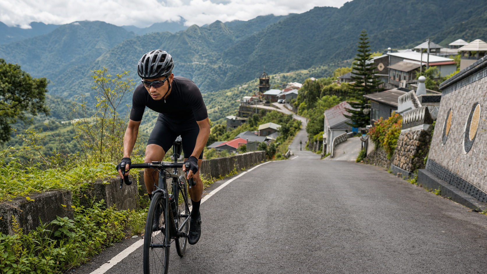
Stage 2 (1.5–3.5 km): Core Climbing Section. This is the most densely graded section of the entire route. The gradient can remain above 7% to 10% for extended periods, and some sections may even feature short steep pitches exceeding 12%. A “seated-dominant, intermittent standing” pedaling strategy is recommended: maintain steady seated output most of the time, keeping cadence between 70 and 80 rpm, and briefly stand to power through particularly steep sections before sitting back down to restore rhythm. This stage also offers the best views of the Dewen Tribe settlement and traditional architectural elements. If you have energy to spare, consider slowing down slightly to take in the scenery, but be sure to watch road conditions and oncoming traffic.
Stage 3 (3.5–5.03 km): Final Sprint Zone. As altitude continues to rise, energy depletion approaches its limit, and this stage demands willpower and rhythm management above all. Reconfirm your breathing pattern at this point, using a fixed inhalation/exhalation frequency to stabilize core tension, and avoid over-sprinting just because the finish is in sight, which could trigger cramps or heat exhaustion. After reaching the finish, cool down by riding gently or walking for a few minutes to let your heart rate gradually decrease. Don’t stop immediately to gasp for air or sit down—this aids lactate metabolism and recovery.
Gear Ratio and Equipment Recommendations
Facing a route with 652 meters of climbing within 5 kilometers and localized gradients potentially exceeding 12%, the equipment priority should be “low gear ratios over high-speed cruising efficiency”:
- Crankset Configuration: A compact crank (50/34T) or even lighter mountain-oriented setup is strongly recommended. A standard crankset on this gradient density is extremely demanding for non-professional riders.
- Cassette Configuration: Start with 11-32T at minimum; recreational riders with average fitness should go straight to 11-34T to ensure the lowest gear can handle the densely packed steep sections within the short distance.
- Cadence Strategy: Given the short distance and dense gradients, a medium-to-high cadence (75–85 rpm) is recommended, avoiding heavy gears that cause rapid muscle fatigue. Although the total time is short, the intensity output approaches the mixed aerobic-anaerobic zone.
- Wheelset and Tire Pressure: Since this is a short, high-intensity route, wheelset weight has relatively limited impact on overall performance. Prioritize grip and comfort instead; moderately lowering tire pressure can improve traction during climbs, especially noticeable on wet or leaf-covered sections.
Nutrition and Hydration Strategy
The Dewen Mountain route is only 5 kilometers long, and for most riders, completion time falls between 20 and 40 minutes. In theory, carrying large amounts of supplies isn’t necessary. However, due to the dense gradients and concentrated intensity, the body depletes water and electrolytes rapidly in a short period. Ensure you are well-hydrated before departure and carry at least 500 milliliters of fluid.
If you plan to incorporate this route into a larger multi-route ride (for example, combining with nearby sections like North Dawu Jiaping or Taiwu Back Gate), you must plan adequate nutrition based on the overall itinerary—don’t estimate the day’s total water and calorie needs based solely on this single route’s short distance. Village stores in the Sandimen Township mountains are limited, so complete your main resupply in the lowlands before entering the mountains.
Weather and Seasonal Recommendations
Sandimen Township spans an enormous terrain range, and afternoon convective cloud systems develop vigorously in the mountains, making summer thunderstorms highly likely. Challenging this route in the early morning is recommended—this avoids the heat and reduces the risk of encountering afternoon thunderstorms.
As mentioned earlier, Sandimen Township recorded the highest two-day cumulative rainfall in Taiwan during Typhoon Morakot. To some extent, this historical data reminds riders that rainfall intensity in this mountain area during extreme weather events can be astonishing. During typhoon season or when heavy rain warnings are issued, avoid riding here entirely. After rainfall, confirm road conditions before departing to avoid landslide or rockfall risks.
Common Mistakes and DNF Risks
Mistake 1: Underestimating the intensity of a short route. Many riders see “only 5 km” and let their guard down, failing to realize this is an extremely high-density climbing route. They often exhaust themselves shortly after departure due to poor pacing.
Mistake 2: Insufficient gear ratio configuration. A standard crankset paired with a typical cassette can easily force average riders to dismount and push on this gradient density. Before departure, confirm your gear setup can handle localized steep sections exceeding 12%.
Mistake 3: Neglecting warm-up. Since the route offers almost no gradual warm-up section, jumping on the bike and sprinting straight into the climb leaves your muscles and cardiorespiratory system no time to adapt, often causing discomfort in the early stages.
High DNF Risk Section: The core climbing section of Stage 2 (1.5–3.5 km) is the area where riders are most likely to dismount and push. First-time challengers should mentally prepare in advance—pushing your bike is nothing to be ashamed of; completing the ride safely is the most important core principle.
Target Time Reference by Rider Level
| Rider Level | Estimated Completion Time | Recommended Preparation |
|---|---|---|
| Beginner / Occasional Rider | 35–50 min | Build short-distance, high-intensity climbing training experience first |
| Advanced Recreational Rider | 20–30 min | FTP of 3 W/kg or above recommended for greater comfort |
| Competitive / Club-Level Rider | 12–18 min | Suitable as an interval climbing training benchmark route |
| Professional / Semi-Professional | 8–12 min | Can serve as a short-distance climbing ability test route |
Despite its short distance, Dewen Mountain is an excellent touchstone for testing a rider’s short-distance explosive power and climbing technique. Consider incorporating it into your regular training checklist to track the progress and long-term trends of your short-distance climbing ability.
Sandimen Township Geography and Surrounding Route Network Supplement
Sandimen Township spans extreme terrain differences from low to high elevation, and with the Ailiao River running through the entire area, the road system here largely follows river valleys and mountain contours. Frequent curves and dramatic gradient changes are the common characteristics of roads in this area. The Dewen Mountain route is a typical representative of this terrain—concentrating massive elevation gain within a short distance, testing not just physical fitness but also real-time reaction to mountain road curves and gradient changes.
If you plan to include Dewen Mountain in a longer ride, research the road conditions of the main connecting roads around Sandimen Township in advance. Especially after the rainy season, landslides and temporary road repairs are not uncommon in mountain areas. Checking the latest announcements before departure is essential homework to ensure a safe and smooth ride—do not skip this step.
Sports Science Perspective: The Physiological Challenge of Short-Distance, High-Intensity Climbs
From a sports physiology standpoint, a route type like Dewen Mountain—“short distance, high gradient density”—challenges the body in fundamentally different ways compared to long, gradual climbs. Long, gradual climbs primarily test the sustained output capacity of the aerobic metabolic system, allowing riders to maintain pace within a stable heart rate zone (typically 70% to 80% of maximum heart rate) for extended periods. But on a route like Dewen Mountain, with over 650 meters of climbing in just 5 kilometers, intensity output often rapidly approaches or even crosses the anaerobic threshold. The body must simultaneously engage both aerobic and anaerobic energy systems, and lactate accumulation occurs far faster than on long-distance climbing routes.
This means that even though completion time may be only 20 to 40 minutes, the physiological stress on the body can rival that of a long-distance climb lasting several times longer. In training planning, riders should treat this type of short-distance, high-intensity route as a specialized training ground for “anaerobic endurance” and “lactate threshold” rather than purely aerobic endurance training. Training frequency should not be overly dense—give the body adequate recovery time to avoid overtraining-related injuries or performance plateaus.
Specific training recommendations include: schedule 1 to 2 sessions per week of repeated climbing on Dewen Mountain or routes with similar gradient density. After each all-out effort, allow complete recovery before the next repetition. Control total repetitions between 3 and 6 depending on individual fitness, and closely monitor heart rate recovery speed and subjective fatigue perception as the basis for adjusting training volume.
Additional Equipment Details: Brake and Drivetrain Maintenance Priorities
Due to the dense gradients of the Dewen Mountain route, the descent sections also require frequent brake use. Prolonged high-intensity braking can cause brake pad overheating, reduced braking power, and in extreme cases, brake failure. Before challenging this route, carefully inspect brake pad wear, and during descents, use intermittent brake application rather than continuous hard braking, giving the braking system a chance to dissipate heat and reducing the risk of overheating.
On the drivetrain side, since the route requires frequent gear changes to respond to gradient variations, confirm precise derailleur adjustment and good chain maintenance before departure. This prevents chain skipping or jamming on critical climbing sections that could disrupt your rhythm or even cause a crash. These seemingly trivial mechanical inspection details are often the decisive factors in successfully completing a short-distance, high-intensity route like this.
Difficulty Comparison with Surrounding Routes
Comparing Dewen Mountain with other Pingtung mountain routes covered in this series, its gradient density actually ranks among the highest. North Dawu Jiaping has a higher total elevation gain (1,300.5 meters), but stretched over 12.89 kilometers, its average gradient density is comparatively gentler. Taiwu Back Gate has a total gain of 414 meters over 5.18 kilometers, with an average gradient density closer to Dewen Mountain’s, though the total gain is somewhat lower. This comparison illustrates that Dewen Mountain represents a “short, punchy, hard climb” among this batch of routes—an ideal benchmark for testing short-distance explosive power and gradient tolerance.
For riders planning multi-route challenges across the Pingtung indigenous mountain townships, schedule Dewen Mountain early in the itinerary while energy reserves are still substantial. Avoid tackling this high-density gradient route after significant energy depletion, as the DNF risk increases considerably.
The Long-Term Impact of Typhoon Morakot on This Mountain Road System
Understanding the geographical context of the Dewen Mountain route requires acknowledging the profound impact Typhoon Morakot had on Sandimen Township in 2009. As mentioned earlier, Sandimen Township recorded an astonishing two-day cumulative rainfall exceeding 2,500 millimeters—the highest in Taiwan—during the typhoon. Such extreme rainfall typically causes structural and long-term damage to mountain road systems: roadbed loss, slope collapse, and bridge destruction. These disasters not only disrupted traffic during the typhoon itself but also placed recurring maintenance and emergency repair pressure on the same road systems in the rainy seasons of subsequent years.
Some residents of Dewen Village relocated to the Changzhi Baihe Tribal Park in 2010. This relocation decision reflects a careful post-disaster assessment of geological stability and long-term residential safety in the original settlement. For riders, understanding this historical context is not merely intellectual background information—it is crucial for developing a correct awareness of the “dynamic nature” of mountain road conditions. Even industrial roads that have been in use for years and appear stable can undergo dramatic changes from a single extreme rainfall event. This is why this article repeatedly emphasizes checking the latest road condition announcements before heading to such mountain routes after rain or during typhoon season.
A Rider’s Observation Guide to Tribal Settlement Structure
As mentioned earlier, Dewen Village was originally composed of three geographically distinct small settlements—Beiba, Dugufule, and Jindalu’an. This settlement pattern of dispersing along mountain contours is a concrete manifestation of traditional Paiwan life wisdom: following terrain and water source distribution, clan members established settlements in locations that were relatively safe, convenient for farming, and defensible, rather than concentrating in a single large settlement. This dispersed settlement structure also means that riders on the Dewen Mountain route may pass through more than one settlement node, each with slightly different architectural styles and traces of daily life—worth slowing down to observe and appreciate.
Since some settlements have relocated to the Changzhi Baihe Tribal Park due to Typhoon Morakot, riders may encounter areas that appear quieter or even somewhat desolate along the way. Behind this scenery may lie the traces of this relocation history. Riders are encouraged to view such landscape changes with understanding and respect, rather than interpreting what they see through simplistic labels like “underdeveloped.” Every seemingly tranquil corner may carry complex and profound social and natural transformation narratives that deserve serious understanding rather than hasty judgment.
Mental Preparation and Goal Setting Before the Challenge
For first-time challengers of Dewen Mountain, honestly assess your recent training volume and physical condition before departure, rather than being misled by the surface number of “only 5 km” and recklessly attempting intensity beyond your capability. This is the first rule of any mountain challenge route. Refer to the tiered target time table provided earlier and set a relatively conservative yet still challenging completion time goal for yourself. During the ride, dynamically adjust your pace based on heart rate, breathing, and subjective fatigue perception.
It is worth emphasizing that the value of this route lies not in whether challengers can complete it in the fastest time, but in whether they can safely and fully experience the terrain intensity and cultural landscape concentrated within this route. Even if you ultimately choose to dismount and push your bike up a steep section midway, that does not constitute failure. What matters most is maintaining clear awareness of your own condition and the surrounding environment throughout the ride—this is the core principle in mountain cycling that deserves more attention than any personal record.
Conclusion: A Concentrated Yet Solid Mountain Trial
Dewen Mountain condenses 652.5 meters of elevation gain and the rich cultural-historical context of Sandimen Township, Pingtung, into just 5 kilometers—a route that exemplifies “streamlined data, abundant substance.” Whether you are an advanced rider looking to test your short-distance climbing ability or a cultural enthusiast hoping to deepen your understanding of the Dewen Tribe and the post-Morakot reconstruction journey through cycling, this route offers a solid and rewarding riding experience worth revisiting again and again. Master the gear ratio configuration, stage strategies, and nutrition planning covered in this article, and Dewen Mountain will be a highly efficient yet uncompromising hardcore trial on your Pingtung indigenous mountain township challenge list—one worthy of serious preparation and full commitment.
Related Reading
- The Rebirth of Dewen Tribe: A Cycling Journey of Migration, Resilience, and Land Memory
- Taiwu Back Gate Guide: A 5.2km Pingtung Mountain Hard-Climb Benchmark with 7.9% Average Gradient
- A Back Gate to Taiwu Township: Reading Resilience and Life Wisdom on Rugged Land
- Shibi Yunling Zhiqiu Practical Guide: The Art of Endurance and Pacing on a 10.76km Long Gradual Climb
台北闊瀨陡坡 騎旅 / 日本單車雜誌編輯車友臨時加入!/ 髮香才是最強的 / feat. 北迴歸線小隊 / 公路車 CT Yeh
6 個月前
大武山後門26%歡樂陡坡!JJSC南台灣單車行Day2 / 被颱風追著跑 / 公路車 / CT Yeh
2 年前
半日 小台灣 極限單車路線挑戰實錄
7 年前
#北橫 + #北進武嶺 最硬的員工旅遊 EP1 | #公路車 #拉拉山 | 明池 | 武嶺 | 武陵農場 | 雲海 | Taiwan Cycling Route Wulin
6 年前
那瑪夏x茶山 阿里山系深山單車行 Day2 累積爬升6000M | 🥶超陡連續下坡 整路看隊友刷 | 爬升一座西進武嶺 | JJSC | 公路車 | CT Yeh
3 年前
大武山20%魔王陡坡【JJSC南台灣遊騎Day2】!屁股真的要裂開了...凡士林抹滿也沒用?神秘金教堂還有超便宜夜市
3 個月前
爬坡ITT實境)台中 魔王 松鼠坡 首航 6:12 大肚山 大三元 科福路
8 年前
雨戰! 西進武嶺員工旅遊 加料 各路段大數據分析 | 同事端出5公斤的公路車來挑戰!? EP1
4 年前