Wutai via Shenshan Guide: A Moderate Challenge on the 6.8 km Road to the Township with Taiwan's Highest Rukai Population
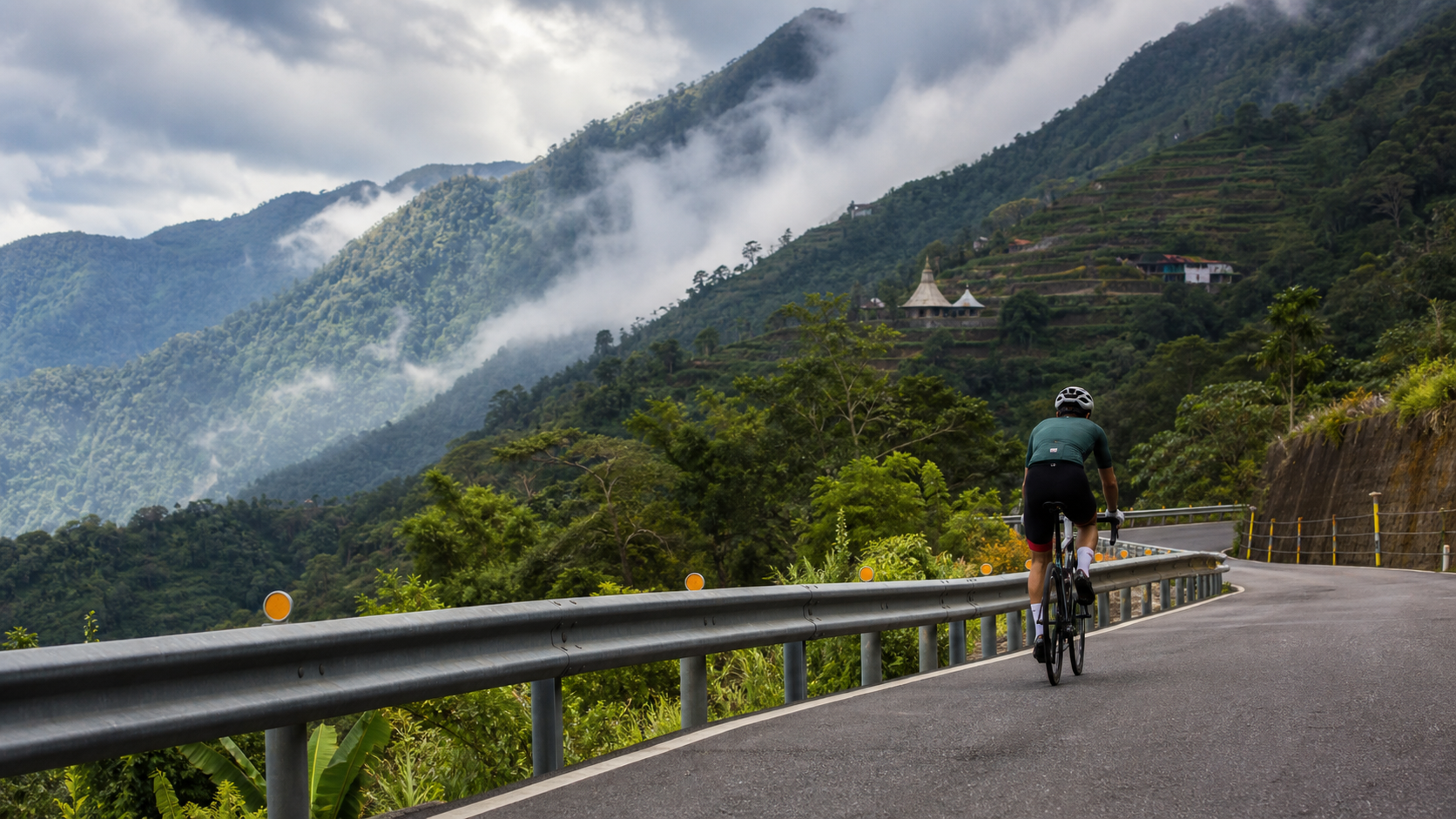
Introduction
This stretch of Provincial Highway 24, cutting deep into Wutai Township, weaves together geographical, historical, and cultural significance, making it one of the most representative routes in Pingtung’s indigenous mountain townships.
Route Overview and Real Data Analysis
The climb from Shenshan to Wutai is a highly representative ascent located within Wutai Township, Pingtung County. The route starts from Shenshan (a tribal settlement within the Wutai Village area) and heads toward Wutai Village, where the township administration is seated. It spans 6.8 kilometers with a cumulative elevation gain of 359.6 meters and an average gradient of 5.2%, classified as Category 3 on Strava. These figures describe a moderately challenging climb of suitable length, with a relatively even gradient distribution, making it an ideal benchmark segment for testing mid-distance climbing endurance.
Wutai Township is the only indigenous mountain township in Pingtung County predominantly inhabited by the Rukai people, and it is also the administrative district with the highest concentration of Rukai population in all of Taiwan. It administers six villages: Wutai Village (the township seat, with the largest population), Jiamu Village, Dawu Village, Jilu Village, Ali Village, and Haocha Village. With an average elevation of around 1,000 meters, it is the highest township in Pingtung County, covering a total area of approximately 279 square kilometers. Streams in the northern half of the township drain into the Ailiao North Creek, while those in the southern half flow into the Ailiao South Creek. This high-elevation geography means that the road system within Wutai Township generally features steep gradients and dense clusters of switchbacks, presenting common characteristics and challenges.
The main artery connecting Wutai Township to the outside world is Provincial Highway 24. Starting from Pingtung City, this road passes through Sandimen Township and eventually reaches Ali Village in Wutai Township, covering a total length of approximately 47.5 kilometers. Along the way, it crosses the Ailiao Creek (via the Sandimen Bridge) and the Ailiao North Creek (via the Wutai Guchuan Bridge), and passes through the Maolin National Scenic Area. The Shenshan-to-Wutai segment described in this article is precisely the key climbing section of Provincial Highway 24 that penetrates deep into Wutai Township, leading toward the core administrative area.
Core Data Summary:
| Item | Value |
|---|---|
| Total Distance | 6.8 km |
| Total Elevation Gain | 359.6 m |
| Average Gradient | 5.2% (moderately challenging, relatively even gradient distribution) |
| Strava Category | Category 3 |
| Administrative District | Wutai Township, Pingtung County |
| Main Connecting Highway | Provincial Highway 24 (Pingtung City to Ali Village, approximately 47.5 km) |
| Ethnic Composition | The administrative district with Taiwan’s highest concentration of Rukai population |
It should be noted that “Shenshan” is not an independent village in Wutai Township’s administrative division; it is more likely a tribal place name within the Wutai Village area. Riders are advised to rely on on-site road conditions and local information for the exact geographical location and administrative归属.
Stage-by-Stage Guide from Start to Finish
Stage 1 (0–2.5 km): Warm-up Climb. After departure, the route continues climbing along Provincial Highway 24 with a relatively even gradient. It is recommended to maintain a steady, moderately high cadence to gradually ease the body into climbing mode. Along this stretch, you can enjoy the valley scenery of the Ailiao North Creek basin.
Stage 2 (2.5–5 km): Core Climb and Guchuan Bridge Area. This section approaches the Wutai Guchuan Bridge area, offering the richest visual and terrain variation of the entire route. The gradient may increase slightly, so it is advisable to adjust your gear ratio dynamically based on the on-site gradient while maintaining a steady output. Also, be mindful of potential crosswinds on the bridge sections.
Stage 3 (5–6.8 km): Final Stretch into Wutai Village. As you gradually approach Wutai Village, the township seat, the elevation continues to rise and the perceived temperature will drop noticeably. It is recommended to conserve some energy for the final stretch. After reaching the finish, take a moment to pause and soak in the unique atmosphere of this township with Taiwan’s highest concentration of Rukai population.
Gear Ratio and Equipment Recommendations
For this 6.8 km route with 359.6 meters of climbing and an average gradient of 5.2%, a moderate-difficulty ascent:
- Gear Ratio Setup: A compact crankset (50/34T) paired with an 11-28T or 11-30T cassette is recommended, allowing most riders to handle it with ease.
- Warm Clothing: With an average elevation of about 1,000 meters, Wutai Township is the highest township in Pingtung County. Even in summer, there can be significant temperature differences on the upper sections, so carrying a lightweight windbreaker is advisable.
- Braking System: When crossing sections like the Guchuan Bridge, it is recommended to check that your braking system is in good condition in advance to ensure stable braking performance on long descents.
Nutrition and Hydration Strategy
At 6.8 kilometers in total length, most amateur riders will complete the route in approximately 25 to 50 minutes. The density of shops in the mountain villages of Wutai Township is limited, so it is advisable to complete your main resupply in Sandimen Township or at the starting point of your ride, and carry at least 1 liter of water with you.
Weather and Seasonal Recommendations
As the highest township in Pingtung County, Wutai Township experiences vigorous development of afternoon convective cloud systems in the mountains, with a high probability of summer thunderstorms. It is recommended to tackle this route in the early morning hours. The road system within Wutai Township suffered severe damage during Typhoon Morakot in the past (see historical section below). Before heading out after rain or during typhoon season, be sure to check the latest road condition announcements.
Common Mistakes and DNF Risks
Mistake 1: Underestimating the temperature difference due to elevation. Wutai Township is the highest township in Pingtung County. Even if it’s sweltering at the foot of the mountain, there can be significant temperature differences on the upper sections, so warm clothing is essential.
Mistake 2: Overlooking the bridges and curves along Provincial Highway 24. This route crosses river terrains such as the Ailiao North Creek. Bridge sections may be affected by crosswinds, and extra caution is needed when passing oncoming traffic at curves.
Target Time Reference for Riders of Different Levels
| Rider Level | Estimated Completion Time | Recommended Preparation |
|---|---|---|
| Beginner / Occasional Rider | 40–55 minutes | Recommended to first accumulate experience on moderate climbs |
| Advanced Recreational Rider | 25–35 minutes | FTP recommended at 2.5–3 W/kg or above |
| Competitive / Club-Level Rider | 15–22 minutes | Suitable as a mid-distance climbing training segment |
| Professional / Semi-Professional Rider | 10–14 minutes | Can be incorporated into endurance race simulation training |
The History of Typhoon Morakot and the Closure of Provincial Highway 24
During Typhoon Morakot in 2009, Provincial Highway 24 was completely severed when the Yila Bridge was washed away, plunging the entire Wutai Township’s external road network into total isolation. Residents of several settlements within the township, including the Guchuan, Dawu, Jilu, and Ali tribes, partially relocated in 2010 to the Changzhi Baihe Tribal Settlement in Changzhi Township. The migration journey of the Haocha tribe (known as Kucapungane in the Rukai language, regarded as an important sacred origin site of the Rukai people) was even more tortuous—in 1977, they first relocated to New Haocha for safety reasons, only to have New Haocha destroyed by flooding during Typhoon Morakot. Residents then undertook a second relocation in 2010, eventually settling at the Rinari permanent housing site in Majia Township. The original site of Old Haocha was designated a national historic monument in 1991, situated at an elevation of 950 to 1,050 meters.
This historical context gives the stretch of Provincial Highway 24 traversed by the Shenshan-to-Wutai climb a historical weight far deeper than its surface gradient data suggests—it is not merely a road for riders to challenge gradients, but a tangible witness to this indigenous mountain township’s experience of devastating natural disasters, tribal relocations, and road reconstruction.
Conclusion: Profound History Within Moderate Difficulty
With its 6.8 kilometers and 359.6 meters of elevation gain at moderate difficulty, the Shenshan-to-Wutai climb connects the geographical and historical threads of Wutai Township, the township with Taiwan’s highest concentration of Rukai population. Whether you are a rider seeking solid climbing training or a cultural enthusiast hoping to gain deeper insight into Rukai culture and the post-Morakot reconstruction journey, this route deserves careful planning and thoughtful engagement. With the equipment and weather recommendations outlined in this article, the Shenshan-to-Wutai climb will be an important starting point for you to discover the Rukai indigenous mountain township of Pingtung.
In-Depth Analysis: The Engineering Scale and Terrain Challenges of Provincial Highway 24
Provincial Highway 24 spans approximately 47.5 kilometers, extending from the flatlands of Pingtung City all the way to Ali Village in Wutai Township. The construction and maintenance of this road is itself a formidable engineering challenge. Along its route, it must cross two major river systems—the Ailiao Creek and the Ailiao North Creek—and carve out roadbeds capable of accommodating vehicular traffic through steep mountain terrain. This level of engineering difficulty, to some extent, also explains why the road system within Wutai Township is relatively vulnerable and prone to damage under extreme weather events.
The 6.8-kilometer Shenshan-to-Wutai segment is the critical section of Provincial Highway 24 that penetrates deep into the core area of Wutai Township. The terrain along the Ailiao North Creek basin it traverses features steep cliffs on both banks and deep, secluded valleys, representing a quintessential geological landscape of the Pingtung mountain region. As riders pass through this section, beyond paying attention to gradient data, it is also recommended to observe the surrounding terrain and landform changes, appreciating the engineering ingenuity and resilience this road demonstrates in overcoming complex terrain challenges.
The Engineering Significance of the Wutai Guchuan Bridge
The Wutai Guchuan Bridge is the key bridge structure on Provincial Highway 24 crossing the Ailiao North Creek. This bridge is not merely a piece of transportation infrastructure; it is a vital node connecting Wutai Township’s lifeline to the outside world. Against the historical backdrop of multiple sections of Provincial Highway 24 being severed during Typhoon Morakot, the structural integrity of cross-river bridges like the Guchuan Bridge directly determines the reliability and safety of Wutai Township’s overall external transportation links, and must not be taken lightly.
When riding across the Guchuan Bridge section, it is recommended to slow down slightly to take in the magnificent valley scenery below the bridge, while also holding a sense of respect for the engineering significance and historical weight this bridge carries. This unique experience of venturing deep into indigenous mountain areas and personally witnessing the interweaving of infrastructure and natural terrain is a precious experience unique to exploring Taiwan’s indigenous mountain townships by road bike—a first-hand sensation that no amount of written material can replace.
The Hierarchical Aesthetics of Traditional Rukai Houses
As the administrative district with Taiwan’s highest concentration of Rukai population, Wutai Township preserves relatively complete elements of traditional Rukai culture, the most representative of which is the hierarchical aesthetics displayed in traditional house architecture. Rukai society traditionally maintains a class distinction between chieftains and commoners, and this social structure is concretely reflected in the scale and decorative details of house architecture—chieftain houses are typically larger in scale and adorned with exquisite, deeply meaningful woodcarved totems, with a dedicated ceremonial platform in front of the house symbolizing the chieftain’s leadership position in the tribe; in contrast, commoners’ houses are smaller in scale with relatively modest decoration, demonstrating the concrete projection of social structure onto architecture.
Slate (stone slab) is precisely the core building material of traditional Rukai architecture. This building wisdom of sourcing materials locally and adapting to mountain terrain and climate has been passed down for centuries and can still be clearly identified in the tribal settlements within Wutai Township today. As riders pass through this mountain area, if you have the opportunity to observe these traditional houses up close, it is recommended to approach them with understanding and respect, appreciating the profound sociocultural significance carried by this architectural system.
The Symbolic Meaning of Lilies in Rukai Culture
In traditional Rukai culture, the lily (Bulabulane) carries special and rigorous cultural significance, closely associated with women’s moral conduct and men’s hunting achievements. In Rukai society, this flower is not merely a beautiful presence in nature; it constitutes a concrete, nuanced, and deeply meaningful system of cultural symbols used to highlight an individual’s virtue and accomplishments within tribal society. This profound cultural context reminds every outsider visiting this land that every plant and tree in sight may carry cultural meaning far deeper than what meets the eye, deserving to be understood and respected with humility and a spirit of inquiry.
Millet, Taro, and Traditional Rukai Agricultural Wisdom
Traditional agriculture within Wutai Township primarily centers on crops such as millet, taro, sweet potatoes, pigeon peas, peanuts, and corn, with millet being the most extensively cultivated. The selection of these crops profoundly reflects the mountain agricultural wisdom accumulated by the Rukai people over generations—these crops generally possess characteristics of drought tolerance and adaptability to poor mountain soils, enabling them to reliably provide daily food sources for tribal members in an environment like Wutai Township, where terrain is steep and arable land is limited.
As you ride past the agricultural landscapes within Wutai Township, take note of the cultivation patterns of these traditional crops, and appreciate how this mountain agricultural wisdom, refined through generations, sustains the livelihood foundation of the entire tribal society under difficult terrain conditions. This is also one of the important aspects of Taiwan’s indigenous culture that deserves greater visibility and understanding from the outside world.
The Haocha Tribe’s Double Relocation and Symbol of Resilience
The Haocha tribe (Kucapungane), mentioned in the historical section of this article, is recognized as the sacred origin site of the Rukai people. The tribe’s relocation journey is one of the most representative cases of double relocation in the modern history of Taiwan’s indigenous peoples. In 1977, out of concerns for residential safety, members of the Haocha tribe first relocated to New Haocha. However, fate had other plans—New Haocha was severely damaged by flooding during Typhoon Morakot in 2009, forcing tribal members to undertake a second relocation, eventually settling at the Rinari permanent housing site in Majia Township in 2010, where they began a new chapter of life.
Experiencing two major relocations within a span of just over thirty years is an extremely heavy and profoundly deep collective trauma for any ethnic group or community. Although the site of Old Haocha now stands empty and silent, it was formally designated a national historic monument in 1991, situated at an elevation of 950 to 1,050 meters. This designation, to some extent, represents Taiwanese society’s formal recognition and commemoration of this relocation history and the importance of Haocha as the cultural birthplace of the Rukai people, carrying profound symbolic significance.
For travelers riding through the lands of Wutai Township, understanding the double relocation history of the Haocha tribe allows one to gain a deeper awareness of the historical weight behind the seemingly peaceful mountain scenery before their eyes, and to better appreciate how the people of this land, after undergoing such dramatic upheavals, have resiliently continued their culture, faith, and way of life.
The Geographical and Ecological Context of the Ailiao Creek Basin
The Ailiao Creek is an indispensable geographical and ecological backbone within Sandimen and Wutai Townships in Pingtung. This creek system is divided into two major tributary systems—the Ailiao North Creek and the Ailiao South Creek—which respectively collect surface runoff from the northern and southern halves of Wutai Township, eventually converging into the main stream of the Ailiao Creek, which continues downstream, nourishing vast farmlands and settlements along its banks. This creek system structure, to some extent, also determines the logic behind the road network layout within Wutai Township—most external roads must follow the natural course of valley terrain to effectively connect mountain tribes with lowland settlements.
When riding through sections along the Ailiao North Creek basin, it is recommended to observe the geology and vegetation on both banks of the creek, experiencing the primitive and magnificent natural power displayed by this high-mountain valley terrain. This firsthand experience of riding through valley terrain is a unique sensation that photographs or videos can never fully convey.
Climate Adaptation Wisdom of a High-Elevation Township
As the highest township in Pingtung County, with an average elevation of about 1,000 meters, this high-elevation environment has, to some extent, shaped a unique set of climate adaptation wisdom among the Rukai people who have lived here for generations. Compared to lowland settlements, high-elevation mountain areas generally have lower temperatures and greater diurnal temperature ranges, which is reflected in the insulation design of traditional houses, the logic of crop selection, and even the arrangement of daily routines.
When riders take on the Shenshan-to-Wutai climb, the temperature variations they personally experience are, to some extent, one of the most direct ways to experience the climatic characteristics of this land. It is recommended that riders, when preparing their equipment, consider not only basic data such as gradient and distance but also fully account for the temperature difference challenges posed by this high-elevation terrain, ensuring comfort and safety throughout the ride and avoiding compromised riding quality due to insufficient warmth.
Difficulty Comparison and Itinerary Integration Suggestions with Nearby Routes
Since the Shenshan-to-Wutai route is located in the core section of Provincial Highway 24 within Wutai Township, if you plan a longer itinerary, it is recommended to extend the starting point to Sandimen Township, experiencing the full gradient variation of Provincial Highway 24 from the lowlands up to Wutai Township in one go. Such a complete route challenge would cover a total distance far exceeding the 6.8-kilometer core section described in this article, requiring correspondingly higher standards for physical preparation and resupply planning.
For riders hoping to experience both the indigenous mountain townships of Sandimen and Wutai in Pingtung within a single day, combining the Shenshan-to-Wutai climb with another route from this series (Wutai, whose starting point involves the Rinari area in Majia Township) would provide a more complete understanding of the geographical depth and cultural context of this mountain region. It is recommended to carefully plan the actual geographical path of the route connections before departure, and to fully consider the cumulative effects of elevation differences and physical exertion, avoiding compromised completion or safety due to inadequate planning.
A Training Science Perspective: The Value of Moderate-Difficulty Routes
Compared to the short, steep climbs with dense gradients like Taiwu Back Gate or Dewen Mountain in this series, the Shenshan-to-Wutai route, with its 6.8 kilometers and 5.2% average gradient, belongs to the relatively balanced moderate-difficulty climbing type. From a training science perspective, this type of route is particularly well-suited for testing a rider’s “sustained output stability”—unlike short, steep climbs that test explosive power, or long, gradual climbs that purely test endurance limits, it requires the rider to maintain a relatively stable and sustainable power output at moderate intensity for nearly 20 to 30 minutes.
This training characteristic holds considerable reference value for athletes preparing for long-distance road races or multi-day riding challenges. It is recommended to incorporate moderate-difficulty routes like Shenshan-to-Wutai into the seasonal training cycle as one of the key benchmark segments for testing mid-distance climbing stability and pacing strategy.
Closing Supplement: A Road Carrying Multiple Layers of Meaning
On the surface, the Shenshan-to-Wutai route is a set of gradient data—6.8 kilometers, 359.6 meters of elevation gain. In reality, it carries the hardships of constructing Provincial Highway 24, the immense impact of Typhoon Morakot, the profound history of the Haocha tribe’s double relocation, and the cultural wisdom and life philosophy accumulated by the Rukai people over generations. It is recommended that every rider taking on this route, while focusing on gradient and pacing, also reserve a portion of their attention to appreciate the rich and profound multiple layers of meaning this road carries. This is precisely the core value of Pingtung’s indigenous mountain township routes—worth being repeatedly explored, documented, and given long-term attention.
Related Reading
- Wutai Route Guide: An Honest Verification of a 5.7 km Moderate Climb and Its Administrative Starting Point
- Journey to the Land of Clouds: A Ride to Understand the Rukai People of Wutai Township and the Haocha Tribe’s Double Relocation
- Riding in Kaohsiung’s Maolin Mountains: 3 Indigenous Tribal Routes—Dona, Wutai, and Ali
- Taiwu Back Gate Guide: A 5.2 km Steep Climb with 7.9% Average Gradient—A Benchmark Hard Climb in Pingtung’s Mountains
一定要騎一次!阿里山最深處:里佳部落!單車旅行 | 2800m爬升 | 深度部落體驗:嗨翻晚會、螢火蟲、銀河 | feat. JJSC & 廢物伙伴 | 公路車 CT Yeh
10 個月前
大武山後門26%歡樂陡坡!JJSC南台灣單車行Day2 / 被颱風追著跑 / 公路車 / CT Yeh
2 年前
新竹羅平 x 天湖部落 大禹嶺級變態陡坡! 4K超高畫質 空拍 | 公路車
5 年前
台北闊瀨陡坡 騎旅 / 日本單車雜誌編輯車友臨時加入!/ 髮香才是最強的 / feat. 北迴歸線小隊 / 公路車 CT Yeh
6 個月前
大武山20%魔王陡坡【JJSC南台灣遊騎Day2】!屁股真的要裂開了...凡士林抹滿也沒用?神秘金教堂還有超便宜夜市
3 個月前
那瑪夏x茶山 阿里山系深山單車行 Day2 累積爬升6000M | 🥶超陡連續下坡 整路看隊友刷 | 爬升一座西進武嶺 | JJSC | 公路車 | CT Yeh
3 年前
藤枝二集團 單車行 Day1 | 南部小武嶺 | 爬坡爬到罵罵叫 | JJSC | 公路車 | CT Yeh
3 年前
台灣登山王之路 KOM 全程參賽4K臨空錄影 PART1 穿越峽谷地形! #東進武嶺 太魯閣 / 燕子口 / 天祥 / 西寶 PART1 (公路車 / CT Yeh)
3 年前