Northern Cross-Island Highway Baling to Mingchi Practical Guide: An Endurance Test of 18.5 km, 3.2% Average Gradient, and an Estimated 592 Meters of Climbing
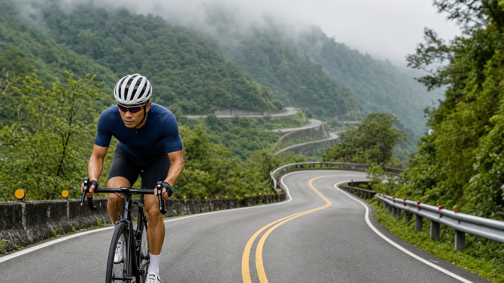
North Cross-Island Highway Baling to Mingchi Practical Guide: An Endurance Test of 18.5 km, 3.2% Average Gradient, and an Estimated 592 m of Climbing
This route won’t send your heart rate soaring, but it will slowly grind down your willpower. The climb from Baling to Mingchi on the North Cross-Island Highway is one of the few stretches in Taiwan where “steady output” is truly put to the test.
Route Overview and Data Analysis
Let’s first address an issue we must honestly confront when planning this guide: the elevation gain field (elevation_m) for this Baling to Mingchi route is recorded as 0.0 meters in the original database. Any cyclist who has ridden the North Cross-Island Highway and has basic geographic knowledge of this route knows this is definitely not the real figure—Baling to Mingchi is a recognized long-distance climb on the North Cross-Island Highway (Provincial Highway 7), where the terrain ascends from the river valley up to the mountain plateau where Mingchi Forest Recreation Area is located. The elevation difference is substantial and cannot possibly be “zero climbing.” This is clearly a data collection deficiency or systematic error, possibly from missing sensor readings, GPS track elevation data not being written correctly, or an exception during backend calculation that caused the field to be zeroed out.
Faced with this missing data, the more responsible approach is not to parrot “0 meters of climbing” and mislead readers, but rather to attempt to derive a reasonable estimate using known reliable data. The two figures we are certain about are: total route distance of 18,497.8 meters (approximately 18.5 km), and an average gradient of 3.2%. Using basic trigonometric relationships, if a route maintains an average gradient of 3.2% across its entire length, the total climbing can be roughly estimated by “distance multiplied by gradient percentage,” which is 18.5 km (18,500 meters) multiplied by 0.032, equaling approximately 592 meters. While this estimation method cannot fully account for undulations in the middle of the route (such as micro-terrain variations where sections dip slightly into the valley before climbing steeply again), it is practical enough as a reference for riders planning their energy allocation and mental expectations. Therefore, this guide will consistently use the phrasing “total climbing approximately 592 meters (estimated based on route distance and average gradient).” Readers should understand this is an estimated value rather than precise climbing data recorded point-by-point by precision instruments (such as barometric altimeters). Your personal cycling computer readings during an actual ride may vary within a certain range, which is normal.
So, where does this combination—3.2% average gradient, 18.5 km, and an estimated 592 m of climbing—sit on the spectrum of Taiwan’s road cycling climbs? If compared to “heavyweight” routes like Wuling or Hehuan Mountain, which often average 6% to 8% or more with climbs exceeding 1,500 meters, Baling to Mingchi is clearly more moderate. But if compared to short climbs in the Xindian mountain area or suburban routes (such as Pingding Ancient Canal or Fengguizui, which are 5 to 8 km with 200 to 400 meters of climbing), Baling to Mingchi’s distance is nearly three times longer, with significantly more total elevation gain. This combination of “not particularly steep, but very long” is precisely the route type most easily underestimated—many riders see the 3.2% figure and instinctively think “this is easy,” but don’t forget that sustaining a 3.2% gradient for 18.5 km means you must maintain continuous low-to-moderate intensity output for over an hour (depending on fitness and pacing), with virtually no true flat sections or descents to let your core, lower back, and legs recover.
In cycling training terminology, this route type is typically called a “marathon-type” climb. In contrast to “sprint-type” or “interval-type” short steep climbs (e.g., average gradients above 8% within 3 km, testing explosive power and anaerobic tolerance), marathon-type climbs truly test aerobic metabolic efficiency, pacing discipline, and psychological endurance management. Many riders who can lift respectable weights at the gym and hold their own in short sprints often run out of steam on these long, gentle climbs—because the body’s energy supply system and psychological tolerance patterns are completely different from short bursts of effort. Therefore, if you’re a rider preparing to take on Baling to Mingchi, please adjust your mindset first: this is not a competition to see if you can push your power meter to its peak; it’s an endurance test of whether you can hold your pace in a zone where “you can talk but are slightly breathless” for over an hour without falling apart.
Segment-by-Segment Strategy from Start to Finish: How to Best Break Down the 18.5 km
To conquer this route efficiently, breaking the 18.5 km into several psychologically and physiologically manageable segments is a strategy all experienced riders use. Below, based on common landmarks and terrain changes along the North Cross-Island Highway, the full route is roughly divided into five segments of approximately 3.5 to 4 km each, helping readers establish a rhythm of “getting through one segment at a time” rather than being crushed by the overwhelming total distance of “still more than ten kilometers to go.”
Segment 1 (Departing Baling, approximately 0 to 4 km): This is the warm-up and reconnaissance phase. The gradient is typically slightly gentler than the overall average, and the road transitions from the industrial roads around the Baling settlement onto the main line of the North Cross-Island Highway, with denser native forests and scattered tribal dwellings appearing on both sides. For this segment, riders are advised to deliberately keep effort low, controlling heart rate at approximately 65% to 70% of maximum, starting at a pace slower than what you feel you “could go faster.” The most common mistake on long, gentle climbs is pushing too hard in the early stages and exhausting yourself later—especially since there are no true descents on the Baling to Mingchi route to help you recover. Once you overextend early on, the remaining kilometers will only become increasingly painful.
Segment 2 (Approximately 4 to 8 km): The gradient begins to settle more consistently near the 3.2% average, and the road gradually leaves the settlement area, entering more purely forested mountain terrain. Here you’ll start to experience the typical “switchback” curve design of the North Cross-Island Highway, with views alternately opening up and being blocked by forest cover as the mountain contours turn. It’s recommended to start paying attention to your cadence in this segment, aiming to maintain a medium-to-high cadence of 70 to 85 rpm, using a lighter gear ratio with a faster spin to reduce the load on your knees and quadriceps with each pedal stroke. This is critical for the long climb ahead with more than ten kilometers still to ride.
Segment 3 (Approximately 8 to 12 km): This is the segment where your mental resolve is most likely to waver, as you’re past the halfway point but the finish is still nowhere in sight, and physical fatigue is clearly accumulating. Some sections here may feature slightly steeper gradients (localized sections steeper than the 3.2% average are normal, since the average itself is the result of blending gentler and steeper sections). Riders are advised to proactively shift to a lower gear to maintain cadence when the gradient steepens, rather than stubbornly grinding in the same gear, to avoid rapid lactic acid buildup in the thighs. Also at this stage, replenishing water and easily digestible carbohydrates such as energy gels or bananas in a timely manner will be more effective than waiting until you clearly feel “hungry” or “thirsty”—your body’s signals typically lag 20 to 30 minutes behind actual needs.
Segment 4 (Approximately 12 to 16 km): As elevation continues to rise, the mountain temperature will begin to show visible changes, and the tree species may gradually shift from broadleaf to coniferous forests (Japanese cedar is a famous plantation species around Mingchi). This segment offers some of the best opportunities to see misty, cloud-wrapped scenery along the entire route, especially in the afternoon when fog is common in mountain areas. Pay extra attention to visibility and road surface slipperiness, slow down through corners, and ensure sufficient reaction distance between yourself, fellow riders, and even oncoming traffic.
Segment 5 (Approximately 16 to 18.5 km, arriving at Mingchi): This is the easing phase before the final push. Most riders feel a psychological boost from “almost there,” and pacing may unconsciously quicken, but discipline is still advised here—save a bit of energy for the short, steep sections that may appear near the entrance to Mingchi Forest Recreation Area (entrance roads to many mountain recreation areas are often slightly steeper than the main line). Upon arriving at Mingchi, remember to cool down by riding gently or walking your bike for a short distance to let your heart rate gradually decrease before entering the recreation area to rest. Stopping and sitting down immediately can cause lactic acid to pool in your legs, leading to more severe soreness the next day.
Gear Ratio and Equipment Recommendations
The gear ratio requirements for a long, gradual climb are fundamentally different from those for a short, steep climb. On short, steep climbs, riders often seek ultra-light gearing to handle brief sections of extreme gradient. However, for a route like Baling to Mingchi, which averages 3.2% over 18.5 kilometers, the key is actually “finding a mid-range gear ratio that allows you to maintain a steady cadence for over an hour without excessive wear on your knee joints.” Below are recommended setups for different bike types and rider levels, for readers to adjust according to their own circumstances.
| Bike Type / Rider Level | Recommended Chainring | Recommended Cassette | Notes |
|---|---|---|---|
| Road bike (casual recreational rider) | Compact 50/34T | 11-32T or 11-34T | Sufficient margin throughout to maintain a high cadence with light gearing, avoiding excessive knee strain |
| Road bike (well-trained rider) | Standard 52/36T or 53/39T | 11-28T or 11-30T | When fitness and strength are sufficient, heavier gearing can be used for efficiency, but it is still recommended to keep a low gear for localized steep sections |
| Disc-brake gravel bike / All-road | 46/30T or similar composite crankset | 11-34T or wider | A wider gear range, suitable for long-distance riding with heavier loads |
| E-bike | Follow manufacturer specifications | Follow manufacturer specifications | It is recommended to make good use of the assist modes and adjust in stages, to avoid running out of battery in the latter half and affecting the return plan |
Beyond gear ratios, the physical toll of a long, gradual climb is mainly concentrated on “sustained seated weight-bearing,” rather than the instantaneous muscular bursts of a short, steep climb. Therefore, saddle selection and adjustment can be even more important than gear ratios on this type of route. It is recommended to confirm that saddle height and angle are appropriate before riding, to avoid prolonged uneven pressure on the sit bones due to poor posture. If you know you are prone to sit bone or perineal discomfort after long rides, consider switching to a long-distance saddle with a cutout design or a wider profile, paired with chamois padding of appropriate thickness in your cycling shorts. Hand and shoulder/neck posture adjustments should not be overlooked either. An 18.5-kilometer continuous climb means your hands will be gripping the handlebars for a long time; periodically changing hand positions (alternating between the tops, drops, and brake hoods) can effectively distribute pressure and prevent premature wrist and shoulder/neck soreness.
Other equipment recommendations include: ensuring your wheelset and tire pressure are suitable for mountain road conditions (some sections of the Northern Cross-Island Highway may have falling rocks or uneven pavement, so tire pressure should not be set too high or too hard); carrying a basic tire repair kit and spare inner tubes, because if you get a flat on this mountain route, there may not be a bike shop readily available nearby; and wearing cycling jerseys and bibs with both breathability and thermal functions, to cope with the temperature differences from the foothills up to nearly 1,000 meters of elevation.
Nutrition and Hydration Management
Along the Northern Cross-Island Highway, resupply options are relatively limited compared to urban or flat routes, which is a key point that must be planned in advance when organizing this ride. Before departing, it is recommended to confirm at Baling or at earlier resupply points (such as Sangguang, Gaoyi, and other settlements along the highway; actual business hours may vary over time, so it is best to check on-site conditions) that your water bottles and portable food are fully stocked. Along the 18.5-kilometer climb from Baling to Mingchi, settlements and shops are not densely distributed, so you cannot fully rely on a “resupply wherever you happen to be” improvisational strategy.
The Sileng area is roughly located around the midpoint of the route from Baling toward Mingchi on the Northern Cross-Island Highway. It was historically an important checkpoint and rest stop. However, whether there are still reliably operating resupply stations along this section today should be confirmed in advance through online communities or riding partners before departure, to avoid arriving and finding nothing. A conservative approach is to prepare as if “there are no resupply points on this entire stretch.” Carry at least two bottles of water (adjust based on temperature and personal sweat rate; in the hot, humid summer mountain conditions, prepare more), as well as enough energy sources to sustain over an hour of high-intensity activity, such as energy gels, bananas, energy bars, or simple salty snacks to replenish electrolytes.
Upon arriving at Mingchi Forest Recreation Area, the park typically has basic facilities such as a visitor center, food and beverage services, and drinking water. This is a good place to fully replenish fluids and calories, and it is one of the few spots along the entire ride where you can formally sit down and rest. However, the park’s opening hours, food options, and prices are subject to change by the managing authority (currently operated by the Forestry Conservation Division of the Veterans Affairs Council and related agencies). It is recommended to check the day’s opening information online before your trip, to avoid arriving too early or too late and finding it closed.
For hydration, it is recommended to follow the principle of “small amounts, frequently,” rather than waiting until you are clearly thirsty and then gulping down large quantities. During a long climb, your body continuously loses fluids and electrolytes through sweat. If you wait until you feel noticeably thirsty to drink, your body has typically already entered a state of mild dehydration. Even if you drink at that point, it takes time for your bodily functions to stabilize, and both pacing and perceived exertion will be affected. It is recommended to take small sips every 15 to 20 minutes, and to supplement electrolytes as appropriate (especially in the hot, humid, and muggy conditions of the Northern Cross-Island mountain area in summer, where sweat rates are often higher than expected).
Weather and Seasonal Recommendations
Along the Northern Cross-Island Highway, especially on mountain sections like those near Mingchi where elevation gradually rises, weather patterns differ significantly from the lowlands. This is a variable that absolutely cannot be ignored when planning this ride. Overall, the Northern Cross-Island mountain area has a rainy and foggy climate. Even if the lowland forecast calls for clear skies, the mountains may still experience localized rain or dense fog due to orographic lifting effects. This weather pattern is quite common in the mountains of north-central Taiwan. Riders should make it a habit to check real-time mountain weather and road conditions rather than setting off based only on the lowland forecast.
As elevation climbs from Baling all the way up to Mingchi Forest Recreation Area (Mingchi is at approximately 1,150 meters above sea level), there is a noticeable temperature lapse effect. Generally speaking, for every 100 meters of elevation gain, the temperature drops by roughly 0.6 degrees Celsius. This means that even if the temperature at the start is comfortable and pleasant, by the time you reach the Mingchi area, the perceived temperature may be noticeably cooler. Especially after sweating, when exposed to wind or when the sky turns overcast, the risk of hypothermia should not be underestimated. It is recommended to adopt a “layering” approach for your cycling clothing, and to carry a lightweight windproof or insulated jacket that can be put on or taken off as conditions dictate when reaching higher elevations or descending on the return.
Seasonally, Taiwan’s mountain rainy season (roughly spanning the transition from spring to summer through the summer typhoon season) tends to bring afternoon thundershowers. It is recommended to plan the ride to depart in the morning and complete the main climbing section before early afternoon, to reduce the chance of encountering heavy rain or lightning. In winter, while the chance of rain is relatively lower, the low temperatures and strong winds in the mountains test the completeness of your cold-weather gear. Before departure, make sure you have warm gloves, a neck gaiter, a windbreaker, and other cold-weather essentials. Regardless of the season, checking the Central Weather Administration’s mountain forecast and confirming via relevant road condition channels whether Provincial Highway 7 has any slope collapses, road construction closures, or other issues are indispensable pre-ride preparation steps. After all, the mountainous terrain along the Northern Cross-Island Highway occasionally experiences temporary traffic controls due to heavy rain or geological factors.
Common Mistakes and DNF Risks
Long-distance gradual climbs may seem gentle, but they are actually a high-risk route type for many cyclists “abandoning midway (DNF).” The reason is often not that the gradient is too steep to ride up, but rather issues with pacing and mental management. Below are several of the most common mistakes, reminding readers to avoid them in advance.
Mistake 1: Pacing too fast in the early section. This is almost the most common fatal flaw on long-distance gradual climb routes. Many cyclists see a gradient figure like 3.2% and think it’s “not steep,” so they sprint through the first few kilometers at a pace beyond their capability. As a result, by the middle of the route (around kilometers 8 to 12), their energy is nearly depleted, and the remaining sections can only be endured through sheer willpower—or they may even give up early. Be sure to deliberately keep your effort low in the first third of the route. It’s better to feel “too easy” at the start than to turn the latter half into torture.
Mistake 2: Getting the timing of refueling wrong. As mentioned in the previous section, the body’s signals of “hunger” or “thirst” often lag behind actual physiological needs by some time. If you wait until you clearly feel unwell before starting to refuel, you may experience a pacing collapse, cramps, or even dizziness before the fuel takes effect. It is recommended to adopt a scheduled, fixed-quantity refueling strategy rather than passively waiting for body signals.
Mistake 3: Underestimating the impact of weather changes. The previous chapter has detailed the highly variable weather conditions in the Beihang mountain area. Ignoring this and setting out with light gear only to encounter sudden rain or a sharp drop in temperature can severely worsen the riding experience, and in serious cases, there is a risk of hypothermia or accidents due to poor visibility.
Mistake 4: Poor gear selection causing the knees to sound the alarm early. Some riders, in order to show off a “climbing with a heavy gear” attitude in front of others, choose a gear ratio clearly beyond their muscular capacity and grind away for extended periods. The cumulative damage of this pedaling pattern to the knee joints—especially the soft tissues around the patella—should not be underestimated. Once a stinging pain begins to develop in the knee during the ride, it is strongly recommended to stop immediately, reduce intensity, or simply abandon the challenge. Forcing your way through often results in a longer recovery period from injury afterward.
Mistake 5: Neglecting mechanical condition checks. If a mechanical failure occurs on a long-distance mountain route (such as shifting malfunctions, brake issues, or unusual wheel noises), dealing with it along the Beihang Highway—where support and rescue resources are relatively limited—is far more complicated than riding in urban areas. Before setting out, be sure to confirm that the bicycle’s mechanical condition is sound and carry basic repair tools.
Reference Target Times for Riders of Different Levels
The times below are for reference only. Actual completion times will vary depending on individual fitness, weather conditions on the day, wind direction, road conditions, and the number of rest stops. Readers are advised to treat these figures as a rough framework for planning the ride and setting expectations, rather than as rigid competitive targets.
| Rider Level | Estimated Completion Time (excluding rest) | Reference Average Pace | Notes |
|---|---|---|---|
| Beginner / Occasional rider | Approximately 90 to 120 minutes | Approximately 9 to 12 km/h | Recommended to take longer rest breaks; pace yourself throughout |
| General recreational rider | Approximately 70 to 90 minutes | Approximately 12 to 16 km/h | Common completion range for those with basic long-distance riding experience |
| Well-trained rider | Approximately 50 to 65 minutes | Approximately 17 to 22 km/h | Requires a consistent training routine and a solid aerobic base |
| Competitive / Professional rider | Approximately 40 to 50 minutes or less | Approximately 22 km/h or above | Typically has race experience and a systematic training background |
One important note: the time ranges in this table are only rough reference values. The Baling to Mingchi section of the Beihang Highway does not currently have a large volume of precise ride records for comparison, unlike certain well-known Strava segments. If readers want a more accurate personalized target time, it is recommended to use their own performance data on other routes with known distances and gradients, combined with power or heart-rate training zone conversions, to work backward and derive a suitable target pace for Baling to Mingchi. This will be more practical than simply applying someone else’s completion time.
Pre-Ride Training Recommendations
To successfully complete a long-distance gradual climb like Baling to Mingchi, building up your physical reserves beforehand is crucial. In particular, the core abilities this route tests are “aerobic endurance” and “pacing discipline,” rather than short-term explosive power, so your training plan should be structured around these elements.
It is recommended to arrange a progressive training period of at least four to six weeks before the challenge. In the early phase, start by accumulating climbing experience on shorter routes with similar gradients, allowing the body to gradually adapt to the sustained pedaling load over time, while also practicing pace control and refueling rhythm. In the middle phase, gradually extend the total distance and total elevation gain of each ride, with the goal of developing the ability to ride continuously for over an hour while keeping the heart rate in the moderate-intensity zone without a noticeable drop in speed. This phase also recommends adding one or two interval training sessions—for example, several sets of short, higher-intensity intervals on flatter sections—to raise your overall aerobic ceiling, making the “comfortable pace” zone on long gradual climbs feel relatively easier.
Beyond cycling-specific training, strengthening the core muscles and lower back also provides tangible benefits for maintaining the riding position over long periods and reducing the risk of soreness and injury from postural compensation. Consider adding some basic core exercises (such as planks, bridges, etc.) as supplementary training. Dietary and sleep adjustments should not be overlooked either. In the week before the challenge, avoid drastic changes in training load, allowing the body ample time for recovery and glycogen storage. The night before the challenge, be sure to get sufficient sleep, as this directly affects performance and concentration the next day.
If you rarely practice long-distance climbing in your regular training, it is recommended to do a simulation test on a shorter route (for example, 5 to 8 kilometers) with a similar gradient before officially taking on Baling to Mingchi. This will help you confirm whether your equipment, refueling strategy, and pacing plan are viable, and allow you to fine-tune based on the results. This is far safer than directly tackling the full 18.5-kilometer route, and it can effectively reduce the risk of abandoning midway or experiencing physical discomfort.
Quick Q&A
Q1: Is the Baling to Mingchi route suitable for cycling beginners to attempt?
A: The average gradient of 3.2% is relatively gentle, and in theory, beginners with basic riding experience have a chance of completing it. However, the sustained 18.5-kilometer distance is still a considerable test of cardiovascular endurance and willpower. Beginners are advised to first confirm that they have experience riding continuously for over an hour without stopping, and to mentally prepare for slower pacing in the early section and the possibility of turning back midway. Don’t make “I must reach Mingchi” the only goal from the start.
Q2: Is this route suitable for electric-assist bikes?
A: Yes. Electric-assist bikes can effectively reduce the physical exertion required on long gradual climbs, allowing more riders of varying fitness levels to comfortably enjoy the scenery along the way. However, it is recommended to check in advance whether the battery capacity is sufficient for the full round trip (if you plan to return the same way), and to make good use of the adjustable assist modes to avoid running out of battery prematurely on the latter climbs.
Q3: Are there many refueling points along the route? Do I need to bring a lot of water and food?
A: As mentioned in the refueling section earlier, support resources along the Beihang Highway are relatively limited. It is recommended to prepare with the conservative mindset that “there are no reliable refueling points on this stretch.” Carry at least two bottles of water and enough portable food, and replenish after arriving at Mingchi Forest Recreation Area, depending on whether it is open that day.
Q4: What season or time of day is best for tackling this route?
A: Overall, spring and autumn offer more comfortable temperatures, and the probability of mountain rainfall is relatively stable and predictable. In summer, pay special attention to afternoon thunderstorms and hot, humid conditions—it is recommended to start early in the morning and complete the main sections before the afternoon. In winter, focus on staying warm against the low temperatures. Regardless of the season, be sure to check the mountain weather forecast and road condition information before setting out.
Q5: Does the route require returning the same way, or can I arrange a one-way itinerary?
A: This depends on your personal itinerary planning and shuttle arrangements. If you have not arranged a support vehicle or a second mode of transport waiting at the Mingchi end, most riders choose to return the same way to Baling. This also means that when tackling this route, you need to factor the return descent into your energy allocation. Although descending is relatively less demanding, prolonged braking places a strain on both your hands and the braking system, so it should not be taken lightly.
Transportation, Itinerary Planning, and Summary
If readers are driving to Baling as their starting point, we recommend confirming parking locations in advance. Parking space is limited along certain sections of the Northern Cross-Island Highway, so it’s advisable to choose a legal parking spot that does not obstruct other road users. If you’re considering adding Lalashan (Daguan Mountain Nature Reserve) as a stop along the way, Baling is exactly the junction leading to Lalashan. You can decide whether to take on the extra challenge based on your energy and time, but keep in mind that the Lalashan direction is itself another climbing route. If you’ve already completed the 18.5 km challenge from Baling to Mingchi on the same day, adding Lalashan would place a considerable extra burden on your stamina. We recommend riding within your limits and not forcing additional mileage when your willpower is already depleted.
For overall itinerary planning, we suggest scheduling the Baling-to-Mingchi ride as a half-day to full-day trip. Aside from the riding itself, which takes one to two hours (depending on individual fitness level), you should also reserve time for strolling and sightseeing in the Mingchi Forest Recreation Area, taking photos, resting, and the return ride along the same route. Allowing three to four hours or even more generous time will make the trip more relaxed, avoiding the risk of sacrificing safety and riding quality due to a tight schedule.
In summary, the Baling-to-Mingchi route is one that packages its challenge behind an average 3.2% gradient but accumulates real difficulty through its 18.5 km distance. The total elevation gain is approximately 592 meters (estimated based on route distance and average gradient, as the original data’s elevation field is missing). While that may not sound impressive, sustaining a steady output for over an hour demands a level of pacing discipline and mental endurance that is by no means inferior to certain shorter but steeper well-known climbs. The greatest appeal of this route lies precisely in its “marathon-style” character—it doesn’t force you to drain all your energy within a few minutes, but instead gives you ample time to experience the changing forests, clouds, mist, and mountain scenery along the Northern Cross-Island Highway. As long as you manage your pacing, plan your refueling, and prepare for weather changes, Baling to Mingchi will be an unforgettable riding experience that combines athletic challenge with scenic enjoyment.
Related Reading
- Northern Cross Mingchi Practical Guide: 19.45 km, 4.3% Average Gradient Cloud-Mist Trial, Full Data Breakdown and Segment Tactics Analysis
- Northern Cross Highway Mingchi–Baling Section: A Cloudy Forest Ride Beneath Lalashan
- Taiwan Provincial Highway 116 Baling Road Practical Guide: 7 km, 8.1% Average Gradient Short Steep Climb
- Mist Rising Over Mingchi: An 18.5 km Ride from Baling into the Depths of the Japanese Cedar Forest
#北橫 + #北進武嶺 最硬的員工旅遊 EP1 | #公路車 #拉拉山 | 明池 | 武嶺 | 武陵農場 | 雲海 | Taiwan Cycling Route Wulin
6 年前
半日 小台灣 極限單車路線挑戰實錄
7 年前
台北闊瀨陡坡 騎旅 / 日本單車雜誌編輯車友臨時加入!/ 髮香才是最強的 / feat. 北迴歸線小隊 / 公路車 CT Yeh
6 個月前
大禹嶺 到 武嶺牌樓 全程前後實況錄影 | 北進武嶺 | 東進武嶺 | KOM | 訓練台 | 坡度分析 | Taiwan KOM Last 10 km HARD | 公路車
6 年前
滿滿的人還有妹子的香,拉拉山上巴陵挑戰行,絕美山陵空拍!feat. JJSC | 公路車 | CT Yeh
3 年前
2019 夏季KOM 5小 完賽心得 準備攻略 東進武嶺 夏季登山王之路 Taiwan KOM Challenge
7 年前
#東進武嶺 全程實況錄影 5小時半 #夏季KOM #太魯閣 Taiwan KOM Challenge Reality Video Taroko scenery
7 年前
爬坡ITT實境)台中 魔王 松鼠坡 首航 6:12 大肚山 大三元 科福路
8 年前