Complete Guide to the Southern Climb of Xindian Lion Head Mountain: 7.64 km, 499 m Elevation Gain, Segment-by-Segment Tactics from Beginner to Advanced
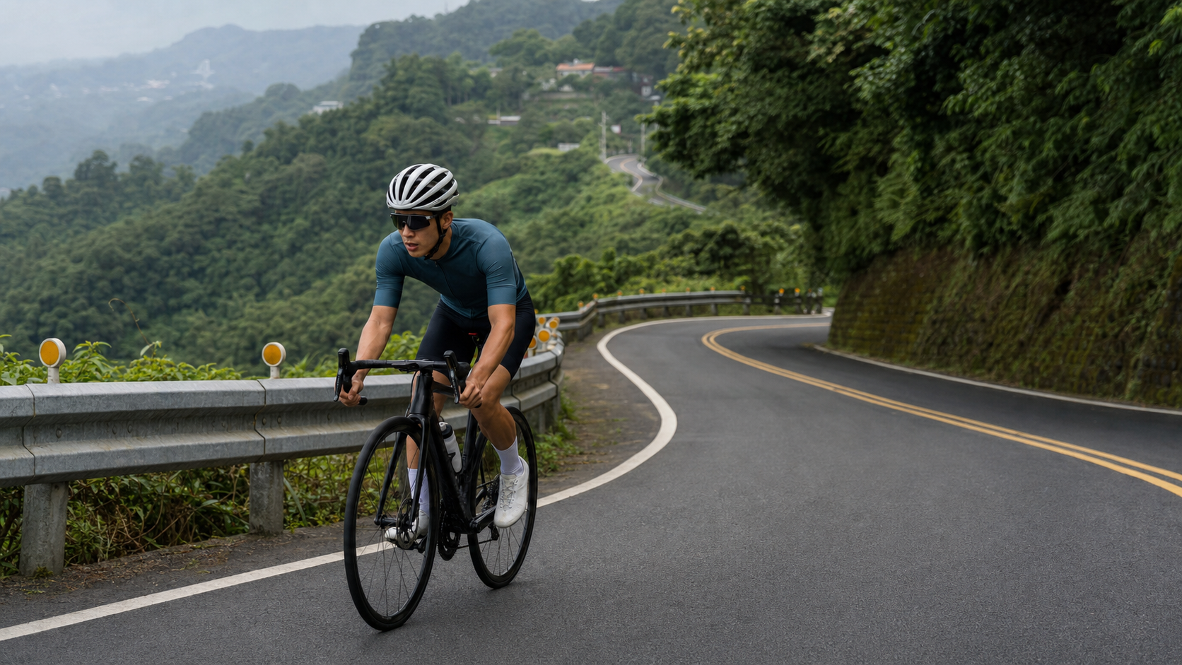
Full Guide to the Southern Climb of Xindian Shitoushan: 7.64 km, 499 m Elevation Gain, Segment-by-Segment Tactics from Beginner to Advanced
The southern climb of Shitoushan in Xindian District, New Taipei City, registered as segment 742080 on Strava, is a highly popular mid-distance climbing route among the cycling community in the outskirts of northern Taiwan. Official data shows: a distance of 7,644.18 meters (approximately 7.64 km), total elevation gain of 499.043 meters, and an average gradient of 5.9%. The reason this route is so well-liked by riders lies in its data profile—the distance is long enough, the elevation gain is substantial, but the gradient distribution is relatively even, unlike certain short, steep climbs that catch riders off guard. Instead, it is better suited for practicing “sustained output” and “pace management,” two core abilities for road cyclists.
Let’s first verify the numbers to establish the data foundation for this guide: if the gradient of the entire route were truly evenly distributed at 5.9%, theoretically 7,644.18 meters should produce approximately 451 meters of elevation gain (7,644.18 × 0.059 ≈ 451), while the officially recorded actual total gain is 499.043 meters—a difference of about 48 meters, roughly a 10% variance. This margin of difference is reasonable and common for a mid-to-long climbing route of over 7 km—it typically reflects that there are indeed some sections with gradients slightly above the average, but overall, the gradient distribution of the southern side of Shitoushan can still be regarded as “roughly even with local undulations,” unlike the severe gradient swings found on certain short, steep climbs in the Shenkeng area. This is also why this route is particularly well-suited for extended tempo training or as an FTP testing ground.
This guide will take an engineer’s approach, breaking the 7.64 km into executable segment-by-segment tactics, and provide specific, data-driven recommendations on gear ratios, nutrition, weather, common mistakes, and target times for riders of different levels.
Route Overview and Data Interpretation: What a 5.9% Average Gradient Means for Training Intensity
The southern side of Shitoushan is located in Xindian District, New Taipei City, and is an important climbing corridor in the Xindian hill country. The southern route connects with the mountainous terrain around Xindian’s well-known Hemei Mountain and Wantan area, and overall belongs to the typical low-elevation hill terrain surrounding the Xindian River basin. The characteristic of this type of terrain is that the gradient does not feature sustained steep sections of 10% or more like the high mountain roads of the Central Mountain Range, nor is it entirely gentle rolling hills. Instead, it sits between the two—a “mid-distance rhythmic climb” that requires riders to maintain moderate-to-high intensity output throughout to complete efficiently.
A 5.9% average gradient corresponds, in road cycling training intensity zones, to roughly the “Tempo to Sweet Spot” range—that is, a power output of approximately 76% to 90% of FTP that can be sustained for extended periods. What makes this intensity range special is that it does not cause lactate to accumulate rapidly and force a slowdown like intensities above the anaerobic threshold, but it is also definitely not an easy pace for chatting while riding. Rather, it is a moderate-to-high intensity challenge that requires riders to consciously control their breathing rhythm and pedaling efficiency to complete the full 7.64 km without fading.
Key Data Overview of the Southern Climb of Shitoushan
| Item | Value |
|---|---|
| Route Distance | 7,644.18 meters (7.64 km) |
| Total Elevation Gain | 499.043 meters |
| Strava Average Gradient | 5.9% |
| Theoretical Gain (Distance × Average Gradient) | Approximately 451 meters |
| Variance from Actual Total Gain | Approximately 48 meters (about 10%, within reasonable error range) |
| Average Gain per Kilometer | Approximately 65 meters |
| Suggested Completion Time (Advanced Riders) | Approximately 22–28 minutes |
| Suggested Completion Time (Average Riders) | Approximately 32–42 minutes |
| Suggested Completion Time (Beginners / Ride Within Limits) | 45 minutes or more, rest stops allowed |
From the converted figure of “approximately 65 meters of gain per kilometer,” the southern side of Shitoushan is actually very close to the intensity density of many classic European climbing stages. It is a solidly spec’d training route, but because the total distance is kept at 7.64 km, riders with basic riding experience, as long as they pace themselves properly, have a good chance of completing the challenge without having to put a foot down.
Segment-by-Segment Tactics: The Pacing Logic of Splitting 7.64 km into Five Sections
Since the gradient distribution on the southern side of Shitoushan is relatively even, the core logic of segment tactics differs from short, steep climbs—the goal is not to guard against “sudden double-digit gradients,” but to solve the problem of “how to avoid fading in the latter half when sustaining moderate-to-high intensity output over a long period.” Below, the full route is conceptually divided into five stages (actual terrain transition points may vary slightly depending on road conditions; please rely on on-site terrain judgment):
Stage 1 (0–1.5 km): The Start and Heart Rate Ramp-Up Period. The key task in this stage is to smoothly transition heart rate and breathing from flat-road conditions to climbing intensity, rather than sprinting at high power the moment the climb begins. Given the total distance of 7.64 km, if you push your heart rate near threshold right at the start, you will inevitably be forced to slow down later due to accumulated muscle fatigue and cardiovascular load, ultimately extending your overall completion time. It is recommended to keep power output in this stage at slightly below 80% of your FTP, giving your body ample time to complete the transition from aerobic to moderate-to-high intensity.
Stage 2 (1.5–3.5 km): Rhythm Establishment Period. Once into this stage, your body should have adapted to the climbing intensity. The task here is to find a pedaling rhythm that can be sustained for the entire remainder—including a consistent cadence (recommended to stay between 75 and 90 rpm) and relatively stable power output. A common mistake many riders make in this stage is being pulled along by the pace of other riders on the road, constantly speeding up and slowing down their own pace. This unstable output pattern will, over the long run, consume more energy and cardiovascular resources than a steady pace.
Stage 3 (3.5–5 km): Mid-Route Test Period. This is the midpoint of the total distance and also the stage where mental fatigue is most likely to set in—you have ridden nearly half the distance, but the finish still feels far away. Physiologically, by this stage, muscle glycogen depletion has accumulated to a certain degree, and if combined with local sections where the gradient is slightly above the average (based on the variance between total gain and the theoretical value, such sections are likely to appear in the middle-to-later part of the route), this will be the area where the subjective effort feels greatest in the entire challenge. The tactical core here is “breathing over speed”: maintain a deep, steady breathing rhythm, moderately reduce cadence to buy recovery space, and do not suddenly drop your speed dramatically due to a momentary feeling of fatigue—that would disrupt the rhythm you have already established.
Stage 4 (5–6.5 km): Grind and Mental Stamina Management Period. After passing the midpoint, the feeling of fatigue typically reaches a plateau—it neither continues to worsen nor is it easy to push the intensity any higher. The most important aspect of this stage is mental management—remind yourself that you have already completed most of the route, and use “segment goals” instead of “finish-line goals” to maintain motivation. For example, focusing on short-term achievable targets like “hold on to the next utility pole” or “hold on to the next bend” can effectively reduce the mental fatigue brought on by a long climb.
Stage 5 (6.5–7.64 km): Final Surge Period. Entering the last kilometer or so, if your physical condition allows, you can attempt to gradually increase power output for a final surge. Even if your heart rate spikes in this stage, it is relatively safe because the finish is not far off, and your body no longer needs to conserve energy for the remaining route. It is recommended to start accelerating only when you can see the top of the climb or a clear terrain transition ahead (such as the tree line opening up or the gradient visibly easing), to avoid going too early and running out of steam.
Gear Ratio and Equipment Setup: Optimal Choices for Mid-Distance Rhythm Climbing
For a mid-distance climb like the southern side of Lion’s Head Mountain, where the gradient is relatively uniform, the logic behind gear ratio configuration differs from short, steep climbs—the focus is not on handling sudden high gradients, but on finding a “cruising gear” that allows you to maintain a steady cadence and power output over a long period.
For the average road cyclist, a standard 50/34 compact crankset paired with a rear cassette up to around 28 teeth is already sufficient to handle the gradient demands of the entire southern side of Lion’s Head Mountain. The advantage of this setup is that on a sustained gradient of around 5.9%, you can still maintain a cadence above 75 rpm without being forced to drastically lower your pedaling speed due to overly heavy gearing. Over a long duration, this also places relatively less strain on the knees and muscles.
For advanced riders looking to challenge faster completion times, a slightly more compact cassette configuration (e.g., 11-25 teeth) can be considered, paired with higher power output and cadence control. However, this needs to be built on a solid FTP foundation; otherwise, you risk sacrificing cadence efficiency in the latter part of the route because the gearing isn’t light enough.
For novice riders, a more conservative gear strategy is recommended. Choose a rear cassette with 30 or even 32 teeth, paired with a 34-tooth or smaller front small chainring. This ensures that even when fatigue sets in mid-route, you still have a sufficiently light gear to switch to, using a higher cadence to reduce muscle strain, and avoiding the need to dismount and walk or take extended breaks due to overly heavy gearing.
In terms of equipment, since the southern side of Lion’s Head Mountain is 7.64 kilometers long and typically takes over 20 minutes, it’s advisable to choose a wheelset that balances weight and comfort, rather than purely pursuing ultra-lightweight race-level wheels. Regarding tire pressure, the road surface in the Xindian mountain area is generally in good condition, but mountain sections inevitably have some potholes or accumulated leaves. It’s recommended to maintain a medium-to-high tire pressure to balance rolling efficiency and road feedback.
Nutrition, Hydration, and Tempo Training Strategies
Compared to short, steep climbs where mid-route nutrition isn’t really necessary, the characteristics of the 7.64-kilometer southern side of Lion’s Head Mountain—which can take over 30 minutes—make the nutrition strategy more important, especially if you plan to include this route as part of a longer group ride.
Pre-ride nutrition recommendations are no different from general mid-to-long distance rides—finish a proper meal 1 to 2 hours beforehand, and 30 minutes before departure, you can supplement with a small amount of easily digestible carbohydrates as needed to ensure stable blood sugar levels, avoiding a sudden drop in energy from hypoglycemia mid-climb.
Hydration is a key point that requires special attention on this route. Due to the longer duration, combined with the hot and humid summers in the Xindian mountain area, it’s recommended to carry at least 750 to 1000 milliliters of water or electrolyte drink, and develop the habit of “drinking once for every kilometer climbed,” rather than waiting until you feel thirsty—thirst is actually already a sign of mild dehydration. Proactive, regular hydration is what maintains optimal physiological performance.
If you’re using the southern side of Lion’s Head Mountain as a venue for tempo/sweet spot training, it’s recommended to use a power meter or heart rate monitor to monitor throughout whether your output intensity stays within the target zone. The gradient of this route is relatively uniform, making it ideal for practicing “power consistency”—that is, keeping power fluctuations within a relatively small range throughout the climb. This is a crucial ability in many long-distance time trials or hill climb races, and the southern side of Lion’s Head Mountain provides an excellent real-world training ground for it.
Weather and Season Selection: Climate Characteristics of the Xindian Mountain Area
Xindian District is located at the southern edge of the Taipei Basin, adjacent to the Xindian River and surrounding hilly terrain. Its climate has dual characteristics of both suburban and mountainous areas—hot and humid in summer with frequent afternoon thunderstorms, while in winter, due to the northeast monsoon and terrain effects, some mountain sections are prone to fog or have a higher chance of rain than the plains.
Challenging the southern side of Lion’s Head Mountain in summer, due to the longer duration, the cumulative effects of oppressive heat and UV exposure are more pronounced than on shorter routes. It’s recommended to start in the early morning hours—on one hand, to avoid the midday heat, and on the other, the air quality and lighting conditions in the Xindian mountain area in the early morning are typically the most ideal of the day, perfect for enjoying the natural scenery along the way.
During the transition between winter and spring, the Xindian mountain area is prone to localized clouds and fog due to the interaction between monsoons and terrain, which can significantly reduce visibility. Combined with an increased risk of slippery roads, it’s essential to check the weather forecast before departure. If there’s a dense fog advisory for the mountain area, priority should be given to rescheduling or choosing an alternative route with better visibility. Autumn (October to November) is usually the most comfortable and pleasant season in the Xindian mountain area, with relatively lower rainfall probability and temperatures not as oppressive as summer—it’s the golden time window for taking on this route.
Common Mistakes and DNF Risks: The Most Easily Overlooked Pitfalls in Mid-Distance Climbs
Unlike short, steep climbs where riders often end up walking due to misjudging gear ratios or gradients, the greatest risks on a mid-distance rhythm climb like the southern side of Lion’s Head Mountain typically come from two categories of problems: “pace imbalance” and “insufficient nutrition,” rather than sudden gradient changes on a single section.
Mistake 1: Pacing too fast in the early section, then running out of steam and slowing down in the latter part. This is the most classic and common mistake in mid-to-long distance climbs. Many riders, because the gradient is relatively gentle in the early part of the route, unconsciously push out power beyond their capabilities. As a result, when they reach the middle and latter sections, the cumulative fatigue effects on muscles and the cardiorespiratory system begin to show, forcing them to drastically slow down, or even stop multiple times to catch their breath. Ironically, the overall completion time ends up being longer than if they had maintained a steady pace throughout.
Mistake 2: Neglecting cadence management and grinding through the entire climb with heavy gears. Some riders are accustomed to climbing with heavier gears and lower cadence, believing this feels more “powerful.” However, on a sustained gradient of 7.64 kilometers, this low-cadence, high-torque pedaling style causes strain on the quadriceps and knee joints to accumulate sharply as distance increases. This can easily lead to muscle cramps or joint discomfort in the latter part of the route, forcing an unplanned stop or even abandoning the challenge.
Mistake 3: Incorrect hydration timing, leading to signs of dehydration in the middle and latter sections. As mentioned in the previous section, many riders habitually wait until they feel thirsty to drink. But on a longer mid-distance climb, this passive approach to hydration can easily lead to mild dehydration symptoms in the latter part of the route, including lack of concentration, increased risk of muscle cramps, and heightened subjective fatigue—all of which directly affect the quality of completion and even safety.
Mistake 4: Misjudging weather conditions and stubbornly attempting the climb despite poor visibility from localized mountain fog. The Xindian mountain terrain is prone to localized clouds and fog, especially during high-humidity seasons or early morning hours. Some riders, because they’ve already planned their itinerary, still push on even when visibility is poor. This is especially dangerous on descents, where poor visibility combined with winding roads increases the risk of accidents. It’s strongly recommended to use the actual on-site visibility as the primary deciding factor—better to reschedule than to take risks.
Mistake 5: Underestimating the psychological fatigue of a mid-distance climb and lacking segmented goal setting. For many riders accustomed to short commutes or urban riding, 7.64 kilometers is a psychologically daunting distance, especially the middle section (the 3.5 to 5 kilometer stage mentioned earlier), where strong fatigue and thoughts of giving up easily arise. Without a pre-established mental strategy of segmented goals, it’s easy to waver psychologically at this stage and choose to turn back early or abandon the challenge.
Target Times and Training Recommendations for Riders of Different Levels
Advanced/Racing-Level Riders (FTP power-to-weight ratio above 4.0 W/kg): Target completion time is roughly 22 to 28 minutes. It is recommended to keep overall power output between 85% and 95% of FTP, treating this route as a real-world battleground for Sweet Spot or threshold training. Because the route’s gradient is relatively consistent, it is highly suitable for power-consistency training—try to keep the gap between Normalized Power (NP) and average power to a minimum throughout the entire climb. This is an important metric for evaluating riding efficiency and pacing ability.
Intermediate/Advanced Recreational Riders (FTP power-to-weight ratio of approximately 3.0 to 4.0 W/kg): Target completion time is roughly 32 to 42 minutes. It is recommended to keep heart rate between 75% and 88% of maximum heart rate, adopting a pacing strategy of being conservative in the early section, steady in the middle, and moderately accelerating in the final section depending on how you feel. For riders at this level attempting the route for the first time, it is recommended to set “completing the entire climb without stopping” as the primary goal, rather than chasing a specific completion time from the outset.
Beginners/Riders Pacing Themselves: It is recommended to allow a completion time of 45 minutes or more, and to permit yourself to stop briefly for rest, hydration, or to catch your breath in the middle section of the route (especially the 3.5 to 5 km segment, where the effort is subjectively most demanding). For beginners tackling this route, the most important takeaway should be building a physical awareness of mid-distance climbing and developing pacing intuition, rather than chasing a specific performance number. It is recommended to use a lighter gear ratio setup and to prioritize attempting the climb during seasons and time slots with stable weather conditions.
Regardless of which training stage you are at, the southern side of Lion’s Head Mountain is a route highly suitable for testing and improving “pacing control ability.” Its gradient is relatively consistent and the distance is moderate—unlike short, steep climbs where sudden changes in gradient can easily disrupt a planned pacing strategy, this route more genuinely reflects a rider’s mastery of power management and energy distribution. Among training routes in the northern Taiwan suburbs, it is a quality choice that combines both challenge and predictability.
Practical Ways to Incorporate the Southern Side of Lion’s Head Mountain into a Periodized Training Plan
For riders with systematic training plan needs, the southern side of Lion’s Head Mountain should not merely be a route tackled on a whim from time to time. It can be deliberately incorporated into a weekly or monthly training cycle as a tool for testing and improving specific physiological metrics. Below are several common training applications for riders with further training needs to reference.
As an alternative venue for FTP testing. Traditional FTP testing is mostly conducted on indoor trainers or flat sections with a 20-minute all-out effort, but outdoor climbing tests can actually better approximate the physiological conditions of real races or long-distance challenges. The full duration of the southern side of Lion’s Head Mountain typically falls between 22 and 42 minutes (depending on rider level). Although slightly longer than the standard 20-minute testing protocol, it can still serve as a reference venue for a “climbing-style FTP test”—ride all-out for the entire climb, record average power and heart rate, and cross-reference the data with indoor test results. This helps riders gain a more comprehensive understanding of their true output capability under different conditions.
As a dedicated segment for Sweet Spot interval training. As mentioned earlier, the 5.9% average gradient roughly corresponds to the Sweet Spot intensity zone of 76% to 90% of FTP—the golden intensity band used in many training plans to raise aerobic threshold while managing fatigue accumulation. Riders can deliberately control their power output to stay within this zone for the entire climb, rather than simply chasing the fastest completion time. This type of training is often more efficient and more sustainable for long-term FTP improvement than purely all-out efforts.
As a venue for repeated climbing interval training. If fitness and time permit, riders can also arrange to ride the southern side of Lion’s Head Mountain two to three times consecutively, with easy flat riding in between as recovery, forming a “long interval” training pattern. This training approach has quite significant effects on improving climbing endurance and lactate metabolism, and is especially suitable for riders preparing for long-distance mountain races or multi-day riding events as a targeted pre-race strengthening session.
For group ride tempo and pace-setting practice. The relatively consistent gradient of the southern side of Lion’s Head Mountain also makes it well-suited for “rotating pace-setting” practice during group rides—stronger riders take turns setting the pace at the front, while the rest of the group practices following and maintaining a steady output intensity. This type of group training not only improves individual pacing ability but also strengthens team cohesion and communication, making it a routine training item for many cycling clubs.
Whichever training application you choose, it is recommended that riders develop the habit of recording data—after each attempt, note key metrics such as completion time, average heart rate, and average power (if equipped with a power meter), and periodically review the trends in these numbers. Because the terrain and gradient of the southern side of Lion’s Head Mountain are relatively fixed, it is one of the few suburban training routes that offers a high degree of comparability. Long-term accumulated data records will be the most direct and convincing basis for riders to evaluate their training effectiveness.
Summary: A Mid-Distance Training Classic Worth Revisiting
The southern side of Lion’s Head Mountain in Xindian—a 7.64 km mid-distance climbing route with 499 meters of total elevation gain—offers a training intensity represented by its 5.9% average gradient that falls precisely within the Tempo to Sweet Spot zone where many riders most need to strengthen. Through this article’s segment-by-segment tactical breakdown, gear ratio and equipment recommendations, nutrition and weather strategies, common mistake reminders, as well as target time planning for riders of different levels and periodized training application suggestions, whether you are an advanced rider looking to refine your pacing ability or a beginner tackling a mid-distance climb for the first time, you can find a training rhythm and challenge goal that suits you on this route. It is not just a climb for testing physical limits—it is a classic suburban route that can accompany riders through long-term training growth, worthy of repeated visits and careful study.
Related Reading
- Riding into the Landscape of Xindian: The Southern Side of Lion’s Head Mountain, a Climbing Memory Alongside the Xindian River
- Complete Guide to the Xianshan Shitan Side: A 5.89 km, 475 m Climb with 8.1% Average Gradient in Miaoli
- Pingxi Wufen Mountain Guide: Full Breakdown of a Tough 4 km, 257 m Climb with 6.4% Average Gradient in the Ruifang Mountains
- Ibuki Mountain South Side Practical Guide: Segment Pacing and Gear Ratio Breakdown for a 6.2 km, 612 m Climb
台北闊瀨陡坡 騎旅 / 日本單車雜誌編輯車友臨時加入!/ 髮香才是最強的 / feat. 北迴歸線小隊 / 公路車 CT Yeh
6 個月前
半日 小台灣 極限單車路線挑戰實錄
7 年前
單車 梅山36灣 坡度介紹 路段介紹 空拍 (相關遊記影片,請參考說明或我的頻道喔,歡迎訂閱)
6 年前
爬坡ITT實境)台中 魔王 松鼠坡 首航 6:12 大肚山 大三元 科福路
8 年前
#公路車 #西進武嶺 配速配瓦實驗 坡度分析 四小時內攻略 建大盃 NeverStop #西進武嶺攻略
6 年前
新玉門關 單車挑戰賽 多視角主集團衝刺菁華版 4K #公路車
5 年前
公路車 爬坡 破PR 紀錄 小技巧 分享
6 年前
大武山20%魔王陡坡【JJSC南台灣遊騎Day2】!屁股真的要裂開了...凡士林抹滿也沒用?神秘金教堂還有超便宜夜市
3 個月前