Flat-road Cycling on Taiwan’s West Coast: Rural Scenery of Changhua, Yunlin, and Chiayi
The three counties of Changhua, Yunlin, and Chiayi on Taiwan’s west coast form the most agriculturally intensive core of the island. The terrain here is simple—almost completely flat, with the greatest elevation changes coming from levees or bridges. For riders accustomed to hill training, flat-road cycling on the west coast may seem to lack challenge, but the charm of this land lies in details beyond speed: the texture of farmland, the smell of fishing harbors, the atmosphere of old streets, wetland migratory birds, and that slow rhythm unique to rural Taiwan.
Overall Route Planning
Starting from Lugang in Changhua, ride south along the auxiliary section of Provincial Highway 61 (West Coast Expressway) or county roads to Budai in Chiayi, covering approximately 180 km in total, which can be planned as a 2–3 day staged trip.
| Stage | Section | Distance | Highlights |
|---|---|---|---|
| Stage 1 | Lugang, Changhua → Taixi, Yunlin | Approx. 60 km | Lugang Old Street, sandbar coastline |
| Stage 2 | Taixi, Yunlin → Dongshi, Chiayi | Approx. 65 km | Wetland ecology, Beigang Mazu |
| Stage 3 | Dongshi, Chiayi → Budai | Approx. 55 km | Oyster industry, Budai Fishing Harbor |
Stage 1: Lugang, Changhua → Taixi, Yunlin (Approx. 60 km)
Lugang: The Best-Preserved Town of Han Chinese Culture in Taiwan
Lugang was one of Taiwan’s most important port cities during the Qing Dynasty, already a significant trading port during the Koxinga era, and briefly the second-largest city in Taiwan in the mid-Qing period. It preserves Taiwan’s most complete heritage of Han Chinese immigrant culture:
- Lugang Tianhou Temple: One of the most important Mazu temples in Taiwan
- Lugang Folk Arts Museum (Gu Family Mansion): Baroque architecture from the Japanese colonial period
- Lugang Old Street (Zhongshan Road): Qing Dynasty red-brick architecture, Nine-Turn Lane
- Lugang Guihua Lane: Taiwan’s best-preserved traditional sanheyuan (three-sided courtyard) settlement
Hanbao Wetland (Approx. 40 km)
The Hanbao Wetland in Changhua County is an important stopover site for migratory birds on Taiwan’s west coast. From October to April each year, large numbers of waterbirds (black-faced spoonbills, black-winged stilts, spoon-billed sandpipers, etc.) pass through or winter here. A birdwatching station is available, making it a good place to stop and observe birds.
Stage 2: Taixi, Yunlin → Dongshi, Chiayi (Approx. 65 km)
Taixi, Yunlin: The Hometown of Taiwan’s Oysters
Taixi Township and Mailiao Township in Yunlin County are Taiwan’s most important production areas for hard clams and oysters. Riding along the industrial roads of Taixi, you can see vast aquaculture ponds and oyster racks—the most iconic agricultural and fishery landscape of Taiwan’s west coast.
Beigang Chaotian Temple (Inland Detour, Approx. 50 km)
If you are willing to detour inland, Beigang Chaotian Temple is one of the most important Mazu temples in Taiwan. The annual Mazu pilgrimage during the third lunar month is Taiwan’s grandest folk religious celebration. The temple’s architecture is ornate, and the incense burns strong.
The Coastline from Taixi to Dongshi
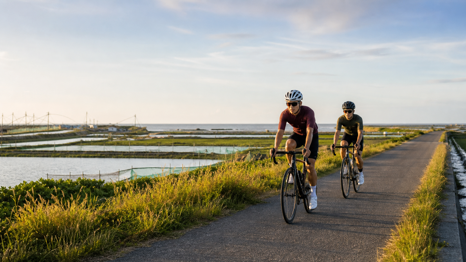
This section follows the levee, with the Taiwan Strait on the right and vast farmland and aquaculture ponds on the left. The scenery is monotonous yet carries a sense of open grandeur. Riding here at sunset, where sea and sky meet in a single line, is truly spectacular.
Stage 3: Dongshi, Chiayi → Budai (Approx. 55 km)
Dongshi, Chiayi: Migratory Bird Sanctuary
Dongshi Township is home to Taiwan’s most important “Dongshi Aogu Wetland,” a critical habitat for rare migratory birds such as the black-faced spoonbill. Observation boardwalks beside the wetland allow close-up viewing of waterbirds.
Budai Fishing Harbor
Budai is a major fishing harbor on Taiwan’s west coast and a port of call for ferries to Penghu. Budai also holds the remains of Taiwan’s largest “salt evaporation fields.” Although the salt industry has ceased, the remaining salt pan landscape has been transformed into a wetland ecological park.
Signature Budai foods:
- Milkfish: Budai is Taiwan’s most important milkfish-producing area; milkfish congee for breakfast is a must-try
- Oysters: Caught fresh and eaten on the spot, served with Taiwanese ginger and soy sauce
- Mullet roe: During the winter mullet season (Nov–Jan), Budai has numerous mullet roe processing plants
Riding Strategy Recommendations
Dealing with Sea Winds
The biggest cycling challenge on the west coast is the wind, especially the strong monsoons of the Taiwan Strait:
- Winter (Nov–Mar): The northeast monsoon is strong; riding from north to south (with the wind) is easiest, while the reverse is grueling
- Summer (May–Sep): With the southwest monsoon, riding from south to north is easier
- Recommended season: Late spring to early summer (Apr–Jun) has the lightest winds and is the most comfortable season for west coast cycling
Route Choice: Provincial Highway 61 vs. County Roads
| Route | Advantages | Disadvantages |
|---|---|---|
| Provincial Highway 61 (West Coast) | Good road conditions, fast | No scenery, heavy traffic |
| County/Township roads | Rich scenery, quiet | Poorer road conditions, requires route planning |
County roads are recommended as the primary choice, with Provincial Highway 61 used only when no alternative route exists.
Conclusion
Flat-road cycling along the west coast of Changhua, Yunlin, and Chiayi is a journey through Taiwan’s agricultural civilization. Those salt fields, oyster racks, Mazu temples, rice paddies, and fishing harbors together form the most unpretentious and authentic picture of life in Taiwan.
Slow down, let speed yield to the landscape, and let this trip be more than just mileage—a heartfelt gaze upon Taiwan’s most simple and unadorned face.
Related Reading
- Taiwan West Coast Cycling Trip: A Slow Coastal Ride from Hsinchu to Tainan
- Changhua to Lugang: Riding the Flatland Section of Taiwan’s Bicycle Path System
- Central West Coast: A Flat Resupply Route from Changhua to Taichung
- Riding the West Coast Expressway: Taiwan’s Longest Flat Coastal Training Ground
嘉義大埔、阿婆灣挑戰賽,美到以為在日本!ft. 環騎5 Cool 西拉雅188 / 公路車 / CT Yeh
7 個月前
嘉義布袋&台南北門 / 好美里、井仔腳鹽田 鮮蚵吃到飽 / CT Yeh / 公路車
4 個月前
太平山單車員工旅遊 | 這樣玩CP值最高!| 公路車
5 年前
微東進 太魯閣 蘇花 單車兩日遊 ! 颱風過後路況超刺激 行程大亂 | 最狂的鹹酥雞訂單 | CT Yeh | 4K 高畫質空拍絕景!
4 年前
虎豹潭!日本老師來台一日約騎 台灣車友熱情招待私房路線 / CT Yeh
21 天前
密境!雙灣自行車道 / 環法日月潭 x YAKIMA 百人大約騎 / 公路車 / CT Yeh
11 個月前
4K單車實境) 嘉義 梅山36灣 訓練台 爬坡 輕鬆騎
6 年前
藤枝二集團 單車行 Day1 | 南部小武嶺 | 爬坡爬到罵罵叫 | JJSC | 公路車 | CT Yeh
3 年前