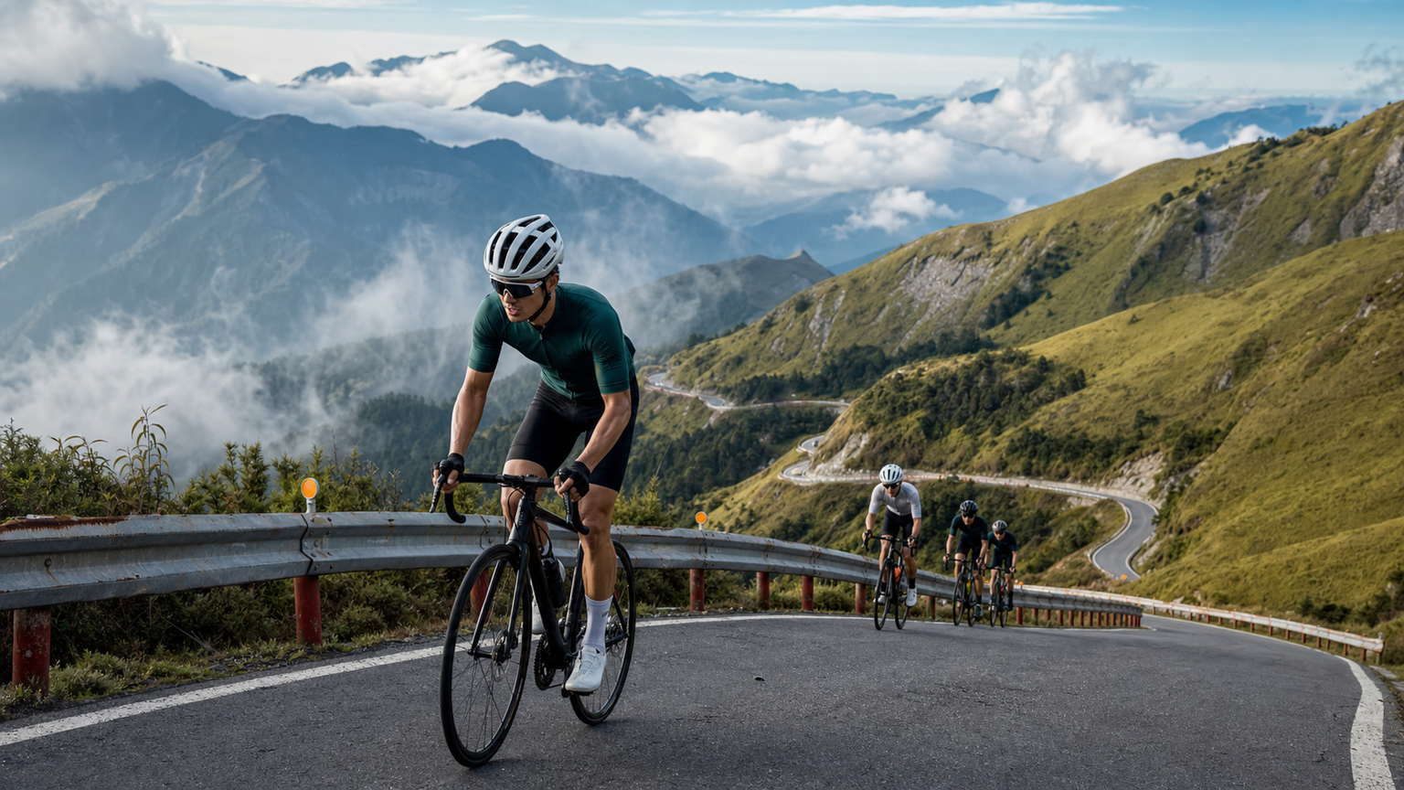
Taiwan’s Top 10 Classic Road Cycling Climbs
Taiwan is a paradise for road cyclists who love climbing. On an island of just 36,000 square kilometers, there are more than 260 peaks above 3,000 meters, and Wuling (3,275m) — Taiwan’s highest paved road — is a pilgrimage site for cyclists across Asia. This article rounds up ten of Taiwan’s most iconic climbs.
Metrics for Evaluating a Climb
Before diving into the routes, here are a few common metrics used to gauge climbing difficulty:
- Elevation Gain: the total accumulated climbing height over the route
- Average Gradient: the average slope across the entire climb
- Max Gradient: the steepest section of the climb
- VAM (Velocità Ascensionale Media): vertical meters climbed per hour, a measure of climbing speed
The Ten Classic Climbs
1. Hehuanshan Wuling (Provincial Highway 14A)
Start: Wushe (about 26 km east of Puli)
Distance: 42 km
Elevation Gain: 2,500 m
Elevation: 1,150m → 3,275m
Average Gradient: approx. 5.9%
The ultimate pilgrimage for Taiwanese road cyclists, and Asia’s highest paved climbing finish. Every year it draws challengers from around the world, and completing it earns serious respect within Taiwan’s cycling community.
Best Time to Ride: April–June (spring blossoms) and October–November (autumn foliage). Summer afternoons often bring thunderstorms, and winter can bring icy, closed roads.
Cautions: Risk of altitude sickness — acclimatize gradually. The descent is fast with many switchbacks, so reliable braking is essential.
2. Taipingshan (Yilan Provincial Highway 7A)
Start: Yilan City
Distance: 55 km
Elevation Gain: 2,200 m
Elevation: 20m → 2,100m
Average Gradient: approx. 4%
Excellent road surface and stunning scenery, with old-growth forest along the way. Taipingshan’s sea of clouds is one of Taiwan’s most beautiful natural sights — riding through it under the right conditions feels like passing through a fairyland.
Best Season: Autumn and winter (October–February), when mornings often bring a sea of clouds and good visibility.
3. Beiyi Highway (Provincial Highway 9)
Start: Muzha, Taipei
Distance: 30 km
Elevation Gain: 600 m
Elevation: 100m → 580m
Average Gradient: approx. 2%
Taipei’s most popular weekend ride — short in distance with a gentle gradient, it’s the “backyard” climb for many Taipei cyclists. The route from Muzha through Shiding to Pinglin winds through a series of scenic mountainside curves.
Highlights: Traffic can be heavy, so extra caution is needed; there are several supply stops along the way.
4. Guguan Hot Springs (Provincial Highway 8)
Start: Fengyuan, Taichung
Distance: 50 km
Elevation Gain: 850 m
Elevation: 200m → 1,000m
Average Gradient: approx. 1.7%
A gentle gradient makes this an ideal introduction for climbing beginners. The scenery along the Dajia River is spectacular, and Guguan’s hot springs are the perfect reward after finishing the ride.
Recommended for: Taichung riders as a beginner climb — groups head out there nearly every weekend.
5. Dasyueshan Forest Road (Provincial Highway 10 Branch)
Start: Dongshi, Taichung
Distance: 49 km
Elevation Gain: 2,350 m
Elevation: 450m → 2,600m
Average Gradient: approx. 4.7%
Superb road surface and a steady gradient make this, in the eyes of many veteran riders, one of Taiwan’s purest climbing experiences. Traffic on the forest road is minimal, and the quiet natural surroundings let riders fully immerse themselves in the mountain forest.
Note: The forest road is narrow — yield to oncoming traffic by keeping to the right.
6. Lishan (Provincial Highway 8)
Start: Shigang, Taichung
Distance: 89 km
Elevation Gain: 2,600 m
Elevation: 250m → 2,000m
Average Gradient: approx. 2.9%
A one-day out-and-back ride from Taichung to Lishan is a “milestone challenge” for many central Taiwan riders — the full round trip exceeds 170 km with over 5,000 m of total elevation gain.
7. Chiayi Alishan (Provincial Highway 18)
Start: Chiayi City
Distance: 67 km
Elevation Gain: 2,200 m
Elevation: 30m → 2,200m
Average Gradient: approx. 3.3%
Sunrise and the sea of clouds are Alishan’s most famous natural sights. Riders who set out early can catch the sunrise upon reaching the summit — a special experience that takes some advance planning.
8. Nantou Cingjing Farm (Provincial Highway 14)
Start: Puli
Distance: 30 km
Elevation Gain: 1,200 m
Elevation: 500m → 1,750m
Average Gradient: approx. 4%
Cingjing’s pastures and European-style buildings make for one of Taiwan’s most distinctive mountaintop landscapes, and it also serves as a waypoint on the way to Wuling. The gradient isn’t especially difficult, but the sustained climbing still poses a real challenge for beginners.
9. Pingtung Wutai (Provincial Highway 24)
Start: Pingtung City
Distance: 55 km
Elevation Gain: 1,600 m
Elevation: 50m → 1,100m
Average Gradient: approx. 2.9%
One of the most rewarding mountain roads in southern Taiwan, with a good road surface and distinctive Paiwan indigenous village culture along the way — a perfect combination of riding and cultural experience.
10. Wujie (Taipower Wujie Road)
Start: Ren’ai Township, Nantou
Distance: 22 km
Elevation Gain: 800 m
Elevation: 600m → 1,400m
Average Gradient: approx. 3.6%
Not widely known, but highly regarded among Taiwan’s climbing enthusiasts. Traffic is virtually nonexistent and the scenery is unspoiled, with the emerald waters of Wujie Reservoir as the reward at the finish.
Training Tips for Climbing
Key Elements of Climbing Efficiency
Pedaling Efficiency: Aim for a cadence of 70–85 rpm on climbs, slightly lower than on flat terrain, but avoid dropping too low (below 60 rpm), which places excessive torque on the knees.
Shifting Strategy: Mountain roads have highly variable gradients, requiring frequent shifting. Shifting early — before the gradient steepens, rather than at the moment of maximum effort — is key to protecting your drivetrain and maintaining power output.
Pacing: The biggest mistake on a climb is starting too fast. Use a heart rate monitor or power meter to make sure you don’t exceed your target intensity during the first third of the climb, saving energy for the latter stages.
Logistics for Completing a Climb
Fueling
- Replenish carbohydrates every 45–60 minutes (energy bars, bananas, rice balls)
- Electrolyte drinks (high-altitude temperatures are lower and sweat loss may be reduced, but electrolytes are still needed)
- Carry emergency backup food (to maintain energy if you need to wait out a mechanical issue)
Descending Safely
Descents on Taiwan’s mountain roads are often more dangerous than the climbs themselves, so pay special attention to:
- Maintaining a safe distance from the rider ahead
- Balancing front and rear braking (roughly 40% front, 60% rear)
- Slowing down before corners and holding a steady speed through the turn
- Reducing descending speed by 30–40% compared to normal in wet conditions
Taiwan’s mountain roads are a precious gift of nature that cyclists around the world envy. Every climb is a journey of self-discovery, and the moment you reach the summit, you’ll understand why so many riders are willing to set out at five in the morning — just for that sea of clouds atop the mountain.
Related Reading
- Comparing Taiwan’s Top 10 Classic Climbs: Gradient, Distance, and Difficulty Analysis
- Taking on Taiwan’s Five Classic Climbs: Wuling, Tataka, Alishan, Hehuan North Peak, and Taipingshan
- Ranking Taiwan’s Top 10 Road Climbs: The Perfect Blend of Difficulty and Scenery
- Selected Climbs Around Taiwan’s Hundred Peaks: A Guide to Hehuan, Wuling, and Dasyueshan Routes
#北橫 + #北進武嶺 最硬的員工旅遊 EP1 | #公路車 #拉拉山 | 明池 | 武嶺 | 武陵農場 | 雲海 | Taiwan Cycling Route Wulin
6 年前
爬坡ITT實境)台中 魔王 松鼠坡 首航 6:12 大肚山 大三元 科福路
8 年前
大禹嶺 到 武嶺牌樓 全程前後實況錄影 | 北進武嶺 | 東進武嶺 | KOM | 訓練台 | 坡度分析 | Taiwan KOM Last 10 km HARD | 公路車
6 年前
太平山單車員工旅遊 | 這樣玩CP值最高!| 公路車
5 年前
台灣登山王之路 KOM 全程參賽4K臨空錄影 PART1 穿越峽谷地形! #東進武嶺 太魯閣 / 燕子口 / 天祥 / 西寶 PART1 (公路車 / CT Yeh)
3 年前
台北闊瀨陡坡 騎旅 / 日本單車雜誌編輯車友臨時加入!/ 髮香才是最強的 / feat. 北迴歸線小隊 / 公路車 CT Yeh
6 個月前
大武山20%魔王陡坡【JJSC南台灣遊騎Day2】!屁股真的要裂開了...凡士林抹滿也沒用?神秘金教堂還有超便宜夜市
3 個月前
新竹羅平 x 天湖部落 大禹嶺級變態陡坡! 4K超高畫質 空拍 | 公路車
5 年前