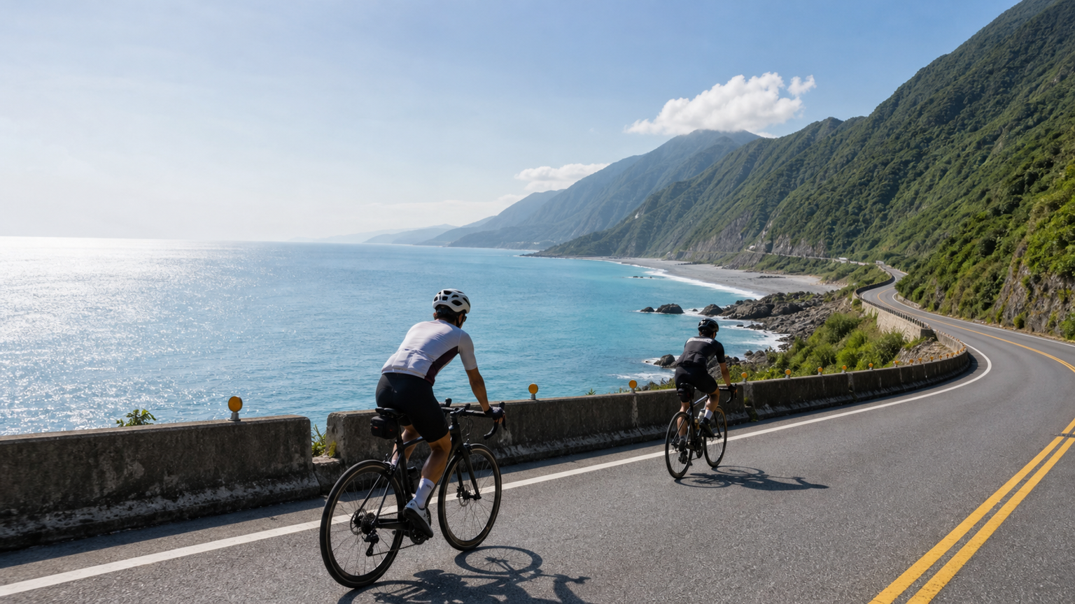
Why Highway 11 Deserves a Dedicated Trip
Highway 11 begins at Nanbin in Hualien City and runs south along the Pacific coast all the way to Taitung City, covering about 180km of road. Many people assume a coastal route means flat riding, but in fact the first 60km hides several hundred meters of gradual climbing, with about 1,545m of cumulative elevation gain over the whole route. It offers a completely different experience from Highway 9 (Tai 9), which runs through the East Rift Valley (Huadong Valley): Highway 9 weaves between rice paddies and mountains, while on Highway 11 the entire unobstructed Pacific Ocean stretches out on your right-hand side.
Suggested Three-Day Itinerary
At a pace most riders can sustain, splitting the 180km into three days is the most comfortable approach. The table below shows measured segment data:
| Day | Segment | Distance | Elevation Gain | Key Points |
|---|---|---|---|---|
| Day 1 | Hualien City → Shitiping | 71.8 km | 689 m | Niushan Hoting, Baqi Lookout climb |
| Day 2 | Shitiping → Chenggong | 56.6 km | 514 m | Tropic of Cancer marker, Sanxiantai |
| Day 3 | Chenggong → Taitung City | 49.2 km | 342 m | Duli Beach, Fugang Fishing Port |
Day 1 Is the Toughest: Baqi and Niushan
Day one looks like the longest, and the difficulty is concentrated around Jiqi. Baqi Lookout is the first noticeable climb after leaving Hualien — about 2km at an average 5% grade — but the view over the entire Jiqi Bay makes it well worth the effort. The road around Niushan Hoting has frequent small rises and dips, with fewer places to refill water, so it’s best to top off two bottles in Fengbin town.
Day 2 Has the Richest Cultural Flavor
Day two passes the Tropic of Cancer marker (23.5°N), the only point on Highway 11 that symbolically straddles the temperate and tropical zones. If you reach Sanxiantai’s eight-arch bridge in the early morning, the backlit silhouette makes for excellent photos. Chenggong’s sailfish dishes are the local resupply favorite, delivering protein and salt in one go.
Wind and Timing Strategy
During the northeast monsoon season (October through the following March), riding from north to south lets you enjoy a tailwind, saving over 10% in pedaling power on average. In summer, afternoon coastal thunderstorms are common, so it’s best to complete about 70% of the day’s distance before noon. The coastline offers no shelter and strong UV exposure, so be sure to reapply sunscreen every two hours.
Resupply and Lodging Points
- Fengbin: The only fairly complete convenience store and food cluster in the middle of Day 1
- Shitiping: Dense with campsites and homestays, an excellent spot for sunrise
- Changbin: Cafes near Jingang Avenue have increased in recent years, good for a caffeine and rest break
- Chenggong: Seafood beside the fishing port, with plenty of lodging options
Gear Reminders
Sea breeze carries salt, so it’s recommended to clean and lubricate your chain daily. Either durable aluminum or mid-depth carbon wheels work fine — there’s no need for extreme aerodynamics. It’s recommended to run tire pressure about 0.3 bar lower than usual; the coastal asphalt has many seams, and lower pressure absorbs vibration and reduces the risk of flats.
What Highway 11 teaches you: true long-distance riding isn’t a battle against the gradient, but coexisting with your own rhythm and this endlessly restless Pacific Ocean. Ride it a little slower, and you’ll remember the sound of every wave.
Related Reading
- Hualien Coastal Highway Cycling Journal: The Azure Sea and Tribal Culture of Highway 11
- Round Hualien-Taitung Cycling Challenge: A Two-Day, One-Night Ride Through the East Rift Valley
- Taiwan’s East Coast Marathon: Coastal Running Scenery Along Highway 11
- Taitung Coastal Highway Cycling Trip: The Most Beautiful Riding Scenery on the East Coast
2022 環花東挑戰賽 Day2 搭到特快車 高速真空吸引! 台東一路逆風殺回花蓮! 總排 ??| Feiyu Pocket 2s | 公路車 | CT Yeh
4 年前
公路車 | 塔塔加驚險員工旅遊 | 還好手腳快沒被抓交替!
5 年前
半日 小台灣 極限單車路線挑戰實錄
7 年前
台北闊瀨陡坡 騎旅 / 日本單車雜誌編輯車友臨時加入!/ 髮香才是最強的 / feat. 北迴歸線小隊 / 公路車 CT Yeh
6 個月前
阿里山塔塔加 兩倍特濃版!全新隧道開通! 進喔!公路車 | CT Yeh
3 年前
嘉義大埔、阿婆灣挑戰賽,美到以為在日本!ft. 環騎5 Cool 西拉雅188 / 公路車 / CT Yeh
7 個月前
爬坡ITT實境)台中 魔王 松鼠坡 首航 6:12 大肚山 大三元 科福路
8 年前
2022 環花東挑戰賽 Day1 全記錄! 4K穿越機美景 x 髮香團 | 廢物伙伴軍團騎聚|花蓮-台東 |公路車 | CT Yeh
4 年前