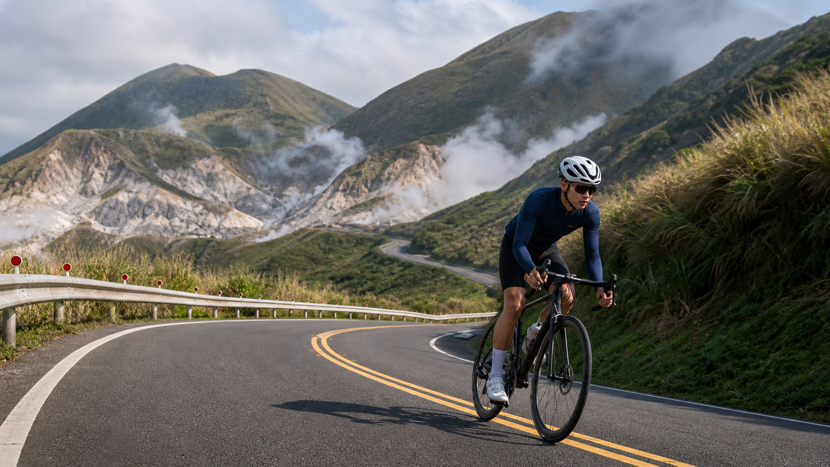
Climbing from the Coast Straight into a Volcanic Crater
Yangjin Highway (Provincial Highway 2A) connects Jinshan to Yangmingshan, climbing about 20 km from the Jinshan coastline with roughly 700 m of accumulated elevation gain. What sets it apart from Bailake Road is that it climbs the entire way from sea level (0 m) up to 800 m — a full, unbroken elevation profile. Along the way you pass active volcanic landscapes like Dayoukeng and Machao, where the smell of sulfur is very real.
Loop Route Design
| Segment | Distance | Elevation Gain | Highlights |
|---|---|---|---|
| Jinshan → Machao | 12 km | ~500 m | Dayoukeng, sulfur fumaroles |
| Machao → Lengshuikeng | 5 km | ~180 m | Milky Lake, hot springs |
| Lengshuikeng → Qingtiangang | 3 km | ~120 m | Vast grassland, grazing cattle |
| Qingtiangang → Descent | Route-dependent | Downhill | Connects to Jingshan Road or Bailake Road |
Volcanic Terrain Safety
Sulfur gas concentrations are high around Dayoukeng and Machao — riders with sensitive airways should not linger there. The “Milky Lake” at Lengshuikeng is a milky-white pool formed by sulfur deposits; swimming or wading is prohibited. The cattle grazing on the Qingtiangang grasslands are free-ranging; keep your distance and avoid startling them.
Three Loop Combinations and Difficulty Comparison
The greatest appeal of Yangjin is that you can climb one way and descend another. Depending on your fitness, you can build different loops:
| Loop Combination | Total Distance | Total Elevation Gain | Difficulty |
|---|---|---|---|
| Up Yangjin, down the same way | ~40 km | ~700 m | Moderate, simplest |
| Up Yangjin, down Bailake Road | ~45 km | ~900 m | Advanced — combines volcanic terrain and sea of clouds |
| Up Yangjin, down Jingshan Road | ~42 km | ~750 m | Intermediate-advanced, avoids Bailake Road traffic |
| Jinshan → Lengshuikeng → Qingtiangang → down to Shilin | ~50 km | ~1,000 m | High — a full one-day volcanic traverse |
“Up Yangjin, down Bailake Road” is widely regarded by Greater Taipei riders as the most rewarding advanced route: in a single ride you take in both active volcanic scenery and a sea of clouds, with nearly 900 m of total climbing and no wasted transfer riding. The descent from Qingtiangang toward Shilin has many technical corners — always keep at least 30 meters of braking distance in reserve.
Climate
Riding from Jinshan’s maritime climate up to Yangmingshan’s mountain climate, the temperature difference can exceed 8°C. The summit is often shrouded in cloud and fog with low visibility — always ride with lights on and bring a windbreaker.
Supplies
Jinshan Old Street offers the most complete range of supplies (duck meat, sweet potatoes). In the mountains, only Lengshuikeng and Qingtiangang have basic shops and restrooms.
What makes Yangjin so special is that it lets you smell that the earth is still alive. When the scent of sulfur fills your lungs and white steam rises from cracks in the rock, you suddenly realize — we are only guests living on the back of a sleeping volcano.
Related Reading
- From the Jinshan Coast to the Crater: Geothermal Heat, Fog, and Warmth Along Xiaoyoukeng on Yangjin Highway
- The Scent of Sulfur and Mist at Lengshuikeng: A Ride of Perseverance on the East Side of Yangmingshan
- Yangjin Highway Xiaoyoukeng Field Guide: A 17.8 km, 793 m Climb Through Taipei’s Backyard Trial
- Yangmingshan Trail Marathon: The Complete Guide to Trail Running on Volcanic Terrain
4K單車實境) 舊陽金P字道 第1P 仰德大道至小油坑 誤跟武嶺神人們 被拉爆爽飛天 Taiwan Cycling Climb Route Recommend
7 年前
半日 小台灣 極限單車路線挑戰實錄
7 年前
台北闊瀨陡坡 騎旅 / 日本單車雜誌編輯車友臨時加入!/ 髮香才是最強的 / feat. 北迴歸線小隊 / 公路車 CT Yeh
6 個月前
阿里山塔塔加 兩倍特濃版!全新隧道開通! 進喔!公路車 | CT Yeh
3 年前
大武山20%魔王陡坡【JJSC南台灣遊騎Day2】!屁股真的要裂開了...凡士林抹滿也沒用?神秘金教堂還有超便宜夜市
3 個月前
太平山單車員工旅遊 | 這樣玩CP值最高!| 公路車
5 年前
經典 陽金P字道 | 路線解析 | 魔王親臨指導 | 武嶺備戰訓練營 | NeverStop | 公路車 | 單車
6 年前
嘉義大埔、阿婆灣挑戰賽,美到以為在日本!ft. 環騎5 Cool 西拉雅188 / 公路車 / CT Yeh
7 個月前